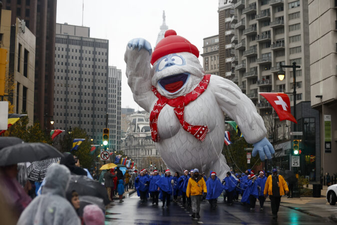
The snow rumors notwithstanding, the Philadelphia region and most of the rest of the Northeast can pretty well rule out a white Thanksgiving, nor will Black Friday turn white.
However, the upper atmosphere evidently is in a state of upheaval with a potentially rare event unfolding, and forecasters say something resembling winter may arrive around here before the holiday weekend ends.
The National Oceanic and Atmospheric Administration’s Climate Prediction Center has chances favoring below-normal temperatures and above-normal precipitation from Thanksgiving Day through Dec. 1.
However, the meteorologists who have grappled with longer-range outlooks are cautioning against taking social media snow forecasting too seriously.
“The observed snowfall is inversely proportional to the hype,” said Judah Cohen, research scientist with the Massachusetts Institute of Technology. He is among those who have noticed the snow mentions that have popped up on X accounts and popular websites.
The next week should generally be uneventful save for rain Tuesday night possibly into getaway Wednesday, when highs are forecast to reach the 60s.
Then a developing pattern change is predicted to import colder air into the Northeast. “I do believe it will get colder as the Thanksgiving week wears on,” said Bob Larson, senior meteorologist with AccuWeather Inc.
A rare event may chill December
What has the attention of Cohen and others in the meteorological world is the potential for a “major” stratospheric warming event in the upper atmosphere over the Arctic sometime in the next several days, a disruption that could allow significant cold air to pour into the United States.
Major events have occurred on average about six times a decade, according to NOAA researchers; however, having one so early would be a rarity.
If one occurred, it would be only the second time in records dating to the early 1950s that it has happened this early, said NOAA meteorologist Laura M. Ciasto.
While computer models have been debating over just what is going to happen, Cohen, chief of seasonal forecasting for the Janus Research Group, said that such an early date has given him pause about forecasting it will happen.
What causes a stratospheric warming event?
On occasion, upward-moving waves from the troposphere, 5 to 9 miles over the Arctic, crash into the stratosphere, 10 to 30 miles up. That has the effect of compromising the polar vortex, the west-to-east winds that lock cold air in the places where the sun disappears for the winter, Ciasto said.
When the winds slacken, the vortex can weaken and allow frigid air to spill southward. In some cases it might “stretch,” or split into pieces that deliver cold air to regions of the Northern Hemisphere.
A major disruption would have longer-lasting impacts, Cohen said.
The European forecast model has consistently predicted a major event, Ciasto said, while the U.S. model has not been as impressed.
What is likely to happen if the warming event occurs?
A major warming in January 2021, when temperatures in the stratosphere suddenly jumped 65 degrees Fahrenheit, resulted in quite a snowy February in the Philadelphia region.
After a warming event, “there’s a greater chance that the jet stream will become more disrupted and dip down” over the continuous United States, Ciasto said, “bringing cold air with it.”
As for timing, the effects may show up anywhere from two to several weeks after the event.
In the meantime, she noted that “several other factors,” including patterns over the North Pacific, favor a chilling for the Northeast.
Don’t be surprised to see snow appear in an actual forecast, but not necessarily on the ground.
New Jersey’s beaches, still recovering from major sand losses from an offshore hurricane and a nor’easter, evidently are in for another assault this week as October is about to make a dramatic exit.
Gale-force gusts off the ocean could develop as early as Tuesday afternoon at the Shore, said Eric Hoeflich, a meteorologist at the National Weather Service office in Mount Holly, with brisk onshore winds persisting “maybe into Friday.”
A potent storm is forecast to affect the entire region Wednesday night into Thursday, with heavy rains in the immediate Philadelphia area, where drought conditions have been intensifying.
Also on Thursday, what is likely to become catastrophic Hurricane Melissa will be passing offshore, churning up the waves crashing on East Coast beaches.
“The coast once again is going to take a pretty good battering,” said Dave Dombek, senior meteorologist with AccuWeather Inc.
On the plus side, Hoeflich said, for the Shore, this week’s storm “doesn’t look as bad” as the beach-erasing nor’easter earlier this month. The path should be more inland, and the lunar influence on the tides would be less. Only minor flooding is expected, he said, subject to change.
However, not only would the track mean region-wide heavy rain, but it would also increase the potential for severe thunderstorms Thursday. A front is due to chase the rains Friday, but it may generate gusts to 50 mph, the weather service says. Power outages are possible both days.
The timetable for the winds and the storm in the Philly region
The National Weather Service has posted a gale warning for Tuesday into Wednesday morning for the waters along the immediate coast for winds from the east that could gust past 50 mph.
That would be more the result of high pressure to the north of the region. Winds circulate clockwise around centers of highs; thus, areas to the south of the center experience winds from the east.
The breezes will be getting a second wind as a storm develops in the Southeast and tracks north. Meanwhile, a weakened Hurricane Melissa will be churning the ocean as it passes well off the U.S. coast on Thursday.
A strong storm system will move across the region later this week. Here is a summary of expected impacts. pic.twitter.com/OvhoVAaS11
Rain for the last 30 days has been about a third of normal in the city and the neighboring Pennsylvania counties.
South Jersey has fared only slightly better, but precipitation is well less than half of normal.
What is the forecast for the trick-or-treaters?
It is all but certain that Friday will be a dry day, with temperatures in the low and mid-50s. Wind gusts are forecast to die down sometime after 5 p.m., but hold onto those brooms, just in case.
A crew working at a Philadelphia warehouse Tuesday was well on its way toward building 120 combination shade stations and planters to be installed this summer on sidewalks in the Kingsessing, Point Breeze, Grays Ferry, and Haddington neighborhoods.
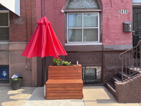
The stations, many of which have already been installed, are built of pressure-treated lumber and come with a bench, umbrella, and decorative planter.
“This idea started as a job creation and heat mitigation program but turned into a broader set of things,” said Franco Montalto, a Drexel engineering professor who directs the program. “We found that a lot of people like these planters. They create social opportunities, and they are an aesthetic improvement.”
The shade can’t come soon enough. Temperatures are forecast to reach 97 on Friday, setting up a dual summer ick for Philadelphians: high heat, high humidity. Together, they’ll combine to make it feel like 106.
This week’s heat wave comes on the heels of data showing Philadelphia ranks as the sixth highest U.S. city for the number of people experiencing an “urban heat-island effect” of more than 9 degrees compared to those living in nonurban areas. It is also one of the few cities that have neighborhoods exceeding 12 degrees of heat island effect.
!function(){“use strict”;window.addEventListener(“message”,(function(a){if(void 0!==a.data[“datawrapper-height”]){var e=document.querySelectorAll(“iframe”);for(var t in a.data[“datawrapper-height”])for(var r=0;r<e.length;r++)if(e[r].contentWindow===a.source){var i=a.data["datawrapper-height"][t]+"px";e[r].style.height=i}}}))}();
Where it’s hottest
The data from the nonprofit Climate Central provide a model for which city neighborhoods are most vulnerable during heat waves because of the density of sidewalks, streets and buildings, along with the lack of tree cover.
Parts of Center City rank among the top for a heat island effect of more than 12 degrees. Center City, however, certainly has residents but is mostly a large swath of offices and retail and not representative of the city’s true residential neighborhoods.
Those highly residential areas, such as Fairmount, Spring Garden, North Philadelphia, East Schuylkill, Southwest Center City, Point Breeze, Kensington, Bella Vista, and Southwark, all bake up to 10 degrees higher than surrounding neighborhoods outside the city, the data suggest.
City officials have said previously that temperatures in some neighborhoods, such as Hunting Park, can rise even higher, leaving medically vulnerable residents at risk. This year, Mayor Jim Kenney’s administration launched a 10-year Philly Tree Plan that calls for planting thousands of trees to increase the city’s canopy to 30% as a way of tackling the disparity.
In general, areas of the city near big parks, with more detached homes and more tree canopy fare much better. Pennypack, West Oak Lane, Overbrook, Olney, Frankford, Bustleton, Northeast Philadelphia, East Falls, and Manayunk all experience a heat-island effect of less than 7 degrees.
(function() {
var l2 = function() {
new pym.Parent(‘heatisland26’,
‘https://media.inquirer.com/storage/inquirer/projects/innovation/arcgis_iframe/heatisland26.html’);
};
if (typeof(pym) === ‘undefined’) {
var h = document.getElementsByTagName(‘head’)[0],
s = document.createElement(‘script’);
s.type = ‘text/javascript’;
s.src = ‘https://pym.nprapps.org/pym.v1.min.js’;
s.onload = l2;
h.appendChild(s);
} else {
l2();
}
})();
Philly’s islands of heat
Climate Central did not base its study on actual temperatures, but rather on modeling that combines data from satellite imagery, impervious land cover, green space, building footprints, transportation, and census tract population data.
Scientists use the data to model which tracts would likely be warmer than others. For example, buildings, roads, and other infrastructure absorb and reemit the sun’s heat more than forests and rivers. Dark surfaces, such as black asphalt roofs, reflect less light and retain more heat. As a result, certain areas can become hotter during extreme heat relative to suburban and rural areas, according to the U.S. Environmental Protection Agency.
The heat-island effect strikes a mix of neighborhoods:
For example, a neighborhood in the eastern part of North Philadelphia has an urban heat-island effect of more than 11 degrees. The population is 12% Hispanic, 16% Black, 44% white, and 23% Asian.
A cluster of streets in Kensington has a heat-island effect of 10 degrees, according to the Climate Central data. The neighborhood is 51% Hispanic, 25% Black, and 19% white. But a cluster in South Philly that’s 73% white, 10% Hispanic, 13% Asian and 2% Black sees the same 10 degree effect.
One of the least impacted parts of the city, West Oak Lane, with a 6.6 degree heat-island effect, is 94% Black. And people living in mostly white Bustleton experience the same effect.
The data, however, differ from Philadelphia’s Heat Vulnerability Index, which is used to indicate neighborhoods most at risk during extreme heat events. The city’s index takes into account more than just temperature. It looks at social, economic and health factors such as age, education, language barriers, percent of people living in poverty, race and ethnicity, and social isolation. It looks at the number of people who have asthma, heart disease, and other health issues.
For example, the Climate Central data give a census tract in North Philadelphia a heat-island effect of 7.75 degrees, which is not among the highest in the city. But the city assigns the same tract a “very high” score on the Heat Vulnerability Index. The neighborhood is 95% nonwhite, many live below the poverty line and have obesity and hypertension.
“Every day is a learning experience,” said Omar Sewell, 42, of South Philadelphia, who is working under a Drexel-led program to build shade stations for city sidewalks. Sewell spoke at the program’s rented warehouse in Kingsessing on Tuesday.
Finding shade
Jennifer Brady, a former EPA staffer who conducted the analysis for Climate Central, said it makes sense that Center City would show a high degree of heat-island effect because of the population density, paucity of trees, tall buildings, and infrastructure that absorbs heat and reduces airflow.
The impact of heat on people in Center City might be much less than in other neighborhoods, Brady said. That’s because people in Center City tend to be wealthier with the means to escape or have easy access to air-conditioned apartments, offices, stores, or shaded square.
“There are other neighborhoods that are not only high risk, but you can’t walk three or four blocks to find any kind of cover or shaded area,” Brady said. “That’s not accounted for in the data. That’s something not explicitly in these numbers, but is an important consideration when you’re thinking about people being able to escape from the heat.”
So, lower-income residents of color tend to bear the brunt of extreme heat’s impact. In 2020, for example, the Hunting Park Neighborhood Advisory Committee surveyed residents about how they cope with heat and asked how many had air-conditioning. Out of 563 who answered, only 100 had air-conditioning.
To help residents cope, the city operates scores of cooling centers, which can include air conditioned buses.
Back at the Drexel program, Oman Sewell, 42, of South Philly was working in a warehouse in Kingessing that Montalto’s program rents to build the shade-giving planters. The planters are placed with guidance from of local community organizations. It’s the fourth year of the program, which is funded by the William Penn Foundation and started with planter installations in Hunting Park.
Sewell started working in June under the tutelage of architect Angelo Zaharatos, founder of Arxis League, a New York-based design group. Sewell was busy Tuesday helping assemble the planters after having made many of the cuts on a miter saw.
Sewell is enthusiastic about the program and credits Zaharatos with daily uplifting readings that might come from, say, Marcus Aurelius, a Roman emperor and philosopher.
“Every day is a learning experience,” Sewell said. “It opens your mind, showing you can actually uses these building blocks and turn the skills into something you can use the rest of your life.”
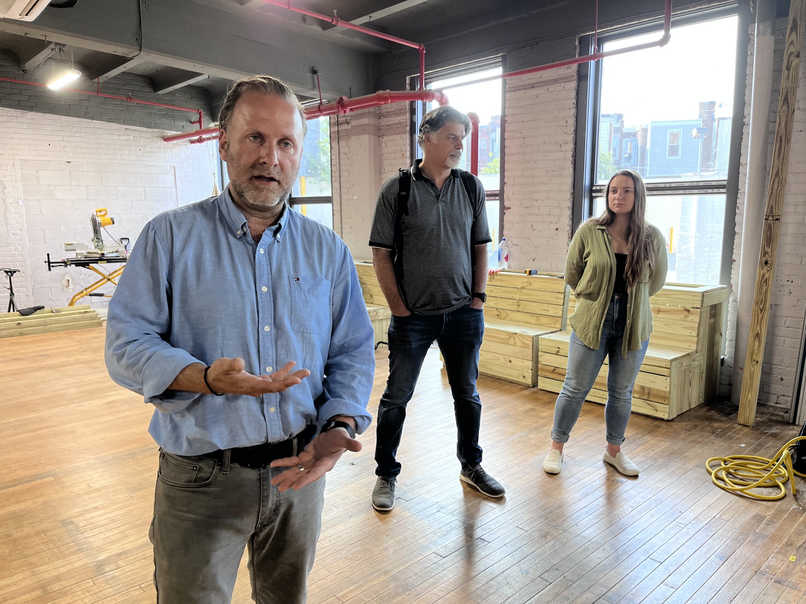
Architect Angelo Zaharatos explains how shade-giving planters are built at a warehouse in Philadelphia’s Kingsessing neighborhood. Drexel professor Franco Montalto (middle) oversees the program. Nikki Pearl (right) manages it.