Category: Science

  • Scientists discover oldest evidence of human-made fire in a 400,000-year-old hearth

    Scientists discover oldest evidence of human-made fire in a 400,000-year-old hearth

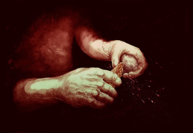
    Scientists have discovered the oldest evidence of ancient humans igniting fires: a 400,000-year-old open-air hearth buried in an old clay pit in southern England.

    The study, published in the journal Nature, is based on a years-long examination of a reddish patch of sediment excavated at a site in Barnham. It pushes back the timeline on fire-making by about 350,000 years.

    The nebulous question of how far back human ancestors conjured fire is deeply intertwined with some of the biggest outstanding mysteries about human evolution. The ability to reliably set fires would have allowed humans to cook food, expanding the range of what they could eat and making meals more digestible. That, in turn, could have supported bigger brains that consumed more energy, catalyzing new social behaviors as humans gathered around campfires.

    But campfires don’t leave fossils. It takes painstaking work to reconstruct these ephemeral uses of technology. And what remains unclear is who set them. No telltale bones have been recovered at Barnham, but researchers think it was Neanderthals, close cousins of our species who interbred with our ancestors.

    “The evidence of fire is incredibly difficult to preserve. If you get to ash and charcoal, it can wash away. Sediment can get washed away,” said Nicholas Ashton, curator of Paleolithic collections at the British Museum and one of the leaders of the work. “We just found this one pocket — quite a large site — where it happens to be preserved.”

    Even when traces of fire remain, the task of distinguishing incidental flames sparked by lightning strikes or wildfires from those set by people is difficult. Perhaps most challenging is distinguishing between fires ignited by humans with the know-how from those produced by scavenging embers from wildfires.

    The study could spark more debate.

    “The authors did an excellent job with their analysis of the Barnham data, but they seem to be stretching the evidence with their claim that this constitutes the ‘earliest evidence of fire making,’” Wil Roebroeks, an archaeologist at Leiden University, said in an email, calling the evidence “circumstantial.”

    Ségolène Vandevelde, an archaeologist and adjunct professor at the University of Quebec at Chicoutimi, praised the multidisciplinary approaches the authors used and said the finding was “solid.”

    Pyroarchaeology

    In the Paleolithic era, the Barnham site would have been a woodland with a seasonal pond — set away from the main river valley, where predators might have roamed, according to Robert Davis, an archaeologist at the British Museum and one of the authors of the study. The wildlife would have included elephants, lions, deer, fish and other small mammals.

    Despite the fleeting nature of fire, it can leave traces under the right conditions. At the site in Barnham, where artifacts such as heat-shattered flint hand axes were also found, researchers were intrigued by a layer of reddish sediment — a result of iron-rich sediments being heated to produce a mineral called hematite. For four years, they studied it, trying to determine whether it was the result of a wildfire or deliberate human activity.

    One of the first questions they asked was whether this was a one-time blaze or something closer to a fireplace that was lit and relit many times.

    To deconstruct this question, scientists studied the magnetism of the sediment, which is altered by heating. They conducted modern experiments, to see if they could come up with an estimate of how many heating events might have resulted in the magnetic profile of the sediment — and found that after about a dozen heating events, each one four hours long, their modern samples mimicked the archaeological one.

    Then they examined the chemistry of the site — scrutinizing particular chemical compounds left behind. The patterns they found suggested humans had been using these fires.

    The last element was small pieces of cracked flint scattered about the site — as well as two bits of pyrite, which can create a spark when struck together. A geological study of the area showed that pyrite was scarce in the local landscape, leading the authors to argue that the inhabitants had carried it there for the specific purpose of making fire.

    Scavenging sparks vs. setting fires

    The archaeological record with examples of fires used by hominins — the ancestors of humans — stretches back more than a million years ago in Africa.

    But what interests scientists is not just the ability to successfully scavenge sparks from wildfires or lightning strikes, but also the ability to reliably create it — possibly by striking flint and pyrite together to create sparks.

    The oldest accepted evidence of fires purposefully set are from a Neanderthal site dated to 50,000 years ago in France. That evidence is considered convincing in part because there are chunks of flint showing “microwear traces of having been struck” to create sparks, Roebroeks said. But at Barnham, there are no microwear traces, leaving room for disagreement.

    “It’s a very contentious debate that’s been going on for some time,” Davis said.

    Early hominins would have learned to harvest fire by collecting embers, harvesting the right fuel and tending the fire. And eventually, they had to learn how to make it on demand — which would allow them to live in colder places, cook, fend off predators and socialize after dark.

    The study does not suggest that Barnham was where fire originated; it was probably widespread across the ancient world. But it does offer a rare, preserved snapshot of prehistoric life.

    “The maintenance of fire requires social cooperation, cultural rules and work coupled with knowledge of wood types, and means that a complicated tradition is at play,” said John Hawks, a paleoanthropologist at the University of Wisconsin at Madison.
  • It’s the coldest morning of the season and the chill goes on, but snow may continue to snub Philly

    It’s the coldest morning of the season and the chill goes on, but snow may continue to snub Philly

    The city experienced its coldest morning since at least Feb. 19 with low temperatures in the teens, even at Philadelphia International Airport, as for the second straight year December is off to quite a chilly start.

    And also for the second straight year, those looking forward to that first generous coating of white in Philly, or viewing the possibility with a certain trepidation, may be in for a wait.

    Readings dropped into single digits in Pottstown and Doylestown, and in the teens elsewhere. As usual, Philadelphia International Airport was the regional hotspot, bottoming out at 18.

    Temperatures are due to top out in the mid-30s Tuesday, more than 10 degrees below normal. A midweek warmup is due as rain approaches, followed by a late-week cooldown, and a deeper chill over the weekend into next week as the Arctic continues to share a generous supply of cold air to the central and eastern United States.

    Flake sightings are possible this week in Philly, but don’t expect a rash of school closings.

    The city and areas to the north and west may see a few snowflakes at the onset of general rainfall Wednesday, said Robert Deal, the science and operations officer at the National Weather Service Office in Mount Holly. And a dusting or less is possible in the region Friday with a cold frontal passage, he said.

    So, while folks around Doylestown had to dig out from a whole three-tenths of an inch of snow during the weekend, and the likes of Atglen, Chester County, and Avalon at the Shore were buried under a tenth of an inch, the vigil goes on for Philly’s first ruler-worth snowfall.

    With an unusual degree of certainty, in its Monday update, NOAA’s Climate Prediction Center said it was very likely that temperatures in Philadelphia and the rest of the Northeast would be below normal in the Dec. 13-17 period, with odds favoring below-normal readings through the solstice.

    That doesn’t mean it’s going to snow.

    Snow has been wanting the last several winters

    The region is accustomed to snow snubs.

    Deal pointed out that since the 2019-20 season, Philly’s official snowfall is more than 80 inches below normal — that’s a total of 56.7 inches measured, vs. 139.4 inches that constitute the normal.

    The last several winters generally have been mild, but snow doesn’t always correlate well with cold, and atmospheric scientists caution that snow is a lousy climate indictor.

    Last season, for example, the Dec. 1-Feb. 28 meteorological winter finished about a degree below normal with plenty of cold air for snow, but snowfall was a paltry 8.1 inches — beating New Orleans by a mere 0.1 inches. The seasonal normal as measured at Philadelphia International Airport is 22.3 inches.

    Tuesday officially would be Philadelphia’s 13th consecutive day of below-normal temperatures, and 13th without measurable snow.

    Why the absence?

    Snow around here typically falls near the battlegrounds of cold, heavy air from the north country and warmer moist air off the Gulf and Atlantic Ocean, which can rout the cold.

    “We generally need a high-pressure system anchored to the north so it keeps the cold air locked in place,” Deal said. “Lately, most of the high-pressure systems have been more transient, shifting offshore.”

    If they are too strong and persistent, those same cold high-pressure systems can repel moisture.

    The climate center outlooks favor below-normal precipitation in the Northeast in the six-to-10-day and eight-to-14-day periods.

    The lack of snow to date is by no means unusual, Deal points out. On average Philly doesn’t measure an official inch until Dec. 10.

    “Right now,” he said, “normal is next to nothing.”

    Brightening prospects

    The winter solstice doesn’t occur until Dec. 21, but if you have had it with these early sunsets, your prospects are brightening considerably.

    Monday’s sunset, just before 4:37 p.m., was a second later than Sunday’s. Tuesday’s will be 4 seconds later than Monday’s, and the sun will call it a day four whole minutes later on Dec. 21.

    That will still be the shortest day, however, since daybreak will be later, but feel free to sleep through it.

  • Philly gets its first winter storm of the season, but hold the shovels

    Philly gets its first winter storm of the season, but hold the shovels

    The region is experiencing a classic Philadelphia early winter storm — a touch of ice and snow, rinsed away by plenty of ice water.

    Some light freezing rain, sleet, and random snowflakes were reported across the region around daybreak Tuesday, and several school districts in Chester and Montgomery Counties opted for two-hour delays.

    Small accumulations of freezing rain, under a tenth of an inch, were measured in the Doylestown and Pottstown areas.

    For the record, the National Weather Service in Mount Holly reported that the city recorded its second official “trace” of snow, defined as a trained spotter’s sighting at least one flake at Philadelphia International Airport.

    That duly noted, Philly’s chances for its first measurable snowfall of the season remained minimal or less.

    “It’s cut and dried,” said Tyler Roys, senior meteorologist with AccuWeather Inc.

    Quite wet, actually. As temperatures rise quickly above freezing, plain, old liquid rain, possibly heavy at times, is expected to persist into the afternoon throughout the region.

    PennDot anti-icing crews have been mobilized, said spokesperson Krys Johnson, but they are also clearing leaf-clogged drains to mitigate road flooding.

    The precipitation should shut off well before the peak afternoon commuting period. However, it appears that the meteorological winter, which began officially Monday, is going to get off to a livelier start than last year’s.

    “We’re changing the script already,” said Roys, noting another storm threat later in the week. “It’s definitely an active start.”

    NOAA’s Climate Prediction Center has the odds favoring below-normal temperatures and above-normal precipitation in the Northeast in the Dec. 7 through 15 period.

    What time will any snow and ice change to rain?

    The changeover to rain should proceed quickly, forecasters say, and it should be raining everywhere by midmorning.

    Winds are from the east, and that is importing warm air off the ocean, where sea-surfaces temperatures off Atlantic City were in the upper 40s on Tuesday morning.

    How much for Philly?

    For Philly, Johnson’s reading of the forecast — “A chance of one snowflake” — was essentially correct. In fact, from King of Prussia eastward, said Roys, “You’re looking at nothing.”

    What is the outlook for the rest of the week?

    The weather community divides the seasons into tidy three-month increments, with Dec. 1 as opening day for winter.

    It will feel that way, with temperatures several degrees below normal into the weekend, with daytime highs Tuesday and Wednesday mostly in the 30s and lows in the 20s.

    A wild card would be the arrival of an Arctic front Thursday morning, said Roys, which might set off snow squalls in parts of the region.

    Another winter storm is possible on the weekend, however computer guidance has been showing just about everything and not much, said Zach Cooper, a weather service meteorologist in the Mount Holly office.

    Welcome to winter in Philly.

  • The Philly area’s most flood-prone waterways, mapped

    The Philly area’s most flood-prone waterways, mapped

    Late on a stormy September night, Katie and Anthony Young were watching a horror show. In this instance, it was also a reality show.

    A surveillance camera showed 8-foot floodwaters drowning the generator in the rear of their restaurant, Hank’s Place. The water crashed into the dining and kitchen areas, tossing around furniture and emptying the contents of refrigerators.

    The remnants of Hurricane Ida in 2021 had overwhelmed the Brandywine Creek at Chadds Ford, one of the region’s most picturesque locales, made famous by a frequent Hank’s customer, artist Andrew Wyeth.

    “I don’t think either one of us was anticipating it being that catastrophic,” Katie Young said.

    In a region where flooding is a perennial threat, an Inquirer analysis of the area’s most flood-prone waterways found the Brandywine ranks among the elite, based on available U.S. Geological Survey data.

    (function() {
    var l2 = function() {
    new pym.Parent(‘area_floods’,
    ‘https://media.inquirer.com/storage/inquirer/projects/innovation/arcgis_iframe/area_floods.html’);
    };
    if (typeof(pym) === ‘undefined’) {
    var h = document.getElementsByTagName(‘head’)[0],
    s = document.createElement(‘script’);
    s.type = ‘text/javascript’;
    s.src = ‘https://pym.nprapps.org/pym.v1.min.js’;
    s.onload = l2;
    h.appendChild(s);
    } else {
    l2();
    }
    })();

    A total of 61 major and moderate floods have occurred since 2005 at Chadds Ford and three other gages on the main stem of the Brandywine and its branches. The Brandywine East Branch near Downingtown has registered more major and moderate floods, with 33 combined, than any gage point in the region.

    No. 2 on the list was the Delaware River at Burlington, with seven major and 19 moderate floods, although that is not quite the same as stream flooding. Technically, flooding measured on the five Delaware River gages south of Trenton, including the one at Washington Avenue in South Philly, is “tidal,” since it is influenced by the behavior of the Atlantic Ocean and the Delaware Bay.

    The chaotic behavior of the atmosphere may forever be elusive; however, more flooding along the Brandywine, the Delaware, and the rest of the region’s waterways is an absolute certainty.

    Various studies have documented increases in extreme precipitation events with the warming of the planet. But humans are affecting the flood calculus immeasurably by hard-topping rain-absorbent vegetation.

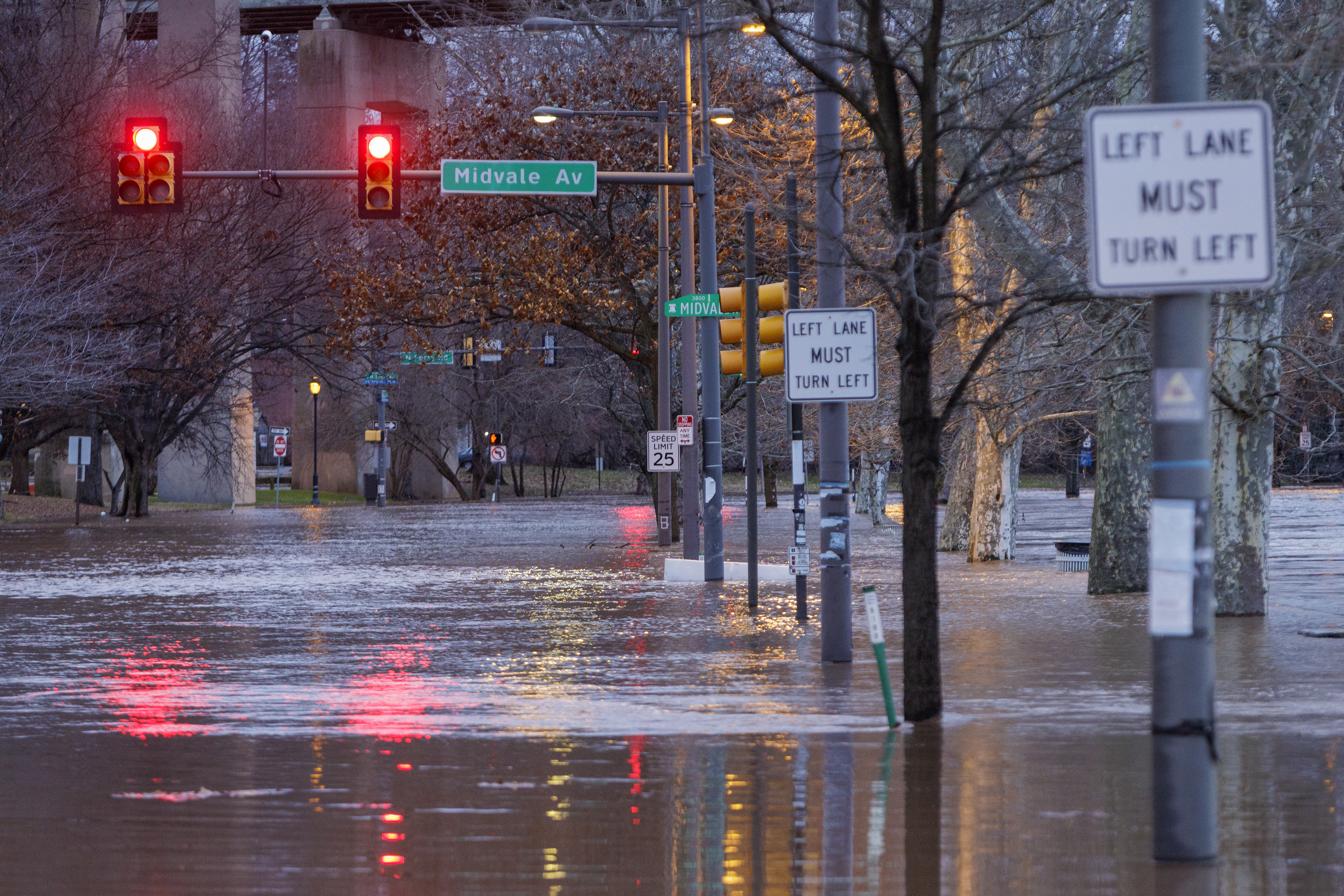
    Schuylkill River floods onto Kelly Drive at Midvale in the East Falls section of Philadelphia on Wednesday, Jan. 10, 2024.

    A comprehensive analysis of the Brandywine watershed published in April reported that impervious surfaces increased by 15% along the Great Valley’s Route 30 corridor from 2001 to 2020.

    Those increases are “significant,” said Gerald Kauffman, director of the University of Delaware’s Water Resources Center, which coauthored the study along with the Brandywine Conservancy and the Chester County Water Resources Authority.

    Municipalities welcome tax-generating development. Conversely, Kauffman said: “You get more value if you build next to a greenway. It’s the eternal debate.”

    From 2001 to 2020, the population in the Brandywine watershed grew nearly 25%, to 265,000 people, with 150,000 more expected by the end of the century. That’s a lot of rooftops and driveways feeding water into the stream, which empties into the Delaware River.

    Along the Delaware, the rising water levels of the Atlantic Ocean and the Delaware Bay are forecast to generate more flooding. The National Oceanic and Atmospheric Administration estimates that sea levels have been rising about an inch every five years.

    While the oceanic salt line — the boundary between ocean and freshwater — usually stays well south of Philly, the tidal pulses contribute to flooding in the city and areas to the north, where the channel narrows, said Amy Shallcross, water resources operations manager at the Delaware River Basin Commission.

    The five tidal gages along the Delaware from Newbold Island to Marcus Hook have registered more than 90 significant floods since 2005, according to the Inquirer analysis.

    The study was limited to the 33 USGS gages that had a period of record of at least 20 years and list designated flood stages.

    Along with the Delaware River sites, other stream gages that appeared in the top 10 list for major and moderate flooding were those on the Perkiomen, Chester, Neshaminy, and Frankford Creeks.

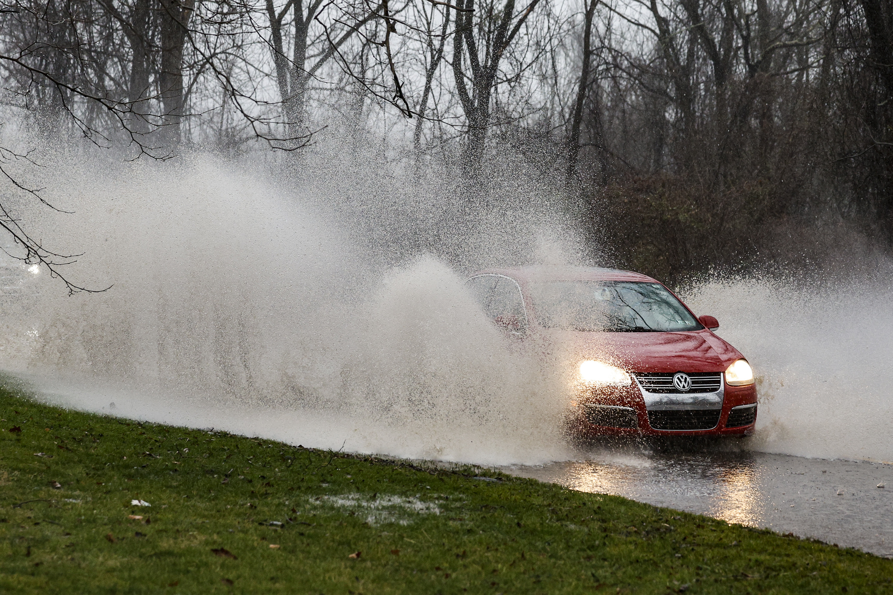
    Motorists brave the heavy rain and deep puddles along Creek Road in Chadds Ford during a nasty flood event in January 2024.

    The gage network cannot capture all the episodic flooding from the likes of thunderstorm downpours.

    Flood frequency is not the only consideration for siting a gage, said Tyler Madsen, a hydrologist with NOAA’s Middle Atlantic River Forecast Center, in State College. For example, the gages have to be located in areas free of unnatural barriers, such as bridge abutments.

    Plus, a major consideration is funding. They are costly to monitor and operate, serving multiple purposes such as measuring water quality and streamflow.

    They rely on a variety of funding sources, including state and local governments, that are not available everywhere.

    The Brandywine study’s suggested remedies included adding flood-control structures and beefing up warning systems all along the watershed, but warned: “Even with unlimited financial and technological resources, it would be impossible to eliminate all flood risks.”

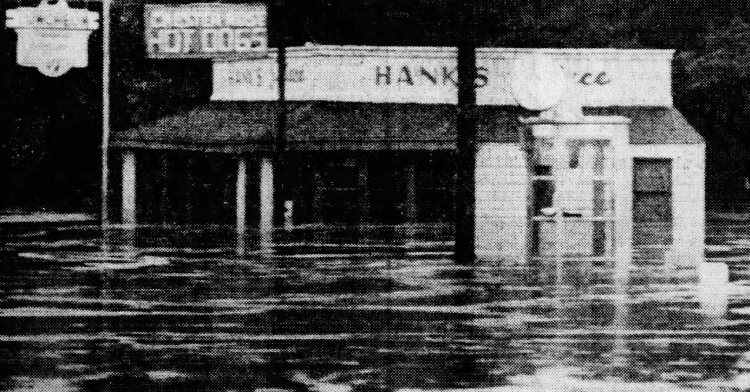
    Hank’s Place, on Routes 1 and 100 in Chadds Ford, was swamped by water from the rains of Tropical Storm Agnes in June 1972. The area has a long history of flooding, and the restaurant was reconstructed after it was flooded and damaged by Ida in 2021.

    The Youngs are prepared to live with those risks, come storms or high water.

    Said Katie Young: “Hank’s belongs here.”

  • No, it’s not going to snow on Thanksgiving in Philly, but a taste of winter is coming

    No, it’s not going to snow on Thanksgiving in Philly, but a taste of winter is coming

    The snow rumors notwithstanding, the Philadelphia region and most of the rest of the Northeast can pretty well rule out a white Thanksgiving, nor will Black Friday turn white.

    However, the upper atmosphere evidently is in a state of upheaval with a potentially rare event unfolding, and forecasters say something resembling winter may arrive around here before the holiday weekend ends.

    The National Oceanic and Atmospheric Administration’s Climate Prediction Center has chances favoring below-normal temperatures and above-normal precipitation from Thanksgiving Day through Dec. 1.

    However, the meteorologists who have grappled with longer-range outlooks are cautioning against taking social media snow forecasting too seriously.

    “The observed snowfall is inversely proportional to the hype,” said Judah Cohen, research scientist with the Massachusetts Institute of Technology. He is among those who have noticed the snow mentions that have popped up on X accounts and popular websites.

    The next week should generally be uneventful save for rain Tuesday night possibly into getaway Wednesday, when highs are forecast to reach the 60s.

    Then a developing pattern change is predicted to import colder air into the Northeast. “I do believe it will get colder as the Thanksgiving week wears on,” said Bob Larson, senior meteorologist with AccuWeather Inc.

    A rare event may chill December

    What has the attention of Cohen and others in the meteorological world is the potential for a “major” stratospheric warming event in the upper atmosphere over the Arctic sometime in the next several days, a disruption that could allow significant cold air to pour into the United States.

    Major events have occurred on average about six times a decade, according to NOAA researchers; however, having one so early would be a rarity.

    If one occurred, it would be only the second time in records dating to the early 1950s that it has happened this early, said NOAA meteorologist Laura M. Ciasto.

    While computer models have been debating over just what is going to happen, Cohen, chief of seasonal forecasting for the Janus Research Group, said that such an early date has given him pause about forecasting it will happen.

    What causes a stratospheric warming event?

    On occasion, upward-moving waves from the troposphere, 5 to 9 miles over the Arctic, crash into the stratosphere, 10 to 30 miles up. That has the effect of compromising the polar vortex, the west-to-east winds that lock cold air in the places where the sun disappears for the winter, Ciasto said.

    When the winds slacken, the vortex can weaken and allow frigid air to spill southward. In some cases it might “stretch,” or split into pieces that deliver cold air to regions of the Northern Hemisphere.

    A major disruption would have longer-lasting impacts, Cohen said.

    The European forecast model has consistently predicted a major event, Ciasto said, while the U.S. model has not been as impressed.

    What is likely to happen if the warming event occurs?

    A major warming in January 2021, when temperatures in the stratosphere suddenly jumped 65 degrees Fahrenheit, resulted in quite a snowy February in the Philadelphia region.

    After a warming event, “there’s a greater chance that the jet stream will become more disrupted and dip down” over the continuous United States, Ciasto said, “bringing cold air with it.”

    As for timing, the effects may show up anywhere from two to several weeks after the event.

    In the meantime, she noted that “several other factors,” including patterns over the North Pacific, favor a chilling for the Northeast.

    Don’t be surprised to see snow appear in an actual forecast, but not necessarily on the ground.

  • What to expect for the Philadelphia Marathon weekend weather forecast

    What to expect for the Philadelphia Marathon weekend weather forecast

    Assuming the sports scientists have it right, the temperatures should be near the performance sweet spots for the runners participating in the Philadelphia Marathon Weekend races on both Saturday and Sunday morning.

    At showtimes, 6:55 a.m., just moments after daybreak, temperatures Saturday are expected to be in the upper 40s to near 50 degrees for the half-marathoners, and in the upper 30s to around 40 for Sunday’s main event.

    Light rain is expected through the early-morning hours Saturday, and forecasters have been on the fence about when it will shut off. Nick Guzzo, a meteorologist at the National Weather Service said Friday afternoon that rain was likely at the start of the race, but that probabilities would drop precipitously once the event was underway.

    AccuWeather Inc. and weather.com were posting about a 50-50 shot that the rain would continue through the morning. The hedging isn’t surprising; timing the onset and end of precipitation has been a longstanding forecast problem.

    Nor would it be surprising for those running the 13.1-mile race to experience conditions different from those logging 26.2 miles the following day, points out Kathleen Titus, the race director and runner who has been involved with the marathon for 20 years.

    This time of year is a busy one for frontal passages, this being a transition period when the atmosphere isn’t quite sure what season it wants to be. The temperature has reached 74 degrees on Nov. 22 (1883), and plunged to 14 (1880), and snowed 4.6 inches on Nov. 22-23, 1989.

    However, nothing momentous is expected this weekend.

    Like the rains, winds are forecast to be light, under 10 mph, from the north on Saturday, and northwest on Sunday, although runners allow that on the course, the wind can be way more capricious than the temperatures.

    Why runners like these temperatures

    Various studies have concluded that temperature is the most important weather variable in runner performance and that the ideal range for marathoning is 39 to 50 degrees Fahrenheit — give or take a few degrees.

    “Your body is always competing between a couple of different things,” said Philip Skiba, sports medicine specialist at Thomas Jefferson University Hospital, who helped train Eliud Kipchoge, the Kenyan who became the world’s first runner to complete a marathon in under two hours.

    During exercise, muscles demand blood to work, while for the body to stay cool, blood has to flow to the skin. If it’s too hot, more blood flows to the skin. When it’s cold, blood is diverted to heat the body’s core.

    With temperates in that 39-to-50 range, the blood flow can more easily serve both the muscles and skin. Said Titus, racers love that temperature range because, “It regulates your body. It just works.”

    Skiba said the temperature ranged from 51 to 55 degrees on the October 2019 day Kipchoge broke the two-hour barrier in a Vienna event that wasn’t held under record-eligible conditions.

    Had the temperatures been lower, Kipchoge could have shaved a few more seconds off his time, Skiba said.

    The wind also is a player in marathons

    While not as dominant as temperature, “wind resistance … is worth a few seconds per mile,” said Skiba, a former triathlete.

    “The more you stay out of the wind, you can save considerable energy,” he said.

    “It’s really important to learn how to draft,” that is, get behind a group running close to your pace and using them for wind-breakers, he said. (Not sure how the wind-breakers feel about that.)

    On the Philly course, the winds can be wild cards, especially on Kelly Drive, Titus said.

    One instant, the wind “hits in your face. Now it’s at my back!”

    Titus said she actually likes running uphill into the wind — and she is believed to be a member of a distinct minority — but agrees that “it is nice to have it at your back when you’re coming into the home stretch. Because it does give you a little boost.”

    The Philly Marathon is holding out hope for a record

    Titus said she is hoping for a record this year, unrelated to race times.

    She encourages people to overdress to stay warm before the running gets underway, and to be liberal about peeling off layers during the race.

    The shed garments are collected and given to the Salvation Army.

    “We’d love to break some record in the clothing donation,” she said.

  • A storm looms in what’s going to be another rough week for Jersey beaches

    A storm looms in what’s going to be another rough week for Jersey beaches

    New Jersey’s beaches, still recovering from major sand losses from an offshore hurricane and a nor’easter, evidently are in for another assault this week as October is about to make a dramatic exit.

    Gale-force gusts off the ocean could develop as early as Tuesday afternoon at the Shore, said Eric Hoeflich, a meteorologist at the National Weather Service office in Mount Holly, with brisk onshore winds persisting “maybe into Friday.”

    A potent storm is forecast to affect the entire region Wednesday night into Thursday, with heavy rains in the immediate Philadelphia area, where drought conditions have been intensifying.

    Also on Thursday, what is likely to become catastrophic Hurricane Melissa will be passing offshore, churning up the waves crashing on East Coast beaches.

    “The coast once again is going to take a pretty good battering,” said Dave Dombek, senior meteorologist with AccuWeather Inc.

    On the plus side, Hoeflich said, for the Shore, this week’s storm “doesn’t look as bad” as the beach-erasing nor’easter earlier this month. The path should be more inland, and the lunar influence on the tides would be less. Only minor flooding is expected, he said, subject to change.

    However, not only would the track mean region-wide heavy rain, but it would also increase the potential for severe thunderstorms Thursday. A front is due to chase the rains Friday, but it may generate gusts to 50 mph, the weather service says. Power outages are possible both days.

    The timetable for the winds and the storm in the Philly region

    The National Weather Service has posted a gale warning for Tuesday into Wednesday morning for the waters along the immediate coast for winds from the east that could gust past 50 mph.

    That would be more the result of high pressure to the north of the region. Winds circulate clockwise around centers of highs; thus, areas to the south of the center experience winds from the east.

    The breezes will be getting a second wind as a storm develops in the Southeast and tracks north. Meanwhile, a weakened Hurricane Melissa will be churning the ocean as it passes well off the U.S. coast on Thursday.

    The Philly region could use the rain

    The interagency U.S. drought monitor has the majority of the region in its “moderate drought” category.

    Rain for the last 30 days has been about a third of normal in the city and the neighboring Pennsylvania counties.

    South Jersey has fared only slightly better, but precipitation is well less than half of normal.

    What is the forecast for the trick-or-treaters?

    It is all but certain that Friday will be a dry day, with temperatures in the low and mid-50s. Wind gusts are forecast to die down sometime after 5 p.m., but hold onto those brooms, just in case.

  • These Philly neighborhoods get the worst of the summer heat

    These Philly neighborhoods get the worst of the summer heat

    A crew working at a Philadelphia warehouse Tuesday was well on its way toward building 120 combination shade stations and planters to be installed this summer on sidewalks in the Kingsessing, Point Breeze, Grays Ferry, and Haddington neighborhoods.

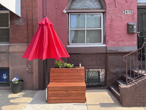
    The stations, many of which have already been installed, are built of pressure-treated lumber and come with a bench, umbrella, and decorative planter.

    “This idea started as a job creation and heat mitigation program but turned into a broader set of things,” said Franco Montalto, a Drexel engineering professor who directs the program. “We found that a lot of people like these planters. They create social opportunities, and they are an aesthetic improvement.”

    The shade can’t come soon enough. Temperatures are forecast to reach 97 on Friday, setting up a dual summer ick for Philadelphians: high heat, high humidity. Together, they’ll combine to make it feel like 106.

    This week’s heat wave comes on the heels of data showing Philadelphia ranks as the sixth highest U.S. city for the number of people experiencing an “urban heat-island effect” of more than 9 degrees compared to those living in nonurban areas. It is also one of the few cities that have neighborhoods exceeding 12 degrees of heat island effect.

    !function(){“use strict”;window.addEventListener(“message”,(function(a){if(void 0!==a.data[“datawrapper-height”]){var e=document.querySelectorAll(“iframe”);for(var t in a.data[“datawrapper-height”])for(var r=0;r<e.length;r++)if(e[r].contentWindow===a.source){var i=a.data["datawrapper-height"][t]+"px";e[r].style.height=i}}}))}();

    Where it’s hottest

    The data from the nonprofit Climate Central provide a model for which city neighborhoods are most vulnerable during heat waves because of the density of sidewalks, streets and buildings, along with the lack of tree cover.

    Parts of Center City rank among the top for a heat island effect of more than 12 degrees. Center City, however, certainly has residents but is mostly a large swath of offices and retail and not representative of the city’s true residential neighborhoods.

    Those highly residential areas, such as Fairmount, Spring Garden, North Philadelphia, East Schuylkill, Southwest Center City, Point Breeze, Kensington, Bella Vista, and Southwark, all bake up to 10 degrees higher than surrounding neighborhoods outside the city, the data suggest.

    City officials have said previously that temperatures in some neighborhoods, such as Hunting Park, can rise even higher, leaving medically vulnerable residents at risk. This year, Mayor Jim Kenney’s administration launched a 10-year Philly Tree Plan that calls for planting thousands of trees to increase the city’s canopy to 30% as a way of tackling the disparity.

    In general, areas of the city near big parks, with more detached homes and more tree canopy fare much better. Pennypack, West Oak Lane, Overbrook, Olney, Frankford, Bustleton, Northeast Philadelphia, East Falls, and Manayunk all experience a heat-island effect of less than 7 degrees.

    (function() {
    var l2 = function() {
    new pym.Parent(‘heatisland26’,
    ‘https://media.inquirer.com/storage/inquirer/projects/innovation/arcgis_iframe/heatisland26.html’);
    };
    if (typeof(pym) === ‘undefined’) {
    var h = document.getElementsByTagName(‘head’)[0],
    s = document.createElement(‘script’);
    s.type = ‘text/javascript’;
    s.src = ‘https://pym.nprapps.org/pym.v1.min.js’;
    s.onload = l2;
    h.appendChild(s);
    } else {
    l2();
    }
    })();

    Philly’s islands of heat

    Climate Central did not base its study on actual temperatures, but rather on modeling that combines data from satellite imagery, impervious land cover, green space, building footprints, transportation, and census tract population data.

    Scientists use the data to model which tracts would likely be warmer than others. For example, buildings, roads, and other infrastructure absorb and reemit the sun’s heat more than forests and rivers. Dark surfaces, such as black asphalt roofs, reflect less light and retain more heat. As a result, certain areas can become hotter during extreme heat relative to suburban and rural areas, according to the U.S. Environmental Protection Agency.

    The heat-island effect strikes a mix of neighborhoods:

    • For example, a neighborhood in the eastern part of North Philadelphia has an urban heat-island effect of more than 11 degrees. The population is 12% Hispanic, 16% Black, 44% white, and 23% Asian.
    • A cluster of streets in Kensington has a heat-island effect of 10 degrees, according to the Climate Central data. The neighborhood is 51% Hispanic, 25% Black, and 19% white. But a cluster in South Philly that’s 73% white, 10% Hispanic, 13% Asian and 2% Black sees the same 10 degree effect.
    • One of the least impacted parts of the city, West Oak Lane, with a 6.6 degree heat-island effect, is 94% Black. And people living in mostly white Bustleton experience the same effect.

    The data, however, differ from Philadelphia’s Heat Vulnerability Index, which is used to indicate neighborhoods most at risk during extreme heat events. The city’s index takes into account more than just temperature. It looks at social, economic and health factors such as age, education, language barriers, percent of people living in poverty, race and ethnicity, and social isolation. It looks at the number of people who have asthma, heart disease, and other health issues.

    For example, the Climate Central data give a census tract in North Philadelphia a heat-island effect of 7.75 degrees, which is not among the highest in the city. But the city assigns the same tract a “very high” score on the Heat Vulnerability Index. The neighborhood is 95% nonwhite, many live below the poverty line and have obesity and hypertension.

    “Every day is a learning experience,” said Omar Sewell, 42, of South Philadelphia, who is working under a Drexel-led program to build shade stations for city sidewalks. Sewell spoke at the program’s rented warehouse in Kingsessing on Tuesday.

    Finding shade

    Jennifer Brady, a former EPA staffer who conducted the analysis for Climate Central, said it makes sense that Center City would show a high degree of heat-island effect because of the population density, paucity of trees, tall buildings, and infrastructure that absorbs heat and reduces airflow.

    The impact of heat on people in Center City might be much less than in other neighborhoods, Brady said. That’s because people in Center City tend to be wealthier with the means to escape or have easy access to air-conditioned apartments, offices, stores, or shaded square.

    “There are other neighborhoods that are not only high risk, but you can’t walk three or four blocks to find any kind of cover or shaded area,” Brady said. “That’s not accounted for in the data. That’s something not explicitly in these numbers, but is an important consideration when you’re thinking about people being able to escape from the heat.”

    So, lower-income residents of color tend to bear the brunt of extreme heat’s impact. In 2020, for example, the Hunting Park Neighborhood Advisory Committee surveyed residents about how they cope with heat and asked how many had air-conditioning. Out of 563 who answered, only 100 had air-conditioning.

    To help residents cope, the city operates scores of cooling centers, which can include air conditioned buses.

    ‘A learning experience’

    Back at the Drexel program, Oman Sewell, 42, of South Philly was working in a warehouse in Kingessing that Montalto’s program rents to build the shade-giving planters. The planters are placed with guidance from of local community organizations. It’s the fourth year of the program, which is funded by the William Penn Foundation and started with planter installations in Hunting Park.

    Sewell started working in June under the tutelage of architect Angelo Zaharatos, founder of Arxis League, a New York-based design group. Sewell was busy Tuesday helping assemble the planters after having made many of the cuts on a miter saw.

    Sewell is enthusiastic about the program and credits Zaharatos with daily uplifting readings that might come from, say, Marcus Aurelius, a Roman emperor and philosopher.

    “Every day is a learning experience,” Sewell said. “It opens your mind, showing you can actually uses these building blocks and turn the skills into something you can use the rest of your life.”

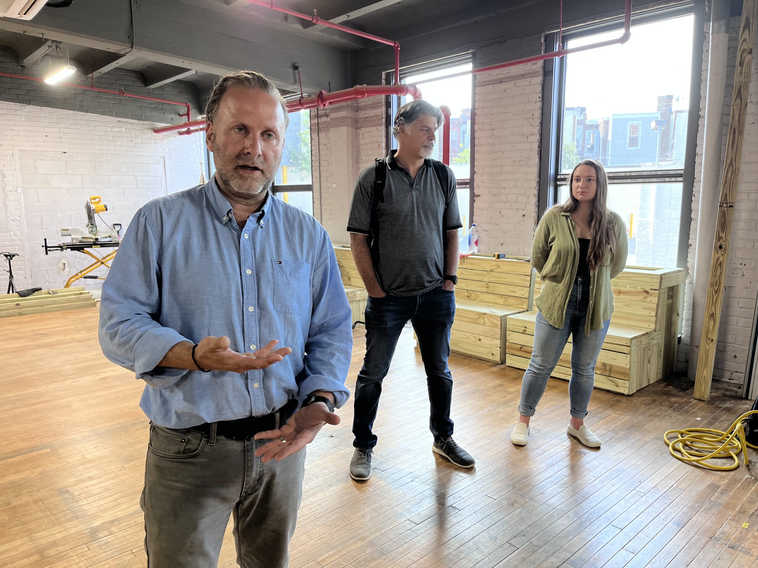
    Architect Angelo Zaharatos explains how shade-giving planters are built at a warehouse in Philadelphia’s Kingsessing neighborhood. Drexel professor Franco Montalto (middle) oversees the program. Nikki Pearl (right) manages it.