Category: Climate

  • Philly-area rain totals varied dramatically, and drought conditions survived the storms

    Philly-area rain totals varied dramatically, and drought conditions survived the storms

    The storms took down trees and wires, flooded roads, spoiled a World Cup party, and set off a deluge of smartphone panic alerts. But they evidently didn’t come close to erasing the rain deficits throughout the Philly region.

    Even with the additional light rains on Tuesday, bringing the two-day total to about 1.45 inches, officially Philadelphia’s rainfall for June still is slightly below normal, and this is after an extraordinary streak of 10 consecutive months of below-normal precipitation.

    And Monday’s storms exhibited a classic summer caprice. Areas of New Jersey and Chester County, both under state-declared drought emergencies, were all but stiffed, according to an analysis by the National Weather Service’s Middle Atlantic River Forecast Center. Northwestern Philadelphia and southeastern Montgomery County got as much as 2 inches.

    The weather service’s Mount Holly office reported that totals within counties varied radically. In Bucks County, for example, 1.8 inches was measured in Bristol and just over a half inch in Doylestown. Across the river, 2.4 inches fell upon Sewell, and about 0.75 in Monroe Township.

    “Some areas got it, some didn’t,” said Ben Casella, executive director of the New Jersey Farm Bureau. It can “rain here, but it may not rain on the other side of town,” he said.

    Not all of that Monday rain was beneficial, said Andrew Frankenfield, educator with the Penn State Agriculture extension in Montgomery County. Some of the water in those downpours on Monday rushed to the gutters and didn’t stop to soak into the soil.

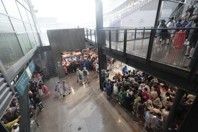
    And those cloudbursts certainly weren’t beneficial to people routed from the World Cup fan fest in Fairmount Park, or to some motorists. Numerous water rescues were reported in the Wyncote section of Cheltenham Township, Montgomery County, And the weather service noted several reports of flooded streets and rushing water up to a foot deep floating cars in Germantown.

    Tuesday’s gentle rains, Frankenfield said, were more beneficial to the plant life, which is only going to get thirstier as the summer progresses.

    Is more rain coming to the Philly region?

    Showers are possible Thursday, said Alex Staarmann, meteorologist with the National Weather Service in Mount Holly, with a better shot Friday night and Saturday.

    However, these may again be lottery-ball situations, something with which farmers are well acquainted.

    Generally throughout the region through Monday, precipitation was running about 75% of normal, on average about 5 inches below normal, according to the river center, which bases its surveys on several measuring stations in each county.

    The latest interagency U.S. Drought Monitor map had most of the region in “moderate drought,” but Cape May County and areas of New Jersey near Delaware Bay are in “extreme drought.” Those regions were all but shut out from the Monday downpours.

    They evidently fared a bit better on Tuesday, with the Millville airport reporting about a third of an inch, and a half inch measured in Sea Isle City.

    While the rains were welcome, the drought anxieties persist, Casella said.

    “As we turn the calendar into July, the crops are going to need more moisture,” Frankenfield said.

    “We certainly need more” rain, he said. “We can’t make it up in a week, we can’t make it up in a month. We’re concerned, but not alarmed.”
  • Storms move through the Philly area, bringing heavy rains, tornado warnings, and flooding

    Storms move through the Philly area, bringing heavy rains, tornado warnings, and flooding

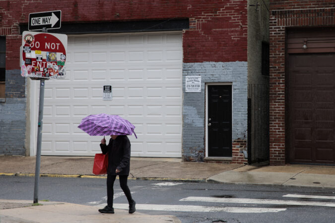
    After 10 months of precipitation deficits, the Philadelphia region was due for some drought relief — but maybe not this much relief, this fast.

    Powerful thunderstorms that set off tornado and severe-storm warnings and waterfall-like downpours arrived in the region Monday just in time for the peak afternoon commute and the France vs. Iraq World Cup match in South Philly.

    And while the tornado warnings and the worst of the storms had backed off by nightfall, the rains were reluctant to give it up, and the National Weather Service warned that more heavy showers are possible Tuesday.

    “It’s been a while since we had rains like this,” said Patrick O’Hara, a meteorologist at the National Weather Service Office in Mount Holly, which issued multiple flood warnings into the evening. Flooding occurred on the Schuylkill Expressway near Gladwyne, and several water rescues were reported in Cheltenham Township.

    Frankford Creek in Philadelphia rose well into moderate flood stage.

    The agency also had issued two tornado warnings for parts of Chester, Delaware, and Montgomery Counties after Doppler radar had detected radar signatures.

    Multiple uprooted trees were reported in the Valley Forge area, officials said. Several reports of downed wires and trees branches and hailstones came from across the region from Chester County and South Jersey.

    The timing could have been worse, but maybe not much worse for World Cup participants and the nearly 70,000 fans who came to watch the rain-interrupted match.

    A severe-storm warning for Philly popped up just as the World Cup match between France and Iraq in South Philly was underway. That was quickly followed by one for Southwest Philadelphia, parts of Delco, and South Jersey.

    The weather service’s flash flood watch remained in effect until 6 a.m. Tuesday.

    On Monday afternoon an early arriving strong storm passed through parts of Philadelphia and Burlington County, snapping trees and taking down “multiple branches” in the Holmesburg section of the city, the weather service said.

    That was followed by a potent storm that generated strong winds and torrential rains north and west of the city and then even stronger storms and flooding downpours throughout the region.

    Will the rains end the Philly region’s drought conditions?

    Not likely. Life is not fair, and neither is summer rain, which by its nature is capricious.

    About 1.2 inches of rain was measured at Philadelphia International Airport on Monday, with over an inch of that falling between 6 p.m. and 8 p.m.

    The rains weren’t evenly distributed across the region, but the Philly total is of some significance: It brought the city’s total close to the normal for June.

    Based on the forecasts of the potential for more substantial rains Tuesday, Phllly stands to break an impressive streak of 10 consecutive months of below-normal precipitation.

    Most of the region is in “moderate drought” according to the inter-agency U.S. Drought Monitor, and Cape May County, most of Delaware, and New Jersey areas along the Delaware Bay are in “extreme drought.”

    State-declared drought emergencies are in effect for New Jersey and Chester County.

    It is unclear how helpful Monday’s rains were in terms of dousing the drought condtions.

    Downpours aren’t known for their attention spans, and rains can run off rapidly.

    “If the rain doesn’t penetrate the soil, it doesn’t help,” said O’Hara, “Ideally, it would soak into the ground over a couple-day period. That would really help.”

  • Strong storms and downpours Monday could affect Philly’s next World Cup match

    After 10 months of precipitation deficits, the region is expected to experience severe storms and much-needed rain on Monday — unfortunately, the worst might coincide with the timing of the France vs. Iraq World Cup match in South Philly.

    The strongest could arrive around the scheduled start of the match, at 5 p.m., said Brian Hurley, senior branch meteorologist with the federal Weather Prediction Center in College Park, Md.

    Given how daytime heating can add volatility to the atmosphere, with severe-thunderstorm threats in the Mid-Atlantic region, he said, in the late afternoon “we’re always asking for it.”

    The Storm Prediction Center in Norman, Okla., which issues those severe storm watches, listed a 2% chance of tornadoes, and an “isolated” twister can’t be ruled out, said Nick Guzzo, meteorologist with the National Weather Service in Mount Holly.

    The storm center listed a 15% chance of damaging straight-line winds with gusts approaching 60 mph.

    With the anticipated moisture capacity of the atmosphere on Monday, localized downpours that could wring up to 2 inches of rain in a hurry could set off localized flooding.

    “Not everyone will get them,” said Hurley.

    He said a round of heavy showers is likely in the late afternoon or early evening, and then it’s possible that rains will shut off, with even an outside shot at a rainbow.

    But more rain is likely later at night and during the overnight hours.

    Overall, forecasters said, just about every area of the region should get a half-inch of rain.

    Officially, Philadelphia has had 10 consecutive months of below-normal precipitation. All of New Jersey and Chester County are under state-declared “drought emergencies,” although conditions have been improving.

    Most of the rest of the region is in “moderate drought,” according to the interagency U.S. Drought Monitor.

    On the plus side, no more extreme heat is in the forecast, with highs topping out in the 80s through next Sunday.

  • Summer arrives officially Sunday in Philly, with El Niño, drought, and the moon as major players

    Summer arrives officially Sunday in Philly, with El Niño, drought, and the moon as major players

    Given the atmosphere’s impatience, it would be understandable if some folks believe that the summer of 2026 began weeks ago.

    But officially, the astronomical summer does not start until 4:24 a.m. Sunday, the instant of the solstice, when the sun beams its most direct light on the Tropic of Cancer. (That’s the one that bisects Mexico.)

    Perhaps the pleasant temperatures this weekend are an overdue solstice gift to the region.

    Officially, on 14 days this year, the temperature has reached at least 90 degrees at Philadelphia International Airport. While not a record — this happened 21 times before the 1991 summer solstice — that is a total more appropriate to midsummer. The annual average is about 30, and usually this kind of heat doesn’t get a jump start in mid-April.

    Is it going to get hot again?

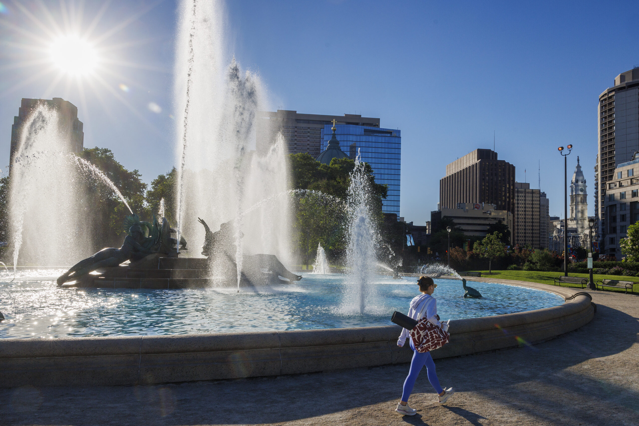
    A woman walks past Swann Memorial Fountain as the sun rises last month.

    Are polar bears white?

    At least three veteran seasonal forecasters have commented that they expect the burgeoning El Niño event to work against punitive hot spells in the region.

    During El Niño, sea-surface temperatures remain above normal in the tropical Pacific for several months, agitating the overlying air and affecting weather across the globe. This one may be among the strongest and is forecast to mature during the summer, earlier than usual.

    During six early-developing strong El Niños, summer temperatures in Philadelphia were near or below average.

    However, the scientists at the government’s Climate Prediction Center evidently are not buying it. In both the July and the July 1-through Aug. 31 outlooks posted Thursday, they saw the odds favoring above-normal temperatures.

    On average Philly has a combined 20 days of 90-degree highs in July, when the Earth is the farthest it gets from the sun, and August. (Along with a September bonus of two more.)

    How come it’s warmer, if we’re farther from the sun?

    On average the Earth is about 93 million miles from the sun, but since its orbit is an imperfect circle the distance varies by roughly 3 million miles.

    At 1 p.m. on July 6 our planet will be 94.5 million miles from the sun, by EarthSky’s calculation, its farthest distance of the year. It makes its annual closest approach in January, which is why winter in the Northern Hemisphere is the shortest season; the gravitational bump speeds up the trip, and February gets shortened.

    The seasonal weather rhythms are about the Earth’s axial tilt, not distance from the sun, and the planet takes its time responding to the changes in solar energy. Just as January is colder than December on average, July is more than 5 degrees warmer in Philly than June on average. Just how warm it gets the rest of this summer may have a lot to do with how much drier it gets.

    Will the drought conditions ever end?

    They always have, but this has been quite an extraordinary run, even if the plant life has managed to avoid major distress.

    The entire region, save for extreme northeastern Bucks County, is in a state of “severe drought,” according to the U.S. Drought Monitor, with Cape May County in “extreme drought.”

    The promised rain to start the workweek should help, but Philadelphia has experienced 10 consecutive months of below-normal precipitation, a rarity in an area in such proximity to bodies of water that are sources of rainfall. All of New Jersey and Chester County remain under drought emergencies.

    Dryness can promote heating, since the sun does not have to divert energy evaporating water.

    However, unusual coolness also can accompany dryness, said Sarah Johnson, warning coordination meteorologist at the National Weather Service office in Mount Holly. Having lived in North Dakota for 20 years, she knows her dry air.

    A lack of moisture can be a boon for cooler nights. Water vapor in the air inhibits nighttime cooling by blocking heat from escaping into the atmosphere.

    It also happens that less vapor in the air is ideal for sky-watching, and that could come in handy in August.

    This could be a big year for the Perseids

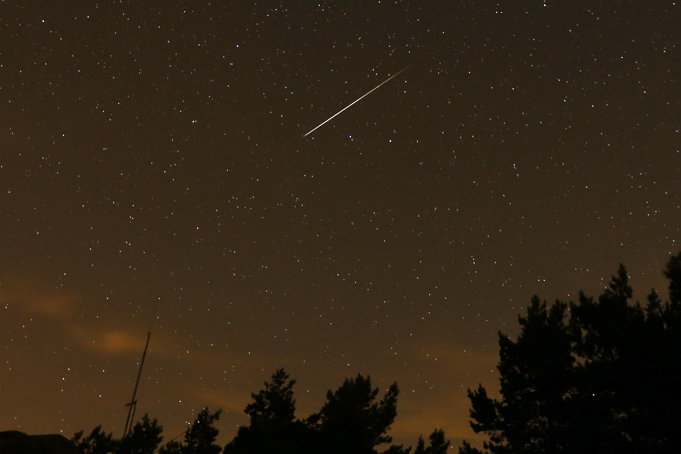
    In this long exposure photo, a Perseid meteor streaks above Madrid.

    Last year, you may recall that the moon showed its big face during the peak of the annual Perseid meteor showers, the most popular of the year.

    This time around, the moon is getting out of the way, and will be in its “new” phase during the peak early mornings of Aug. 12 and 13.

    While the Geminids, which occur in December, are considered the most prolific showers of the year, according to the American Meteor Society, they are not as popular as the Perseids: People tend to prefer August nights to December’s.

    The Perseids are so named because the cometic detritus that is ignited by the atmosphere appears to radiate from the constellation Perseus. In the early-morning hours, that typically is low in the northern sky.

    Under ideal conditions — ultra-dark, light-pollution free skies — as many as 90 meteors an hour might be visible, EarthSky says.

    But the moon will be the star in late August

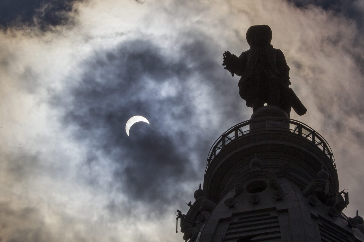
    Billy Penn waves at the moon during a lunar eclipse.

    Two weeks after the Perseid peak, Philadelphia and most of the rest of the Western Hemisphere will be treated to a lunar eclipse in which just about all of the moon will be in shadow.

    The show begins at 9:24 p.m. Aug. 28, and more than 90% of the moon will be obscured by Earth’s shadow three hours later. It will be all over around 4 a.m.

    Chances are excellent that the region will still be needing rain, but may it choose another night.

  • Philly has been seeing huge temperature swings within 24 hours. Here’s what’s going on.

    Philly has been seeing huge temperature swings within 24 hours. Here’s what’s going on.

    Like so many humans, perhaps the atmosphere is having issues adjusting to the time change. At the very least, it’s having trouble keeping track of the seasons.

    After making a run at 70 degrees on a stormy Monday, on Tuesday it will be welcome back to hats and gloves in Philly.

    Temperatures were forecast to fall to freezing by daybreak, which would be a drop of 35 to 40 degrees in less than 24 hours. In some years, that would rank among the biggest annual day-to-day temperature drops.

    But this comes less than a week after the official readings plummeted from 83 degrees, normal for mid-June, to 35 in 24 hours, one of the largest day-to-day temperature swings in Philly’s climate record.

    In official record-keeping dating to 1874 — covering more than 55,000 days — the Wednesday-to-Thursday shift would rank in the top 20 for day-to-day temperature tumbles, according to an Inquirer analysis.

    “It’s really remarkable,” said Eric Balaban, pulmonary and critical care fellow at the Temple Lung Center.

    He and other experts say that aside from what it may do to the morale of spring’s ardent fans, the thermal roller-coaster and the accompanying winds likely are having effects on health, particularly for people with respiratory cardiovascular conditions.

    And we probably should expect to see the dramatic swings to continue for a while, said Matt Benz, senior meteorologist with AccuWeather Inc.

    “I’d be surprised if we didn’t, given the pattern we’ve being going through,” Benz said.

    Why the temperature has been so jumpy lately in Philly

    Philadelphia and other areas in the mid-latitudes are prone to become battlegrounds this time of year between the stubborn winter and the impatient spring.

    March is notorious for temperature swings as cold air masses from the north encounter encroaching warmth and storms tend to form along the borders of the skirmishes.

    One reason the contrasts have been especially vigorous this year is the obvious. “After this hard winter, that’s to be expected,” said Ray Martin, a lead meteorologist at the National Weather Service. We haven’t had many of those lately.

    But that 48-degree drop last week belongs in an elite category. It ranked No. 18 among day-to-day temperature falls, based on the available records. The all-timer was the 57-degree drop from March 28 to 29 in 1921, with several 50-degree drops appearing in the record.

    Whenever they occur, the radical shifts can have health consequences, according to medical experts and a variety of studies.

    The possible health effects of rapid temperature changes

    The temperature changes typically are set off by potent fronts, such as the one that crashed through the region on Monday, and they generate powerful winds.

    By stirring particulate matter and transporting early tree pollens, the winds present a risk to those with respiratory conditions and allergies, said Manav N. Segal, with the Chestnut Hill Allergy & Asthma practice.

    “We are seeing an increase in call volume already because of patients’ spring allergy symptoms,” he said Monday. And conditions this week are just a prequel: The allergy season will pick up steam once the weather turns more consistently warmer and the allergy season intensifies, he said.

    Said Balaban, “People who have preexsiting conditions are simply at higher risk.”

    Rapid changes in temperature and levels of atmospheric moisture with frontal passages can irritate the airways and increase airway inflammation, said Joann Martin, nurse with Guardian Nurses Healthcare Advocates in Flourtown, Montgomery County. Studies have shown associations between temperature variability and increased asthma-related hospital visits.

    Changes in temperature, humidity, and barometric pressure — a measure of the weight of the air that falls as fronts approach and rises after they pass — are “recognized triggers for migraine and severe headaches.”

    In addition, “Sudden temperature shifts can affect blood pressure, vascular tone, and cardiac workload,” Martin said, increasing the changes for heart attacks and strokes.

    For most people, however, after a long winter, the temperature drops are a source of frustration over the delay of a much-anticipated spring.

    More temperature swings are likely in coming weeks in the Philly region

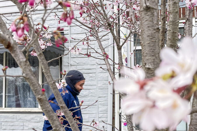
    For now, at least, it appears that the region’s cherry blossoms should be safe, even though temperatures Tuesday morning were expected to come close to freezing in Philly and may fall into the upper 20s Wednesday and Thursday mornings.

    Daytime highs won’t be much higher than 40 Tuesday and Wednesday, before a modest warmup begins.

    It likely would take a serious late-March or early-April freeze to damage the blossoms, said Sandi Polyakov, head gardener for the Japan America Society of Greater Philadelphia. He expects a bloom peak in early April.

    However, the temperature seesaw probably isn’t over, said AccuWeather’s Benz.

    “There’s still a lot of cold air left over in Canada,” he said, ”and a lot of warmth coming up from the Gulf.”

    He noted that Monday’s storm was dropping a healthy 20 to 30 inches of snow in the western Great Lakes.

    “Until we get out of that type of stuff,” he said, “the cold air doesn’t have to go very far to get here.”

  • After an actual winter in the Philly region, plant life may see the impacts

    After an actual winter in the Philly region, plant life may see the impacts

    Temperatures in the Philly region may not visit freezing again until the end of next week, with a run of 70-degree days possible in the interim. And after some substantial winter napping, the region’s plant life is going to notice.

    Horticulturalists offered a variety of perspectives on what effects the surprisingly enduring snow and ice snow cover and Arctic freezes have had on the regional flora and what may be ahead.

    They allow that while it wasn’t exactly a vacation, spending five weeks and change under a glacier and snowpacks hasn’t been all bad for the plant life.

    But as the great thaw accelerates, they have cautionary words for home gardeners: Watch your step.

    And meteorologists warn that if you expect the thaw to be linear, you clearly have wandered into the wrong part of the country. Winter and spring are still in a nasty turf war that can turn ugly in March in the Northeast.

    Five weeks under the covers had benefits for Philly’s plant life

    Officially, Philadelphia has logged 36 days of snow cover of at least one inch, including 23 consecutive days after the Jan. 25 snow-and-ice fest. The timing of that snowpack was fortuitous in that it “insulated the ground, protecting perennials, grasses, and marginally hardy bulbs” from the Arctic freezes that followed, said Lisa Roper, horticulturalist at Chanticleer Garden in Wayne.

    Horticulturist Lisa Roper tends to echinacea Tennesseensis at the Gravel Garden at Chanticleer in this file photo. She says the snow offered a measure of protection for the plants.

    Said Sky Deswert, garden educator with the Norris Square Neighborhood Project in Philly, “Without the snow, there is a greater risk that dormant plants and roots will suffer from the cold.”

    The snow was beneficial “to things like blue hydrangeas, insulating the stems from the cold,” said Bill Cullina, executive director of the University of Pennsylvania’s Morris Arboretum & Gardens in Chestnut Hill.

    Overall, said Roger Davis, a landscape manager at Longwood Gardens in Chester County, “Snow cover does not typically cause any problems for most plants in our home gardens.”

    Unfortunately, it also typically doesn’t cause problems for voles, those plant-nibbling so-called field mice that evidently had a field day.

    But the winter also offered significant challenges

    “Voles have been active underground, eating roots and even the crowns of grasses and perennials,” said Cullina. Snow has given voles ideal cover from an impressive lists of predators, including owls, foxes, raccoons, and cats.

    They can kill shrubs and small trees by chewing at ground level, said Chanticleer’s Roper.

    Deer also have been nuisances. “Heavy snow cover makes it difficult for deer to find food,” she said. “The deer will start to eat plants they typically leave alone.”

    At Morris Arboretum, Cullina said, “They have been browsing needled evergreens that they normally ignore.”

    Bill Cullina shown here in this file photo in front of a a red oak tree at the Morris Arboretum. Beware of “mud time,” he advises.

    He added that frost-heaving, in which soil expands and contracts with fluctuating temperatures, is back after taking off much of this century. “This can force recently planted perennials and even shrubs as well as bulbs out of the ground.”

    Said Roper, “Keep your eye out for plants pushed out of the ground; you can stick them back in if you see them.”

    Some of the broad-leaved evergreens, such as rhododendron and hollies, may have suffered from “the combined effects of sun reflecting off the snow and frozen ground that prevents water uptake,” said Cullina. That can lead to leaf burn and defoliation.

    “Not much you can do at this point except wait until the plants leaf out …and then prune off any dead branches,” he said.

    Shrubs planted near the eaves of houses may have suffered from another hazard — rooftop snow, said Theresa Smith, senior vice president of NaturLawn, a national lawn service company with several outlets in the region. “When you have snow falling off in heavy pieces, it’s definitely going to damage some of those softer plants.”

    And beware of salt damage on lawns, particularly near well-salted roads and driveways, said Smith. Salt can dehydrate vegetation. She also warned that prolonged snow cover can yield bumper crops of “snow mold,” a fungus that thrives in cold, moist conditions.

    If you see those unsightly straw-colored mold patches, rake them out and put down grass seed on the bare spots, Roper said.

    ‘Mud season’ has arrived in Philly. Watch where you step.

    The ground has assumed a certain spongelike quality now that most of the snow is melted, and it’s going to take some time to wring out the sponge.

    Cullina said that reminiscent of his native Maine, it “feels like Philly is getting a little taste of mud season this year.”

    Smith strongly advises gardeners to keep off the mud as much as possible. “You don’t want to add to the compaction that’s already there,” she said.

    The tighter the soil gets, said Longwood’s Davis, the more it reduces the air spaces. “Foot traffic has more effect on wet soil than you might think.”

    And beware the moods of March

    Smith cautions against yielding to an agricultural spring fever, despite the promising temperature forecast for the next several days. Starting Sunday, the high temperatures could reach 70 degrees on four or five days, said Bob Larsen, a senior meteorologist with AccuWeather Inc.

    Smith votes for harnessing planting ambitions during March, a notorious transitional month when the aggressive warm air masses clash with the retreating winter.

    Her birthday is in March, and she recalls receiving snow as a not necessarily welcome birthday present more than once.

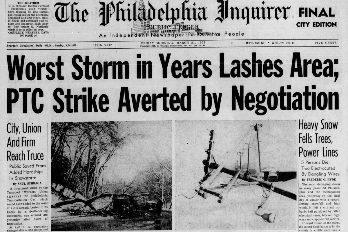
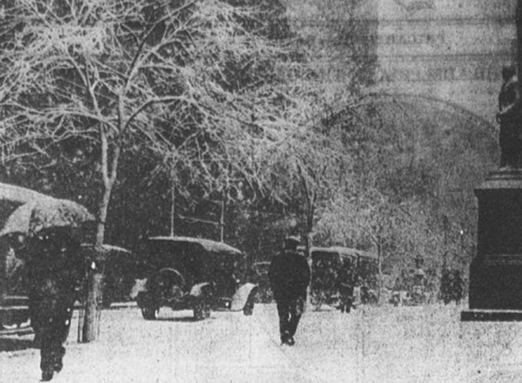
    Philadelphia’s last verified blizzard occurred in March, in 1993; in 1958 over 50 inches of snow fell upon Morgantown, Chester County, during the so-called equinox storm, and 20 inches fell in Philly on April 1, 1915.

    Our coverage of the 1958 Equinox Storm.

    “Home gardeners just need to relax a little bit,” she said, “and wait for the weather patterns to become more consistent.”

  • The sea is higher than we thought and millions more are at risk, study finds

    The sea is higher than we thought and millions more are at risk, study finds

    Climate change’s rising seas may threaten tens of millions more people than scientists and government planners originally thought because of mistaken research assumptions on how high coastal waters already are, a new study said.

    Researchers studied hundreds of scientific studies and hazard assessments, calculating that about 90% of them underestimated baseline coastal water heights by an average of 1 foot, according to Wednesday’s study in the journal Nature. The problem arises far more frequently in the Global South, the Pacific, and Southeast Asia, and less in Europe and along the Atlantic coasts.

    The cause is a mismatch between the way sea and land altitudes are measured, said study coauthor Philip Minderhoud, a hydrogeology professor at Wageningen University and Research in the Netherlands. And he attributed that to a “methodological blind spot” between the different ways those two things are measured.

    Each way measures its own areas properly, he said. But where sea meets land, there are a lot of factors that often do not get accounted for when satellites and land-based models are used. Studies that calculate sea level rise impact usually “do not look at the actual measured sea level, so they used this zero-meter” figure as a starting point, said lead author Katharina Seeger of the University of Padua in Italy. In some places in the Indo-Pacific, the figure is close to 1 meter, or about 3 feet, Minderhoud said.

    One simple way to understand that is that many studies assume sea levels without waves or currents, when the reality at the water’s edge is of oceans constantly roiled by wind, tides, currents, changing temperatures, and things like El Niño, Minderhoud and Seeger said.

    Adjusting to a more accurate coastal height baseline means that if seas rise by a little more than 3 feet — as some studies suggest will happen by the end of the century — waters could inundate up to 37% more land and threaten 77 million to 132 million more people, the study said.

    That would trigger problems in planning and paying for the impacts of a warming world.

    People at risk

    “You have a lot of people here for whom the risk of extreme flooding is much higher than people thought,” said Anders Levermann, a climate scientist at the Potsdam Institute for Climate Impacts Research in Germany, who was not part of the study. Southeast Asia, where the study finds the biggest discrepancy, has the most people already threatened by sea level rise, he said.

    Minderhoud pointed to island nations in that region as an area where the reality of discrepancy hits home.

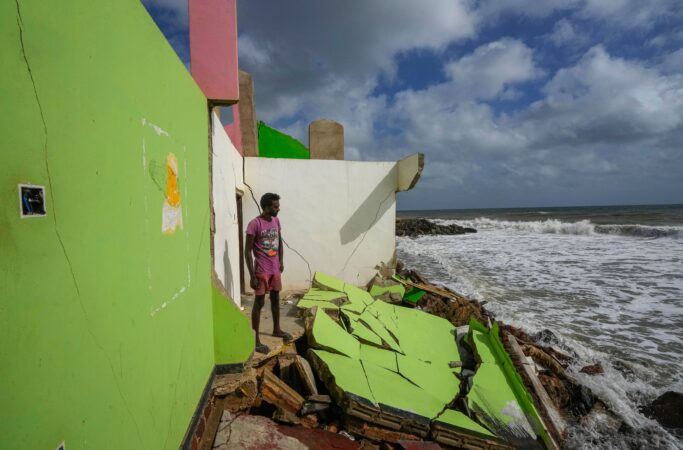
    For 17-year-old climate activist Vepaiamele Trief, the projections are not abstract. On her island home in the South Pacific archipelago of Vanuatu, the shoreline has visibly retreated within her short lifetime, with beaches eroded, coastal trees uprooted, and some homes now barely 3 feet from the sea at high tide. On her grandmother’s island of Ambae, a coastal road from the airport to her village has been rerouted inland because of encroaching water. Graves have been submerged and entire ways of life feel under threat.

    “These studies, they aren’t just words on a paper. They aren’t just numbers. They’re people’s actual livelihoods,” she said. “Put yourself in the shoes of our coastal communities — their lives are going to be completely overturned because of sea level rise and climate change.”

    Paying attention to the starting point

    This new study is pretty much about what is the truth on the ground.

    Calculations that may be correct for the seas overall or for the land are not quite right at that key intersection point of water and land, Seeger and Minderhoud said. That is especially true in the Pacific.

    “To understand how much higher a piece of land is than the water, you need to know the land elevation and the water elevation. And what this paper says the vast majority of studies have done is to just assume that zero in your land elevation data set is the level of the water — when, in fact, it’s not,” said sea level rise expert Ben Strauss, CEO of Climate Central. His 2019 study was one of the few the new paper said got it right.

    “It’s just the baseline that you start from that people are getting wrong,” said Strauss, who was not part of the research.

    Maybe not so bad, some scientists say

    Other outside scientists said that Minderhoud and Seeger may be making too much of the problem.

    “I think they’re exaggerating the implications for impact studies a bit — the problem is actually well understood, albeit addressed in a way that could probably be improved,” said Gonéri Le Cozannet, a scientist at the French geological survey. Most local planners know their coastal issues and plan accordingly, Rutgers University sea level expert Robert Kopp said.

    That’s true in Vietnam, in the high-impact area, Minderhoud said. Officials there have an accurate sense of elevation, he said.

    The findings come as a new UNESCO report warns of major gaps in understanding how much carbon the ocean absorbs. That report said that models differ by 10% to 20% in estimating the size of that carbon sink, raising questions about the accuracy of global climate projections that rely on them.

    Together, the studies suggest governments may be planning for coastal and climate risks with an incomplete picture of how the ocean is changing.

    “When the ocean comes closer, it takes away more than just the land we used to enjoy,” said Thompson Natuoivi, a climate advocate for Save the Children Vanuatu.

    “Sea level rise is not just changing our coastline, it’s changing our lives. We are not talking about the future — we’re talking about the right now.”

  • Philly’s surprisingly cold and snowy winter isn’t over yet, but big changes are coming

    Philly’s surprisingly cold and snowy winter isn’t over yet, but big changes are coming

    Robert Koopmeiners is up to here with this winter and is among the masses more than ready for the atmosphere to flip the switch.

    “It’s getting kind of old,” he said. But he wasn’t complaining about Arctic freezes, or winter storms, or black ice, or hideously darkening mountains of plowed snow.

    He was talking about the weather in Colorado, where he is a National Weather Service meteorologist, where bone-dry Denver has set nine high-temperature records since Dec. 1, where wildfire alerts were in effect, and water is getting scarce.

    Warm West, cold East, and vice versa are standard fares in the great national atmospheric seesaw that hasn’t been doing much seesawing lately, as if a boulder has been placed atop our end of it.

    That’s the result of an atmospheric roadblock for the ages in the high latitudes around Greenland, meteorologists say, that has allowed winter to reappear with a ferocity not experienced in several years in the Northeast, and a winterlong spring in parts of the West. The cold in the East may even be related to rising global temperatures.

    The result for the Philadelphia region has been one of the colder and snowier meteorological winters — the Dec. 1 to Feb. 28 period — on record. Officially Philadelphia has had more days of snow cover of an inch or more than in the five seasons ending with the winter of 2023-24 combined.

    After quite a wintry start to the new week, with even some more snow possible, a major warmup is due to begin with a spring teaser possible next weekend. (It may turn colder the second half of the month, but that can wait.)

    In the meantime, the atmosphere is enjoying a belly laugh over the preseason outlooks for the winter of 2025-26.

    Philadelphia’s winter scorecard

    By convention, the weather community divides the seasons into three-month increments. In part that’s in recognition of the fact that weather often has an adversarial relationship with astronomy. For example, it has snowed, and hit 90 degrees, in the astronomical spring, the period between the vernal equinox and summer solstice.

    The day before Easter in 1915, Philadelphia was socked with 19 inches of snow, despite a forecast of “Unsettled, rain likely.”

    For the three-month 2025-26 winter period, official temperatures at Philadelphia International Airport have averaged a shade over 33 degrees, putting it in the top third for coldest winters in the period of record dating to the late 19th century.

    The official snow total is in the top 20% of all winters on record. The normal through February is just under 20 inches.

    What forecasters predicted would happen

    Zero. That would be the number of publicly available winter outlooks that predicted Philly would experience 30.1 inches of snow, 150% of normal.

    AccuWeather Inc. and 6abc went with 14 to 18 inches. Fox29 called for 16 inches, and 17 days of snow cover. At last count, that snow-cover count was up to at least 35. Other forecast services called for normal — 23.1 inches — or slightly above-normal snowfall.

    Regarding temperatures, all the outlooks foresaw normal — the three-month average is 36.1 degrees — to above-normal temperatures for the Philly region, save for Arcfield Weather, a private-sector company, which went for below.

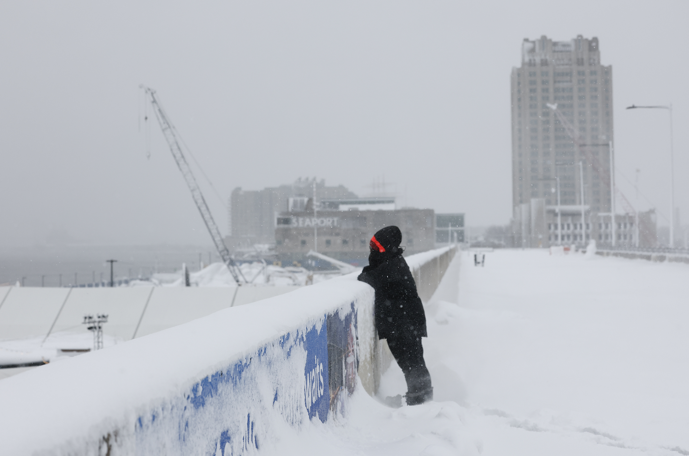
    Nicole Swinson looks into Penn’s Landing while standing in the snow on Monday, Feb. 23, 2026.

    ‘Blocking’ has been the leitmotif of Philly’s winter

    If it seemed that what happened kept happening, that was more than perception.

    It was the result of particularly vigorous “blocking” in the vicinity of Greenland in which high pressure, or heavier air, persists in the upper atmosphere. It was a massive obstruction that kept directing cold air and storms toward the East while toasting the West, said Climate Prediction Center branch chief Jon Gottschalck.

    The East got stuck under a “trough” of upper-air low pressure that favored storminess and cold, he added. The West, quite the opposite.

    “The blocking pulled the storms eastward, and the cold followed,” said Paul Pastelok, Accuweather’s longtime seasonal forecaster. “We should have caught on to that.”

    In addition, an upper-air pressure pattern over the Arctic — the Arctic Oscillation — was stuck in its negative phase from December until recently, said climate center meteorologist Laura Ciasto, with negative consequences for local winter-phobes.

    When it’s negative, the weather-moving west-to-east jet stream winds can become more active at the midlatitudes where we live, and the conditions colder and stormier. The oscillation has had “an interesting winter,” she said. “Typically,” she said, “we expect the AO to fluctuate.”

    Related to the oscillation’s behavior were episodes of “polar vortex stretching,“ said Ciasto. The vortex’s powerful winds usually trap cold air in the Arctic, but on occasion they weaken and ”stretch,“ allowing cold air to spill southward.

    Another explanation for why the forecasts went awry may be an obvious one: We’re not used to this level of Arctic cold or prodigious snowfalls like the Sunday-Monday event that creamed parts of the region with 20 inches or more. “We have simply gone many years without experiencing a storm like this,” said Owen Shieh, warning coordination meteorologist at NOAA’s Weather Prediction Center.

    Did the world suddenly grow colder?

    No, the planet didn’t cool off precipitously. In fact, said Pastelok, the blocking may have been related to warming-related sea-ice reductions near Greenland. The solar energy absorbed by freshly freed waters could have effects on pressure patterns in the high atmosphere, he said, adding that for now, that’s only a hypothesis.

    While the world evidently cooled slightly last year after a record 2024, according to NOAA’s database, it’s still about 2 degrees Fahrenheit warmer than the 20th-century average, the supply of Arctic air isn’t quite as it used to be.

    As it turns out, Philly’s winters in the 21st century have trended milder, with average temperatures about 2 degrees Fahrenheit above long-term averages.

    The overall warming trend has been one reason the climate center has had the odds favoring above-normal winter temperatures for Philly for the last seven consecutive winters. And they indeed were above normal for six straight years — but not seven.

    Retired climate center forecaster Mike Halpert once remarked that while sticking with the trend can be a smart bet, “some years you’re going to be woefully wrong.”

  • Light snow may top the black ice in the Philly region Wednesday as storm recovery continues

    Light snow may top the black ice in the Philly region Wednesday as storm recovery continues

    At this point, the prospect of a barely measurable snow Wednesday morning may seem like so much drizzle in the ocean.

    However, given that a coating of snow could cover another harvest of stealth black ice in the morning as the snow melt refreezes overnight, motorists and pedestrians might want to exercise a measure of caution.

    The forecasts are calling for a half-inch to maybe an inch in the Philly area.

    While potentially hazardous, this won’t upstage what happened earlier in the week, when totals of 20 inches or more were common in South Jersey and southeastern Bucks County, and on Tuesday the aftermath recovery was proceeding.

    For the record, the official total at Philadelphia International Airport was 14 inches. Of that, 7.5 inches fell on Monday, setting a record for the date. It was No. 16 on the all-time snowstorm list, and the first time in 33 years that a foot or more had fallen so late in the season.

    The seasonal total now stands at 30 inches, one of the snowier years in the 142-year period of record.

    The post-storm issues included contending with scores of downed trees throughout the region. A fallen tree in Radnor Township, Delaware County, still was affecting service on the Norristown High Speed Line.

    Service still was still suspended on the Cynwyd Regional Rail line, SEPTA said, and other lines were operating with delays.

    Airport operations were getting back to normal, said spokesperson Heather Redfern, flights having resumed Monday afternoon.

    As for schools, they were opting for a variety of options from virtual learning (Philadelphia) to two-hour delays (Cherry Hill, Moorestown), to party’s over, get here on time (Upper Darby).

    This may be the week of black ice in Philly

    Invisible and insidious black ice, a dangerous slipping hazard, in all likelihood will be present through the workweek as the snow melt picks up speed during the day, with highs in the 40s, and temperatures falling below freezing at night.

    More light snow, rain, or a snow-and-rain mix is possible Thursday into Thursday night, the weather service said. But odds are the immediate Philly area will see mostly rain, said Eric Hoeflich, a weather service meteorologist in Mount Holly.

    After a modest warmup on a dry weekend, some computer models were hinting at more snow early next week as a storm moves east, but “not all the guidance is showing a significant system,” the weather service said in its afternoon discussion. “It’s definitely on our radar,” the agency said, but it doesn’t “appear to have potential for a ‘major’ event.”

    In short, anything rivaling the Sunday-Monday storm would be, at the very least, unlikely.

    Hoeflich said he spent 30 hours in the Mount Holly office, not leaving until 2 p.m. Monday. He said that the weather service provided air mattresses for him and other staffers and that his colleagues came armed with soft pretzels.

    Sarah Johnson, the warning coordination meteorologist, brought pizza. Evidently carbs are a sine qua non of storm forecasting.

    Said Hoeflich, “We certainly didn’t go hungry.”

  • Philly got its biggest snow in 10 years. This time nature will help with the cleanup.

    Philly got its biggest snow in 10 years. This time nature will help with the cleanup.

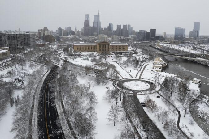
    If it wasn’t an actual blizzard, Philly’s biggest snowfall in a decade sure acted like one, and the weather the rest of this week isn’t expected to be particularly pleasant.

    But in terms of disruption — not to mention aesthetics — this was in a wholly different category from the Jan. 25 siege of snow and ice. And the aftermath should not be anywhere near as punitive and burdensome.

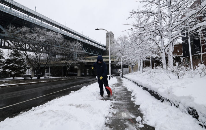
    Although the 14 inches measured officially at Philadelphia International Airport, dwarfed the 9.3 inches of snow and sleet that accumulated in last month’s storm, Zach Schwartz, 33, was among those who found the picturesque snow more palatable than the attack of ice balls and an Arctic freeze.

    “The last snowstorm was a tough time for everyone,” said Schwartz, who was at a Point Breeze playground helping a friend build an igloo for their kids, “and I think the city was kind of in shock a little bit.”

    The most recent storm, which left as much as 20 inches of snow in parts of South Jersey and southeastern Bucks County, did cause some issues.

    More than 130,000 households lost power at some point. Scores of trees came down as the snow, heavy and wet at the start, glommed onto branches that took beatings from the winds that gusted past 40 mph.

    The storms closed schools to the chagrin of hundreds of thousands of learning-eager children, and museums on Monday. It disrupted SEPTA services and airport operations.

    At least 87 trees across the city were downed as a result of the storm as of Monday afternoon, and the city was working to determine which ones to prioritize clearing first, Parks and Recreation commissioner Susan Slawson said.

    Mayor Cherelle L. Parker advised Philadelphians to avoid unnecessary travel as crews worked to clear the streets.

    Yet early fears that the snowfall would reach what the National Weather Service called “potentially historic” levels didn’t quite materialize, and it was not known if the storm had met “blizzard” criteria. Stopping short of “historic,” New Jersey Gov. Mikie Sherrill called it “a generational storm.”

    This one likely won’t have the staying power of last month’s storm

    While the volume of snow is formidable, road crews throughout the region now have a tremendous ally — the late-February sun.

    The city did adjust its response after the prior storm cleanup left many residents chock-full of complaints. Director of Clean and Green Initiatives Carlton Williams said Monday instead of one snow melter, the city secured three, with two already on the road Monday, despite the much shorter notice of the storm.

    But the big melter is in the sky.

    The amount of solar energy beaming toward Philadelphia is more than 35% stronger than it was on Jan. 25, according to NASA’s figures, and blacktop is great absorber of sunlight. Plus the region now is getting an hour more of daylight.

    Plus, instead of an Arctic freeze, it is forecast to be moderately cold this week, with highs in the low 30s Tuesday, and in the 40s Wednesday and Thursday.

    A weak clipper could produce an inch or less of snow early Wednesday, but, sorry kids, that won’t be another school-closer. More light rain or snow or a mix is possible Thursday.

    Computer models on Monday were seeing a potential for more snow early next week, but they may well sober up come Tuesday.

    After the Jan. 25 storm, Philly had 18 consecutive days of at least 3 inches on the ground officially at the airport, the longest stretch in 65 years. That streak won’t be challenged this time around.

    One other huge difference: Those 14 inches didn’t include a speck of ice, which, as we learned, is amazingly melt-resistant.

    Why snow totals varied tremendously

    The nor’easter that generated the snow did qualify as a “bomb cyclone,” said Tom Kines, senior meteorologist with AccuWeather Inc. The technical criteria aside, a bomb cyclone is particularly powerful storm.

    In fact, the storm’s intensity, based on a measure of its central pressure, was equal to that of a Category 1 hurricane, he added.

    Fortunately, the Shore escaped major flooding, but the winds circulating around the storm’s center over the ocean hurled back snow far inland.

    window.addEventListener(“message”,function(a){if(void 0!==a.data[“datawrapper-height”]){var e=document.querySelectorAll(“iframe”);for(var t in a.data[“datawrapper-height”])for(var r,i=0;r=e[i];i++)if(r.contentWindow===a.source){var d=a.data[“datawrapper-height”][t]+”px”;r.style.height=d}}});

    South Jersey locations received the most, along with areas in southeastern Bucks County. However, totals backed off precipitously to the west.

    “There was a really tight gradient,” said Amanda Lee, a weather service meteorologist in Mount Holly. All areas in Philly’s neighboring Pennsylvania counties did report at least several inches of snow.

    Within that broad east-west divide, however, amounts varied considerably from place to place, due in part to “banding,” in which narrow corridors of snow, caused by rapidly rising air, migrate from place depositing rapidly accumulating snow to areas underneath.

    Conversely, areas on either side of the band are snow-deprived.

    As to whether this qualified as Philadelphia’s first blizzard in 33 years, that is a verdict deferred.

    By the National Oceanic and Atmospheric Administration’s decree, a blizzard requires “frequent winds of 35 mph or higher with considerable falling and/or blowing snow that frequently reduces visibility to 1/4 of a mile or less. These conditions are expected to prevail for a minimum of 3 hours.”

    That’s a lot to ask for a snowstorm, and it is going to take considerable forensic work of poring through observations to determine whether those conditions were met in Philadelphia or elsewhere in the region, said Nick Guzzo, a weather service meteorologist in Mount Holly.

    Another big difference between this and the January storm

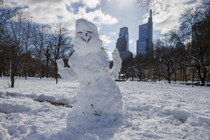
    Whatever else it is called, this was the most spectacularly beautiful snowfall of the season, thanks to the snow’s remarkable adhesive power.

    On the morning of Jan. 26 the trees were bare, as though they wanted no part of the snow and ice-ball assault.

    On Monday this time around, snow enchanted the branches and uncannily worked its way into architectural details.

    Cape May Mayor Zack Mullock said his town, famous for its Victorian buildings, “looks beautiful” covered in the foot of snow that had fallen.

    Said Mullock, “It looks like a snow globe.”

    Staff writers Ximena Conde, Kristen A. Graham, Michelle Myers, Amy S. Rosenberg, Henry Savage, and Nick Vadala contributed to this article.