Category: Science

  • Another weekend snow watch and ‘exceedingly rare’ cold are on tap for Philly

    Another weekend snow watch and ‘exceedingly rare’ cold are on tap for Philly

    Another weekend snow chance and more cold are in the forecasts. But the big difference between last week and this one in the Philadelphia region is a matter of degrees — about 10 of them.

    A coastal “bomb cyclone” could form during the weekend with significant impacts, at least at the Shore. Computers were still sorting out what effects, if any, it would have in Philly. On Thursday, however, they favored snow staying to the south and east, with only a 40% chance they got to I-95.

    In the meantime the cold will be epical by Philly standards.

    If the forecast holds, in addition to coming close to ending a 32-year zero-less streak, Philadelphia would have daily minimums of 5 degrees Fahrenheit or lower on the next two mornings.

    And it appears the city will have its first nine-day stretch in which the temperature failed to reach 30 degrees since 1979, based on analysis of temperature data from the Pennsylvania state climatologist.

    In issuing a cold weather advisory for wind chills as low as 10 below zero, the National Weather Service in Mount Holly noted that “it is exceedingly rare to get this combination of length and magnitude of an arctic airmass for this area.”

    Philadelphia’s forecast high on Thursday, 19, would be more than 10 degrees lower than the forecast for Anchorage, Alaska.

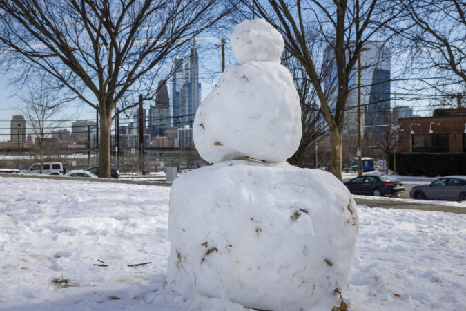
    Heading into the weekend, that subtly laminated lunar landscape with the one-horse-open-sleigh look in the fields and parks is almost certain to persist while bedeviling road-clearing efforts.

    Some snow is possible late Saturday or Sunday — and this is becoming a habit — in time for the rising of the full “Snow Moon,” which may be a problem for the Jersey Shore. The full moon will likely contribute to tidal flooding.
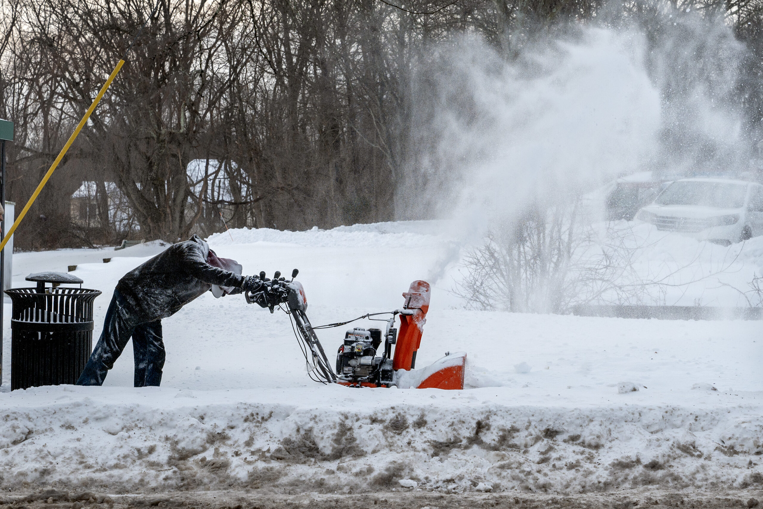
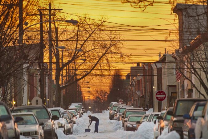
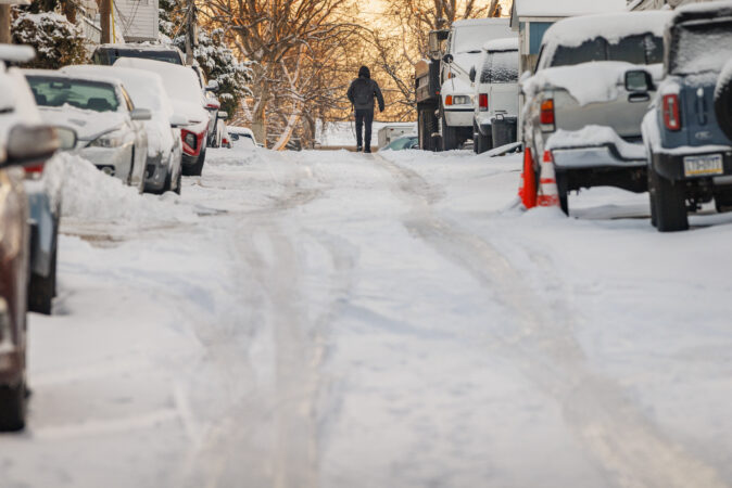
    Snow removal contractor Jordan Harlow clears the sidewalk in front of an apartment building on Main Street in Doylestown Wednesday, Jan. 28, 2026, following Sunday’s snowstorm. He said the layer of ice made it twice as difficult to use the snow blower.

    The snow outlook for the weekend

    On Wednesday only two things were certain about the latest threat: A major coastal storm is going to blow up during the weekend, and it’s not going to rain.

    “Everything looks like it’s going to come together,” said Paul Pastelok, the long-range forecaster for AccuWeather Inc.

    AccuWeather said it may intensify enough to qualify as a “bomb cyclone.”

    An early consensus among computer models was that the storm would stay too far offshore to generate a major snowfall in the immediate Philly area. Pastelok said it was looking for Philly to get “sideswiped” with a 1- to 3-inch event. However, that was very much subject to change.

    The weather service would not be making a first guess at potential accumulations until Thursday afternoon, said Alex Staarmann, a National Weather Service meteorologist in Mount Holly. In its forecast discussion Wednesday, it said that based on a consensus of the models, the Shore had a 35% to 50% chance of 6 inches of snow or more, with a 20% chance along I-95.

    More certain was the potential coastal flooding threat at the Shore with potent onshore winds coinciding with Sunday’s full moon.

    And while it may seem the atmosphere enjoys ruining weekends, it’s not uncommon for weather systems to fall into 3½- and seven-day cycles. That has to do with the spacing between weather systems, meteorologists say.

    Regardless of what happens during the weekend, the region is going to begin the workweek with snow on the ground.

    The snow is going to have more staying power than the average computer-model snow forecast.

    It’s not going to get a whole lot warmer anytime soon

    Even though it’s ice cold, as if developing a slow leak, the depth of the snow pack is actually decreasing, but ever so ponderously.

    That 9.3 inches of snow and sleet that accumulated Sunday was down to 6 inches at Philadelphia International Airport on Wednesday morning, Staarmann said.

    Compaction and sublimation, which is similar to evaporation, are lowering the depth, despite the cold. But Wednesday’s depth report was the same as Tuesday’s.

    And after what does or doesn’t happen Sunday, temperatures are forecast to remain below freezing at least until Feb. 4.

    No significant warm-up is in sight, and the National Oceanic and Atmospheric Administration’s Climate Prediction Center has odds strongly favoring below-normal temperatures until Feb. 11.

    The upper-air pattern continues to favor cold pouring into the Northeast.

    And more cold air is possible later in the month with a visit from the polar vortex, Pastelok said.

    Average temperatures in Philly finished 3.6 degrees below normal in December, and despite a 10-day warm spell earlier in the month, January is projected to finish at least 2 degrees below long-term averages.

    For Pastelok and other seasonal forecasters, it has been a tough winter.

    “We underestimated how cold the Northeast would be this year,” he said.
  • After Philly’s biggest snow in 10 years, a very big chill is coming

    After Philly’s biggest snow in 10 years, a very big chill is coming

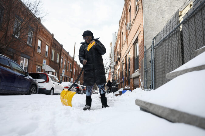
    For the Philly region Monday it wasn’t so much a matter of digging out from the heftiest snowfall in a decade, it was more like a chipping, shaving, scraping, expletive-inducing, and ice-chunk hurling operation.

    Public transportation appeared to be getting back on track, and major roads were open for business with speed reductions removed, thanks to crews working through the weekend.

    But expect some side streets in the city and elsewhere to remain fit for sleigh rides this week and trash pickup to be delayed. City offices will be shut down again Tuesday, as will Philly school buildings, with Camden and more calling for a snow day or opting for remote learning.

    And if you’re stepping outside, get used to that underfoot crunching sensation. The removal operation isn’t going to get much help this week from the atmosphere. It’s about to turn about as frigid as it ever gets around here. New Jersey officials are warning of “historic” demands on energy.

    “We’re going to be in the freezer all week,” said Mike Gorse, meteorologist at the National Weather Service Office in Mount Holly. Philly may have its first zero-degree reading in 32 years later in the week.

    It’s as if after recent wimpy winters, the Arctic is reacquainting with Philly and much of the rest of the East.

    And did we mention another snow threat for the weekend?

    “There’s a chance,” said Marc Chenard, meteorologist with NOAA’s Weather Prediction Center in iced-over College Park, Md., who was among those who had to chuck some frozen boulders before leaving for work Monday morning. “I had to chip it and carry it in pieces,” he said. Sound familiar?

    Why this storm was particularly challenging

    Snow totals for the biggest snowfall since Jan. 22-23, 2016, varied throughout the region; the inconveniences, not so much.

    A general 8 to 12 inches of snow and sleet accumulated while temperatures remained mostly in the teens Sunday, 10 degrees or more below forecast.

    A shallow layer of warmer air caused a changeover to sleet, and the tiny ice balls remained frozen for the entire trip through the stubbornly cold air near the surface. As much as 2 to 3 inches of sleet piled on, containing the same amount of liquid as several inches of snow.

    That added weight to the snowpack. Based on the amount of melted precipitation measured in the 9.3 inches at Philadelphia International Airport, the snowpack weighed about as much as a 12- to 15-inch pile of the pure flaky fluff.

    On a 200-square-foot driveway — a 10 by 20 — what fell Sunday weighed about 1,100 pounds. On a 100-square-foot sidewalk — 5 by 20 — that would be about 550 pounds.

    In addition, ice tends to be rather shovel resistant.

    This is going to be a memorably cold week in Philly

    The ice and snow isn’t going to give up easily. On Monday, temperatures topped out in the upper 20s, and that’s going to be warmest day of the week.

    Based on the forecast, it may not get above 28 degrees until next week, said Chenard, a cold streak the region hasn’t seen in decades.

    Chenard said the upper-air patterns remain in place to import Arctic air on winds from the northwest for at least the next several days.

    In fact, temperatures may have trouble getting out of the teens in Philly until the weekend, and Philly has a shot at reaching zero for the first time in 32 years.

    The forecast lows are in the single digits all week, and down to 1 degree on Friday morning and 2 degrees on Saturday, the National Weather Service says. Both would be record lows for the dates.

    The stubborn snow cover “absolutely” will increase the chances of the airport reaching zero for the first time since January 1994, Gorse said. Snow is ideal for radiating daytime warmth (such as it is) into space.

    Temperatures will moderate some on the weekend, he said, but that might come in advance of yet another storm.

    Said Chenard, “There will be coastal low. It’s a matter of how close it is.”

    window.addEventListener(“message”,function(a){if(void 0!==a.data[“datawrapper-height”]){var e=document.querySelectorAll(“iframe”);for(var t in a.data[“datawrapper-height”])for(var r,i=0;r=e[i];i++)if(r.contentWindow===a.source){var d=a.data[“datawrapper-height”][t]+”px”;r.style.height=d}}});

    One historic footnote in the Philly weather annals

    Philly’s official snowfall total for the winter stands at 15.7 inches, almost double normal for the date and double what fell all of last season.

    Sunday’s was not only the biggest snow in 10 years, it also set a record for a Jan. 25.

    It beat the 8.5 inches of Jan. 25, 2000, a day that the weather service just as soon would like to forget.

    The storm came as a surprise, just a week after a weather service honcho announced a computer upgrade that would bring the nation closer to a “no surprise” era.

    Expect surprises to continue.

    Staff writers Ximena Conde, Kristen A. Graham, Maddie Hanna, Rob Tornoe, and Nick Vadala contributed to this article.

  • Heavy snow and potentially dangerous icing are expected in Philly this weekend

    Heavy snow and potentially dangerous icing are expected in Philly this weekend

    After the coldest morning of the winter, Philadelphia could experience more snow this weekend than it did during the entire winter of 2024-25, accompanied by a potentially nasty mix of ice.

    The National Weather Service on Saturday was holding serve on its call for 8 to 12 inches in and around Philly, and those amounts may be tweaked depending on the best guesses on how much sleet and freezing rain enters the mix. AccuWeather Inc. was going with 6 to 10.

    Subtle changes to accumulation forecasts are likely, but that merely would mean, “We’re just getting a different blend of horrors,” said Mike Lee, a meteorologist in the Mount Holly office.

    One thing is certain: Whatever falls won’t melt. Temperatures dropped into single digits throughout the region, and got as low as 11 at the Philadelphia International Airport banana belt. . Temperatures won’t get above the mid-20s while anything is falling from the skies Sunday and early Monday.

    The weather service has issued a profoundly predictable winter storm warning, in effect from 7 p.m. Saturday until 1 p.m. Monday.

    Whatever the outcome, the storm still in its formative stage already has had significant impacts on the region and may have set an unofficial record for pre-storm buildup and preemptive closings.

    Philadelphia Mayor Cherelle L. Parker declared a state of emergency for Sunday, as did Pennsylvania Gov. Josh Shapiro and New Jersey Gov. Mikie Sherrill. PennDot is imposing speed restrictions. SEPTA is expecting issues.

    Some schools already were planning for multiple-day closings, as the snow and ice will be accompanied by one of the region’s more impressive cold snaps of the last several years.

    Were it not for the storm, in fact, the cold might be getting headlines.

    Wind chills Saturday morning are expected to drop below zero. Sunday’s high of 25 degrees may make it the warmest day of the week.

    It is likely that layers of snow and ice will harden into a frozen mass that the January sun won’t be able to do a whole lot about.

    As a public service, for now we will hold off on mentioning another potential storm threat.

    The latest on the timing of the storm in Philly

    While the weather service warning goes into effect 7 p.m. Saturday, flake sightings could hold off until daybreak Sunday, said Alex Staarmann, a weather service meteorologist.

    Snow may accumulate rapidly Sunday morning with temperatures in the teens. Models were suggesting sleet could mix in as soon as early afternoon, said Tom Kines, senior meteorologist with AccuWeather Inc.

    Temperatures in the bottom 5,500 feet of the atmosphere are going to remain well below freezing. However, as the coastal storm intensifies, its onshore winds from the northeast are forecast to import warmer air from over the ocean into the upper atmosphere, which would change the snow to sleet and rain.

    It’s possible the precipitation will flip back to all snow and accumulate maybe another inch early Monday, Staarmann said. But at that point it would have all the impact of drizzle in the ocean. The mass of snow and ice evidently will be vacationing in Philly for a while.

    “It will stick around for a week, maybe two weeks,” Staarmann said.

    How much for Philly?

    Just how much snow and ice would be on the ground remained unclear Friday. And it’s all but certain the projections are going to change. For the record, a grand total of 8.1 inches fell all of last season in Philly.

    Louis Uccellini, former head of the National Weather Service and one of the nation’s most prominent winter-storm experts, said some later modeling was cutting back on the ice in areas west of the city, suggesting the possibility of higher snow amounts.

    (function () {window.addEventListener(‘message’, function (e) { var message = e.data; var els = document.querySelectorAll(‘iframe[src*=”‘ + message.id + ‘”]’); els.forEach(function(el) { el.style.height = message.height + ‘px’; }); }, false); })();

    “It’s not that we’re getting 2 to 4 [inches],” said Staarmann. “We’re going to get a lot of snow.”

    However, some icing was a near certainty throughout the region.

    The ice potential for the Philly region

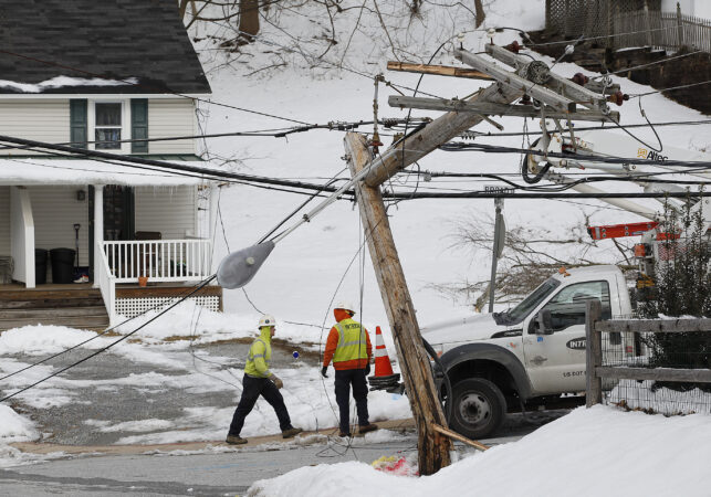
    The weather service is predicting a quarter-inch of freezing rain, which is probably about the last thing the people at Peco wanted to hear. Freezing rain is a greater threat to power lines and trees than sleet.

    Yes, Peco is well aware of the storm and has crews on standby, said spokesperson Candace Womack.

    Sleet develops when a partially melted snowflake or rain drop freezes on the way to the ground. It doesn’t accumulate efficiently like snowflakes. Freezing rain is rain that doesn’t turn to ice until it lands on a surface and freezes on contact.

    During a winter storm, both hold down snow accumulations. Typically, an inch of liquid precipitation can yield a foot of snow. A similar amount of liquid would yield about 4 inches of sleet.

    (function () {window.addEventListener(‘message’, function (e) { var message = e.data; var els = document.querySelectorAll(‘iframe[src*=”‘ + message.id + ‘”]’); els.forEach(function(el) { el.style.height = message.height + ‘px’; }); }, false); })();

    Both can fall when surface temperatures are well below freezing, if the upper air is warm enough.

    A big difference is that sleet bounces off surfaces, but ice gloms onto them, a menace to power lines and tree branches.

    An ice storm resulted in over 700,000 Peco outages in 2014, a winter record. In that case, freezing rain came 18 hours after a heavy snowfall.

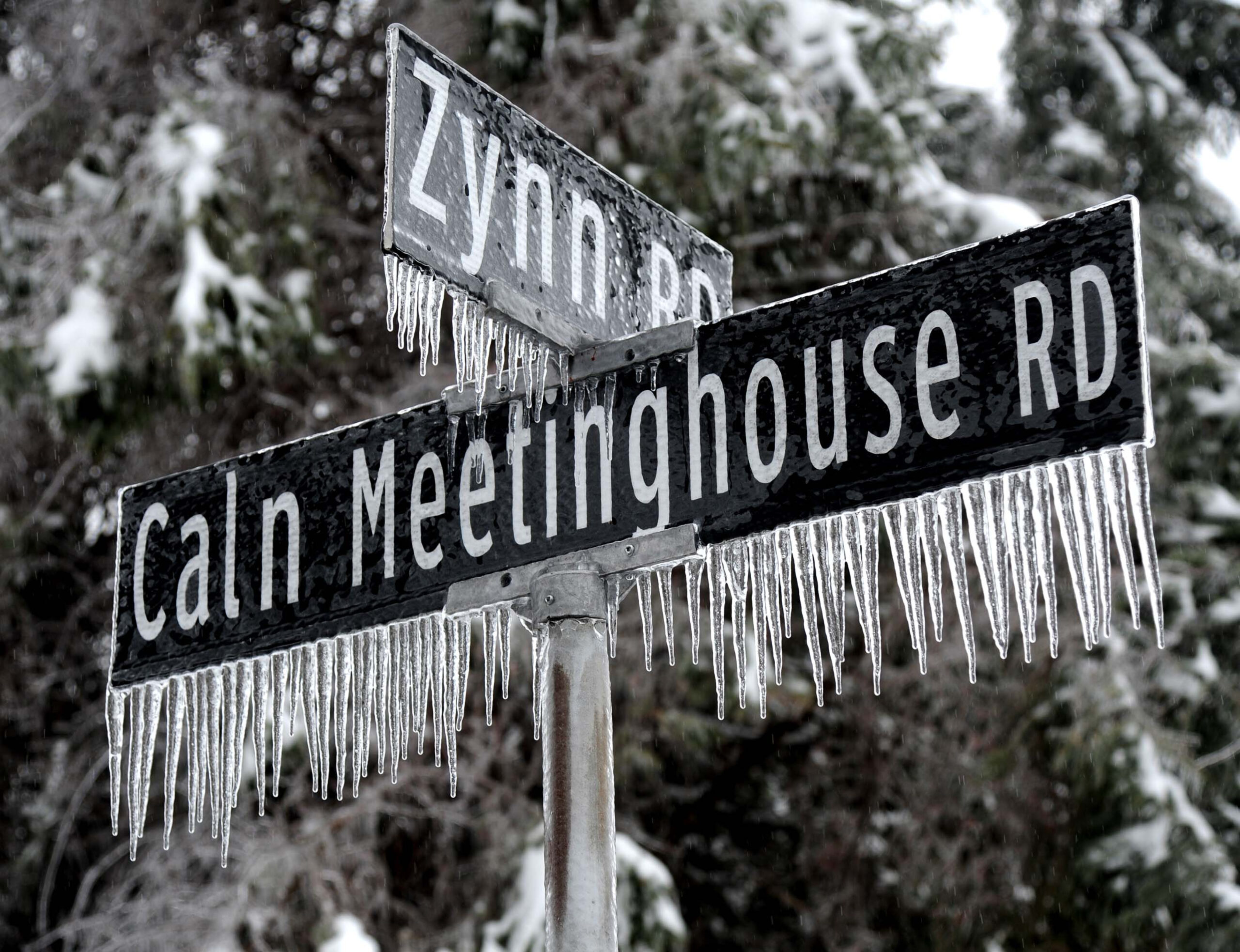
    An overnight freezing rain storm swept through the Philadelphia region Feb. 5, 2014, leaving downed trees and power lines in its wake, along with icicles everywhere as evidenced by these streets signs in Downingtown.

    When will the snow and ice disappear?

    The snow and ice are going to be around for as far as the computer models can see. Temperatures may not get above freezing the rest of the month, as NOAA’s Climate Prediction Center has the odds favoring below normal temperatures through Feb. 6.

    The U.S. model was indicating another storm threat for around Groundhog Day, a week from Monday, Uccellini said.

    Phil might want a pass this year.

  • DHS pauses cuts to FEMA as massive winter storm barrels in

    DHS pauses cuts to FEMA as massive winter storm barrels in

    The Department of Homeland Security has paused terminations of employees working on the Federal Emergency Management Agency’s disaster response as it ramps up preparations for a massive and life-threatening winter storm that will pummel half the country this weekend.

    Earlier this month, the Washington Post reported that the agency planned to terminate disaster response and recovery workers in waves. On New Year’s Eve, agency officials eliminated about 65 positions that were part of FEMA’s largest workforce, known as the Cadre of On-Call Response and Recovery (CORE) — staffers who are among the first on the ground after a disaster and often stick around for years to help communities recover.

    But on Thursday night, DHS’s head of human resources sent an email notifying teams that “just a few minutes ago,” FEMA headquarters decided the agency would halt their process of non-renewing dozens of federally funded employees. These roles, hired by FEMA for multiyear terms under the Stafford Act using the disaster relief fund, have been up for renewal on a rolling basis.

    Earlier that day, about 30 disaster workers received notices that their jobs would not be renewed. The pause then prompted human resources staff to backtrack, notifying those same workers that they still had jobs, according to the email and an official familiar with the process. Like others interviewed for this story, the official spoke on the condition of anonymity because they were not authorized to speak publicly about the matter.

    “I didn’t even know what was happening until it happened,” the official said, adding that as human resources initially emailed people informing them that their jobs would not be renewed, senior leaders were learning that FEMA was pausing terminations.

    In a statement, the Department of Homeland Security said that the agency regularly changes staffing levels for its disaster response and recovery efforts.

    “The CORE program consists of term-limited positions that are designed to FLUCTUATE based on disaster activity, operational NEED, and available funding,” the department said in its statement, which included text in all-caps.

    “FEMA’s National Response Coordination Center has been activated in response to a historic winter storm, in line with this mission FEMA is following standard protocol to ensure mission functions are being met,” it added.

    Officials would not comment on how long the pause would last.

    While states and local authorities handle most of their preparation and response to winter storms, FEMA will often deliver resources ahead of time, including generators and personnel if the potential for disaster seems high. Stafford Act employees, such as CORE members, will deploy to a state if they request an emergency or disaster declaration and the president approves it.

    The sudden shift in staffing direction has caught officials across the agency by surprise, six officials said. In recent weeks, their teams were told to prepare to lose a substantial number of people over the next few months.

    Since December, DHS has terminated more than 100 people across the agency who FEMA employs under the Stafford Act.

    Some were informed on New Year’s Eve; others were given only a day or two to turn in their equipment; and still more were cut after their supervisors sent detailed memos explaining why their roles remained vital to FEMA’s mission. The agency also lost veteran employees who oversaw finances for Hurricane Helene recovery, as well as civil engineers who assist states with mitigation and rebuilding roadways, bridges and schools. Some offices in the Midwest have lost experienced managers who typically help lead operations during emergencies and big disasters.

    On Wednesday, FEMA cut nearly 85 local hires from several regions, including a handful who were still working on Hurricane Helene recovery projects in North Carolina — a state now readying itself for potential power outages — according to two people with knowledge of the situation. FEMA’s call center in Puerto Rico lost many of their local hires Wednesday as well, one FEMA official said. If multiple states are hit hard enough and ask the president for federal assistance, those workers could have helped out, two officials said.

    The same day the department halted the terminations, Homeland Security Secretary Kristi L. Noem visited the agency’s headquarters to help guide national coordination and preparation for the sweeping storm. Noem, whose department oversees FEMA, also hosted a call Thursday morning with governors from 21 states that are bracing for dangerous, chilling weather. She assured them that DHS and FEMA will support them.

    “We can pre-deploy any needs that you may have, as far as generators or supplies to different parts of your state if you think you have a weakness in some area that’s going to be hit pretty hard,” Noem told the governors, reiterating that “if there is certain responses or requests specific to this event, feel free to reach out and use that contact information, and we’ll do all that we can to be helpful.”

    During the call, Karen Evans, FEMA’s agency’s interim administrator, and Gregg Phillips, who is now overseeing the Office of Response and Recovery, also offered their personal cell phone numbers in case any governor needs to get in touch with them immediately.

    Noem has instructed FEMA to be aggressive in preparing for the heavy snow and ice forecast to blanket a large portion of the United States and has promised a rapid and well-coordinated response, according to an official with knowledge of the situation. FEMA has delivered tens of thousands of meals and liters of water to various states, and it has positioned drivers who shuttle supplies outside distribution centers from Louisiana up to Pennsylvania.

    The decision to pause the terminations also coincides with the House’s approval Thursday of a spending bill that would fund FEMA’s disaster relief fund and help the agency “maintain staffing levels, including a reservist workforce and its Cadre of Response/Recovery Employees, necessary to fulfill the missions required under” federal law.

    Ahead of the storm, 10 officials from different parts of the agency who spoke to the Post said they were nervous about their ability to properly respond, given how their ranks have thinned over the past year, with the agency losing about 20% of its staff.

    Noem, who has exercised strict oversight over FEMA since taking over DHS, has repeatedly expressed a desire to shrink or eliminate the agency. The Post reported that she previously recommended cutting agency staffing by about half.

    In a previous statement, FEMA spokesperson Daniel Llargués said the agency had “not issued and is not implementing a percentage-based workforce reduction.”

    Employees in CORE roles are typically renewed every two to four years. When the end of an employee’s contracted term approaches, their supervisors typically seek approval to renew those roles. Most positions are usually reinstated, according to four current and former FEMA officials, in part because recovery work is long and complex.

    But in recent weeks, DHS’s process for renewing these temporary roles has changed frequently, according to officials with knowledge of the situation. Last week, supervisors in each region had to write memos justifying every role coming up for renewal this year, which would then be sent to FEMA’s temporary top official and then to Noem, according to two people familiar with the process. Guidance then shifted earlier this week. In a memo from Thursday, obtained by the Post, FEMA officials said that DHS will be making the calls without collecting justifications, and that “only extensions approved by DHS will be processed and they will be limited to 90 days.”

    One CORE employee said DHS suddenly cut her job without warning after her manager had submitted a memo urging to keep her on. Because some firings have been abrupt, some were not able to transition their work, she said.

    “And to be clear, I think most of us expected there to be staffing cuts this year,” the person said. “Just not in the bulldozer approach that didn’t take into account your job or performance.”

  • Snow, perhaps more than a foot, is all but certain this weekend for Philly

    Snow, perhaps more than a foot, is all but certain this weekend for Philly

    Based on what the computers and their human interpreters are saying, a key question this weekend will be whether measuring the snow in the Philly region will require a ruler or a yardstick.

    This no doubt will be a moving target, but on Friday morning, the National Weather Service in Mount Holly was seeing eight to 14 inches for Philly, said meteorologist Alex Staarmann. Several inches were possible even at the Jersey Shore.

    For Philly, that would be the first double-digit snowfall in 10 years.

    A wild card would be a potentially unpleasant atmospheric parfait that would add ice to the mix on Sunday, and computer models Friday were suggesting that mixing was likely near I-95 and in Delaware and South Jersey. However, the weather service expects that to yield to all snow Sunday night.

    While this is all quite a complicated meteorological setup, in essence Arctic air is pressing southward and it is going to interact with an impressively juicy storm to the south.

    “Having the Arctic front come through before the onset of wintry precipitation, that’s really concerning,” said Ray Kruzdlo, the staff hydrologist in the weather service office, where “it’s all hands on deck.”

    Below-zero windchills are expected Saturday morning, prompting a cold-weather advisory, and temperatures in Philly may stay below freezing the rest of the month.

    What time will the snow start and end?

    The timing and duration of precipitation aren’t among the strong suits of computer models.

    The weather service’s winter storm watch, which covers the entire region, all of Delaware, and most of Pennsylvania and New Jersey, is in effect from 7 p.m. Saturday until 1 p.m. Monday.

    The daytime Saturday “looks fine if you have to get out,” said Tom Kines, senior meteorologist with AccuWeather Inc.

    The weather service is listing the likeliest starting time as the early morning hours of Sunday, with snow likely into the early morning hours of Monday.

    Sunday is going to be one of the colder days of the winter with temperatures in the teens and lower 20s. The weather service introduces the possibility of freezing rain and sleet by 1 p.m., with a forecast temperature of 19 degrees.

    Wait, it can rain when it’s 19 degrees?

    Yes, it can rain when it’s below 20 degrees at the surface, and precipitation doesn’t get much more dangerous.

    Snow and sleet, liquid that freezes on the way down, can at least provide traction on the roads. Rain that freezes on contact becomes an ice sheet. Also, when freezing rain accumulates on fallen snow it can bring down trees and power lines.

    Peco has heard the storm rumors (who hasn’t?) and will have crews on call through the weekend, said spokesperson Candace Womack.

    The threat of ice is related to the possibility of warm layers of air, borne on onshore winds from the ocean, at levels of the atmosphere where precipitation is formed.

    That could well happen Sunday as the coastal storm intensifies, said Kruzdlo, and winds build from the Northeast, perhaps gusting past 20 mph. Any rain or sleet would encounter very cold air at the surface, locked and dammed in place by the Appalachian Mountains.

    “That’s the complexity of living where we are so close to the ocean,” Kruzdlo said. “We have tens of thousands of observations at the surface,” he added, but data from the upper atmosphere is wanting, adding challenges to forecasting changeovers.

    Along the I-95 corridor, storms of purely snow are the exceptions, Kruzdlo said.

    What are chances that the storm is a bust?

    In the chess matches between science and the nonlinear chaos of the atmosphere, chaos has been known to win.

    One of the more notable busts occurred in January 2015 when forecasts called for an I-95 East Coast snowstorm so ferocious that the mayor of New York imposed a curfew.

    Philly was supposed to get a foot or more, and ended up with an inch or two. That prompted the head of the Mount Holly weather service office to issue a public apology.

    His boss at the time, weather service head Louis Uccellini, said no apology was necessary: Science has its limits. Busts have been known to happen in the battle of science against nonlinear.

    This time around, meteorologists are all but certain something “impactful” is going to happen.

    Said Kruzdlo, the slim chance of this storm “not being significant is leaving us.”

  • A major winter storm is looking inevitable for Philly, with the snow expected to stick around

    A major winter storm is looking inevitable for Philly, with the snow expected to stick around

    The details are likely to remain elusive well into the weekend, but on Wednesday evidence was accumulating that the Philadelphia region could become a winter wonderland for the remainder of January.

    “We’re definitely going to get some snow,” said Alex Staarmann, a meteorologist with the National Weather Service in Mount Holly, which probably won’t make a first accumulation guess until Thursday afternoon. Snow could begin as early as Saturday night and continue into Monday.

    The weather service Thursday posted a winter-storm watch for the entire region — for all of Delaware and most of Pennsylvania and New Jersey — in effect from 7 p.m. Saturday until 1 p.m. Monday.

    At the weather office, “It’s all hands on deck,” said agency hydrologist Ray Kruzdlo Thursday. The “outside chance” that the region would be spared a major storm “is leaving us.”

    AccuWeather Inc. is calling for 6 to 10 inches for Philly, very much subject to change, said senior meteorologist Bob Larsen.

    Several inches of snow would be all but certain, the weather service said. Philadelphia could have a 75% chance of a foot or more, based on analysis of a blend of computer models, and a 50-50 shot of 18 inches or more. However, the individual models are having their usual squabbles, with the American being the snowiest.

    In any event, Staarmann said: “It could be a significant storm for most of the region.”

    And that applies to the rest of the Mid-Atlantic and Northeast. AccuWeather Inc. estimated that snow and ice during the weekend could affect half the nation’s population.

    Said Stephen Morgan, a meteorologist with Fox Weather: “It’s one of the most sprawling systems we’ve seen in several years.”

    Predictably, computer models have been using the map as a Ouija board, moving around the zones of the expected heaviest snows.

    Earlier in the week, it appeared that the region would be near the northern edge of the snowfall; on Wednesday, however, the models bumped the snow north, increasing the chances that snow could mix with sleet and freezing rain in Delaware and South Jersey.

    The snow could mix with sleet at the height of the storm even in the Philly region, the weather service said. That would hold down accumulations: Sleet is slow to accumulate. Conversely, since it is pure ice, it is slower to melt.

    Should any rain get mixed in, it would freeze on contact: The upper air may be warmer, but temperatures at the surface are forecast to be mostly in the teens Sunday.

    The amounts of snow and mixing would depend on the track of a storm that is forecast to develop off the Texas Gulf Coast and track through the Tennessee Valley and off the Mid-Atlantic coast on Sunday. That track ultimately will be determined by other moving parts in the atmosphere.

    As the storm intensifies, its onshore winds would import warmer air into the upper atmosphere, changing the snow to sleet and/or freezing rain, but the surface layers would remain quite cold, Larsen said.

    Despite the potential mixing, it is at least possible that Philly will get its first double-digit snowfall since Jan. 22, 2018, said Paul Dorian, a meteorologist with Arcfield Weather, based in Valley Forge.

    In the short term, Thursday may be a day to savor. It’s heading into the mid-40s, with nothing falling from the skies. The cold begins to filter in Friday, and highs will be in the teens Saturday.

    After the precipitation shuts off Sunday night or Monday, whatever has fallen won’t be in a hurry to disappear, Staarmann said.

    Temperatures might not get above freezing for several days after the snow stops, he said. Wind chills are expected to be in the single digits Monday morning, and below zero Tuesday.

    “This overall very cold weather pattern is likely to continue into next weekend, potentially beyond,” the weather service said.

    “The next couple of weeks will feature some of the worst weather winter has to offer,” Dorian said.

    Said Fox’s Morgan: “The overall pattern in the Northeast seems to be locked in to a colder than average at least to Groundhog Day.”

    Punxsutawney Phil might want a “do not disturb” sign this year outside his burrow.

  • A major snowstorm is looking more likely this weekend for Philly, and maybe a white week

    A major snowstorm is looking more likely this weekend for Philly, and maybe a white week

    Computer models continue to insist with a rather uncharacteristic certainty that the Philadelphia region and much of the Mid-Atlantic can expect a significant snowstorm during the weekend.

    Now, when have they ever been wrong?

    On Wednesday, models were in general agreement that Philly had a high likelihood of a snowfall of at least 6 inches, the National Weather Service said, with the potential for substantially more. It listed Sunday’s snow probability at 80%, unusually high for an event at least four days away.

    Whatever does or does not happen from here, the likes of Acme, Giant, Wegmans, Whole Foods, and Trader Joe’s thank you.

    “All the tools we have are starting to point toward something is going to happen,” said Mike Lee, a lead meteorologist at the weather service office in Mount Holly.

    “We know it’s going to get more people uneasy, but we want people to be aware.”

    It’s too early to make a guess on snow totals, his colleague, Alex Staarmann said.

    “We’re definitely going to get some snow. It could be a significant storm for most of the region. That’s all we can say at this point.”

    He added that it wouldn’t melt quickly with temperatures remaining below freezing for several days. Wind chills Monday night could fall below zero, he said.

    As for the chances that snow will snub the region this weekend (it’s been known to happen), Bob Oravec, lead forecaster with the National Oceanic and Atmospheric Administration’s Weather Prediction Center, said that’s highly unlikely. “Given the very good agreement in the numerical models, this has a very low chance of being a bust overall.”

    Early estimates for snow amounts vary from the prodigious to the prosaic.

    The big commercial services, AccuWeather Inc. and the Weather Channel, also are on board. In fact, although the storm remains a virtual concept, the Weather Channel already has affixed a name to it.

    When might snow arrive in the Philly area?

    Forecasters said the snow could begin as early as late Saturday, and continue into Monday.

    The snow would spread south to north.

    In the early going, it was uncertain which areas would receive the very heftiest amounts.

    The snow machine would be set off by dry polar air interacting with copious moisture to the south, which is likely to encounter resistance to the north.

    The big snows would occur between that dry wall to the north and a wall of ice and rain to the south, said Matt Benz, a senior meteorologist with AccuWeather.

    Whatever does fall in Philly likely would all snow, but it’s possible sleet could mix in south of the city.

    After temperatures moderate the next two days and climb into the mid-40s Thursday, the cold air is expected to pour into the region Friday. High temperatures Saturday through Monday may struggle to get past 20, with or without a snow cover.

    Is it possible that Philly will be flakeless?

    Of course.

    Snow forecast busts are part of the cost of doing winter business in the Philly region.

    Some of the key west-to-east moving features that will power the system have not yet made landfall, and thus have not been observed by land-based instruments.

    One piece of energy is over the Pacific, and another somewhere over Siberia, Benz said.

    “The pieces just aren’t moving that quickly,” he said. They may not make landfall over North America until Thursday, he added, and that could be present real issues for the machines and their human interpreters.

    Said Oravec: “Historically, when these features can better be identified by the weather balloon network across North America, the models forecasts improve and converge on a common solution.”

    Benz said it may take until Friday for computers to sort it all out with newly ingested data.

    Recall that the snow forecasts last weekend bedeviled forecasters on both Saturday and Sunday.

    Oravec said computer models are marvels and “do a great job at identifying large-scale patterns that are conducive for major winter storms.”

    But “some of the smaller details that can enhance the impacts are harder to model.”

    Perhaps the most important data point to consider: The prospective first flakes may not be in evidence until the very beginning of next week.

  • Researchers find Antarctic penguin breeding is heating up sooner, and that’s a problem

    Researchers find Antarctic penguin breeding is heating up sooner, and that’s a problem

    WASHINGTON — Warming temperatures are forcing Antarctic penguins to breed earlier and that’s a big problem for two of the cute tuxedoed species that face extinction by the end of the century, a study said.

    With temperatures in the breeding ground increasing 5.4 degrees Fahrenheit (3 degrees Celsius) from 2012 to 2022, three different penguin species are beginning their reproductive process about two weeks earlier than the decade before, according to a study in Tuesday’s Journal of Animal Ecology. And that sets up potential food problems for young chicks.

    “Penguins are changing the time at which they’re breeding at a record speed, faster than any other vertebrate,” said lead author Ignacio Juarez Martinez, a biologist at Oxford University in the United Kingdom. “And this is important because the time at which you breed needs to coincide with the time with most resources in the environment and this is mostly food for your chicks so they have enough to grow.’’

    For some perspective, scientists have studied changes in the life cycle of great tits, a European bird. They found a similar two-week change, but that took 75 years as opposed to just 10 years for these three penguin species, said study co-author Fiona Suttle, another Oxford biologist.

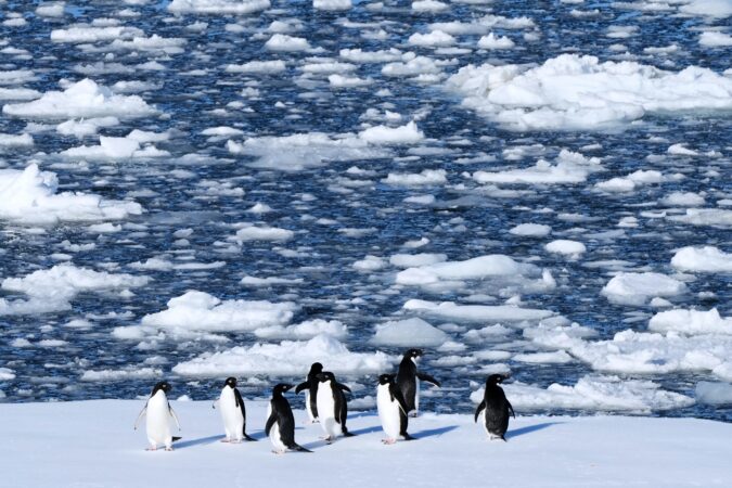
    Researchers used remote control cameras to photograph penguins breeding in dozens of colonies from 2011 to 2021. They say it was the fastest shift in timing of life cycles for any backboned animals that they have seen. The three species are all brush-tailed, so named because their tails drag on the ice: the cartoon-eye Adelie, the black-striped chinstrap and the fast-swimming gentoo.

    Warming creates penguin winners, losers

    Suttle said climate change is creating winners and losers among these three penguin species and it happens at a time in the penguin life cycle where food and the competition for it are critical in survival.

    The Adelie and chinstrap penguins are specialists, eating mainly krill. The gentoo have a more varied diet. They used to breed at different times, so there were no overlaps and no competition. But the gentoos’ breeding has moved earlier faster than the other two species and now there’s overlap. That’s a problem because gentoos, which don’t migrate as far as the other two species, are more aggressive in finding food and establishing nesting areas, Martinez and Suttle said.

    Suttle said she has gone back in October and November to the same colony areas where she used to see Adelies in previous years only to find their nests replaced by gentoos. And the data backs up the changes her eyes saw, she said.

    “Chinstraps are declining globally,” Martinez said. “Models show that they might get extinct before the end of the century at this rate. Adelies are doing very poorly in the Antarctic Peninsula and it’s very likely that they go extinct from the Antarctic Peninsula before the end of the century.”

    Early bird dining causes problems

    Martinez theorized that the warming western Antarctic — the second-fasting heating place on Earth behind only the Arctic North Atlantic — means less sea ice. Less sea ice means more spores coming out earlier in the Antarctic spring and then “you have this incredible bloom of phytoplankton,” which is the basis of the food chain that eventually leads to penguins, he said. And it’s happening earlier each year.

    Not only do the chinstraps and Adelies have more competition for food from gentoos because of the warming and changes in plankton and krill, but the changes have brought more commercial fishing that comes earlier and that further shortens the supply for the penguins, Suttle said.

    This shift in breeding timing “is an interesting signal of change and now it’s important to continuing observing these penguin populations to see if these changes have negative impacts on their populations,” said Michelle LaRue, a professor of Antarctic marine science at the University of Canterbury in New Zealand. She was not part of the Oxford study.

    People’s penguin love helps science

    With millions of photos — taken every hour by 77 cameras for 10 years — scientists enlisted everyday people to help tag breeding activity using the Penguin Watch website.

    “We’ve had over 9 million of our images annotated via Penguin Watch,” Suttle said. “A lot of that does come down to the fact that people just love penguins so much. They’re very cute. They’re on all the Christmas cards. People say, ‘Oh, they look like little waiters in tuxedos.’”

    “The Adelies, I think their personality goes along with it as well,” Suttle said, saying there’s “perhaps a kind of cheekiness about them — and this very cartoonlike eye that does look like it’s just been drawn on.”

  • It may feel like zero in Philly this week, and the ‘wind chill’ has Pennsylvania roots

    It may feel like zero in Philly this week, and the ‘wind chill’ has Pennsylvania roots

    The region evidently is about to migrate from the refrigerator to the freezer this week, with wind-chill levels possibly approaching zero as temperatures fall to the teens and a brisk west wind adds sting.

    “Wind chill” has been a staple of National Weather Service forecasts and media weather reports since 1973.

    (Commercial services, such as AccuWeather Inc., now have their own variants.)

    At different times it has been a subject of contention, confusion, derision, and revision; its popularity, however, endures.

    In terms of alerting the public to potential health hazards, “I think it’s useful,” said Michael DeAngelis, vice chair of emergency medicine at Temple University’s Lewis Katz School of Medicine.

    Said Harvey V. Lankford, a retired physician and writer who has done a deeper dive into wind chill than most humans: “It’s a yardstick.

    “The public loves it.”

    But where do those numbers come from, and do they tell us how we really feel?

    The birth of ‘wind chill’

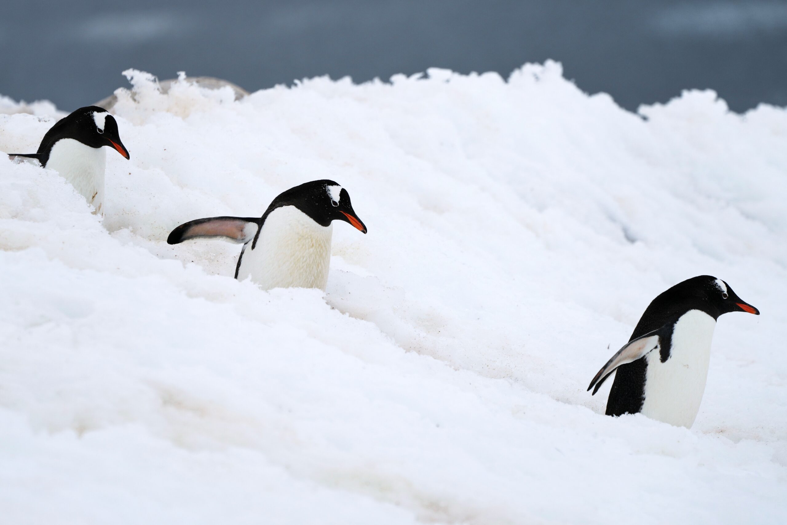
    Gentoo penguins walk at Neko Harbour in Antarctica, Saturday, Nov. 22, 2025. (AP Photo/Mark Baker)

    Wind chill is a measure of heat loss from the body from the combination of temperature and wind.

    What we know about its effects has a lot to do with former Eagle Scout Paul Siple, the pride of Erie’s Central High School.

    He pursued his quest while accompanying Admiral Richard Byrd on his legendary expeditions to that icy forbidden planet known as Antarctica, where the wind stings “like a knife drawn across the face,” as one of his associates put it. At age 19, Siple had won a highly publicized national competition to join Byrd.

    Siple minted the term wind chill in his 565-page unpublished doctoral dissertation, a copy of which Lankford obtained from Clark University, in Worcester, Mass.

    On a later expedition, Siple, assisted by geologist Charles Passel, conducted experiments measuring how long it took to freeze a container of water under a variety of temperature and wind conditions. Winds obviously accelerated the freezing process.

    Using that data they estimated heat loss from human skin, publishing their findings in a landmark 1945 paper.

    But Lankford said Siple got remarkable results in his more primitive earlier research, which included estimating frostbite thresholds, using a relatively simple formula involving wind speeds and temperatures.

    Siple’s work would become the basis for the wind chill factor that the weather service massaged and began sharing publicly in 1973.

    Frostbite and the wind chill revision

    The wind chill calculations underwent a significant revision a quarter century ago.

    U.S. and Canadian scientists during the 1990s used human subjects to upgrade the index, including establishing new frostbite thresholds.

    Twelve subjects, with sensors inside their cheeks and their faces bare, were subjected to temperatures ranging from 32 to 58 below at three different wind speeds.

    They were monitored for signs of “frostnip,” which precedes frostbite by about a minute.

    For the record, the researchers found that with wind chills of 40 below, frostnip occurs within 15 minutes.

    The weather service said the revised index profited from “advances in science, technology and computer modeling.”

    Yet Siple obviously had been on to something decades earlier, Lankford said.

    In a paper published in 2021 in the journal Wilderness and Environmental Medicine, Lankford and coauthor Leslie R. Fox wrote that some of the modern findings on frostbite thresholds were remarkably similar to what appeared in Siple’s dissertation.

    Lankford said they were not surprised by the similarities: “We were stunned.”

    Staying safe in the cold

    Aside from frostnip and frostbite potential, exposure to frigid temperatures and strong winds poses a variety of other health hazards, DeAngelis said.

    Those conditions can seriously exacerbate certain lung problems.

    For the healthy, he recommends proceeding with caution while exercising. Sweating in the cold — it does happen, just ask runners and hikers — can increase the risk of hypothermia.

    Plus, your brain, heart, kidneys, and other internal organs will be diverting blood flow from muscles and extremities, and that could slow recovery from exertion.

    Or you could just put off that run or bike workout until Thursday, when it may go up to 40 degrees.

  • Snow is expected during the weekend in Philly, but how much is up in the air

    Snow is expected during the weekend in Philly, but how much is up in the air

    Some snow is possible in the Philly region during the holiday weekend, but about the only thing certain is that schools will be closed until Tuesday.

    Snow — not a whole lot of it — is expected Saturday morning, and possibly again during the day Sunday.

    “Definitely something,” said Ray Martin, a lead meteorologist at the National Weather Service Office in Mount Holly, “maybe not a lot of something.”

    In short, he added, expect a “100% chance of forecast uncertainty.”

    How much for Philly?

    (function () {window.addEventListener(‘message’, function (e) { var message = e.data; var els = document.querySelectorAll(‘iframe[src*=”‘ + message.id + ‘”]’); els.forEach(function(el) { el.style.height = message.height + ‘px’; }); }, false); })();

    Some snow is expected in the early morning hours of Saturday, said Dan Pydynowski, senior meteorologist with AccuWeather Inc., and “sidewalks and streets could be slick for a time” in the Philly region.

    However, temperatures in the afternoon are expected to approach 40 degrees and that should melt any snow. If the precipitation lingers, it likely would turn to rain.

    That snow would be associated with a system from the west, and more significant amounts are expected well north and west of Philly.

    On Sunday when it will be colder, the source would be a coastal storm that has been befuddling computer models the last three days. On Wednesday, the U.S. model was seeing a significant snowstorm for the I-95 corridor. On Thursday, it said never mind and fell in line with other guidance that kept the storm offshore.

    On Friday, models were bringing the storm closer to the coast, but the model consensus was that it would be more of threat at the Shore and perhaps throw back a paltry amount to the immediate Philly region.

    “On the other hand, a slight shift … in the track could bring 1-2 inches into the urban corridor,” the weather service said in its afternoon discussion.

    Said Martin, “It’s always tricky with these offshore lows. It’s also possible that both systems pass us and we get basically nothing.”

    Far more certain is a rather big chill

    A Philadelphia firefighter spreads salt to control icing at a fire scene on Friday.

    That the region was about to experience its coldest weather of the season to date was all but certain.

    High temperatures on Monday, Martin Luther King Jr. Day, probably won’t get out of the 30s, and no higher than the mid 20s Tuesday and Wednesday, forecasters say.

    Overnight lows are due to tumble into the teens, with wind chills approaching zero early Wednesday.

    No more precipitation is forecast at least through Thursday, but with odds favoring continued below-normal temperatures through Jan. 29 and above-normal precipitation, it should be a robust period for virtual snow threats, if not actual snow.

    “Even if nothing really happens this weekend,” said Martin, “there’s always next weekend.”

    Pydynowski said that “some signs” point to a snowfall “late next week or next weekend.”

    But one uncertainty at a time.