Category: Science

  • The Philly area’s most flood-prone waterways, mapped

    The Philly area’s most flood-prone waterways, mapped

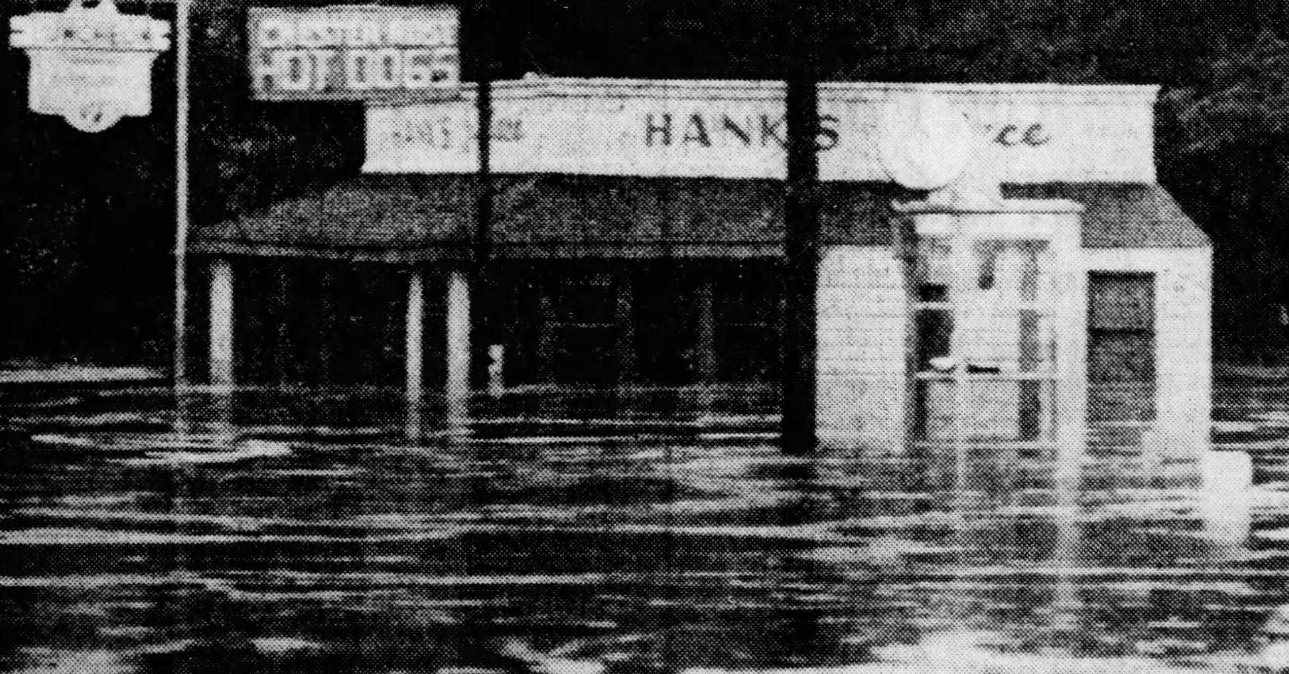
    Late on a stormy September night, Katie and Anthony Young were watching a horror show. In this instance, it was also a reality show.

    A surveillance camera showed 8-foot floodwaters drowning the generator in the rear of their restaurant, Hank’s Place. The water crashed into the dining and kitchen areas, tossing around furniture and emptying the contents of refrigerators.

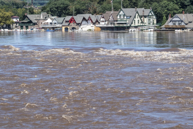
    The remnants of Hurricane Ida in 2021 had overwhelmed the Brandywine Creek at Chadds Ford, one of the region’s most picturesque locales, made famous by a frequent Hank’s customer, artist Andrew Wyeth.

    “I don’t think either one of us was anticipating it being that catastrophic,” Katie Young said.

    In a region where flooding is a perennial threat, an Inquirer analysis of the area’s most flood-prone waterways found the Brandywine ranks among the elite, based on available U.S. Geological Survey data.

    (function() {
    var l2 = function() {
    new pym.Parent(‘area_floods’,
    ‘https://media.inquirer.com/storage/inquirer/projects/innovation/arcgis_iframe/area_floods.html’);
    };
    if (typeof(pym) === ‘undefined’) {
    var h = document.getElementsByTagName(‘head’)[0],
    s = document.createElement(‘script’);
    s.type = ‘text/javascript’;
    s.src = ‘https://pym.nprapps.org/pym.v1.min.js’;
    s.onload = l2;
    h.appendChild(s);
    } else {
    l2();
    }
    })();

    A total of 61 major and moderate floods have occurred since 2005 at Chadds Ford and three other gages on the main stem of the Brandywine and its branches. The Brandywine East Branch near Downingtown has registered more major and moderate floods, with 33 combined, than any gage point in the region.

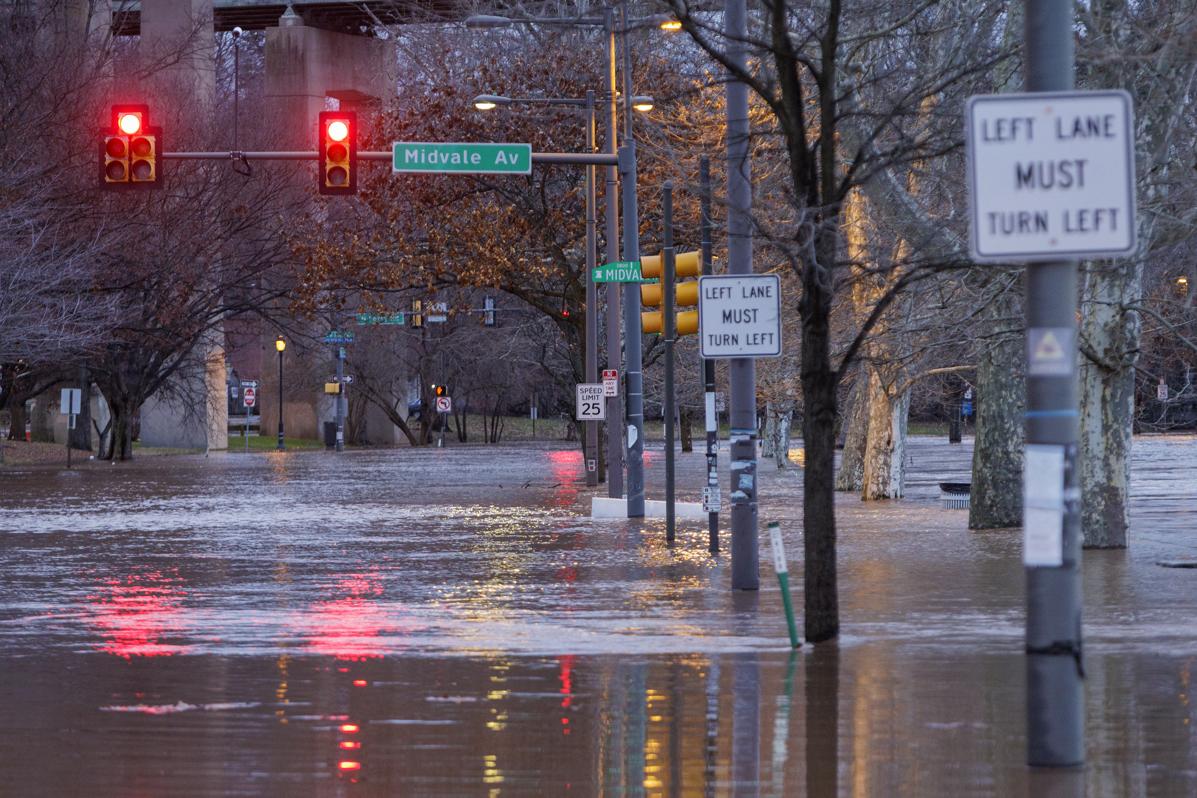
    No. 2 on the list was the Delaware River at Burlington, with seven major and 19 moderate floods, although that is not quite the same as stream flooding. Technically, flooding measured on the five Delaware River gages south of Trenton, including the one at Washington Avenue in South Philly, is “tidal,” since it is influenced by the behavior of the Atlantic Ocean and the Delaware Bay.

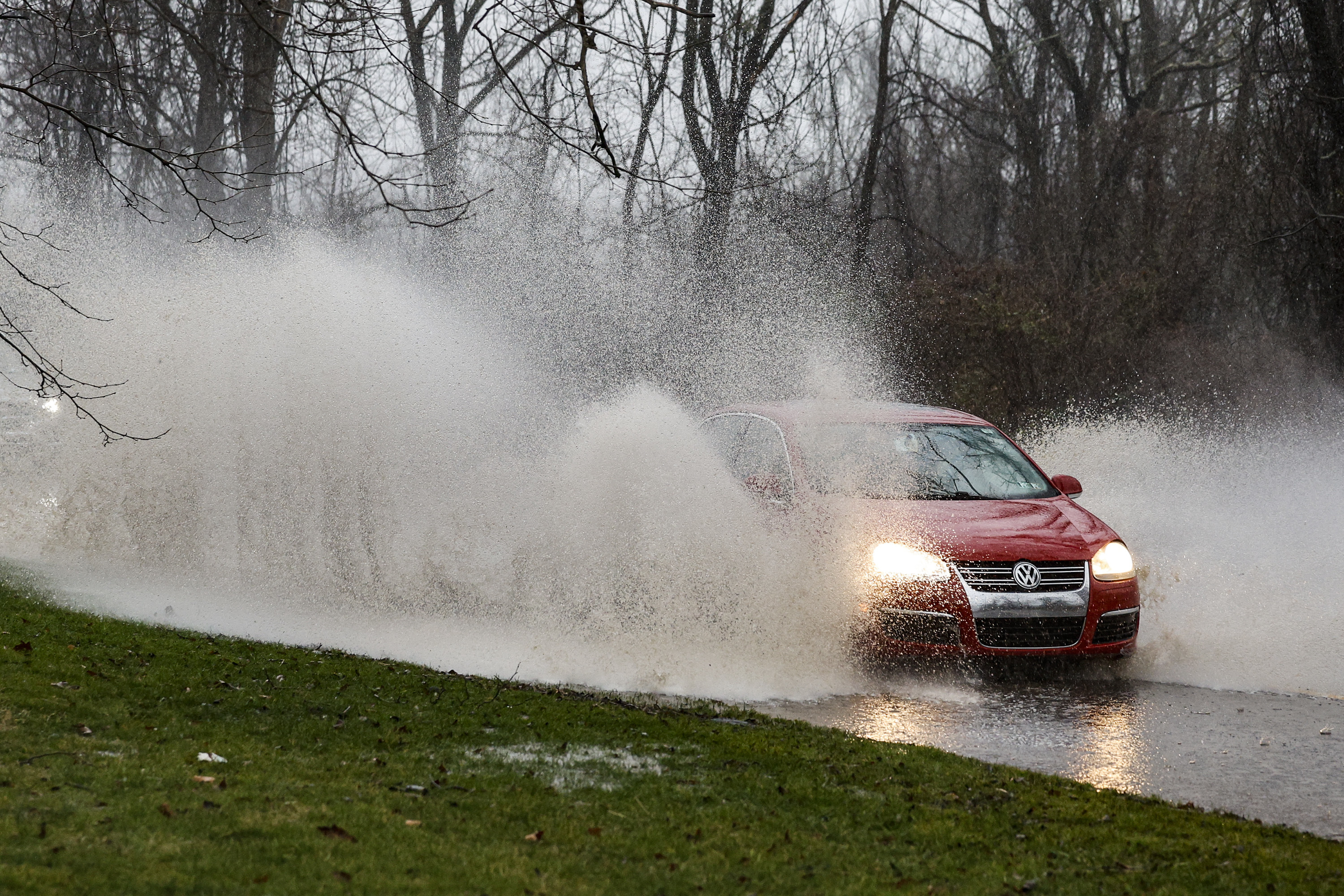
    The chaotic behavior of the atmosphere may forever be elusive; however, more flooding along the Brandywine, the Delaware, and the rest of the region’s waterways is an absolute certainty.

    Various studies have documented increases in extreme precipitation events with the warming of the planet. But humans are affecting the flood calculus immeasurably by hard-topping rain-absorbent vegetation.

    Schuylkill River floods onto Kelly Drive at Midvale in the East Falls section of Philadelphia on Wednesday, Jan. 10, 2024.

    A comprehensive analysis of the Brandywine watershed published in April reported that impervious surfaces increased by 15% along the Great Valley’s Route 30 corridor from 2001 to 2020.

    Those increases are “significant,” said Gerald Kauffman, director of the University of Delaware’s Water Resources Center, which coauthored the study along with the Brandywine Conservancy and the Chester County Water Resources Authority.

    Municipalities welcome tax-generating development. Conversely, Kauffman said: “You get more value if you build next to a greenway. It’s the eternal debate.”

    From 2001 to 2020, the population in the Brandywine watershed grew nearly 25%, to 265,000 people, with 150,000 more expected by the end of the century. That’s a lot of rooftops and driveways feeding water into the stream, which empties into the Delaware River.

    Along the Delaware, the rising water levels of the Atlantic Ocean and the Delaware Bay are forecast to generate more flooding. The National Oceanic and Atmospheric Administration estimates that sea levels have been rising about an inch every five years.

    While the oceanic salt line — the boundary between ocean and freshwater — usually stays well south of Philly, the tidal pulses contribute to flooding in the city and areas to the north, where the channel narrows, said Amy Shallcross, water resources operations manager at the Delaware River Basin Commission.

    The five tidal gages along the Delaware from Newbold Island to Marcus Hook have registered more than 90 significant floods since 2005, according to the Inquirer analysis.

    The study was limited to the 33 USGS gages that had a period of record of at least 20 years and list designated flood stages.

    Along with the Delaware River sites, other stream gages that appeared in the top 10 list for major and moderate flooding were those on the Perkiomen, Chester, Neshaminy, and Frankford Creeks.

    Motorists brave the heavy rain and deep puddles along Creek Road in Chadds Ford during a nasty flood event in January 2024.

    The gage network cannot capture all the episodic flooding from the likes of thunderstorm downpours.

    Flood frequency is not the only consideration for siting a gage, said Tyler Madsen, a hydrologist with NOAA’s Middle Atlantic River Forecast Center, in State College. For example, the gages have to be located in areas free of unnatural barriers, such as bridge abutments.

    Plus, a major consideration is funding. They are costly to monitor and operate, serving multiple purposes such as measuring water quality and streamflow.

    They rely on a variety of funding sources, including state and local governments, that are not available everywhere.

    The Brandywine study’s suggested remedies included adding flood-control structures and beefing up warning systems all along the watershed, but warned: “Even with unlimited financial and technological resources, it would be impossible to eliminate all flood risks.”

    Hank’s Place, on Routes 1 and 100 in Chadds Ford, was swamped by water from the rains of Tropical Storm Agnes in June 1972. The area has a long history of flooding, and the restaurant was reconstructed after it was flooded and damaged by Ida in 2021.

    The Youngs are prepared to live with those risks, come storms or high water.

    Said Katie Young: “Hank’s belongs here.”

  • No, it’s not going to snow on Thanksgiving in Philly, but a taste of winter is coming

    No, it’s not going to snow on Thanksgiving in Philly, but a taste of winter is coming

    The snow rumors notwithstanding, the Philadelphia region and most of the rest of the Northeast can pretty well rule out a white Thanksgiving, nor will Black Friday turn white.

    However, the upper atmosphere evidently is in a state of upheaval with a potentially rare event unfolding, and forecasters say something resembling winter may arrive around here before the holiday weekend ends.

    The National Oceanic and Atmospheric Administration’s Climate Prediction Center has chances favoring below-normal temperatures and above-normal precipitation from Thanksgiving Day through Dec. 1.

    However, the meteorologists who have grappled with longer-range outlooks are cautioning against taking social media snow forecasting too seriously.

    “The observed snowfall is inversely proportional to the hype,” said Judah Cohen, research scientist with the Massachusetts Institute of Technology. He is among those who have noticed the snow mentions that have popped up on X accounts and popular websites.

    The next week should generally be uneventful save for rain Tuesday night possibly into getaway Wednesday, when highs are forecast to reach the 60s.

    Then a developing pattern change is predicted to import colder air into the Northeast. “I do believe it will get colder as the Thanksgiving week wears on,” said Bob Larson, senior meteorologist with AccuWeather Inc.

    A rare event may chill December

    What has the attention of Cohen and others in the meteorological world is the potential for a “major” stratospheric warming event in the upper atmosphere over the Arctic sometime in the next several days, a disruption that could allow significant cold air to pour into the United States.

    Major events have occurred on average about six times a decade, according to NOAA researchers; however, having one so early would be a rarity.

    If one occurred, it would be only the second time in records dating to the early 1950s that it has happened this early, said NOAA meteorologist Laura M. Ciasto.

    While computer models have been debating over just what is going to happen, Cohen, chief of seasonal forecasting for the Janus Research Group, said that such an early date has given him pause about forecasting it will happen.

    What causes a stratospheric warming event?

    On occasion, upward-moving waves from the troposphere, 5 to 9 miles over the Arctic, crash into the stratosphere, 10 to 30 miles up. That has the effect of compromising the polar vortex, the west-to-east winds that lock cold air in the places where the sun disappears for the winter, Ciasto said.

    When the winds slacken, the vortex can weaken and allow frigid air to spill southward. In some cases it might “stretch,” or split into pieces that deliver cold air to regions of the Northern Hemisphere.

    A major disruption would have longer-lasting impacts, Cohen said.

    The European forecast model has consistently predicted a major event, Ciasto said, while the U.S. model has not been as impressed.

    What is likely to happen if the warming event occurs?

    A major warming in January 2021, when temperatures in the stratosphere suddenly jumped 65 degrees Fahrenheit, resulted in quite a snowy February in the Philadelphia region.

    After a warming event, “there’s a greater chance that the jet stream will become more disrupted and dip down” over the continuous United States, Ciasto said, “bringing cold air with it.”

    As for timing, the effects may show up anywhere from two to several weeks after the event.

    In the meantime, she noted that “several other factors,” including patterns over the North Pacific, favor a chilling for the Northeast.

    Don’t be surprised to see snow appear in an actual forecast, but not necessarily on the ground.

  • What to expect for the Philadelphia Marathon weekend weather forecast

    What to expect for the Philadelphia Marathon weekend weather forecast

    Assuming the sports scientists have it right, the temperatures should be near the performance sweet spots for the runners participating in the Philadelphia Marathon Weekend races on both Saturday and Sunday morning.

    At showtimes, 6:55 a.m., just moments after daybreak, temperatures Saturday are expected to be in the upper 40s to near 50 degrees for the half-marathoners, and in the upper 30s to around 40 for Sunday’s main event.

    Light rain is expected through the early-morning hours Saturday, and forecasters have been on the fence about when it will shut off. Nick Guzzo, a meteorologist at the National Weather Service said Friday afternoon that rain was likely at the start of the race, but that probabilities would drop precipitously once the event was underway.

    AccuWeather Inc. and weather.com were posting about a 50-50 shot that the rain would continue through the morning. The hedging isn’t surprising; timing the onset and end of precipitation has been a longstanding forecast problem.

    Nor would it be surprising for those running the 13.1-mile race to experience conditions different from those logging 26.2 miles the following day, points out Kathleen Titus, the race director and runner who has been involved with the marathon for 20 years.

    This time of year is a busy one for frontal passages, this being a transition period when the atmosphere isn’t quite sure what season it wants to be. The temperature has reached 74 degrees on Nov. 22 (1883), and plunged to 14 (1880), and snowed 4.6 inches on Nov. 22-23, 1989.

    However, nothing momentous is expected this weekend.

    Like the rains, winds are forecast to be light, under 10 mph, from the north on Saturday, and northwest on Sunday, although runners allow that on the course, the wind can be way more capricious than the temperatures.

    Why runners like these temperatures

    Various studies have concluded that temperature is the most important weather variable in runner performance and that the ideal range for marathoning is 39 to 50 degrees Fahrenheit — give or take a few degrees.

    “Your body is always competing between a couple of different things,” said Philip Skiba, sports medicine specialist at Thomas Jefferson University Hospital, who helped train Eliud Kipchoge, the Kenyan who became the world’s first runner to complete a marathon in under two hours.

    During exercise, muscles demand blood to work, while for the body to stay cool, blood has to flow to the skin. If it’s too hot, more blood flows to the skin. When it’s cold, blood is diverted to heat the body’s core.

    With temperates in that 39-to-50 range, the blood flow can more easily serve both the muscles and skin. Said Titus, racers love that temperature range because, “It regulates your body. It just works.”

    Skiba said the temperature ranged from 51 to 55 degrees on the October 2019 day Kipchoge broke the two-hour barrier in a Vienna event that wasn’t held under record-eligible conditions.

    Had the temperatures been lower, Kipchoge could have shaved a few more seconds off his time, Skiba said.

    The wind also is a player in marathons

    While not as dominant as temperature, “wind resistance … is worth a few seconds per mile,” said Skiba, a former triathlete.

    “The more you stay out of the wind, you can save considerable energy,” he said.

    “It’s really important to learn how to draft,” that is, get behind a group running close to your pace and using them for wind-breakers, he said. (Not sure how the wind-breakers feel about that.)

    On the Philly course, the winds can be wild cards, especially on Kelly Drive, Titus said.

    One instant, the wind “hits in your face. Now it’s at my back!”

    Titus said she actually likes running uphill into the wind — and she is believed to be a member of a distinct minority — but agrees that “it is nice to have it at your back when you’re coming into the home stretch. Because it does give you a little boost.”

    The Philly Marathon is holding out hope for a record

    Titus said she is hoping for a record this year, unrelated to race times.

    She encourages people to overdress to stay warm before the running gets underway, and to be liberal about peeling off layers during the race.

    The shed garments are collected and given to the Salvation Army.

    “We’d love to break some record in the clothing donation,” she said.

  • A storm looms in what’s going to be another rough week for Jersey beaches

    A storm looms in what’s going to be another rough week for Jersey beaches

    New Jersey’s beaches, still recovering from major sand losses from an offshore hurricane and a nor’easter, evidently are in for another assault this week as October is about to make a dramatic exit.

    Gale-force gusts off the ocean could develop as early as Tuesday afternoon at the Shore, said Eric Hoeflich, a meteorologist at the National Weather Service office in Mount Holly, with brisk onshore winds persisting “maybe into Friday.”

    A potent storm is forecast to affect the entire region Wednesday night into Thursday, with heavy rains in the immediate Philadelphia area, where drought conditions have been intensifying.

    Also on Thursday, what is likely to become catastrophic Hurricane Melissa will be passing offshore, churning up the waves crashing on East Coast beaches.

    “The coast once again is going to take a pretty good battering,” said Dave Dombek, senior meteorologist with AccuWeather Inc.

    On the plus side, Hoeflich said, for the Shore, this week’s storm “doesn’t look as bad” as the beach-erasing nor’easter earlier this month. The path should be more inland, and the lunar influence on the tides would be less. Only minor flooding is expected, he said, subject to change.

    However, not only would the track mean region-wide heavy rain, but it would also increase the potential for severe thunderstorms Thursday. A front is due to chase the rains Friday, but it may generate gusts to 50 mph, the weather service says. Power outages are possible both days.

    The timetable for the winds and the storm in the Philly region

    The National Weather Service has posted a gale warning for Tuesday into Wednesday morning for the waters along the immediate coast for winds from the east that could gust past 50 mph.

    That would be more the result of high pressure to the north of the region. Winds circulate clockwise around centers of highs; thus, areas to the south of the center experience winds from the east.

    The breezes will be getting a second wind as a storm develops in the Southeast and tracks north. Meanwhile, a weakened Hurricane Melissa will be churning the ocean as it passes well off the U.S. coast on Thursday.

    The Philly region could use the rain

    The interagency U.S. drought monitor has the majority of the region in its “moderate drought” category.

    Rain for the last 30 days has been about a third of normal in the city and the neighboring Pennsylvania counties.

    South Jersey has fared only slightly better, but precipitation is well less than half of normal.

    What is the forecast for the trick-or-treaters?

    It is all but certain that Friday will be a dry day, with temperatures in the low and mid-50s. Wind gusts are forecast to die down sometime after 5 p.m., but hold onto those brooms, just in case.