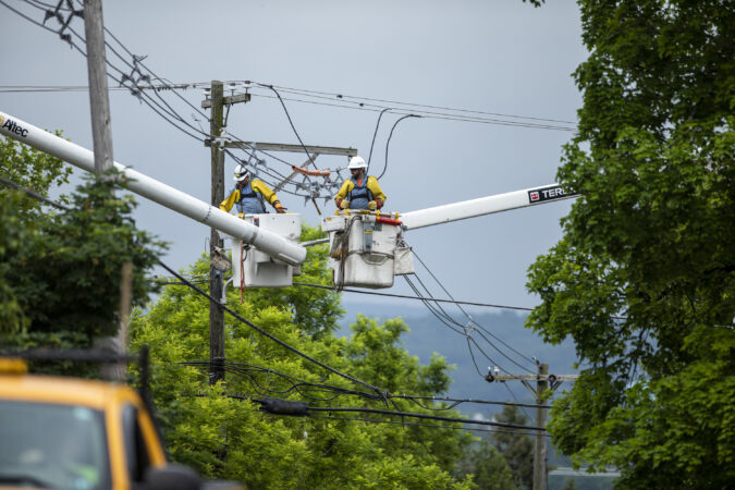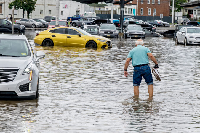
Flood warnings remainin effect in the Philly region as a result of episodic downpours that have been wringing out 2 to 3 inches of rain in a hurry, including in downtown Camden, which was hammered earlier in the week .
Flooding has been reported along numerous roads, with vehicles stranded, including in the vicinity of the Ben Franklin Bridge, the National Weather Service said. The rains could continue until 7 or 8 p.m., said Alex Staarmann, meteorologist inthe Mount Holly office.
Multiple water rescues have been reported in Wilmington.
Philadelphia broke a 74-year-old record for a July 9 with 2.4 inches of rain measured officially, according to the weather service.
Official more rain has fallen in Philly in the last six days than in any entire month since March of 2025.
At one point flood warnings had been posted for the city in all seven neighboring counties.
And the entire Philly region had been under a rinse-and-repeat flood watch Thursday for yet another round of downpours. A severe-thunderstorm watch has been posted until 10 p.m. for Camden and Gloucester Counties and all of Delaware.
But the rain lately has been random. And in the grand casino of the atmosphere, these storms once again are likely to be hit and miss.
“It looks like that’s going to be the case,” said Joseph DeSilva, meteorologist with the National Weather Service in Mount Holly, which has the flood watch in effect until 11:59 p.m. Thursday.
Despite those rains earlier this week — close to 4.4 inches in Camden — in the weekly inter-agency U.S. Drought Monitor update posted Thursday, some degree of drought conditions persisted in all of New Jersey, Philly, and the neighboring Pennsylvania counties.
Strong thunderstorms also are possible in the Philly region
The atmosphere is energized, and thunderstorms are likely from midafternoon into the evening.
The federal Storm Prediction Center lists a 15% chance that some may be come severe, with wind gusts approaching 60 mph.
The weather service says the air is so saturated that storms could wring out 1 to 2 inches in an hour in localized downpours.
But, again, rainfall totals can — and likely will — vary radically within the counties.
The drought conditions will be stronger than the storms
The drought monitor has most of the region was in “moderate drought,” with some improvement in Burlington, Camden, and Gloucester Counties.
But all of Chester County and most Montgomery County were in “severe drought.” Southeastern New Jersey, including the Shore towns, were in “extreme drought.”
Soil moisture levels will remain significantly below normal during the next week, according to the National Oceanic and Atmospheric Administration’s Climate Prediction Center.
(function(){function e(){window.addEventListener(`message`,function(e){if(e.data[`datawrapper-height`]!==void 0){var t=document.querySelectorAll(`iframe`);for(var n in e.data[`datawrapper-height`])for(var r=0,i;i=t[r];r++)if(i.contentWindow===e.source){var a=e.data[`datawrapper-height`][n]+`px`;i.style.height=a}}})}e()})();
Showers are possible Saturday afternoon, DeSilva said, but then it appears the atmospheric faucets are going to shut off for a while.
“Next week looks pretty dry,” DeSilva said.