Philadelphia historian, author, and educator Michelle Craig McDonald knows her coffee. Especially the revolutionary kind.
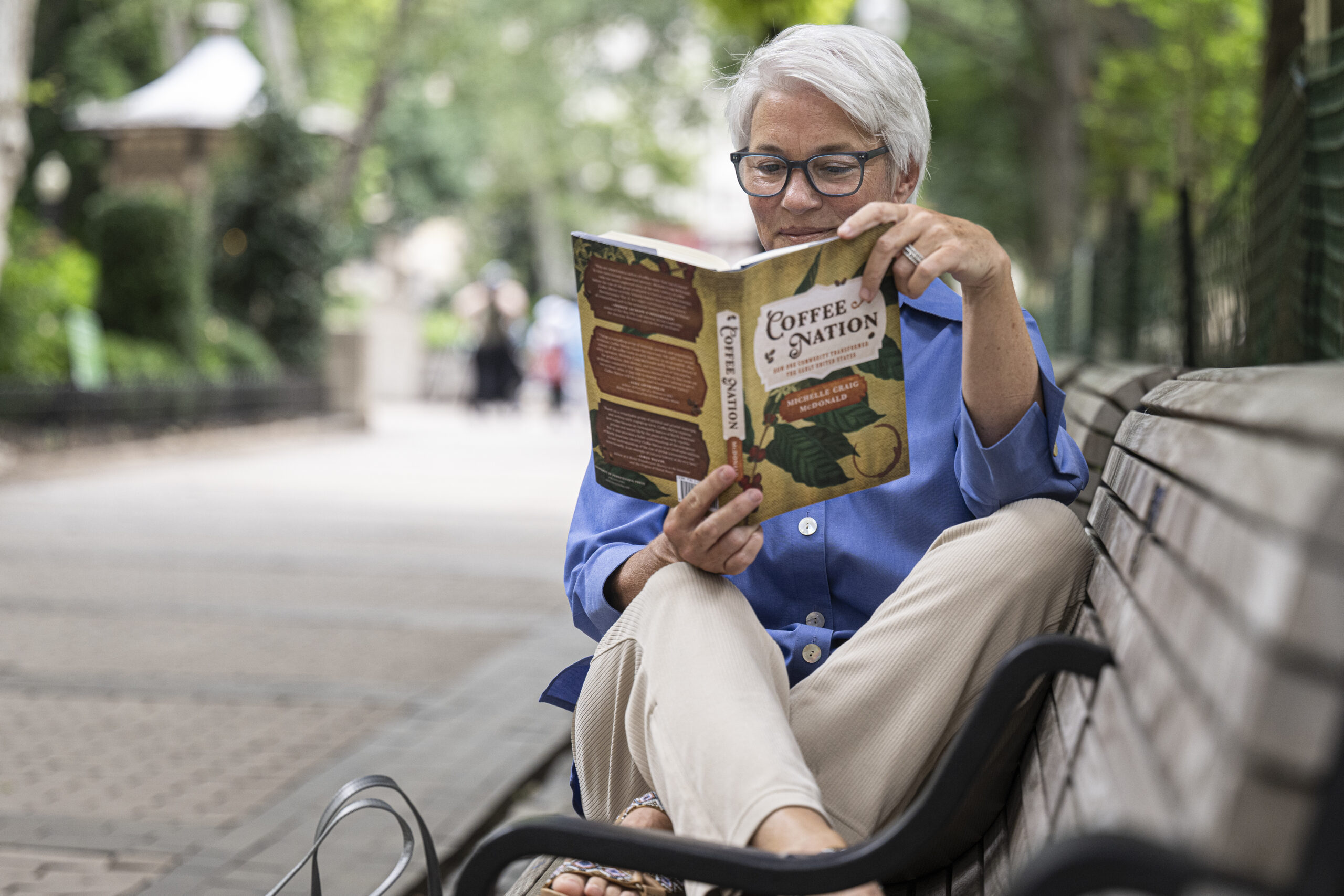
McDonald, who serves as an academic adviser for PBS’s series Drive By History, is the author of the new book, Coffee Nation: How One Commodity Transformed the Early United States.
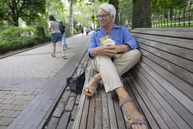
Philly historian and educator Michelle Craig McDonald enjoys reading in Rittenhouse Square Park. She is the author of “Coffee Nation: How One Commodity Transformed the Early United States.”
Telling the story of America and coffee, McDonald traces the bean’s beginnings from slavery-based plantations of the Caribbean and South America in the early 1700s through its prominence in Colonial life to the rebranding of the exotic good as an American staple. McDonald details the emergence of coffee shops, like the Old London Coffee House at Front and Market Streets, as critical Revolutionary-era hubs for politics and business.
“Within 50 years of our independence, the United States becomes one of the largest suppliers of coffee to the world — but we can never grow it,” said McDonald. So in this moment, when we think about independence, coffee really reminds us that the United States remains deeply tied and deeply embedded with the economies of the region. It was not just a self-sustaining nation that looked inward.”
Given the nature of her research, it’s no surprise that McDonald’s Perfect Philly Day revolves around food and drink. McDonald, a Southern California native who lives in Rittenhouse Square with her husband and fellow historian, Roderick A. McDonald, said her perfect day includes lots of coffee and cooking, a great Philly workout, and reading crime novels in Rittenhouse Square.
6:30 a.m.
My coffee pot is my first spot. I’m going to need fortification if I’m going to tackle the day’s news. I just go with the tried and true Colombian roast from Trader Joe’s.
When we are down the Shore, my favorite comes from Remedee Coffee, started by two sisters who source their beans from Colombia. It’s a great small business.
On a perfect day, this is when we do our New York Times games — like Connections or Wordle — which we do together. My sister says it’s cheating. I like to say it’s “collaborating.”
8:30 a.m.
I love cooking of all kinds, but baking is my first love. My go-to on a perfect day is a batch of scones. I have a recipe that I got online from a website called Love and Lemons. It’s a base recipe. You can make anything you want. Cranberry, orange walnut, apricot, ginger almond, or my brother-in-law’s favorite, which I know because he buys the ingredients every time I visit, blueberry lemon.
I used to head over to Metropolitan Bakery on 19th Street, which I am still mourning the loss of.
I loved their Millet Muffins and raisin walnut bread. My freezer is stuffed with both because I bought as many as I could before they closed. And I’m slowly rationing them so I don’t lose them quickly.
9:30 a.m.
We have a solid division of labor in the household. I do the cooking. But my husband does the shopping. While the scones are in the oven, he may well be on his way down to the Italian Market on his vintage 1962 Schwinn bicycle — expertly serviced by Curtis at Via Bicycle on Broad Street. He’s a fan favorite!
My husband is the provisioner of the house. I get to take what he brings back from the list — and sometimes not from the list. It feels like my own personal version of Chopped. He comes home with five ingredients and says, “What can you do with this?’”
10 a.m.
I’m hitting the gym. I do love eating, which means I need to pay the piper. I go to Pure Barrein Center City. It’s wonderful. It’s a class — a core-based workout that does weightlifting, planks, pushups. An hour there, any day I can get it, gives me enough brownie points for the rest of the day’s culinary adventures.
If the weather is nice, we might substitute a bike ride down the Schuylkill River Trail. Manayunk is a great destination.
Noon
That’s when Small World Seafood is in the area with deliveries. It’s an Old City business that was born out of necessity. The owner provided fresh seafood to restaurants during the COVID-19 pandemic. Then he began an online business selling directly to customers. You can get anything — halibut, skate steaks, steelhead trout, oysters, clams — for a lazy cooking night.
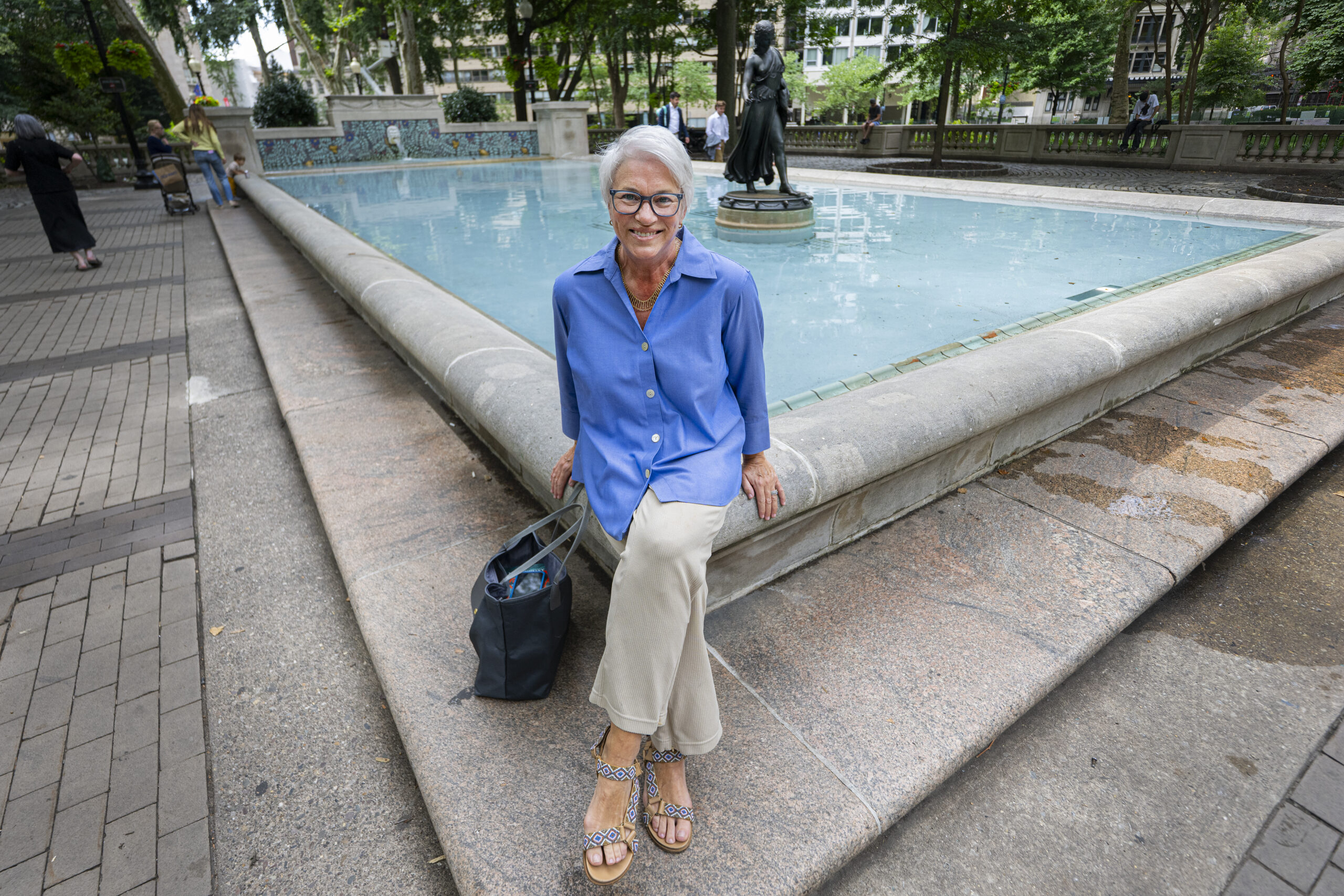
Michelle Craig McDonald’s perfect Philly day includes lots of coffee and cooking, a great Philly workout, and reading crime fiction in Rittenhouse Square.
1 p.m.
I’ve got the fish and I’m marinating it for dinner. Steelhead trout is one of my favorites, so super easy, a little bit of soy, a little bit of orange, a little bit of brown sugar, a little bit of maple, and garlic.
2 p.m.
On a perfect day, when I can while my time away, you will find me reading in Rittenhouse Square. I have an abiding passion for crime fiction. Ann Cleeves. Donna Leon.
And if it’s not great weather, you could still find me reading, but probably in one of any of a dozen coffee shops that are within walking distance of my house.
There was a great article that just ran recently in The Inquirer about the rise of Yemeni coffee shops in the city, such as Moka & Co.
3 p.m.
This is where it’s going to get busy. I would be remiss if I didn’t bring a little history and culture into this day. The American Philosophical Society has a wonderful project called “The Revolutionary City: A Portal to the Nation’s Founding.” It’s a partnership where five Philadelphia historical institutions — the APS, the Library Company of Philadelphia, the Historical Society of Pennsylvania, the Kislak Center at Penn Libraries, and the Museum of the American Revolution — came together to plan for 2026, and all their exhibits build on each other. Now I know that’s a long afternoon. Readers can pick and choose and see the others on their second favorite perfect Philly day [laughter].
6 p.m.
My husband and I cook together. If it’s Saturday, the compulsory listen is “The Many Moods of Ben Vaughn.” Cooking is my way to unwind and my husband is an excellent sous chef.
8 p.m.
We tend to have a leisurely meal with a glass of wine or two, and review the day’s exploits. An episode of television in the evening is a good escape. We are huge PBS fans. We love British crime dramas. We are huge fans of Shetland, a Scottish crime drama, and Vera, an old British crime drama with a curmudgeonly police detective.
10 p.m.
I am not a night owl. But I will confess to a wee dram of bourbon most evenings. Then, a little more light reading. And it’s time for lights out.
This interview has been edited for length and clarity.
The Price Point compares homes listed for similar sale prices across the region to help readers set expectations about house hunting.
According to recent Zillow data, homes with “character” — visual distinction and a sense of history — are all the rage.
As the birthplace of the nation, the Philadelphia region has its fair share of drool-worthy older homes of all shapes, sizes, and price tags.
In May, the median sale price for homes in the Philadelphia metropolitan area was $405,000.
So, here are three pre-World War II homes in the Philadelphia region that about$405,000 can buy — all with ample “character.”
A Fairmount condo with a private patio
This second-floor condoboasts a desirable location, according to its listing agent, Jeniffer Benner with Home Sweet Home PHL.
It’s situated on a tree-lined street in the heart of the Art Museum neighborhood, with easy walkability to Center City, the Schuylkill River Trail, and Roberto Clemente Park just a block away.
Benner said a main draw is the property’s private rear patio, which is “tough to find in condo spaces.”
Built in 1920 with a major remodel in 2014, the home’s living room boasts modern features and touches of the past with its traditional red brick exterior. It has nine-foot ceilings, custom shutters, hardwood floors, recessed lighting, and crown molding. The built-in entertainment center has been a favorite of prospective buyers.
“A lot of people think that’s a really nice feature, rather than having a blank box like some of the newer construction condos,” Benner said. “They like that character.”
There are two bedrooms and two bathrooms, with the primary suite including two closets, one a walk-in.
Benner said the condo fee isminimal — $223 per month — because it only covers exterior maintenance and insurance for the townhouse’s three units. Compared to city condo fees that can reach upward of $1,000 a month, the cost is “very affordable.”
The property was listed for sale in March for $420,000. The listing price has since come down to $410,000.
A Tudor-style home in Drexel Hill
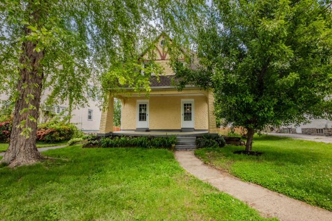
This Tudor-style home in Drexel Hill has an old-fashioned feel, as most of the neighborhood’s homes were built between 1925 and 1934, said listing agent Jason Cox with Long & Foster Real Estate.
“This is a throwback, and that’s one of the reasons people love it,” said Cox.
Two columns frame the property’s double-entry doors, which Cox said is an imprint of historical Drexel Hill homes. The kitchen’s mullioned glass-front cabinets and the bathroom’s checkered-tile accents further the home’s traditional aesthetic.
The front yard is shaded by a willow tree, and the backyard is spacious enough for a garden, play set, pool, or all of the above.
The three-story home has one full bathroom and five bedrooms — rare for its listing price. There are three larger bedrooms on the second floor, in addition to a smaller room that could double as an office, and a finished attic with skylights on the third floor.
The living room has a traditional brick fireplace, and the dining room features access to a deck that is a prime location for outdoor grilling. Recently repainted and carpeted, the home is move-in ready.
Cox, who lives a block away from the property, “can’t say enough about the neighborhood.” Ideal for families, the home is walking distance from the local elementary and middle schools, and is a five-minute drive from Upper Darby High School. In the neighborhood, some families have stayed for two or three generations.
Sitting on more than a half-acre, this home’s standout feature is its expansive backyard. About three years ago, the homeowners installed a patio and a gazebo with a mounted TV, transforming the empty space.
“It makes the outside feel like the inside, and it can be screened in,” said listing agent Aaron Wallace with KW Main Street. “It’s the best thing about this property.”
The four-bedroom, two-bath property was built in 1911 but underwent a major renovation in 2020. The contractor did everything “soup to nuts,” Wallace said, including the roof, windows, both bathrooms, and kitchen. “They left no stone unturned with this renovation.”
The bright and airy ground floor includes the mudroom, living room, dining room, kitchen, and full bathroom. Going up a level, there are three bedrooms and the second full bathroom. On the third floor, there’s a generously-sized carpeted room that can be utilized as a bedroom, office, or an alternative living space.
Another highlight is the living room’s fireplace, which is framed by a wooden chevron accent wall and serves as a focal point in the house.
Magnolia’s pre-K-8 school is within walking distance from the home, and there is a baseball field behind the house that hosts local games. Wallace said the homeowners enjoy watching games from their gazebo.
“It has a great small-town feel, and the big city is not too far away,” said Wallace.
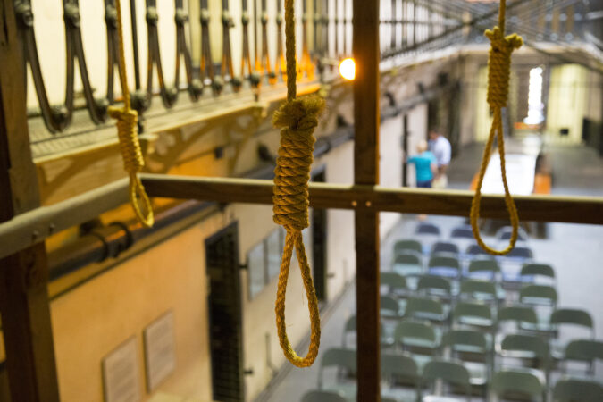
Ten Irish Catholics from the hard coal region went to the gallows, convicted of murder in a long-running labor war against the all-powerful coal companies. Another 10 would be hanged over the next few years, for a total of 20. Their trials made a mockery of justice, with a coal company president as prosecutor, a Pinkerton detective hired by the company as the star witness, and Irish Catholics excluded from the jury.
The hanged men were called Molly Maguires, a name straight out of Ireland, where a secret society using that moniker battled the landlords on behalf of starving peasants during the horror of the 1840s potato famine. These Mollies disguised themselves in women’s clothing, or straw clothing, or whiteface or blackface. And they timed their killings around major holidays.
That’s because the Molly Maguires were merely the flip side of a group quite familiar to Philadelphians — the mummers. The connection explains many of the mysteries about the Mollies — where the name came from, why the Mollies wore odd disguises, why they did their killing around high points of the calendar, and why they were revived in Pennsylvania amid resistance to the Civil War draft.
In Ireland, mummers were more actors than musicians. They visited every home in a district around New Year’s and collected money by putting on a skit that always featured a killing. The money paid for a party for the whole community. Groups like the mummers performed this kind of trick or treat around other big holidays — St. Brigid’s Day on Feb. 1, Easter, the summer solstice and Halloween.
During the potato famine, small bands of men — dressed in the women’s clothes or the straw of the mummers — began going from house to house, collecting money for the hungry. But these men weren’t mummers. They were Molly Maguires. And when they didn’t get what they wanted, or when landlords evicted tenant farmers, the mock killing of the mummers became the very real violence of the Molly Maguires.
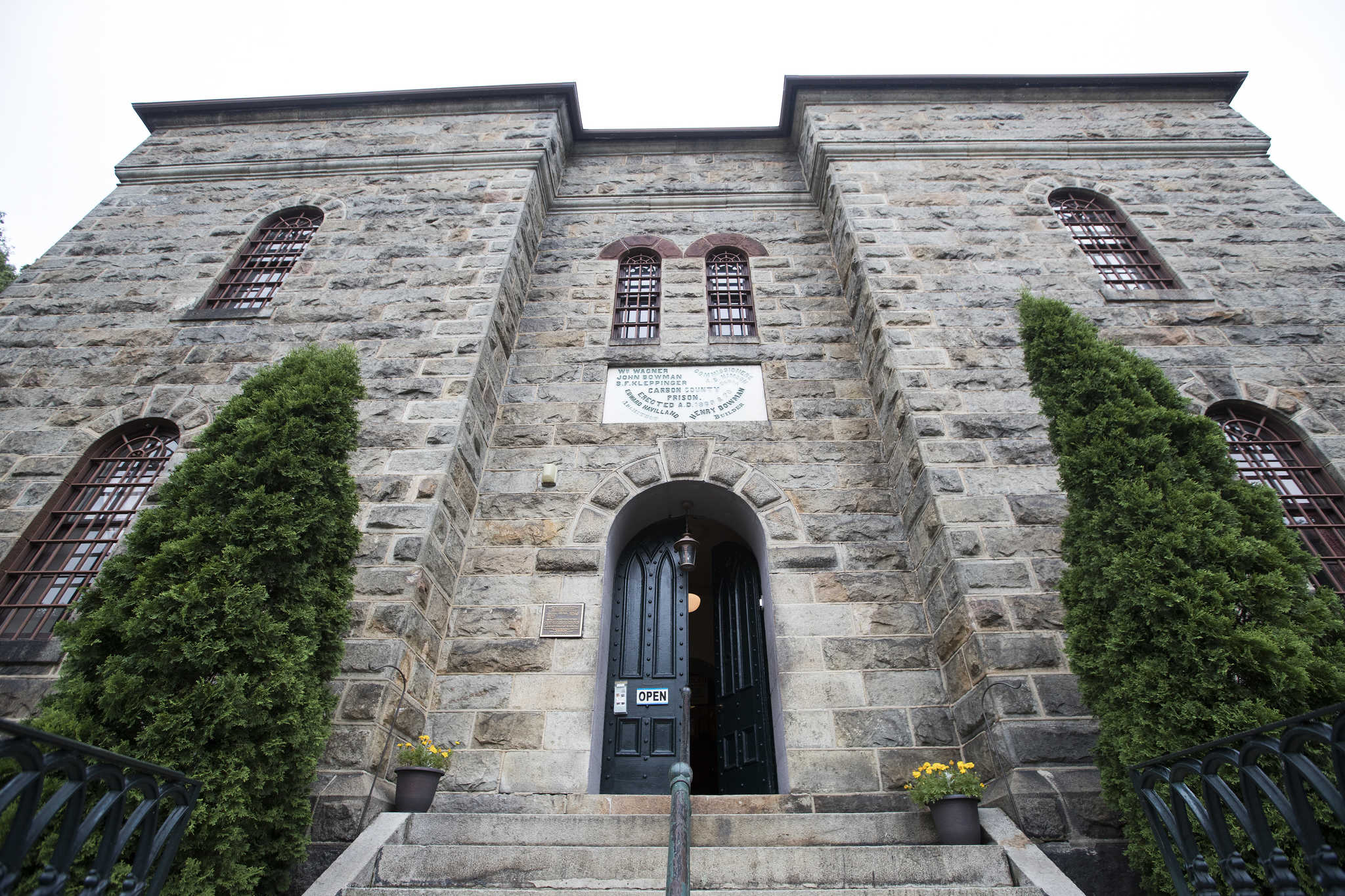
The entrance to the former Carbon County Jail in Jim Thorpe, Pa., where seven Irish coal miners were hanged in 1877.
The killings often took place around the days that the mummers celebrated, to signal that the Mollies were acting on behalf of the community. The three most celebrated Molly murders in Ireland came within a day or two of St. Brigid’s Day, the summer solstice, and Halloween.
The name itself sounds like something from the mummers’ play. A female character often had names that began with the letter M — Molly Masket or Mary Ann McMonagle. And, curiously, Molly Maguire wasn’t always Molly — a number of death threats were signed “Mary Ann Maguire.” The similarity between “Mary Ann McMonagle” and “Mary Anne Maguire” underlined the links between the mummers and the Mollies.
Famine emigration led many from the Molly Maguire heartland to the booming anthracite industry in Northeastern Pennsylvania. It was one of the few rural places in the United States where famine immigrants settled in such concentrated numbers that the folkways of the Irish countryside were transplanted wholesale, including mummery — and its associated pattern of violence. In 1848, a man acquitted of killing an Irishman was murdered in Schuylkill County, on Dec. 30. The killer, an Irishman, had whitened his face like a mime or a mummer.
Mummery had long been established in Philadelphia, but a peculiar offshoot, called the fantasticals, emerged in Northern Liberties before the Civil War, as a protest against mandatory militia service. At the time, able-bodied men between ages 21 and 45 were regularly required to muster for militia drill. This meant a day without pay — and the fantasticals protested by making a mockery of it.
They showed up for drill in ridiculous costumes, with giant wooden swords, or in some cases the leg of a deer. This mockery widened from muster day to mummers parades around Christmas and the Fourth of July and Halloween, and spread beyond Philadelphia.
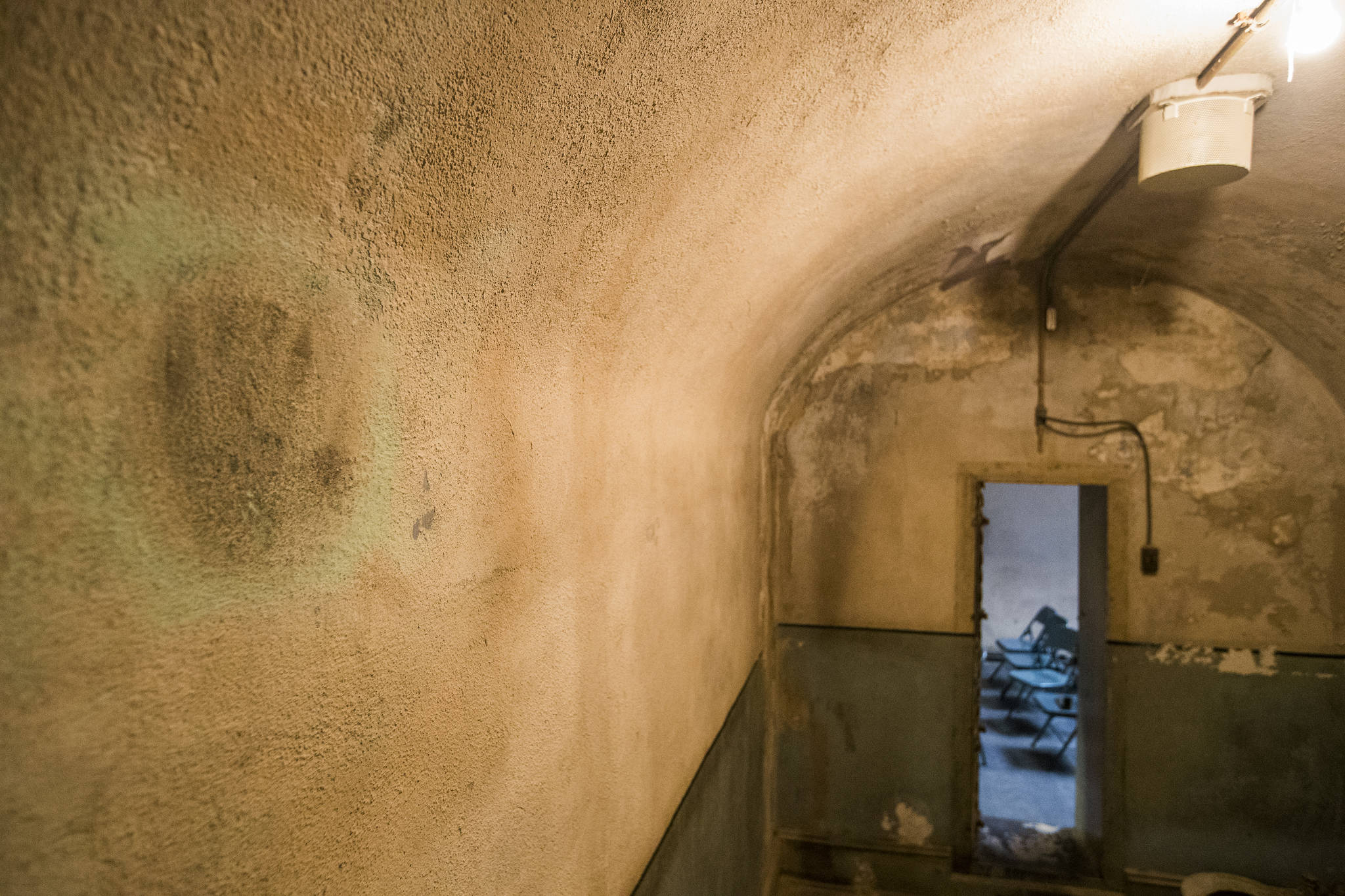
Before one of the Molly Maguires was hanged, he put his hand on the dirty floor of his cell in the former Carbon County Jail and then placed it firmly on the wall proclaiming, “This handprint will remain as proof of my innocence.”
In 1855, the Pottsville militia was called out after a mine boss was beaten in Branchdale, Schuylkill County. Though just four men attacked him, the militia rounded up 28 Irish Catholics. Adding insult to arrest, the militia then played a Protestant anthem from Ulster, “The Boyne Water,” which celebrated the defeat of Catholic Ireland.
It just so happened that the fantasticals made their first appearance in Schuylkill County that very year, marching in Pottsville on Christmas Day. The whole performance mocked the Pottsville militia and its music. The captain wielded a giant wooden sword, the rest were dressed in “every imaginable burlesque costume,” and the band was drunk — and played that way. In 1857, when the militia was used to break a strike by largely Irish mine workers in Cass Township, the fantasticals appeared in Schuylkill Haven on the Fourth of July and in Cressona on Dec. 26.
A few short years after those anti-militia mummers parades, opposition to compulsory militia service in the Civil War led to the revival of the Molly Maguires. The man who administered the 1862 militia draft in Schuylkill County was a nativist Republican who saw conscription as a way to sweep large numbers of Irish Catholic Democrats into the maw of a bloody war. He set unfairly high conscription quotas for heavily Irish Cass Township, then urged that the draftees be shipped out before a crucial election.
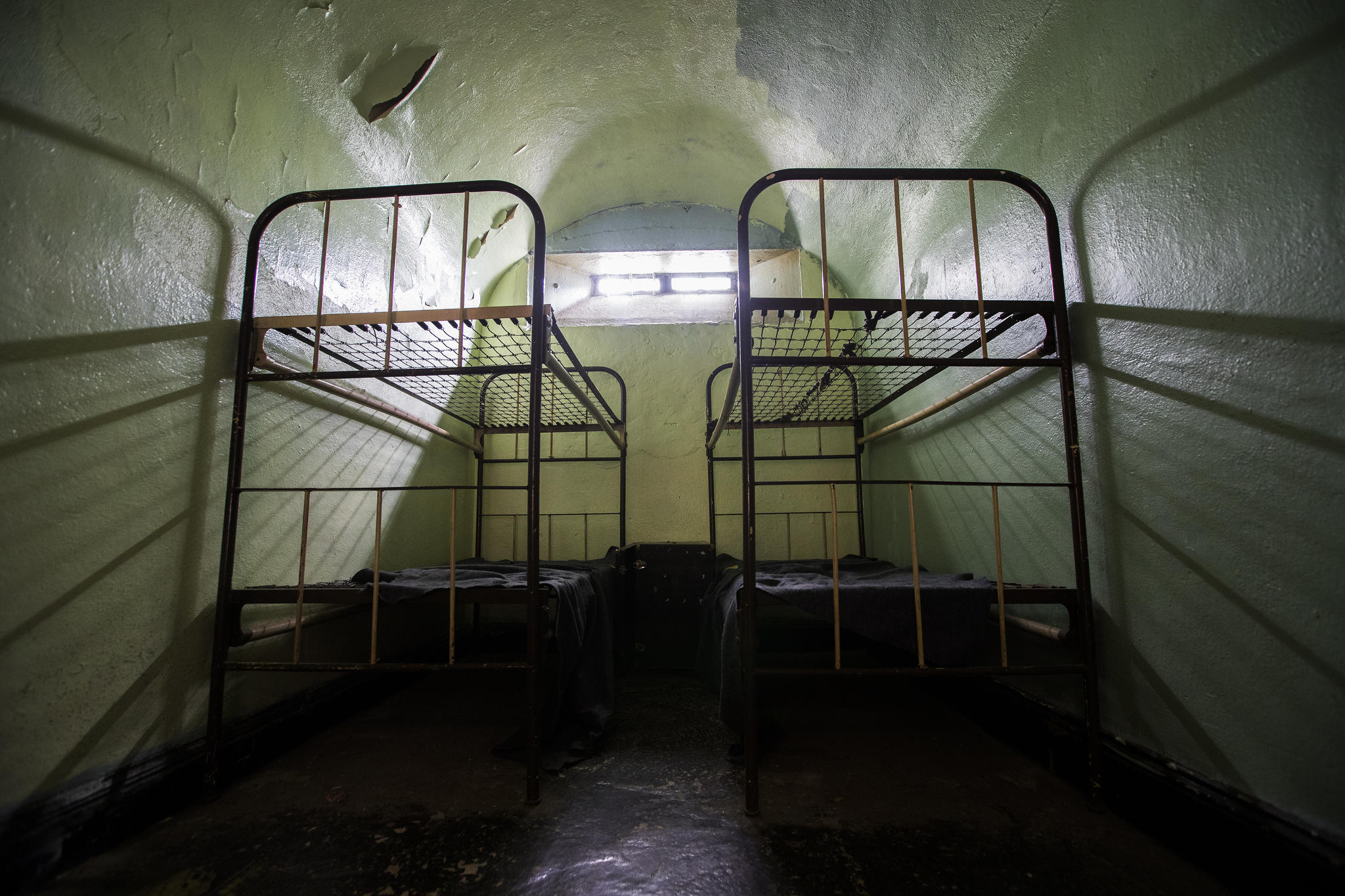
A cell in the former Carbon County Jail in Jim Thorpe, Pa.
In response, Irish mine workers went out on strike, marching under arms with a fife and drum from mine to mine. Two months later, they went out on strike again, calling themselves Molly Maguires. When a government crackdown appeared imminent, the Mollies targeted residents who had shown government sympathies by volunteering for the military.
On Jan. 2, 1863, five men fatally shot an Irish mine worker home wounded from the Union Army, then cheered for the Confederate president. Over the next nine days, two former militia men were attacked in Cass Township. A few days after Halloween, gunmen with false whiskers and blackened faces killed a mine owner who had been helping to enforce conscription.
Note the progression. In the last half of the 1850s, some Schuylkill County residents were making fun of the militia, but by 1862, they were on strike to oppose the militia draft, and as 1862 edged into 1863, they were shooting former militia members around New Year’s. As in Ireland, what started as mummer revelry ended as Molly Maguire rebellion.
The Molly troubles raged for another 15 years, ending only when a Pinkerton infiltrated the organization. The ensuing executions showed that the Mollies were no match for the coal companies and the state of Pennsylvania when it came to dealing death at high points of the calendar. The biggest killing — the hanging of 10 men on June 21, 1877 — came on the summer solstice.
Philadelphia and its surrounding counties are set for what could be a record-breaking $322 million in federal and state funding to go toward building new trails segments, say trail advocates.
The money is part of a larger $8.2 billion pool of transportation funding updated through the federal Transportation Improvement Program (TIP) for 2027 and spread over four years.
“We consider this to be potentially record breaking,” said Patrick Monahan, vice chair of the Circuit Trails Coalition in Pennsylvania. “It’s proof that the trails are being treated as essential infrastructure, making it safer and easier to walk and bike in the region.”
Pennsylvania gets its TIP plan updated every two years and the majorityof money goes to highways, bus and rail systems, trolleys, and ferries. It is part of an agreed-upon list of priority transportation projects. That list includes 344 projects.
In all, this year’s proposed $322 million in funding for trails would advance 27 bike and pedestrian projects across Philadelphia, Bucks, Chester, Delaware, and Montgomery Counties.
The Delaware Valley Regional Planning Commission (DVRPC) is set to vote on approving the allocations in July.
The trails, either begun or being planned, are part of the Circuit Trails, a network of hundreds of miles of multiuse trails throughout the Philadelphia region including southern New Jersey, which updates its TIP funding in alternate years.
$11 millionfor the second phase to extend the Schuylkill Banks trail in Philadelphia south from near 61st Street to Passyunk Avenue that would include a new park at the base of the Passyunk Avenue Bridge.
$58.5 million for Philadelphia’s Spring Garden Connector project that would link trail systems along the Delaware and Schuylkill rivers and make Spring Garden Street safer for cyclists and pedestrians.
$50 million to improve safety for roadway users, including pedestrians and cyclists, on PA 291 from Irving Street to Ridley Creek. The project includes building a multiuse side path that will be designated as part of the East Coast Greenway, a trail system linking Maine to Florida.
$8.5 million for the Chester Valley Trail, a multiuse trail along the alignment of the former Philadelphia and Thorndale Branch, a former freight train route, including renovation of the Whitford Bridge and Downingtown TrestleBridge for bicycle and pedestrian use.
$10 million to develop a segment in Whitemarsh Township, Montgomery County, that would run from the existing Wissahickon Trail in Fort Washington State Park to the existing Cross County Trail near SEPTA’s Fort Washington Station.
We take paper for granted now. But in the late 1600s, when Pennsylvania’s founder William Penn recruited German papermaker and preacher William Rittenhouse to manufacture the writing parchment in the New World, paper was a luxury.
England’s King William III made it difficult for his subjects — at home and in the Americas — to have it. Like many monarchs of his day, he believed it was the Crown’s duty to record history.
The English imported paper from other European countries. So, to make matters worse, colonists who managed to appeal to the king for paper were double and triple taxed. They got fed up and went about securing their own paper to document the goings on in the government, inform citizens, record history, and ultimately plan a revolution.
Artist Ava Haitz’s No. 1 honors the country’s first paper mill, celebrating the invention and craftsmanship that made widespread written communication possible.
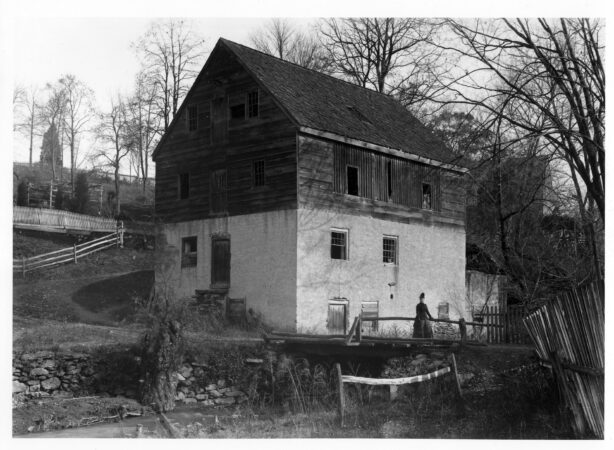
In 1690, Rittenhouse partnered with Philadelphia’s first printer, William Bradford, to build America’s first paper mill, situated in northwest Philadelphia and powered by the Monoshone Creek, a tributary of the Schuylkill.
The paper mill will be celebrated this Saturday at Historic RittenhouseTown, part of a series of weekly “Firstival” celebrations. Firstivals are the Philadelphia Historic District’s yearlong birthday nod to places and events with Philadelphia roots. The day parties are a hallmark of this year’s Semiquincentennial fetes.
At the Rittenhouse mill, paper was made from linen rags fashioned from flax grown in Germantown, that were broken down and shaped into sheets. The mill grew quickly as Rittenhouse, America’s first Mennonite bishop, provided paper for Bibles and Quaker and Mennonite texts in German.
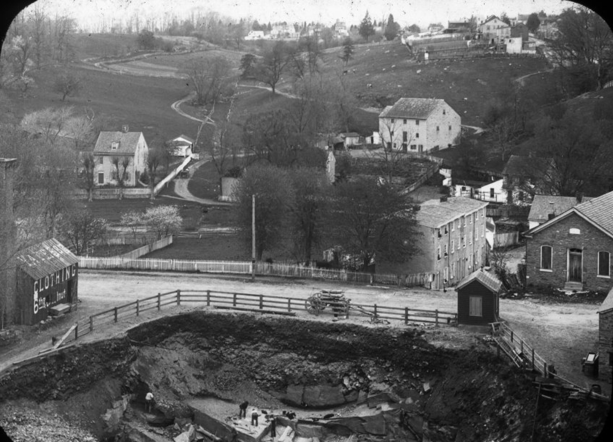
An aerial view of RittenhouseTown circa 1840-1860. The site eventually grew to more than 200 acres.
Rittenhouse’s first paper mill was destroyed by a flood, said Alexander Jones, preservation and education manager at Historic RittenhouseTown.
Then “Rittenhouse rebuilds and he buys out his partner,” Jones said. “The paper mill becomes his sole enterprise. Instead of hiring workers, he recruits his family and it becomes a giant company town. There is a church, a blacksmith, stone houses, a bake house, and more than 40 buildings with five or six of them under what is now Lincoln Drive.”
RittenhouseTown’s paper mill was the only source of paper in America for more than 40 years, Jones said. It would grow to more than 200 acres.
David Rittenhouse — Rittenhouse’s great-grandson and the astrologer, clockmaker, and first director of the U.S. Mint after whom Rittenhouse Square is named — was born in his family’s RittenhouseTown homestead in 1732.
The town thrived for more than a century.
By the mid-1800s, the paper mill began to slow down as dyes from textile and carpet manufacturers and chemicals from blacksmithing started to pollute the Schuylkill. The filthy water made it nearly impossible to produce good quality paper at the mill.
The Fairmount Park Commission began acquiring parts of RittenhouseTown through a series of purchases and donations from 1890 to 1917. The city demolished many of the town’s buildings, including a barn that, Jones said, was razed and rebuilt within a year.
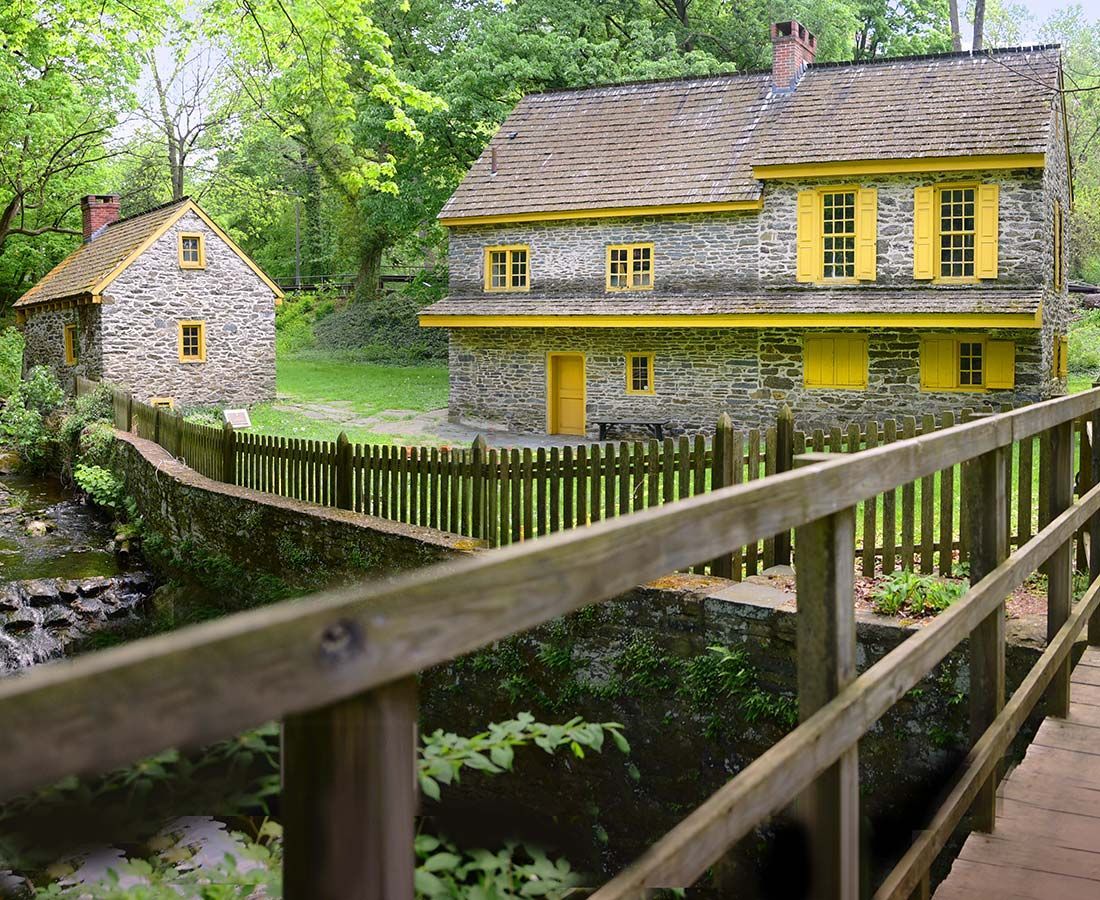
RittenhouseTown’s homestead and bakehouse. The first permanent home for the Rittenhouse family and birthplace of David Rittenhouse, great-grandson of William Rittenhouse for whom Center City’s Rittenhouse Square is named.
By that time, however, the Rittenhouse family had spread throughout the Philadelphia region from Center City to Blue Bell, Jones said.
Today, RittenhouseTown spans 20 acres nestled in Fairmount Park right behind Lincoln Drive. Six of the original buildings remain, serving as a reminder that RittenhouseTown was the first building block of American industry.
“The paper mill really got the ball rolling for Philadelphia,” Jones said. “And from that first came so many other American firsts in Philadelphia: the first Mennonite bishop, the first company town, and America’s first director of the U.S. Mint.”
This week’s Firstival is Saturday, June 27, 11 a.m.-1 p.m., at Historic RittenhouseTown, 208 Lincoln Drive.
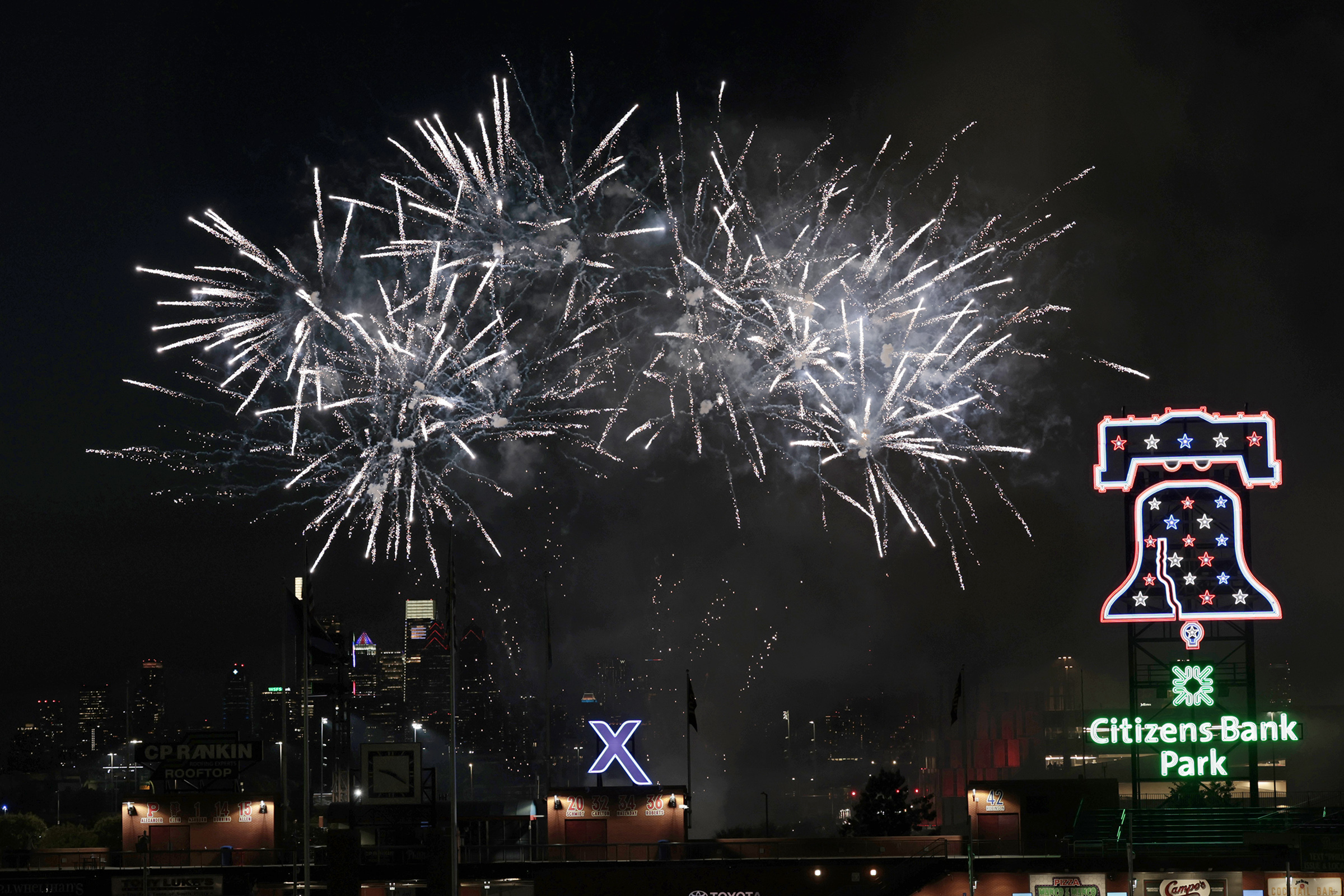
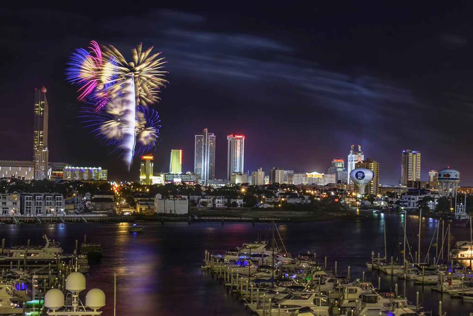
This Fourth of July will be unlike any in recent memory. As the nation marks its 250th anniversary, Philadelphia and the surrounding region are packed with celebrations — and fireworks displays. From the city and suburbs to South Jersey and the Shore, there are dozens of opportunities to catch a show.
Whether you’re staying in Philadelphia, heading to the suburbs, or spending the holiday down the Shore, here’s where to find Fourth of July fireworks across the region.
Wawa Welcome America: 🕙 July 4, 5 p.m. 📍Christina Aguilera and Philadelphia native Jill Scott headline a concert followed by fireworks, 2600 Benjamin Franklin Parkway, Philadelphia, Pa., 19130, 🌐 july4thphilly.com
Conshohocken Fireworks Display: 🕙 July 3, 9:15 p.m., 📍The fireworks will take place at Sutcliffe Park, but the borough is closing the park and surrounding areas to the public due to the size of the display. (They advise you to watch the show from another vantage point in town.), 🌐 conshohockenpa.gov
South Philly-raised director and actor Amina Robinson is one of the region’s most celebrated theater makers, known for directing major productions including Fat Ham, Once on This Island, and The Color Purple. Now based in Cherry Hill with her husband and son, Robinson was just named the new artistic director of Norristown’s Theatre Horizon, where she’ll take the helm later this year.
When she’s not directing plays and musicals like this spring’s Ain’t Misbehavin’, the Temple University professor spends her days walking around Philadelphia and visiting family in West Philly. On her perfect Philly day, she takes her family for cheesesteaks at Jim’s before walking around the Schuylkill and, of course, catching a show at her soon-to-be artistic home, Theatre Horizon.
8 a.m.
I get up and I wake up my son and my husband. We decide to get ready and go to Philly for breakfast. We’re gonna go to Eggcellent Cafe on Chestnut Street and I’m gonna eat their truffle avocado toast — it’s so big and good. I’m gonna have their golden turmeric latte, too.
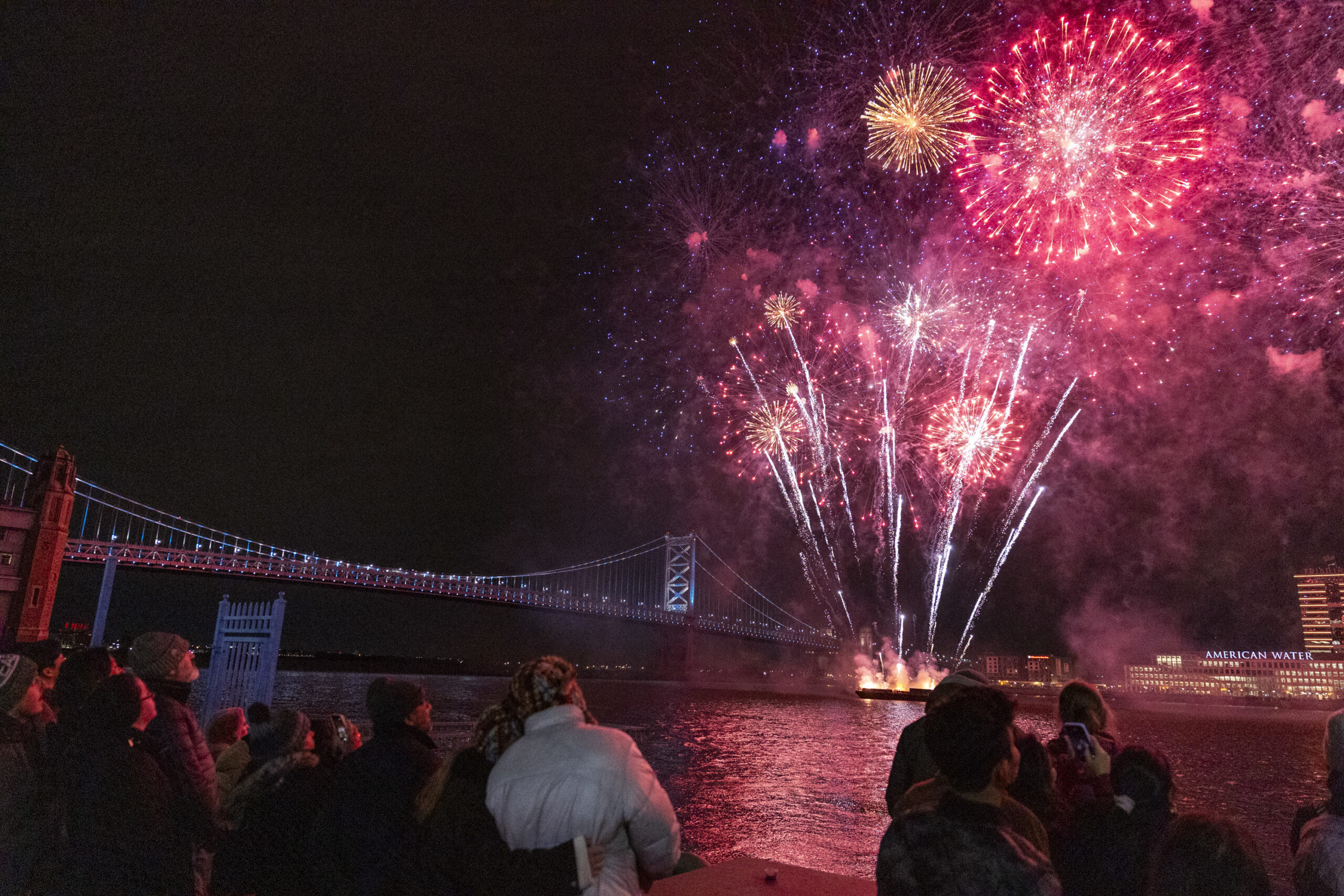
Families and friends gather from all over to watch the firework show over the Delaware River on New Years Eve at Penn’s Landing in Philadelphia on Wednesday, Dec. 31, 2025.
10:30 a.m.
We’ll walk breakfast off by taking a nice little walk down Penn’s Landing, right along the water.
11 a.m.
After that, we’ll go visit my mom in Overbrook Park. I would bring her decaffeinated Dunkin’ Donuts coffee, that’s a must. Then we’ll sit and talk with my mom for a little bit. I would see my brother and my stepdad, and probably my nephew, and maybe my brother’s girlfriend would be there, but I really would be going to visit my mommy.
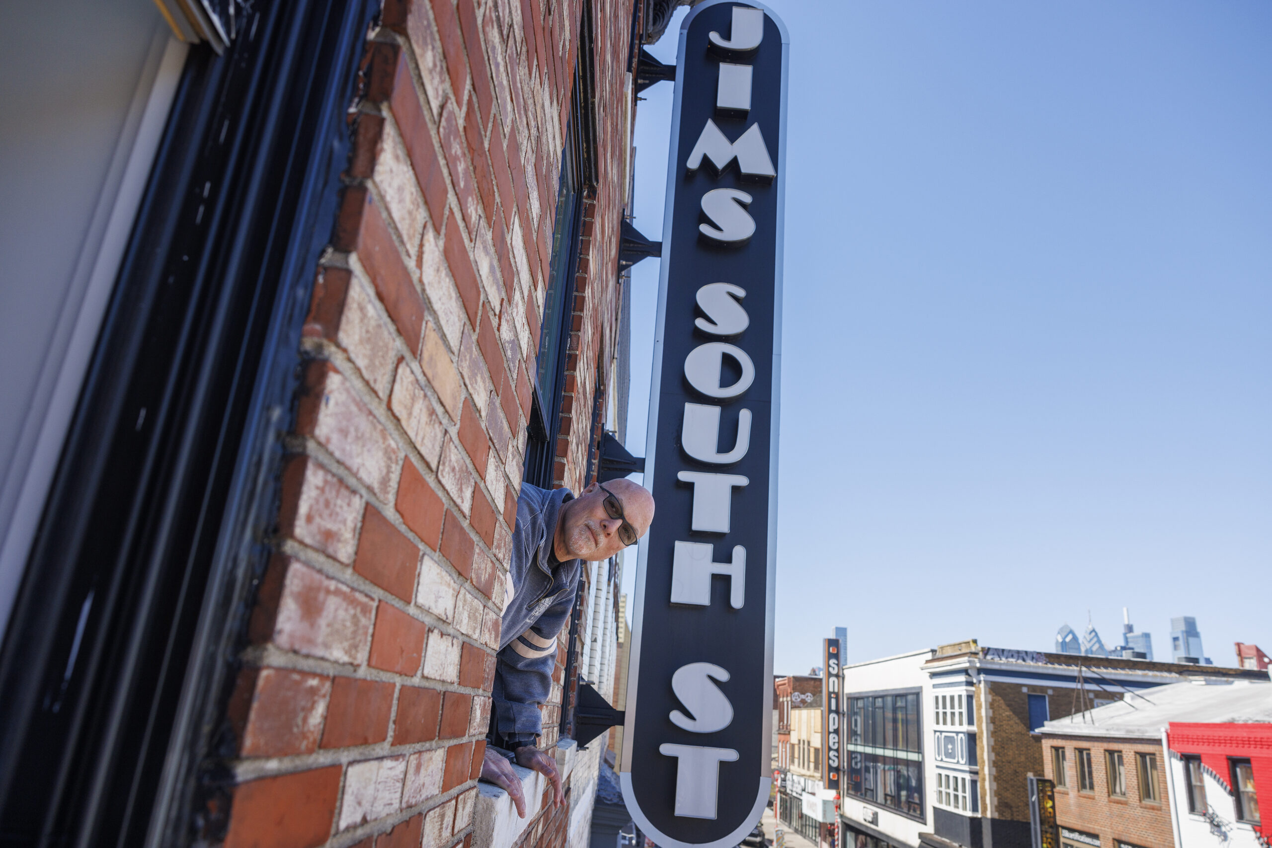
Ken Silver, owner of Jim’s Steaks, corner of 4th and South Street with sign on front of building.The restaurant is under construction after 2022 fire destroyed the cheesesteak restaurant. Photo taken on Monday, March 25, 2024.
1 p.m.
For lunchtime I want to go down to Jim’s on South Street and get a cheesesteak with whiz and fried onions. I probably need to walk off my cheesesteak, but I’m not going to walk off my cheesesteak. I’m going to let it just sit in my belly for a while.
3 p.m.
Then we’ll go out to the Art Museum area and chill out and walk around. Maybe we’ll have ice cream, there are usually ice cream trucks out there. I love walking around that area so much — I’ve always loved West River Drive and Kelly Drive. When I was a kid, I didn’t know that Boathouse Row was like boathouses, even though it’s called that — I used to always say, when I grew up, I’m gonna live in one of those houses.
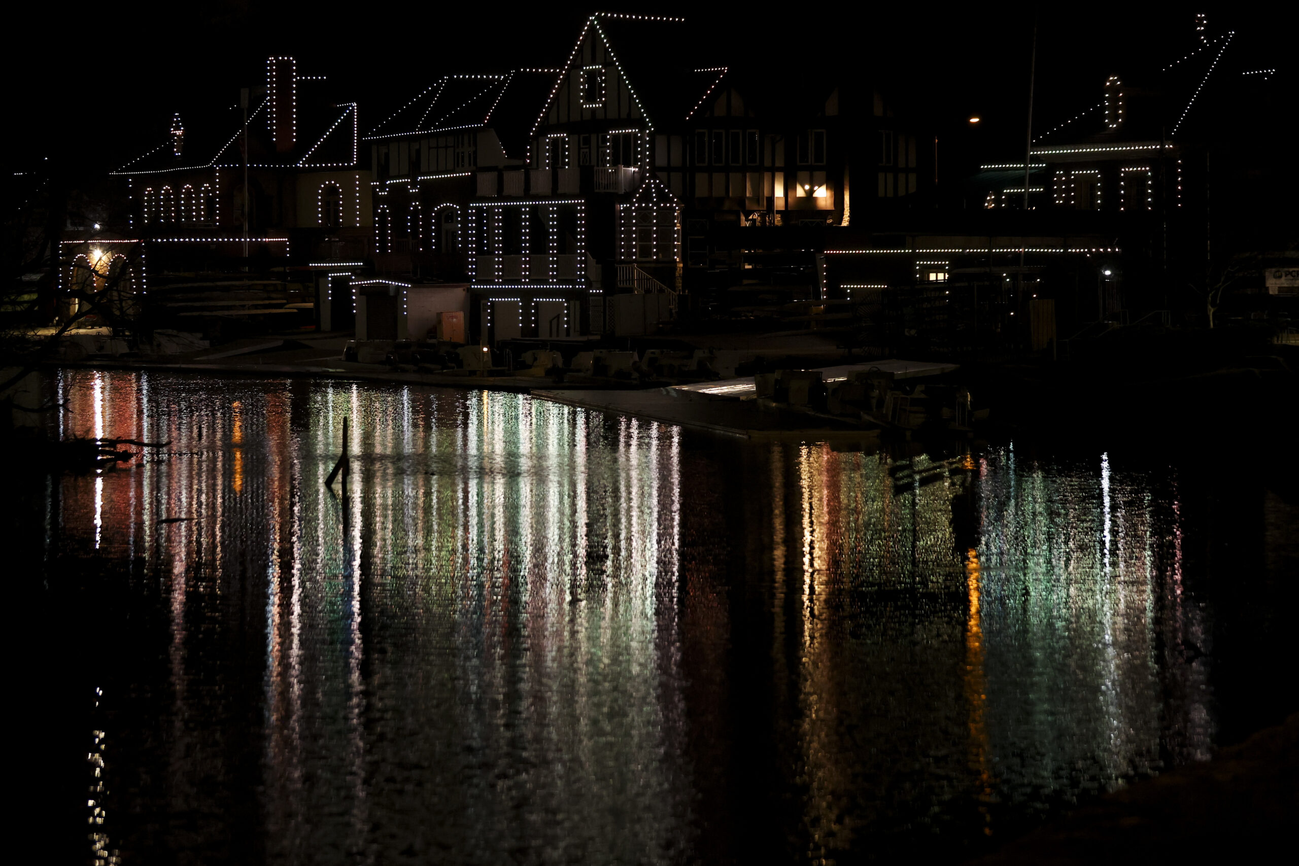
Boathouse Row is relit with a new programmable system containing 6,400 LED lights that allow for 16 million color combinations in Philadelphia, Pa. on Thursday, March 7, 2024.
5:30 p.m.
At night, I’m gonna go to Norristown. There’s this Mexican restaurant on Main Street that’s so freaking good, Taqueria La Michoacana. I would definitely have their beans and rice, and tacos, and I don’t know what else.
7:30 p.m.
I would go see a show at Theatre Horizon. They want to foster empathy and edify the people who come to see the theater. As the incoming artistic director, I’d love to start programs like that to grow the artistic community there, all the while supporting the community that’s already been built there.
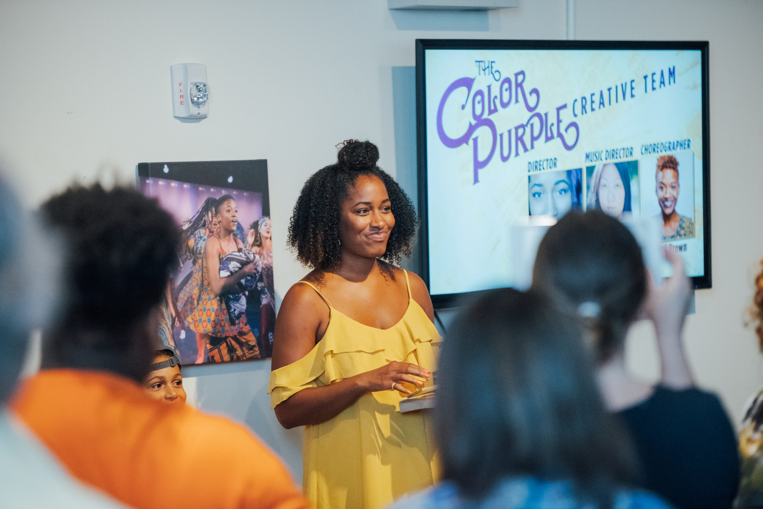
New artistic director Amina Robinson at an event for Theatre Horizon’s 2018 production of ‘The Color Purple.’
10 p.m.
I’d head home to sit outside and watch the cars go by, just like chill out and relax. Then I’ll lay on the couch and fall asleep watching a television show, probably a Lifetime Movie Network movie.
Both schools would still close under the plan, which is now in the school board’s hands. Instead of merging into large neighborhood high schools, however, the small, selective-admission schools would be absorbed by magnets.
Watlington said the tweaks would still allow the district to bring more high-quality academic and extracurricular opportunities into neighborhood schools while acknowledging the need to manage limited resources.
Butstudents, staff, parents — and some powerful allies at both schools — say Watlington’s counter-proposalisn’t enough. Both communities are still fighting.
Under the revised plan, Lankenau would merge with Saul, not Roxborough, and Robeson would merge into Motivation, not Sayre.
State Rep. Morgan Cephas (D., Phila.) recently visited the Philadelphia Flower Show, where she and other officials marveled at Lankenau students’ exhibit, which examines abundance, roots, and connections through culturally important plants. The display won a gold medal and the prestigious Alfred M. Campbell Memorial Trophy.
The dichotomy struck Cephas, she said. Lankenau students “are at the Flower Show, and [the district] is trying to close the school?”
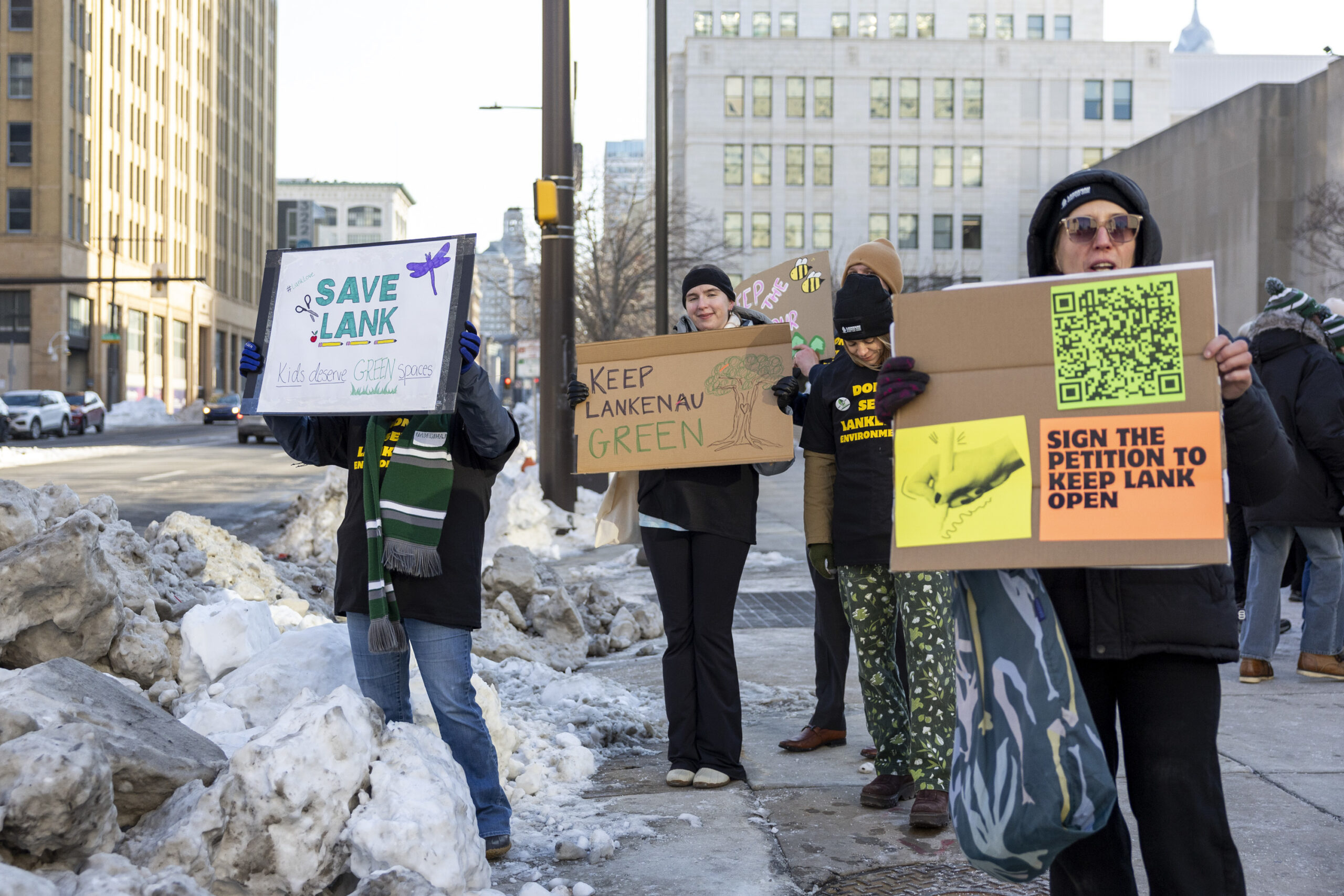
On Wednesday, students, parents, lawmakers, and Philadelphia Federation of Teachers officials gathered at Lankenau to drum up support for Gov. Josh Shapiro’s budget proposal. But really, it was another save-our-school rally.
A ‘prime example of a successful school’
Lankenau “is a prime example of a successful school,” said Messiah Stokes, an 11th grader at the Upper Roxborough school. The school has a 100% graduation rate, and is Pennsylvania’s only three-year agriculture, food, and natural resources career and technical education program.
The school itself sits on 17 acres,which district officials have proposed giving to the city — though a 1970s legal agreement could foil that plan. Lankenau is also adjacent to 400 more wooded acres via the Schuylkill Center for Environmental Education. The environmental center shares its land and its opportunities with students, who hold bird-watching clubs on breaks and hold classes outside when weather permits, and have abundant internship opportunities.
“My school is a prime example of a successful school,” said Stokes.
Watlington has said that Saul — the city’s agricultural magnet on a working farm on Henry Avenue — has a mission that’s closely aligned with Lankenau’s, but supporters say Lankenau’s success is closely tied with its wooded campus, its streams, and its ecosystems.
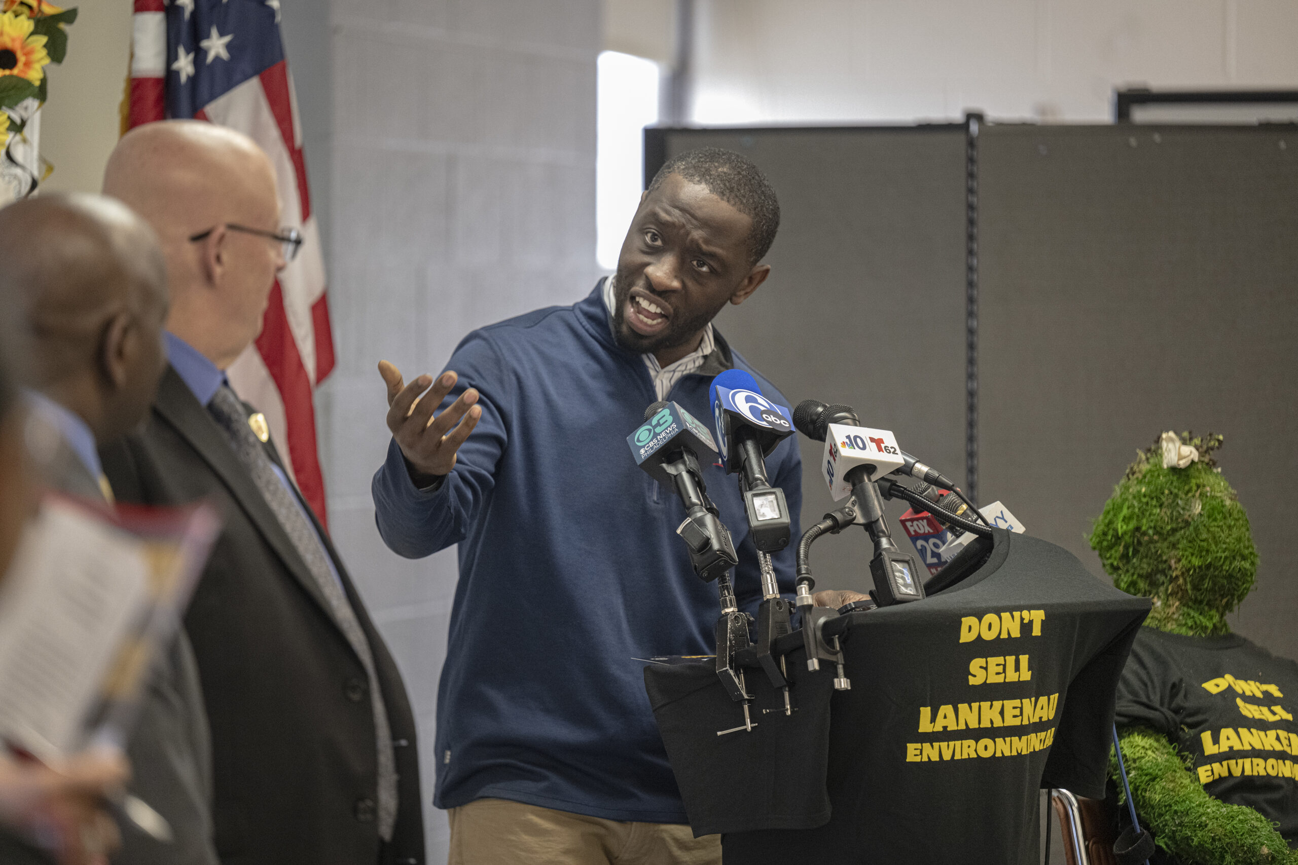
Councilmember Isaiah Thomas speaks at Lankenau High School during a gathering to support the efforts to fight closing recommendations on Wednesday.
Councilmember Isaiah Thomas, chair of City Council’s education committee, is incredulous that the district is attempting to close the school, which educates mostly Black students.
“I wonder if Lankenau did everything that it currently does: graduation rate … community involvement, the educators’ participation — I wonder if Lankenau was 98% white, will we be closing Lankenau?” Thomas said.
Still, “small schools are worth the investment,” said Amy Szymanski, a special-education teacher at the school. “Shutting down a school doesn’t just impact one community, it shakes other schools that have to absorb the impact as well.”
Szymanski urged district officials and decision makers to come up with different plans.
‘Culture is not transferable’
Robeson did everything the district asked it to do and then some, said Elana Evans, a longtime educator at the West Philadelphia school.
The school was heralded as a model for other Pennsylvania public schools by former Gov. Tom Wolf. It won citywide prizes and sent a student to Harvard University. Its students successfully petitioned district leaders for air-conditioning in their building. And its staff secured donations to have a major cafeteria renovation, though its building is still judged in “poor” condition by district standards.
“Why can’t Paul Robeson have a new school?” said Evans, who previously taught at University City High, closed by the district in 2013. “Haven’t we proved ourselves, haven’t the kids sacrificed enough? Haven’t they shown what they can do and what they’re willing to do?”
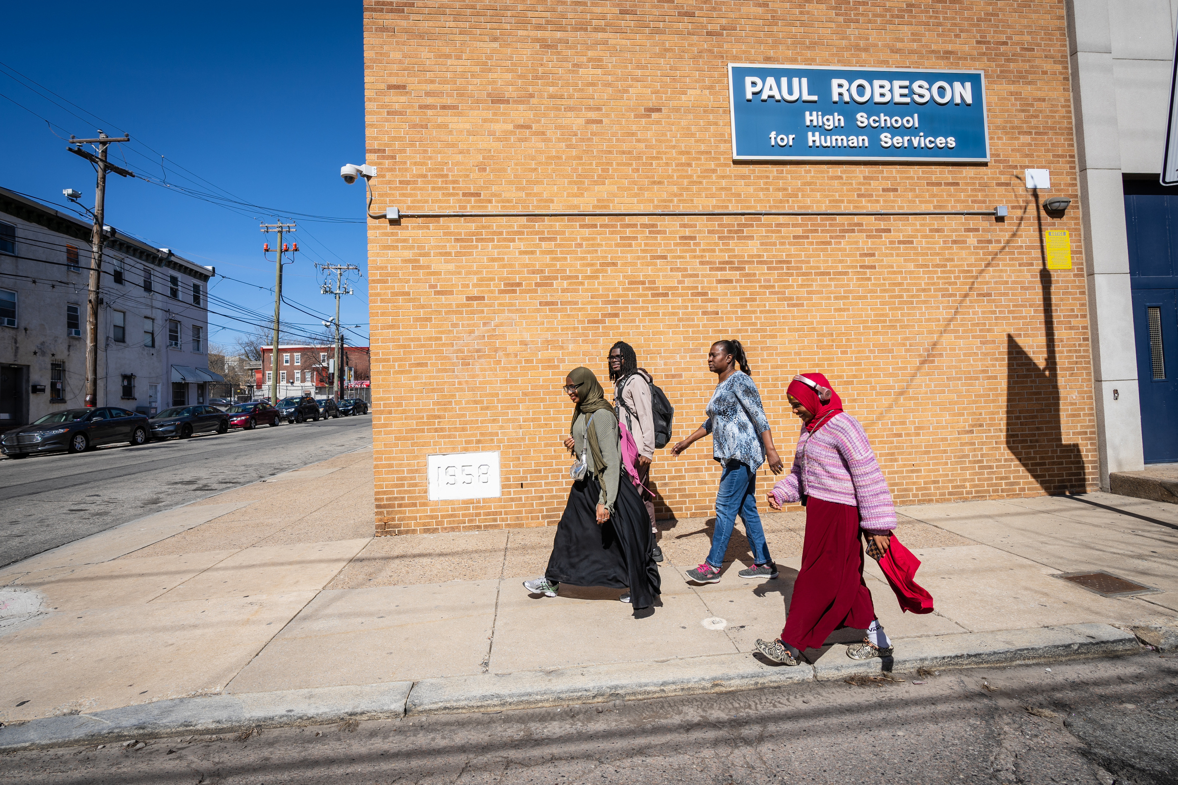
Students walk outside Paul Robseon High School with Elana Evans, a Robeson teacher (in blue) in this 2025 file photo.
And though moving to Motivation, in Southwest Philadelphia, may be slightly more palatable for some Robeson parents, for most, it won’t, said Evans.
“Students would still have to go to 60th Street, traveling a distance,” said Evans. “If those parents wanted them to go toMotivation, they would have picked Motivation.”
The district has said it wants to preserve the successful Robeson culture, just elsewhere, but Kyana Hopkins, said that won’t work.
“Culture is not transferable,” Hopkins said. “Make it make sense.”
Samantha Bromfield, president of Robeson’s Home and School Association, said the district will lose families if Robeson goes away.
“Understand that a parent like me will send my child back to being homeschooled” if Robeson closes, Bromfield said. “Your choice doesn’t fit my criteria of what I’m looking for my children.”
Inheritance, and questions
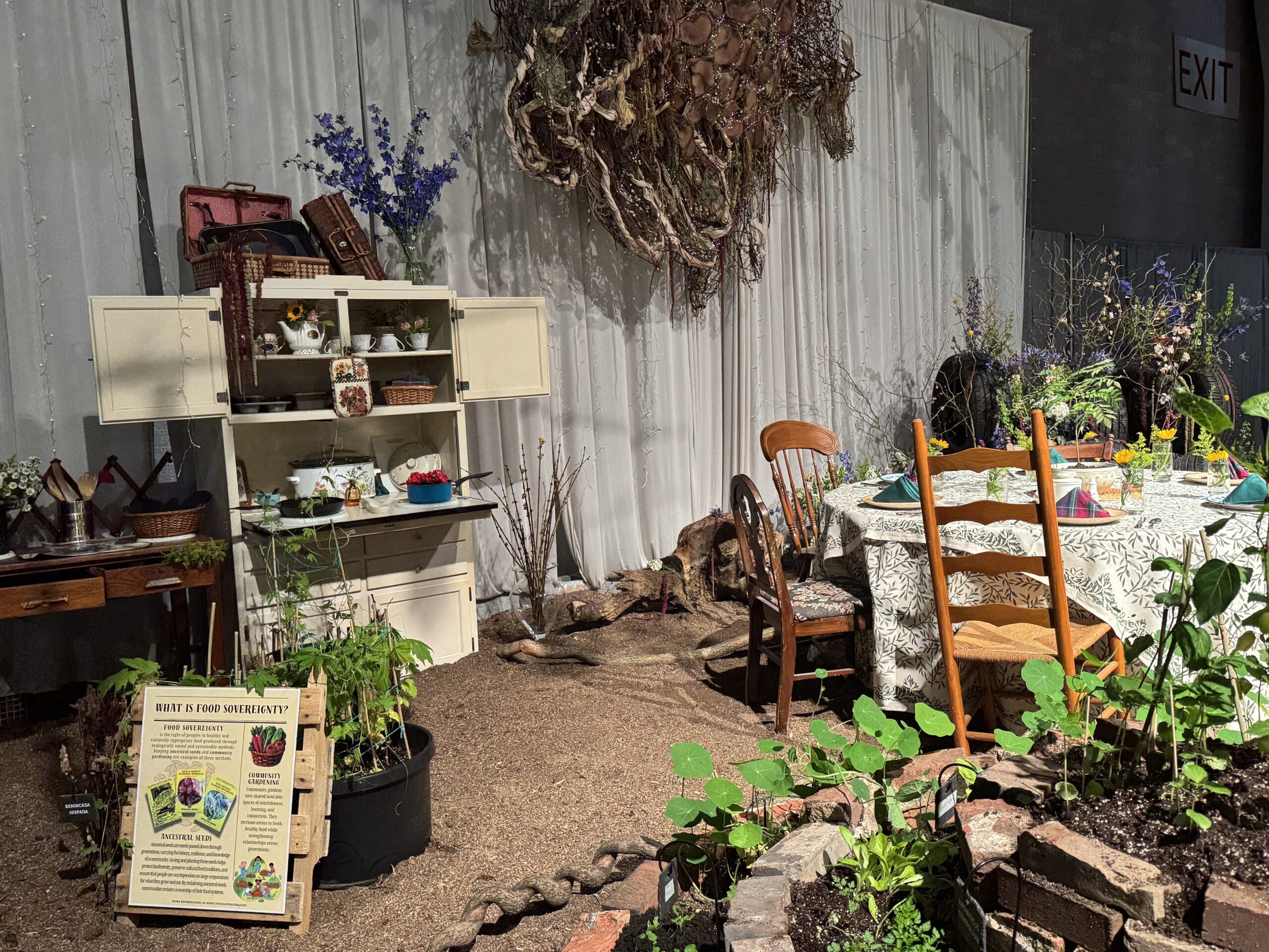
The Flower Show was abuzz Wednesday, with a crowd hovering around the Lankenau exhibit. “Inheritance” — a verdant wonderland showcasing plants grown from local seeds, set around a weathered wooden table — asked viewers to think of the question, “What tastes like home to you?”
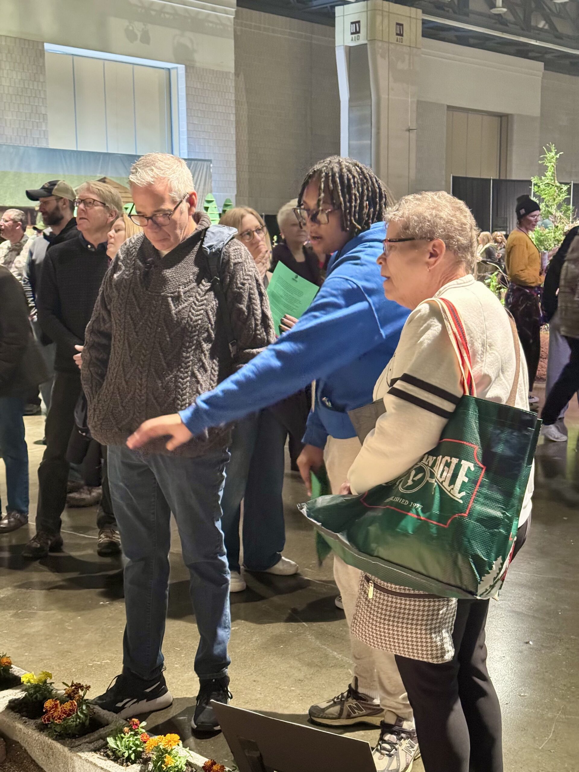
Lankenau High senior Sasha John (blue hoodie) explains her prize-winning school’s Philadelphia Flower Show exhibit to visitors on Wednesday.
Several Lankenau students staffed the exhibit, answering questions — and showing visitors green “Keep LANK Open” fliers, encouraging passersby to share words of support for the school with the school board and City Council.
“It doesn’t make sense to me,” said Amelia Pennycooke, a Lankenau senior, of the proposed closing. “We have so many opportunities at Lank.”
Lankenau High School’s exhibit, which the school’s eco art class worked on all school year, won a gold medal and the Alfred M. Campbell Memorial Trophy at the Philadelphia Flower Show. “Inheritance” examines the question “what plants taste like home to you?” It was designed and built by Lankenau students.
Noel Alford, a Lankenau parent, said the school needs to remain open, its land not used for any other purpose. The amendment to Watlington’s plan falls short, she said.
“Saul is a mistake,” said Alford. “Saul is an agricultural school. They are two different magnet schools.”
While elected officials have no say in which schools close, Thomas said it’s up to them to keep pressuring the board to rethink some closures, including Lankenau’s.
“This is a legacy moment for us as elected officials,” said Thomas. No one “wants to add that black mark on their career that says you were the person that was in charge when this injustice took place.”
This is a satellite photo of Philadelphia taken on Jan. 4. The city had trace amounts of snow on rooftops following a brief snow shower in mid-December.
Two weeks later, on Jan. 19, Philly would be covered by a 4-inch dusting of snow. A gentle prelude to wrathful winter weeks that were to come.
One week later, the biggest snowstorm in 10 years left Philly with up to 8 inches of snow on the ground. This photo taken on Jan. 29 shows that any remaining parts of the city that weren’t already snowy were now covered.
As temperatures dipped down to single digits, the Schuylkill River down to the Passyunk Avenue Bridge was completely frozen over.
The Schuylkill froze first because it is relatively shallow and still compared to the Delaware. “Shallow water freezes faster than deeper water because water that cools at the surface becomes more dense and sinks and is replaced by warmer water from below,” said Jonathan Edwards-Opperman, a physical scientist for the U.S. National Ice Center.
Edwards-Opperman also said that ice will form faster in “parts of the river that are more sheltered from winds or if currents are weaker near parts of the shoreline.”
This explains why inland waters like the Cooper River and shielded water like that around Petty Island froze quickly.
By Feb. 8, the mountains of snow would solidify. With such sustained cold temperatures, the rest of the Delaware began to freeze as well.
Before Feb. 13, the U.S. Coast Guard’s cutting operations cleared a lot of ice around the Port.
Ray Kruzdlo, senior service hydrologist at the National Weather Service in Mount Holly, hypothesizes that “as the cargo ships or tankers worked through the ice, the ice broke up and then moved around or got flushed out.”
Meanwhile, the Delaware began to freeze between the Walt Whitman and Ben Franklin Bridges. Though it may seem the downstream ice drifted north, the new ice likely formed as relatively frigid upstream water flowed downriver.
According to Amy Shallcross, Delaware River Basin Commission manager of water resource operation, U.S. Geological Survey data from temperature gauges at Chester, and Fort Mifflin, Trenton ↗ shows that the lower end of the river warmed earlier first. Chester recorded above-freezing temperatures a full week before upstream waters at Trenton did.
“Water in the bay or in the lower part of the river is not as deep, and so it can freeze [and thaw] easier. If we got colder water from upstream, that might be why there was more freezing in the Philadelphia area,” said Shallcross.
After almost two weeks of overcast weather that obscured satellite imagery and a brief whiteout that left an additional 12 inches of snow on the ground, the city is finally clear. The recent snow melted almost immediately due to warm winter weather, and by Feb. 28, Philly had finally recovered from its long-lasting freeze.
Explore what the region looked like in the past few weeks.
January 4January 19January 29February 8February 13February 28
NaturalInfrared
story continues after advertisement
According to Shallcross, the last time Philadelphia’s rivers froze over was in 2018. However, it was nowhere as cold or severe, as the temperature was just below freezing.
“I don't think we've experienced that long of a cold snap that came about that quickly. And so it really was an unusual situation that we've just experienced,” said Shallcross.
The major freeze following the late January snowstorm meant that snow stuck around for three weeks. In contrast, the storm of late February was an example of how even larger snowfalls in Philadelphia can disappear quickly if the weather cooperates in the days following the storm. 12 inches of snow on the ground melted away in just a few days, as temperatures hovered in the 40s following the storm.
Fair to say that it’s been a harsh winter. After all, Punxsutawney Phil did see his shadow, and so far he’s been proven right. Thankfully, we’re not far away from spring.
Staff Contributors
Design, Development, and Reporting: Jasen Lo
Editing: Sam Morris
Photography: European Space Agency Copernicus Satellite Imagery
Copy editing: Brian Leighton
Subscribe to The Philadelphia Inquirer
Our reporting is directly supported by reader subscriptions. If you want more journalism like this story, please subscribe today
Two of the 20 Philadelphiaschools originally targeted for closure under Superintendent Tony B. Watlington Sr.’s facilities plan have been spared and will remain open.
Conwell Middle School in Kensington and Motivation High in Southwest Philadelphiawill not close after all, Watlington announced at acharged school board meeting Thursday.
Watlington said the change from 20 to 18 school closures was not because of politicians, though.
“We pored through thousands of feedback loops from a number of Philadelphians, to include parents, students, grassroots organizations, and certainly elected officials,” the superintendent told reporters during a briefing this week. “We took all of that feedback together and, in tandem, we landed on these recommended changes, not reflecting one voice or sector more than the others.”
Watlington’s $2.8 billion facilities plan, which now includes closing 18 schools, colocating six, and upgrading 159, is not yet final and continues to face strong opposition from affected school communities. He formally presented it to the school board Thursday, and the board is expected to vote in the coming weeks, though no date has been set. Schools would begin closing in 2027, and school building upgrades would take several years.
Under the revisions Watlington presented Thursday:
Conwell would remain open and continue to be a magnet, but would also add a neighborhood admissions component. Students from nearby Elkin Elementary, a K-4, would move to Conwell beginning in fifth grade, and the school would still accept students from around the city.
Motivation would absorb students from Paul Robeson High, which is on the closure list. Robeson and Motivation are both citywide admissions schools, and Motivation would remain so under the plan. Robeson had previously been scheduled to move into Sayre, another citywide admissions school.
Lankenau High, the city’s environmental science magnet, had been targeted for closure and would have moved into Roxborough High. It would still close under the revised plan, but would instead move into Saul High School, the city’s agricultural science magnet. Both are in Roxborough.
‘Accelerating Opportunity’
In his presentation to the board, Watlington called the 10-year plan “Accelerating Opportunity.”
The proposed changes were spurred not by finances — though the district has 70,000 empty seats and has indicated it needs to shrink its footprint — but by a desire to accelerate progress, Watlington said.
(function() {
var l2 = function() {
new pym.Parent(‘schools6’,
‘https://media.inquirer.com/storage/inquirer/projects/innovation/arcgis_iframe/schools6.html’);
};
if (typeof(pym) === ‘undefined’) {
var h = document.getElementsByTagName(‘head’)[0],
s = document.createElement(‘script’);
s.type = ‘text/javascript’;
s.src = ‘https://pym.nprapps.org/pym.v1.min.js’;
s.onload = l2;
h.appendChild(s);
} else {
l2();
}
})();
The district is making gains in academics, attendance, and dropouts, but still, the superintendent said, “the majority of our young people still don’t perform at grade level of reading and math.”
Philadelphia, Watlington told reporters, “must multiply that acceleration curve by five or 10. Because we can’t wait for generations to improve these outcomes and opportunities for all of our children. And we know that there’s a huge disparity based on where you live in Philadelphia.”
The 159 modernization projects to upgrade schools range from new roofs and fresh paint in some buildings to larger projects, including a $58 million refresh at South Philadelphia High. The district released the full list of proposed modernization project details this week. But funding for them is not yet certain; the district plans to pay $1 billion of the $2.8 billion cost and hopes state and philanthropic funding will cover the rest.
How did Conwell and Motivation get spared?
Students, parents, and staff at each of the 20 schools proposed for closure have made cases for why Watlington should change his mind since their schools landed on the closure list last month.
In Conwell’s case, Watlington told reporters the advocacy work of the “large, historic alumni base” of the magnet middle school helped move the needle.
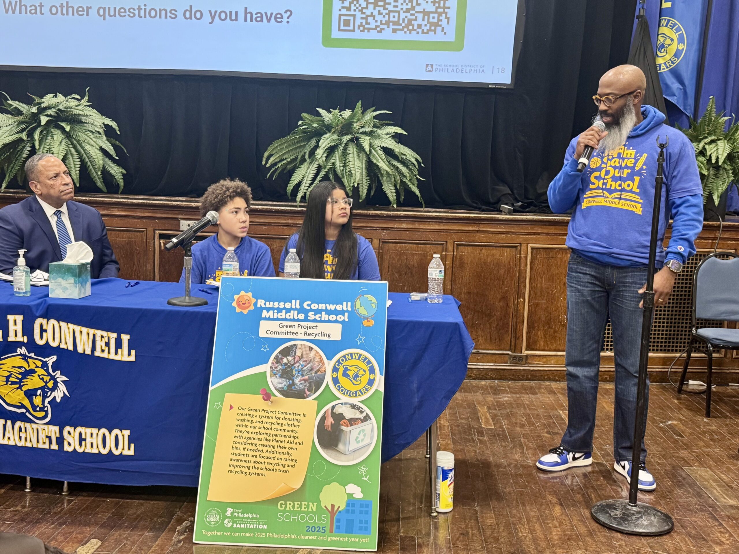
Philadelphia School District Deputy Superintendent Oz Hill and student moderators listen to Andre Sanford-Adams, the school’s health and physical education teacher, speak about why he thinks it’s a mistake to close Conwell at a meeting at the school.
So, too, did “significant feedback from individuals about a part of the city where individuals felt very strongly that we have to figure out how to invest more in.” Conwell supporters spoke out strongly against divesting from a school in Kensington, the center of the city’s opioid epidemic. Councilmember Quetcy Lozada, for example, said at a meeting at Conwell that “we are saying to these families, we are punishing them because as a city, we can’t respond to the public safety issues that we have on the outside, and that is just not fair.”
Also, Watlington said, the distance between Conwell and the school its students would have been sent to — AMY at James Martin, more than two miles awayin Fishtown — was significant.
Conwell would remain a magnet school, open to students citywide only through the school selection process. Elkin students would be in separate classes, and Conwell would continue to offer accelerated classes to its magnet students.
Closing Motivation would have leftSouthwest Philadelphia with no magnet school. Watlington said officials liked the idea of routing Robeson, a strong citywide school in West Philadelphia, to Motivation.
“The building itself at Motivation is not at the bottom of the heap in terms of programmatic ratings,” the superintendent said. “The problem with Motivation is that we’ve lost enrollment.”
Relocating Robeson inside Motivation solves “the number one problem we’re solving for, is how do we build our enrollments, address under- and overenrollment so we can push in more high-quality academic and extracurricular programs. Our community, quite frankly, made some suggestions that had merit.”
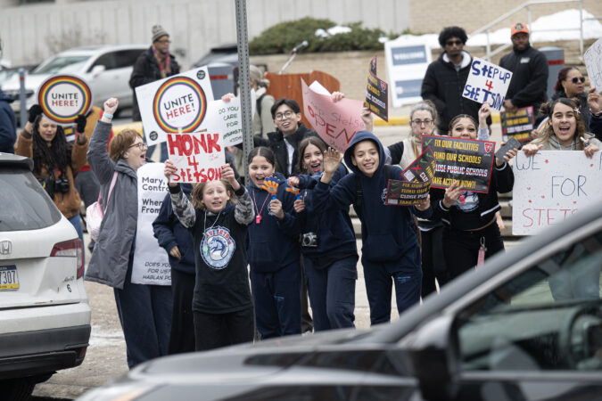
Teachers, students and community members rally against closing Lankenau High School on North Broad Street outside the school board meeting last month.
Disappointment for Lankenau and other schools
The outcry around closing Lankenau was also significant; Watlington’s team did not retreat from a closure recommendation, but now wants to locate the school at Saul, another magnet with a complementary mission.
“We have to do our due diligence, and those sometimes can be a bit complicated, but we’ll work through all of the details as appropriate,” he told reporters.
The ball is in the school board’s court now. It has not set a date for a vote on the plan or said whether it will consider further public engagement.
But, Watlington said, “we look forward to the board of education receiving these recommendations and doing some thoughtful digesting of these very well-thought-out recommendations that reflect our community at large’s feedback.”