- What you should know
- Snow has switched over to sleet across Philadelphia after as much as 7 inches blanketed the region. Freezing rain also remains a possibility.
- 600 pieces of equipment, 1,000 employees and 2,500 miles of streets: How Philly clears its snow.
- Pennsylvania’s Fine Wine & Good Spirits stores are closed Sunday, Philly schools will be closed Monday, and trash collection in the city will be suspended and delayed.
- You can be fined up to $300 for not shoveling your sidewalk in Philly. Here are the rules.
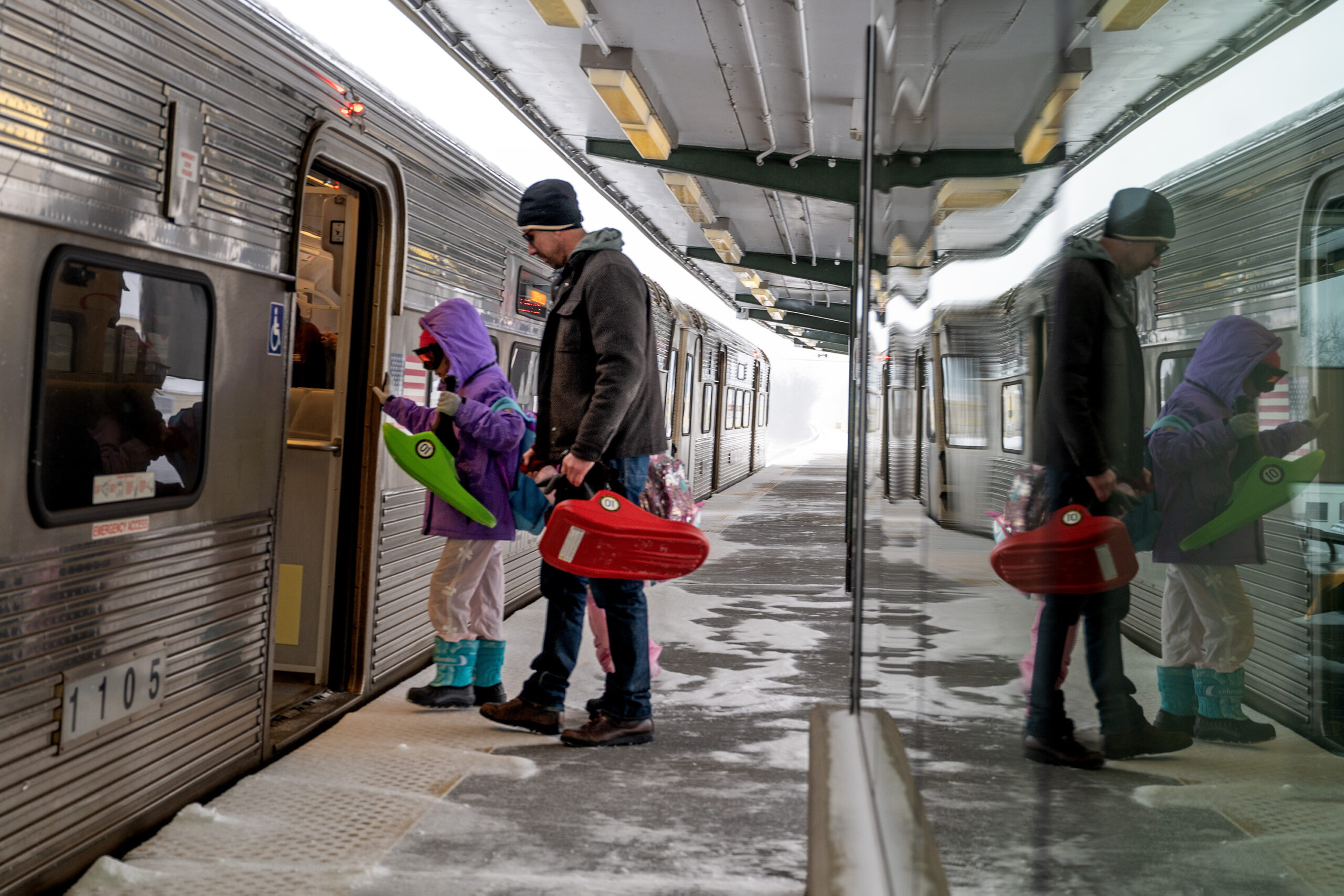
- Here’s a list of the best sledding hills in Philadelphia, the suburbs, and New Jersey.
// Timestamp 01/25/26 4:19pm
Philly’s biggest snow in five years has an icy finish, and it isn’t going anywhere soon
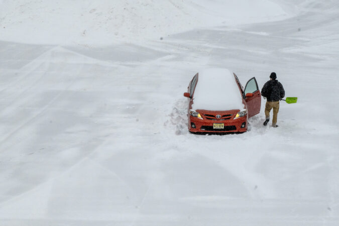
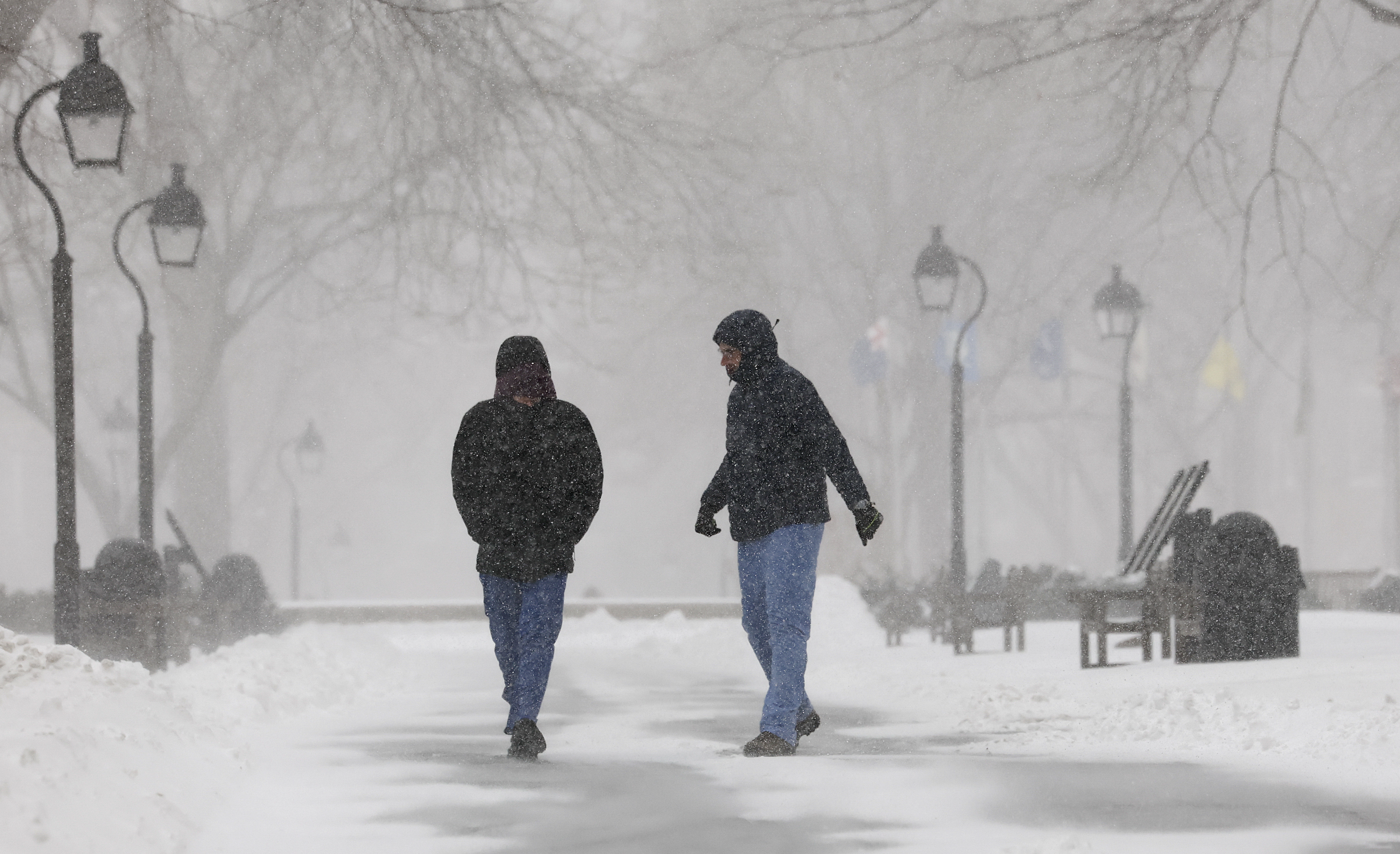
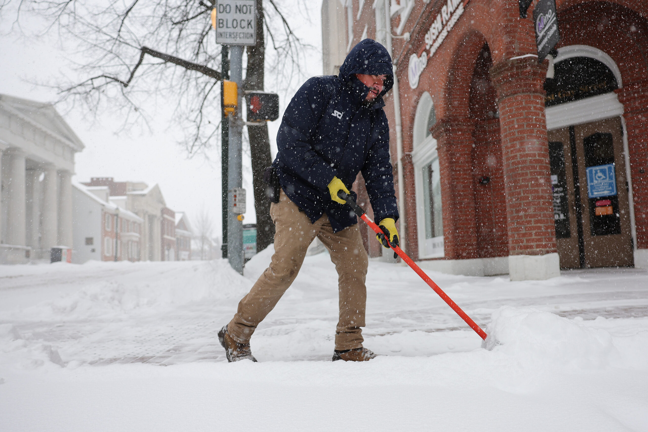
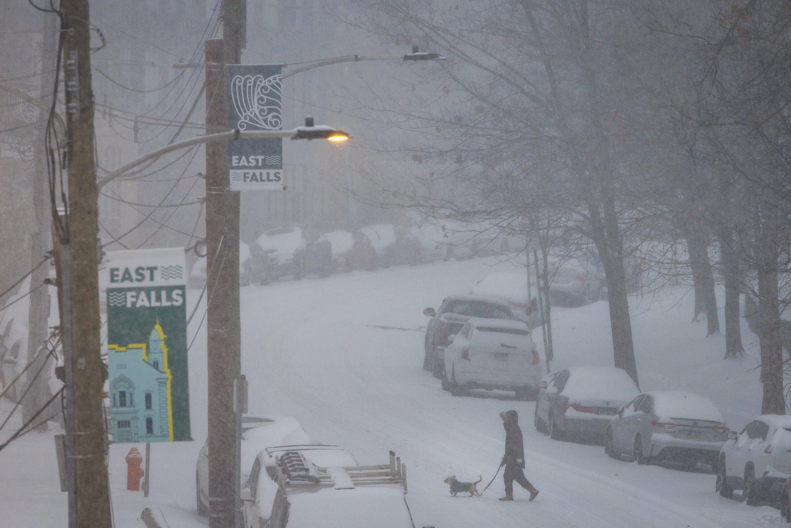
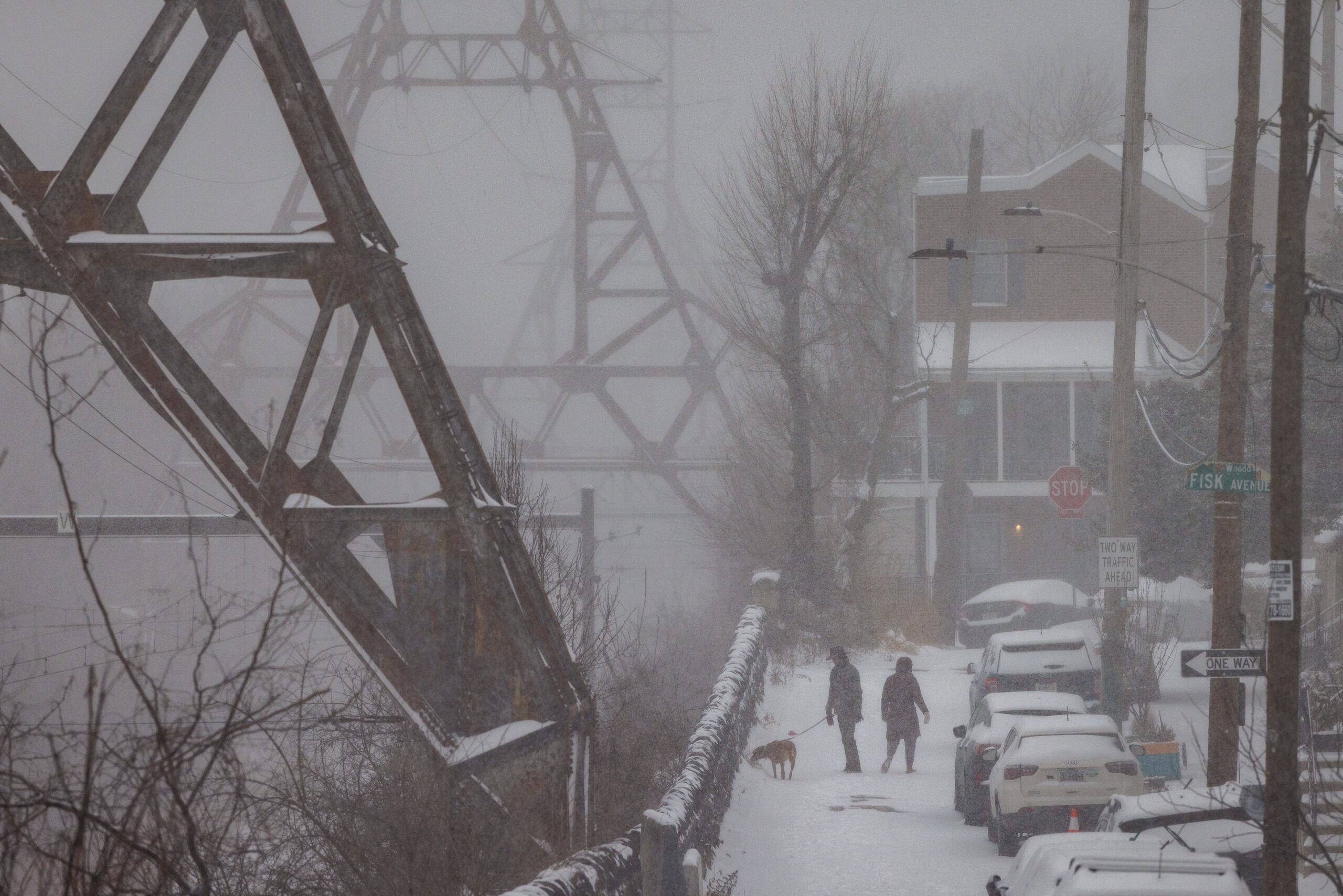
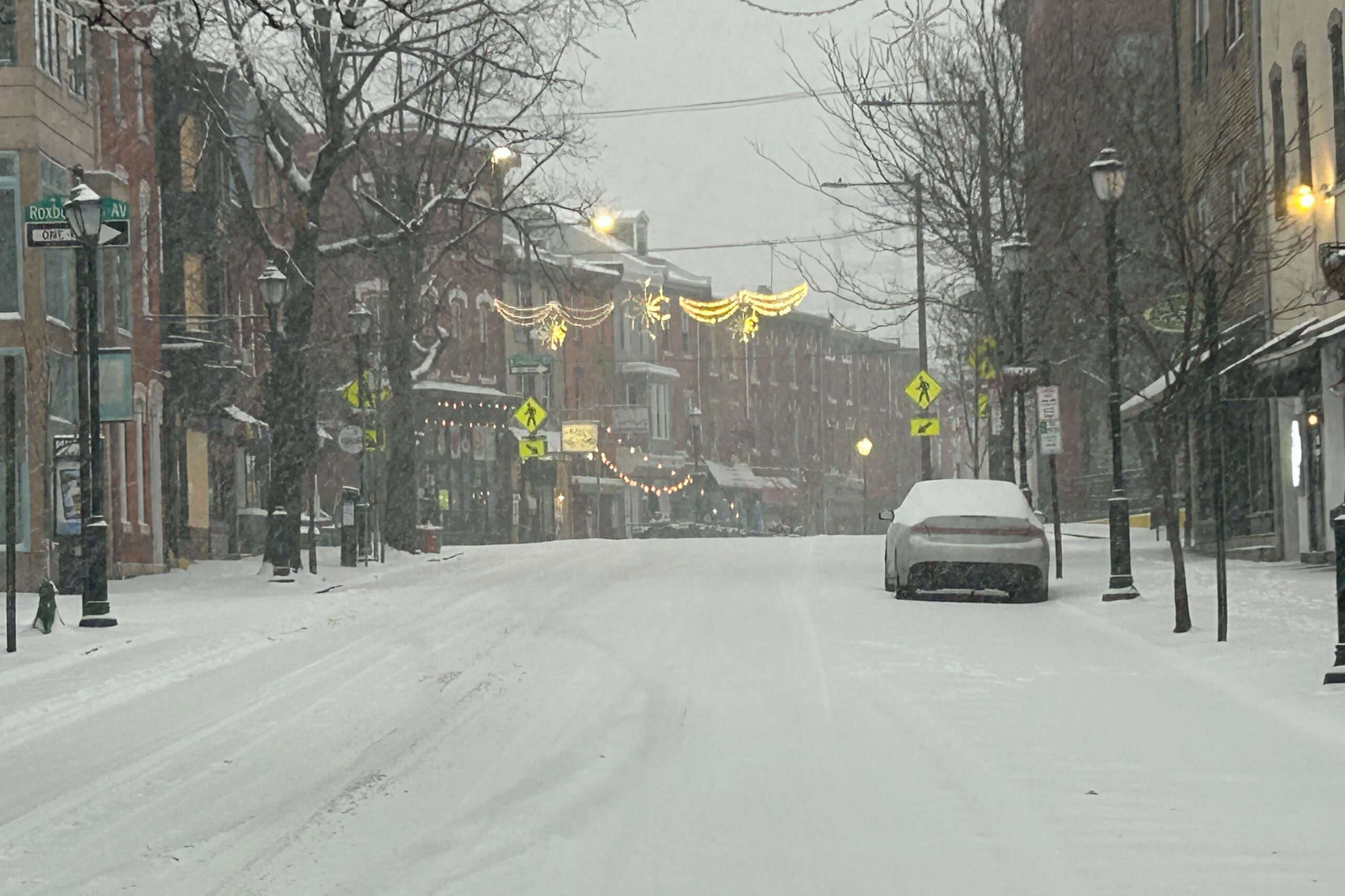
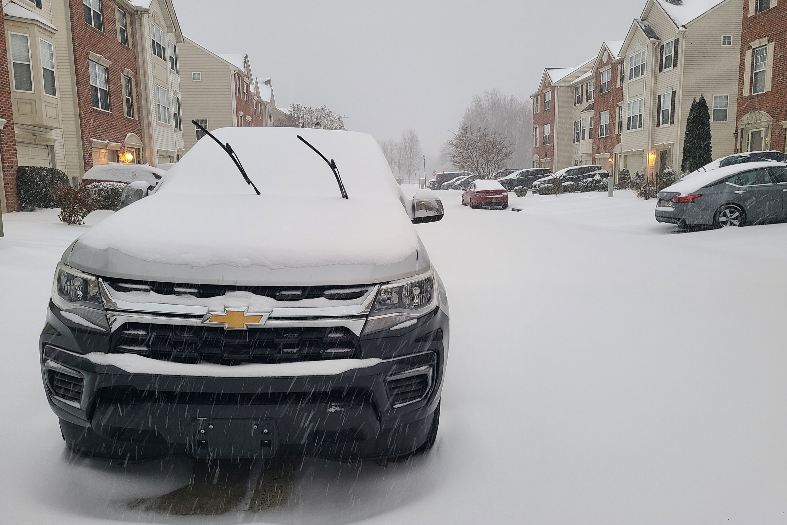
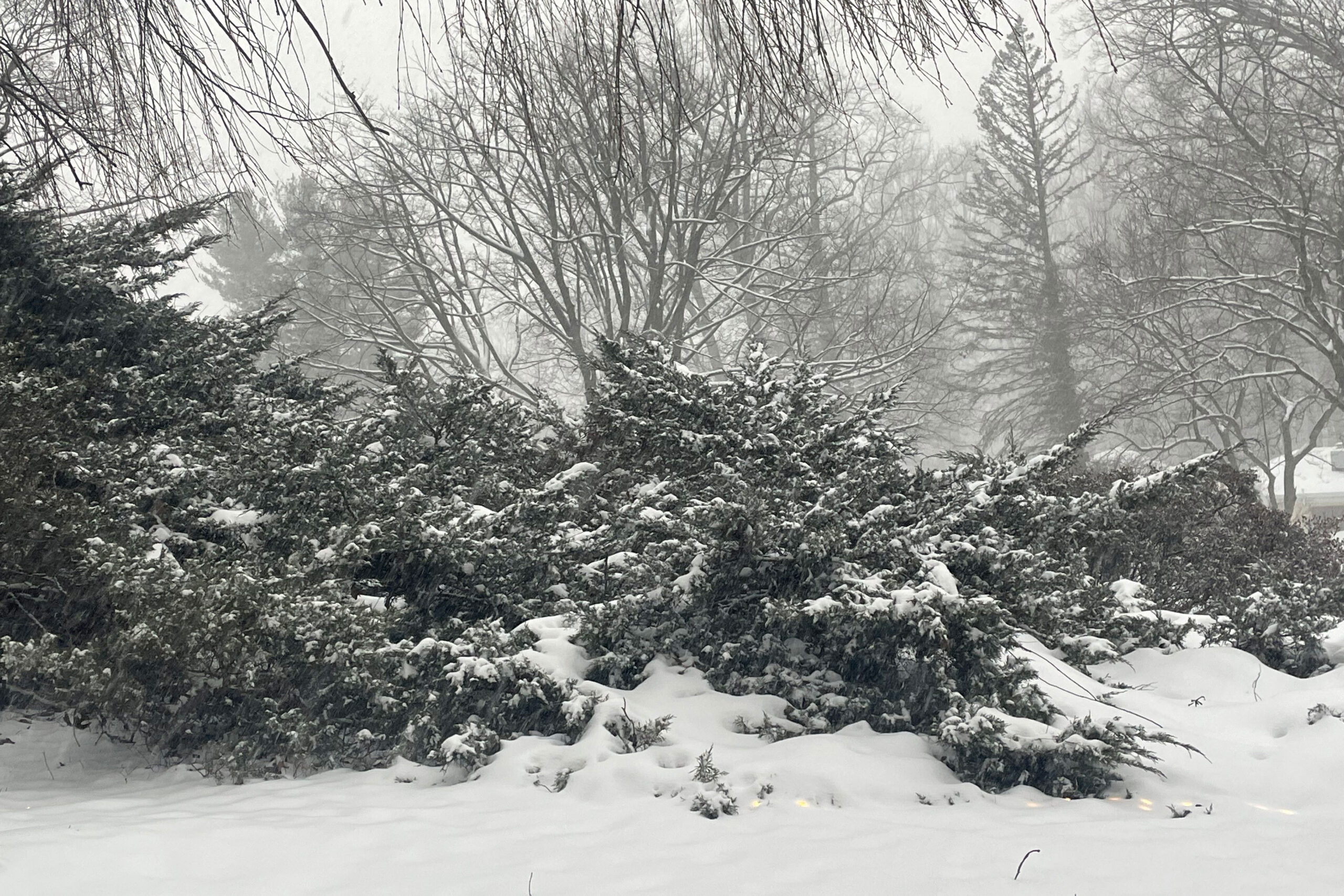
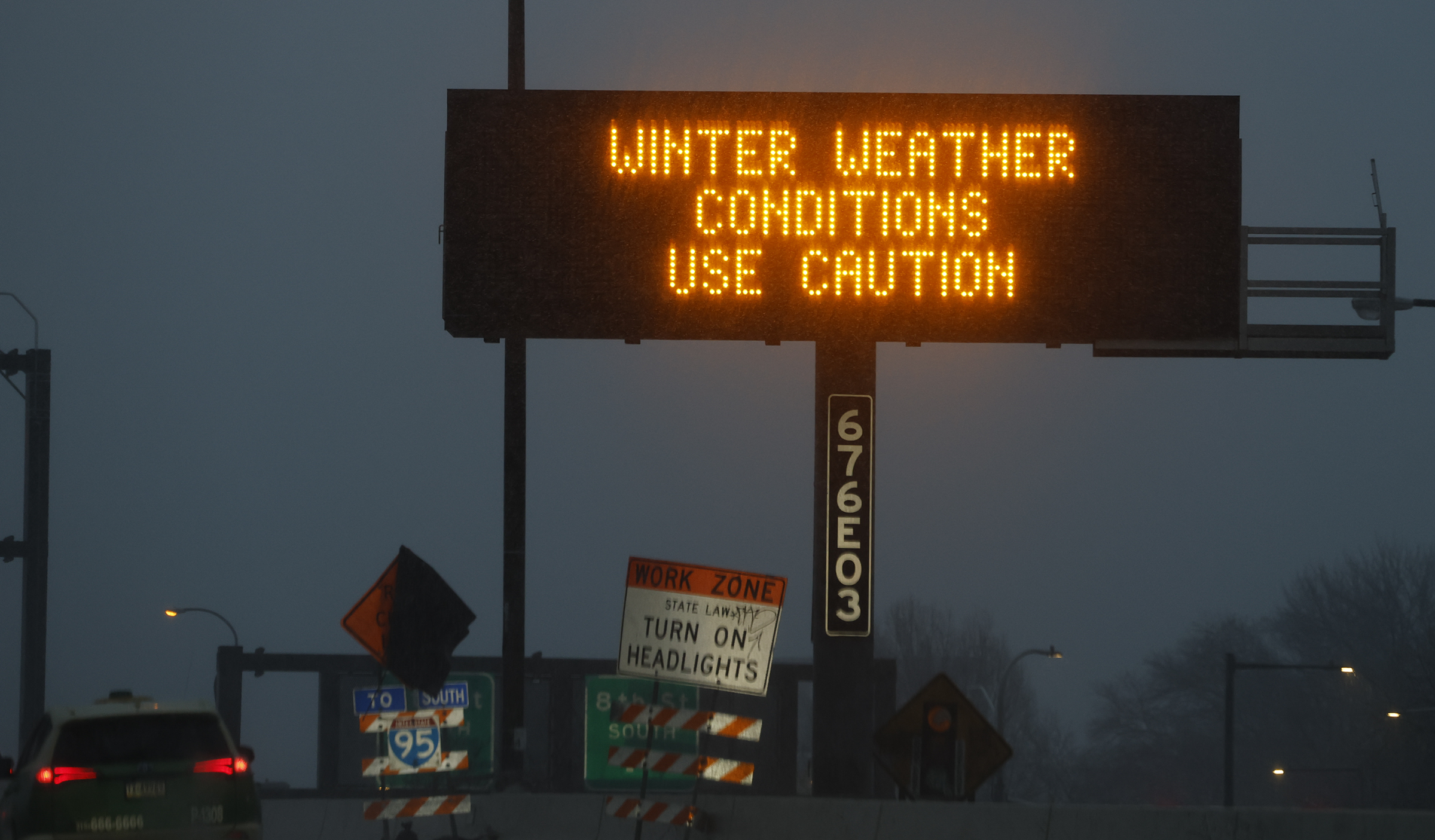
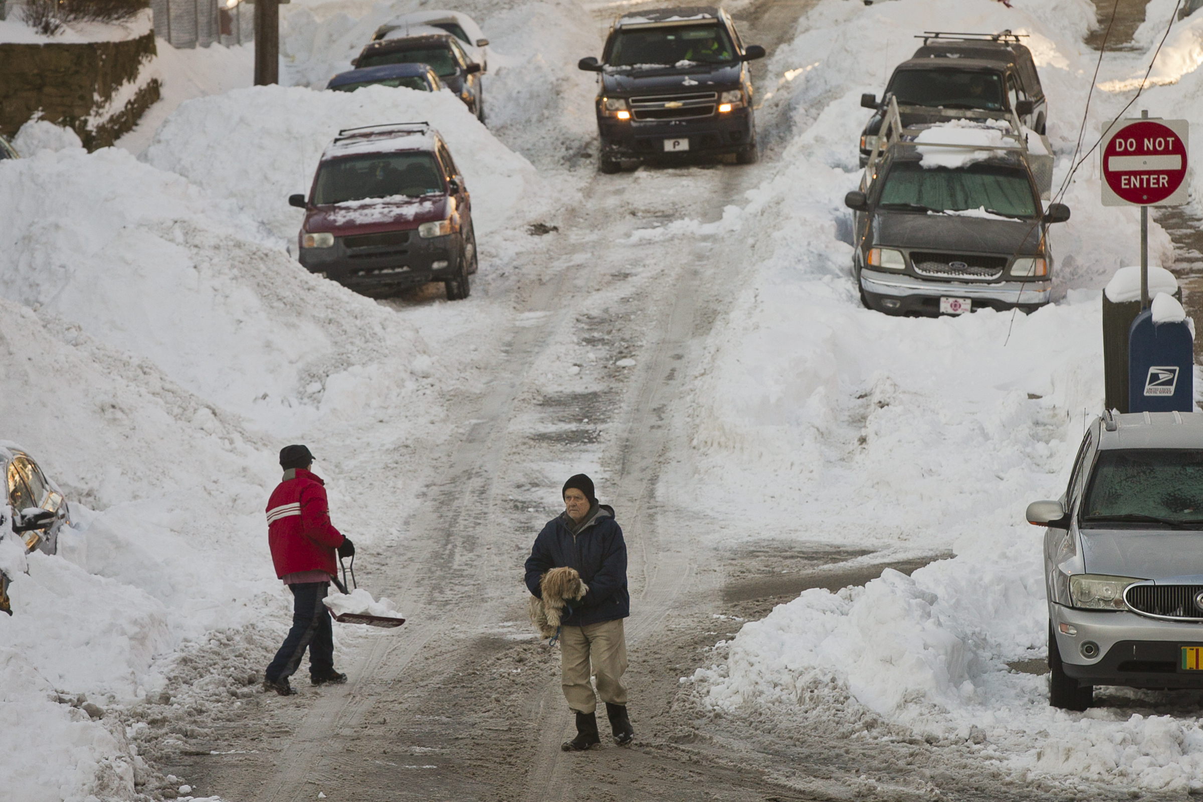
Hours of percussive sleet layered a nasty icing on Philadelphia’s biggest snowfall in five years Sunday, and it may be some time before bare ground resurfaces in the region, if not normality.
This was not the stuff of postcards.
Officially 7.4 inches of snow was measured at unusually quiet Philadelphia International Airport, with similar amounts reported in the neighboring counties, as temperatures didn’t get out of the teens during the day anywhere near Philly.
And shovelers beware: That mess may weight as much as 18 inches of pure snow. Besides, we may be out of practice. This was the most snow since the 81 inches of Feb. 2-3, 2021. Incidentally, that snowfall was the biggest in five years, in what has been a generally snow-deprived decade.
Forecasters say it is unlikely that the precipitation would flip back to snow, but some additional accumulation was possible, since sleet — liquid that freezes before it lands — counts as snow. In some places it was falling at the rate of 0.5 inches an hour, the National Weather Service said, an extraordinary rate for sleet.
Some freezing rain — liquid that freezes on contact with a surface — was possible Sunday evening, said Nick Guzzo, meteorologist at the National Weather Service in Mount Holly.
However, widespread power outages were unlikely, a function of the unusual behavior of a potent but peculiar storm that wrought a familiar set of disruptions and inconveniences.
// Timestamp 01/25/26 3:23pm
How much snow and ice has fallen so far?
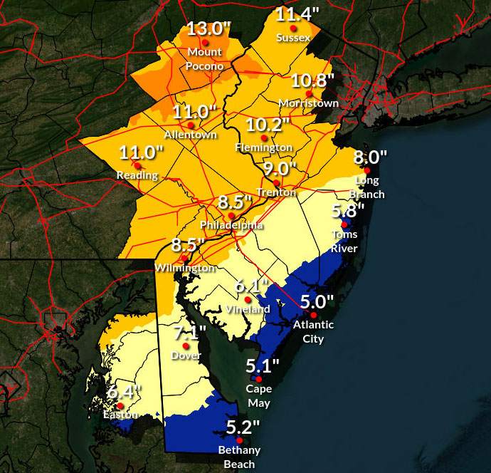
A far-reaching winter storm blanketed the Mid-Atlantic in an icy brew of snow and sleet Sunday, with preliminary totals nearing a foot in parts of New Jersey.
Philadelphia ranked near the top end of regional totals. A survey of five regional National Weather Service offices showed PHL’s total ranked 103rd of 565 reports made in the last six hours.
The Philadelphia metropolitan region generally received between four and nine inches of snow by early Sunday afternoon, according to National Weather Service reports.
Among the highest totals:
- Pottstown – 9.5 inches
- Norristown – 8.7 inches
- Stowe – 8.5 inches
- Lower Pottsgrove – 8.5 inches
- New Hanover – 8.5 inches
Use the map and chart below to find preliminary snow totals in your area. Hover over dots on the map to reveal more information, or search for Philadelphia-area totals below.
window.addEventListener(“message”,function(a){if(void 0!==a.data[“datawrapper-height”]){var e=document.querySelectorAll(“iframe”);for(var t in a.data[“datawrapper-height”])for(var r,i=0;r=e[i];i++)if(r.contentWindow===a.source){var d=a.data[“datawrapper-height”][t]+”px”;r.style.height=d}}});window.addEventListener(“message”,function(a){if(void 0!==a.data[“datawrapper-height”]){var e=document.querySelectorAll(“iframe”);for(var t in a.data[“datawrapper-height”])for(var r,i=0;r=e[i];i++)if(r.contentWindow===a.source){var d=a.data[“datawrapper-height”][t]+”px”;r.style.height=d}}});
// Timestamp 01/25/26 3:17pm
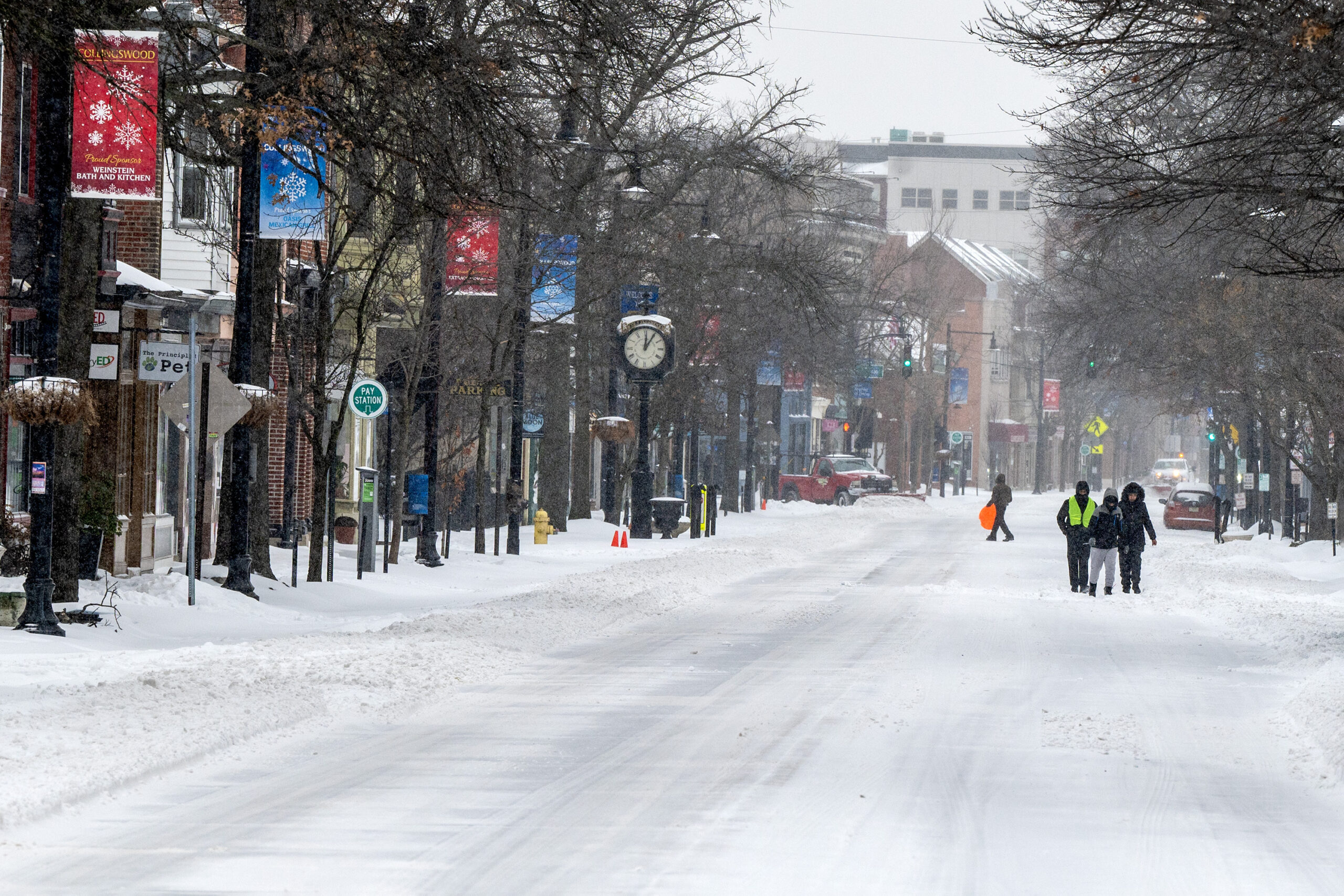
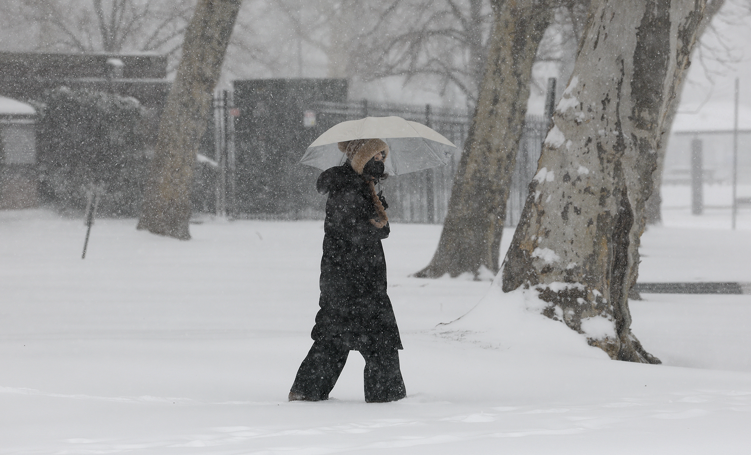
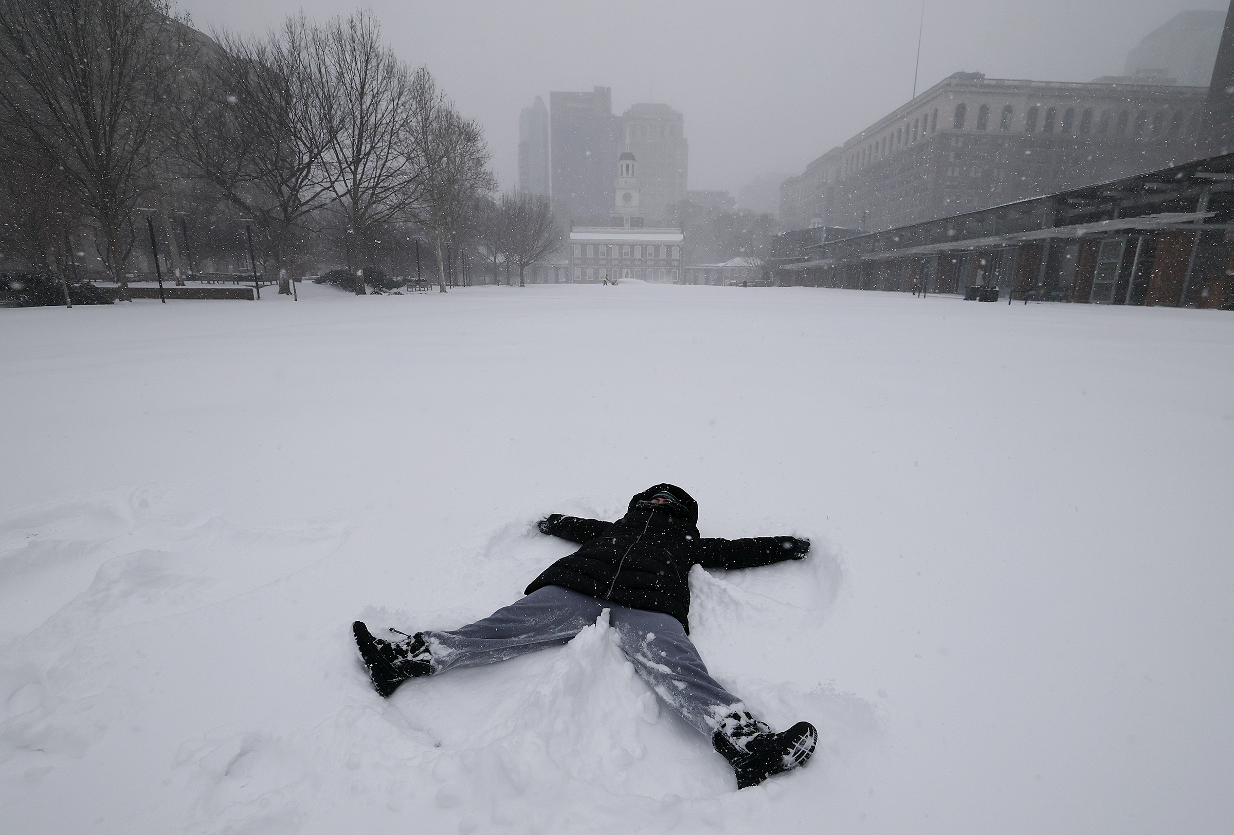
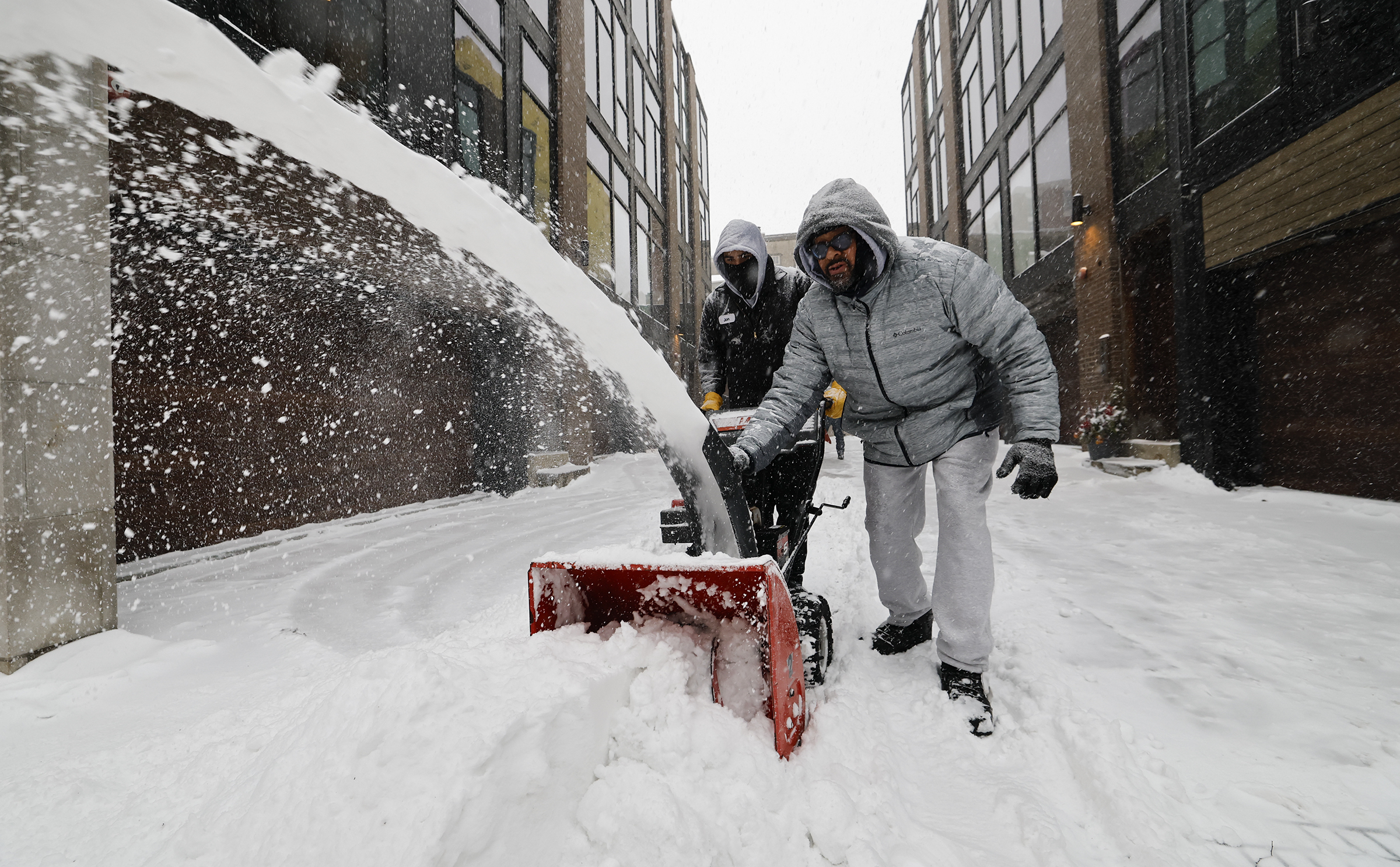
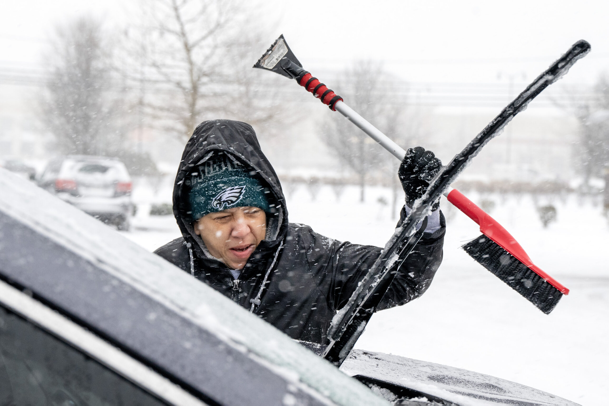
Photos: Residents brave the sleet and snow
// Timestamp 01/25/26 1:41pm
Philly officially has its biggest snow in five years
At 1 p.m., 7.4 inches of snow was measured at Philadelphia International Airport, the biggest snow in five years.
It also pushed the seasonal total to 13.8 inches, also the highest since the winter of 2020-21.
Given how cold it was during the snowfall, the regional totals didn’t show their usual wide variations, and were mostly in the 6- to 8-inch range. It’s possible that another inch could be added to the totals with the slow-accumulating sleet and a possible flip-back to light snow before the precipitation ends.
Some freezing rain also is possible late in the day or evening Sunday.
// Timestamp 01/25/26 12:34pm
Sleet routing the snow across the Philly region
Temperatures at the surface remain in the teens, but sleet has routed the snow throughout the region.
Before the changeover, weather service spotters reported as much as 7 inches of snow. By convention, spotters measure snow before changeovers, since sleet and rain compress the snowpack.
Sleet, which is liquid that freezes on the way to the surface, counts as snowfall, but it accumulates ponderously. A tenth of an inch of liquid will yield about an inch of snow, but it would take three times that to produce an inch of sleet.
The changeover is the result of a layer of warm air in the upper atmosphere imported from the ocean by the onshore winds of a potent coastal storm.
The sleet is due continue this afternoon, and freezing rain also remains a possibility before it all ends late tonight or early Monday, said Nick Guzzo, meteorologist at the National Weather Service Office in Mount Holly.
Whereas sleet and freezing rain hold down accumulations, he notes that they slow down the melting process.
Ice cubes take longer to melt than snowflakes.
Be careful shoveling. The whole frozen mess may feel like it weighs as much as 18 inches of snow.
// Timestamp 01/25/26 12:26pm
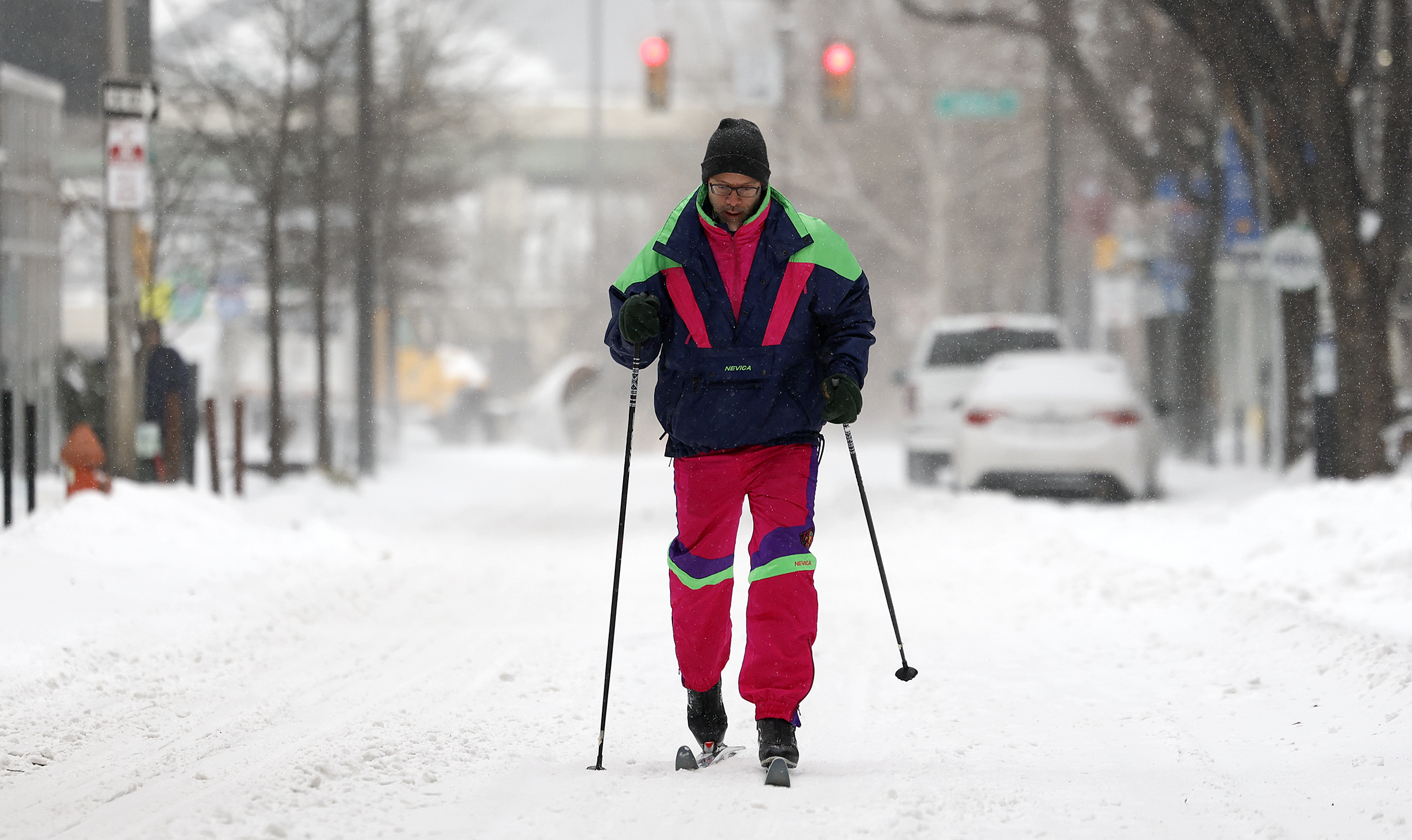
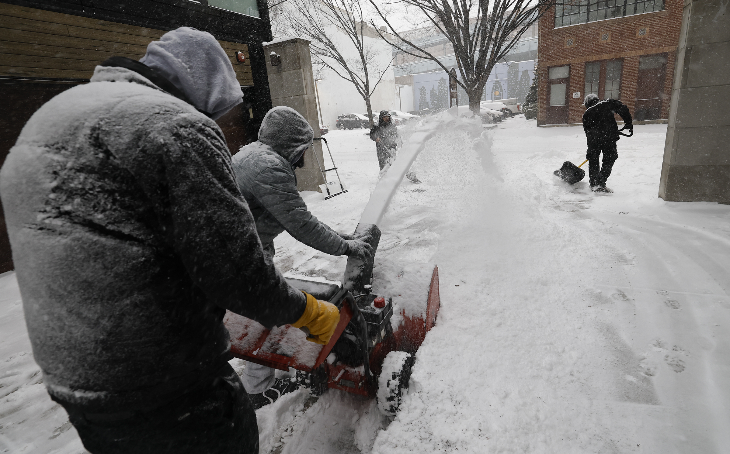
Photo gallery: Snow blankets the Philly region
// Timestamp 01/25/26 11:43am
Snow totals across the Philly region, so far
Five inches or more of snow have fallen in several locations in the Philly region, according to reports from National Weather Service trained spotters.
Here is the current list, which is likely to grow before sleet mixes in the next few hours:
- Berwyn, Chester County, 6.5
- Chadds Ford, Delaware County, 5.5
- Norristown, Montgomery County, 5.9
- New Hanover Township, Montgomery County, 5.0
- Burlington, Burlington County, 5.2
- Mount Ephraim, Camden County, 5.0
- Newark, New Castle County, 5.2
// Timestamp 01/25/26 11:36am
Lehigh Valley International Airport cancels all flights Sunday
// Timestamp 01/25/26 11:34am
City warming centers remain open during snowstorm
Warming centers across Philadelphia will remain open during this storm as part of the ongoing Code Blue declaration, Philadelphia Mayor Cherelle L. Parker said a news conference Sunday.
24-hour warming centers are available for use, stocked with water, snacks, blankets, warming kits, and cots, said Crystal Yates-Galle, deputy managing director for health and human services.
As of Sunday morning, there were 285 slots available. The city has an interactive map of warming centers here, or residents can call 215-232-1984.
“We have capacity,” Yates-Galle said. “We will increase as the demand increases.”
// Timestamp 01/25/26 11:03am
No, the city is not handing out free salt
Carlton Williams, director of the office of clean and green initiatives, debunked a widespread piece of misinformation he said has been circulating online.
No, he said, the city is not handing out free salt, which it needs for roadways and events given the expected icy conditions.
“We must be smart about the work that we’re doing … because this is a matter of life and death if we don’t get this right,” Williams said at a news conference Sunday.
Williams said 4 to 7 inches of snow are expected to fall in the next couple hours, and it’s likely to freeze.
Meanwhile, in some parts of the city, accumulation will likely get to a point where snow must be removed from the neighborhood and deposited elsewhere.
The city has also invested in a snow melter “that delivers 135 tons an hour melting snow,” Williams said.
So far, that snow has fallen at a rate of two inches in two hours, said Dom Morales, director of the office of emergency management
Like other officials, he warned of treacherous conditions on the roads, noting that state’s 511PA website can provide details on road conditions.
“Whether you have four wheel drive, all wheel drive, the conditions are not favorable to being on the road right now,” Morales said.
He warned that sleet and freezing rain could create “invisible ice” and lead people to fall off their stoops even if they’ve shoveled earlier.
Morales encouraged people to keep their phones charged in case power goes out and check out the city’s website for details on how to respond to common scenarios including a downed tree, a water emergency, and a power outage.
“Philly we have a few more days ahead of us,” Morales said. “So please, let’s keep ready, and let’s take care of one another.”
// Timestamp 01/25/26 10:48am
Cherry Hill Mall, Christiana Mall close due to snow
Both the Cherry Hill Mall and the Christiana Mall will be closed Sunday due to the snow.
In New Castle County, level 2 driving restrictions are in effect, meaning only essential personnel are permitted to drive.
In Philadelphia, Emilia, James Beard Award-winning chef Greg Vernick’s Italian restaurant in Kensington, has postponed its scheduled opening from Monday to Tuesday. Vernick told The Inquirer he was unsure if his fish supplier could deliver Monday.
// Timestamp 01/25/26 10:43am
Heavy snow continues as sleet line advances
Snow totals of 4 to 6 inches have been reported across the region as heavy snow continues.
Meanwhile, the sleet line continues to advance northward and had reached central Delaware by mid morning. The Washington, D.C., area flipped to sleet around 8:30 a.m., after about seven inches had accumulated.
Sleet is expected to join the party in the immediate Philly area by early afternoon, and that would put the brakes on further accumulations. Before that happens, it is possible that the city officially will have had its biggest snowfall in five years.
// Timestamp 01/25/26 10:37am
Parker warns Philly residents to stay home and off the roads
Philadelphia Mayor Cherelle L. Parker asked people to stay home and off the roads if possible as the city grapples with a winter storm that has dumped about three inches so far — and is expected to turn to ice in the coming hours.
“This remains a significant winter storm, and there are rough travel conditions expected all day,” Parker said.
Parker said 1,000 city workers are clearing roads and sidewalks and battling snow with about 600 pieces of equipment, including triaxial dump trucks, loaders, sanitation compactors with plows attached, and pickup trucks.
“And this was a new one for me, Philadelphia, even ATVs have been deployed,” Parker noted.
Philadelphia remains under a snow emergency that began Saturday night at 9 p.m.. The city has no update on when it plans to lift the emergency.
The city has teams working in “an enhanced emergency posture” to address the needs of people affected by the bitter cold. The city has implemented 250 additional beds for those in need, Parker said. If residents see anyone in need of immediate help, they can call 215-232-1984.
// Timestamp 01/25/26 10:08am
SEPTA to suspend bus, regional rail service at 2 p.m.
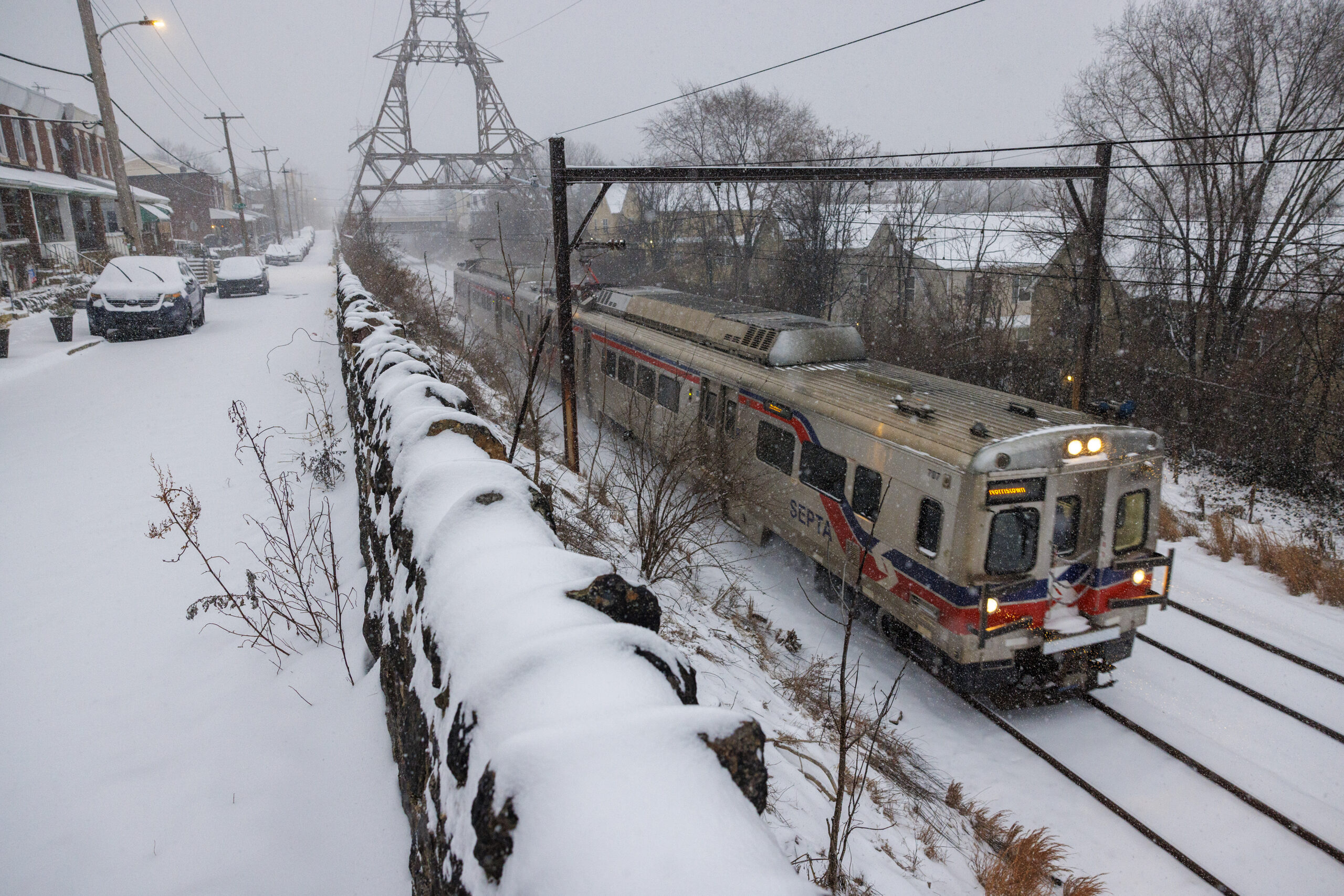
SEPTA will suspend all bus and Regional Rail service at 2 p.m. Sunday, the agency announced.
As for trolley service, the T1 is suspended, the T3 is cutting back at 59th/Chester, and the T4 is cutting back at Island/Woodland, SEPTA said. The T2 and T5 are currently running regular service.
The Market-Frankford and Broad Street subway lines will continue to run. through the storm, the agency said. Crews have been assigned to keep station entrances, platforms, and sidewalks clean of ice and snow, as best they can.
// Timestamp 01/25/26 9:40am
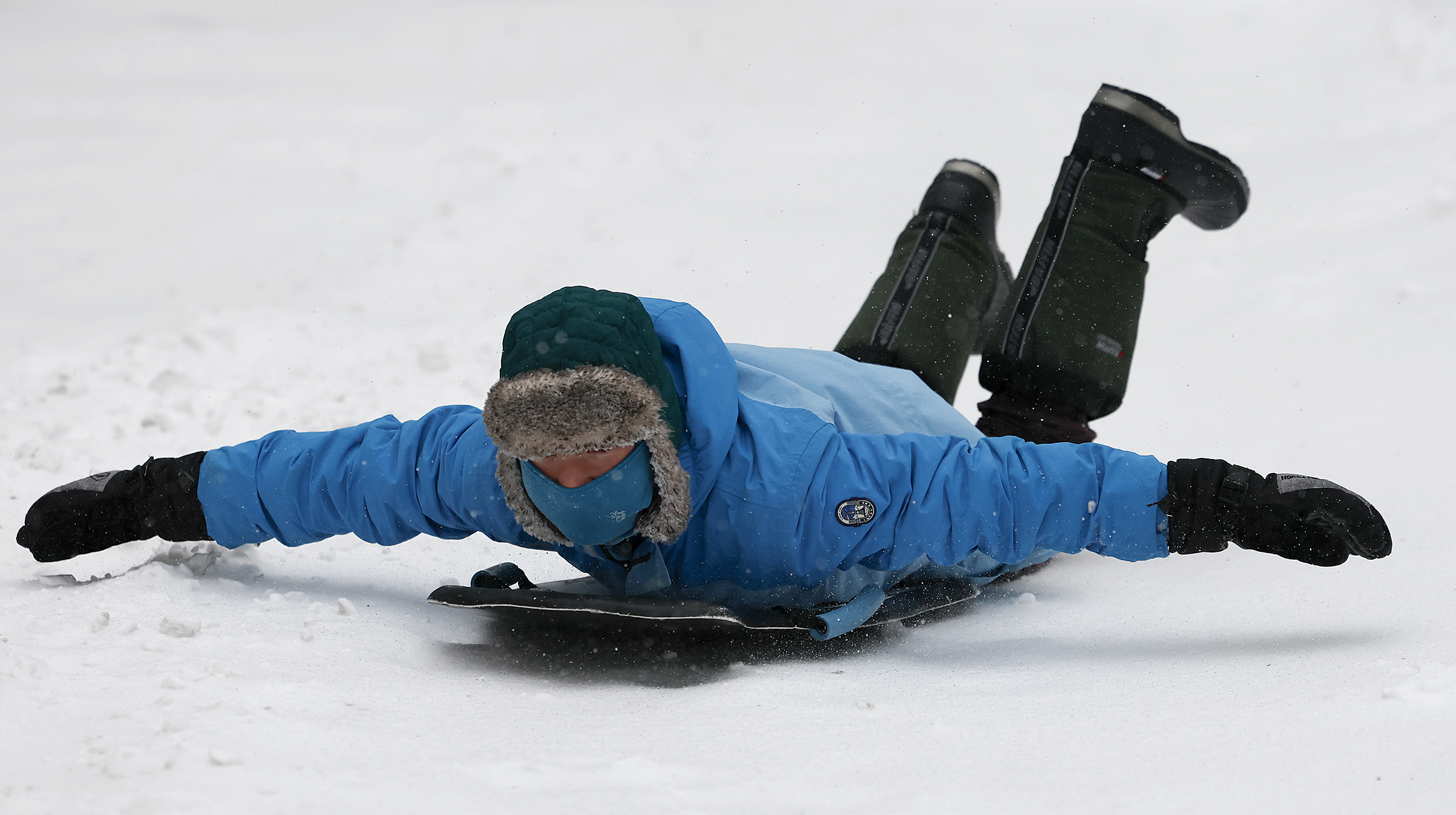
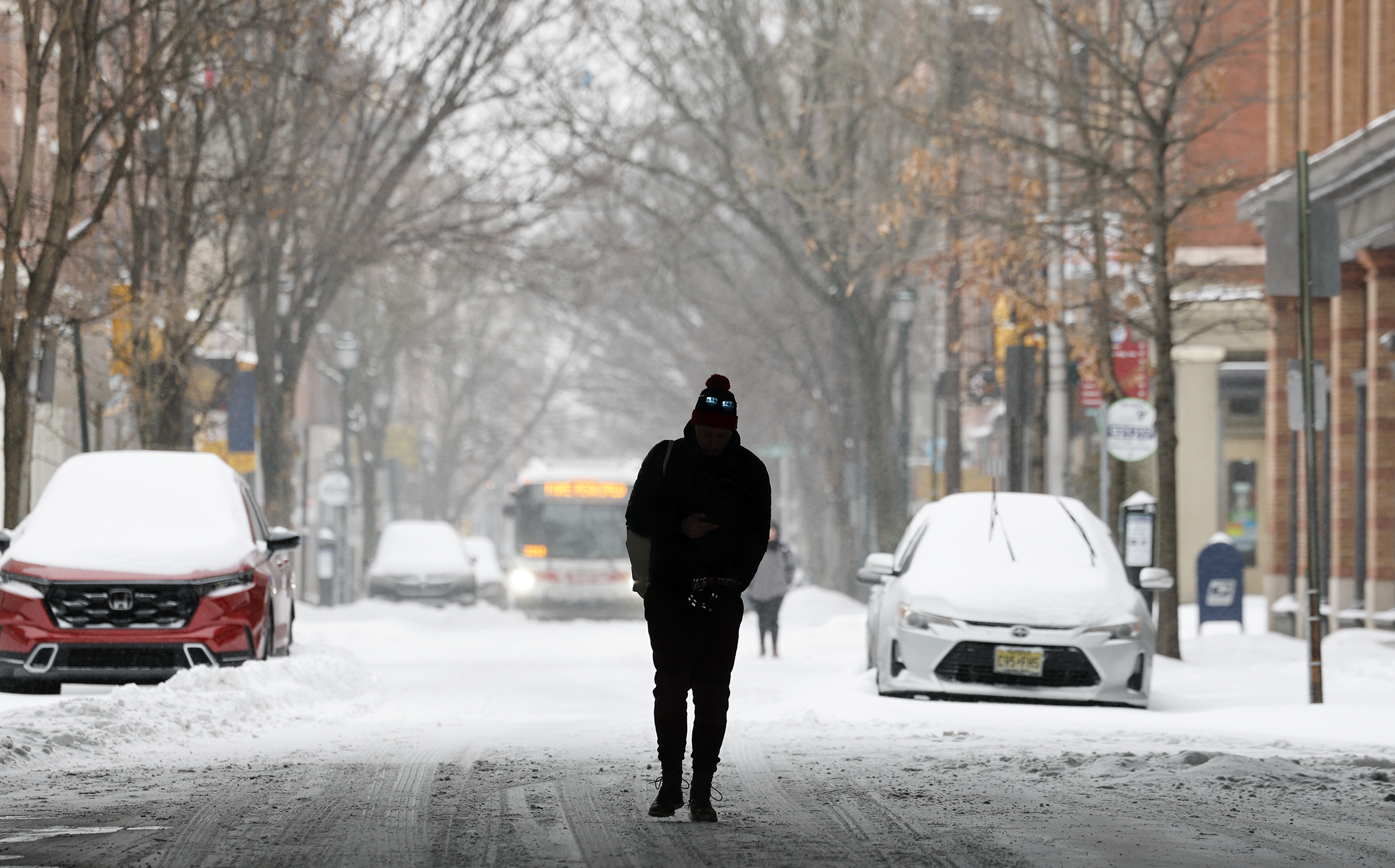
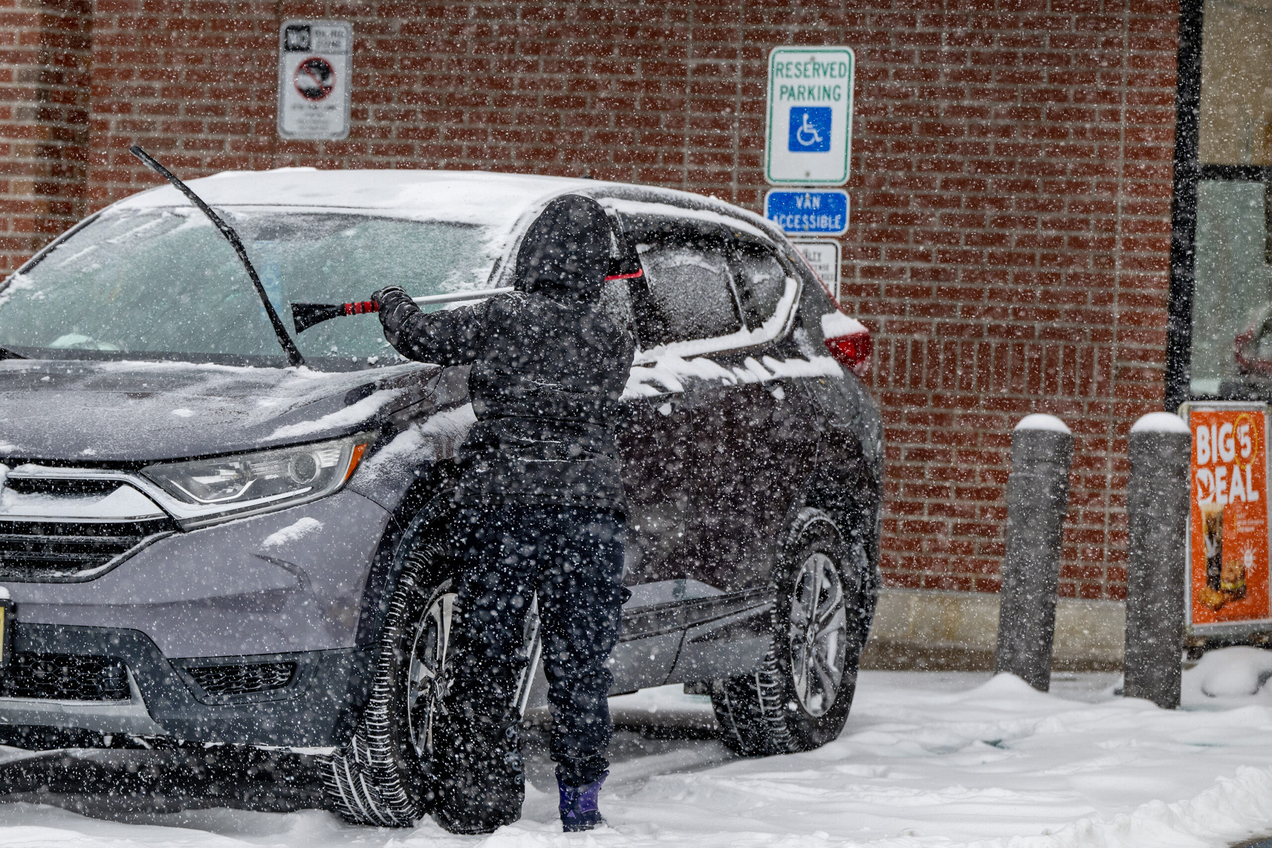
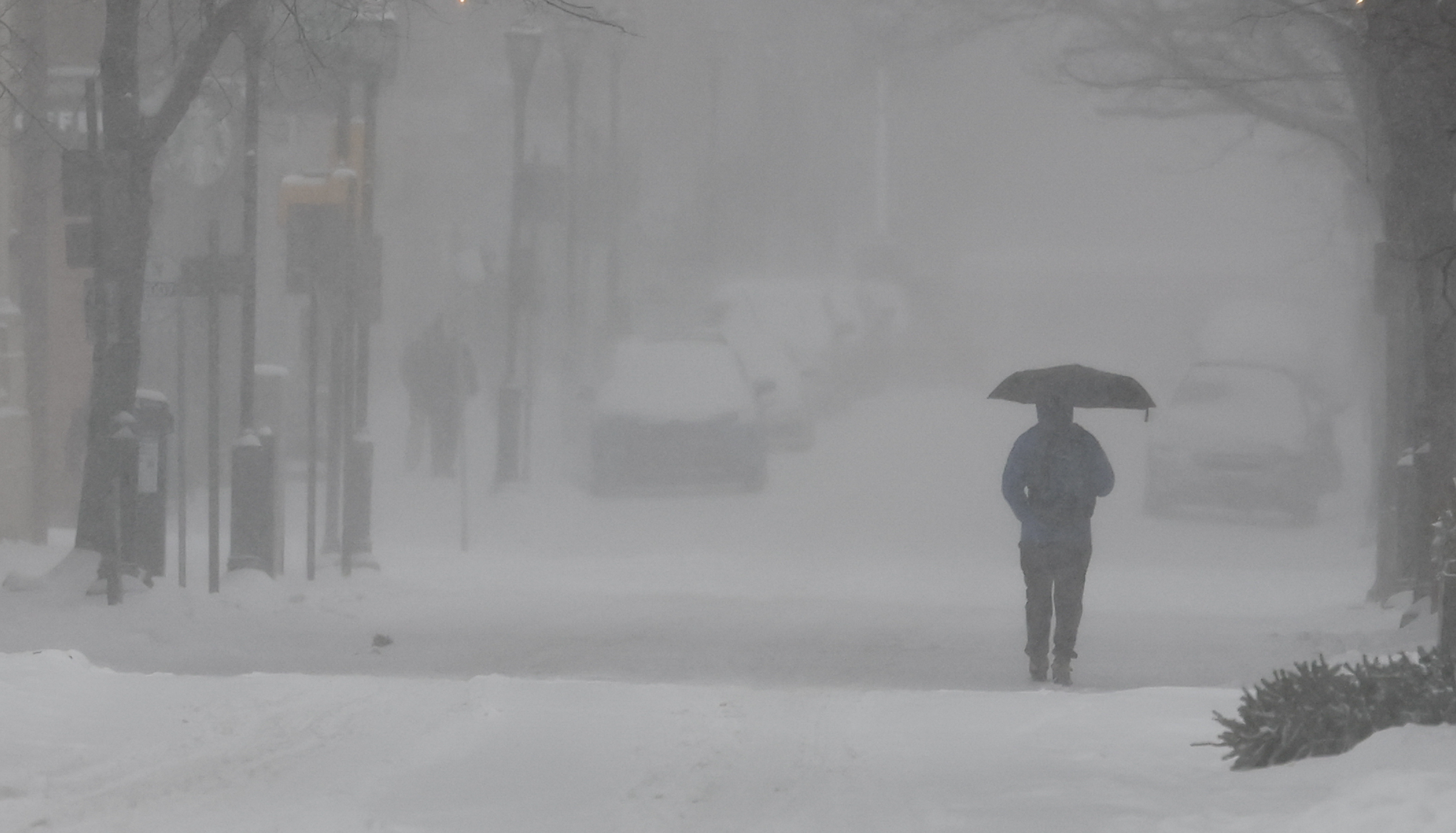
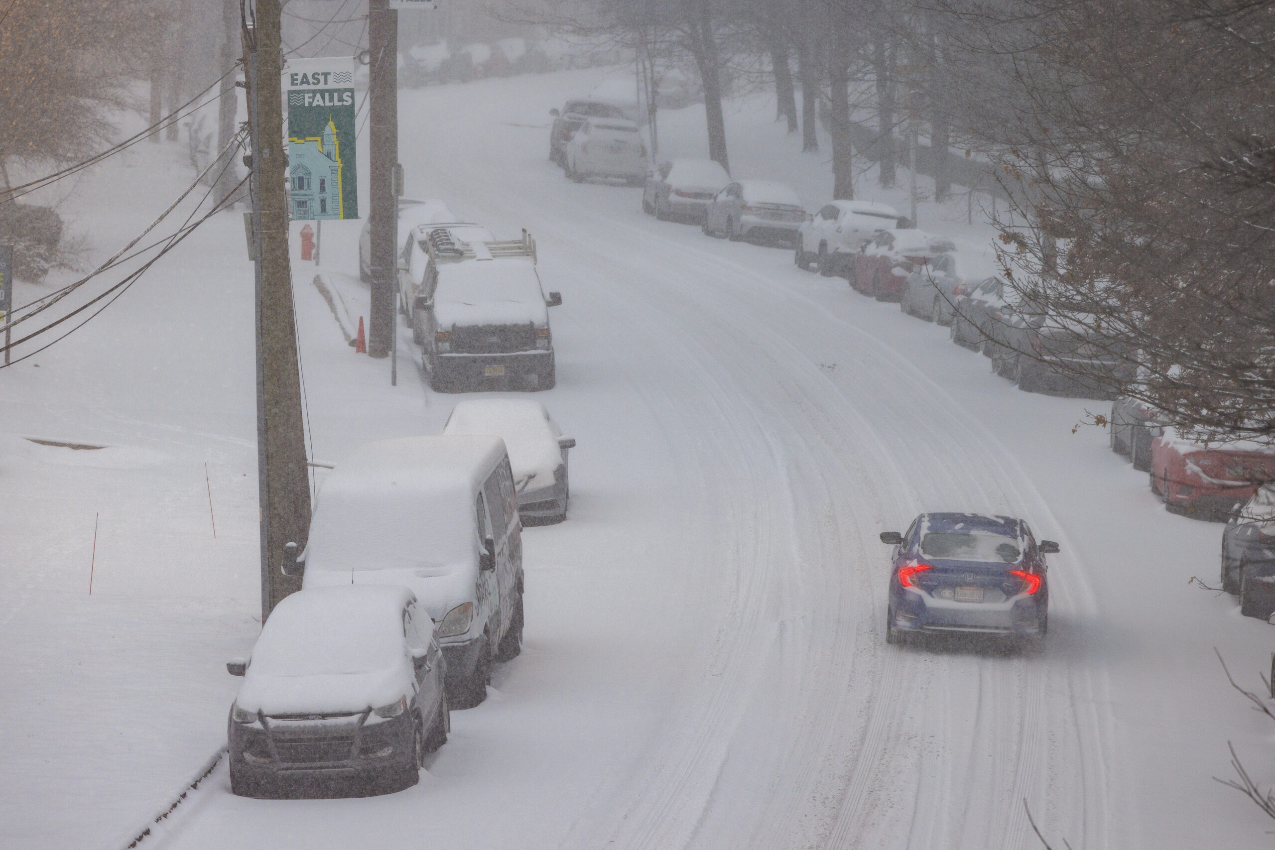
Photos: Snow blankets the region
// Timestamp 01/25/26 9:27am
$5 parking in Center City garages to avoid getting your car towed
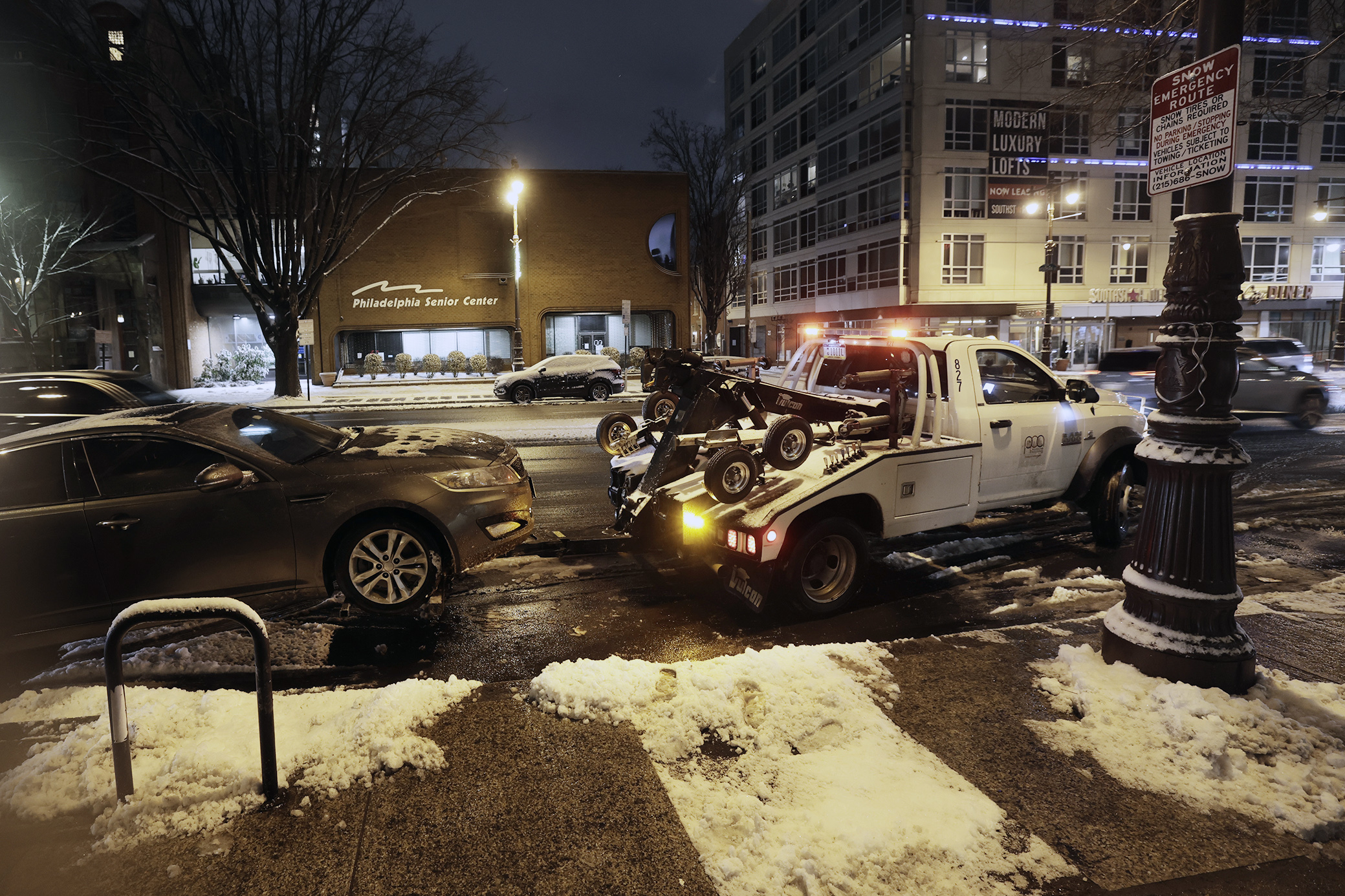
As the snow covers everything in its path, parking on designated snow emergency routes is the fastest way to get your car towed.
To prevent this, the Philadelphia Parking authority is offering $5 parking for 24 hours in Center City garages until the snow emergency is lifted.
It’s “better than being impounded,” the agency wrote on social media.
To receive the discounted rate, parking tickets have to be paid at the PPA Management Office of each of the participating garages:
- AutoPark at Independence Mall (5th & Market Streets)
- AutoPark at Jefferson (10th & Ludlow Streets)
- AutoPark at the Fashion District (10th & Filbert Streets)
- AutoPark at Old City (2nd & Sansom Streets)
- Parkade on 8th (801 Filbert Street)
- Philadelphia Family Court Garage (1503-11 Arch Street – Going south on 15th Street, enter the garage on the west side just after 15th & Cherry Streets)
Meters and time limit violations won’t be enforced until the emergency ends. But if you suspect your car was towed, call 215-686-SNOW or visit www.philapark.org/tow to locate it. A license plate number is needed.
// Timestamp 01/25/26 9:10am
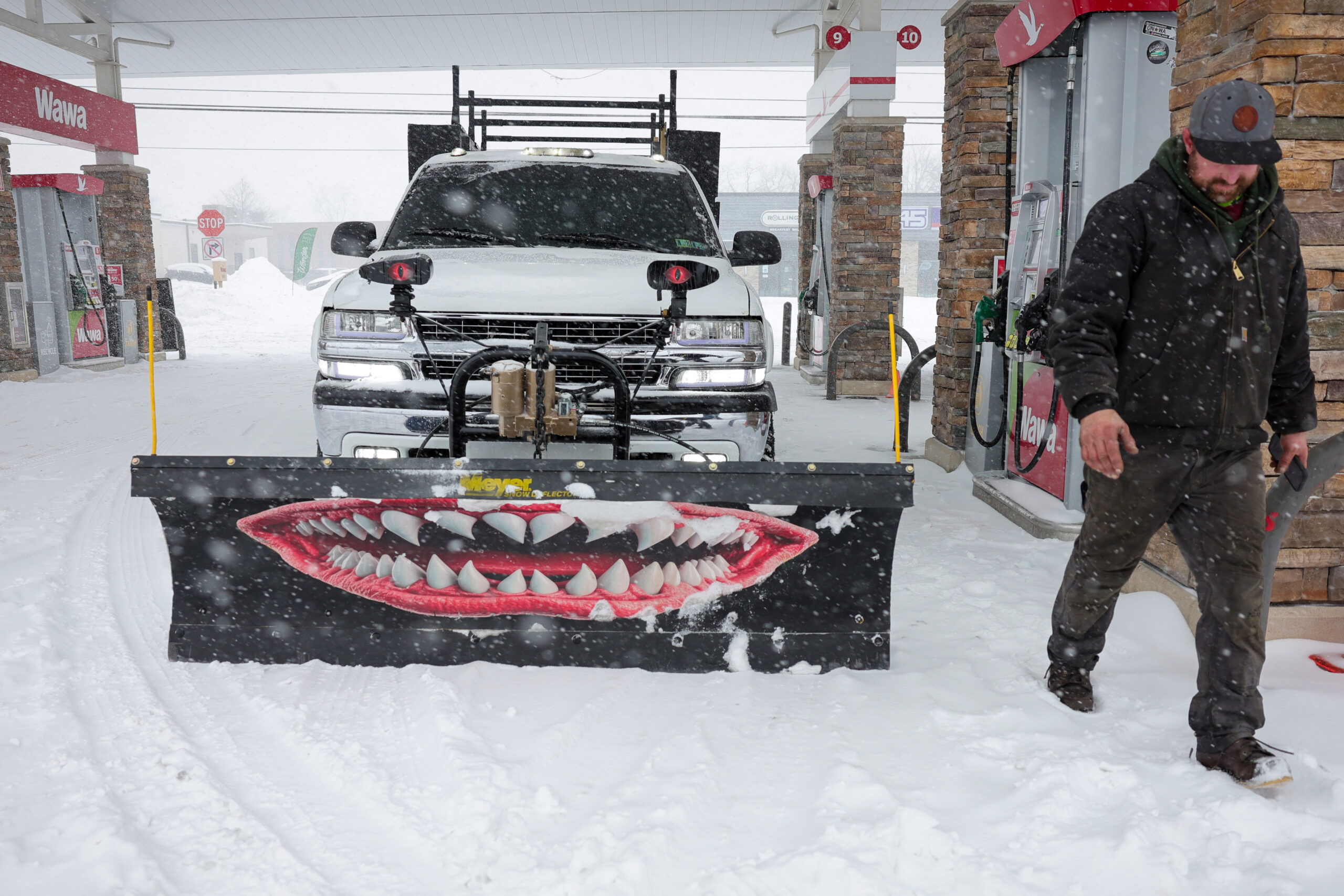
Plows out in Philly as snow blankets the region
PennDOT and Philadelphia Department of Streets are working hard plowing to keep highways and roads passable. Please avoid unnecessary travel so they have room to safely work. If traveling, use caution and give yourself at least 6 car lengths behind snow response equipment. pic.twitter.com/yATOdEnJqV
— Philadelphia OEM (@PhilaOEM) January 25, 2026
PennDOT and Philadelphia plows are out on the roads Sunday, as snow continues to blanket the region.
Officials warn driving conditions are unsafe and are asking residents to avoid unnecessary travel, which will also aid their snow removal efforts.
If traveling, officials urge caution and suggest giving yourself at least six car lengths behind snow response equipment.
// Timestamp 01/25/26 9:05am
Heavy snow bands moving through the region
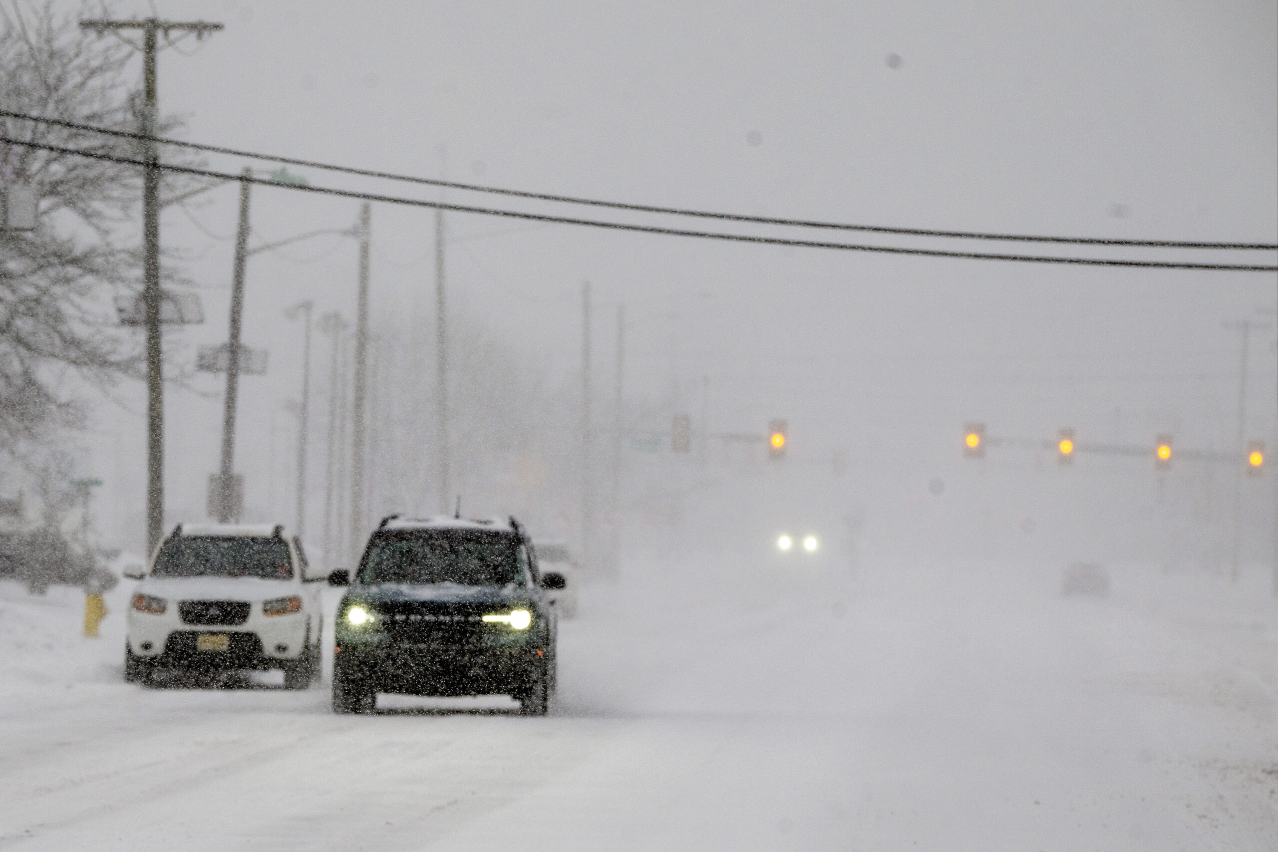
Heavy snow bands generating snowfall rates of 1 to 2 inches an hour are rippling across the region, the National Weather Service says.
They also are reducing visibility to a half-mile or less, said Mike Gorse, a meteorologist in the Mount Holly office.
And nothing is melting. At 8 a.m., PHL was the regional hot spot at 15 degrees.
// Timestamp 01/25/26 8:53am
Philly already has its biggest snow of the month
Not that the bar was especially high, but officially Philly has had its biggest snowfall of the month, with 1.6 inches measured officially at the mostly dormant Philadelphia International Airport.
That tops the 1.1-inch report of last weekend. It also brings the seasonal total to 8, and one of the safer bets is that this winter will end up being snowier than the winter of 2024-25 – 8.1 inches.
By 8:30 a.m., amounts of 2.5 to 3 inches were common throughout the region.
The next official report from PHL is due at 1 p.m. For now, it is playing catch-up with the 1.8-inch reading at Rittenhouse Square.
// Timestamp 01/25/26 8:40am
Heavy snow arrives, with ice to follow. It all may stick around for a week or more.
It may not approach their magnitudes, but Sunday’s snow-and-ice cold brew is expected to bear eerie similarities to some of Philly’s historic winter storms and perhaps rival them for disruption.
By 7 a.m., up to 3 inches had been reported around the region, with heaviest amounts to the south where the snow started earlier.
Officially, at Philadelphia International Airport, 1.6 inches had been measured, already making this the city’s biggest official total of the month. But Center City trumped it at 1.8.
From 8 to 10 inches was expected around the city before the snow mixes with sleet and possibly freezing rain during the afternoon, said Nick Guzzo, a meteorologist at the National Weather Service Office in Mount Holly. All that is subject to change, of course.
The precipitation is due to shut off early Monday, but by then it may be a case of welcome to ice station Philly.
Nothing that falls is going to melt, as temperatures will get no higher than the 20s Sunday and may not see 30 for the rest of the week
// Timestamp 01/25/26 8:19am
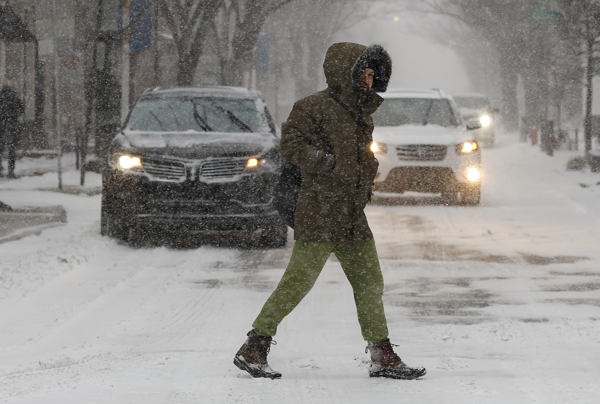
Early snow photos from across the Philly region
// Timestamp 01/25/26 8:11am
Cancellations piling up at PHL
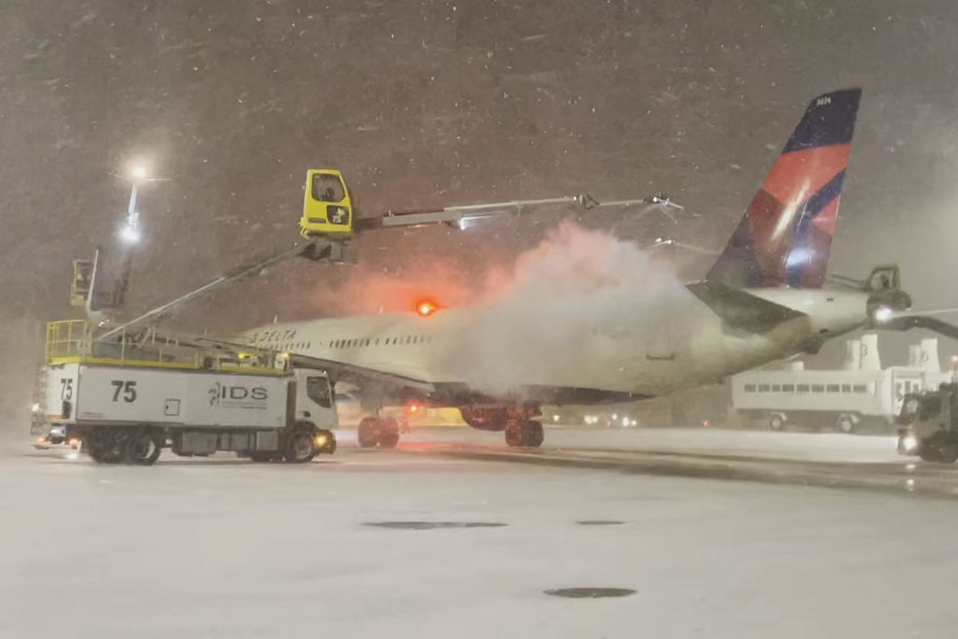
At least 641 flights have been canceled going into or out of Philadelphia International Airport Sunday, as a major snowstorm moves across the Northeast.
Due to the reduced number of flights, TSA agents will only be operating at checkpoints A-East, D/E, and F.
Travels are encouraged to check with their airlines for the latest flight information.
// Timestamp 01/25/26 7:44am
How much snow will fall in Philly?
On Saturday, the National Weather Service was going with 8 to 10 inches for the immediate Philly area, said meteorologist Amanda Lee, with less to the southeast. AccuWeather Inc. was calling for 6 to 10 inches.
A lot of that would fall during a “front-end thump,” said AccuWeather meteorologist Elizabeth Glenny. Once the mixing begins, accumulation rates would back off.
While people understandably want to know how many inches of snow are going to land, that is almost always difficult to answer, meteorologists say, especially in a storm of this nature.
In this case, snow amounts are dependent on a coastal storm that had not yet formed Saturday and on what might happen in parts of the atmosphere that are not well-observed.
Temperatures in the bottom 5,500 feet of the atmosphere over Philly are expected to remain below freezing, said AccuWeather senior meteorologist Tom Kines, but computer models insist that a warm layer in the higher atmosphere would result in the changeover.
That warmth would be imported from the Atlantic Ocean by the strong onshore winds from the northeast generated by the storm — it’s not for nothing that these things are called nor’easters.
Another wild card would be if the snow is heavy enough that it could survive the warm layer and delay the changeover.
But the mixing of sleet, which is liquid that remains frozen in its trip through the atmosphere, and freezing rain, liquid that freezes on contact, is inevitable, forecasters said.
Freezing rain atop a snowpack is especially dangerous because it adds weight to vulnerable and snow-burdened power lines and tree branches. Sleet is polite enough to bounce off hard surfaces, but since it is pure ice, it is slower to melt.
Said the weather service’s Mike Lee, the mixing “just means we’re getting a different blend of horrors.”
// Timestamp 01/25/26 7:42am
Timing of Philly storm
Snow is forecast to accumulate rapidly Sunday morning, with temperatures in the teens and snowfall rates of one to two inches per hour.
Models were suggesting sleet could mix in as soon as early afternoon, said Tom Kines, senior meteorologist with AccuWeather Inc.
Temperatures in the bottom 5,500 feet of the atmosphere are going to remain well below freezing. However, as the coastal storm intensifies, its onshore winds from the northeast are forecast to import warmer air from over the ocean into the upper atmosphere, which would change the snow to sleet and rain Sunday afternoon and evening.
It’s possible the precipitation will flip back to all snow and accumulate maybe another inch early Monday, Staarmann said. But at that point it would have all the impact of drizzle in the ocean. The mass of snow and ice evidently will be vacationing in Philly for a while.
“It will stick around for a week, maybe two weeks,” Staarmann said.
// Timestamp 01/25/26 7:40am
Vehicle restrictions on Pa. highways now in effect
Vehicle restrictions aimed at limiting the number of cars on roads statewide during Sunday’s snowstorm are not in effect across Pennsylvania.
PennDot’s vehicle restrictions are instituted in a tiered system, with today’s coming in at tier four — the second-highest level. Under that tier, commercial vehicles are totally prohibited from using a number of interstates around Pennsylvania, as well as the Pennsylvania Turnpike.
“The decision to implement these restrictions was made with the intention of balancing safety for everyone on the roadway, including commercial drivers,” PennDot secretary Mike Carroll told reporters Friday at a news conference. “We will remove these restrictions as soon as conditions warrant.”
In addition to limiting the travel of vehicles like tractor trailers and commercial buses, PennDot’s restrictions also apply to school buses, motorcycles, RVs, and passenger vehicles that are towing trailers, Carroll added. None of those vehicles, he said, are permitted to use roadways while the restrictions are in place.
Officials urged motorists to stay home, noting the anticipated snowfall rate of one to two inches per hour, as well as the overall snowfall totals, will make keeping roads safe and clear difficult.
Restrictions, PennDot notes online, are evaluated hourly. Pennsylvania’s traveler information website, 511PA, keeps an up to date map of which roads are impacted by the restrictions, and Carroll recommended travelers check that website before heading out, should they absolutely have to.
“Stay home and watch the NFL games, despite the fact that the Eagles and Steelers are not playing,” Carroll said.
// Timestamp 01/24/26 7:39am
Top January snowstorms in Philadelphia history
Philadelphia could see double-digit snowfall totals for the first time in 10 years Sunday, as a massive storm makes its way across the Northeast.
But as large and disruptive as this storm will likely be, it will have a difficult time cracking the list of the top January snowstorms in Philly history.
A decade ago, almost to the day, 22.4 inches of snow fell in Philly, the fourth-largest snowstorm in city history. The blizzard basically forced SEPTA and the rest of Philly to shut down and blasted through the city’s budget.
Nothing compares to what happen 30 years ago, when the so-called Blizzard of 1996 dropped nearly 31 inches of snow on Philly over a two-day span. Vehicles were left stranded across the city and highways across the region closed in what The Inquirer described at the time as the “Snowstorm of the Century.”
It would take 12.3 inches of snow for this latest storm to make its way on to the list of the snowiest January storms in Philly history. That would match a 1922 event dubbed the “Knickerbocker storm” because snow caused the collapse of the Knickerbocker Theatre in Washington, D.C., killing 98 people, which remains the worst natural disaster in the city’s history.
Here’s the full list of the Philly snowfalls of a foot or more in January history:
- 30.7 inches: Jan. 7-8, 1996
- 22.4 inches: Jan. 22-23, 2016
- 16.7 inches: Jan. 22-23, 1935
- 15.1 inches: Jan. 26-27, 2011
- 13.5 inches: Jan. 21-22, 2014
- 13.2 inches: Jan. 19-20, 1961
- 13.2 inches: Jan. 19-20, 1978
- 12.6 inches: Jan. 22-23, 2005
- 12.3 inches: Jan. 28-29, 1922
// LiveBlog Name: Let it snow
// RelatedLink Text: What’s next? URL: https://www.inquirer.com/weather/snow-ice-sleet-philly-storm-20260125.html
// RelatedLink Text: Where to sled URL: https://www.inquirer.com/life/best-places-to-sled-philadelphia-and-beyond-20260124.html
// RelatedLink Text: Top Jan. storms URL: https://www.inquirer.com/weather/philadelphia-snow-top-10-january-snowfall-totals-snowstorms-history-20260124.html
// RelatedLink Text: Shoveling rules URL: https://www.inquirer.com/life/snow-shoveling-rules-philadelphia-fines-sidewalks-20260122.html
Leave a Reply