Category: Weather

  • Philly sets a rain record, and more showers are possible Friday and Saturday

    Philly sets a rain record, and more showers are possible Friday and Saturday

    It may be a while before the drought advisories disappear, but since Monday Philadelphia has had more rain than in any entire month since March 2025. And the city of Camden has been clocked well over a half-foot of rain.

    In both instances, if it seemed like most of that came in a hurry, it did.

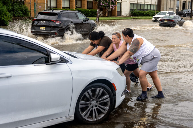
    On Thursday, for the second time in a week, downpours set off a flood of warnings in the city, the neighboring counties and Delaware.

    And more showers are possible Friday and Saturday, but the atmosphere isn’t expected to upstage its performance since it turned off last weekend’s 100-degree heat.

    Thursday’s downpours wrung out 2 and 3 inches of rain in several towns across the region.

    Flooding was reported along numerous roads, with vehicles stranded, including in the vicinity of the Ben Franklin Bridge, the National Weather Service said. The rains could continue until 7 or 8 p.m. Thursday, said Alex Staarmann, meteorologist inthe Mount Holly office.

    Multiple water rescues have been reported in Wilmington.

    Philadelphia broke a 74-year-old record for a July 9 with 2.61 inches of rain measured officially, according to the weather service.

    At one point flood warnings had been posted for the city and in all seven neighboring counties.

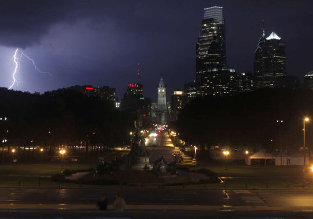
    But the rain lately has been random. And in the grand casino of the atmosphere, that was the case Thursday, and not every place got the soakings.

    The drought conditions are likely to persist despite the storms

    In the weekly inter-agency U.S. Drought Monitor update posted Thursday, some degree of drought conditions persisted in all of New Jersey, Philly, and the neighboring Pennsylvania counties.

    The drought monitor has most of the region was in “moderate drought,” with some improvement in Burlington, Camden, and Gloucester Counties.

    But all of Chester County and most Montgomery County were in “severe drought.” Southeastern New Jersey, including the Shore towns, were in “extreme drought.”

    Soil moisture levels will remain significantly below normal during the next week, according to the National Oceanic and Atmospheric Administration’s Climate Prediction Center.

    (function(){function e(){window.addEventListener(`message`,function(e){if(e.data[`datawrapper-height`]!==void 0){var t=document.querySelectorAll(`iframe`);for(var n in e.data[`datawrapper-height`])for(var r=0,i;i=t[r];r++)if(i.contentWindow===e.source){var a=e.data[`datawrapper-height`][n]+`px`;i.style.height=a}}})}e()})();

    And it appears the atmospheric faucets are going to shut after Saturday.

    Said Joseph DeSilva, meteorologist at the weather service’s Mounty Holly office, “Next week looks pretty dry.”

  • 7 heat-related deaths have been reported in Philadelphia this month, 8 for the year

    7 heat-related deaths have been reported in Philadelphia this month, 8 for the year

    Philadelphia so far has confirmed seven heat-related deaths in the last week, bringing the seasonal total to eight, the city health department reported Tuesday.

    And officials in the Garden State are investigating 29 “suspected” heat-related deaths, most of them in the central and northern parts of the state, a spokesperson for the New Jersey Health Department said..

    Four deaths were reported on Monday, and three additional fatalities Tuesday, said James Garrow, a spokesperson for the Philadelphia Department of Public Health, with an eighth earlier in the season.

    No details were available about the victims, including their ages and when and where the deaths occurred.

    The possible New Jersey heat-related deaths would have occurred during the record three-day hot spell that ended on July Fourth, the state said.

    In Philadelphia, temperatures on those three days hit 101 degrees or higher, the first time that had happened in the period of record dating to 1873, the National Weather Service said.

    It also was only the third time that they officially reached triple digits on three straight days.

    In New Jersey, the suspected victims ranged in age from the mid-30s to the 80s, said health department spokesperson Dalya Ewais. She added, however, that death toll numbers “are still unconfirmed,” pending forensic examinations.

    In the last decade Philadelphia has averaged but five deaths annually, a dramatic drop from the deadly summers of the 1990s.

    In 1993, Philadelphia recorded 118 heat-related deaths — compared with 50 in the 10-year period that began in 2017. The eight reported so far are the most since the eight of 2022, according to health department records.

    The shock of the 1993 death toll in Philly — which foreshadowed Chicago’s 1995 disaster, and Europe’s in 2003 — led to the creation of the city’s heat-response system, recalled David L. Cohen, who was chief of staff under former Mayor Ed Rendell.

    Federal officials have lauded the program as a model for other cities. It includes setting up cooling centers, encouraging people to look in on neighbors, and having the Philadelphia Corporation for Aging set up a heat hotline.

    A study published in the Bulletin of the American Meteorology Society in 2025 credited the program with saving 270 lives from 1995 through 1998.

    If the forecast holds, the city can give the program a rest at least through the week. No highs of even 90 degrees are expected through Monday.

  • Downpours set off flood alerts and road closings — but now the Philly region could use some more rain

    Downpours set off flood alerts and road closings — but now the Philly region could use some more rain

    The waterfall downpours came just as the sun-cooked vegetation was showing those hay-brownish tints and taking on that desperate we-need-a-drink-now look.

    “You have to be careful what you wish for in the summer,” said Scott Kleebauer, branch forecaster at the national Weather Prediction Center in College Park, Md.

    But sometimes too much is not enough.

    While downpours flooded streets and caused Regional Rail problems for SEPTA, which also reported weather-relates signal problems, Kleebauer suggested it wouldn’t hurt for Philadelphia and other parts of the Mid-Atlantic to place an order for more rain.

    Through Sunday, Philadelphia’s year-to-date precipitation was about 75% of normal, and even with additional rains on Monday, still was roughly 4 inches — or a month’s worth — below long-term averages, according to the Middle Atlantic River Forecast Center.

    More rain might be about the last thing some people would want after rounds of strong storms on Sunday with frequent lightning and downpours on Sunday and Monday, when as much as 2 to 4 inches fell in a short period upon parts of Philadelphia, Bucks, and Burlington Counties, the National Weather Service said.

    And in the city of Camden, 4.38 inches was measured, the agency said.

    “Numerous roads remain closed due to flooding,” the agency said.

    In late morning, moderate flooding was reported along Frankford Creek, and the weather service posted a flood warning that remained in effect until early evening. At one point Kelly Drive was closed due to flooding on the Schuylkill.

    Comden County received about 1,000 911 calls just in the stretch of the morning storm, said Dan Keashen, Camden County’s public affairs director.

    SEPTA train service on the Trenton line was suspended due to water over the rails. A car got stuck in floodwaters by a rail bridge and Eighth Street and Fairmount Avenue, the weather service reported.

    The rains backed off during the afternoon, but the weather service has shower possibilities every day this week, except Wednesday.

    The federal Climate Prediction Center’s outlook for the 8-to-14-day period favors above-normal precipitation for the region.

    So, is the drought on the run in the Philly region?

    Maybe, but droughts are slow to develop and slow to abandon their methodical harvests.

    All of New Jersey and Chester County remain under state-declared drought “warnings,” and the majority of the region is under “moderate drought,” according to the interagency U.S. Drought Monitor.

    “There’s definitely been some improvement,” said Kleebauer. “Unfortunately there’s been some losers.”

    Summer rains are notoriously capricious and random.

    “My grass has been happy the past few days,” said Lee Robertson, a weather service meteorologist in Mount Holly, but he added that it’s going to “take a while” to make up the accumulated rain deficits.

    But in reality, “It’s really difficult to get everybody to win,” said Kleebauer.

    The steering currents aloft that move storms get as lazy as a lot of humans in the heat.

    “Stuff just kind of meanders or has slow general motion,” he said. Storms can get stuck in place, and the more one place gets, the less other places will get. Even in a juiced atmosphere, moisture is finite.

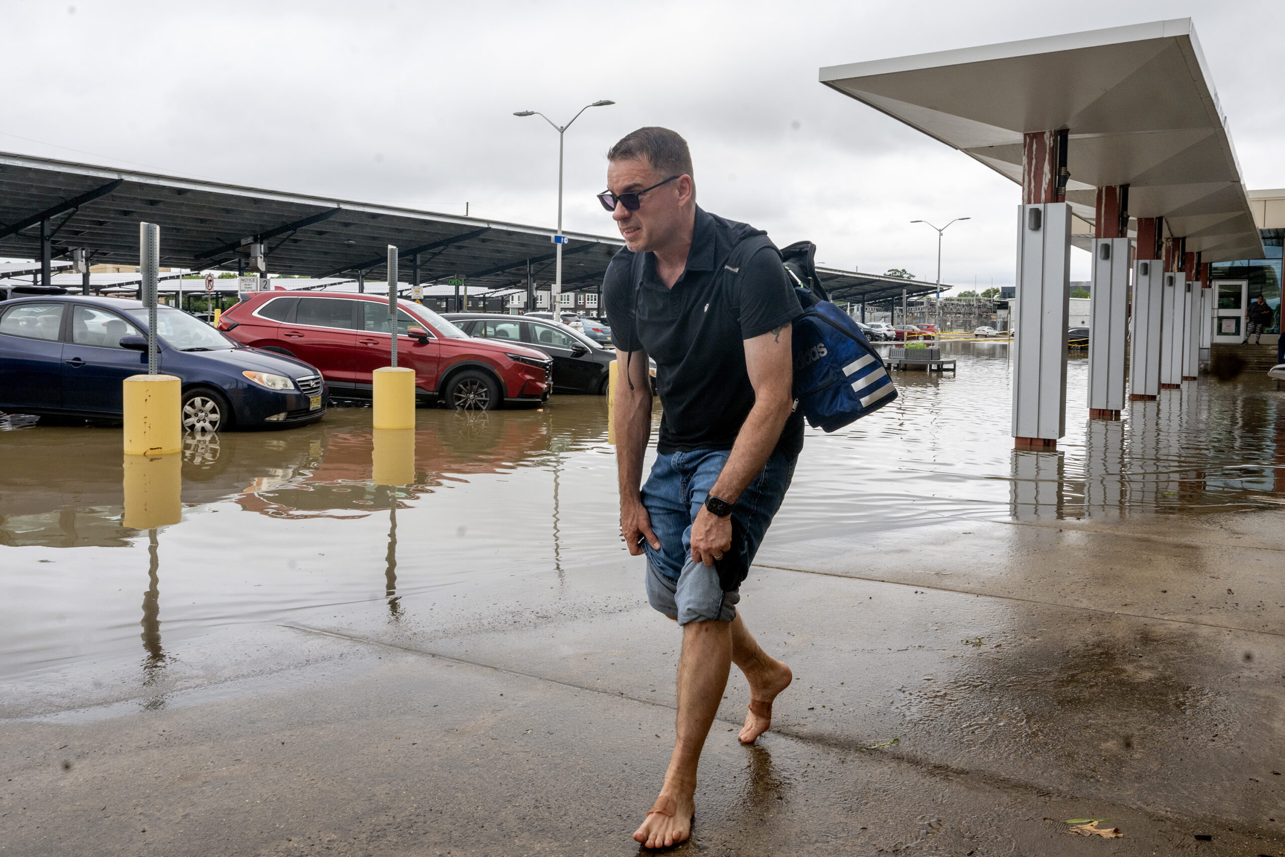
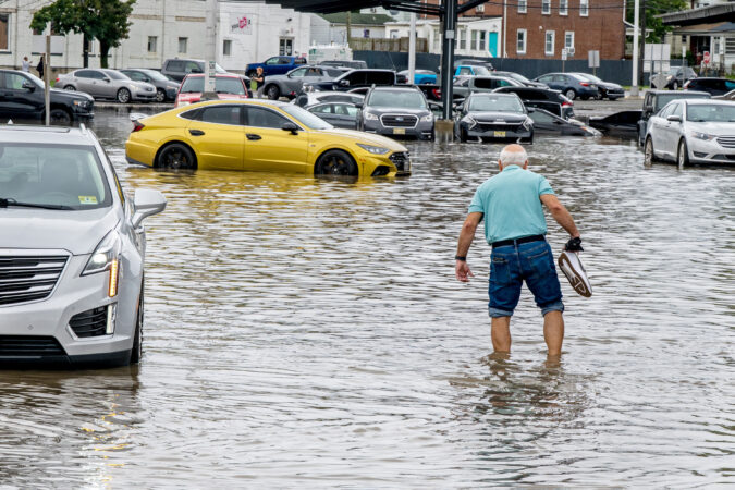
    Joe Puccio of Williamstown rolls up his pants legs to make his way to his truck in the flooded parking lot at the Ferry Avenue PATCO station in Camden Monday, July 6, 2026, as a flash flood threat continues for the region. He said he commutes to work in Philadelphia every day and the flooding is something that happens a lot in the area, but he has never seen it as bad before. His truck started okay, but Route 130, his normal way home was also under water so he had to take back roads.

    The extreme heat appears to be over, for now

    The rains at least have marked the end of the region’s extreme heat as the “heat dome” has migrated westward. It is not uncommon for storms to break out as a hot spell deteriorates.

    But that three-day stretch ending with that torrid 250th birthday party on July 4 was historic in its own right.

    It marked the first time in records dating to 1873 that the temperature had reached 101 or higher three consecutive days and only the third time it had hit 100 three days straight, according to the weather service.

    It may be hard to remember, but on Feb. 8 it got down to 8 degrees at the airport, proving that Philly truly is a four-season resort.

    Inquirer staff writers T.J. Furman and Sarah Nicell contributed to this article.

  • July 4th storms downed trees and wires, causing power outages throughout the Philadelphia region

    July 4th storms downed trees and wires, causing power outages throughout the Philadelphia region

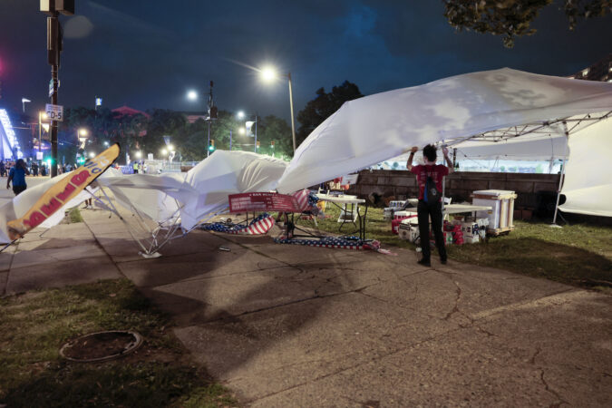
    Storms and strong winds late Saturday downed trees and wires throughout the Philadelphia region, and more severe weather is forecast into Monday.

    A slew of wind-damaged trees and wires in the suburban counties were reported to authorities and the National Weather Service late Saturday and Sunday morning. Such debris briefly suspended service on the Lansdale/Doylestown regional rail line during July Fourth celebrations.

    Thousands of people, largely in Chester and Bucks Counties, were also without power early Sunday, Peco’s online tracker showed. During the storms’ peak, at about 10:45 p.m., that number reached almost 50,000. By 2:20 p.m. Sunday, it had fallen to less than 7,000.

    The outages came as Peco workers, from linemen to call center staff, were on strike. Negotiations between the union and energy company were ongoing Sunday afternoon.

    Bucks County officials were able to evacuate Independence Day festivities ahead of the storm, county Emergency Management Director George Wilson said.

    While a pine tree fell into a home in Upper Southampton and another downed tree hit a car in Doylestown, no one was injured, he said. Additional felled trees and debris caused road closures Sunday.

    “Overall, we were pretty lucky,” Wilson said.

    But in Philadelphia — where heavy rain, lightning, and wind gusts near 60 mph suspended the city’s Semiquincentennial concert on the Benjamin Franklin Parkway — minimal power outages were reported, according to the city’s Office of Emergency Management.

    Spokesperson Jeffrey Kolakowski said tree limbs and vegetation were knocked over on and around the Parkway and have since been cleared.

    Another round of severe weather and extreme heat was forecast, according to NWS. Heavy rainfall and winds on Sunday and heavy showers and thunderstorms on Monday may bring flash flooding to the Philly area.

    The weather service issued a flood watch Sunday that was in effect until 8 p.m. on Monday. It covered much of the region, including Philadelphia; Bucks, Chester, Delaware, and Montgomery Counties; Camden and Gloucester Counties; and Northwestern Burlington County.

    The inclement weather may hamper cleanup efforts and power restoration, Wilson said.

    Chester County leaders were asking residents to “stay weather aware.”

    “Our teams stand ready to assist our community,” spokesperson Kevin Beck said in a statement.

  • It’s hot, hot, hot in Philadelphia, with a third-straight 100-degree day possible Saturday

    It’s hot, hot, hot in Philadelphia, with a third-straight 100-degree day possible Saturday

    No question, it’s hot, hot, hot. But the city fell short of setting a record-high temperature on Friday for that date.

    Another record, however, appears likely: A new warmest low temperature for July 3. The record is 77 degrees, hit three times, most recently in 2002. The low on Friday as of nearly 8 p.m. was 82 degrees, which would be a record-setter.

    But there was still the potential for storms to knock that record down before the day is out.

    “We are still in the running for our new record warmest low temperature,” said Patrick O’Hara, meteorologist at the National Weather Service office at Mount Holly.

    The record high temperature for a July 3 stands at 104 degrees, set in 1966. As of about 4 p.m., the temperature had reached 102, the National Weather Service said.

    The Atlantic City Airport, however, hit 105 degrees, setting a new record there, O’Hara said.

    The temperature on Saturday is expected to reach a high of 100, O’Hara said. The record for that date is 103.

    Just because Philadelphia didn’t break a high-temperature record doesn’t mean the heat hasn’t had a big impact. The Wawa’s Salute to Independence Semiquincentennial Parade, scheduled for Friday, was canceled due to heat concerns.

    Storms also posed a risk. A severe thunderstorm watch was issued for the entire region on Friday, and on Saturday, the risk looked even greater.

    “Any storm could be strong to severe,” said Ray Martin, meteorologist at the National Weather Service office in Mount Holly.

    The risk on Friday was more to the north and west of the city, said Matt Benz, senior meteorologist with AccuWeather.

    On Saturday, Benz said there was about a 65% chance of thunderstorms in the evening when Philadelphia’s July Fourth concert is scheduled to be underway on the Benjamin Franklin Parkway.

    “At this point, it’s difficult to promise dry weather for fireworks,” he said.

    Philadelphia, where fireworks aren’t scheduled to start until close to 12 a.m., might have the best shot of not being impacted by weather, he said.

    “As we get close to midnight, we might start to dry out,” he said.

    Concern about lightning strikes could be more widespread than storms, Benz said.

    Meanwhile, AccuWeather said Philadelphia was forecast to only drop to 83 degrees overnight Friday into Saturday, which would tie the city’s all-time record for a high minimum temperature.

    The good news is both SEPTA and Peco reported no major weather-related problems Friday afternoon.

    Regional Rail trains were traveling 10 miles slower to alleviate stress on the overhead wire and tracks, which can be impacted by the heat, said Andrew Busch, spokesperson for SEPTA. The slower speed has led to some delays.

    Peco recommends that customers keep their thermostats between 75 and 78 during the day and shades drawn, said spokesperson Izamarie Camacho. All unnecessary lights and devices also should be turned off, Camacho said.

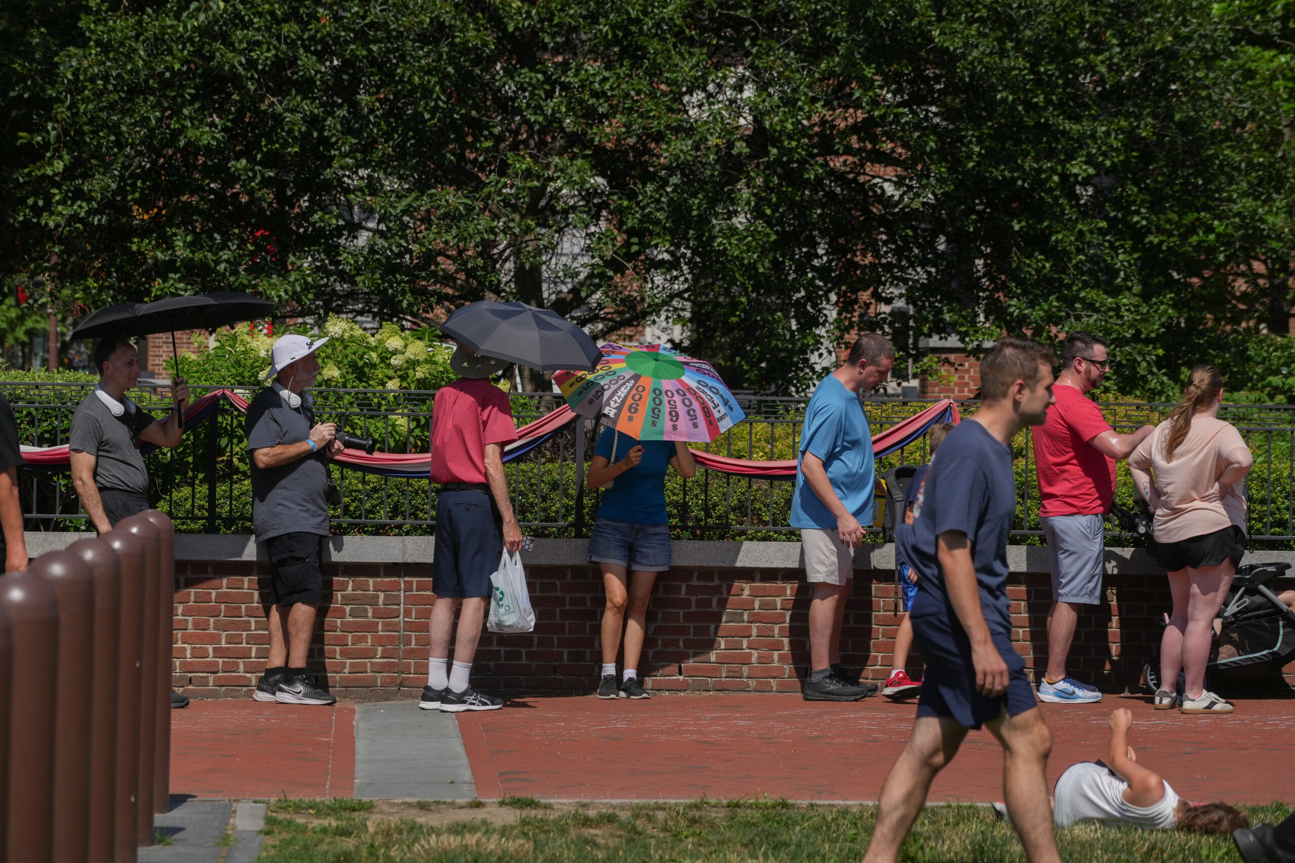
    Visitors in Philadelphia shade themselves from the sun, July 3, 2026.

    Local hospitals contacted didn’t report an uptick in heat-related illnesses or injuries. Temple University Hospital’s main campus had five heat-related cases on Friday as of 4:30 p.m., according to a spokesperson. No other information about the cases or whether it was an increase from prior days was available.

    The Philadelphia Fire Department has seen “a marked increase in calls” over the last few days, said Rachel Cunningham, communications director. There were more than 1,000 calls on Wednesday and Thursday, but the department didn’t have a breakdown on how many were heat-related.

    The number of calls on Friday was not available.

    The number of people seen at the department’s medic tents at Lemon Hill, where the FIFA World Cup Fan Festival is occurring, and Lincoln Financial Field, where the games are held, has remained relatively low. Just four people came in on Thursday, with two becoming patients and no one requiring transport to a hospital, Cunningham said. On Wednesday, five people came in, one becoming a patient and no one requiring transport. And on Tuesday, 14 people came in, with five becoming patients and two requiring transport to a hospital.

    The coolest spot in the region looks to be the Jersey Shore, Benz said. The Atlantic City boardwalk was 82 degrees at about 3 p.m. Friday.

    “You almost have to be touching the water to feel that kind of temperature,” he said.

    A sea dip is one sure way to get cool — ocean water temperatures are in the low 60s, he said.

    But for those celebrating the holiday in Philadelphia, Benz said “stay hydrated, take it easy, enjoy the Fourth, and keep an eye on the sky.”

  • The hot nights are getting more dangerous as Philly’s rowhouses become ‘brick ovens’

    The hot nights are getting more dangerous as Philly’s rowhouses become ‘brick ovens’

    Philadelphia almost certainly will have set more temperature records over the next two days — but maybe not during the steam-bath afternoons.

    Nature’s natural cooling system, nightfall, is having a hard time getting it done with the atmosphere so swollen with water vapor. It didn’t get lower than 82 Friday morning and an encore is expected the morning of the Fourth.

    Both would be record-high minimum temperatures for the dates in Philadelphia. That record bar is considerably lower than for the high-temperature records — 104 degrees for Friday, and 103 for Saturday — set during the sizzling 1966 Independence week. A late-day thunderstorm could knock back Saturday’s temperatures, and storms Saturday night are “likely.”

    Thursday’s high, 103, tied the record set in 1901, when the nation was a mere 125 years old.

    Those potential century-plus readings are attention-getting, but health officials have long held that for heat-related mortality, consistently warm nights are more dangerous than the days, particularly for older people who live alone in brick rowhouses in the city. As a former Philadelphia health official has observed, without nighttime cooling, they can become “brick ovens.”

    “The intensity and length of the extreme heat will exacerbate impacts to both people and infrastructure,” the weather service warned.

    The sequence of hot nights “are particularly harmful because the body doesn’t have a chance to recover,” said Kraftin Schreyer, associate professor of emergency medicine at Temple University’s Lewis Katz School of Medicine. Extreme heat can exacerbate circulatory and lung conditions, and certain mental disorders, she added.

    But she and other health experts say the detrimental effects may be modified by the heat the region already has experienced this year.

    The Philly forecast for the 250 climax

    Friday’s high is expected to challenge the reigning champ, the 104 set during a blistering heat wave in 1966, when the nation was a mere 190 years old.

    On Saturday, when Philly celebrates the nation’s 250th birthday, the high may fall just short of 100, said Matt Benz, senior meteorologist with AccuWeather, as the high pressure “heat dome” covering much of the nation loses some of its protective power over Philly.

    That also could be a window for “ring of fire” thunderstorms that could be nasty. The federal Storm Prediction Center sees a 15% chance that any storms on Saturday could become “severe,” with wind gusts up to 60 mph. The National Weather sees a 60% chance of storms Saturday night.

    By Sunday, highs will be backing off to the 90s, however the sequence of warm nights probably will persist, at least in areas of Philadelphia most affected by the urban heat island effect.

    The urban heat island and heat-health dangers

    The world has been getting warmer, but cities long ago got the jump on climate change, and their impacts on temperature were observed in the 19th century and documented in a famous experiment in the 1950s by legendary climatologist Helmut Landsberg.

    Landsberg, who observed temperatures had fallen in some European cities after World War II bombings destroyed buildings, set up instrument arrays in an area of Maryland that was undergoing rapid development. As surfaces were paved and structures erected, he recorded significant localized temperature increases.

    In Philly, dense neighborhoods can be several degrees warmer than other areas even within the city. Urban areas reduce cooling at night because they are efficient at storing the sun’s energy and slower to release heat after sunset.

    The heat-death tolls in Paris in 2003, Chicago in 1995, and Philadelphia in 1993 underscored the urban heat hazards.

    It’s warmer, but heat deaths have dropped dramatically in Philly

    The city reported 113 heat-related deaths in the summer 1993, and no other summer has come close. In fact, a total of 42 were recorded in the 10-year period that ended last summer.

    “We’ve been really lucky,” said Samuel Eldrich, medical director of the Temple Health-Chestnut Hill Hospital Emergency Department

    The decline has a lot do with Philadelphia and that summer of 1993, Eldrich added.

    That year, Philadelphia was under fire because it was the only major Eastern city reporting significant numbers of heat deaths. The medical examiner’s office was using forensic evidence, such as closed windows, in determining heat deaths.

    The reasoning: With so many people dying, doctors wouldn’t be able to get to the bodies in time to verify core body temperatures of 105 degrees, the standard for hyperthermia. The Centers for Disease Control later decreed Philadelphia’s method was correct, and it was adopted elsewhere.

    The dramatically high death toll was the impetus for the city’s emergency response plan, lauded by CDC and the National Oceanic and Atmospheric Administration that lauded as a national prototype.

    It includes opening cooling centers and nudging residents to look in on older neighbors, and having the Philadelphia Corporation for the Aging operate a “heat line,” 215-765-9040. It will be operating daily from 8:30 a.m. to 8:30 p.m., and the agency “can also assist callers reporting concerns about vulnerable neighbors, family members, or community members,” said spokesperson Bill Conallen.

    Citing Census figures, the Corporation for Aging says about 95,000 people 65 and older live alone in the city.

    ‘This is temporary’

    Subject to change, the heat wave is due to end Monday, with highs in the lower 80s (remember when that seemed hot?).

    In the meantime the experts are offering coping tips, the three most-important being hydrate, hydrate, hydrate.

    How much water should you drink? More than you think, said Schreyer. Men should drink about a gallon a day, women three quarts, but four to eight cups additional wouldn’t hurt. Sip, don’t guzzle, she said.

    At a time when everyone wants to be outside, it’s critical to take breaks in air-conditioned stores, malls, or wherever, even for a few minutes, Eldrich said. “It gives your body a chance to recover,” he said.

    Sunny G. Hallowell, associate professor of nursing at Villanova University, recommends cool showers and tepid baths. Also, especially with storms threatened, be prepared for power outages. She suggested storing damp towels in the refrigerator or freezer as a quick cool-down resource should the A/C go off.

    She also recommends keeping a cool attitude. “This is temporary,” she said, and if the temperature hits a record, that’s “something to brag about.”

    And if you’ve had it with the heat, think back to your misery during the Arctic freezes, and think that with the heat, “You got your wish.”
  • Lightning injuries are rare, but an expert says the Parkway is an especially risky venue on July 4

    Lightning injuries are rare, but an expert says the Parkway is an especially risky venue on July 4

    In the grand casino of the atmosphere, scheduling outdoor events on July Fourth in the Philly region is almost always going to be a rolling of the bones.

    And on the day Philadelphia and the rest of the nation are holding a mass 250th birthday party, the odds may be dicier than usual, with thunderstorms and accompanying lightning possible Saturday afternoon and night, forecasters say.

    The National Weather Service on Thursday listed a 50-50 chance of storms Saturday night, and the federal Storm Prediction Center, in Norman, Okla., bumped up the probability of severe storms — those with winds up to 60 mph — to 15%.

    July happens to be the peak month for lightning-bearing thunderstorms in Philadelphia, occurring every five days on average, and who doesn’t want to be outside on the Fourth?

    As if record-challenging heat and an atmosphere that feels like syrup weren’t enough.

    Lightning injuries and fatalities are rare — on average in the last decade, 20 people have been killed annually by lightning in the United States, according to the National Weather Service. But among outdoor events with large crowds across the country, Philly’s July Fourth concert would be among the riskiest for lightning, according to Stephen Strader, disaster specialist at Villanova University.

    “It’s way up there, a lot higher than I thought it was,” he said.

    The city is well aware of the atmosphere’s capriciousness, the potential risks in July, and the potential effects on the Parkway celebration and the World Cup match in South Philly and has developed safety protocols, said Jeffery Kolakowski, communications director for the Office of Emergency Management.

    Unfortunately, for attendees and planners, predicting the when and where for thunderstorms remains elusive.

    “There’s uncertainty of the when and where of the storms,” said Rich Thompson, branch chief and lead forecaster at the federal Storm Prediction Center, in Norman, Okla., the source of those severe storm and tornado watches. “It’s still one of the great frontiers of meteorology. It’s incredibly difficult.”

    ‘Ring of Fire’ fireworks and the weekend forecasts

    Readings soared to 97 on Wednesday, and the heat index shot past 105 in Philly as the atmosphere thickened in a hurry.

    And it’s about to get thicker. The heat is forecast to peak Thursday and Friday with highs surpassing 100. It could cool down all the way to 99 on Saturday, said Matt Benz, senior meteorologist with AccuWeather Inc. Unfortunately that would indicate increasing volatility in the atmosphere.

    High pressure though the atmosphere, the so-called heat dome phenomenon, has put a lid on convective storms, “but that starts to come off Friday into Saturday,” he said. That could lead to “ring of fire” thunderstorms, so named because they form on heat-dome edges. They can be especially nasty.

    “We’re worried that something is going to be blowing up,” he said.

    The storms could come in one bunch in the early evening and yield to a peaceful night, but they also could come in waves over a period of hours.

    Even without strong storms — or storms not in the immediate vicinity of the festivities — lightning strikes are possible.

    “Unfortunately that could be the biggest concern that day you’ve got lighting and people outdoors,” said Benz.

    The lightning threat

    The chances of being struck by lightning are remote, about one in a million in a given year, according to the weather service.

    But they do happen: They’re what Strader calls “low probability events” with “high consequences.” In 2019, several people were injured when lightning struck at a PGA tournament in Georgia.

    In 2014, a severe thunderstorm forced thousands of concertgoers at Philadelphia’s Made in America Music Festival to evacuate the Parkway for a short time that Sunday evening.

    But for the most part, Fourth of July fireworks have been confined to the manmade kind.

    In his analysis, Strader looked at thousands of outdoor events attended by 10,000 or more people, what he called “large outdoor public gatherings,” to calculate which ones would expose the most people to cloud-to-ground lightning strikes, taking into account location and time of year.

    He found that both the Parkway and World Cup events in Philly this year would rank among the top 6%, using his criteria. The Parkway would be particularly problematic given the lack of shelter options.

    All during the events the City’s Emergency Operations Center will be operating with a “play by play” from a National Weather Service forecaster, said Kolakowski.

    In the event of lightning he said, “an evacuation of the area could be issued and people would be asked to leave the event ground in a safe manner and seek shelter.”

    He said weather messages would be broadcast on screens, loudspeakers, social media, and text alert.

    He added that people can get free event or safety alerts by texting CUPPHL or AMERICA to 888-777.

    May they be unnecessary.

  • July in Philly has become 4.4 degrees hotter since 1940 on average. Nights are even warmer.

    July in Philly has become 4.4 degrees hotter since 1940 on average. Nights are even warmer.

    Philadelphians sweated through Julys in the 1940s, brooding over World War II as temperatures averaged in the mid-to-upper 70s, including nighttime lows.

    Today, as the city prepares to mark the nation’s 250th anniversary, they swelter under average July temperatures of around 80 degrees — and those nighttimes have gotten warmer.

    Over the past 85 years, Julys in Philadelphia are running on average 4.4 degrees warmer than in 1940, based on an analysis of historical weather data. That translates to an increase of about 0.52 degrees per decade.

    (function(){function e(){window.addEventListener(`message`,function(e){if(e.data[`datawrapper-height`]!==void 0){var t=document.querySelectorAll(`iframe`);for(var n in e.data[`datawrapper-height`])for(var r=0,i;i=t[r];r++)if(i.contentWindow===e.source){var a=e.data[`datawrapper-height`][n]+`px`;i.style.height=a}}})}e()})();

    Nights are even toastier, showing a rise of 4.8 degrees over the same time period.

    (function(){function e(){window.addEventListener(`message`,function(e){if(e.data[`datawrapper-height`]!==void 0){var t=document.querySelectorAll(`iframe`);for(var n in e.data[`datawrapper-height`])for(var r=0,i;i=t[r];r++)if(i.contentWindow===e.source){var a=e.data[`datawrapper-height`][n]+`px`;i.style.height=a}}})}e()})();

    “Science shows that while summer heat is nothing new, climate change is pushing it beyond what we’ve experienced in the past,” Zachary Labe, a climate scientist at the nonprofit Climate Central, said in an email.

    The Inquirer used 1940 as a base year in its analysis because it is the oldest year for consistent records at Philadelphia International Airport. The data from the National Oceanic and Atmospheric Administration’s Regional Climate Centers ends at July 2025.

    The data does not include this July, which could set records.

    105 degrees possible

    The National Weather has issued an extreme heat warning with possible record highs starting Thursday and heading into the July 4 weekend.

    And Philadelphia has declared a heat emergency, activating the city’s pioneering heat-response system.

    High temperatures Thursday, Friday, and Independence Day are all forecast to top 100 degrees and threaten daily records. The current record highs for those dates are 103 degrees for Thursday, 104 for Friday, and 103 for the Fourth.

    The record-warmest lows are 82, 77, and 79 for those days respectively, according to data from the National Weather Service’s Mount Holly office.

    The weather service says dangerously hot conditions with heat index values between 100 and 110 degrees are expected each day. Very warm low temperatures in the mid-70s to the low 80s at night won’t offer much relief, the office noted.

    When combined, multiple days of such high temperatures and humidity will exacerbate impacts, say those meteorologists. The hottest conditions are expected Thursday through Friday.

    Climate change

    Although it’s difficult to pin any single heat wave to climate change, the majority of climate scientists say the burning of fossil fuels has led to ever-increasing amounts of heat-trapping greenhouse gases in the atmosphere and transformed the climate.

    The Princeton-based Climate Center says human activities have warmed the planet by about 1.2°C (2.2°F) above pre-industrial levels. The Princeton-based organization of scientists says that since 1970, July has warmed in 94% of the 243 U.S. cities it studied. Temperatures for the month have risen by 2.6 degrees on average.

    “That includes hotter and more humid nights like those this week, which raise health risks because the body has less time to cool down and recover,” Labe said.

    A big impact on cities

    Excessive heat hits urban areas like Philadelphia hard, said Mathy Stanislaus, of the Philadelphia Climate Justice Collective.

    The collective is a partnership of the Mantua Civic Association, SEAMAAC, Esperanza, Overbrook Environmental Education Center, and the Environmental Collaboratory at Drexel University. Stanislaus is vice provost and executive director of The Environmental Collaboratory.

    In the most densely populated, least tree-lined parts of Philadelphia temperatures can soar 20 degrees higher than in greener, wealthier neighborhoods, he notes.

    That’s because of the heat island effect, which occurs when cities are significantly warmer than surrounding areas because of the lack of tree canopy combined with high concentrations of heat-absorbing pavement, dark roofs, and buildings.

    It’s something many people in the suburbs, or wealthier areas, might not think about, Stanislaus said.

    “I don’t think people realize the gravity of the circumstances for lower income urban communities who have an affordability crisis compounded by the heat crisis,” he said.

    Stanislaus said some households in the city don’t have air-conditioning, and those that do can face a choice as to whether they should use it or not.

    “Even if they have an AC, they may not be able to afford to actually run it,” he said.

    According to a report by the collective, Philadelphia households overall on average spend about 6.7% of their income on energy, but that the burden is much higher for Black and Hispanic households. The poor conditions of many homes because of their age contribute to the strain.

    Stanislaus says temperatures strain critical public and healthcare systems.

    He credits Philadelphia for its array of cooling centers, pools, and spraygrounds. But, he said, many residents are not aware of them or lack transportation. He’d like to see more money devoted to public awareness during heat waves.

    In addition, he said healthcare systems need more staff trained in heat-related care and education, as well as better tracking heat-related illnesses and deaths.

    There has been one death attributed to heat so far this year, according to data from the Philadelphia Department of Public Health. In the past two decades, the biggest number of deaths came in 2011 and 11 with 35. But the city has upped its response measurably since then and the number of deaths has trended down.

    Stanislaus believes heat-related deaths and illnesses are underreported.

    “There’s an urgency to heat,” Stanislaus said. “We need to meet the moment.”

  • Philly declares a heat emergency and Welcome America alters events as 100-degree temperatures loom

    Philly declares a heat emergency and Welcome America alters events as 100-degree temperatures loom

    The National Weather Service on Tuesday issued an “extreme heat” warning for the entire region through July Fourth, with a record-tying three consecutive days of 100-degree temperatures possible in Philadelphia.

    Though heat warnings may lack the sizzle of warnings for blizzards or hurricanes, health officials advise that they can be more dangerous — slow-motion disasters that target the most-vulnerable populations. Plus, the timing of this one couldn’t be much worse.

    Along with the daytime heat indexes approaching 110, the nights aren’t going to be much cooler. Temperatures Friday morning may not get below 80 degrees in the city, said Sarah Johnson, the warning coordination meteorologist with the National Weather Service in Mount Holly, which has been briefing emergency managers since late last week.

    “It’s very concerning,” she said.

    The city on Tuesday declared a “heat health emergency” in effect from 1 p.m. Wednesday through 8 p.m. Saturday, activating its pioneering heat-response system.

    In deference to the heat, Wawa Welcome America announced several schedule changes, including canceling Thursday’s All-American Block Party, and moving back start times for concerts Thursday and Friday.

    It also said the Liberty Medal ceremony on Friday honoring Pope Leo XIV would be moved to inside the Constitution Center and the route of the Semiquincentennial Parade, which begins at Fifth and Chestnut Streets, would end at Broad and Chestnut, rather than proceeding to Logan Circle as originally planned.

    PJM Interconnection, the region’s electric grid operator and one of the nation’s largest, already has sounded alarm bells regarding power demands. Peco advised that it has a contingency plan in case workers go on strike Saturday, as they have threatened.

    SEPTA is making preparations for what would have been a challenging week even if the weather was cool (as it was in 1776, by the way). At Philadelphia International Airport, a bigger concern would be pop-up thunderstorms that could disrupt the weekend celebrations that have been 250 years in the making.

    The heat wave will have staying power in Philly

    Only twice has Philly had three consecutive days of triple-digit temperatures — in 1993, and on July 2, 3, and 4 of 1966. That could happen again on July 2, 3, and 4 of 2026, the weather service says.

    Officially it reached 90 degrees Tuesday at the airport, the 16th time this year that the high reached at least 90 degrees, the second-most number of days before Jul 1 in records dating to 1874. Wednesday’s forecast high, in the mid to upper 90s, would be the prelude to the holiday heat festival.

    Along with the heat, of concern for event planners is the potential for strong thunderstorms on Saturday afternoon and evening during the climax of the Semiquincentennial events.

    Preparing for the heat and storm threats in the region

    At Philadelphia International Airport, it’s not the heat so much as the attendant storm threat that is the major concern, said spokesperson Heather Redfern.

    The national extent of the extreme heat — the result of a so-called heat dome of high pressure — and the pop-up storm threat could “impact flights with delays, diversions to other airports and cancellations,” she said.

    The airport was expecting more than 680,000 departing and arriving passengers from Wednesday through next Tuesday. Redfern advised travelers to sign up for airline flight alerts.

    In its forecast discussion Tuesday, the weather service cautioned “that any holiday weekend festivities could be impacted by thunderstorms,” adding that “the environmental setup would be favorable for strong to severe” storms.

    SEPTA was expecting a crush of passengers, especially Saturday when in addition to the 250th bash, a World Cup soccer match will be played in South Philly. The agency may set up misters outside stations where long lines may develop, spokesperson Andrew Busch said. The agency would try to make some cooling buses available if the city requests, he said.

    A Saturday complication for Peco is a threatened strike by 1,500 union members. The company said it has a “contingency plan” in place to keep customers’ air-conditioning systems operating and would be able to respond to any severe storm issues.

    With or without storms, in deference to the heat SEPTA will be reducing speeds on all rail lines, said Busch, as extreme heat can cause overhead lines to sag and tracks to buckle.

    Heat-wave response is a Philly thing

    It’s not in a league with the Rocky statue or cheesesteaks, but heat response is a very Philly thing that got its start in the 1990s when the city won high praise from the Centers for Disease Control and the National Oceanic and Atmospheric Administration.

    The impetus was the summer of 1993 when Philadelphia recorded 118 heat-related deaths — about triple the combined total of 2015-16. That summer was also the last time the city had three consecutive days of 100-plus degree temperatures.

    The relatively inexpensive program includes setting up more than 50 cooling centers; health officials hold that even a short break from extreme heat can save lives. Residents are encouraged to look in on elderly neighbors, and the Philadelphia Corporation for Aging will be operating a heat hotline, 215-765-9040.

    Variants of Philly’s response system have spread to other cities around the country.

    In Philadelphia, even though summer temperatures have been rising, heat-related deaths have declined dramatically.

    May that trend continue.

    Staff writer Ariana Perez-Castells contributed to this article.

  • What to know about symptoms and treatment for dehydration and heat exhaustion

    What to know about symptoms and treatment for dehydration and heat exhaustion

    Brace yourselves, Philadelphians. It’s going to be a hot one out there.

    Staying healthy during the heat wave comes down to two basic things: drinking water and cooling down as much as possible.

    Here is what you need to know about heat-related illnesses:

    What are the signs of dehydration?

    Water serves critical functions in the body, including cooling it down, maintaining blood volume, and balancing electrolytes.

    Dehydration happens when individuals lose more water than they are taking in. Even though it could happen to anyone, dehydration poses a specific risk to children, elderly, and people with chronic illnesses.

    The signs of dehydration are dark-colored urine, less frequent urination, fatigue, confusion, and dizziness. With babies, parents should monitor diapers to ensure that they are continuing to provide urine.

    Untreated dehydration can contribute to heat exhaustion or heatstroke, reduced blood pressure, fainting, and seizures.

    What are the symptoms of heat exhaustion?

    As the body remains overheated, it will continue to sweat and further lose liquids. If individuals’ skin becomes cold and pale, they complain of dizziness and headaches, and seem tired or weak, these are all signs they might be suffering from heat exhaustion.

    At this stage, consider calling 911 if a person is vomiting, the symptoms get worse, or last longer than one hour.

    What are the symptoms of heatstroke?

    Heatstroke is when the body can no longer regulate its temperature. People may stop sweating and spike a fever. The cold, pale skin could turn hot and red. In addition to the fever, people may be confused, pass out, and vomit.

    If someone is vomiting, unable to drink, or losing consciousness, medical attention is likely needed in an emergency department. Medical staff there can cool the person down and provide intravenous fluids. If you suspect that someone is suffering heatstroke, call 911.

    How to prevent and treat dehydration, heat exhaustion, and heatstroke

    Water is your best friend during the heat wave. As much as possible, keep hydrated. Adequate water intake for adults is about 11 to 15 cups a day. While water is not the only hydrating drink, avoid caffeinated and alcoholic drinks, which can contribute to dehydration.

    Cooling down is also critical. Look for shade, avoid the sun, and when possible, stay inside air-conditioned buildings. This will help the body regulate heat and preserve liquid, especially during the hottest hours of the day in the afternoon.

    There are open splash parks and pools throughout the city where people can go to cool down, though if you spend time in the sun, be sure to put on sunscreen to avoid sunburns.

    For people who are dehydrated, get them to a shaded and cooler area and have them drink water. If at any point they lose consciousness, vomit, or are unable to drink, seek medical attention immediately.

    How to treat heat rash and cramps

    Two other potential unpleasant outcomes of heat are rashes and cramps.

    When sweat is trapped in the skin, a potentially itchy heat rash can appear. It can be in the form of small blisters to larger lumps. Heat rashes usually resolve without treatment when the body cools down. The CDC recommends keeping the rash dry and using baby powder to soothe itchiness. Go see a healthcare provider if the rash doesn’t go away within a few days, gets worse, or if you develop additional symptoms or are concerned that other health issues are involved.

    Heat cramps are involuntary muscle spasms that can occur due to fluid and electrolyte loss, which is common when exercising on a hot day. If you have heat cramps, stop any physical activity, move to a cool place, and drink water. A sports drink with electrolytes can also help.

    Seek medical attention if the heat cramps last longer than an hour or if you have a heart condition.