Category: Weather

  • How to stay cool without air conditioning in Philly

    How to stay cool without air conditioning in Philly

    Summer in Philly is always hot.

    There are lots of air conditioned spaces you can go to for relief. Organizations like the Pennsylvania Department of Health have always recommended going to air-conditioned spaces — like a mall or library — to protect yourself from heat-related problems.

    “With extreme heat, it is always important to remain cool, possibly in air-conditioned atmospheres,” state health department of health press secretary Maggi Mumma said in 2020.

    There are, however, some things you can do at home to keep a little cooler if you are AC-less this summer. Here is what you need to know:

    How to cool your body down

    Let’s start with the basics: One key way to fight heat-related discomfort is to drink lots of cool water, which can both keep you hydrated and help cool you down. Sugary or alcoholic beverages can cause you to lose more body fluids. Dr. Joseph Teel, an associate professor of family medicine and community health at Penn Medicine, says you should drink water frequently.

    How much? There is no one-size-fits-all answer. How much you need to drink can vary if you have health conditions such as congestive heart failure, Teel says, or be exacerbated by your environment, level of exercise, and overall health. One tip: Don’t wait until you are thirsty to drink, the state health department says.

    When someone suffers heat exhaustion on a sports field, Teel says an ice bath can help bring down their temperature. You can take the same approach. A cold bath or shower, he says, can help but is not a permanent solution because “you can’t stay in the shower all summer.”

    You can use cool compresses, Mumma says, to help cool down. Making one is simple: Just wet a washcloth or towel in cold water, and put it on your body. Where should you put it? Some of the most effective areas, Teel says, are around your neck and on your groin, and if you’re at home, you can try using them with minimal clothing on to hit a few areas at once.

    You can step up that technique by using fans to make it an “evaporative process,” Teel says. “If we have water on our skin and it evaporates, it takes with it some heat,” he says. Put on your cold compress and use a fan to blow air across your skin, which Teel says can “cool you down a little faster than just a cold cloth itself.”

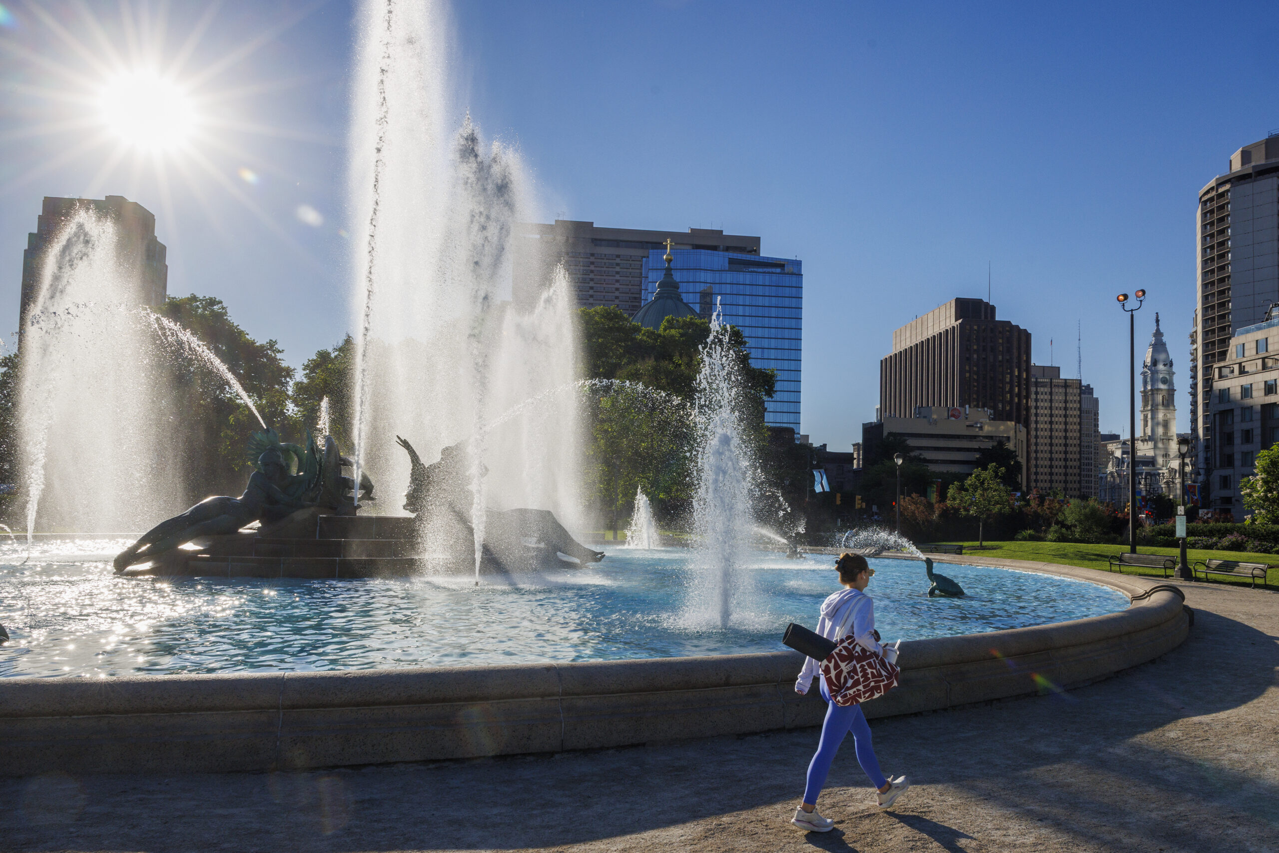
    Beating the heat in Love Park fountain, during a hot summer day in Philadelphia.

    How to cool down your house

    Use fans wisely. Fans can be one of the best ways to keep cool — but there are right and wrong ways to use them. The city, for example, says you should never use a fan with your windows closed, which can create an “oven effect” by circulating hot air inside your home.

    Fans can be more effective when the heat of the day is over, and you can open your windows to allow the cool night air in, Teel says. One of the best ways to create airflow is to put a box fan in an open window at one end of your space blowing air in, and another fan in a window blowing air out at the other end.

    And if your home has ceiling fans, make sure the blades are rotating counterclockwise during hot weather. That way, the fan will push air down into your space to create a breeze. (Many ceiling fans have a directional switch on their motor that controls the direction in which they spin.)

    There are more ways to keep your home cool.

    Think about when you use your appliances. The Pennsylvania Utility Commission, for example, says that you should wait to use any appliances that generate heat — such as dryers, dishwashers, and ovens — until after 7 p.m. to avoid heating up your home unnecessarily. Turning off other nonessential appliances and lights is also a good idea.

    Keep your blinds closed during the day. The sun, Teel says, can heat up your home faster, like a greenhouse. The PUC recommends spending time in rooms that are not hit with direct sunlight during the day.
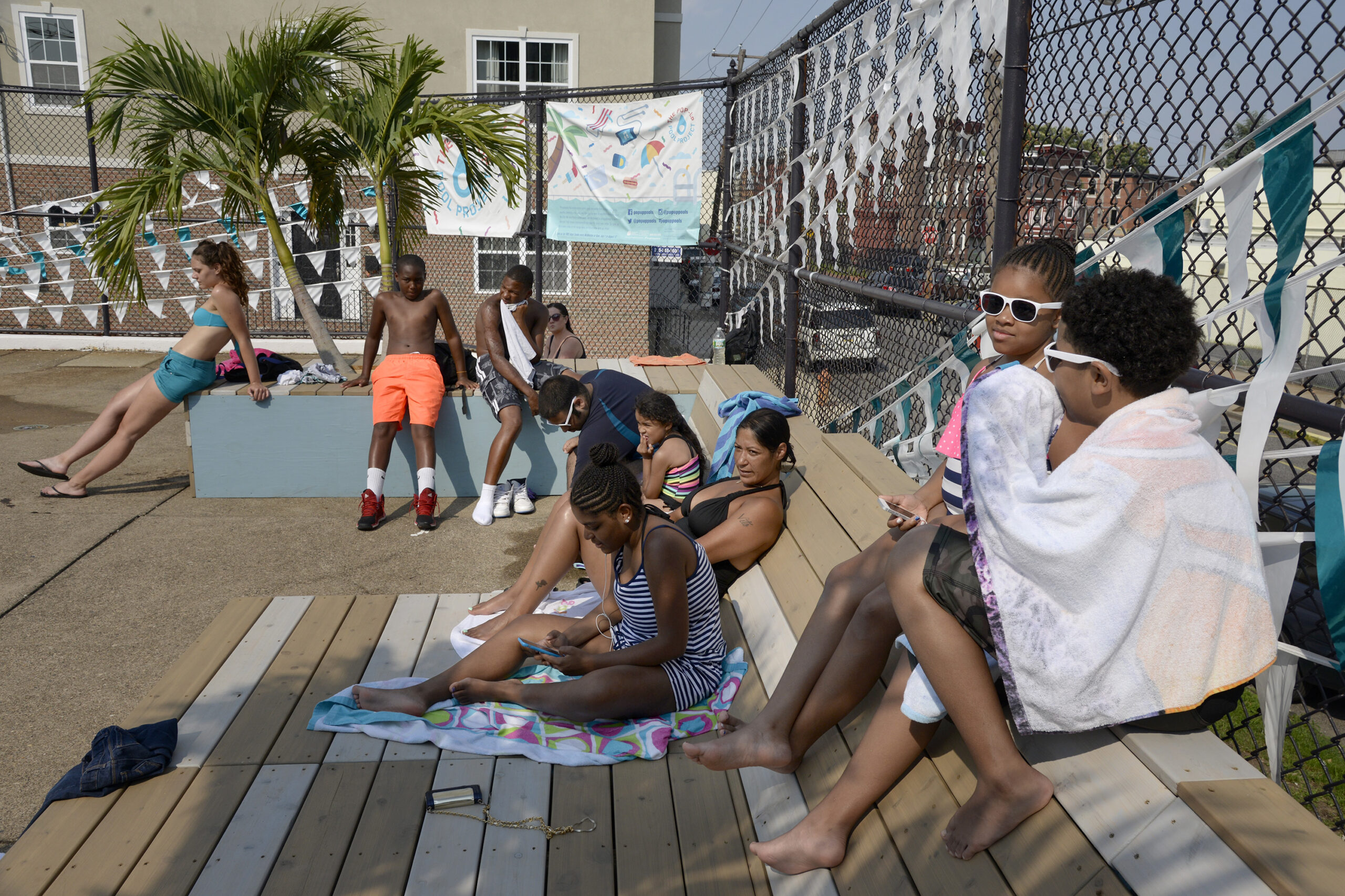
    City pools were closed in 2020, but will reopen for the 2021 summer.

    If you’re going to buy an AC

    Window air conditioners are much cheaper and more convenient to install than central air, and if you can afford one, it may be a good time. However, there are some things to consider when buying a window unit.

    As Consumer Reports points out, you will want to get an AC that is appropriately sized for the room you are trying to cool. If it’s too small, it will have trouble cooling the room; if it’s too big, it will cool the room quickly but leave too much moisture behind. A good rule of thumb is for the unit to have 20 BTUs (British Thermal Units) of cooling power for every square foot of space in the room.

    And if you need help with utility costs this summer, funding from the Low Income Home Energy Assistance Program is available for qualified residents, a city spokesperson says.

    Think about when you go out

    The health department recommends staying indoors as much as possible and limiting exercise during the hottest parts of the day, Mumma says. However, if you have to go out, stay in the shade as much as possible and wear sunscreen, a ventilated hat, and sunglasses.

    If you need to go shopping, Teel says, “look ahead in the week, and pick a cooler day. Avoid the time when you will be subjected to midday heat.”

    At home, Teel says, wear as little clothing as possible. When out and about, consider using light-colored, loose-fitting clothes made of breathable, light materials like cotton that let air to circulate around you.
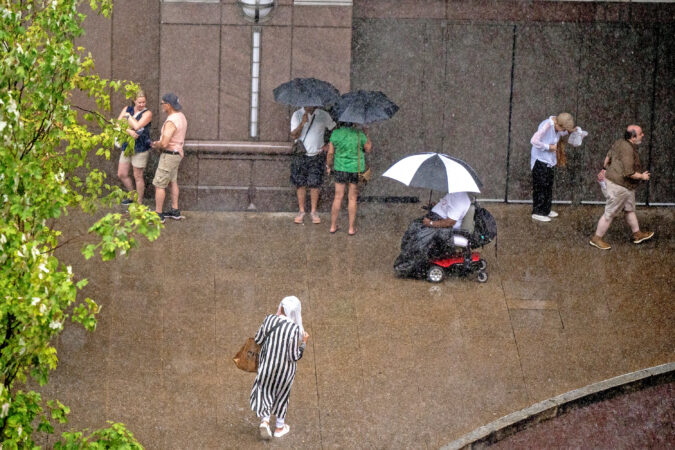
  • Near-record heat around 100 degrees is forecast in Philly this week, with July 4th storms possible

    Near-record heat around 100 degrees is forecast in Philly this week, with July 4th storms possible

    Coinciding with the climax of the nation’s 250th birthday celebration, the atmosphere may make a run at history this week as July gets off to a torrid start in much of the nation, with temperatures in Philly aiming toward 100 degrees both Thursday and Friday.

    And while the record-challenging extreme heat may ease some late in the weekend, atmospheric fireworks may threaten Fourth of July events.

    Conditions also favor tropically steamy nights when it may seem that even the fireflies are adding to the heat.

    The National Weather Service has issued an “excessive heat watch,“ in effect from Wednesday afternoon through the day Saturday, for heat indexes up to 110. The watch covers all of New Jersey, Delaware, and most of Pennsylvania.

    The Delaware Valley Regional Planning Council has posted a “code orange” air-quality alert for Tuesday, advising that pollution could affect people with respiratory and heart condtions.

    If the heat wave persists as forecast, the cumulative warmth could become dangerous for people with background medical conditions and older residents who live alone without air-conditioning in the city’s rowhouses.

    The official high in Philly reached 90 on Monday, and the forecasts are calling for highs in the 90s at least through the weekend.

    Both FIFA Fan Festival organizers and SEPTA are preparing for a pending inferno.

    The World Cup afternoon matches on Wednesday and Thursday won’t be shown at the FIFA Fan Festival, said Melissa Ferdinand, spokesperson for Philadelphia Soccer 2026, but the evening matches will be.

    Among other measures SEPTA will be reducing speeds on regional rails, lest extreme heat cause overhead wires to sag and tracks to buckle, said agency spokesperson Andrew Busch.

    The forecasts for the rest of the week

    Philly’s temperatures are likely to reach the low 90s on Tuesday, said John Feerick senior meteorologist with AccuWeather Inc., but that will be just a warm-up.

    Readings will soar well into the mid- and upper-90s on Wednesday, and likely crest at or above the century mark Thursday and Friday.

    “The humidity gets tropical, too,” he said.

    Some showers are possible Friday afternoon and evening and Saturday, the weather service says

    The so-called high-pressure heat dome is forecast to bake about two-thirds of the nation. Philadelphia will be near the eastern edge of the hot zone, and that can become a precarious place to be when the heat backs off.

    The outlook for the weekend and the ‘ring of fire’ potential

    Ring of fire” thunderstorms, which can generate prodigious amounts of rain, can form along the edges of heat-generating high-pressure systems, the weather service says. This far in advance — or even a day or even hours ahead of time — it isn’t possible to predict where and when such a storm or storms might develop.

    But in its forecast discussion Monday the weather service office in Mount Holly warned that “the environmental setup would be favorable for strong to severe thunderstorms.”

    “We’re seeing chances of thunderstorms,” said Paul Fitzsimmons, meteorologist with the weather service office in Mount Holly.

    Said Feerick, “I think there’s going to be some pretty intense storms. A lot of times, the heat waves come to an end with a bang. That’s a possibility next weekend for sure. The fireworks might be supplied by mother nature, and humans.”

    On Monday morning the weather service advised, “It is important to point out that any holiday weekend festivities could be impacted by thunderstorms — in addition to the extreme heat.”

    But, Fitzsimmons said, “By Sunday, might be getting a little bit cooler.”

    Warmer world, warmer Philly, although 100s have been less frequent

    Philadelphia’s temperature increases have tracked fairly close to the globe’s, which during the last 12 months were about 2 degrees Fahrenheit above the 20th century average. Local summers have become increasingly warmer.

    Yet 100-degree readings in Philadelphia have been relatively scarce this century. On average, temperatures of 100 or higher have occurred every four years in Philly, but when it reached 100 last summer, that was the first time in 13 years, the longest 100-less stretch on record.

    That could be mere randomness, or it could be related to increased mugginess, which can retard both daytime heating and nighttime cooling. Warmer air can hold more water vapor.

    In records dating to 1874, it has reached 100 a total of 62 times, according to an analysis of temperature data, in 40 different years. For whatever reasons, they have tended to come in clusters, including a five-year run of 100-degree readings that ended in 1955, and three years, ending in 2012.

    Said Busch, “I guess we could look forward to it next year.”

  • Philly’s weather forecast has drought-easing rains this weekend, then a heat wave through July 4

    Philly’s weather forecast has drought-easing rains this weekend, then a heat wave through July 4

    The region may be getting some significant drought relief during the weekend, and then it may be some time before it gets relief from heat that could persist through July Fourth.

    Rounds of showers — possible Friday night into Saturday evening when Croatia and Ghana meet in a World Cup match in South Philly — should be more widespread across the region than Monday’s scattershot downpours, said Brian Hurley, senior branch forecaster with the Weather Prediction Center, in College Park, Md.

    The severe storms likely would stay well to the south of Washington, D.C. However, “you always have potential” for a few thunderstorms, he said.

    Then, after two decent days Sunday and Monday, what is looking like the longest-lasting hot spell of the season to date is due to get underway Tuesday as temperatures head to the mid-90s.

    “That’s going to be main story,” said Hurley.

    The wild card for the duration would be the possibility of “ring of fire” thunderstorms, forecasters said, which might have temporary cooling effects. Those are storms that form along the boundaries of high-pressure heat domes, and Philly may be near the eastern edge.

    How hot might it get next week in Philly?

    Expect some tweaking during the next few days, but with “increasing confidence” the National Weather Service in Mount Holly was seeing heat indexes in the triple figures next week.

    Come Tuesday, daytime temperatures should be “off to the races,” said Bill Deger, senior meteorologist with AccuWeather Inc., which has forecast highs up to 98 degrees late in the workweek.

    It also will be steamy, and that will inhibit nighttime cooling as water vapor slows the escape of daytime warning. Readings are unlikely to get lower than the 70s Wednesday through at least next Saturday.

    The heat could lap into the following week, said Deger. “It shows some staying power,” he said.

    The region already has had 14 days with official temperatures of 90 or higher in 2026, about half the average total for an entire year.

    The potential for those ring-of-fire storms would be a wild card, said Hurley and Deger.

    Cooling thunderstorms can break heat waves, although they may come with a price. Ring-of-fire storms in July 2020 wrung out as much as 6 inches of rain that set off widespread flooding.

    As drought continues, the Philly region could use more rain

    Six inches might be a bit over the top, but the region could use more rain to ease the ongoing drought conditions.

    Some areas received close to 2 inches on Monday and Tuesday; however, the jackpot zones eluded areas where the dry conditions have been most intense — parts of South Jersey and Chester County.

    The entire region remained in some state of drought according to the interagency U.S. Drought Monitor, but Chester County was in “severe drought,” along with small pieces of Bucks and Delaware Counties. In “extreme drought” were all of Cape May County, other Jersey Shore towns, and areas bordering Delaware Bay.

    In an analysis based on a network of measuring stations throughout the counties, the weather service’s Middle Atlantic River Forecast Center calculated that Cape May County received less than a half inch of rain, and Cumberland and Salem Counties about 0.6 inches.

    In contrast, Burlington, Camden, and Gloucester Counties weighed in with well over an inch.

    On the other side of the river, Philly’s total was 1.28 inches, compared with 0.71 for Chesco, which, like New Jersey, is under a state-declared drought emergency.

    All this could change next week.

    .

  • Philly-area rain totals varied dramatically, and drought conditions survived the storms

    Philly-area rain totals varied dramatically, and drought conditions survived the storms

    The storms took down trees and wires, flooded roads, spoiled a World Cup party, and set off a deluge of smartphone panic alerts. But they evidently didn’t come close to erasing the rain deficits throughout the Philly region.

    Even with the additional light rains on Tuesday, bringing the two-day total to about 1.45 inches, officially Philadelphia’s rainfall for June still is slightly below normal, and this is after an extraordinary streak of 10 consecutive months of below-normal precipitation.

    And Monday’s storms exhibited a classic summer caprice. Areas of New Jersey and Chester County, both under state-declared drought emergencies, were all but stiffed, according to an analysis by the National Weather Service’s Middle Atlantic River Forecast Center. Northwestern Philadelphia and southeastern Montgomery County got as much as 2 inches.

    The weather service’s Mount Holly office reported that totals within counties varied radically. In Bucks County, for example, 1.8 inches was measured in Bristol and just over a half inch in Doylestown. Across the river, 2.4 inches fell upon Sewell, and about 0.75 in Monroe Township.

    “Some areas got it, some didn’t,” said Ben Casella, executive director of the New Jersey Farm Bureau. It can “rain here, but it may not rain on the other side of town,” he said.

    Not all of that Monday rain was beneficial, said Andrew Frankenfield, educator with the Penn State Agriculture extension in Montgomery County. Some of the water in those downpours on Monday rushed to the gutters and didn’t stop to soak into the soil.

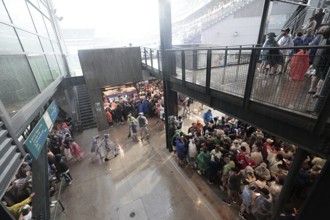
    And those cloudbursts certainly weren’t beneficial to people routed from the World Cup fan fest in Fairmount Park, or to some motorists. Numerous water rescues were reported in the Wyncote section of Cheltenham Township, Montgomery County, And the weather service noted several reports of flooded streets and rushing water up to a foot deep floating cars in Germantown.

    Tuesday’s gentle rains, Frankenfield said, were more beneficial to the plant life, which is only going to get thirstier as the summer progresses.

    Is more rain coming to the Philly region?

    Showers are possible Thursday, said Alex Staarmann, meteorologist with the National Weather Service in Mount Holly, with a better shot Friday night and Saturday.

    However, these may again be lottery-ball situations, something with which farmers are well acquainted.

    Generally throughout the region through Monday, precipitation was running about 75% of normal, on average about 5 inches below normal, according to the river center, which bases its surveys on several measuring stations in each county.

    The latest interagency U.S. Drought Monitor map had most of the region in “moderate drought,” but Cape May County and areas of New Jersey near Delaware Bay are in “extreme drought.” Those regions were all but shut out from the Monday downpours.

    They evidently fared a bit better on Tuesday, with the Millville airport reporting about a third of an inch, and a half inch measured in Sea Isle City.

    While the rains were welcome, the drought anxieties persist, Casella said.

    “As we turn the calendar into July, the crops are going to need more moisture,” Frankenfield said.

    “We certainly need more” rain, he said. “We can’t make it up in a week, we can’t make it up in a month. We’re concerned, but not alarmed.”

  • Storms move through the Philly area, bringing heavy rains, tornado warnings, and flooding

    Storms move through the Philly area, bringing heavy rains, tornado warnings, and flooding

    After 10 months of precipitation deficits, the Philadelphia region was due for some drought relief — but maybe not this much relief, this fast.

    Powerful thunderstorms that set off tornado and severe-storm warnings and waterfall-like downpours arrived in the region Monday just in time for the peak afternoon commute and the France vs. Iraq World Cup match in South Philly.

    And while the tornado warnings and the worst of the storms had backed off by nightfall, the rains were reluctant to give it up, and the National Weather Service warned that more heavy showers are possible Tuesday.

    “It’s been a while since we had rains like this,” said Patrick O’Hara, a meteorologist at the National Weather Service Office in Mount Holly, which issued multiple flood warnings into the evening. Flooding occurred on the Schuylkill Expressway near Gladwyne, and several water rescues were reported in Cheltenham Township.

    Frankford Creek in Philadelphia rose well into moderate flood stage.

    The agency also had issued two tornado warnings for parts of Chester, Delaware, and Montgomery Counties after Doppler radar had detected radar signatures.

    Multiple uprooted trees were reported in the Valley Forge area, officials said. Several reports of downed wires and trees branches and hailstones came from across the region from Chester County and South Jersey.

    The timing could have been worse, but maybe not much worse for World Cup participants and the nearly 70,000 fans who came to watch the rain-interrupted match.

    A severe-storm warning for Philly popped up just as the World Cup match between France and Iraq in South Philly was underway. That was quickly followed by one for Southwest Philadelphia, parts of Delco, and South Jersey.

    The weather service’s flash flood watch remained in effect until 6 a.m. Tuesday.

    On Monday afternoon an early arriving strong storm passed through parts of Philadelphia and Burlington County, snapping trees and taking down “multiple branches” in the Holmesburg section of the city, the weather service said.

    That was followed by a potent storm that generated strong winds and torrential rains north and west of the city and then even stronger storms and flooding downpours throughout the region.

    Will the rains end the Philly region’s drought conditions?

    Not likely. Life is not fair, and neither is summer rain, which by its nature is capricious.

    About 1.2 inches of rain was measured at Philadelphia International Airport on Monday, with over an inch of that falling between 6 p.m. and 8 p.m.

    The rains weren’t evenly distributed across the region, but the Philly total is of some significance: It brought the city’s total close to the normal for June.

    Based on the forecasts of the potential for more substantial rains Tuesday, Phllly stands to break an impressive streak of 10 consecutive months of below-normal precipitation.

    Most of the region is in “moderate drought” according to the inter-agency U.S. Drought Monitor, and Cape May County, most of Delaware, and New Jersey areas along the Delaware Bay are in “extreme drought.”

    State-declared drought emergencies are in effect for New Jersey and Chester County.

    It is unclear how helpful Monday’s rains were in terms of dousing the drought condtions.

    Downpours aren’t known for their attention spans, and rains can run off rapidly.

    “If the rain doesn’t penetrate the soil, it doesn’t help,” said O’Hara, “Ideally, it would soak into the ground over a couple-day period. That would really help.”

  • Storms could interrupt Philly’s France-Iraq World Cup match. Here’s the forecast and FIFA’s rules.

    Storms could interrupt Philly’s France-Iraq World Cup match. Here’s the forecast and FIFA’s rules.

    Thunderstorms are expected to make their way through the Philadelphia region later Monday evening, potentially interrupting the World Cup match between France and Iraq (5 p.m, Fox).

    The strongest storms are forecast to move in beginning around 4 p.m., bringing with them heavy rain, wind gusts approaching 60 mph, and the potential for an isolated tornado.

    “Storms will certainly have lightning with them,” said Zack Cooper, a meteorologist at the National Weather Service’s Mount Holly station.

    An inch or two of rain could fall in and around the city, Cooper said, but depending on the storm’s severity that could all come in an hour or less, leading to flash flooding. Philadelphia and the surrounding region are under a flood watch.

    “Exactly how much would fall on a given thunderstorm is impossible to know, but we could certainly see some pretty high rain rates in these storms tonight,” Cooper said.

    For those going to the game, umbrellas aren’t allowed in the stadium, but you can bring a poncho.

    It might not be ideal for fans heading to Monday’s game, but Philadelphia could use the rain. The city has gone 10 straight months with below-normal precipitation, and Chester Country is among four in Pennsylvania under a drought warning.

    What are FIFA’s rules for rain and thunderstorms?

    FIFA will pause play if there is a lightning strike within eight miles of the stadium. The match will remain paused for 30 minutes, with any subsequent lightning strikes resetting the clock.

    Six Club World Cup matches were delayed by severe weather last summer. A match between Chelsea and Benfica at Bank of America Stadium in Charlotte, N.C., was delayed multiple times due to lightning strikes, taking four hours and 38 minutes to finish.

    The FIFA Fan Fest at Lemon Hill Park in Fairmount would close if lightning is detected within an eight-mile radius. Fans would need to exit the grounds and move to a safe location, and could re-enter after 30 minutes if no additional lightning is detected.

    Festivities were interrupted Thursday evening, when high winds prompted the event to close early.

  • Strong storms and downpours Monday could affect Philly’s next World Cup match

    After 10 months of precipitation deficits, the region is expected to experience severe storms and much-needed rain on Monday — unfortunately, the worst might coincide with the timing of the France vs. Iraq World Cup match in South Philly.

    The strongest could arrive around the scheduled start of the match, at 5 p.m., said Brian Hurley, senior branch meteorologist with the federal Weather Prediction Center in College Park, Md.

    Given how daytime heating can add volatility to the atmosphere, with severe-thunderstorm threats in the Mid-Atlantic region, he said, in the late afternoon “we’re always asking for it.”

    The Storm Prediction Center in Norman, Okla., which issues those severe storm watches, listed a 2% chance of tornadoes, and an “isolated” twister can’t be ruled out, said Nick Guzzo, meteorologist with the National Weather Service in Mount Holly.

    The storm center listed a 15% chance of damaging straight-line winds with gusts approaching 60 mph.

    With the anticipated moisture capacity of the atmosphere on Monday, localized downpours that could wring up to 2 inches of rain in a hurry could set off localized flooding.

    “Not everyone will get them,” said Hurley.

    He said a round of heavy showers is likely in the late afternoon or early evening, and then it’s possible that rains will shut off, with even an outside shot at a rainbow.

    But more rain is likely later at night and during the overnight hours.

    Overall, forecasters said, just about every area of the region should get a half-inch of rain.

    Officially, Philadelphia has had 10 consecutive months of below-normal precipitation. All of New Jersey and Chester County are under state-declared “drought emergencies,” although conditions have been improving.

    Most of the rest of the region is in “moderate drought,” according to the interagency U.S. Drought Monitor.

    On the plus side, no more extreme heat is in the forecast, with highs topping out in the 80s through next Sunday.

  • Summer arrives officially Sunday in Philly, with El Niño, drought, and the moon as major players

    Summer arrives officially Sunday in Philly, with El Niño, drought, and the moon as major players

    Given the atmosphere’s impatience, it would be understandable if some folks believe that the summer of 2026 began weeks ago.

    But officially, the astronomical summer does not start until 4:24 a.m. Sunday, the instant of the solstice, when the sun beams its most direct light on the Tropic of Cancer. (That’s the one that bisects Mexico.)

    Perhaps the pleasant temperatures this weekend are an overdue solstice gift to the region.

    Officially, on 14 days this year, the temperature has reached at least 90 degrees at Philadelphia International Airport. While not a record — this happened 21 times before the 1991 summer solstice — that is a total more appropriate to midsummer. The annual average is about 30, and usually this kind of heat doesn’t get a jump start in mid-April.

    Is it going to get hot again?

    A woman walks past Swann Memorial Fountain as the sun rises last month.

    Are polar bears white?

    At least three veteran seasonal forecasters have commented that they expect the burgeoning El Niño event to work against punitive hot spells in the region.

    During El Niño, sea-surface temperatures remain above normal in the tropical Pacific for several months, agitating the overlying air and affecting weather across the globe. This one may be among the strongest and is forecast to mature during the summer, earlier than usual.

    During six early-developing strong El Niños, summer temperatures in Philadelphia were near or below average.

    However, the scientists at the government’s Climate Prediction Center evidently are not buying it. In both the July and the July 1-through Aug. 31 outlooks posted Thursday, they saw the odds favoring above-normal temperatures.

    On average Philly has a combined 20 days of 90-degree highs in July, when the Earth is the farthest it gets from the sun, and August. (Along with a September bonus of two more.)

    How come it’s warmer, if we’re farther from the sun?

    On average the Earth is about 93 million miles from the sun, but since its orbit is an imperfect circle the distance varies by roughly 3 million miles.

    At 1 p.m. on July 6 our planet will be 94.5 million miles from the sun, by EarthSky’s calculation, its farthest distance of the year. It makes its annual closest approach in January, which is why winter in the Northern Hemisphere is the shortest season; the gravitational bump speeds up the trip, and February gets shortened.

    The seasonal weather rhythms are about the Earth’s axial tilt, not distance from the sun, and the planet takes its time responding to the changes in solar energy. Just as January is colder than December on average, July is more than 5 degrees warmer in Philly than June on average. Just how warm it gets the rest of this summer may have a lot to do with how much drier it gets.

    Will the drought conditions ever end?

    They always have, but this has been quite an extraordinary run, even if the plant life has managed to avoid major distress.

    The entire region, save for extreme northeastern Bucks County, is in a state of “severe drought,” according to the U.S. Drought Monitor, with Cape May County in “extreme drought.”

    The promised rain to start the workweek should help, but Philadelphia has experienced 10 consecutive months of below-normal precipitation, a rarity in an area in such proximity to bodies of water that are sources of rainfall. All of New Jersey and Chester County remain under drought emergencies.

    Dryness can promote heating, since the sun does not have to divert energy evaporating water.

    However, unusual coolness also can accompany dryness, said Sarah Johnson, warning coordination meteorologist at the National Weather Service office in Mount Holly. Having lived in North Dakota for 20 years, she knows her dry air.

    A lack of moisture can be a boon for cooler nights. Water vapor in the air inhibits nighttime cooling by blocking heat from escaping into the atmosphere.

    It also happens that less vapor in the air is ideal for sky-watching, and that could come in handy in August.

    This could be a big year for the Perseids

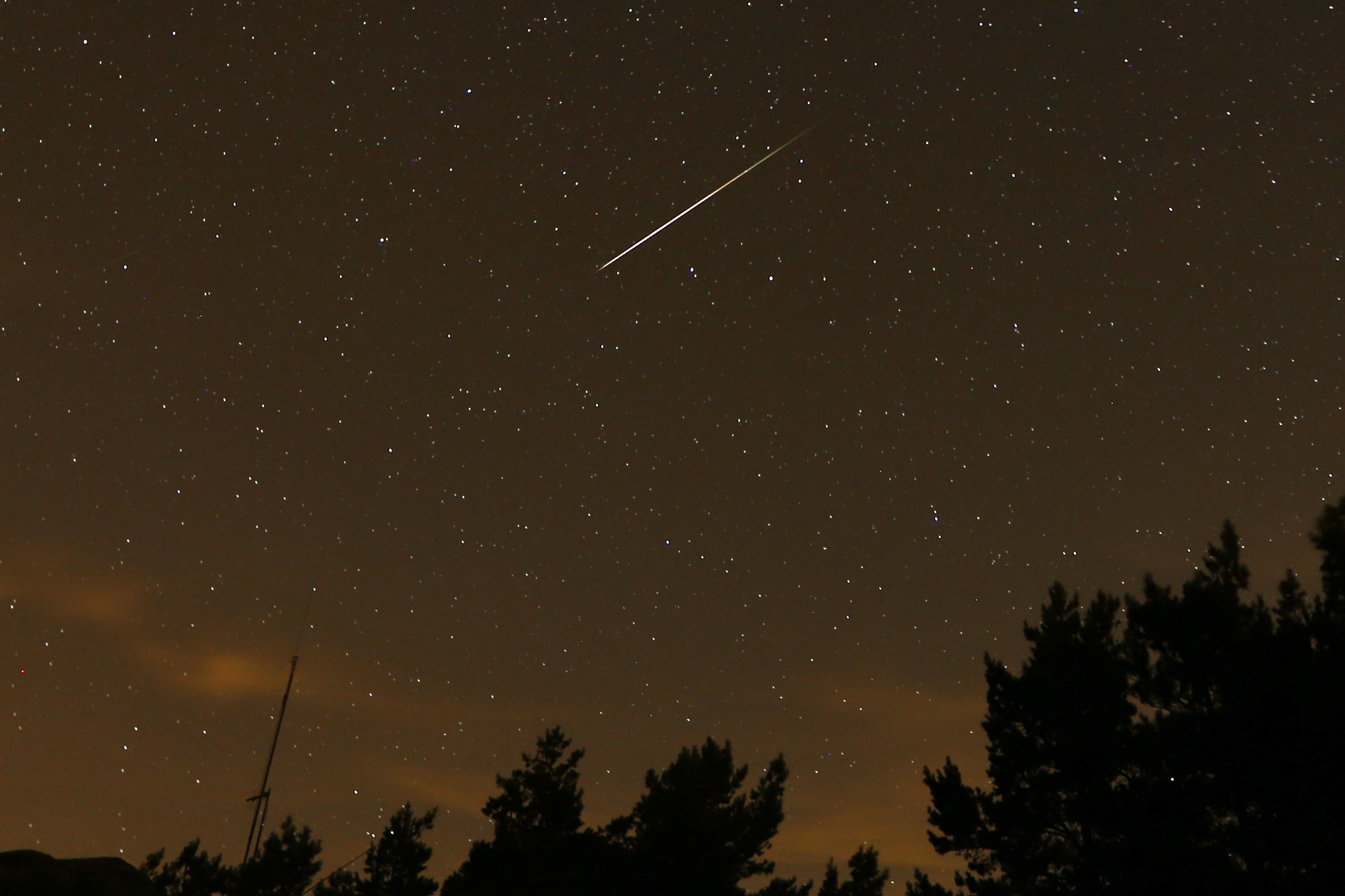
    In this long exposure photo, a Perseid meteor streaks above Madrid.

    Last year, you may recall that the moon showed its big face during the peak of the annual Perseid meteor showers, the most popular of the year.

    This time around, the moon is getting out of the way, and will be in its “new” phase during the peak early mornings of Aug. 12 and 13.

    While the Geminids, which occur in December, are considered the most prolific showers of the year, according to the American Meteor Society, they are not as popular as the Perseids: People tend to prefer August nights to December’s.

    The Perseids are so named because the cometic detritus that is ignited by the atmosphere appears to radiate from the constellation Perseus. In the early-morning hours, that typically is low in the northern sky.

    Under ideal conditions — ultra-dark, light-pollution free skies — as many as 90 meteors an hour might be visible, EarthSky says.

    But the moon will be the star in late August

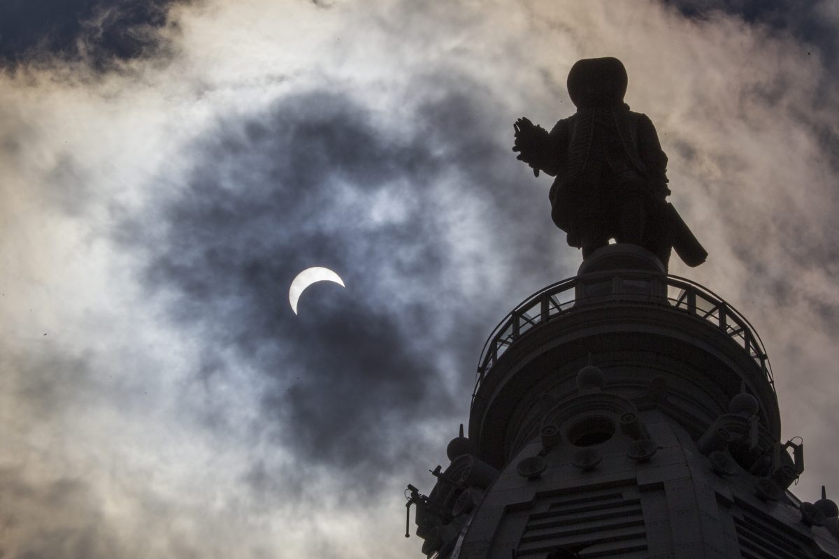
    Billy Penn waves at the moon during a lunar eclipse.

    Two weeks after the Perseid peak, Philadelphia and most of the rest of the Western Hemisphere will be treated to a lunar eclipse in which just about all of the moon will be in shadow.

    The show begins at 9:24 p.m. Aug. 28, and more than 90% of the moon will be obscured by Earth’s shadow three hours later. It will be all over around 4 a.m.

    Chances are excellent that the region will still be needing rain, but may it choose another night.

  • Philly has been seeing huge temperature swings within 24 hours. Here’s what’s going on.

    Philly has been seeing huge temperature swings within 24 hours. Here’s what’s going on.

    Like so many humans, perhaps the atmosphere is having issues adjusting to the time change. At the very least, it’s having trouble keeping track of the seasons.

    After making a run at 70 degrees on a stormy Monday, on Tuesday it will be welcome back to hats and gloves in Philly.

    Temperatures were forecast to fall to freezing by daybreak, which would be a drop of 35 to 40 degrees in less than 24 hours. In some years, that would rank among the biggest annual day-to-day temperature drops.

    But this comes less than a week after the official readings plummeted from 83 degrees, normal for mid-June, to 35 in 24 hours, one of the largest day-to-day temperature swings in Philly’s climate record.

    In official record-keeping dating to 1874 — covering more than 55,000 days — the Wednesday-to-Thursday shift would rank in the top 20 for day-to-day temperature tumbles, according to an Inquirer analysis.

    “It’s really remarkable,” said Eric Balaban, pulmonary and critical care fellow at the Temple Lung Center.

    He and other experts say that aside from what it may do to the morale of spring’s ardent fans, the thermal roller-coaster and the accompanying winds likely are having effects on health, particularly for people with respiratory cardiovascular conditions.

    And we probably should expect to see the dramatic swings to continue for a while, said Matt Benz, senior meteorologist with AccuWeather Inc.

    “I’d be surprised if we didn’t, given the pattern we’ve being going through,” Benz said.

    Why the temperature has been so jumpy lately in Philly

    Philadelphia and other areas in the mid-latitudes are prone to become battlegrounds this time of year between the stubborn winter and the impatient spring.

    March is notorious for temperature swings as cold air masses from the north encounter encroaching warmth and storms tend to form along the borders of the skirmishes.

    One reason the contrasts have been especially vigorous this year is the obvious. “After this hard winter, that’s to be expected,” said Ray Martin, a lead meteorologist at the National Weather Service. We haven’t had many of those lately.

    But that 48-degree drop last week belongs in an elite category. It ranked No. 18 among day-to-day temperature falls, based on the available records. The all-timer was the 57-degree drop from March 28 to 29 in 1921, with several 50-degree drops appearing in the record.

    Whenever they occur, the radical shifts can have health consequences, according to medical experts and a variety of studies.

    The possible health effects of rapid temperature changes

    The temperature changes typically are set off by potent fronts, such as the one that crashed through the region on Monday, and they generate powerful winds.

    By stirring particulate matter and transporting early tree pollens, the winds present a risk to those with respiratory conditions and allergies, said Manav N. Segal, with the Chestnut Hill Allergy & Asthma practice.

    “We are seeing an increase in call volume already because of patients’ spring allergy symptoms,” he said Monday. And conditions this week are just a prequel: The allergy season will pick up steam once the weather turns more consistently warmer and the allergy season intensifies, he said.

    Said Balaban, “People who have preexsiting conditions are simply at higher risk.”

    Rapid changes in temperature and levels of atmospheric moisture with frontal passages can irritate the airways and increase airway inflammation, said Joann Martin, nurse with Guardian Nurses Healthcare Advocates in Flourtown, Montgomery County. Studies have shown associations between temperature variability and increased asthma-related hospital visits.

    Changes in temperature, humidity, and barometric pressure — a measure of the weight of the air that falls as fronts approach and rises after they pass — are “recognized triggers for migraine and severe headaches.”

    In addition, “Sudden temperature shifts can affect blood pressure, vascular tone, and cardiac workload,” Martin said, increasing the changes for heart attacks and strokes.

    For most people, however, after a long winter, the temperature drops are a source of frustration over the delay of a much-anticipated spring.

    More temperature swings are likely in coming weeks in the Philly region

    For now, at least, it appears that the region’s cherry blossoms should be safe, even though temperatures Tuesday morning were expected to come close to freezing in Philly and may fall into the upper 20s Wednesday and Thursday mornings.

    Daytime highs won’t be much higher than 40 Tuesday and Wednesday, before a modest warmup begins.

    It likely would take a serious late-March or early-April freeze to damage the blossoms, said Sandi Polyakov, head gardener for the Japan America Society of Greater Philadelphia. He expects a bloom peak in early April.

    However, the temperature seesaw probably isn’t over, said AccuWeather’s Benz.

    “There’s still a lot of cold air left over in Canada,” he said, ”and a lot of warmth coming up from the Gulf.”

    He noted that Monday’s storm was dropping a healthy 20 to 30 inches of snow in the western Great Lakes.

    “Until we get out of that type of stuff,” he said, “the cold air doesn’t have to go very far to get here.”

  • Blizzard conditions were confirmed at the Jersey Shore and southern Delaware

    Blizzard conditions were confirmed at the Jersey Shore and southern Delaware

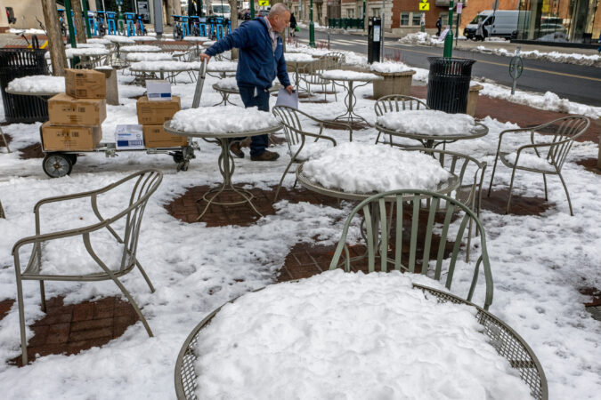
    Philadelphia and environs didn’t quite make the grade, but areas along the Jersey Shore and in southern Delaware did experience blizzard conditions early on the morning of Feb. 23, the National Weather Service reported Friday.

    Blizzard criteria — sustained winds or frequent gusts to 35 mph, with falling and/or blowing snow reducing visibility to less than a quarter mile for three or more continuous hours — were met along about a 20- to 25-mile-wide corridor in New Jersey from Monmouth to Cape May, said Alex Staarmann, a meteorologist in the Mount Holly office who was part of the investigative team.

    Those conditions also were observed in Sussex County, Del.

    In addition to direct instrument observations, Staarmann said, the weather service relied on available visual evidence from photographs and videos. “They’re an element of analysis as well,” he said.

    As for why Philadelphia came up short, Staarmann said “the visibility certainly was low enough at times, but the winds weren’t quite as strong as we were forecasting farther inland.”

    Among the locations where blizzard conditions were preliminarily confirmed were the extreme eastern portion of Burlington County, Atlantic City, Long Beach Island, and all the resort towns in Cape May County.

    The weather service had posted a blizzard warning for the entire state of New Jersey, all of Delaware, and for Philly, Delaware County, and nearby portions of Bucks, Chester, and Montgomery Counties.

    However, conditions were not quite so extreme to the north and west of the city, nor were the snow totals quite so robust.

    Blizzard or not, by any other name it was a disruptive storm that generated 20 inches of snow in parts of the region, and 14 inches at Philadelphia International Airport, No. 16 on the all-time snow list that dates to the winter of 1884-85.