Coinciding with the expected behavior of the atmosphere over Philly, the clocks are taking a major leap into spring this weekend, this time around as early as it ever happens.
On Sunday the clocks will skip right over 2 a.m. and proceed to 3 a.m. as daylight saving time begins and will continue throughNov. 1.
The sun won’t set before 7 p.m. until Sept. 22.
Congratulations to those who prefer eating dinner before dark or savoring an extra dose of daylight after work. If you dread being shorted an hour on a precious weekend and hold that DST actually stands for “delayed sunrise time,” we offer a modest consolation prize.
The sun appears to be setting on the all-DST-all-the-time movement.
Recall that the U.S. Senate unanimously (at least technically) passed the 2022 iteration of the Sunshine Protection Act that would have ditched the switch and installed daylight saving time as the year-round system. U.S. Rep. Brendan Boyle (D., Pa.) said at the time “the idea definitely has legs,” and isn’t that what they said about the Eagles’ offense?
It’s as if the campaign has gone back to bed.
The 2022 bill’s sponsor, Marco Rubio, at the time a senator representing the Sunshine State, is now the secretary of state and appears to have bigger fish to fry. His immediate supervisor, President Donald Trump, who at different timesadvocated for year-round standard and year-round DST, has lost interest.
So, evidently, have legions of state lawmakers around the country.
The number of bills calling for year-round daylight saving time has dropped dramatically, and this year they are far outnumbered by bills advocating year-round standard time, based on a survey of data compiled by the National Conference of State Legislatures.
That said, the discussion may never die. The Sunshine Protection Act was reintroduced in the Senate last year. Sen. Rick Scott (R., Fla.) says he’s giving it another shot. But expect 100% chance that clocks go back in the fall; the bill remains in committee.
To honor a day that so many look forward to, and so many others dread, we offer a few numbers for consideration, starting with a visit to Marquette, Mich.
79: Minutes of difference in sunrise times
Sunrise Monday in Marquette doesn’t occur until 8:11 a.m., compared with 6:52 a.m. in Lubec, Maine. That is a 79-minute difference — in the same time zone. Lubec is on the shores of the Atlantic. Marquette is on the shores of Lake Superior in Michigan’s Upper Peninsula.
In Marquette, the sun’s reluctance to get out of bed may be understandable. The city already has had close to 210 inches of snow (about 10 Philly winters’ worth) this season. “Even by our standards, this has been a pretty remarkable winter,” said Chris Burling, a meteorologist with the National Weather Service in Marquette.
As with the snow, the locals appear to accept the late sunrises with a measure of equanimity. “I think there’s some grumbling for a couple days,” said Burling, “but otherwise, it’s just …that’s how it is.”
Sleep experts advise that people in the westerly longitudes of time zones stand to suffer more than their counterparts to the east. In Marquette, twilight won’t end until close to 10:30 p.m. around the summer solstice. That can be disruptive to bodily sleep rhythms, experts say, by depriving bodies of melatonin, the sleep hormone that the body produces in the dark.
The Michigan legislature is among those that have considered a bill for year-round standard time. Federal law permits states to go all-standard, but all-daylight saving time would require Congress to pass a law to allow it.
800: Pro-daylight saving time bills
Eight hundred bills have been introduced in state legislatures since 2005 to enact year-round daylight saving time, according to Tom Klein, policy associate with the legislatures conference.
93: Time-change bills in 2025
There were 93 bills introduced in 2025 in favor of either year-round Daylight Saving Time or standard time.
35: States
Thirty-five states considered such bills in 2025, about evenly split between all-DST and all-standard, by the conference’s count.
21: Bills this year
In 2026, 21 bills are under consideration, with 16 calling for year-round standard time and five favoring all-Daylight Saving Time.
1,454: Days
It’s been 1,454days since the U.S. Senate approved the Sunshine Protection Act.
Just 238days until we fall backward again. Incidentally, since Daylight Saving Time begins on the second Sunday in March, this is the earliest it could happen. Nov. 1 is the earliest possible starting date for standard time.
Innumerable
Projected number of days before the clock-switch debate ends.
Temperatures in the Philly region may not visit freezing again until the end of next week, with a run of 70-degree days possible in the interim. And after some substantial winter napping, the region’s plant life is going to notice.
They allow that while it wasn’t exactly a vacation, spending five weeks and change under a glacier and snowpacks hasn’t been all bad for the plant life.
But as the great thaw accelerates, they have cautionary words for home gardeners: Watch your step.
And meteorologists warn that if you expect the thaw to be linear, you clearly have wandered into the wrong part of the country. Winter and spring are still in a nasty turf war that can turn ugly in March in the Northeast.
Five weeks under the covers had benefits for Philly’s plant life
Officially, Philadelphia has logged 36 days of snow cover of at least one inch, including 23 consecutive days after the Jan. 25 snow-and-ice fest. The timing of that snowpack was fortuitous in that it “insulated the ground, protecting perennials, grasses, and marginally hardy bulbs” from the Arctic freezes that followed, said Lisa Roper, horticulturalist at Chanticleer Garden in Wayne.
Horticulturist Lisa Roper tends to echinacea Tennesseensis at the Gravel Garden at Chanticleer in this file photo. She says the snow offered a measure of protection for the plants.
Said Sky Deswert, garden educator with the Norris Square Neighborhood Project in Philly, “Without the snow, there is a greater risk that dormant plants and roots will suffer from the cold.”
The snow was beneficial “to things like blue hydrangeas, insulating the stems from the cold,” said Bill Cullina, executive director of the University of Pennsylvania’s Morris Arboretum & Gardens in Chestnut Hill.
Overall, said Roger Davis, a landscape manager at Longwood Gardens in Chester County, “Snow cover does not typically cause any problems for most plants in our home gardens.”
Unfortunately, it also typically doesn’t cause problems for voles, those plant-nibbling so-called field mice that evidently had a field day.
But the winter also offered significant challenges
“Voles have been active underground, eating roots and even the crowns of grasses and perennials,” said Cullina. Snow has given voles ideal cover from an impressive lists of predators, including owls, foxes, raccoons, and cats.
They can kill shrubs and small trees by chewing at ground level, said Chanticleer’s Roper.
Deer also have been nuisances. “Heavy snow cover makes it difficult for deer to find food,” she said. “The deer will start to eat plants they typically leave alone.”
At Morris Arboretum, Cullina said, “They have been browsing needled evergreens that they normally ignore.”
Bill Cullina shown here in this file photo in front of a a red oak tree at the Morris Arboretum. Beware of “mud time,” he advises.
He added that frost-heaving, in which soil expands and contracts with fluctuating temperatures, is back after taking off much of this century. “This can force recently planted perennials and even shrubs as well as bulbs out of the ground.”
Said Roper, “Keep your eye out for plants pushed out of the ground; you can stick them back in if you see them.”
Some of the broad-leaved evergreens, such as rhododendron and hollies, may have suffered from “the combined effects of sun reflecting off the snow and frozen ground that prevents water uptake,” said Cullina. That can lead to leaf burn and defoliation.
“Not much you can do at this point except wait until the plants leaf out …and then prune off any dead branches,” he said.
Shrubs planted near the eaves of houses may have suffered from another hazard — rooftop snow, said Theresa Smith, senior vice president of NaturLawn, a national lawn service company with several outlets in the region. “When you have snow falling off in heavy pieces, it’s definitely going to damage some of those softer plants.”
And beware of salt damage on lawns, particularly near well-salted roads and driveways, said Smith. Salt can dehydrate vegetation. She also warned that prolonged snow cover can yield bumper crops of “snow mold,” a fungus that thrives in cold, moist conditions.
If you see those unsightly straw-colored mold patches, rake them out and put down grass seed on the bare spots, Roper said.
‘Mud season’ has arrived in Philly. Watch where you step.
The ground has assumed a certain spongelike quality now that most of the snow is melted, and it’s going to take some time to wring out the sponge.
Cullina said that reminiscent of his native Maine, it “feels like Philly is getting a little taste of mud season this year.”
Smith strongly advises gardeners to keep off the mud as much as possible. “You don’t want to add to the compaction that’s already there,” she said.
The tighter the soil gets, said Longwood’s Davis, the more it reduces the air spaces. “Foot traffic has more effect on wet soil than you might think.”
And beware the moods of March
Smith cautions against yielding to an agricultural spring fever, despite the promising temperature forecast for the next several days. Starting Sunday, the high temperatures could reach 70 degrees on four or five days, said Bob Larsen, a senior meteorologist with AccuWeather Inc.
Smith votes for harnessing planting ambitions during March, a notorious transitional month when the aggressive warm air masses clash with the retreating winter.
Her birthday is in March, and she recalls receiving snow as a not necessarily welcome birthday present more than once.
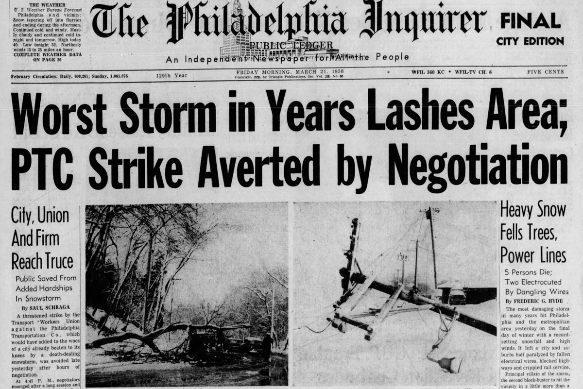
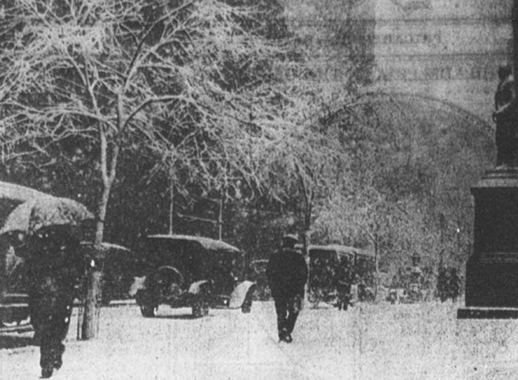
Philadelphia’s last verified blizzard occurred in March, in 1993; in 1958 over 50 inches of snow fell upon Morgantown, Chester County, during the so-called equinox storm, and 20 inches fell in Philly on April 1, 1915.
Our coverage of the 1958 Equinox Storm.
“Home gardeners just need to relax a little bit,” she said, “and wait for the weather patterns to become more consistent.”
Residents of Syracuse, N.Y. — America’s snowiest city — once barraged a service hotline with street neglect complaints during blizzards, even if plows had passed two hours earlier but the work was hidden by fresh snow.
Now public trust seems to be rising as Syracuse and other cities across the U.S. integrate upgrades such as video monitoring, GPS mapping and artificial intelligence into snow operations that once relied almost entirely on manual planning.
Syracuse was one of the first to revamp the way it deploys its snowplows, and complaint calls have dropped by 30% under the new system, said Conor Muldoon, the city’s chief innovation officer.
“People will look out their window and say, ‘Hey, you guys are doing a terrible job,’” Muldoon said. “And we can point to a public map and say, ‘Here’s all the breadcrumbs for when that plow was there.’”
Snowier than usual in the U.S. snow capital
Each winter, Syracuse averages 126 inches (3.2 meters) of snow, more than any other U.S. city of at least 100,000 people. Even before the blizzard that pounded the Northeast last week, the city had already surpassed its typical average due to a record 2-foot (60-centimeter) accumulation on one day in late December.
With a goal of clearing every street within 24 hours after a storm, Syracuse partnered in 2021 with San Francisco-based Samsara to put live GPS tracking and dashcams on city fleet vehicles including snowplows. Integrated with GIS mapping software, the system allows officials to monitor live video and plow locations in real time.
While residents can’t access live feeds, they can view a public map that updates every 5 minutes to show which roads have been cleared.
Samsara started incorporating AI into its products in 2019. This winter, for the first time, it has provided customers with footage from other cameras within its large network, helping officials better understand conditions on a street even when no worker is there.
Kiren Sekar, the company’s chief product officer, cited an example of needing to dispatch the closest plow for a snow emergency in Plainwell, Michigan.
“Rather than having to sift through a list of vehicles, it can actually figure this out: ‘We’ve got Trevor in vehicle 203, 15 minutes away,’” Sekar said.
New York City’s approach
Samsara partners with communities of various sizes to upgrade their snowplow systems, but the nation’s largest city — New York City — developed its own.
Its tracking program known as BladeRunner monitors snow removal equipment (including garbage trucks with plows attached) while a human in a command center — not AI — analyzes the GPS data. The city is exploring AI in the future to process the thousands of 311 calls and online service requests it can get in a single day.
The other way the big city’s approach differs from its upstate neighbor of Syracuse is that each plow runs a specific route during storms, ensuring main and side streets get essentially the same treatment.
“So what it does is allow equity,” said Joshua Goodman, deputy commissioner at the city’s Department of Sanitation.
Typically 99% of the city’s roads will be plowed within the first four hours after a moderate snowfall under ideal conditions, but Goodman said it didn’t quite meet that mark during last week’s historic storm.
Cutting costs and insurance claims
With U.S. cities and states spending upward of $4 billion each year on snow operations, the new technology also helps assure roads aren’t overplowed or oversalted, which can cause environmental damage.
Fayetteville, Ark., launched a public-facing snow removal map for the first time this winter. It reported improvements in plowing time, labor costs and fuel savings, despite enduring about double the snow from a year ago.
“This is the first year some roads have ever been treated or plowed, and that goes right back to being able to see where we need to go and if we’ve been there,” said Ross Jackson Jr., the city’s fleet operations manager.
The township of Edison, N.J., reduced its spending on salt and brine by 35% and its insurance payouts by 60%, thanks to video that helped prove plow drivers usually weren’t at fault when the vehicles collided with another motorist’s car.
Video installed on snowplows in Iowa helped demonstrate that all but one of 12 snowplow accidents in a single day were the other driver’s fault, said Craig Bargfrede, the state’s winter operations administrator.
“How can you not see this big orange truck with flashing lights ahead of you?” he said. “Boom, they just drive right into us.”
Kalamazoo County was the first county in Michigan to employ turn-by-turn navigation to dispatch snowplows during a storm. Rusty McClain, assistant general superintendent of its road commission, called it a huge improvement in efficiency.
“The old-school way of doing it, that bird’s-eye view of where everyone needs to go to plow, was just in a large book with paper maps,” McClain said. “You’d have to pull over, find the page you’re looking for, call somebody on the phone and ask if they have plowed that area.”
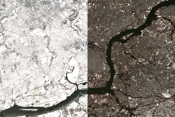
This is a satellite photo of Philadelphia taken on Jan. 4. The city had trace amounts of snow on rooftops following a brief snow shower in mid-December.
Two weeks later, on Jan. 19, Philly would be covered by a 4-inch dusting of snow. A gentle prelude to wrathful winter weeks that were to come.
One week later, the biggest snowstorm in 10 years left Philly with up to 8 inches of snow on the ground. This photo taken on Jan. 29 shows that any remaining parts of the city that weren’t already snowy were now covered.
As temperatures dipped down to single digits, the Schuylkill River down to the Passyunk Avenue Bridge was completely frozen over.
The Schuylkill froze first because it is relatively shallow and still compared to the Delaware. “Shallow water freezes faster than deeper water because water that cools at the surface becomes more dense and sinks and is replaced by warmer water from below,” said Jonathan Edwards-Opperman, a physical scientist for the U.S. National Ice Center.
Edwards-Opperman also said that ice will form faster in “parts of the river that are more sheltered from winds or if currents are weaker near parts of the shoreline.”
This explains why inland waters like the Cooper River and shielded water like that around Petty Island froze quickly.
By Feb. 8, the mountains of snow would solidify. With such sustained cold temperatures, the rest of the Delaware began to freeze as well.
Before Feb. 13, the U.S. Coast Guard’s cutting operations cleared a lot of ice around the Port.
Ray Kruzdlo, senior service hydrologist at the National Weather Service in Mount Holly, hypothesizes that “as the cargo ships or tankers worked through the ice, the ice broke up and then moved around or got flushed out.”
Meanwhile, the Delaware began to freeze between the Walt Whitman and Ben Franklin Bridges. Though it may seem the downstream ice drifted north, the new ice likely formed as relatively frigid upstream water flowed downriver.
According to Amy Shallcross, Delaware River Basin Commission manager of water resource operation, U.S. Geological Survey data from temperature gauges at Chester, and Fort Mifflin, Trenton ↗ shows that the lower end of the river warmed earlier first. Chester recorded above-freezing temperatures a full week before upstream waters at Trenton did.
“Water in the bay or in the lower part of the river is not as deep, and so it can freeze [and thaw] easier. If we got colder water from upstream, that might be why there was more freezing in the Philadelphia area,” said Shallcross.
After almost two weeks of overcast weather that obscured satellite imagery and a brief whiteout that left an additional 12 inches of snow on the ground, the city is finally clear. The recent snow melted almost immediately due to warm winter weather, and by Feb. 28, Philly had finally recovered from its long-lasting freeze.
Explore what the region looked like in the past few weeks.
January 4January 19January 29February 8February 13February 28
NaturalInfrared
story continues after advertisement
According to Shallcross, the last time Philadelphia’s rivers froze over was in 2018. However, it was nowhere as cold or severe, as the temperature was just below freezing.
“I don't think we've experienced that long of a cold snap that came about that quickly. And so it really was an unusual situation that we've just experienced,” said Shallcross.
The major freeze following the late January snowstorm meant that snow stuck around for three weeks. In contrast, the storm of late February was an example of how even larger snowfalls in Philadelphia can disappear quickly if the weather cooperates in the days following the storm. 12 inches of snow on the ground melted away in just a few days, as temperatures hovered in the 40s following the storm.
Fair to say that it’s been a harsh winter. After all, Punxsutawney Phil did see his shadow, and so far he’s been proven right. Thankfully, we’re not far away from spring.
Staff Contributors
Design, Development, and Reporting: Jasen Lo
Editing: Sam Morris
Photography: European Space Agency Copernicus Satellite Imagery
Copy editing: Brian Leighton
Subscribe to The Philadelphia Inquirer
Our reporting is directly supported by reader subscriptions. If you want more journalism like this story, please subscribe today
The remnants of winter are about to go on spring break — or at least yield to a “dirty warm-up” — but they evidently are going to take a messy parting shot at the region Tuesday morning.
The National Weather Service has posted a winter weather advisory effective at 5 a.m. until 11 a.m. for the entire region for a mix of snow (not much) and ice beginning around daybreak before flipping to just plain rain.
The precipitation is expected to start around daybreak as snow that won’t be plowable, or maybe even visible, but the more significant threat would be a glaze of freezing rain, said Nick Guzzo a meteorologist with the National Weather Service Office in Mount Holly.
At most, snow would accumulate a few tenths of an inch, he said, transitioning to freezing rain and just plain liquid rain throughout the region before the morning is over.
But coinciding with the peak morning commuting period, the timing is a concern, he added.
Temperatures are due to be near freezing when the precipitation gets underway but climb into the mid-30s by midmorning. The March sun should make quick work of melting anything that freezes on the roadways.
Then the temperature might not drop below freezing for the next 10 days, and make it to 70 degrees Sunday.
But don’t expect it to be “bright and beautiful,” said Bob Larsen, senior meteorologist with AccuWeather Inc.
A major pattern change is underway across the nation
“It’s what we like to refer to as a ‘dirty warm-up,’” said Larsen. Here’s the dirt: It is due to be cloudy at least through Friday with rain possible Thursday and Friday and highs in 50s. Normal highs are in the upper 40s.
The sun is due back Saturday with readings in the 60s, and perhaps into the 70s on Sunday, but with another chance of rain. Larsen said at least two days, and maybe four, next week are expected to feature highs in the 70s, before a cool down perhaps next Thursday or Friday.
The surges of mild air are related to a major pattern change in the upper atmosphere. For the last several weeks, the atmosphere has aligned to favor cold, snow, and ice in the East and springlike temperatures in West.
That’s about to reverse, as the West gets its turn with winter and the East gets a spring tease.
But don’t put in the screens just yet, Larsen advises.
“March can be a cruel month,” he said, and winter isn’t prone to go gently. “We’re not going to slam door on it yet.”
He that some signs are pointing to a more-wintry end to the month, which would not be at all unusual.
“In my mind there’s only two seasons, summer and winter,” Larsen said, and spring and fall are when they fight their turf wars.
Robert Koopmeiners is up to here with this winter and is among the masses more than ready for the atmosphere to flip the switch.
“It’s getting kind of old,” he said. But he wasn’t complaining about Arctic freezes, or winter storms, or black ice, or hideously darkening mountains of plowed snow.
He was talking about the weather in Colorado, where he is a National Weather Service meteorologist, where bone-dry Denver has set nine high-temperature records since Dec. 1, where wildfire alerts were in effect, and water is getting scarce.
Warm West, cold East, and vice versa are standard fares in the great national atmospheric seesaw that hasn’t been doing much seesawing lately, as if a boulder has been placed atop our end of it.
That’s the result of an atmospheric roadblock for the ages in the high latitudes around Greenland, meteorologists say, that has allowed winter to reappear with a ferocity not experienced in several years in the Northeast, and a winterlong spring in parts of the West. The cold in the East may even be related to rising global temperatures.
The result for the Philadelphia region has been one of the colder and snowier meteorological winters — the Dec. 1 to Feb. 28 period — on record. Officially Philadelphia has had more days of snow cover of an inch or more than in the five seasons ending with the winter of 2023-24 combined.
After quite a wintry start to the new week, with even some more snow possible, a major warmup is due to begin with a spring teaser possible next weekend. (It may turn colder the second half of the month, but that can wait.)
In the meantime, the atmosphere is enjoying a belly laugh over the preseason outlooks for the winter of 2025-26.
Philadelphia’s winter scorecard
By convention, the weather community divides the seasons into three-month increments. In part that’s in recognition of the fact that weather often has an adversarial relationship with astronomy. For example, it has snowed, and hit 90 degrees, in the astronomical spring, the period between the vernal equinox and summer solstice.
The day before Easter in 1915, Philadelphia was socked with 19 inches of snow, despite a forecast of “Unsettled, rain likely.”
For the three-month 2025-26 winter period, official temperatures at Philadelphia International Airport have averaged a shade over 33 degrees, putting it in the top third for coldest winters in the period of record dating to the late 19th century.
The official snow total is in the top 20% of all winters on record. The normal through February is just under 20 inches.
AccuWeather Inc. and 6abc went with 14 to 18 inches. Fox29 called for16 inches, and 17 days of snow cover. At last count, that snow-cover count was up to at least 35. Other forecast services called for normal — 23.1 inches — or slightly above-normal snowfall.
Regarding temperatures, all the outlooks foresaw normal — thethree-month averageis 36.1 degrees — to above-normal temperatures for the Philly region, save for Arcfield Weather, a private-sector company, which went for below.
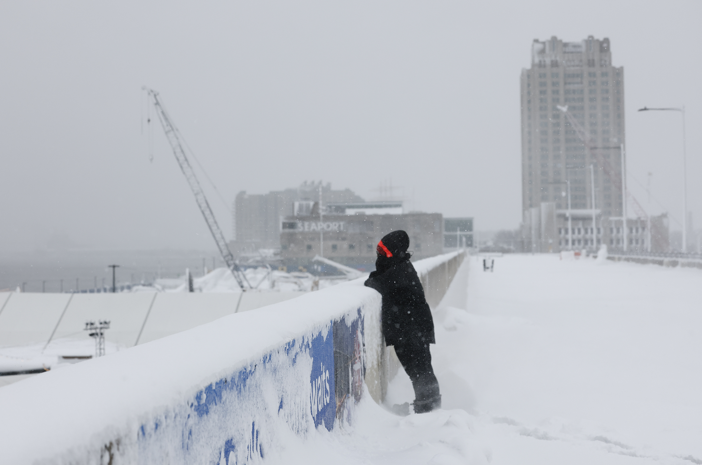
Nicole Swinson looks into Penn’s Landing while standing in the snow on Monday, Feb. 23, 2026.
‘Blocking’ has been the leitmotif of Philly’s winter
If it seemed that what happened kept happening, that was more than perception.
It was the result of particularly vigorous “blocking” in the vicinity of Greenland in which high pressure, or heavier air, persistsin the upper atmosphere. It was a massive obstruction that kept directing cold air and storms toward the East while toasting the West, said Climate Prediction Center branch chief Jon Gottschalck.
The East got stuck under a “trough” of upper-air low pressure that favored storminess and cold, he added. The West, quite the opposite.
“The blocking pulled the storms eastward, and the cold followed,” said Paul Pastelok, Accuweather’s longtime seasonal forecaster. “We should have caught on to that.”
In addition, an upper-air pressure pattern over the Arctic — the Arctic Oscillation — was stuck in its negative phase from December until recently, said climate center meteorologist Laura Ciasto, with negative consequences for local winter-phobes.
When it’s negative, the weather-moving west-to-east jet stream winds can become more active at the midlatitudes where we live, and the conditions colder and stormier. The oscillation has had “an interesting winter,” she said. “Typically,” she said, “we expect the AO to fluctuate.”
Related to the oscillation’s behavior were episodes of “polar vortex stretching,“ said Ciasto. The vortex’s powerful winds usually trap cold air in the Arctic, but on occasion they weaken and ”stretch,“ allowing cold air to spill southward.
Another explanation for why the forecasts went awry may be an obvious one: We’re not used to this level of Arctic cold or prodigious snowfalls like the Sunday-Monday event that creamed parts of the region with 20 inches or more. “We have simply gone many years without experiencing a storm like this,” said Owen Shieh, warning coordination meteorologist at NOAA’s Weather Prediction Center.
Did the world suddenly grow colder?
No, the planet didn’t cool off precipitously. In fact, said Pastelok, the blocking may have been related to warming-related sea-ice reductions near Greenland. The solar energy absorbed by freshly freed waters could have effects on pressure patterns in the high atmosphere, he said, adding that for now, that’s only a hypothesis.
While the world evidently cooled slightly last year after a record 2024, according to NOAA’s database, it’s still about 2 degrees Fahrenheit warmer than the 20th-century average, the supply of Arctic air isn’t quite as it used to be.
As it turns out, Philly’s winters in the 21st century have trended milder, with average temperatures about 2 degrees Fahrenheit above long-term averages.
The overall warming trend has been one reason the climate center has had the odds favoring above-normal winter temperatures for Philly for the last seven consecutive winters. And they indeed were above normal for six straight years — but not seven.
Retired climate center forecaster Mike Halpert once remarked that while sticking with the trend can be a smart bet, “some years you’re going to be woefully wrong.”
At this point, the prospect of a barely measurable snow Wednesday morning may seem like so much drizzle in the ocean.
However, given that a coating of snow could cover another harvest of stealth black ice in the morning as the snow melt refreezes overnight, motorists and pedestrians might want to exercise a measure of caution.
The forecasts are calling for a half-inch to maybe an inch in the Philly area.
For the record, the official total at Philadelphia International Airport was 14 inches. Of that, 7.5 inches fell on Monday, setting a record for the date. It was No. 16 on the all-time snowstorm list, and the first time in 33 years that a foot or more had fallen so late in the season.
The post-storm issues included contending with scores of downed trees throughout the region. A fallen tree in Radnor Township, Delaware County, still was affecting service on the Norristown High Speed Line.
Service still was still suspended on the Cynwyd Regional Rail line, SEPTA said, and other lines were operating with delays.
Airport operations were getting back to normal, said spokesperson Heather Redfern, flights having resumed Monday afternoon.
As for schools, they were opting for a variety of options from virtual learning (Philadelphia) to two-hour delays (Cherry Hill, Moorestown), to party’s over, get here on time (Upper Darby).
This may be the week of black ice in Philly
Invisible and insidious black ice, a dangerous slipping hazard, in all likelihood will be present through the workweek as the snow melt picks up speed during the day, with highs in the 40s, and temperatures falling below freezing at night.
More light snow, rain, or a snow-and-rain mix is possible Thursday into Thursday night, the weather service said. But odds are the immediate Philly area will see mostly rain, said Eric Hoeflich, a weather service meteorologist in Mount Holly.
After a modest warmup on a dry weekend, some computer models were hinting at more snow early next week as a storm moves east, but “not all the guidance is showing a significant system,” the weather service said in its afternoon discussion. “It’s definitely on our radar,” the agency said, but it doesn’t “appear to have potential for a ‘major’ event.”
In short, anything rivaling the Sunday-Monday storm would be, at the very least, unlikely.
Hoeflich said he spent 30 hours in the Mount Holly office, not leaving until 2 p.m. Monday. He said that the weather service provided air mattresses for him and other staffers and that his colleagues came armed with soft pretzels.
Sarah Johnson, the warning coordination meteorologist, brought pizza. Evidently carbs are a sine qua non of storm forecasting.
Inside a large exhibition room at the Pennsylvania Convention Center on Monday morning, where workers are setting up next week’s Philadelphia Flower Show, one could be fooled into believing that spring has somehow arrived early in Philly.
The scent of mulch permeates every corner, tendrils of pink and red flowers are delicately laid over massive tree trunks, a mobile hanging from the ceiling dangles dozens of iridescent butterfly cutouts over the floor, and bright green shrubbery dots the halls.
It seems as if Punxsutawney Phil maybe got it wrong this time.
But one thing gives it away: the gaping open loading dock door ushering in a channel of 35-degree air that slices through the center of the exhibition hall. Clusters of snowflakes billow in toward a mint-colored wooden fence and a tree house.
For the organizers of the Philadelphia Flower Show, an annual week and a half-long event that features dozens of horticultural exhibits, the 14-inch snow dump over the weekend was less than ideal, said Seth Pearsoll, theshow’s creative director and vice president with the Pennsylvania Horticultural Society. But it wasn’t a surprise.
“We have been watching the weather for weeks on end,” Pearsoll said. “You just got to stay on top of it.”
The show, which opens to the general public on Saturday —the Horticultural Society members preview is Friday — and ends March 8,is typically held in the late winter/early spring. That’s led to some historically dicey weather.
A 1993 blizzard forced the show to close early. Meteorologists predicted huge snowfalls in 2001 and 2013 as well. And, in 2018, a nor’easter hit the city on the opening night of the show. When the show was held outside during the years of the COVID-19 pandemic, it was shuttered or postponed for short stretches because of inclement weather.
Despite the weather challengesthe show, which has been running for nearly 200 years, is typically held at this time of year partly due to tradition. The show dates to an era long before the internet when the event was designed to present the season’s products to florists, landscapers, farmers, and others in the horticultural industry so they could place their orders in time for spring planting.
“After that it was just part of the DNA of the show,” Pearsoll said.
The show brings in a quarter million visitors each year, he said, and requires meticulous planning and constant pivoting.
The original schedule for Monday included a 7 a.m. load-in time, he said, but his team later pushed that to noon to ensure that all the trucks could get to the facility safely. Many of the plant deliveries for Monday were moved to Tuesday or Wednesday, by which time the team hopes roads will be clearer.
Trucks won’t just be contending with the weather in Philly but across the country as the event is getting shipments in from Minnesota, Florida, and New York, among other states.
Most of the plants themselves are protected in climate-controlled trucks.
“I think, for me, having been a part of outdoor shows, having worked a million flower shows, weather is always a thing,” Pearsoll said. “So I’ve really come to see it as just another one of those planning variables in the event industry.”
The way he views it, the snowy, slushy, frigid weather outside enhances the magic of walking through rows of plants that have, through “sorcery,” as he calls it, been manipulated into blooming out of season.
“It’s this crazy thing, right?” he said. “It mean it’s science. It’s art.”
The Philadelphia Flower show is scheduled for Saturday through March 8 (with a Horticultural Society members preview on Friday) at the Pennsylvania Convention Center, 11th and Arch Streets. Hours: 10 a.m. to 8 p.m., except until 6 p.m. on March 8. Admission varies depending on person’s age and day and time of entrance. Information: phsonline.org or 215-988-8800.
Snow isn’t a constant in Philadelphia but after two big storms dumped on us just weeks apart this year, it’s clear some things remain predictably consistent during a snowstorm in Philly, no matter the year.
While all hail hasn’t broken loose yet, we have fallen right back into our classic winter storm habits, some of which aren’t snow great. So put on your parka, pull up your boots, and come traipsing through our winter tropes with me, because if there’s one thing that certainly isn’t predictable during a snowstorm it’s SEPTA.
Acting like the Philadelphia Museum of Art is Vail
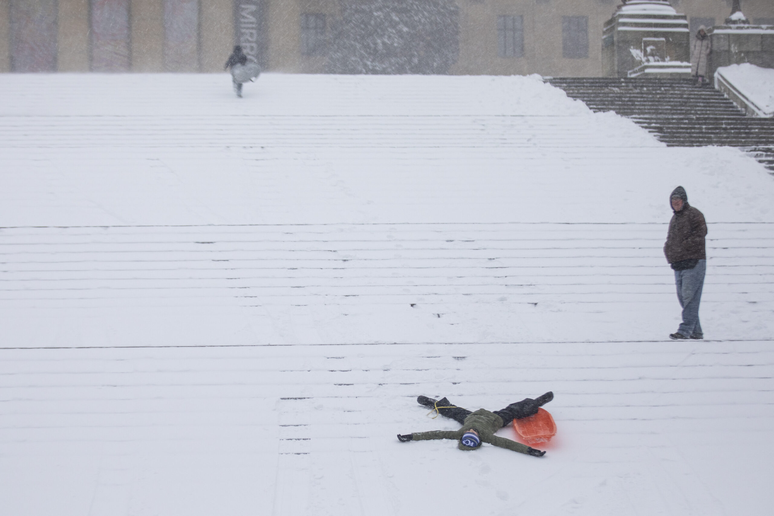
A snow boarder goes down the steps of the Philadelphia Museum of Art.
I love that people sled and snowboard down the steps of the Philadelphia Museum of Art after a snowstorm like it was a ski resort. It’s one of those traditions that gives Philly such a wonderful, joyous sense of place, but, like many of our beloved traditions, it is also a highly dangerous activity.
There is no ground beneath the snow here, just pointy stone steps that could leave your face looking like a Picasso painting if you hit them the wrong way. Even if you manage to stay upright the entire way down, it’s a bumpier ride than Philly’s pothole-plagued streets (which are certainly going to get worse after this storm).
A sledder wipes out while sledding down the Philadelphia Museum of Art steps.
The substance
Throughout a snowstorm and for five minutes immediately following one, Philadelphia looks absolutely stunning. But after those five minutes are up, things get real gross, real quick. The snow turns into lakes of slush and large, gray mountains of immovable ice, making the city look like a dumpster site on Hoth for the next five weeks.
It reminds me of that movie The Substance with Demi Moore, except the substance for Philly is snow. It makes the city beautiful for a short time, but in the end, it just turns it into a bigger mess than it was to begin with.
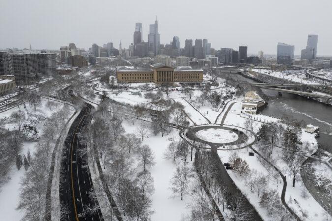
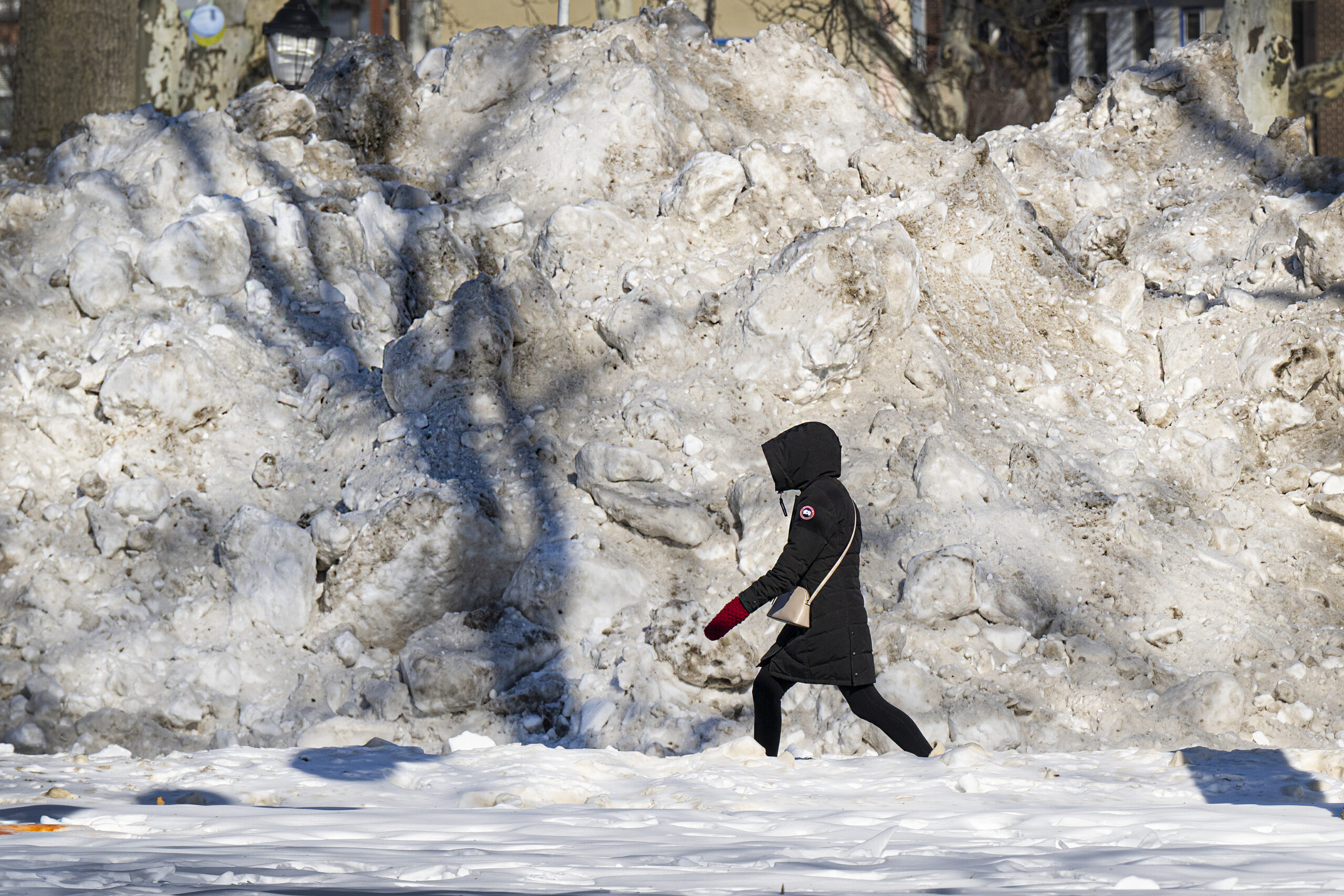
A pedestrian walks past a large pile of snow and ice along the Benjamin Franklin Parkway this year.
Doggone dirty
Among the many reasons the snow gets so gross so quickly here is because some dog owners are under the impression that the laws of polite society freeze when the temperature does. Just because your dog left its pile on a pile of snow does not mean you don’t have to pick it up.
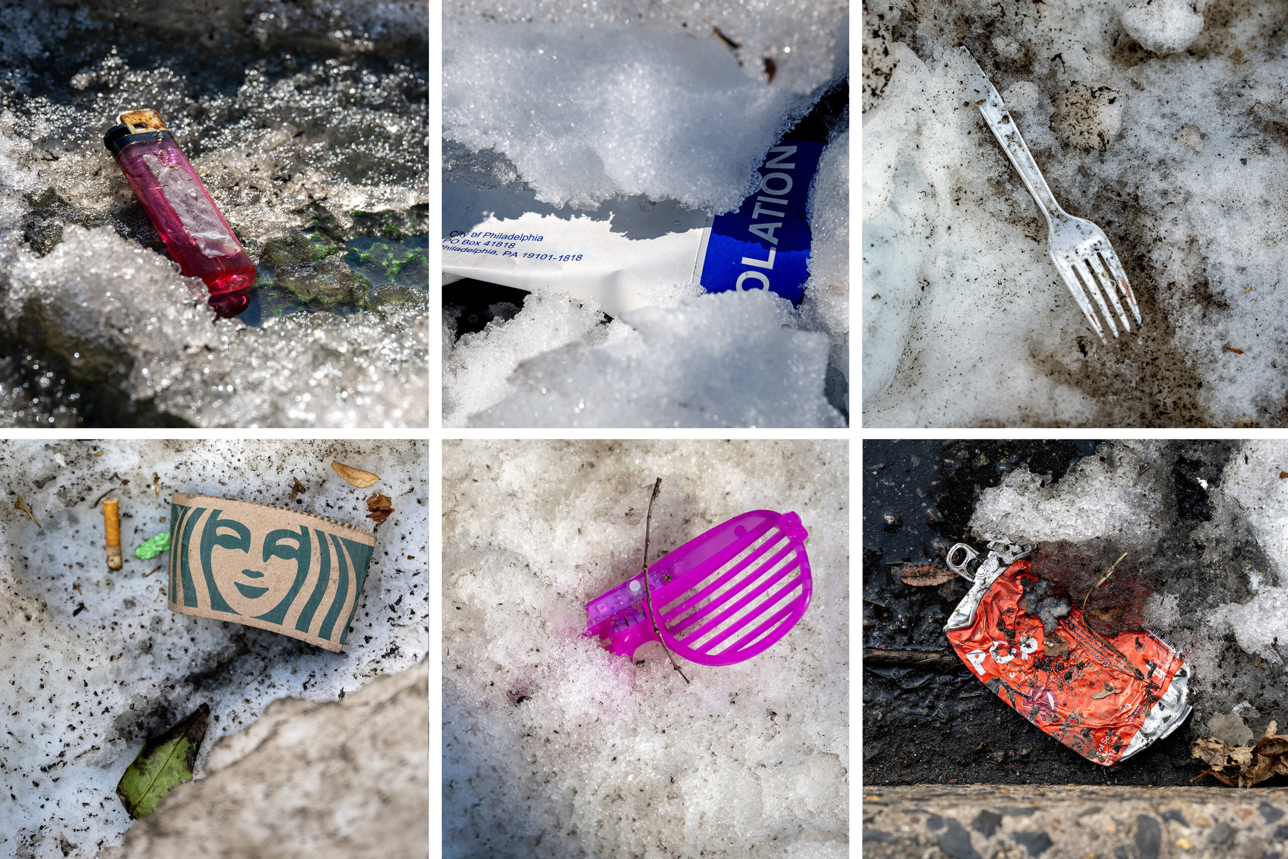
Trash spotted in the snow in Philadelphia. Photographed, but not pictured (as a courtesy to you), was also a pile of dog poo.
Then there are the really terrible, lazy owners who kick snow over their dog’s piles in an attempt to cover it up, thus leaving a nasty surprise for unsuspecting pedestrians. While all dogs may go to heaven, there’s a special circle of hell for those folks.
Snowstalgia
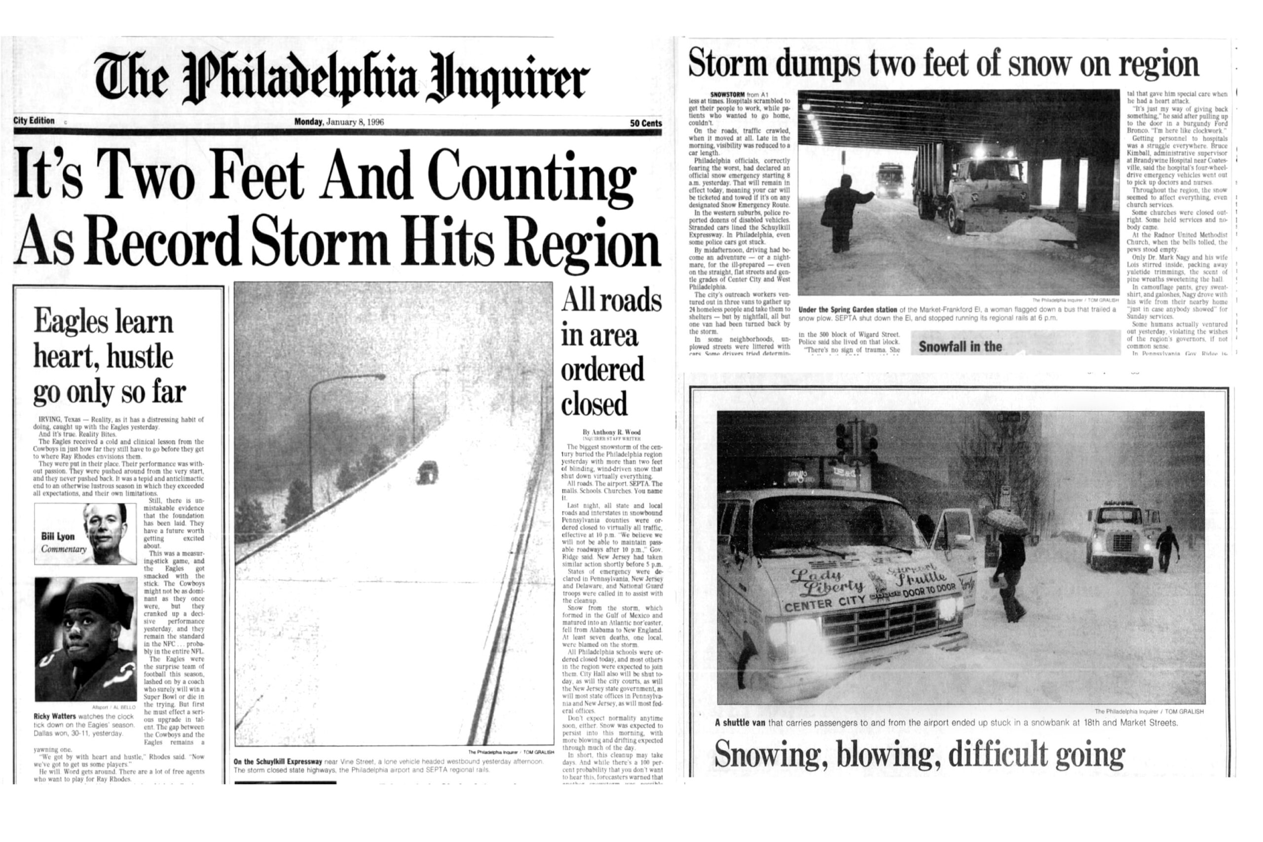
No matter how much snow is predicted or falls during a storm, it will inevitably be compared to the Blizzard of ‘96 by at least three people you speak you to, or three times by at least one person you speak to.
The Blizzard of ‘96 is pretty much our Beetlejuice, you have to say it three times or it doesn’t snow around here.
Front page and inside photos from The Philadelphia Inquirer. January 8, 1996. The Blizzard of 1996, or “Storm of the Century,” a severe nor’easter that was Philadelphia’s largest-ever snowfall of 30.7 inches Jan. 6-8, 1996.
Work or Wawa
There are two types of people who travel out in Philly during a storm: those who are going to work and those who are going to Wawa.
There’s absolutely no rational reason someone has to go on a Wawa run during a snowstorm — especially since everyone waited an hour in line at the Acme for milk and bread two days before it hit — yet there they always are, sometimes in flip-flops, just picking up a cup of coffee like it’s something they can’t get at home.
The flagship Wawa store near Independence Hall.
I’m sure some folks go just in the hopes of being interviewed by the 6ABC reporter who’s doing live shots from the Wawa parking lot, and some do it just to get out of the house while their kids are at home. Whatever the reason, if you’re one of those people, be nice to the Wawa workers who risked their lives to go to work so you had somewhere to go.
Savesies
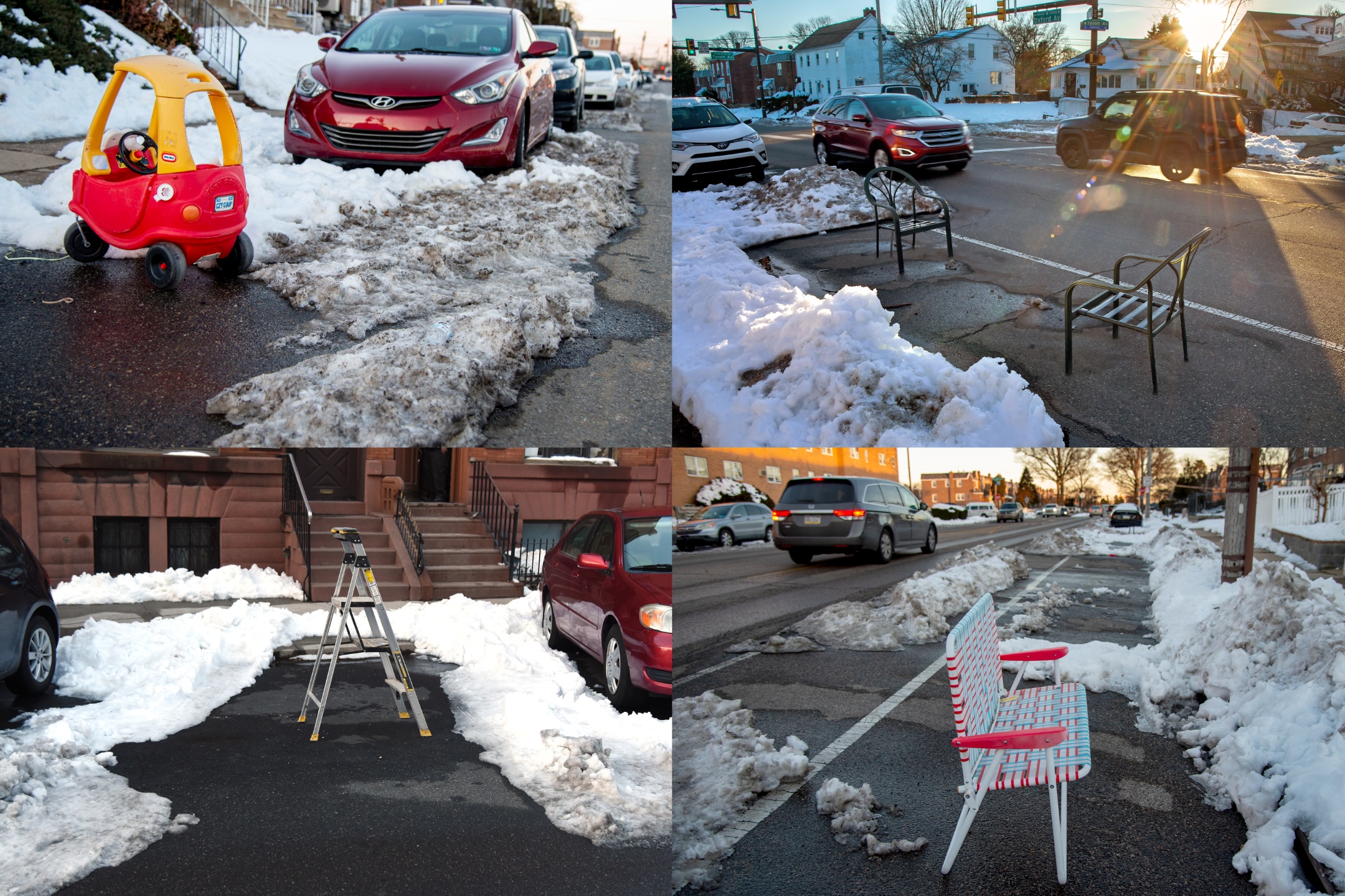
Few things will pit neighbor-against-neighbor in this city quite like savesies, the longstanding Philly practice of using an orange cone, folding chair, or any other inanimate object to save a parking space you’ve shoveled out.
Collage of savesies, a long-held parking tradition across Philadelphia.
Folks are either firmly for or against the tradition, but no matter which camp they land in, few are bold enough to mess around and find out by parking in a saved space, lest they become the recipient of a strongly-worded letter on their windshield, a knock at their door, or whatever curse has plagued the Flyers since 1976.
Shorts shovelers
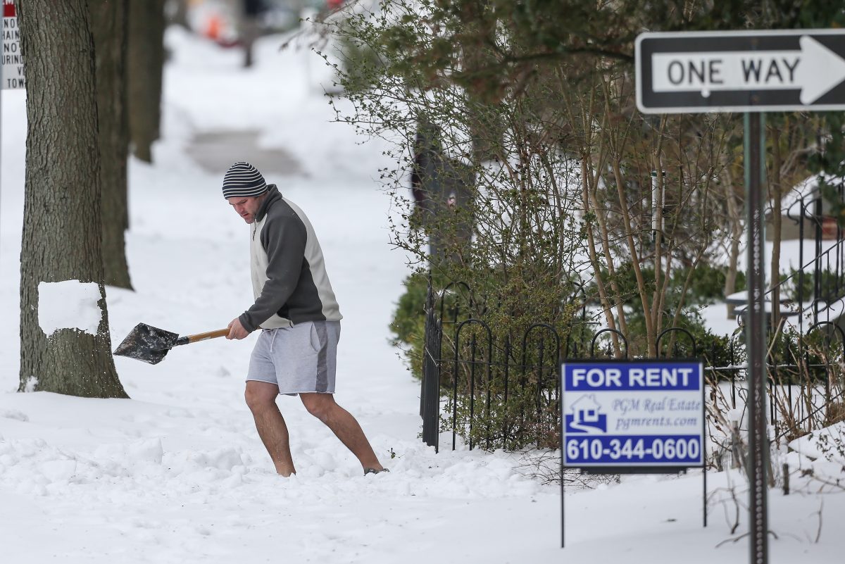
Shoveling in shorts is a long-standing tradition practiced by men in the Philadelphia region.
It could be 3 degrees out with a windshear of negative 10 and eight inches of snow on the ground and you will still see some dude out shoveling in shorts and an Eagles hoodie. In Delco, you will see several.
Do these men get hot flashes in their legs? Is their calf hair luxuriously thick? Did someone cut off the bottom half of all their pants? Inquirer minds (mainly mine) want to know!
Greetings from sunny Florida
During a snowstorm, someone you know will inevitable post a picture of themselves in Florida, where they snowbird in the winter or are visiting for Phillies spring training. The caption will say something like “Sorry to miss out on the storm!” or “Sending my friends in Philly sunny vibes from Florida!”
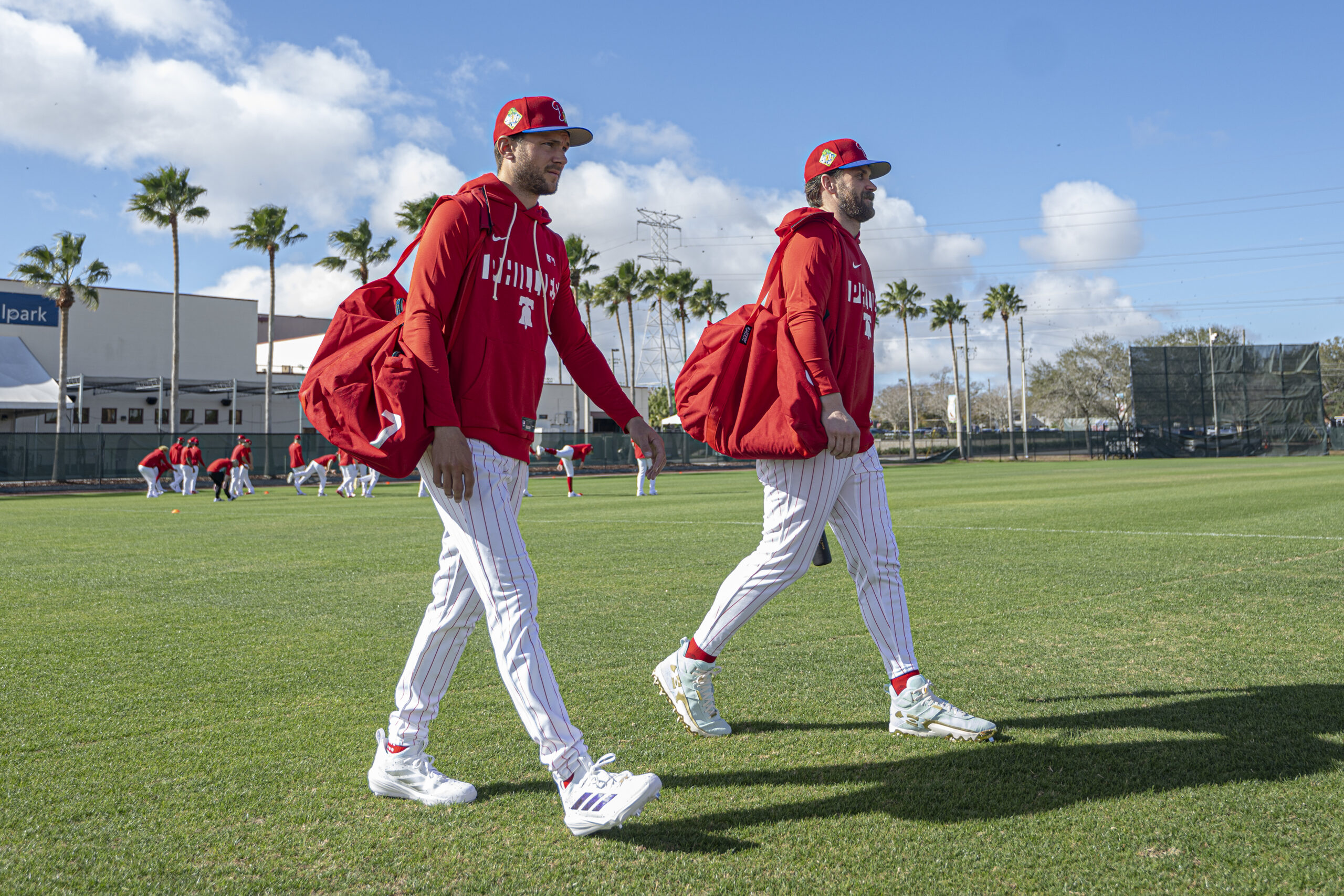
Philadelphia Phillies Trea Turner and Bryce Harper enter the field during the first full-squad workout of spring training Feb. 16, 2026, at BayCare Ballpark in Clearwater, Fla.
These are bold-faced lies. They are not sorry and they are not sending you anything but a hard time. Just rest assured in the knowledge that no matter what, you are in the greatest city in the world and they are still in Florida.
If it wasn’t an actual blizzard, Philly’s biggest snowfall in a decade sure acted like one, and the weather the rest of this week isn’t expected to be particularly pleasant.
But in terms of disruption — not to mention aesthetics — this was in a wholly different category from the Jan. 25 siege of snow and ice. And the aftermath should not be anywhere near as punitive and burdensome.
Although the 14 inches measured officially at Philadelphia International Airport, dwarfed the 9.3 inches of snow and sleet that accumulated in last month’s storm, Zach Schwartz, 33, was among those who found the picturesque snow more palatable than the attack of ice balls and an Arctic freeze.
“The last snowstorm was a tough time for everyone,” said Schwartz, who was at a Point Breeze playground helping a friend build an igloo for their kids, “and I think the city was kind of in shock a little bit.”
The most recent storm, which left as much as 20 inches of snow in parts of South Jersey and southeastern Bucks County, did cause some issues.
More than 130,000 households lost power at some point. Scores of trees came down as the snow, heavy and wet at the start, glommed onto branches that took beatings from the winds that gusted past 40 mph.
The storms closed schools to the chagrin of hundreds of thousands of learning-eager children, and museums on Monday. It disrupted SEPTA services and airport operations.
At least 87 trees across the city were downed as a result of the storm as of Monday afternoon, and the city was working to determine which ones to prioritize clearing first, Parks and Recreation commissioner Susan Slawson said.
Mayor Cherelle L. Parker advised Philadelphians to avoid unnecessary travel as crews worked to clear the streets.
Yet early fears that the snowfall would reach what the National Weather Service called “potentially historic” levels didn’t quite materialize, and it was not known if the storm had met “blizzard” criteria. Stopping short of “historic,” New Jersey Gov. Mikie Sherrill called it “a generational storm.”
This one likely won’t have the staying power of last month’s storm
While the volume of snow is formidable, road crews throughout the region now have a tremendous ally — the late-February sun.
The city did adjust its response after the prior storm cleanup left many residents chock-full of complaints. Director of Clean and Green Initiatives Carlton Williams said Monday instead of one snow melter, the city secured three, with two already on the road Monday, despite the much shorter notice of the storm.
But the big melter is in the sky.
The amount of solar energy beaming toward Philadelphia is more than 35% stronger than it was on Jan. 25, according to NASA’s figures, and blacktop is great absorber of sunlight. Plus the region now is getting an hour more of daylight.
Plus, instead of an Arctic freeze, it is forecast to be moderately cold this week, with highs in the low 30s Tuesday, and in the 40s Wednesday and Thursday.
A weak clipper could produce an inch or less of snow early Wednesday, but, sorry kids, that won’t be another school-closer. More light rain or snow or a mix is possible Thursday.
Computer models on Monday were seeing a potential for more snow early next week, but they may well sober up come Tuesday.
After the Jan. 25 storm, Philly had 18 consecutive days of at least 3 inches on the ground officially at the airport, the longest stretch in 65 years. That streak won’t be challenged this time around.
One other huge difference: Those 14 inches didn’t include a speck of ice, which, as we learned, is amazingly melt-resistant.
Why snow totals varied tremendously
The nor’easter that generated the snow did qualify as a “bomb cyclone,” said Tom Kines, senior meteorologist with AccuWeather Inc. The technical criteria aside, a bomb cyclone is particularly powerful storm.
In fact, the storm’s intensity, based on a measure of its central pressure, was equal to that of a Category 1 hurricane, he added.
Fortunately, the Shore escaped major flooding, but the winds circulating around the storm’s center over the ocean hurled back snow far inland.
window.addEventListener(“message”,function(a){if(void 0!==a.data[“datawrapper-height”]){var e=document.querySelectorAll(“iframe”);for(var t in a.data[“datawrapper-height”])for(var r,i=0;r=e[i];i++)if(r.contentWindow===a.source){var d=a.data[“datawrapper-height”][t]+”px”;r.style.height=d}}});
South Jersey locations received the most, along with areas in southeastern Bucks County. However, totals backed off precipitously to the west.
“There was a really tight gradient,” said Amanda Lee, a weather service meteorologist in Mount Holly. All areas in Philly’s neighboring Pennsylvania counties did report at least several inches of snow.
Within that broad east-west divide, however, amounts varied considerably from place to place, due in part to “banding,” in which narrow corridors of snow, caused by rapidly rising air, migrate from place depositing rapidly accumulating snow to areas underneath.
Conversely, areas on either side of the band are snow-deprived.
By the National Oceanic and Atmospheric Administration’s decree, a blizzard requires “frequent winds of 35 mph or higher with considerable falling and/or blowing snow that frequently reduces visibility to 1/4 of a mile or less. These conditions are expected to prevail for a minimum of 3 hours.”
That’s a lot to ask for a snowstorm, and it is going to take considerable forensic work of poring through observations to determine whether those conditions were met in Philadelphia or elsewhere in the region, said Nick Guzzo, a weather service meteorologist in Mount Holly.
Another big difference between this and the January storm
Whatever else it is called, this was the most spectacularly beautiful snowfall of the season, thanks to the snow’s remarkable adhesive power.
On the morning of Jan. 26 the trees were bare, as though they wanted no part of the snow and ice-ball assault.
On Monday this time around, snow enchanted the branches and uncannily worked its way into architectural details.
Cape May Mayor Zack Mullock said his town, famous for its Victorian buildings, “looks beautiful” covered in the foot of snow that had fallen.
Said Mullock, “It looks like a snow globe.”
Staff writers Ximena Conde, Kristen A. Graham, Michelle Myers, Amy S. Rosenberg, Henry Savage, and Nick Vadala contributed to this article.