Category: Weather

  • One of Philly’s longest snow-cover streaks is over, at least officially

    One of Philly’s longest snow-cover streaks is over, at least officially

    Officially* one of Philadelphia’s region’s most impressive and enduring snow-cover streaks in the period of record ended peacefully at 7 a.m. Tuesday.

    After 23 consecutive days of at least an inch on the ground at Philadelphia International Airport, the National Weather Service observer reported a mere “trace” at 7 a.m. Tuesday, meaning that whatever was left was hardly worth a ruler’s time.

    “I can’t imagine too many people are sad about this,” said Mike Silva, meteorologist at the weather service office in Mount Holly.

    The news might have evoked vast choruses of “good riddance” were it not for the fact that mass quantities of the snow and ice remain throughout the region, enough to contribute to the formation of dense fog late Tuesday night into Wednesday morning, the weather service warned.

    And regarding that asterisk, observations at PHL have been known to differ from actual conditions elsewhere, if not common sense.

    Plus, computer models are seeing yet another weekend winter-storm threat.

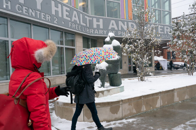
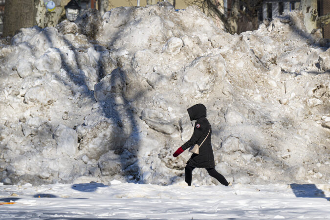
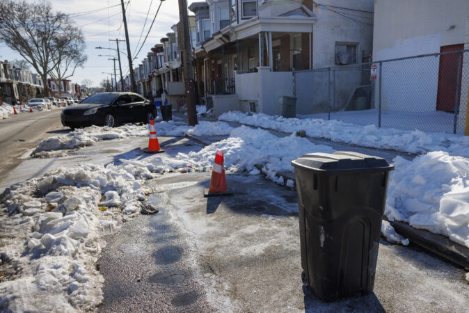
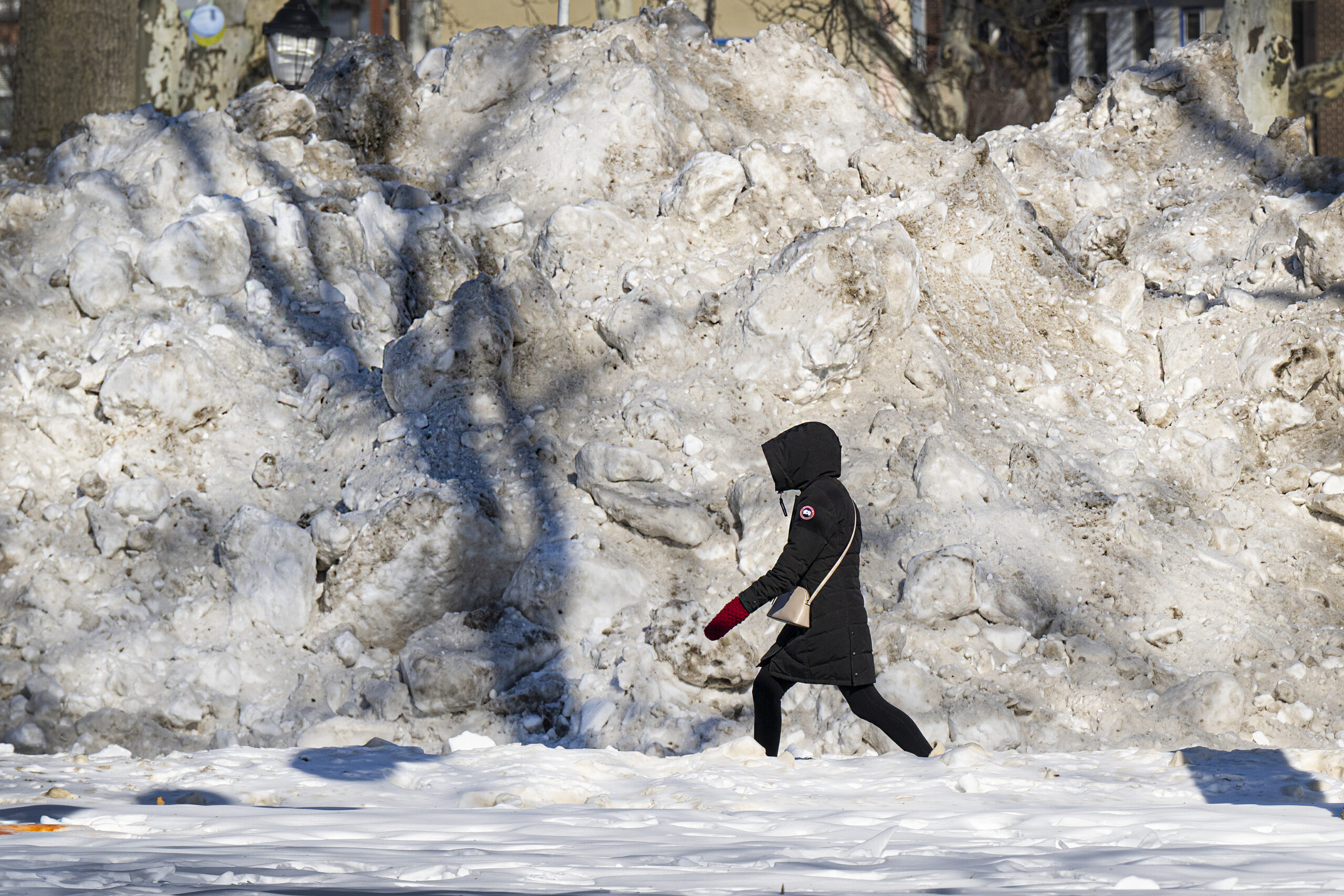
    In the meantime, heaps of aging, graying plowed snow are ubiquitous around the great Philadelphia city-state. As for melting “those big mountains, that’s going to take forever,” Silva said.

    For 18 days after 9.3 inches of snow and sleet was measured at the airport, the official snowpack had been 3 inches or more, the longest such streak in 65 years.

    The 23-day run of an inch or more, which began on Jan. 25 when the snow started, was the longest since 2003.

    The endurance had to do with the melt-resistant icy sleet that fell atop several inches of snow and the Arctic freeze that followed. Temperatures remained significantly below normal for 17 consecutive days.

    The great melt is picking up steam in the Philly region

    However, the melting process is at long last accelerating. Bare ground is appearing around tree roots, and evidence of vegetative life has been poking through the snow cover.

    Temperatures above freezing and the February sun have been making hay, but so has the return of invisible atmospheric moisture, even as precipitation remains far below normal.

    When warm, moist air comes in contact with snow, it condenses and yields latent heat that accelerates melting. That is evident in the swelling ranks of rivulets on driveways and in the streets.

    The combination of the moisture, the cold snow and ice pack, and generally calm winds will result in fog that could reduce visibilities to a quarter mile at times. The weather service issued a dense fog advisory, in effect from 10 p.m. Tuesday until 10 a.m. Wednesday.

    Melting conditions should be excellent the rest of the workweek, with highs in the 40s and light rain possible Wednesday night, and likely on Friday.

    Temperatures are due to remain above freezing into the weekend, but “then we’ll have to see what happens Sunday,” Silva said.

    Another storm is due to develop in the Southeast, and expect another week of computer-model vacillation on whether it will produce rain, snow, or partly cloudy skies.

    “We have some models that say snowstorm, and others that say nothing,” Silva said.

    It’s been a while since computer model forecasts have been this conflicted about a weekend storm — about a week.

  • Philly’s snowpack reaches a 65-year milestone, and here’s when it finally may disappear

    Philly’s snowpack reaches a 65-year milestone, and here’s when it finally may disappear

    You may not have noticed, but that endless snowpack has developed a slow leak — in this case historically slow.

    Its endurance continues to climb the charts among the snowpacks of yesteryear — and in at least one way may well be unprecedented in the period of record dating to the late 19th century.

    As of 7 a.m. Friday, officially at Philadelphia International Airport, three inches of the snowy and icy remnants of what fell on the region on Jan. 25 had survived.

    That made this the most-enduring snowpack of at least three inches in 65 years, said Alex Staarmann, a meteorologist at the National Weather Service in Mount Holly, the office’s climate specialist.

    That earlier one, which lasted from Jan. 20 to Feb. 14, 1961, was replenished by multiple significant snowfalls, as did others at the top of the endurance list; the 2026 version was basically one-and-done after 9.3 inches were measured at the airport.

    This one — and it still has its sparkle where it hasn’t mutated into frozen sludge — even has bested the snow cover attending the 44 inches that accumulated in a six-day period in February 2010, when at least four inches survived for 17 days.

    The latest batch was at four inches for 18 days, good for fourth place all-time.

    Not that it hasn’t had some aesthetic benefits. It can be like light therapy in the morning, and a spectacular screen for the tree shadows. It has beautifully entombed all that unfinished yard work.

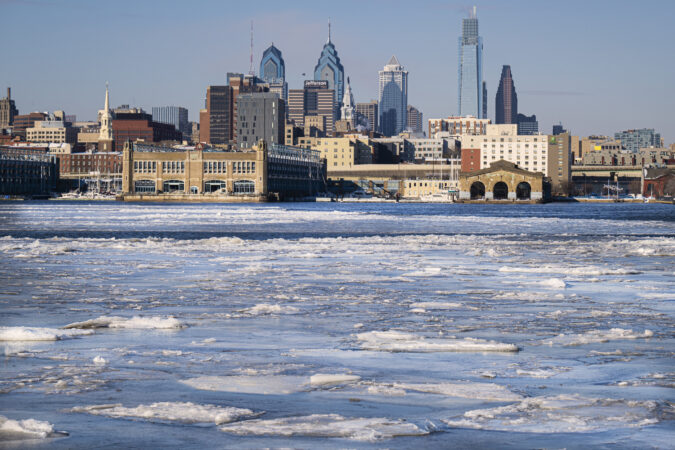
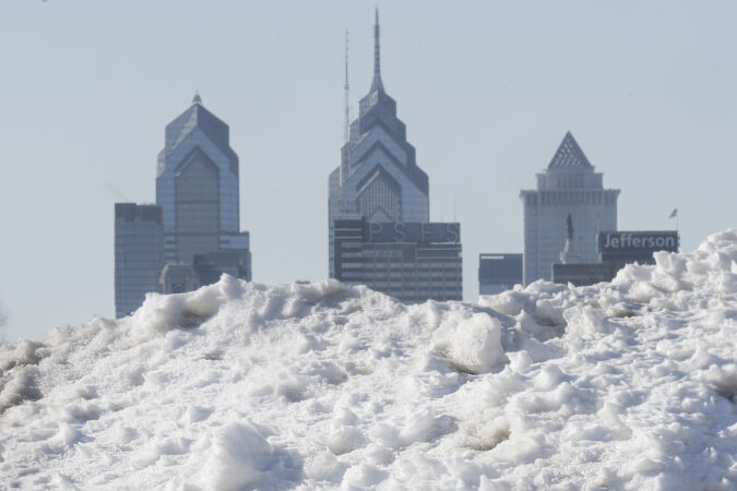
    Snow and ice debris is piled along the Camden waterfront in Camden, N.J., framing the Philadelphia skyline across the Delaware River, Thursday, Feb. 5, 2026.

    But it’s also been a royal pain throughout the region and begged the question: When it will go away?

    When will bare ground emerge in the Philly region?

    A farewell tour is likely next week as a snow threat for the holiday weekend remains a remote one, with accumulations only between “wet flakes” and “a dusting” possible, said Staarmann.

    And you might keep an eye on Tuesday for a melt watch. Temperatures are forecast to fall below freezing Monday morning, and then stay above 32, even at night, through the workweek.

    Highs are expected in the 40s Saturday through Monday, and then 50 or better the next three days.

    More significantly for melting, the air will become noticeably more moist on Tuesday, and that should accelerate the melting. Your skin might even notice the difference.

    Why has the snowpack been so enduring in Philly?

    Since the precipitation ended on Jan. 25, the air has been remarkably dry, an underrated factor in the persistence of the ground cover, along with what happened after the snow stopped that day.

    After more than seven inches of snow had fallen, it was topped with several hours of accumulating sleet.

    Those miniature ice balls turned out to be a mighty additive: Ice may be way slower to accumulate, but it is also way slower to melt, giving the snowpack staying power.

    “If we hadn’t had this much sleet, we might have some evidence of it, but it wouldn’t be this deep or persistent,” said Staarmann.

    The Arctic freeze that followed and the consistently arid air have been the ideal preservatives.

    Moist air, an efficient melter, has been absent.

    When enough invisible water vapor comes in contact with snow and ice, it condenses and gives off latent heat that can liquefy the pack in a hurry.

    After Philadelphia’s record 30.7-inch snowfall of Jan. 7-8, 1996, it was a moisture surge 11 days after the snow stopped that had a whole lot to do with erasing the snowpack even before the modest rains that followed, recalled David Robinson, the longtime New Jersey state climatologist.

    The melt set off disruptive flooding, but even though rain is in the forecast for midweek, anything resembling a repeat is unlikely this time around.

    Is that all there is for the winter of 2025-26?

    NOAA’s Climate Prediction Center on Friday had odds favoring above-normal temperatures through Feb. 23, followed by a possible cool down.

    Regarding any potential for snow, “We still have a few weeks left of opportunities,” said Staarmann.

    As long as computers are operating, snow chances will never die.

    However, the February sun is getting stronger by the day and lasting longer. If it does snow again, it’s a near certainty that it won’t match this one for staying power.

  • Philly is warming up after a historic cold snap, as locals break out short sleeves and plan vacations

    Philly is warming up after a historic cold snap, as locals break out short sleeves and plan vacations

    Punxsutawney Phil may have seen his shadow, but Phillies pitchers and catchers are reporting in at the Clearwater spring training facility, and that means one thing: Warmer weather is arriving in Philadelphia.

    After the biggest snowfall in a decade and an Arctic freeze that locked in the snowpack with a tenacity rarely experienced in the region, Philadelphians can now be seen walking the streets in short sleeves, eating lunch outside, and preparing for spring staples like the Cherry Blossom Festival.

    It was only in the 40s in Philly Wednesday, but after what felt like a never-ending cold front, it might as well have been summer.

    “I can’t wait to take walks again,” said Jenny Rojas, a Korean major at the University of Pennsylvania. She and classmate Justin Lo were strolling through campus in 40-degree weather like it was a breath of fresh air after weeks of below-freezing temperatures.

    “I’m from Michigan, so this snow isn’t that bad, but the temperatures were freezing. We just stayed inside,” said Lo, a Penn economics major.

    As Philadelphians bustled through Penn’s campus, an assortment of short-sleeve T-shirts, skirts, and shorts was sported by many. Some folks’ lack of coats didn’t stop Lo and Rojas from bundling up still. And while the temperature is getting reasonable, Philadelphians are still traversing treacherously slippery sidewalks and 3-foot snow piles blocking walkways.

    The remnants are going to be slow to vanish with overnight lows below freezing, but the snowpack is decidedly showing its age and is on the run.

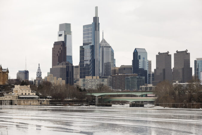
    The ice covering the Schuylkill River is melting on Wednesday, Feb. 11, 2026 in Philadelphia, Pa. The high on Wednesday was 46 degrees.

    Temperatures are due to cool down some Thursday and Friday with highs in the 30s, but the 40s are due back on the weekend.

    For some, like Penn administrative assistant Sheria Crawley, it was just a relief, and a surprise, to be able to finally say, “Thank God it’s 30 degrees out.” Crawley, who has lived in the city for years, said the snowstorm of 2026 is one of the worst she’s seen, not giving residents a reprieve from the cold.

    “It was brutal because we’re used to getting snow and then a warm-up right after that takes the snow away. This year, we couldn’t catch a break,” she said.

    The thing she can’t wait for most this spring is to see the “last vestige” of snow finally melt. Crawley said she would be excited then, but the severity of this storm would stick with her for years.

    “I feel like there’s going to be a mass exodus from the city to all the classic vacation spots nearby so that we can just recover from that storm,” she said.

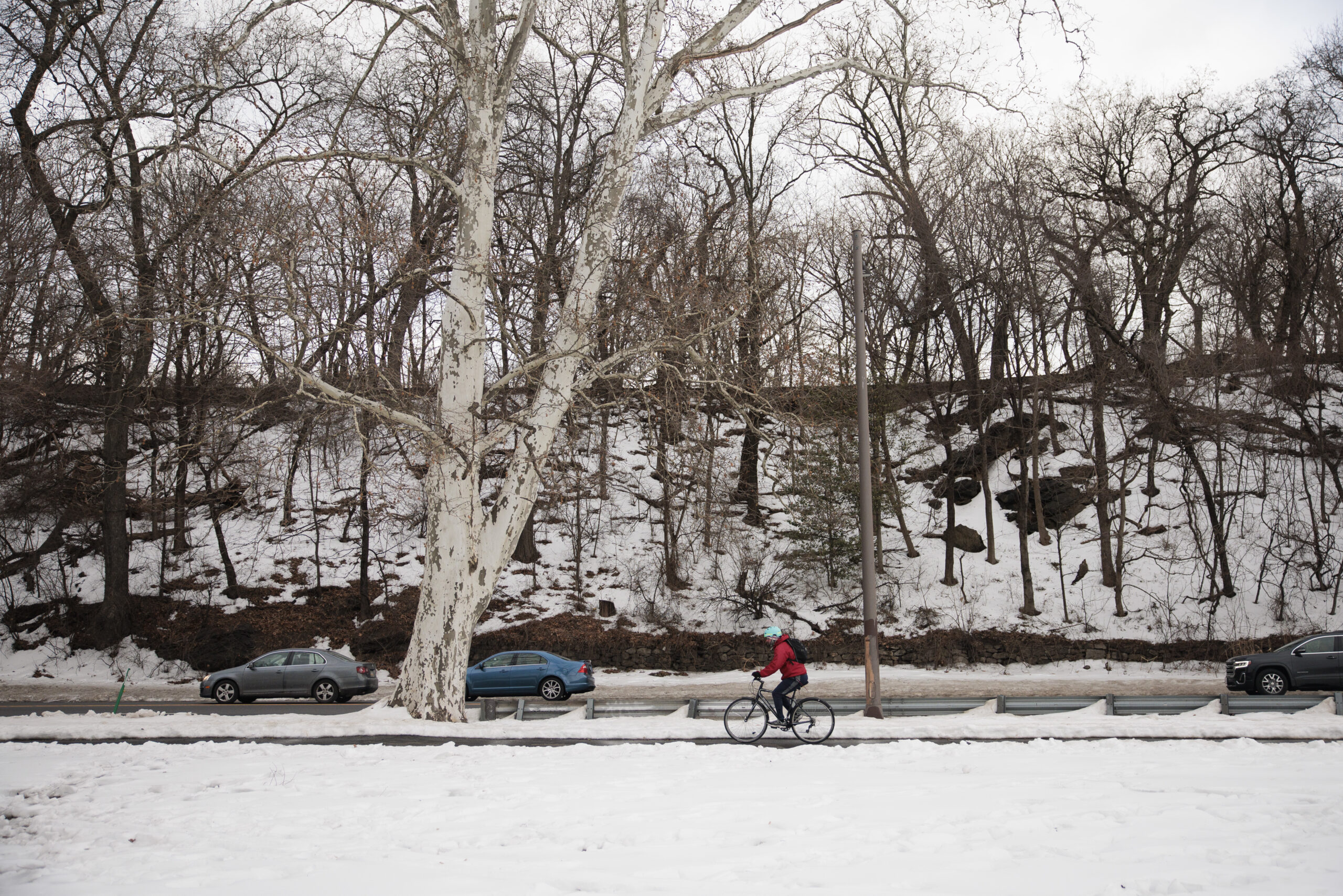
    A cyclist travels on the Schuylkill River Trail along Kelly Drive on Wednesday, Feb. 11, 2026 in Philadelphia, Pa. The high on Wednesday was 46 degrees.

    Eirini Antonopoulou felt like a phoenix rising from the ashes after weeks cooped up inside without the sunshine.

    “Since the previous weeks have been so gloomy, I’ve been feeling kind of down,” the Penn freshman said. “It’s gorgeous out today. We have more sunlight now, so I feel more optimistic.”

    Antonopoulou’s classmate, Tyrus Roney, said he was happy to see city life returning to normal, with people stopping to chat and not bundled up, rushing to their destinations.

    “It’s just it’s so much more vibrant with people outside interacting with each other,” Roney said. “Now we just have to take care of this dirty snow on the side of the road.”

    On another day, perhaps we would mention that the region has an outside chance of seeing some fresh snow late in the weekend. That can wait; as long as it chooses.

  • Library warming centers strained workers and left people without help for complex issues, staff say

    Library warming centers strained workers and left people without help for complex issues, staff say

    The bitter and persistent cold of recent weeks was so dangerous that various Philadelphia agencies coalesced around one mission: Get the city’s most vulnerable off the streets.

    Philadelphia libraries became a key piece in these efforts, with some branches doubling as so-called warming centers for more than 20 days straight in an effort to provide a respite to people who would otherwise be living outside.

    The mobilization of what can exceed 10 branches during life-threatening cold snaps is largely, though not universally, welcomed by library staff, the community groups that support the workers, and the people who use the spaces.

    As outdoor deaths mount in places like New York City, where at least 18 people have died on the streets since Jan. 19, Philadelphia library workers see the initiative as a way to prevent similar outcomes here, where there have been three cold-related deaths since Jan. 20.

    But employees say the warming center initiative, in only its second year as a formalized network, leaves branch staff, from librarians to security, unequipped to help some of the people walking through their doors with complex mental and physical health needs.

    “People are feeling tired, feeling very burnt out, the physical, the emotional, and the mental load of not just doing our regular work, but having like this critical service, like lifesaving service, being offered on top of that for 12-plus hours a day has been really, really hard to sustain,” said Liz Gardner, a library worker, speaking as a union steward in the American Federation of State, County and Municipal Employees District Council 47’s Local 2186, which represents first-level supervisors, including those at libraries.

    There’s the “little stuff,” like how an online map sometimes listed the wrong information in December. Last-minute location changes among the South Philly branches made it confusing for even the self-described information professionals to direct people where to go. At one point, a branch that was not Americans with Disabilities Act-accessible was cast as a warming center, to the chagrin of many.

    Library workers and community groups described having to lobby the Free Library to crowdsource snacks and water. The transportation that transfers people to nighttime warming centers after the libraries close has often been late, meaning staff have to decide between staying after their shift or leaving people outside, which they don’t want to do.

    What’s more, library workers and volunteers say, some people require more than a warm space. People in mental health crises, struggling with substance abuse issues, and requiring wound care need medical support, workers say.

    “What [the city is] continuing to do is take advantage of a group of people that care so deeply about the city of Philadelphia and the communities that they serve, and they’ll continue to do it, regardless of if they have the support or not,” said Brett Bessler, business agent for DC 47 Local 2186.

    Altogether, the concerns surrounding the warming center system yield existential and moral quandaries: Is this system the best and most humane way to treat some of the city’s most vulnerable people?

    Crystal Yates-Gale, the city’s deputy managing director for health and human services, acknowledged some of the challenges described by library staff and volunteers. Many logistical issues, such as location changes, food, and transportation woes, were improving or had been resolved, she said. Some of the concerns regarding staffing might be a matter of miscommunication, she said.

    “I think everybody’s exhausted. It’s like Groundhog Day,” Yates-Gale said. “It’s the same thing: Every day you wake up, they’re all just quite exhausted, but everybody’s working toward the same goal.”

    Kelly Richards, president and director of the Free Library of Philadelphia, echoed the sentiment that staff have been saving lives. In a statement, he said he appreciated staff efforts and feedback as the Free Library continues “making improvements to better serve our communities.”

    ‘They need more than a warm building’

    Details of who uses the warming centers are limited. Visitors are not asked if they are at a library to escape the cold or for regular library programming.

    Three library workers from various corners of the city described some of the daily challenges they have faced at warming centers to The Inquirer under the condition that they remain anonymous, fearing professional repercussions.

    One worker who has lived through various iterations of heating and cooling operations involving libraries described a catatonic man being brought into their branch by first responders, left for staff to figure out his care.

    “They need more than a warm building,” the worker said. “These are human beings, and we’re the wrong department to help.”

    A worker at a different branch described trying to persuade a man with a festering wound to seek medical intervention. In another instance, when staff told a man he could not set up his sleeping bag on the library floor, he began shouting, telling workers they had to accommodate him.

    Library staff say one of the biggest challenges is the lack of consistent support for people with complex medical issues.

    Yates-Gale said the Philadelphia Department of Behavioral Health and Intellectual disAbility Services staff focuses support on what are considered “high-volume” warming centers, including the Central Library and the Northeast Regional and Nicetown branches. Mobile teams are available by request.

    In other cases, through a partnership with Project HOME, the city’s homeless services office assigns what is called a restroom attendant.

    Library workers and volunteers say the current setup is unfair to all involved.

    At the South Philadelphia Library on a recent Friday afternoon, a woman yelped in pain as she rubbed a blackened, possibly frostbitten toe. Children played with blocks in a corner as others checked out books.

    Library staffers maintain similar scenes have played out at the various warming centers, with workers left to balance the comfort and safety of people there to check out books and use their computers with those of people who might die if kicked out and sent to the streets.

    The worker who told of trying to persuade a man to seek medical attention noted that staffers are behind on work and programming has taken a hit.

    Kelsey Leon, a harm reductionist who regularly works with homeless Philadelphians with addiction, has been visiting libraries during the cold snap after hearing concerns from librarians, and working to deliver wound care kits to the centers so people there can treat themselves.

    Librarians “are so clearly beyond their capacity to handle this,” she said.

    The city says it’s listening to feedback

    A battle for snacks, workers and volunteers say, has become emblematic of the disconnect between what the Free Library and the city want warming centers to be and what they actually are.

    Most people using the service do not bring their own food.

    The city initially provided snacks at the overnight warming centers in recreation centers but made no such offerings at the daytime ones at libraries.

    When staff and volunteers noted this would mean people going 12 hours without sustenance and offered to fill that gap with crowdsourced snacks and drinks, they faced resistance.

    “We were told repeatedly that warming centers at libraries are distinct from shelters, and that is the reason they couldn’t provide food,” said a third library worker, adding the Free Library and the city eventually allowed the outside snacks to come in.

    Part of the initial hesitation, according to Yates-Gale, was based on logistical considerations, including protecting library materials and adding cleanup to the plate of security officers who handle maintenance.

    The city provided library leadership with lists of food sites, the idea being that people could leave the libraries, get a meal close by, and come back.

    Still, Yates-Gale said, the city is listening and adjusting in real time.

    Last week, after two weeks of operations, the city brought water and cereal to warming centers. The city says people also have access to water fountains.

    The city said it is not giving up on improving warming center conditions. Yates-Gale said that starting Tuesday, the Philadelphia Office of Homeless Services would send reinforcement teams to daytime warming centers to get people to connect to additional services.

    The backup cannot come fast enough.

    Ibrahim Banch, 26, has been homeless before, but the cold he has experienced recently is something different.

    “The air feels solid. It stands your hair up,” he said. He knew he couldn’t stay outside, so he sought out the warming centers as temperatures dropped. Recently released from prison, he said, he is waiting to be placed in an emergency shelter bed. But the warming centers are a last resort.

    He said the city should staff all centers with workers equipped to deal with the mental health needs that many clients have.

    “People at the library shouldn’t have to take this responsibility,” Banch said. “It’s not a shelter or a caregiving place.”

    Volunteers still eager to help

    Erme Maula, with the Friends of Whitman Library in South Philadelphia, echoed the challenging conditions described by workers. She believes it doesn’t have to be this way.

    The city’s 54 branches are full of supporters who can coalesce around the warming centers with donations, she said. Volunteers continue to collect toiletries and other essential items for people using the branches for warmth.

    As an advanced practice community health nurse, she could see healthcare workers organizing to help people and ease the load of librarians. But it is the sort of effort that would need support from the city.

    “People are kind and want to be generous, but they didn’t know you have to take care of what they expected the city to be able to take care of,” Maula said.

    Maula and others who spoke to The Inquirer emphasized they want the warming centers to be improved — not to go away.

    As with the snack issue, Yates-Gale said the city is responding to feedback in real time.

    “Now that we know that there needs to be an adjustment for support staff, we’re ready and able to immediately begin staffing the libraries,” she said.

    But that might not be felt by library staff until the next warming center activation. With daytime temperatures finally warming up, the city is slated to begin winding down warming center operations at libraries; nighttime centers will remain open until those temperatures similarly rise.

    “I’m really hopeful that we see substantial improvements to make this a more sustainable practice that helps more people in a more meaningful way,” Local 2186’s Gardner said.
  • Philly’s snowpack is making history, along with misery

    Philly’s snowpack is making history, along with misery

    That inert, frozen mass that has turned parking and walking and the routine business of life into punitive experiences around here is a certifiable Philadelphia rarity.

    It almost certainly will take a significant hit this week — temperature readings may reach the big 4-0 (hold the applause; a downside is possible) — but the snowpack already has earned historic status in Philly’s weather annals.

    The official snow depth at Philadelphia International Airport at 7 a.m. Monday was 5 inches, the 15th consecutive day that it has weighed in at 5 inches or more.

    That is tied for the fourth-longest streak in National Weather Service records dating to the late 19th century. But this one arguably is more impressive than its predecessors.

    The Philly snow cover’s staying power

    The staying power of the other snow-cover streaks at the top of the list were the results of heavy snow followed by additional snowfall of 10 inches or more that replenished the snow pack. That list includes the 44 inches that fell in a six-day period in February 2010.

    window.addEventListener(“message”,function(a){if(void 0!==a.data[“datawrapper-height”]){var e=document.querySelectorAll(“iframe”);for(var t in a.data[“datawrapper-height”])for(var r,i=0;r=e[i];i++)if(r.contentWindow===a.source){var d=a.data[“datawrapper-height”][t]+”px”;r.style.height=d}}});

    This time around, only 0.3 inches have been measured since the 9.3 inches of snow and white ice stopped falling on Jan. 25.

    The sleet that fell atop the several inches of snow added considerable durability to the pack, since ice melts more slowly than snow, and then it all was rock-frozen by a memorable arctic freeze, followed by reinforcements.

    Temperatures the last 15 days have averaged 10 to 15 degrees below normal, and Sunday’s low of 8 was the coldest of the season to date.

    It isn’t often that the Philadelphia region experiences such “magnitude … and persistence” of cold, said Kyle Imhoff, the Pennsylvania state climatologist. Plus, typically big snows are followed by a thawing period of few days later. What’s happened since Jan. 25, he said, “is a much rarer occurrence.”

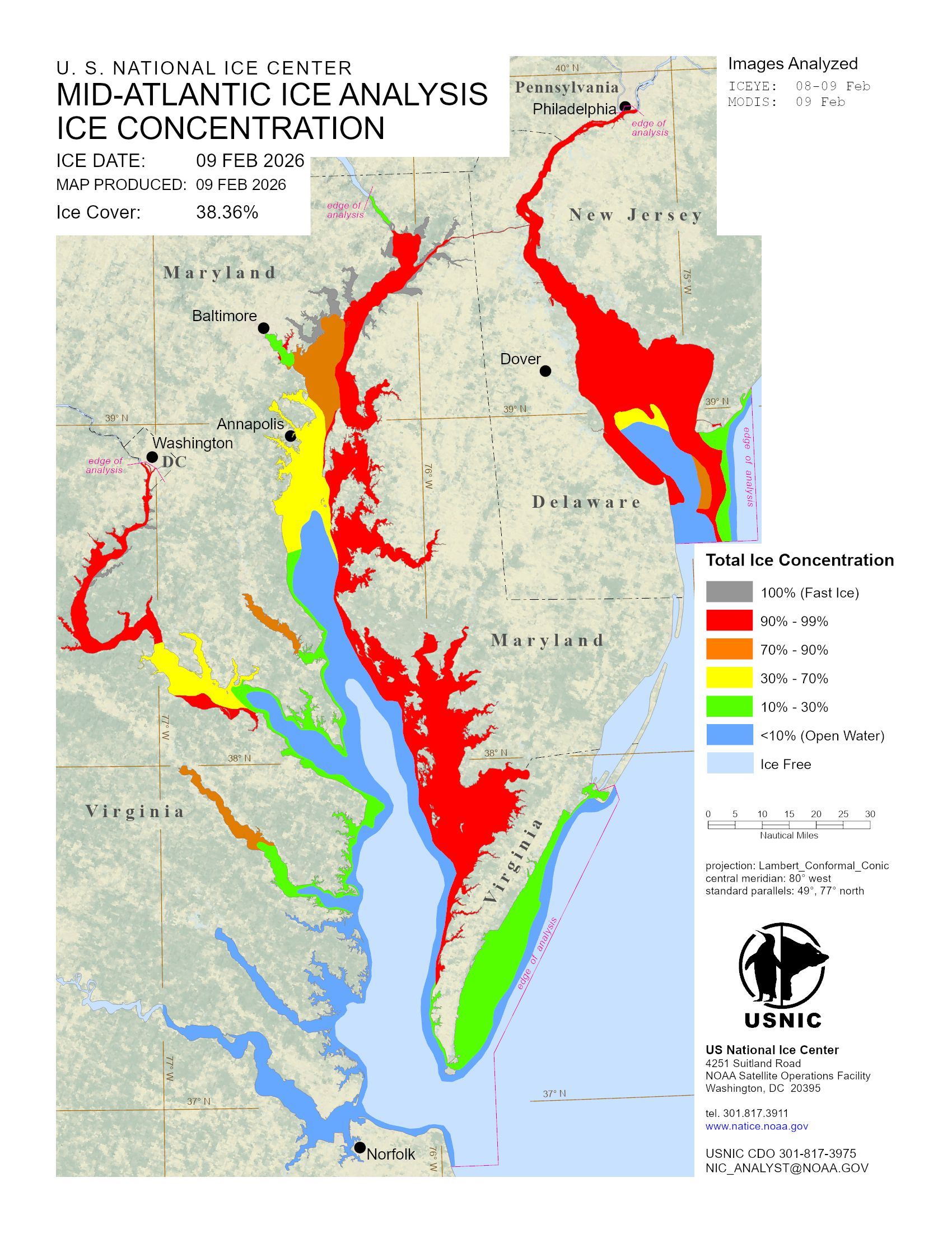
    The cumulative effects have been evident along the Schuylkill, which is looking (deceptively) fit for skating, and the Delaware River navigation channel. The river and most of Delaware Bay are between 90% and 99% ice covered, the U.S. National Ice Center reported Monday.

    It hasn’t been just us. Data pulled by Samantha Borisoff, climatologist at the Northeast Regional Climate Center, showed impressive snow-cover endurance streaks in Wilmington, Atlantic City, Washington, and New York.

    Ice cover throughout the Mid-Atlantic region expanded Sunday, said ice center physical scientist Jonathan Edwards-Opperman. While Saturday was harsher with winds gusting past 50 mph and below-zero windchills from midmorning on in Philly, the “strong winds pushed a lot of the existing ice into the shore, which exposed open water,” he said.

    Ice levels along Midatlantic waterways on Monday, Feb. 9, 2026.

    When the gusts backed off Sunday, the ice went to town. “We saw rapid new growth,” he said.

    Said PhilaPort spokesperson Ryan Mulvey, “Talking with people around the port we haven’t seen ice like this in over 10 years.”

    That said, however, he added that the Coast Guard has kept the traffic moving and “we have not experienced any ice-related delays.”

    It is about to get better

    It did not get to freezing Monday afternoon, but it should make it to the upper 30s, or perhaps the low 40s by midweek, said Amanda Lee, a meteorologist with the National Weather Service in Mount Holly.

    And daytime highs should go above 32 at least through the workweek. That combined with the growing power of the February sun — its daily wattage will be about 10% higher on Tuesday than it was on Feb. 1, according to NASA — should lessen the snow and ice cover considerably.

    That thaw, however, could come with some bumps in the road.

    “I think it’s fair to expect potholes to grow or develop as the weather gets warmer,” said PennDot spokesperson Helen Reinbrecht. Patching crews will be out there, conditions, permitting, she said.

    Those conditions should persist at least until the weekend, when another storm could affect the region, said Lee.

    It’s only Monday, which means the computers still have several more days of disputation.

    In the meantime, you may not be seeing much in the way of bare ground, but expect an outbreak of puddles. It’s been a while.

  • Philly residents thought they had a winter parking system. Then the snow stuck around.

    Philly residents thought they had a winter parking system. Then the snow stuck around.

    By the time Taylor Schuler finally freed their car, they were exhausted. It had taken five hours across two days, hacking at the wall of ice encasing their Prius’ bumper, shoveling piles of frozen snow off the tires, to complete the job. As the sun set on their afternoon of labor, they were tempted to put a piece of furniture in their hard-earned spot, a practice sometimes known as “savesies” in Philadelphia.

    But they knew better. Having just moved to Philly from Houston, the 28-year-old academic librarian wasn’t all that familiar with cold-weather etiquette, so they took to the internet ahead of January’s snowstorm to figure out what exactly Philly’s rules are. They gathered that people weren’t all that fond of the “savesies” practice, so, tempted as they were to hold onto their spot, they let it go.

    Once the spot was cleared, they circled the block, a quick trip to make sure their car was still working. Their internet research had also led them to believe no one would just take their spot immediately. As they rounded the corner toward their house, though, they saw another driver lurch into the spot they just spent hours digging out.

    “Oh jeez,” Schuler thought to themselves. “It’s like the Wild West out here.”

    In some snow-burdened cities, saving a shoveled-out parking spot is a deeply ingrained winter habit. Boston even formally acknowledges the practice by allowing residents to mark a spot they dug out for up to 48 hours after a storm. In Chicago, protecting your precious dug-out parking space with a lawn chair is called “dibs,” and it’s been a beloved and widely accepted tradition since the great blizzard of 1967.

    But Philadelphia exists in a murkier middle ground. Until about two weeks ago, it snowed infrequently enough and melted fast enough that any theory about our collective approach to storm parking was never really put to the test. But the lingering snow has revealed a kind of civic chaos, with neighbors operating under wildly different assumptions and fights breaking out over who is entitled to snow-cleared parking spots.

    The divide is often generational. Older residents, who experienced harsher winters, are more likely to embrace savesies as another classic Philly tradition while younger residents and transplants see it as territorial nonsense, out of step with the values of densely populated city life.

    Schuler finds the entire debate exhausting. “I just want to be able to go to work and come home,” they said. “I didn’t ask for any of this.”

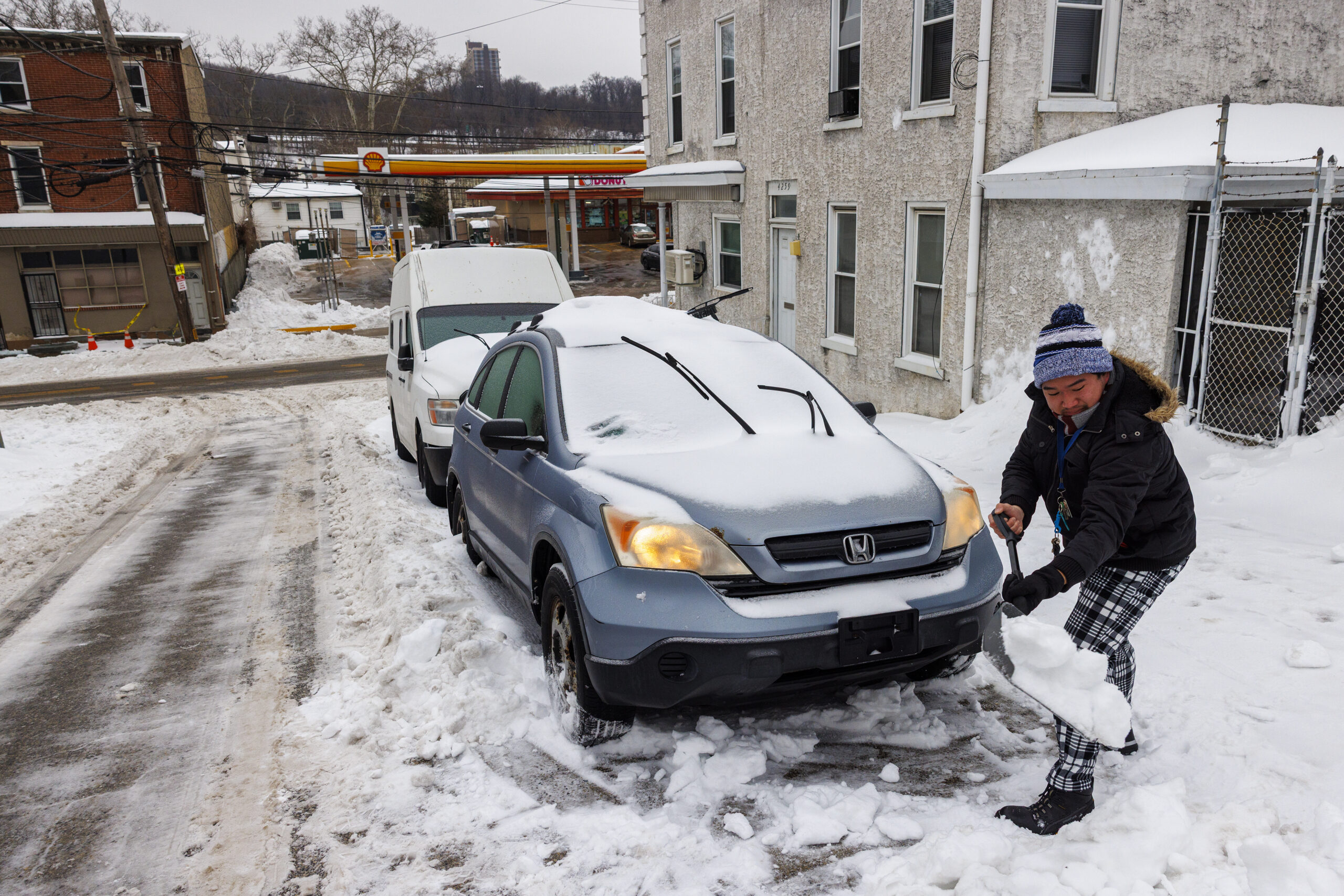
    Connor Phan digs his car out after the recent snowstorm.

    Jeff Martin, 43, who lives in South Philly, describes himself as firmly “no savesies” but with caveats. He won’t put out a chair. He won’t defend one. But he also won’t move someone else’s. “I don’t believe in the chair,” Martin said. “But I’m going to obey the chair.” His reasons are entirely practical. “I don’t want to get keyed,” he said.

    Martin argues Philadelphia’s parking wars are a symptom of the changing climate. “The fact that over the last 20 years, we haven’t gotten as much snow as we did over the previous 20 years has made us forget how to deal with it,” he said, “and the city forget how to deal with it to the point where they don’t properly fund the removal of snow.”

    For the record, the city is firmly in the “#nosavesies” camp, and the police routinely remind Philadelphians that saving parking spots is illegal. Of course, that doesn’t stop people from doing it — and other people complaining about it.

    Lucas Tran didn’t see the cinderblock in the spot he parked in on Tuesday night. It wasn’t until another driver pulled up and told him that he was in her spot that he became aware of it. She said she had dug out the spot herself, saved it with the cinderblock, and that Tran had to move.

    At first, he refused. But he backed down after she called him a liar and a “little b—.” He didn’t want things to escalate. The next day, she left a handwritten apology on his car. “Thank you for moving your car,” it read. “You are NOT a little b—.”

    Tran takes a “special exception” approach to the savesies debate. If the woman had been elderly or a first responder, or if it had been two or three days after the storm rather than a full week later, he might have been more understanding. “But the roads are drivable now, he said. “There are more options to park. You can’t keep claiming a spot that’s public property.”

    Back in West Philly, Schuler spent the week parking wherever they could. The spot they dug out remained occupied until one evening, when they pulled up, excited to reclaim what was once theirs — only to find a folding table balanced on two overturned pots in their way. Someone had “savesied” Schuler’s spot.

    Schuler snapped a photo and uploaded it to Reddit, where the response was nearly unanimous. As one Redditor put it, “that’s diabolical.”

    It was the one version of “savesies” Schuler had never seen defended. “If there’s anything people agree on,” they said, “it’s that you don’t do that.”

  • Weekend to stay frigid, forecasters say, but heat wave to near 40 may arrive on Wednesday

    Weekend to stay frigid, forecasters say, but heat wave to near 40 may arrive on Wednesday

    The frigid temperatures, the blocks of ice clogging the Delaware and Schuylkill Rivers, and the mounds of snow piled high in driveways and parking lots across the Philadelphia region are not likely to change much Sunday and Monday, Zack Cooper said Saturday afternoon.

    Cooper, a meteorologist at the National Weather Service in Mount Holly, said to expect a high of just 18 degrees on Sunday, a significant drop from Saturday’s high of 28. For Monday’s return to work for many, the weather service predicts a high of 36.

    “It’s been a long time since we’ve seen this type of prolonged stretch of cold weather,” Cooper said. “It’s been about 10 years.”

    The good news, he said, is that the temperature should peak for the week at near 41 on Wednesday. More good news, he said, is that the daytime highs are expected to reach above freezing for the rest of the week, 36 on Tuesday, Thursday, and Friday, and 38 on Saturday. But the nighttime lows should still dip below the freezing point of 32 degrees.

    In that case, Cooper said, some of the ice will melt during the warmer daytime hours but not enough to cause widespread flash flooding near rivers, lakes, and streams. A slow warmup, with warmer days and colder nights, is always best, he said.

    That’s also important regarding the giant snow piles around town because Friday was the 12th consecutive day of a snowpack of at least 5 inches at Philadelphia International Airport. In 2014, the weather service issued warnings of flash floods along the Delaware River south of Trenton after a rapid warmup, and a presidential disaster declaration was needed in 1996 when melting ice jams caused major flooding along the Delaware and the Susquehanna Rivers.

    It’s been a rough February so far for Philadelphia area residents. Daily average temperatures have been below freezing every day since Jan. 23, and the region went nine days, from Jan. 24 to Feb. 2, without reaching 32 degrees at all.

    Last week, a barge heading north got stopped in the ice on the Delaware River, ferry service was halted in the Delaware Bay due to ice, and the Coast Guard had to deploy a 175-foot-long cutter to smash up ice floes in the Delaware all the way up to Trenton.

    Cooper said the recent nine-day stretch of temperatures below freezing is likely among the top 10 longest local cold snaps on record. The last period of such frigidity, he said, was an eight-day stretch in 2015.

    As for the wind chills, Saturday night could reach minus 13 degrees. Sunday could go to minus 12, and Monday could be minus 3. High wind warnings are expected to be lifted on Sunday. No snow is expected next week.

    So what should folks do until Wednesday? Hang in there, Cooper said. “We take weather as it comes,” he said. “It’s ever-changing, and you have to adapt and adjust.”

    And if it does reach 41 on Wednesday, Cooper said, “It will feel nice.”

  • Ice is building on Philly’s waterways as the snowpack persists and the cold intensifies

    Ice is building on Philly’s waterways as the snowpack persists and the cold intensifies

    Accompanying one of the more-enduring snowpacks in the period of record, ice has continued to build in the Philadelphia region’s waterways, and all indications are that it’s going to intensify in the next three days, perhaps significantly.

    With temperatures expected to fall to single digits by Saturday night and wind gusts up to 55 mph, the region is about to experience an assault from a “cold air gun,“ said Alex Sosnowski, senior meteorologist at AccuWeather Inc.

    The combination, plus the below-freezing temperatures at least through Monday and the ongoing cold spell that began last month, will not only deepen the ice cover but will make it more uniform by freezing over breaks in the ice.

    “You’re going to see the ice-over become more extensive,” Sosnowski said.

    Earlier in the week, icing temporarily stranded a vessel on the Delaware River that was delivering much-needed salt supplies to Philly. (They did eventually get here.)

    The U.S. Coast Guard was using a 175-foot-long cutter to break up ice on a portion of the river channel that runs from the mouth of the ice-covered Delaware Bay — where Cape May-Lewes Ferry service was disrupted this week — to Trenton.

    As of Friday morning, the craft had been ramming ice for 45 hours since the freeze began at the end of last month, U.S. Coast Guard Petty Officer Matthew West said.

    So far, however, the ice hasn’t reached crisis levels, said Ryan Mulvey, a spokesperson for the Philadelphia Regional Port Authority. For ship traffic on the river, it’s been more a matter of “road work ahead” rather than ”road closed.”

    “We’re open as usual,” he said. “I think the largest ships help with breaking up some of the ice flow.”

    One thing is certain, meteorologists are warning: The ice factory is going to be in full production mode until Tuesday.

    And, ironically, even as precipitation deficits and drought conditions persist, flooding potential is a source of concern.

    The short-term outlook for icing in the Philly region

    A key to melting, said Sosnowski, is having a sequence of daily average temperatures above freezing, not just daytime highs above 32 degrees. Nights also have to warm up.

    The prospects of that happening aren’t looking good for the next several days. Officially, Friday was the 12th consecutive day of a snowpack of at least 5 inches at Philadelphia International Airport, the seventh-longest such stretch in records dating to the winter of 1884-85.

    Daily average temperatures have been below freezing every day since Jan. 23.

    Highs on Saturday and Sunday, even in the city, may struggle to reach 20 degrees, with lows in single digits Sunday and Monday mornings.

    A promised warmup during the workweek wasn’t looking as toasty on Friday as it was earlier in the week. Monday’s temperatures were forecast to top out in the 20s, and no daily average temperatures are forecast above freezing through Friday.

    Some rain or snow also is possible Wednesday, said Nick Guzzo, a meteorologist with the National Weather Service in Mount Holly. A storm is possible next weekend, but computer models continue to disagree with each other, and themselves.

    To erase the snowpack, the region could use a warm, moist air mass and rain that would produce “river rises” that would help break up the ice, the weather service says.

    But not too much rain.

    The long-term outlook: Flooding concerns amid a drought

    Some of the worst flooding on record has resulted from ice-jamming, a signature example occurring after Philadelphia’s mammoth 1996 snowstorm.

    Moist air preceding a rainfall all but erased the snowpack with a historic melt. When that air came in contact with the snow, it condensed, releasing latent heat that sped up the melting.

    Rain followed, and liberated ice jams led to destructive flooding along the Delaware and the Susquehanna Rivers and a presidential disaster declaration.

    NOAA’s Middle Atlantic River Forecast Center is well aware of the potential and is monitoring conditions, said senior hydrologist Johnathan Kirk.

    “That’s what we have to watch for,” said Sosnowski, who well remembers 1996.

    “It is going to take one of the more mild-mannered thaws to avoid ice-jam flooding,” he said.

    A mild thaw is possible, Sosnowski said, but “the odds are stacked against it. It’s been so cold for so long.”

  • Philly is not dumping snow in the Schuylkill, but it has in the past

    Philly is not dumping snow in the Schuylkill, but it has in the past

    Many Philadelphians are continuing to deal with snow-clogged, slushy, ice-laden streets nearly two weeks after a winter storm produced the city’s biggest snowfall in a decade.

    To deal with the snow, the city has deployed roughly 1,000 workers and 800 pieces of snow-removal equipment, and instituted programs to break up ice at crosswalks and streets in residential neighborhoods, among other efforts. But to some Inquirer readers, the solution has been right in front of us all along.

    “I know we used to toss snow into the river,” one reader wrote via Curious Philly, The Inquirer’s forum for questions on all things local. “What happens to it now?”

    » ASK US: Have something you’re wondering about the Philly region? Submit your Curious Philly question here.

    In the past, the city has dumped snow into the Delaware River and the Schuylkill on various occasions. But in recent decades, that practice has been used rarely — if at all — primarily over environmental concerns. Here is what we know:

    An old practice

    Newspaper archives show references to dumping snow in the Delaware and Schuylkill dating back at least to the late 19th century — during a storm colloquially known as the “Great Arctic Outbreak of 1899.” That storm dumped 19 inches of snow on Philadelphia around Valentine’s Day.

    In the aftermath, the city sought permission from its Board of Port Wardens to dump snow in the rivers surrounding Philadelphia, but there were concerns over the “considerable amount of dirt” that would be thrown into the water.

    The practice was utilized in the winter of 1909, when 21 inches of snow fell. Initially, snow was dumped into the rivers at three points, but officials later expanded approved dumping sites to be “at any point and from any wharf” along either river.

    “It was contended that this was perfectly proper, since snow is not refuse, but will readily melt after it is thrown into the water,” The Inquirer reported at the time.

    https://www.newspapers.com/article/philadelphia-daily-news/190719291/

    Article from Jan 10, 1996 Philadelphia Daily News (Philadelphia, Pennsylvania) <!— –>

    The blizzard of ’96

    Perhaps the most well-known modern use of Philadelphia’s rivers as a snow dump came in 1996, when a debilitating 30.7 inches of snow fell in early January. The city was left with few options, and got a permit from state environmental officials to dump snow in the rivers, Inquirer reports from the time indicate.

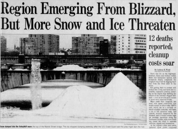
    Within days, roughly 500 tons of snow were dumped into the rivers, and that total would grow into the thousands. Famously, city trucks were spotted dumping snow into the Schuylkill from the Market Street Bridge — until being asked to stop by the U.S. Coast Guard.

    “We did advise the city to stop dumping snow into the Schuylkill. Our concern was the accumulation of ice in the river,” a Coast Guard spokesperson said at the time. The piles of snow in the river ran the risk of forming dams that could cause flooding.

    The piles became so severe they had to be beaten back down. By mid-January, one Inquirer report noted, wrecking balls were sent in to break up at least one mountain of snow that threatened to clog the Schuylkill.

    https://www.newspapers.com/article/the-philadelphia-inquirer/190719516/

    Article from Feb 22, 2003 The Philadelphia Inquirer (Philadelphia, Pennsylvania) <!— –>

    An ‘option of last resort’

    The city again in 2003 dumped snow into Philadelphia’s rivers, this time in an attempt to mitigate the impacts from a February storm that left about 19 inches of the white stuff. This time, though, city officials seemed to at least feel bad about it, calling it an “option of last resort.”

    For this storm, roughly 400,000 pounds of snow was dumped into the Schuylkill. But along with it went road salt, antifreeze, trash, and other pollutants, prompting concerns from regional environmental groups. That pollution, they said, could harm marine life and devastate the riverbanks.

    “All the stuff that’s on the road surface goes into the water,” Delaware Riverkeeper Network head Maya van Rossum told The Inquirer that year. “This is not the appropriate way to deal with the snow. There are plenty of places on the land to put it.”

    The dumping, Streets Commissioner Clarena Tolson said, was limited. And the Pennsylvania Department of Environmental Protection said it asked the city to only dump “virgin snow” into the rivers.

    https://www.newspapers.com/article/the-philadelphia-inquirer/190719722/

    Article from Feb 12, 2010 The Philadelphia Inquirer (Philadelphia, Pennsylvania) <!— –>

    No more dumping, officially

    By 2010, the city appeared to have officially abandoned the practice of dumping snow into city riverways. That February, one storm caused more than 28 inches of snow to fall, but Mayor Michael A. Nutter’s administration declined to pour it into the rivers.

    “We’re going to take some of that down to the Navy Yard. We will not dump in the river,” Tolson said. “There are environmental concerns with placing snow in the river. The snow accumulates pollutants and salt, and dumping it in the river would be a very extreme measure.”

    The Center for Environmental Policy at the Academy of Natural Sciences applauded the Nutter administration’s decision, writing in a letter to The Inquirer that the move would “prevent serious environmental damages to the river.”

    “Urban precipitation, including snow, acquires a witch’s brew of contaminants such as oil, grease, litter, road salt, and lawn fertilizer,” director Roland Wall wrote. “We salute the city for making a commonsense decision that will protect one of Philadelphia’s natural treasures.”

    A pedestrian walks past a large pile of snow and ice along the Benjamin Franklin Parkway days after a fierce winter storm dropped up to 9 inches of snow and sleet, with freezing temperatures leaving large banks of ice and snow on streets and sidewalks in Philadelphia, Monday, Feb. 2, 2026.

    So what do we do now?

    On Wednesday, Carlton Williams, the city’s director of clean and green initiatives, said the city does not dump snow in Philadelphia’s rivers, as that practice is “not an EPA standard.” Instead, the city has gravitated toward removing the snow from city streets and placing it at 37 snow dump sites around Philadelphia.

    The city did not respond to a request for comment regarding those dump sites’ locations. Some of them contain mounds of snow up to 12 feet high that stretch for blocks, Williams said Wednesday. Officials also brought in a snow-melting machine from Chicago.

    Pennsylvania Department of Environmental Protection guidelines, meanwhile, recommend municipalities push snow at least 100 feet away from surface waters, where it will be able to melt with less environmental impact.

    “Dumping of snow directly into a stream carries with it the shock of loading de-icing chemicals and anti-skid agents,” the agency said in a recent recommendations document. “Allowing a natural melt provides a slow release of the water, dilutes the chemicals, and provides filtration of the solids through the soil.”

  • A dash of snow, an Arctic chill, and 55 mph wind gusts are possible this weekend in Philly

    A dash of snow, an Arctic chill, and 55 mph wind gusts are possible this weekend in Philly

    By now Arctic air may qualify for a frequent-visitor pass around here, but the version coming this weekend will be of a different quality and have a particular sting.

    “It’s going to be a slap in the face,” said Cody Snell, a meteorologist with the National Oceanic and Atmospheric Administration’s Weather Prediction Center.

    After a day in which highs will be around freezing on Friday — a solid 10 degrees below normal — some nuisance snow is possible late in the day or evening and early Saturday, and maybe even squalls. Then temperatures are going to tumble through the teens in the wake of another potent Arctic front.

    They might not see 20 degrees in the Philly region until Monday.

    Adding bite will be winds that could gust to 55 mph, and the National Weather Service says wind chills of 10 and 15 below are likely Saturday in the immediate Philly area. The agency has issued an “extreme-cold warning” — a relatively new addition to the advisory list — in effect Saturday afternoon through Sunday morning. Wind chills of 17 below zero are possible, and winds could gust to 55 mph, the weather service says.

    Said Ray Martin, a lead meteorologist at the weather service office in Mount Holly, “It’s going to be awful.” Among the recent sequence of Arctic invasions, “it looks like the worst.”

    In short, that unusually tenacious snowpack that was left over from the 9.3 inches of snow and white ice that fell on Jan. 25 and has since mutated into a form of frozen slurry will be spending at least another weekend in Philly.

    What’s more, it’s likely to be a harvest weekend for the ice that is solidifying upon the region’s waterways, a growing concern.

    A warm-up is due to begin Monday and pick up steam during the workweek, with highs maybe reaching 40 degrees on Thursday. But it may encounter some resistance, and another storm threat might be brewing for next weekend, forecasters say.

    The snowpack already has achieved an elite status

    Friday marked the 12h consecutive day in which the official snow cover at Philadelphia International Airport, measured daily at 7 a.m., was at least 5 inches.

    In the 142-year period of record, that ties for seventh place for a snow-cover duration of that depth.

    “To hold on to a snowpack like this is unusual,” said Johnathan Kirk, senior hydrologist at NOAA’s Middle Atlantic River Forecast Center, in State College, Pa., which is keeping a close eye on the waterway icing.

    The Schuylkill in Philly is ice-covered, as is the Delaware River from Trenton to Washington Crossing.

    In addition to an eight-day stretch when temperatures failed to reach 30, the durability is related to the 2 or so inches of sleet that capped the snow on Jan. 25. Sleet is white ice that melts more slowly than snow.

    The dry and cold air has been a natural preservative; snow and ice melt more readily when the air is moist.

    Another factor was the impressive liquid content of the snow and sleet, Snell said. The frozen mass contained 1.39 inches of liquid, the weather service said, comparable to what is contained in 15 to 18 inches of snow.

    As temperatures finally nudged above freezing, some melting did occur this week, which would explain that unsightly slushy porridge at Philly intersections. However, the official snow depth lost only an inch between Jan. 27 and Wednesday.

    The snowpack may receive a fresh frosting Friday night into early Saturday with up to an inch of snow, Martin said, but it’s not going to have the same staying power.

    What’s different about this Arctic air mass

    Any snow that falls is likely to get blown away in a hurry, Martin said, as winds will pick up before daybreak Saturday and gusts howl to 50 mph by late morning.

    Typically, cold air pours into the region from the northwest and becomes modified as it passes over land, the Great Lakes, and the mountains.

    This is going to be a straight-up Arctic shot. It will come more or less from the north, and the icy lakes are not going to do much to impede it, said Matt Benz, senior meteorologist at AccuWeather Inc.

    The weather center’s Snell said a weak storm system moving off the Atlantic coast is forecast to blow up as it interacts with warm Gulf Stream waters. The differences between the cold high pressure with its heavier air over the East and the lighter air of the storm are going to place the Philadelphia region in a frigid sandwich.

    Heavier air tends to rush toward lighter air, like air escaping from a punctured tire.

    A thaw is coming to Philly, eventually

    Just how warm it gets next week remains unclear, AccuWeather’s Benz said.

    “Arctic air is hard to dislodge sometimes,” he said, adding that recent model trends suggest the warm-up will not be quite as robust as expected earlier.

    A wild card would be a potential storm next weekend. The European forecast model was seeing rain and 60 degrees, Martin said, while the U.S. model was suggesting a blizzard.

    His take: “I have no clue at this point.”

    An anniversary of note

    On Feb. 5, 2010, 6.6 inches of snow fell upon the airport, the beginning of an unprecedented siege in which 44.3 inches accumulated in a six-day period.

    A man shovels cars out under mountains of snow in West Bradford Township, Chester County, during the incredible snow siege of February 2010.

    Twelve days after the snow stopped, the official snow depth was down to 4 inches.