Category: Weather

  • The arctic cold persists, and so does Philly’s snowpack. Both may even go away some day.

    The arctic cold persists, and so does Philly’s snowpack. Both may even go away some day.

    It looks like the Philly region will evade any snow generated by that coastal “bomb cyclone” during the weekend, but the disruptive snowpack on the ground continues to melt at a glacial pace. Maybe ever slower.

    “For now, it’s not budging,” said David Robinson, the New Jersey state climatologist who is an international expert on snow cover.

    And, ironically, that has a whole lot to do with what happened in the hours right after the snow stopped around 11:30 a.m. Sunday.

    Add one of the more signifiant Arctic cold spells in Philadelphia’s period of record, and the entire region has endured a white and wintry week rarely experienced around here.

    As of Friday morning, the official snow depth at the airport still was 6 inches, about two-thirds of what was measured when the storm ended five days before.

    For perspective, the depth was 6 inches five days after a snowstorm in 2016 — after 22.4 inches had fallen.

    The cold won’t be as harsh during the workweek, but a thaw isn’t imminent, and some snow is possible Wednesday.

    Temperatures are forecast to drop deep into the single digits Saturday morning, flirting with records. It is not due to get into the 20s until Sunday, when backlash winds from the potent coastal storm are expected to drive wind chills below zero.

    Those winds may contribute to significant flooding at the Shore, where they could gust to 50 mph.

    About last Sunday in Philly

    About 7.5 inches of snow had fallen officially by 11:30 a.m. Sunday at Philadelphia International Airport, more in some other places, when it yielded to several hours of sleet that accumulated 2 to 3 inches, coating the snow with a sparkling, icy veneer.

    “You can’t help but recognize the beauty of it,” said Robinson, a Rutgers University geography professor and keeper of the Rutgers Snow Lab.

    While it may be an aesthetic pleasure, especially at night under the full “snow moon” rising this weekend, it has had a profoundly chilling effect on cleanup efforts.

    The sleet, liquid that freezes before it lands, literally put an ice cap on the snow. “Ice pellets are tougher to melt,” said PennDot’s Thomas Rogal, a maintenance supervisor for the Philadelphia district. In a melting race, a homely sleet ball wouldn’t have a chance against a six-sided snowflake.

    On Sunday, said Rogal, the sleet was a game-changer for the road crews. Instead of just plowing, crews were “scraping the road surfaces,” he said. Sleet added a stubborn stickiness to the mass of frozen material.

    It also contained about as much liquid as several inches of snow, said Robinson.

    The surprisingly cold temperatures, in the lower 20s and teens, inhibited the effectiveness of salt on Sunday. “The material just didn’t function,” said Rogal.

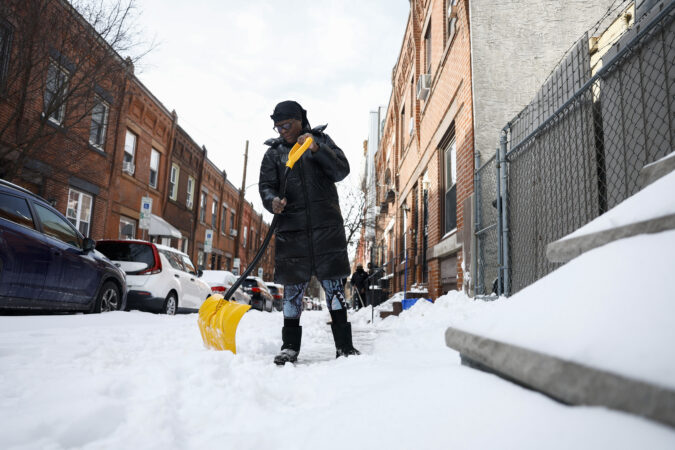
    In the city, the glacial mass has been especially disruptive, a royal, inconvenient pain for people living on side streets, for street crews, for anyone who has tried shoveling, and for the schools.

    In addition to the snow and ice challenges, the cold has stressed aging heating systems in the public schools, once they reopened.

    A thermometer in a Central High School classroom on Friday read 39 degrees. That’s colder than the normal high for the date in Philly — outdoors.

    When will all this go away?

    Philly hasn’t had a stretch of days like this in which the temperature has failed to reach 30 degrees since 1979, according to records tracked by the Pennsylvania state climatologist.

    And it likely is going to finish in the top 10 for consecutive days in which readings didn’t get past freezing, said Mike Silva, a meteorologist with the National Weather Service in Mount Holly.

    Low temperatures Thursday and Friday morning, 13 and 11, respectively, were several degrees above the forecasts. That probably was related to the winds at the airport, he said.

    It also may be related to the sleet, said Robinson: Ice doesn’t have quite the same chilling effect as fresh snow.

    Conditions Saturday morning — clear skies and lighter winds — should be more conducive for daytime heating (we use the term loosely) to radiate into space. Morning lows could approach the record of 3 degrees, set in 1948.

    Some moderation is expected with the workweek, but not much. “We were hoping to get to the mid-30s,” said Sliva, but “it looks like we may barely get to freezing.”

    Even at those temperatures, some melting should occur.

    The total daily solar energy beaming toward Philly now is about 30% higher than it was on Jan. 1, according to NASA’s calculations, and the sunrise-to-sunset time is increasing by about two minutes a day.

    Even the cold has a bright side, said PennDot’s Rogal. Potholes, it turns out, have something in common with a lot of humans: “They aren’t particularly fond of this weather.”

    “The freeze-thaw is what always gets us,” he said. “We’re actually in better shape when the cold sets and stays.”

    Even if it snows next week — “There’s a couple of systems that could affect us,” said Silva — based on 150 years of official record-keeping for Philly, it is going to warm up and the ground will reappear.

    Eventually.
  • A coastal ‘bomb’ and single-digit temperatures are expected this weekend in the Philly area

    A coastal ‘bomb’ and single-digit temperatures are expected this weekend in the Philly area

    It remains a long shot that a fresh layer of frosting will coat the hardening and tenacious snowpack, but evidently that street-congesting frozen mass isn’t exiting in the near future.

    As of Friday morning, it appeared that a potent coastal storm that is expected to qualify as a meteorological “bomb” was going to spare the Philadelphia region from another snowfall.

    But it is expected to have serious impacts on the New Jersey and Delaware beaches, with a combination of onshore gales and a tide-inciting full moon, forecasters are warning.

    On the mainland, it is poised to generate winds that would add sting to what has been one of the region’s most significant outbreaks of Arctic air in the period of record.

    Lows at Philadelphia International Airport both Thursday and Friday mornings — 13 and 11, respectively — were several degrees above what was forecast.

    But they are to drop into single digits Saturday morning, and flirt with a record. Wind chills during the weekend are expected be in the 10-below range, said Mike Silva, a meteorologist with the National Weather Service in Mount Holly.

    “Even though there might not be much or any snow in Philly,” he said, “it’s going to be cold, and we’re still going to have the wind impacts.”

    window.addEventListener(“message”,function(a){if(void 0!==a.data[“datawrapper-height”]){var e=document.querySelectorAll(“iframe”);for(var t in a.data[“datawrapper-height”])for(var r,i=0;r=e[i];i++)if(r.contentWindow===a.source){var d=a.data[“datawrapper-height”][t]+”px”;r.style.height=d}}});

    Is the snow threat off the table for Philly?

    Computer models continue to keep the storm far enough off the coast to preclude a major snowfall inland.

    But “it wouldn’t take much of a jog west to really mess up the forecast,” said Tom Kines, senior meteorologist with AccuWeather Inc. It’s been known to happen.

    On Friday morning, the National Weather Service was posting a 30% chance that Philly would get something measurable — technically 0.1 inches — Saturday night into Sunday, with about a 10%shot at an inch.

    The weather service was expecting an inch at the Shore, but with a slight chance of several inches.

    Forecasters are certain that a storm is going to blow up off the Southeast coast as frigid air that is penetrating all the way to Disney World interacts with the warm waters of the Gulf Stream.

    Gusts at the Shore during the day Sunday might be as high as 40 mph as the storm could reach “bomb” status.

    What exactly is a ‘bomb?’

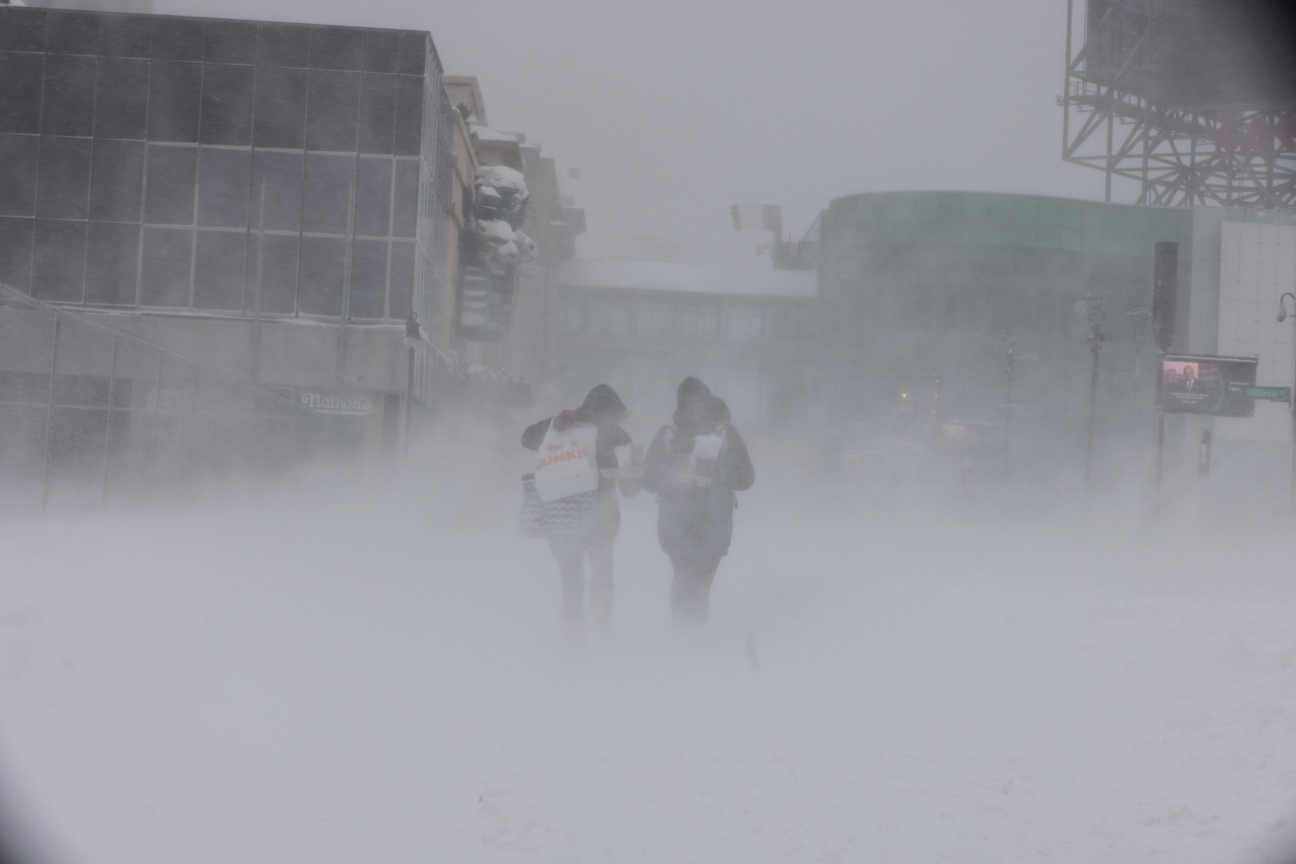
    Two brave souls endure the snow and winds from a meteorological bomb cyclone in Atlantic City in January 2022.

    The technical definition of a meteorological bomb is a drop in central barometric pressure of 0.7 inches in a 24-hour period, about a 2% to 3% change in the weight of the air. That might not seem like much, but it’s a big deal if you’re a column of air.

    Such a drop in pressure indicates a rapidly developing storm. Air is lighter in the centers of storms, as precipitation is set off by lighter warm air rising over denser cold air.

    As a weather term, bomb first appeared in an academic paper in 1980 by atmospheric scientists Frederick Sanders at the Massachusetts Institute of Technology and John Gyakum at McGill University.

    They found that the western Atlantic, in the proximity of the Gulf Stream, was one of two regions on the planet most prone to bombs. The other was the area near the Kuroshio Current in the far northwestern Pacific.

    Both are massive reservoirs of warmer waters that interact with cold air coming off land masses. Some of the European settlers in the colonial era learned about the effects the hard way, experiencing mega-storms that were alien to areas in England.

    Gyakum, who was Sanders’ graduate student at MIT, recalled Thursday that the duo took some blowback for using the word bomb.

    But with a cyclone of such ferocity, the term was worth using to draw the public’s attention to potential impacts, which sometimes exceed those of hurricanes, Gyakum said.

    He said he had no doubt this weekend’s storm would reach bomb status.

    While any heavy snows from this storm are likely to bypass the Philly region, some accumulating snow is possible the middle of next week, Kines said, although nothing in a league with what happened Sunday.

    When can Philly expect a thaw?

    Temperatures during the coming workweek are due to moderate, at least slightly, with highs around freezing Monday through Thursday, 10 to 12 degrees warmer than what is expected this weekend.

    The cold “certainly eases up,” Kines said.

    But that 9.3 inches of snow and sleet that accumulated Sunday evidently has taken a particular liking to the region. As for when it will disappear, he said: “It’s going to take a while.”

    The overall cold upper-air pattern looks to persist, said Paul Pastelok, AccuWeather’s long-range forecaster. And the extensive snow cover is going to have a refrigerant effect on temperatures.

    So when will it warm up and go away?

    “We’ll find out Monday,” Kines said. He was referring to Groundhog Day, of course, when Punxsutawney Phil will issue his extended forecast.

    Nevertheless, he said, meteorologists will be on call if needed.

    “It never hurts to get a second opinion,” he said.

  • Philly threatened shoveling fines. Then it left its own parks and properties snowy and icy.

    Philly threatened shoveling fines. Then it left its own parks and properties snowy and icy.

    Before 9.3 inches of snow and sleet blanketed Philadelphia, in the biggest snowfall the city has seen in a decade, officials were adamant: Shovel or face a fine.

    In a news conference last week, Director of Clean and Green Initiatives Carlton Williams said residents would have six hours to shovel after the last bit of snow fell. Failure to do so could result in a $300 fine.

    But four days after the last icy flake fell, residents across Philadelphia say the city has set a bad example on the shoveling front, noting various city-owned properties, many of them parks, remain inaccessible for people with strollers, wheelchairs, and those who have limited mobility, and a frigid obstacle for even the most nimble.

    “It feels emblematic of the city’s attitude towards its residents, where it’s like they have rules and laws for everybody, but if they can’t manage to do something, it’s like, ‘We don’t have the resources. People need to be patient. We’re trying,’” said Coryn Wolk of Cedar Park.

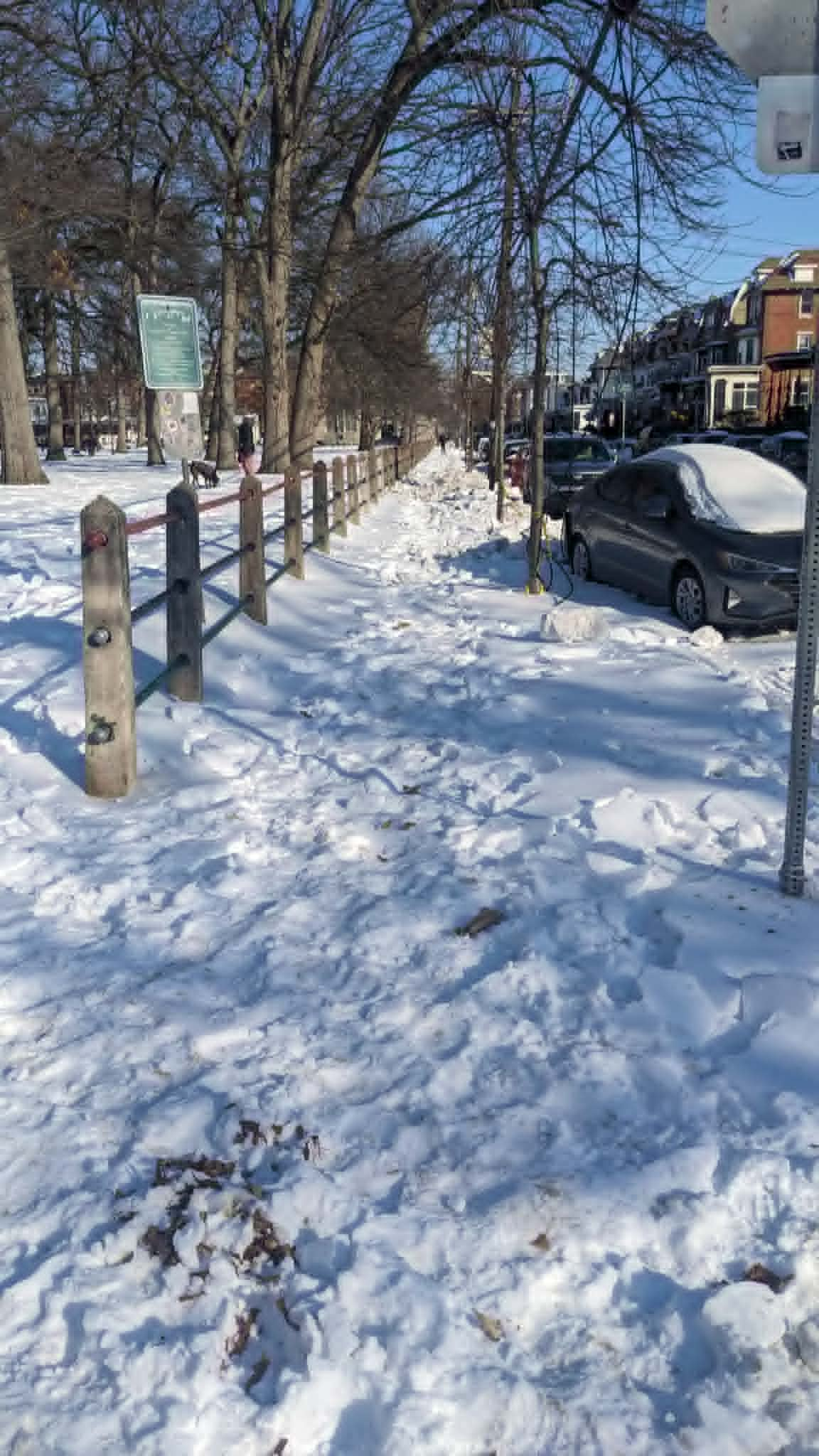
    The 36-year-old said she does have some sympathy for the city, as do many others, because it is responsible for so many sidewalks and buildings, and the icy weather isn’t helping cleanup efforts. But as she walked through Malcolm X Park Thursday, frustration set in as she trudged through a sidewalk of tightly packed, icy snow.

    The city did not respond to a request for comment regarding shoveling issues but its rules say paths on sidewalks must be three feet wide. Those on streets with sidewalks less than three feet wide can carve out paths that are one foot wide.

    A sidewalk of Malcom X Park in West Philadelphia on Thursday, Jan. 29, 2026.

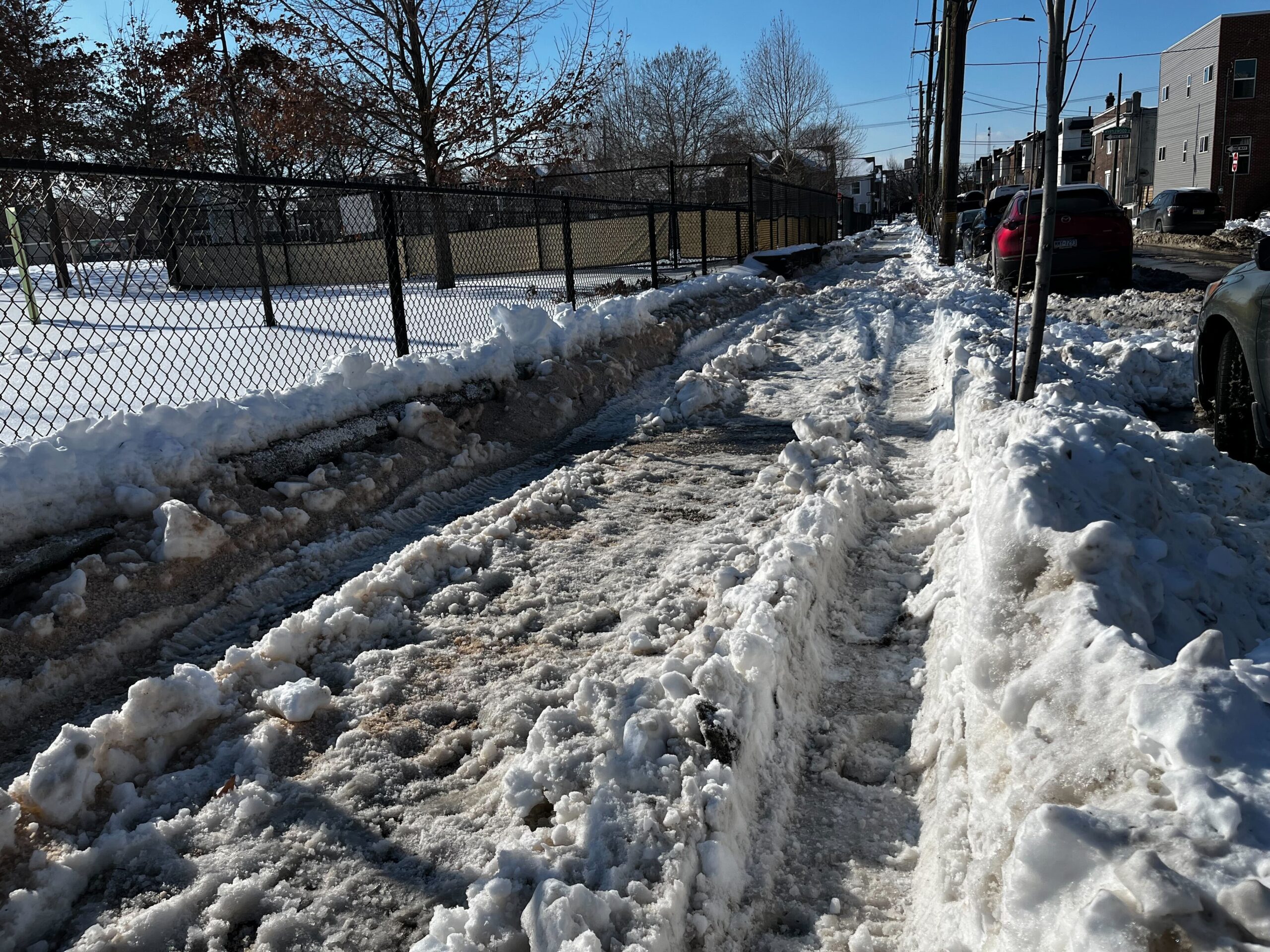
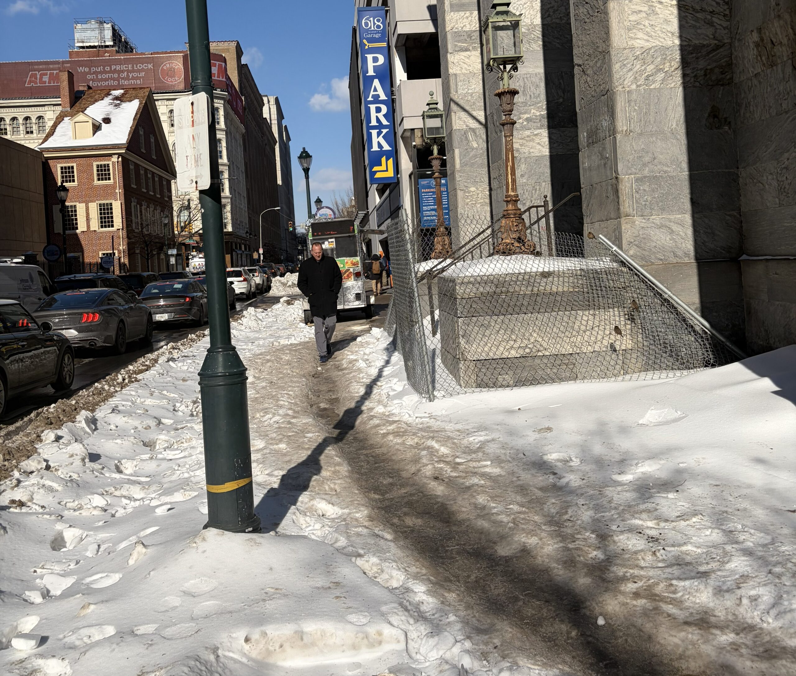
    Still, Greys Ferry’s Lanier Park, Ridgeway Park in the Hawthorne section of the city, and Cobbs Creek Park also had sidewalks covered by a trampled layer of gray and yellow snow Thursday. In Center City, outside the former Philadelphia History Museum, another city-owned property, passersby had molded a narrow path that should have been shoveled.

    A sidewalk along Lanier Park in Grays Ferry on Thursday, Jan. 29, 2026.

    Residents say the problem extends to trolley and bus stops that line streets, describing large mounds of snow they need to climb like athletes to reach their modes of transportation.

    Chase Howell, 29, described a herculean snow trudge through Center City with the child she nannies Wednesday. In one instance, she tried to catch the Route 4 bus along Broad and Spruce Streets only to find there was “no way to access the bus lane” because of snow pileups. To her disappointment, the next bus shelter north “was halfheartedly shoveled a foot wide but incredibly slippery.”

    In the process of lifting and pushing the stroller, Howell hurt her back, but she said that’s secondary in her whole ordeal.

    The city owes residents who use wheelchairs more than this, she said. “City curbs should be shoveled three feet wide just as the requirement is for residences and businesses.”

    Those stops and bus shelters are not under SEPTA’s purview. The responsibility of cleanup falls to the city and others who own property next to the stops, according to the agency’s spokesperson Andrew Busch. SEPTA, however, is responsible for the bus stops at the major transit hubs and clearing platforms, entrances, lots, and other areas at train stations.

    Walking around West Philadelphia, Razan Idris has seen plenty of businesses and properties that have also neglected to clear their sidewalks. But she thinks the cleanup is part of a larger issue that can be applied to property owners who don’t pick up trash or who let their buildings rot.

    “I see it as kind of the same thing, like there is little to no accountability for whoever is owning a building or an area or a lot,” said the 30-year-old.

    But ultimately, the buck stops with the city, said Idris.

    The former Philadelphia History Museum, which is city-owned, on Thursday, Jan. 29, 2026.

    By failing to care for public sidewalks surrounding parks and municipal properties, other residents feel the city is sending a message that the rules on shoveling aren’t being enforced.

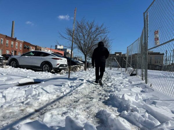
    In South Philly, pedestrians trudged through crusty snow on the sidewalk along West Passyunk Avenue next to the former Melrose Diner. The sidewalk looked like it hadn’t been shoveled since the storm hit last week.

    The property is owned by M R Realty Limited Partnership, state records show. Business owner Michael Petrogiannis did not respond to a request for comment.

    A passerby, who only identified himself as Derek, complained about how some property owners leave their neighbors with the responsibility of making the sidewalks safe for use.

    “They don’t come out and shovel,” he said. “So I’m the one shoveling for them.”

    Staff writers Henry Savage and Max Marin contributed to this article.

  • Another weekend snow watch and ‘exceedingly rare’ cold are on tap for Philly

    Another weekend snow watch and ‘exceedingly rare’ cold are on tap for Philly

    Another weekend snow chance and more cold are in the forecasts. But the big difference between last week and this one in the Philadelphia region is a matter of degrees — about 10 of them.

    A coastal “bomb cyclone” could form during the weekend with significant impacts, at least at the Shore. Computers were still sorting out what effects, if any, it would have in Philly. On Thursday, however, they favored snow staying to the south and east, with only a 40% chance they got to I-95.

    In the meantime the cold will be epical by Philly standards.

    If the forecast holds, in addition to coming close to ending a 32-year zero-less streak, Philadelphia would have daily minimums of 5 degrees Fahrenheit or lower on the next two mornings.

    And it appears the city will have its first nine-day stretch in which the temperature failed to reach 30 degrees since 1979, based on analysis of temperature data from the Pennsylvania state climatologist.

    In issuing a cold weather advisory for wind chills as low as 10 below zero, the National Weather Service in Mount Holly noted that “it is exceedingly rare to get this combination of length and magnitude of an arctic airmass for this area.”

    Philadelphia’s forecast high on Thursday, 19, would be more than 10 degrees lower than the forecast for Anchorage, Alaska.

    Heading into the weekend, that subtly laminated lunar landscape with the one-horse-open-sleigh look in the fields and parks is almost certain to persist while bedeviling road-clearing efforts.

    Some snow is possible late Saturday or Sunday — and this is becoming a habit — in time for the rising of the full “Snow Moon,” which may be a problem for the Jersey Shore. The full moon will likely contribute to tidal flooding.

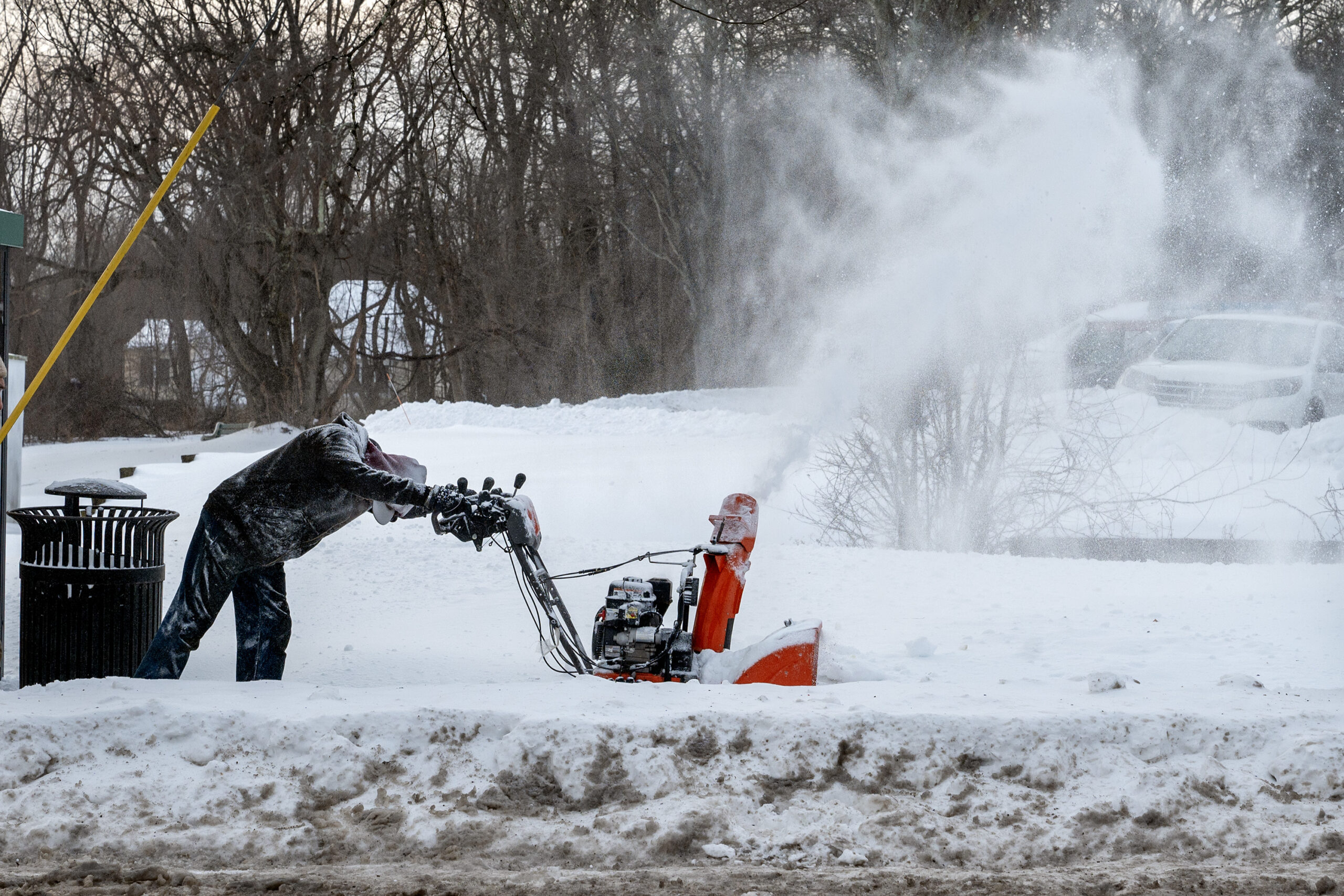
    Snow removal contractor Jordan Harlow clears the sidewalk in front of an apartment building on Main Street in Doylestown Wednesday, Jan. 28, 2026, following Sunday’s snowstorm. He said the layer of ice made it twice as difficult to use the snow blower.

    The snow outlook for the weekend

    On Wednesday only two things were certain about the latest threat: A major coastal storm is going to blow up during the weekend, and it’s not going to rain.

    “Everything looks like it’s going to come together,” said Paul Pastelok, the long-range forecaster for AccuWeather Inc.

    AccuWeather said it may intensify enough to qualify as a “bomb cyclone.”

    An early consensus among computer models was that the storm would stay too far offshore to generate a major snowfall in the immediate Philly area. Pastelok said it was looking for Philly to get “sideswiped” with a 1- to 3-inch event. However, that was very much subject to change.

    The weather service would not be making a first guess at potential accumulations until Thursday afternoon, said Alex Staarmann, a National Weather Service meteorologist in Mount Holly. In its forecast discussion Wednesday, it said that based on a consensus of the models, the Shore had a 35% to 50% chance of 6 inches of snow or more, with a 20% chance along I-95.

    More certain was the potential coastal flooding threat at the Shore with potent onshore winds coinciding with Sunday’s full moon.

    And while it may seem the atmosphere enjoys ruining weekends, it’s not uncommon for weather systems to fall into 3½- and seven-day cycles. That has to do with the spacing between weather systems, meteorologists say.

    Regardless of what happens during the weekend, the region is going to begin the workweek with snow on the ground.

    The snow is going to have more staying power than the average computer-model snow forecast.

    It’s not going to get a whole lot warmer anytime soon

    Even though it’s ice cold, as if developing a slow leak, the depth of the snow pack is actually decreasing, but ever so ponderously.

    That 9.3 inches of snow and sleet that accumulated Sunday was down to 6 inches at Philadelphia International Airport on Wednesday morning, Staarmann said.

    Compaction and sublimation, which is similar to evaporation, are lowering the depth, despite the cold. But Wednesday’s depth report was the same as Tuesday’s.

    And after what does or doesn’t happen Sunday, temperatures are forecast to remain below freezing at least until Feb. 4.

    No significant warm-up is in sight, and the National Oceanic and Atmospheric Administration’s Climate Prediction Center has odds strongly favoring below-normal temperatures until Feb. 11.

    The upper-air pattern continues to favor cold pouring into the Northeast.

    And more cold air is possible later in the month with a visit from the polar vortex, Pastelok said.

    Average temperatures in Philly finished 3.6 degrees below normal in December, and despite a 10-day warm spell earlier in the month, January is projected to finish at least 2 degrees below long-term averages.

    For Pastelok and other seasonal forecasters, it has been a tough winter.

    “We underestimated how cold the Northeast would be this year,” he said.

  • Philly’s unplowed snow has slowed SEPTA and frustrated residents and businesses

    Philly’s unplowed snow has slowed SEPTA and frustrated residents and businesses

    With more than 60 hours since the last bit of snow descended upon Philadelphia, the widespread complaints about the conditions of secondary and tertiary streets have reached a fever pitch.

    The Philadelphia Streets Department has tried to quell the public’s concerns with daily videos of excavators diligently filling dumpsters with snow. Yet evidence of icy streets and snow banks blocking lanes dominate social media, with city data showing the street conditions vary block by block.

    Between 3 p.m. Tuesday and 3 p.m. Wednesday, the city’s GPS data show, about 30% of city streets had been visited by plows. Some areas, like Center City and South Philadelphia west of Broad Street, saw most numbered streets and cross streets hit by plows during that time. Meanwhile, South Philly and Center City neighborhoods east of Broad Street saw little to no reported activity.

    The same was true for large swaths of North and West Philadelphia. And neighborhoods like Overbrook, Wynnefield, and Nicetown, which have seen the fewest reported visits from city plow trucks since the storm began, saw only a handful of streets plowed between Tuesday and Wednesday afternoon, according to city data.

    On the neighborhood line of Grays Ferry and Devil’s Pocket, Dani Hildebrand was one resident who felt forgotten as the streets around him were plowed and garbage picked up. Hildebrand’s block was supposed to have trash collection come through Tuesday with the one-day delay announced by the city. But on Wednesday, bags of garbage lined his block.

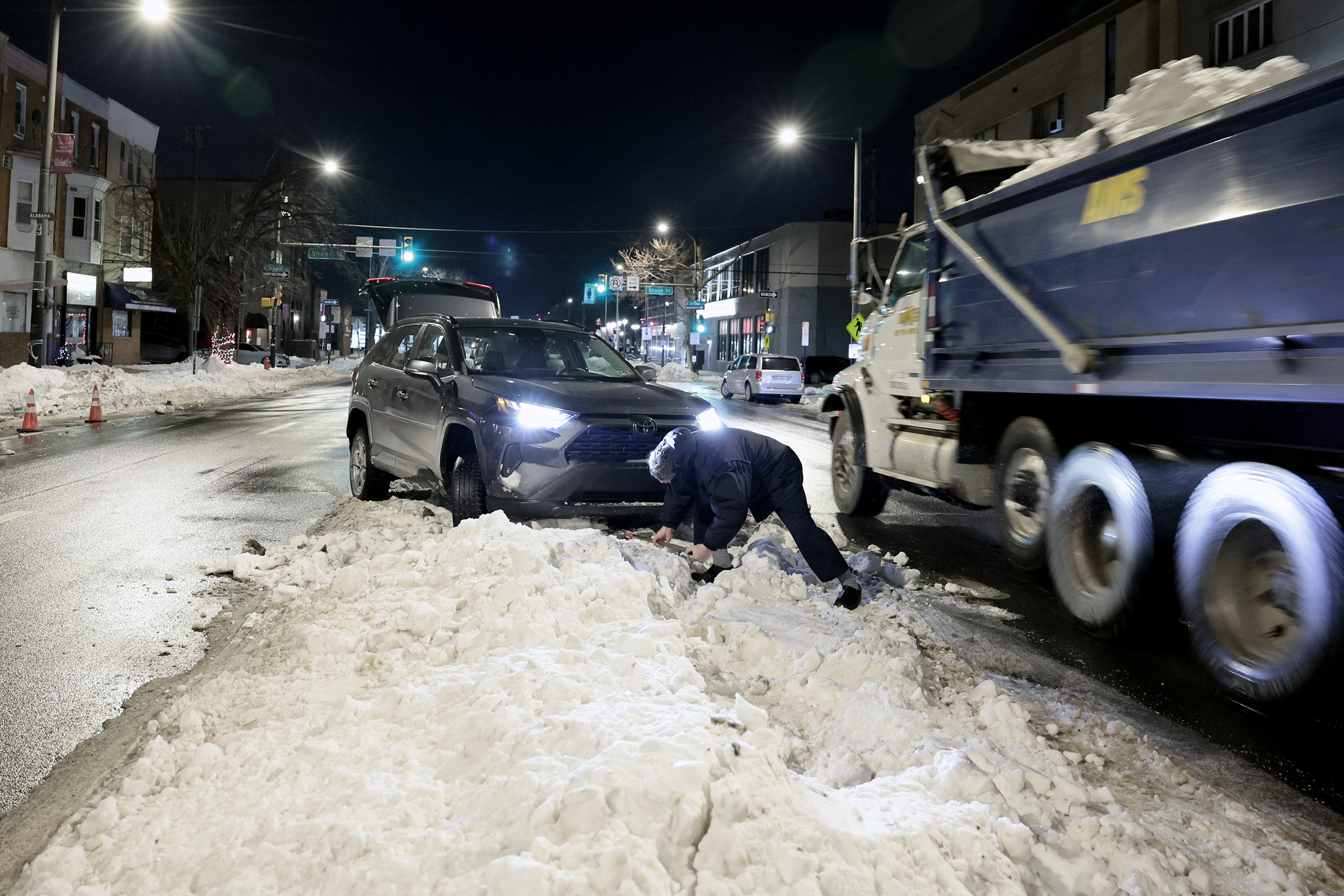
    An unidentified man shovels snow from underneath his car after it became hung up when he was trying to park in the middle of South Broad Street in Philadelphia in the early morning hours of Wednesday, Jan. 28, 2026. Dump trucks filled with snow from the city’s snow removal operations were zooming by as he worked to get his car free.

    The 41-year-old father of three said his school-age children yearn to leave the house, even if for an errand, but it’s not in the cards.

    “Between piles of snow, trash, and dog pee and poop, it’s not ideal,” he said. “We’ve been stuck in since Sunday, and while I’m close to a market, it’s not safe to walk there with my three kids and I can’t get my car out.”

    The city, for its part, has said the snow clearing would take as long as it needs to and the work would continue until all roads are dug out. Residents should expect trash-collection delays as crews navigate the snow and ice. At the same time, officials have consistently asked for patience, noting that the frigid temperatures were not aiding snow-removal efforts.

    They have pointed to the 14 teams with more than 200 vehicles and excavators that are trying to move the snow and ice into storage facilities using dumpsters. Future Track trainees with the Philadelphia Streets Department have also taken up shovels to help clear crosswalks in the city.

    But, the city notes, this is time-consuming work.

    Wanted: Private plowers

    Chris DiPiazza, owner of the Passyunk Square bakery Mighty Bread, could not afford to wait for city plows and paid for a private service to clear his street Tuesday afternoon.

    After the storm, the bakery was unable to make or receive deliveries because the city had not plowed Gerritt Street, the narrow road it’s on. Adding to frustrations, DiPiazza said, snowplows that had come through the adjacent 12th and 13th Streets had left giant snow piles on both ends of the block.

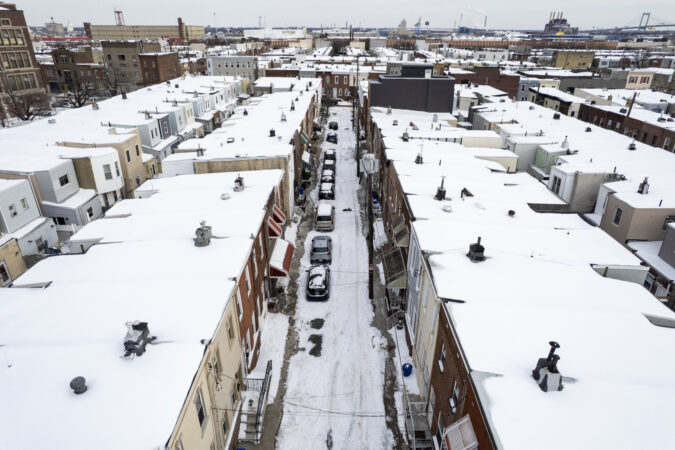
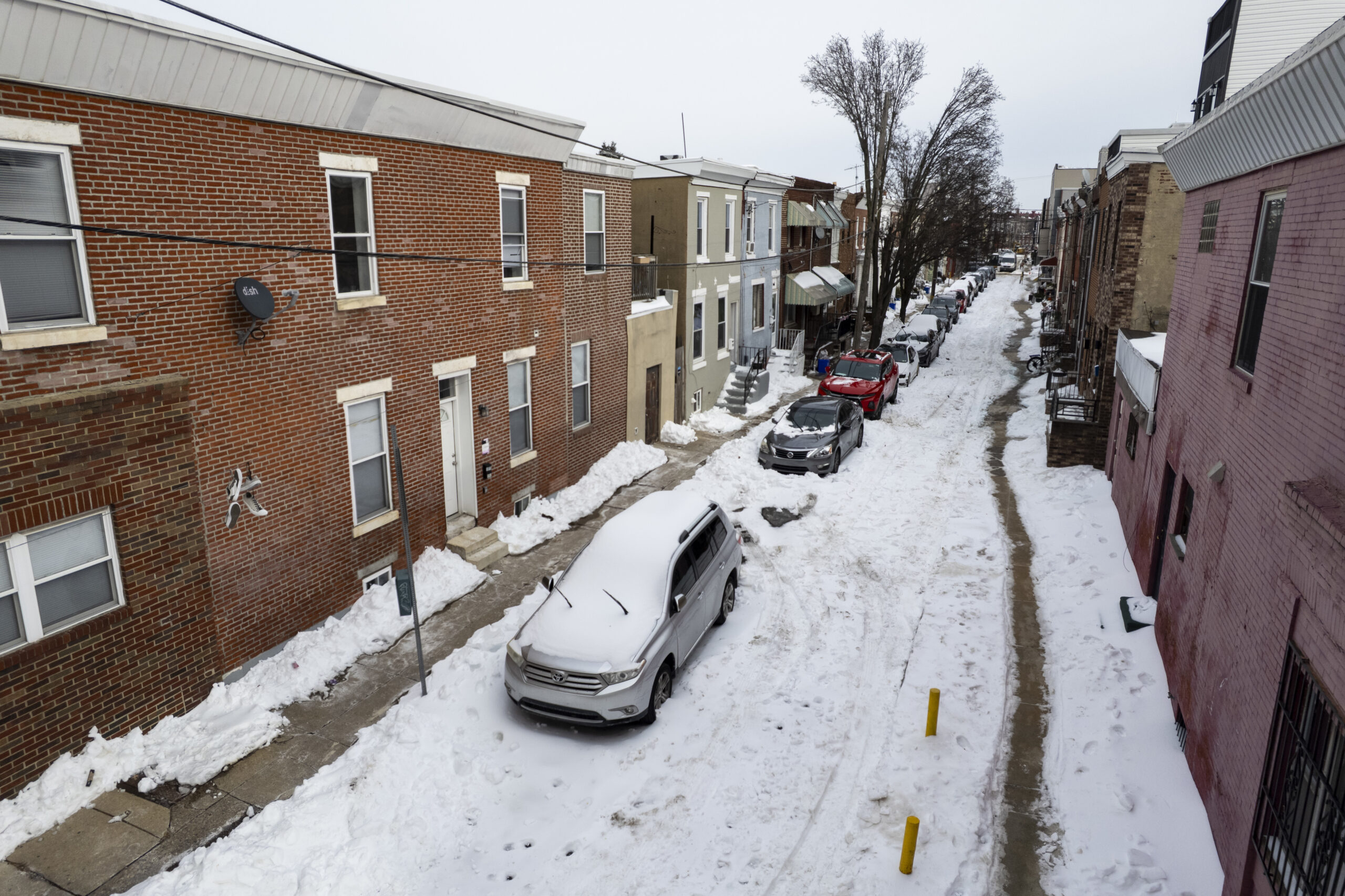
    The 700 block of Hoffman is still covered in snow on Wednesday, Jan. 28, 2026 in South Philadelphia.

    A 311 operator said it could take upward of three days for plowing to occur, DiPiazza said.

    That news was especially frustrating when residents are expected to do their part by shoveling sidewalks in front of their homes within six hours of snowfall stopping, but the city is not fulfilling its own end of that promise, DiPiazza said.

    “The city’s responsibility is to make the streets safe for people to drive, and they didn’t do that,” he said.

    SEPTA vs. ice

    For SEPTA’s size and reach, the organization is not so different from the average Philadelphian living without a plowed street.

    The snow-covered roads were especially difficult for bus routes through secondary and tertiary streets after the storm, SEPTA spokesperson John Golden said.

    “Those streets are hard to navigate on a good day,” he said.

    The lagging plow service made SEPTA pause service for many bus routes.

    “Some of our buses just aren’t able to navigate the streets because of lack of plowing,” Golden said.

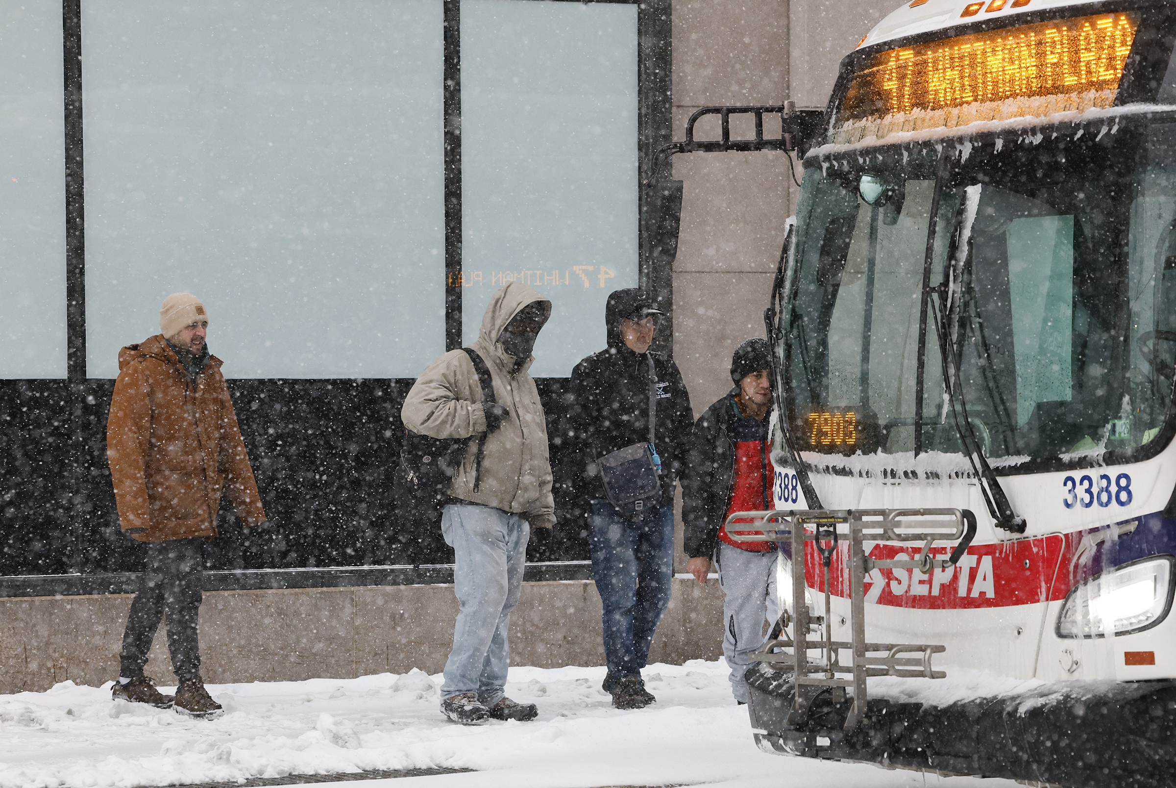
    SEPTA riders board the 47 bus at 8th and Market Streets with the snow falling on Sunday, January 25, 2026.

    But service had returned to all but a handful of routes by Wednesday afternoon. The weekend storm was not particularly onerous for SEPTA compared with other large storms in years past, Golden said, but he noted the frigid temperatures in the days following have made things difficult. Ice is not melting as quickly as it usually does, leaving the roads treacherous.

    Golden said that while SEPTA officials have been in frequent contact with the streets department about problem spots, they don’t have any special recourse besides waiting for the city to clear the streets.

    How does 2026 compare with 2016?

    When the city was smacked with 22.5 inches of snow in January 2016, it was the fourth-largest snowfall in Philly history, and newly sworn-in Mayor Jim Kenney’s first major test in office.

    At the time, many side street residents issued the same complaints heard with this most recent storm — they were the last to be dug out, and entire blocks were locked in.

    But by the fourth day of storm cleanup, a Kenney spokesperson claimed 92% of all residential streets “were plowed and passable” and the administration was taking in kudos for what many — though not all — said was a job well done.

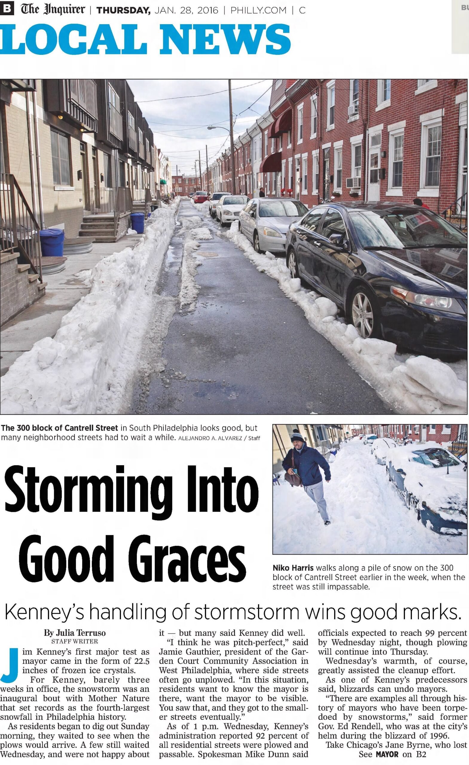
    The front page of The Philadelphia Inquirer’s B section in January 2016, following a major snowstorm that was similar to the January 2026 storm. The article reported some complaints of snow plow delays, but residents were largely complimentary of then new Mayor Jim Kenney’s handling of the storm.

    Though 9.3 inches fell this time around, city officials have said the conditions were very different. The temperature drop has been the largest hurdle so far, providing no help in melting the ice. The city still urges patience and says teams are working nonstop.

    For parents whose children took part in virtual learning Wednesday and residents who were sick of parking wars and icy crosswalks with another potential snowfall on the way, patience was almost gone.

    Residents in North and West Philly shared frustrations on social media of parking shortages because mounds of ice left people nowhere to go; some were even parking at an angle in parallel spots, to the chagrin of others. Bus stops were piles of dirty, frozen ice, and crosswalks remained icy.

    For Hildebrand, it was all very discouraging.

    “A plan could have been made and implemented, since the city knew about this a week before it happened, but it truly seems like bare minimum effort,” he said.

  • Philly snow cleanup: What to know about plowing, parking, schools, and more

    Philly snow cleanup: What to know about plowing, parking, schools, and more

    As Mayor Cherelle L. Parker put it earlier this week, we’re not out of the woods yet.

    The storm that hit Philadelphia Sunday brought with it 9.3 inches of snow for the city proper — the most we’ve seen at one time in a decade. And while that really sells the wintery vibe — especially when combined with the bitter cold we’re experiencing — cleanup efforts are ongoing.

    Highways and public transportation in the region are largely restored, but some city streets remain packed with snow and ice. City school buildings Wednesday were in their third day of snow-related closures. And we might even be looking at more snow to come.

    Here is what you need to know:

    Roads (mostly) cleared

    PennDot’s vehicle and speed restrictions have been lifted on all interstates and major highways across the Philadelphia region, as were those on state roads in New Jersey. But street plowing in the city remains a work in progress.

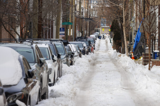
    Residents from around the city told The Inquirer many side streets and some secondary streets remained coated in several inches of snow and ice, making traveling on them difficult or impossible. Data from PlowPHL, a service that tracks plow movement, indicated Tuesday that roughly a quarter of city streets had not received any snow treatment since the storm.

    Parking enforcement resumes

    The Philadelphia Parking Authority reopened its offices Wednesday, and began on-street parking enforcement for safety violations including parking in bus zones and in front of fire hydrants. The 24-hour $5 emergency garage parking rate was also rescinded, with PPA garages returning to their usual rates, the authority said.

    Public transit resuming

    SEPTA on Monday restored all of its subway, trolley, and suburban trolley services, and as of Wednesday was running Regional Rail lines on their normal weekday schedules. Bus service, SEPTA notes online, is largely operational, though several routes remain suspended due to road conditions.

    Among the suspended buses Wednesday were routes 3, 5, 40, 41, and 115, according to the agency’s alerts page. The suspended routes, SEPTA indicated, would be restored “once it is safe to do so.”

    PATCO, meanwhile, returned to its normal weekday schedule Tuesday.

    Airport operational

    Philadelphia International Airport experienced hundreds of flight cancellations and delays due to the storm, but remained open despite the inclement weather, Parker said at a news conference this week.

    As of early Wednesday afternoon, the airport had experienced about 87 delays and 57 cancellations, according to flight data tracking website FlightAware. On Monday, the day after the storm, there were 326 delays and 290 cancelations, followed by 255 delays and 156 cancelations Tuesday, FlightAware indicated.

    Schools go virtual

    Philadelphia school buildings are slated to reopen Thursday after three straight days of being closed in the wake of the storm. A full snow day was declared Monday, followed by two days of virtual learning Tuesday and Wednesday.

    Archdiocesan high schools and city parochial schools will also go back to in-person classes Thursday.

    Students and staff who arrive late to class due to weather-related issued would not have their lateness counted against them, Superintendent Tony B. Watlington Sr. said.

    This week’s disruption to the usual school schedule had begun taking its toll on some parents. Outside the city, many suburban districts had already reopened by Wednesday.

    More snow possible

    Post-storm, the Philadelphia region faces frigid temperatures that are expected to remain well below freezing until at least Feb. 4. Highs were expected to top out around the teens, and lows consistently in the single digits — along with wind chills reaching down into the negatives.

    And then, of course, there is the potential for more snow this weekend.

    Forecasters said Wednesday that it remained unclear exactly what we should expect, but a major coastal storm is likely to appear during the weekend. Early computer models indicated that the system would remain far offshore enough to spare the Philadelphia area from major snowfall, but accumulation predictions remain in flux.

  • Many Philly side streets remain full of snow and ice days after Sunday’s storm

    Many Philly side streets remain full of snow and ice days after Sunday’s storm

    It is a sentiment long held by residents across Philadelphia, especially those living on side streets, dating back to when snowfall was a more frequent occurrence than it has been in recent years: Don’t expect the city to do a thorough plowing job.

    That belief is one that Philadelphia Mayor Cherelle L. Parker has said she is trying to shake with action.

    Two days before a storm that whacked the city with 9.3 inches of snow and sleet, Parker, surrounded by the leaders of various agencies, including the Philadelphia Streets Department, vowed to buck precedent on the plowing issue.

    “We will make every effort to get to every primary, secondary, and tertiary street in the city of Philadelphia, and that is our standard,” she said, adding it would take “as long as it takes,” citing worker safety.

    “But know that we won’t leave any neighborhood, any block, or any community behind.”

    Still, residents across the city Tuesday said they were losing patience as side streets and even some secondary streets remained packed with several inches of snow and ice, locking cars in and making navigating intersections impossible.

    Fishtown resident Rohan Khadka, 22, was hoping plowing might happen overnight. Instead he woke up Tuesday to streets that were hard for him to cross even with the proper footwear.

    “A lot of our roads down here look exactly the same,” he said. “Most of the cleanup that has happened, to my knowledge, has either been by other residents or just cars happening to clean it because they’re using those roads.”

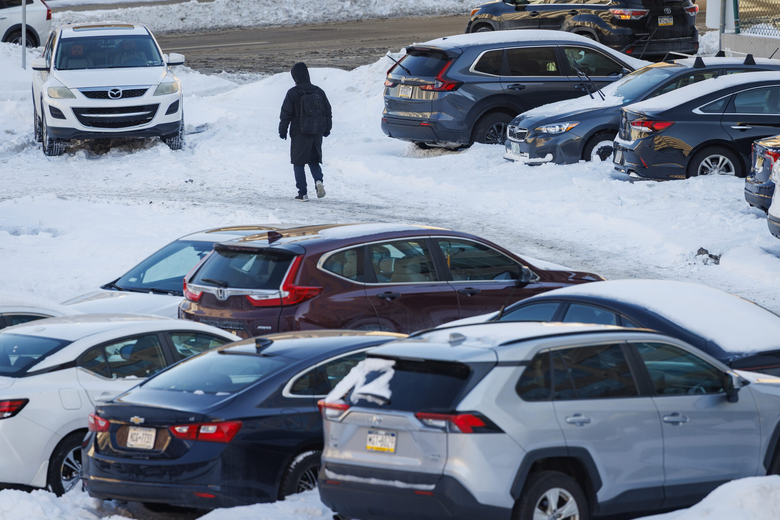
    A pedestrian walks through a snow-covered parking lot at Ninth and Arch Streets in Center City Philadelphia, Tuesday, Jan. 27, 2026.

    Analysis of the City of Philadelphia’s PlowPHL data, which tracks the movement of plows via GPS data, showed that about a quarter of streets citywide had received no snow treatment at all — including salting or plowing — after the conclusion of the storm Sunday night.

    Some areas were worse off than others.

    In places like Overbrook and Wynnefield, the city had salted or plowed about 70% of streets by the end of Sunday morning, when the storm began. But the majority of streets in these neighborhoods received no additional plowing or salting since Sunday, according to city data.

    The same was true for about a third of streets in South Philadelphia.

    The streets department said Tuesday it was deploying over 200 vehicles and excavators as part of a so-called lifting operation. Fourteen teams were fanning across the city to scoop up snow from the narrow roads and load it into dump trucks on nearby primary streets.

    The snow hauls were then being taken to storage sites across the city.

    Director of Clean and Green Initiatives Carlton Williams drove through parts of South Philadelphia on Tuesday afternoon, as dozens of the side-street-size excavators made their way through the city’s narrowest byways.

    “It is the smaller tertiary streets that are challenging,” he said. “There’s more of them. It’s difficult to navigate through those streets.”

    As Williams passed a side street with several inches of snow packed, he noted a car illegally parked on the corner, which would make it difficult for machines to get through.

    Williams said this storm came with additional challenges. Not only did the snow fall in a condensed period of time, but it was followed by sleet and frozen rain.

    “We wouldn’t have many of the challenges that we’re facing today, slowdowns, if those other weather conditions beyond our control did not exist,” he said. “But again, I want to reassure the public that we’re aware. You see us out here today. We’ll be out here tomorrow, and we’ll continue to fight this storm.”

    But for Philadelphians waiting for a plow, time is of the essence.

    311 ringing off the hook

    For Moya Ferenchak, 30, the effectiveness of the operation carries serious health implications. They started pet sitting on the 1500 block of South Capitol, a South Philly side street, for a friend last Tuesday, bringing exactly one week’s worth of food and lifesaving medication — more than they expected to need.

    Ferenchak, who lives with a disability that causes limited mobility, cannot shovel. Calling a car not only is expensive but also would require Ferenchak to travel with all their belongings to an intersection that is not blocked by snow.

    Adding to frustrations across the city were reports of inundated 311 phone lines.

    “I called first thing this morning, and there was a 50-plus-person queue,” Ferenchak said. “Then I called again, and there was like a 70-plus-person queue. I waited for like an hour or so, and then it hung up on me.”

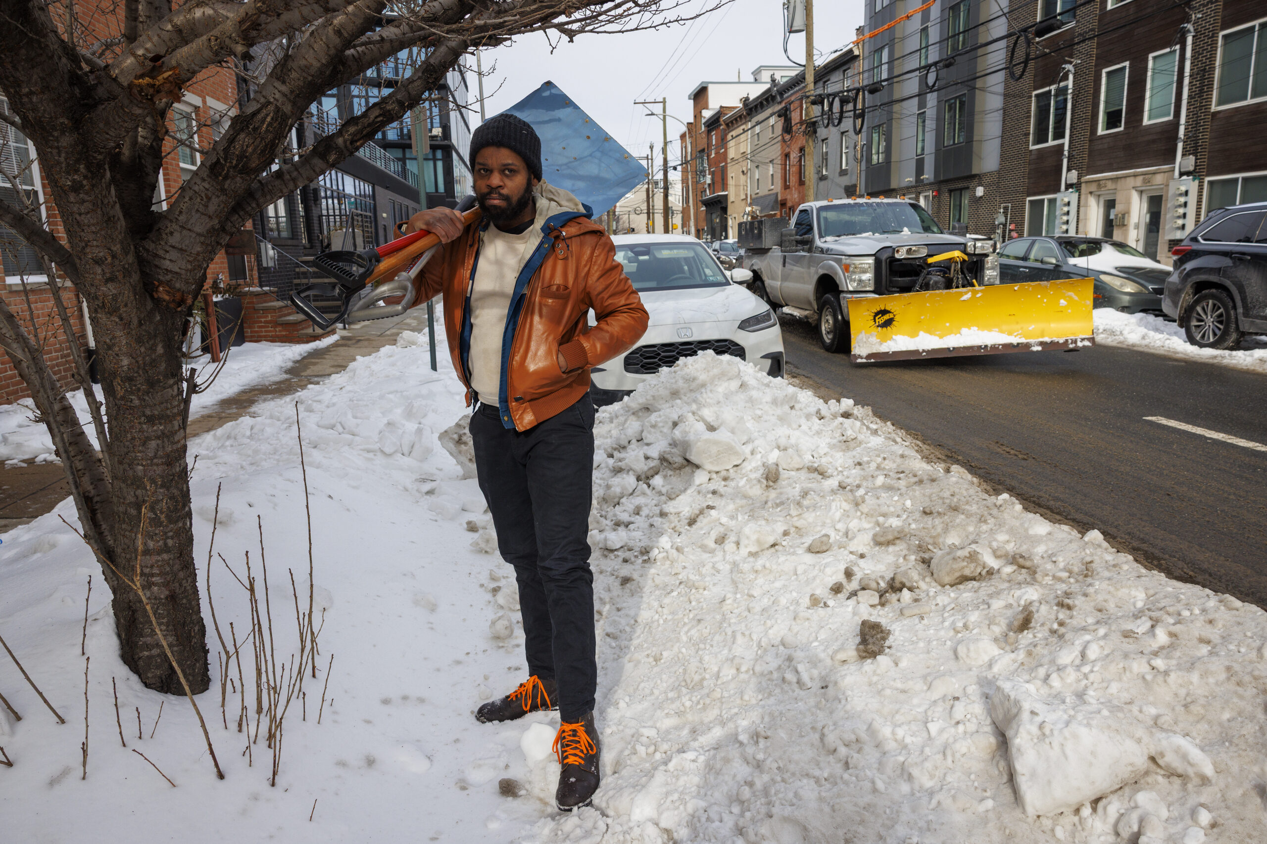
    Alex Wiles of Philadelphia has been hustling during the recent snow, shoveling sidewalks and digging out cars. This photograph was taken along North Second Street near his home, Tuesday, Jan. 27, 2026. He was heading to the bus for a trip to his next client.

    The processing of online 311 tickets has also been a source of confusion for residents who wonder if they are being paid attention to. Williams said the complaints are populating a map used to direct plows to avoid redundancies.

    “We’ll take that data and get it within the operation,” he said.

    Some homes feel the impact more than others

    On the 4800 block of Regent Street in West Philadelphia, Justin Rothrauff described the road as “treacherous” for the mix of families and older residents who live there.

    “One of the big problems, besides the street not being plowed, is that the plowing that they have done on some of those primary roads has blocked the secondary and tertiary roads,” the 43-year-old teacher said, adding even if he could somehow get his car out of his block, he is not sure he would make it back in.

    While Rothrauff had heard of people paying to have their roads shoveled, he feels no one should have to.

    “I refuse to pay anyone money, I pay enough taxes in the city,” he said.

    For some Philadelphians, some information could go a long way. A much-touted live map of plow operations has been reported for mistakenly listing some streets as plowed, according to the residents who live there.

    Ken Wong shovels snow on Waverly Street, in Philadelphia, Monday, Jan. 26, 2026.

    Krista Dedrick-Lai, 45, a South Philly resident, hopes the city will do more to tell people about plowing statuses, and explain why their streets are still covered in snow days after the storm, even if the answers are not what they are hoping to hear.

    “Sometimes context can make everyone feel better,” she said, noting her block on Federal Street got a plow Monday and Tuesday, but the snow banks had blocked cars in.

    Fortunately, she said, she and her husband have not needed to leave their house to work or to help their child learn through third-grade virtual learning modules.

    Others, however, do not have that flexibility. Making matters worse, more snow may be on the horizon this weekend.

  • Streets will be closed around City Hall for snow removal operation

    Streets will be closed around City Hall for snow removal operation

    The Streets Department on Tuesday is removing snow that has piled up around City Hall, and the operation requires street closures on nearby blocks, the agency said.

    With the region expected to remain in a prolonged deep freeze, there is no chance the snow piles will melt anytime soon. And weather forecasters say the region might be hit with another storm this weekend, so the city is eager to get rid of the existing snow.

    The “lifting operation” includes the removal of snow using dozens of vehicles, including excavators and loaders, the department said Tuesday.

    The city already has been conducting lifting operations in North Philadelphia, removing snow from Girard Avenue and nearby neighborhoods since Sunday evening, the department said.

    Similar operations have been underway in neighborhoods across the city, the department said.

    The streets around City hall will be closed through midnight Tuesday.

    The closures include:

    • Penn Square around City Hall
    • North Broad Street from Arch Street to City Hall
    • South Broad from Chestnut Street to City Hall
    • 15th Street from Arch to Chestnut
    • John F. Kennedy Boulevard from Filbert to 16th Street
    • East Market Street from 13th Street to City Hall
    • West Market Street from 16th to City Hall

    The snow is being removed to 37 storage sites across the city, mainly large paved surfaces, the department said.

  • ‘Bone-chilling’ cold is sticking around Philly, and so is the snow

    ‘Bone-chilling’ cold is sticking around Philly, and so is the snow

    Out of the snow globe, and into the freezer.

    After having experienced its heaviest snowfall in about a decade, the Philadelphia region now faces frigid temperatures that are expected to barely squeak out of the teens until next week. And all while dealing with cleanup from the 9.3 inches of snow that blanketed the city, a task made more complicated by minimal natural melting due to the cold — plus monitoring another potential winter storm for this coming weekend.

    But don’t panic just yet. Forecasters at the National Weather Service office in Mount Holly say it’s too early to tell whether mean old Jack Frost will set his sights on us once again in the coming days, and what level of snowfall we could see if he does.

    “There will likely be a system somewhere off the Eastern Seaboard over the weekend,” said weather service meteorologist Joe DeSilva. “But it’s very uncertain at this point.”

    Besides, we’ve got enough to worry about already.

    It won’t just be cold in the Philadelphia area this week — it will be dangerously so. On Tuesday, temperatures generally stretched only into the low or mid 20s, a good five to 10 degrees lower than what we saw Monday, the weather service said. Lows, meanwhile, stuck stubbornly in the single digits, with wind chills making it feel like zero or below.

    That cold, it seems, will refuse to budge until next week. As we move through the final week of January, temps are expected to continue to nosedive, the weather service said.

    Daytime highs throughout the week are expected to top out in the mid- or upper teens in the Philadelphia region, with some spots seeing the off chance of making it into the 20s. Lows are likely to stick in the single digits through Friday. As the weather service put it in a Tuesday afternoon update, this is “bone-chilling” cold that has the potential not only to stress the energy grid — as New Jersey and Philadelphia officials alluded to Monday — but also to cause frostbite and hypothermia.

    Philadelphia, in fact, has the grim potential of hitting zero degrees for the first time in 32 years sometime in the coming days. We haven’t seen zero at the Philadelphia International Airport since Jan. 19, 1994, but that mercifully long streak could be broken Thursday or Friday, when temperatures are expected to go as low as 2 or 3 degrees, DeSilva said.

    “We still have three nights before we get there, so lots could change between now and then,” he added.

    A pedestrian walks through a snow-covered parking lot at Ninth and Arch Streets in Center City Philadelphia, Tuesday, Jan. 27, 2026.

    These lows arrive as Philadelphia continues to dig out from last weekend’s winter storm, which resulted in a days-long snow emergency in the city that was only lifted Tuesday amid closures for city offices, courts, and schools. Despite a full-court press by the Philadelphia Streets Department, many smaller streets remained unplowed, and the cold weather threatened to institute a deep freeze that could complicate the cleanup, officials have said.

    Unfortunately, no break is imminent. Temperatures are not expected to get above freezing until the early or middle part of next week, and even then perhaps barely so. In its Tuesday afternoon forecast, the weather service called the length and magnitude of the arctic air mass descending upon the area “exceedingly rare” and urged caution. Normal low temperatures for Monday’s date, for example, stand at about 25 degrees.

    “We are running 15 to 20 degrees below average,” DeSilva said.

    And then there is the possibility of even more snow amid our extended bout of cold — though as of Tuesday afternoon, it remained just that. The weather service noted that it remained unclear where precipitation could fall, and in what amounts, though early models indicated that the storm could spare much of the area away from the coast. Still, DeSilva said, it remained too early Tuesday to tell what to expect.

    “If lows track further off the coast, we could see less impact here, but if they’re closer, we may have some moderate impacts,” DeSilva said.

  • After Philly’s biggest snow in 10 years, a very big chill is coming

    After Philly’s biggest snow in 10 years, a very big chill is coming

    For the Philly region Monday it wasn’t so much a matter of digging out from the heftiest snowfall in a decade, it was more like a chipping, shaving, scraping, expletive-inducing, and ice-chunk hurling operation.

    Public transportation appeared to be getting back on track, and major roads were open for business with speed reductions removed, thanks to crews working through the weekend.

    But expect some side streets in the city and elsewhere to remain fit for sleigh rides this week and trash pickup to be delayed. City offices will be shut down again Tuesday, as will Philly school buildings, with Camden and more calling for a snow day or opting for remote learning.

    And if you’re stepping outside, get used to that underfoot crunching sensation. The removal operation isn’t going to get much help this week from the atmosphere. It’s about to turn about as frigid as it ever gets around here. New Jersey officials are warning of “historic” demands on energy.

    “We’re going to be in the freezer all week,” said Mike Gorse, meteorologist at the National Weather Service Office in Mount Holly. Philly may have its first zero-degree reading in 32 years later in the week.

    It’s as if after recent wimpy winters, the Arctic is reacquainting with Philly and much of the rest of the East.

    And did we mention another snow threat for the weekend?

    “There’s a chance,” said Marc Chenard, meteorologist with NOAA’s Weather Prediction Center in iced-over College Park, Md., who was among those who had to chuck some frozen boulders before leaving for work Monday morning. “I had to chip it and carry it in pieces,” he said. Sound familiar?

    Why this storm was particularly challenging

    Snow totals for the biggest snowfall since Jan. 22-23, 2016, varied throughout the region; the inconveniences, not so much.

    A general 8 to 12 inches of snow and sleet accumulated while temperatures remained mostly in the teens Sunday, 10 degrees or more below forecast.

    A shallow layer of warmer air caused a changeover to sleet, and the tiny ice balls remained frozen for the entire trip through the stubbornly cold air near the surface. As much as 2 to 3 inches of sleet piled on, containing the same amount of liquid as several inches of snow.

    That added weight to the snowpack. Based on the amount of melted precipitation measured in the 9.3 inches at Philadelphia International Airport, the snowpack weighed about as much as a 12- to 15-inch pile of the pure flaky fluff.

    On a 200-square-foot driveway — a 10 by 20 — what fell Sunday weighed about 1,100 pounds. On a 100-square-foot sidewalk — 5 by 20 — that would be about 550 pounds.

    In addition, ice tends to be rather shovel resistant.

    This is going to be a memorably cold week in Philly

    The ice and snow isn’t going to give up easily. On Monday, temperatures topped out in the upper 20s, and that’s going to be warmest day of the week.

    Based on the forecast, it may not get above 28 degrees until next week, said Chenard, a cold streak the region hasn’t seen in decades.

    Chenard said the upper-air patterns remain in place to import Arctic air on winds from the northwest for at least the next several days.

    In fact, temperatures may have trouble getting out of the teens in Philly until the weekend, and Philly has a shot at reaching zero for the first time in 32 years.

    The forecast lows are in the single digits all week, and down to 1 degree on Friday morning and 2 degrees on Saturday, the National Weather Service says. Both would be record lows for the dates.

    The stubborn snow cover “absolutely” will increase the chances of the airport reaching zero for the first time since January 1994, Gorse said. Snow is ideal for radiating daytime warmth (such as it is) into space.

    Temperatures will moderate some on the weekend, he said, but that might come in advance of yet another storm.

    Said Chenard, “There will be coastal low. It’s a matter of how close it is.”

    window.addEventListener(“message”,function(a){if(void 0!==a.data[“datawrapper-height”]){var e=document.querySelectorAll(“iframe”);for(var t in a.data[“datawrapper-height”])for(var r,i=0;r=e[i];i++)if(r.contentWindow===a.source){var d=a.data[“datawrapper-height”][t]+”px”;r.style.height=d}}});

    One historic footnote in the Philly weather annals

    Philly’s official snowfall total for the winter stands at 15.7 inches, almost double normal for the date and double what fell all of last season.

    Sunday’s was not only the biggest snow in 10 years, it also set a record for a Jan. 25.

    It beat the 8.5 inches of Jan. 25, 2000, a day that the weather service just as soon would like to forget.

    The storm came as a surprise, just a week after a weather service honcho announced a computer upgrade that would bring the nation closer to a “no surprise” era.

    Expect surprises to continue.

    Staff writers Ximena Conde, Kristen A. Graham, Maddie Hanna, Rob Tornoe, and Nick Vadala contributed to this article.