Author: Anthony R. Wood

  • Philly’s surprisingly cold and snowy winter isn’t over yet, but big changes are coming

    Philly’s surprisingly cold and snowy winter isn’t over yet, but big changes are coming

    Robert Koopmeiners is up to here with this winter and is among the masses more than ready for the atmosphere to flip the switch.

    “It’s getting kind of old,” he said. But he wasn’t complaining about Arctic freezes, or winter storms, or black ice, or hideously darkening mountains of plowed snow.

    He was talking about the weather in Colorado, where he is a National Weather Service meteorologist, where bone-dry Denver has set nine high-temperature records since Dec. 1, where wildfire alerts were in effect, and water is getting scarce.

    Warm West, cold East, and vice versa are standard fares in the great national atmospheric seesaw that hasn’t been doing much seesawing lately, as if a boulder has been placed atop our end of it.

    That’s the result of an atmospheric roadblock for the ages in the high latitudes around Greenland, meteorologists say, that has allowed winter to reappear with a ferocity not experienced in several years in the Northeast, and a winterlong spring in parts of the West. The cold in the East may even be related to rising global temperatures.

    The result for the Philadelphia region has been one of the colder and snowier meteorological winters — the Dec. 1 to Feb. 28 period — on record. Officially Philadelphia has had more days of snow cover of an inch or more than in the five seasons ending with the winter of 2023-24 combined.

    After quite a wintry start to the new week, with even some more snow possible, a major warmup is due to begin with a spring teaser possible next weekend. (It may turn colder the second half of the month, but that can wait.)

    In the meantime, the atmosphere is enjoying a belly laugh over the preseason outlooks for the winter of 2025-26.

    Philadelphia’s winter scorecard

    By convention, the weather community divides the seasons into three-month increments. In part that’s in recognition of the fact that weather often has an adversarial relationship with astronomy. For example, it has snowed, and hit 90 degrees, in the astronomical spring, the period between the vernal equinox and summer solstice.
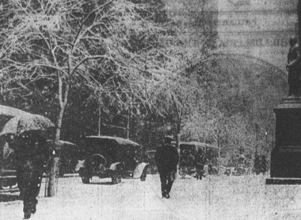
    The day before Easter in 1915, Philadelphia was socked with 19 inches of snow, despite a forecast of “Unsettled, rain likely.”

    For the three-month 2025-26 winter period, official temperatures at Philadelphia International Airport have averaged a shade over 33 degrees, putting it in the top third for coldest winters in the period of record dating to the late 19th century.

    The official snow total is in the top 20% of all winters on record. The normal through February is just under 20 inches.

    What forecasters predicted would happen

    Zero. That would be the number of publicly available winter outlooks that predicted Philly would experience 30.1 inches of snow, 150% of normal.

    AccuWeather Inc. and 6abc went with 14 to 18 inches. Fox29 called for 16 inches, and 17 days of snow cover. At last count, that snow-cover count was up to at least 35. Other forecast services called for normal — 23.1 inches — or slightly above-normal snowfall.

    Regarding temperatures, all the outlooks foresaw normal — the three-month average is 36.1 degrees — to above-normal temperatures for the Philly region, save for Arcfield Weather, a private-sector company, which went for below.
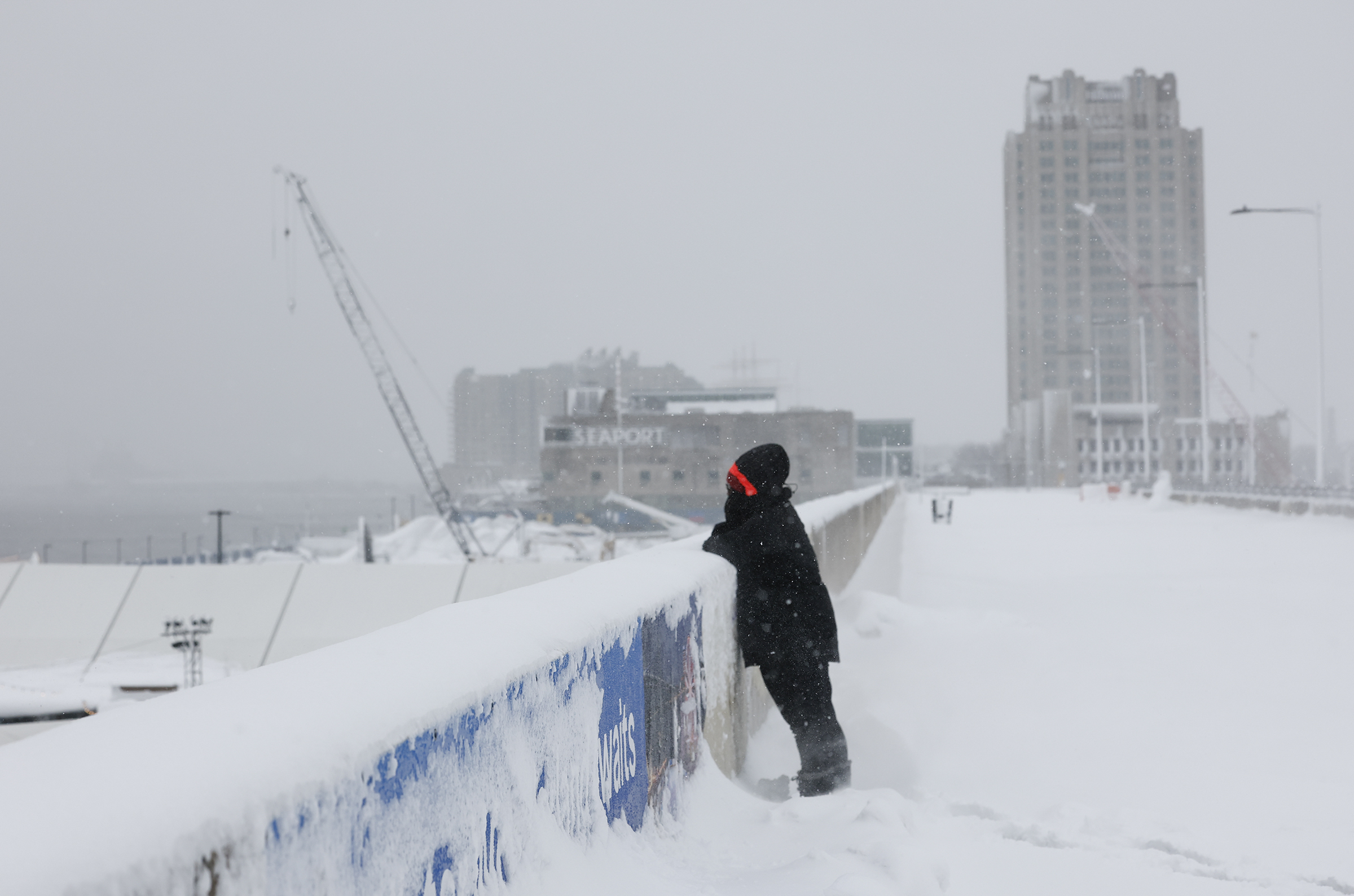
    Nicole Swinson looks into Penn’s Landing while standing in the snow on Monday, Feb. 23, 2026.

    ‘Blocking’ has been the leitmotif of Philly’s winter

    If it seemed that what happened kept happening, that was more than perception.

    It was the result of particularly vigorous “blocking” in the vicinity of Greenland in which high pressure, or heavier air, persists in the upper atmosphere. It was a massive obstruction that kept directing cold air and storms toward the East while toasting the West, said Climate Prediction Center branch chief Jon Gottschalck.

    The East got stuck under a “trough” of upper-air low pressure that favored storminess and cold, he added. The West, quite the opposite.

    “The blocking pulled the storms eastward, and the cold followed,” said Paul Pastelok, Accuweather’s longtime seasonal forecaster. “We should have caught on to that.”

    In addition, an upper-air pressure pattern over the Arctic — the Arctic Oscillation — was stuck in its negative phase from December until recently, said climate center meteorologist Laura Ciasto, with negative consequences for local winter-phobes.

    When it’s negative, the weather-moving west-to-east jet stream winds can become more active at the midlatitudes where we live, and the conditions colder and stormier. The oscillation has had “an interesting winter,” she said. “Typically,” she said, “we expect the AO to fluctuate.”

    Related to the oscillation’s behavior were episodes of “polar vortex stretching,“ said Ciasto. The vortex’s powerful winds usually trap cold air in the Arctic, but on occasion they weaken and ”stretch,“ allowing cold air to spill southward.

    Another explanation for why the forecasts went awry may be an obvious one: We’re not used to this level of Arctic cold or prodigious snowfalls like the Sunday-Monday event that creamed parts of the region with 20 inches or more. “We have simply gone many years without experiencing a storm like this,” said Owen Shieh, warning coordination meteorologist at NOAA’s Weather Prediction Center.

    Did the world suddenly grow colder?

    No, the planet didn’t cool off precipitously. In fact, said Pastelok, the blocking may have been related to warming-related sea-ice reductions near Greenland. The solar energy absorbed by freshly freed waters could have effects on pressure patterns in the high atmosphere, he said, adding that for now, that’s only a hypothesis.

    While the world evidently cooled slightly last year after a record 2024, according to NOAA’s database, it’s still about 2 degrees Fahrenheit warmer than the 20th-century average, the supply of Arctic air isn’t quite as it used to be.

    As it turns out, Philly’s winters in the 21st century have trended milder, with average temperatures about 2 degrees Fahrenheit above long-term averages.

    The overall warming trend has been one reason the climate center has had the odds favoring above-normal winter temperatures for Philly for the last seven consecutive winters. And they indeed were above normal for six straight years — but not seven.

    Retired climate center forecaster Mike Halpert once remarked that while sticking with the trend can be a smart bet, “some years you’re going to be woefully wrong.”
  • Light snow may top the black ice in the Philly region Wednesday as storm recovery continues

    Light snow may top the black ice in the Philly region Wednesday as storm recovery continues

    At this point, the prospect of a barely measurable snow Wednesday morning may seem like so much drizzle in the ocean.

    However, given that a coating of snow could cover another harvest of stealth black ice in the morning as the snow melt refreezes overnight, motorists and pedestrians might want to exercise a measure of caution.

    The forecasts are calling for a half-inch to maybe an inch in the Philly area.

    While potentially hazardous, this won’t upstage what happened earlier in the week, when totals of 20 inches or more were common in South Jersey and southeastern Bucks County, and on Tuesday the aftermath recovery was proceeding.

    For the record, the official total at Philadelphia International Airport was 14 inches. Of that, 7.5 inches fell on Monday, setting a record for the date. It was No. 16 on the all-time snowstorm list, and the first time in 33 years that a foot or more had fallen so late in the season.

    The seasonal total now stands at 30 inches, one of the snowier years in the 142-year period of record.

    The post-storm issues included contending with scores of downed trees throughout the region. A fallen tree in Radnor Township, Delaware County, still was affecting service on the Norristown High Speed Line.

    Service still was still suspended on the Cynwyd Regional Rail line, SEPTA said, and other lines were operating with delays.

    Airport operations were getting back to normal, said spokesperson Heather Redfern, flights having resumed Monday afternoon.

    As for schools, they were opting for a variety of options from virtual learning (Philadelphia) to two-hour delays (Cherry Hill, Moorestown), to party’s over, get here on time (Upper Darby).

    This may be the week of black ice in Philly

    Invisible and insidious black ice, a dangerous slipping hazard, in all likelihood will be present through the workweek as the snow melt picks up speed during the day, with highs in the 40s, and temperatures falling below freezing at night.

    More light snow, rain, or a snow-and-rain mix is possible Thursday into Thursday night, the weather service said. But odds are the immediate Philly area will see mostly rain, said Eric Hoeflich, a weather service meteorologist in Mount Holly.

    After a modest warmup on a dry weekend, some computer models were hinting at more snow early next week as a storm moves east, but “not all the guidance is showing a significant system,” the weather service said in its afternoon discussion. “It’s definitely on our radar,” the agency said, but it doesn’t “appear to have potential for a ‘major’ event.”

    In short, anything rivaling the Sunday-Monday storm would be, at the very least, unlikely.

    Hoeflich said he spent 30 hours in the Mount Holly office, not leaving until 2 p.m. Monday. He said that the weather service provided air mattresses for him and other staffers and that his colleagues came armed with soft pretzels.

    Sarah Johnson, the warning coordination meteorologist, brought pizza. Evidently carbs are a sine qua non of storm forecasting.

    Said Hoeflich, “We certainly didn’t go hungry.”

  • Philly got its biggest snow in 10 years. This time nature will help with the cleanup.

    Philly got its biggest snow in 10 years. This time nature will help with the cleanup.

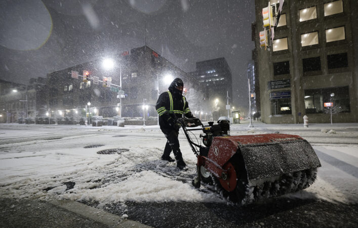
    If it wasn’t an actual blizzard, Philly’s biggest snowfall in a decade sure acted like one, and the weather the rest of this week isn’t expected to be particularly pleasant.

    But in terms of disruption — not to mention aesthetics — this was in a wholly different category from the Jan. 25 siege of snow and ice. And the aftermath should not be anywhere near as punitive and burdensome.

    Although the 14 inches measured officially at Philadelphia International Airport, dwarfed the 9.3 inches of snow and sleet that accumulated in last month’s storm, Zach Schwartz, 33, was among those who found the picturesque snow more palatable than the attack of ice balls and an Arctic freeze.

    “The last snowstorm was a tough time for everyone,” said Schwartz, who was at a Point Breeze playground helping a friend build an igloo for their kids, “and I think the city was kind of in shock a little bit.”

    The most recent storm, which left as much as 20 inches of snow in parts of South Jersey and southeastern Bucks County, did cause some issues.

    More than 130,000 households lost power at some point. Scores of trees came down as the snow, heavy and wet at the start, glommed onto branches that took beatings from the winds that gusted past 40 mph.

    The storms closed schools to the chagrin of hundreds of thousands of learning-eager children, and museums on Monday. It disrupted SEPTA services and airport operations.

    At least 87 trees across the city were downed as a result of the storm as of Monday afternoon, and the city was working to determine which ones to prioritize clearing first, Parks and Recreation commissioner Susan Slawson said.

    Mayor Cherelle L. Parker advised Philadelphians to avoid unnecessary travel as crews worked to clear the streets.

    Yet early fears that the snowfall would reach what the National Weather Service called “potentially historic” levels didn’t quite materialize, and it was not known if the storm had met “blizzard” criteria. Stopping short of “historic,” New Jersey Gov. Mikie Sherrill called it “a generational storm.”

    This one likely won’t have the staying power of last month’s storm

    While the volume of snow is formidable, road crews throughout the region now have a tremendous ally — the late-February sun.

    The city did adjust its response after the prior storm cleanup left many residents chock-full of complaints. Director of Clean and Green Initiatives Carlton Williams said Monday instead of one snow melter, the city secured three, with two already on the road Monday, despite the much shorter notice of the storm.

    But the big melter is in the sky.

    The amount of solar energy beaming toward Philadelphia is more than 35% stronger than it was on Jan. 25, according to NASA’s figures, and blacktop is great absorber of sunlight. Plus the region now is getting an hour more of daylight.

    Plus, instead of an Arctic freeze, it is forecast to be moderately cold this week, with highs in the low 30s Tuesday, and in the 40s Wednesday and Thursday.

    A weak clipper could produce an inch or less of snow early Wednesday, but, sorry kids, that won’t be another school-closer. More light rain or snow or a mix is possible Thursday.

    Computer models on Monday were seeing a potential for more snow early next week, but they may well sober up come Tuesday.

    After the Jan. 25 storm, Philly had 18 consecutive days of at least 3 inches on the ground officially at the airport, the longest stretch in 65 years. That streak won’t be challenged this time around.

    One other huge difference: Those 14 inches didn’t include a speck of ice, which, as we learned, is amazingly melt-resistant.

    Why snow totals varied tremendously

    The nor’easter that generated the snow did qualify as a “bomb cyclone,” said Tom Kines, senior meteorologist with AccuWeather Inc. The technical criteria aside, a bomb cyclone is particularly powerful storm.

    In fact, the storm’s intensity, based on a measure of its central pressure, was equal to that of a Category 1 hurricane, he added.

    Fortunately, the Shore escaped major flooding, but the winds circulating around the storm’s center over the ocean hurled back snow far inland.

    window.addEventListener(“message”,function(a){if(void 0!==a.data[“datawrapper-height”]){var e=document.querySelectorAll(“iframe”);for(var t in a.data[“datawrapper-height”])for(var r,i=0;r=e[i];i++)if(r.contentWindow===a.source){var d=a.data[“datawrapper-height”][t]+”px”;r.style.height=d}}});

    South Jersey locations received the most, along with areas in southeastern Bucks County. However, totals backed off precipitously to the west.

    “There was a really tight gradient,” said Amanda Lee, a weather service meteorologist in Mount Holly. All areas in Philly’s neighboring Pennsylvania counties did report at least several inches of snow.

    Within that broad east-west divide, however, amounts varied considerably from place to place, due in part to “banding,” in which narrow corridors of snow, caused by rapidly rising air, migrate from place depositing rapidly accumulating snow to areas underneath.

    Conversely, areas on either side of the band are snow-deprived.

    As to whether this qualified as Philadelphia’s first blizzard in 33 years, that is a verdict deferred.

    By the National Oceanic and Atmospheric Administration’s decree, a blizzard requires “frequent winds of 35 mph or higher with considerable falling and/or blowing snow that frequently reduces visibility to 1/4 of a mile or less. These conditions are expected to prevail for a minimum of 3 hours.”

    That’s a lot to ask for a snowstorm, and it is going to take considerable forensic work of poring through observations to determine whether those conditions were met in Philadelphia or elsewhere in the region, said Nick Guzzo, a weather service meteorologist in Mount Holly.

    Another big difference between this and the January storm

    Whatever else it is called, this was the most spectacularly beautiful snowfall of the season, thanks to the snow’s remarkable adhesive power.

    On the morning of Jan. 26 the trees were bare, as though they wanted no part of the snow and ice-ball assault.

    On Monday this time around, snow enchanted the branches and uncannily worked its way into architectural details.

    Cape May Mayor Zack Mullock said his town, famous for its Victorian buildings, “looks beautiful” covered in the foot of snow that had fallen.

    Said Mullock, “It looks like a snow globe.”

    Staff writers Ximena Conde, Kristen A. Graham, Michelle Myers, Amy S. Rosenberg, Henry Savage, and Nick Vadala contributed to this article.

  • Snow arrives in Philly (again), rare blizzard conditions expected into Monday

    Snow arrives in Philly (again), rare blizzard conditions expected into Monday

    Before a single wet flake was sighted in the Philly region late Sunday afternoon, what forecasters warned would be a storm of rare severity already was having impacts on the workweek.

    A blizzard warning remained in effect for Philadelphia and all of New Jersey and Delaware until 6 p.m. Monday. And while snow amounts might not qualify as “historic,” by the time it stops Monday this was expected to be the heftiest snowfall in a decade, with accumulation estimates of one to two feet.

    Philadelphia hasn’t experienced a verified blizzard in 33 years, and this one would be powered by a “bomb cyclone” storm whose intensity would be similar to that of Category 1 hurricane, meteorologists said. This marked the first time ever that the entire state of New Jersey was under a blizzard warning, said Judah Cohen, a research scientist with the Massachusetts Institute of Technology.

    With heavy, wet snow at the onset, and gusts howling to 45 mph on the mainland during the night — up to 55 at Shore — thousands of homes in Southern and Central New Jersey were without power Sunday night. Plus, with drier snow expected later as temperatures fall below freezing, the region may see something it hasn’t in several winters: considerable drifting.

    By the time the plows are done this week, the region could end up with a mini-version of the White Mountains.

    (function () {window.addEventListener(‘message’, function (e) { var message = e.data; var els = document.querySelectorAll(‘iframe[src*=”‘ + message.id + ‘”]’); els.forEach(function(el) { el.style.height = message.height + ‘px’; }); }, false); })();

    In addition to heavy snows, a nor’easter that was ripening off the Virginia coast Sunday was destined to generate potent onshore winds setting off moderate flooding along the New Jersey and Delaware coasts.

    The governors of Pennsylvania, New Jersey, and Delaware declared states of emergency and advised against driving.

    Schools announced preemptive plans for closings or virtual learning. SEPTA suspended all bus service and warned that Monday might be a mess. PATCO said it would continue on its snow schedule Monday, Amtrak suspended its Keystone Service from Harrisburg to Philadelphia, and NJ Transit announced it was suspending service as of 6 p.m. Sunday. Philadelphia opened extra warming centers that would be available through Tuesday.

    About two-thirds of the 1,460 flights scheduled into and out of Philadelphia International Airport for Sunday and Monday had been canceled by 5 p.m. Sunday.

    Although the forecast updates later on Sunday were trimmed back from what the weather service said might be “potentially historic” amounts, meteorologists suggested that the conditions would warrant the region’s precautions.

    The weather service’s updated predictions called for 12 to 18 inches, with up to two feet in South Jersey. AccuWeather Inc. was going with 10 to 14 inches.

    “That’s nothing to sneeze at,” said Tom Kines, senior meteorologist with AccuWeather.

    The weather service projections might have been “a little bit high,” said Ray Martin, a lead meteorologist in the Mount Holly office, but, “We don’t want people to be under-warned, that’s for sure.”

    The storm almost certainly will reach “bomb cyclone” status, said Cody Snell, meteorologist at the Weather Prediction Center in College Park, Md.

    “It will very easily qualify,” he said. The criteria is related to drops in the central barometric pressure. In layman’s terms, a bomb is one heck of a storm.

    The storm got off to an uneventful start in the region with light rain falling into early Sunday afternoon with temperatures well above freezing.

    But the changeover finally got underway late in the afternoon from south to north. Amounts of 1 to 5 inches were reported around the region by Sunday evening. Officially 1.7 inches had landed at Philadelphia International Airport, as of 7 p.m. Forecasters said snow could accumulate two inches an hour during the night.

    Amounts likely will vary as a result of “banding,” narrow, moving corridors where snow falls heavily, said Nick Guzzo, a Mount Holly meteorologist. Banding already was evident early Sunday evening, he said.

    And didn’t we just get rid of a bunch of this stuff?

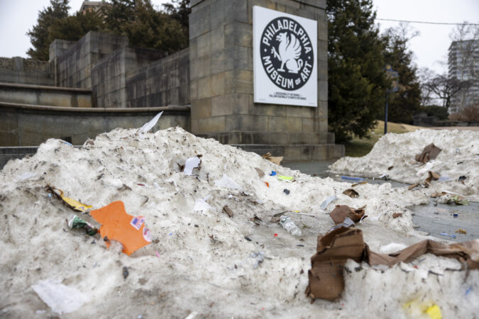
    Yes, that 9.3 inches of snow and white ice that fell on Jan. 25 is survived by some debris-strewn graying and blackening mountains, but it’s otherwise gone.

    It just took about three weeks.

    This one shouldn’t be as tenacious, as it won’t be infused with ice balls, and it will have a tough fight with the increasing power of the February sun.

    In the short term, however, it is likely to be quite obstructive.

    Accumulations are likely to vary substantially. Narrow corridors of heavier snow were likely to form during the night, and areas under the bands are going to receive the highest amounts.

    This also will be a “long duration” storm with its effects continuing well into Monday afternoon. Some snow could continue through the day, the weather service says.

    Some folks were determined to mine the best of the situation imposed by nature.

    Bartender Bill Coburn at Les & Doreen’s Happy Tap said it was a “snowload,” in which people seek refuge from the blizzard at local bars.

    “I think it comes from when you’re a kid — you have a snow day and you all go out somewhere, go sledding,” said James Brenner, 43, who lives above Atlantis: The Lost Bar in Kensington. “It’s just an adult version of that.”

    In Germantown, Ashley Ellis Gitongu, 33, brought her three boys to the grocery store to buy some strawberries, a final outing before the impending storm.

    With another child on the way, Gitongu was dealing with it all with a certain equanimity. “I’m not too worried, but we are going to be stuck inside for two days,” Gitongu said. And it looks like they’ll be getting some exercise.

    “All the furniture is out of the way in the living room so they can play soccer inside,” she said. “We have softballs, Legos, anything to keep them active and distracted.”

    Among those not traumatized by it all was Eric Dobson, 57.

    “These kind of winters were common when I was a kid,” said the Germantown resident. “I guess we have become soft, so we panic.”

    “I don’t know why we always get milk and bread in the storms,” said Dobson with a laugh. “I don’t even think we eat that much bread.”

    This story will be updated.

    Melanie Burney, Kristen A. Graham, Michelle Myers, Ariana Perez-Castells, Maggie Prosser, Brett Sholtis, and Aubrey Whelan contributed to this article.

  • Chesco towns are among the Philly area’s wealthiest, but big Bucks County is making gains

    Chesco towns are among the Philly area’s wealthiest, but big Bucks County is making gains

    It abuts an internationally famous garden. It may well be the most affluent community in the nation that hosts a prison, a source of some unwanted attention a few years back.

    And, according to recently released U.S. Census data, picturesque Pocopson Township is in a rarified zone for wealth in the eight-county Philadelphia region, with an annual median household income of $230,000.

    Chester County towns dominated the top 50 list in an analysis of incomes in the region’s municipalities — compiled from self-reported American Community Survey data — calculated for the five-year period that ended in 2024.

    But the analysis also showed that not only has Bucks County been gaining star power, some of its towns may merit the label “Big Bucks County.”

    Legendary locale New Hope and neighboring Solebury — places associated with Real Housewives of Beverly Hills alumna Yolanda Hadid and actor Bradley Cooper — are among the towns that have made significant moves up the income chart, compared with the five-year period that ended in 2014.

    Inflation-adjusted median annual incomes jumped 58% in New Hope, to $175,000. Incomes were up nearly 30% in Solebury, to $196,000, among the highest in the region.

    The national median income was around $80,000, according to census figures.

    Income figures are estimates, rounded to the nearest hundred, and are subject to margins of error. A total of 286 municipalities were included in the analysis; those with fewer than 2,500 residents were excluded. Here are some key findings.

    window.addEventListener(“message”,function(a){if(void 0!==a.data[“datawrapper-height”]){var e=document.querySelectorAll(“iframe”);for(var t in a.data[“datawrapper-height”])for(var r,i=0;r=e[i];i++)if(r.contentWindow===a.source){var d=a.data[“datawrapper-height”][t]+”px”;r.style.height=d}}});

    Chester County still has the wealthiest towns

    Chester County towns held six of the top 10 spots, including Birmingham, adjacent to Pocopson.

    The county evidently is rich in an amenity attractive to the wealthy — and to others.

    “Chester County has been a leader in terms of the amount of land preserved,” said Andrew Svekla, Office of Smart Growth manager with the Delaware Valley Regional Planning Commission. “The availability of open space is an amenity that everyone is looking for.”

    While the natural environment is an understandable attraction, not everyone who spends time in Pocopson comes for the green space: The Chester County Prison has been a mainstay in the township since 1959.

    In August 2023, Pocopson and Longwood Gardens became international news when inmate Danilo Cavalcante escaped and set off a two-week investigative frenzy that mutated into a massive exercise of Where’s Danilo? He spent time hiding in Longwood and was eventually captured in South Coventry Township, about 20 miles away.

    Otherwise, the likes of Pocopson and Birmingham have not exactly been centers of media attention, and the towns even have avoided the development-vs.-open-space conflicts that have erupted elsewhere, said Matthew J. Edmond, executive director of the Chester County Planning Commission.

    “They aren’t in the path of growth,” he said. “These areas are off the beaten path.” The residents represent a mix of old and new money, he said.

    He likened Chester County to a macro-version of Lower Merion Township, where neighborhoods vary from ultra-wealthy Gladwyne to the middle-class sections of Ardmore.

    While overall the county has the highest median income in the state, “when you get down to the granular level, it’s a very diverse county,” he said.

    Incomes in other counties in the region have grown

    The overall picture of wealth in the eight-county region was quite a diverse one in the census survey, ranging from Pocopson’s median income to the $40,000 levels of Camden, the City of Chester, and Darby Borough.

    But the preponderance of the higher incomes clearly were west of the Delaware River.

    Jersey’s wealthier municipalities tend to be clustered in the New York metro area, Svekla said, and only six were on the top 50 list in the Philly region. They included Camden County’s Haddonfield, with a median income of $200,500, and Moorestown, at $160,000 and a favorite of professional athletes. They include ex-Phillie Nick Castellanos, onetime 76er Ben Simmons, Flyers legend Bobby Clarke, and former Eagle Terrell Owens, who famously drew media attention by doing push-ups on his driveway.

    It also is the home of Kevin Patullo, the Eagles’ former offensive coordinator whose house was pelted with eggs in October after one of the team’s lackluster performances.

    Haddon Heights and Haddon Township did not join Haddonfield in the top 50 but were high on the list of towns where incomes had grown substantially in the last 10 years.

    Other places that experienced substantial paycheck bumps in the last 10 years included the Blue Route towns of Conshohocken and West Conshohocken. Both are close to I-476 interchanges and have experienced growth spurts in population and wealth since the highway connecting the Pennsylvania Turnpike to I-95 opened in the 1990s.

    Bucks lags in population growth, but not wealth

    Led by Chester County, population increased in all eight counties between the 2010 and 2020 census counts. “We’re growing mainly due to international immigration,“ said Greg Diebold, the Delaware Valley planning commission’s senior data analyst.

    “Bucks has been one of the slower-growing counties,” he said, having added only about 4% to its population between 2010 and 2020.

    In terms of median-income growth over the last 10 years, however, it had seven municipalities in the top 20, more than any other county.

    window.addEventListener(“message”,function(a){if(void 0!==a.data[“datawrapper-height”]){var e=document.querySelectorAll(“iframe”);for(var t in a.data[“datawrapper-height”])for(var r,i=0;r=e[i];i++)if(r.contentWindow===a.source){var d=a.data[“datawrapper-height”][t]+”px”;r.style.height=d}}});

    Not all the gainers were wealthy towns

    One Delaware County town, Upland Borough, adjacent to the City of Chester and the location of part of the closed Crozer-Chester Medical Center, made the biggest-growth list with incomes up more than 40% to $61,000.

    Bankrupt Chester itself, with one of Pennsylvania’s highest poverty rates, reported a 10% gain, to $41,000.

    However, half of the 10 towns where incomes decreased the most were in Delaware County.

    Speaking to the region’s overall prosperity, fewer than 25% of the 286 towns showed drops in income in the period that ended in 2024, compared with the five-year period that ended in 2014.

    And only 20% this time around reported incomes below the national median.

  • Winter storm warning for Philly; blizzard conditions expected at the Shore

    Winter storm warning for Philly; blizzard conditions expected at the Shore

    A winter storm warning is in effect for Sunday — a blizzard warning for the Jersey Shore — and Sunday into Monday Philly’s snow has a shot at doubling the amount that fell on Jan. 25, the National Weather Service says.

    “At this point, that’s certainly possible,” Zachary Cooper, meteorologist with the National Weather Service said Saturday. The official forecast is calling for just over a foot in the city, with the potential for the total reaching 18 inches.

    Blizzard warnings up for the Shore, where onshore winds are forecast to howl past 35 mph, with moderate to major flooding possible.

    While it wasn’t in the official language, the weather service on a Saturday morning might well have included a supermarket stampede warning.

    The actual winter storm warning is in effect from 7 a.m. Sunday until 6 p.m. Monday.

    With a surprising level of agreement computer models and their interpreters Saturday were seeing the storm as being inevitable. It was forecast to affect the I-95 corridor from Washington to Boston — a rarity in recent winters.

    The weather service listed a 25% chance that totals could approach two feet in the city.

    “It’s going to be a long-duration event,” said Cody Snell, meteorologist with NOAA’s Weather Prediction Center in College Park, Md.

    On the plus side, this will not have the staying power of the 9.3 punitive inches that accumulated on Jan. 25 and spent a three-week vacation in the region. No ice is in the forecast, and daytime temperatures above freezing and the February sun likely will erase most it by the end of the workweek.

    (function () {window.addEventListener(‘message’, function (e) { var message = e.data; var els = document.querySelectorAll(‘iframe[src*=”‘ + message.id + ‘”]’); els.forEach(function(el) { el.style.height = message.height + ‘px’; }); }, false); })();

    What time would the snow begin in Philly?

    Precipitation is expected to begin Sunday morning, said Snell, possibly as a mix of snow and rain that becomes all snow.

    Snow may have a hard time sticking during the day, said Tom Kines, senior meteorologist with AccuWeather Inc., since temperatures will be near or slightly above freezing and the late-winter sun will be a factor, even it’s just a rumor in the sky.

    Plus the ground won’t be especially cold after a Saturday in which the temperature may approach 50 degrees.

    However, the upper air is going to be quite cold, Snell said, and when the snow is falling heavily, as it is expected to do Sunday night, “it will cool the column.”

    He said areas that get caught in heavy snow “bands” would see the highest amounts.

    What would be so different about this storm?

    The storm is forecast to mature into a classic nor’easter, so named for the strong winds generated from the Northeast.

    Nor’easters are the primary source of heavy snows along I-95, but the ones that produce heavy snow from Washington to Boston have been scarce lately.

    “Over the past several years, they’ve been few and far between,” Kines.

    The Jan. 25 storm was not a nor’easter per se, said Snell, but more of a case of the “overrunning” of warm air over cold air producing the snow and sleet.

    John Gyakum, an atmospheric scientist at McGill University in Montreal and a winter storm specialist, said he anecdotally has seen a trend of coastal storms intensifying too far north to have much of an impact on the Philly region.

    If that were the case, it could be a symptom of global warming, said Steve Decker, meteorology professor at Rutgers University. Storms form where cold and warm meet, and that may have been happening farther north lately.

    In any event that evidently won’t be the case Sunday.

    What could go wrong with the forecasts?

    Are you new around here?

    The storm consists of multiple moving parts, and as it bounds off the Southeast coast, it is due to intensify rapidly over the warm Atlantic waters.

    Meteorologists advised it was still unclear precisely how intense it would become and what path it would take.

    Forecast busts have been known to happen, including a famous one 25 years ago. On a Friday, the weather service warned of a storm of “historic” proportions to begin that Sunday.

    What Philly got was about an inch of snow that fell over three uneventful hours.

    In 2015, the head of the Mount Holly weather service office publicly apologized for a busted forecast.

    However, in recent years, the region hasn’t had all that many serious snow scares.

    In this case, expect details to jump around even as the precipitation is falling, but Snell said “confidence is growing” that substantial snow is going to happen.

    Inquirer staff writer Stephen Stirling contributed to this article.

  • Accumulating snow is looking more likely for the Philly region Sunday into Monday

    Accumulating snow is looking more likely for the Philly region Sunday into Monday

    Whatever unfolds almost certainly won’t resemble what came down from the skies on Jan. 25 or its obstructive aftermath, but accumulating snow Sunday into Monday is looking more likely.

    The National Weather Service on Friday listed a 90% chance of precipitation, with a 75% likelihood of two inches or more of snow for the immediate Philadelphia region, and about a one in three shot of at least six inches.

    And add about a 100% chance of uncertainty regarding how this would play out, said Richard G. Bann, a forecaster with the National Oceanic and Atmospheric Administration’s Weather Prediction Center, in College Park, Md.

    Computer models continued to show a wide range of outcomes from a storm that was still two days away from developing, ranging from a gentle snowfall to a school and road closer. Expect differences to persist.

    In addition to snow, a potent storm with powerful onshore winds could result in coastal flooding, the weather service office in Mount Holly advised.

    “I don’t think we would jump to either end of the extremes,” Bann said, “but we can’t say anything is completely out of the realm of possibility just yet.”

    The storm would evolve from multiple moving parts before maturing off the Southeast coast, he added. “Part of the equation is starting to come together but we’re still not there yet.”

    By Saturday, he said, “hopefully we’ll kind of know what part of the chessboard we’re working on.”

    When snow might begin in the Philly region

    Timing issues are among those likely to be fine-tuned in the next couple of days, but the early thinking is that snow, or rain changing to snow, would arrive in the Philly region Sunday morning or in the afternoon, continuing into Monday.

    The intensity of the snow and winds would depend on the strength of the storm, precisely where over the ocean it ripens, and the eventual track.

    The U.S. model has been bullish on bringing it close enough for a major snowfall along I-95. The other models, not so much, but the weather service noted that one of the balkers, the European, had come on board with at least light accumulations for the region.

    “We’re definitely going to be spinning up an area of low pressure,” Bann said, “but exactly what that means for D.C., Philly — any of us — is still in question.”

    But on the plus side: No ice is expected in this go-round.

    So much for the remnants of Jan. 25

    One of the most-stubborn snowpacks in the period of record, which has mutated into one of the uglier snowpacks in the period of record, should be pretty much erased by the time any flakes start falling Sunday.

    Submerged objects have been reappearing, evoking a surfacing submarine, and bare ground is becoming ever more visible.

    A decent, soaking rain on Friday — perhaps double Philly’s month total so far, a mere 0.25 inches — and temperatures in the 40s, combined with a sunny Saturday with high near 50 degrees, should pretty well clear the yards. Those plowed-snow mountains are likely to survive a while longer.

    The snowpack’s tenacity had everything to do with the two to three inches of sleet — melt-resistant white ice — that fell atop the several inches of snow on Jan. 25. The entire mess was locked in by an Arctic freeze.

    Bann endured similar conditions in his area, and recalled that it was way harder to move out of the way than the Mid-Atlantic mega-snows of February 2010, when 35 to 45 inches accumulated.

    He said he shoveled awhile, took a break, and then was astonished to see that his neighbors were finishing his work.

    Asked if he sent them any thank-you gifts, he replied: “I haven’t stopped.”

  • Another weekend snow threat is in the outlook for the Philly region

    Another weekend snow threat is in the outlook for the Philly region

    You may have read this somewhere before: Computer models are seeing the potential for a significant winter storm to affect the Philly region on yet another weekend.

    Those ingenious machines continue to predict that a storm will intensify off the Southeast coast Sunday into Monday. But “a large amount of uncertainty” remains about whether it will generate accumulating snow in the Philadelphia region, the National Weather Service said in its morning discussion Thursday. In the early going, areas south and east of Philly were the likeliest targets.

    Based on past experience, not to mention the nonlinear chaos of the atmosphere, about the only thing certain was that they would be changing their stories multiple times in the next few days, as would their virtual peers.

    In the short term, it is highly likely that, along with a certain dreariness, the region will be getting something that has been mighty scarce lately — rain. Philly’s rain total this month is under 15% of normal. Over the last 60 days throughout the region, it has been 40% to 50% below normal.

    The forecast for the rest of the workweek in Philly

    The freshness date on the snowpack has about expired and about now looks like it could use a good scrubbing, along with the air.

    Atop the remnants, generally light winds have been aiding and abetting a rather stagnant air mass. A “code orange” air quality alert was in effect for South Jersey Thursday, and health officials advised those with respiratory conditions to limit outdoor exposure.

    The primary irritants were tiny particulates, about 30 times smaller in diameter than a human hair.

    Rain is likely to be in the air Thursday night into Friday, and it could be a substantial amount, on the order of a half-inch or more. So far this month, officially 0.25 inches have been measured at Philadelphia International Airport.

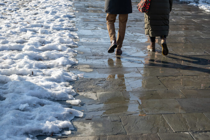
    The moist air and the rain should erase more of the snowpack, “but we don’t want the snow and ice to melt too quickly,” said Ray Martin, a lead meteorologist at the National Weather Service Office in Mount Holly. No significant flooding is expected, just some potential damage to footwear.

    Temperatures are expected to top out in the 40s Thursday and Friday.

    About the weekend storm potential

    It may hit 50 degrees on Saturday with an appearance of the sun. So much for the easy part.

    Come Sunday, “there could be some rain or snow,” said Matt Benz, senior meteorologist with AccuWeather Inc.

    A storm is due to slide across the South and eventually regroup off the Atlantic coast on Sunday.

    But Benz pointed out that a key feature of the potential storm still was over the Pacific and not due to make landfall until sometime later Thursday, when it would be captured by land-based observation and give the machines a clearer idea of its intentions.

    And it is not at all clear how much cold air would be available for snow, Benz said, but if the storm intensifies sufficiently, “it can manufacture its own cold.” Another factor is just where off the coast the storm would be when it matured.

    In case you’re wondering why the atmosphere seems to pick on Sundays, having storms show up in seven-day cycles is a common phenomenon.

    They often migrate in 3½-day cycles, which has to do with the rhythms of storm movements as they travel across the country, and it so happens that the more significant one has been arriving on the seventh day.

    It keeps happening until it doesn’t, and it’s still very possible that it doesn’t this time around.

    Said Benz: “We have a long way to go to Sunday.”

  • One of Philly’s longest snow-cover streaks is over, at least officially

    One of Philly’s longest snow-cover streaks is over, at least officially

    Officially* one of Philadelphia’s region’s most impressive and enduring snow-cover streaks in the period of record ended peacefully at 7 a.m. Tuesday.

    After 23 consecutive days of at least an inch on the ground at Philadelphia International Airport, the National Weather Service observer reported a mere “trace” at 7 a.m. Tuesday, meaning that whatever was left was hardly worth a ruler’s time.

    “I can’t imagine too many people are sad about this,” said Mike Silva, meteorologist at the weather service office in Mount Holly.

    The news might have evoked vast choruses of “good riddance” were it not for the fact that mass quantities of the snow and ice remain throughout the region, enough to contribute to the formation of dense fog late Tuesday night into Wednesday morning, the weather service warned.

    And regarding that asterisk, observations at PHL have been known to differ from actual conditions elsewhere, if not common sense.

    Plus, computer models are seeing yet another weekend winter-storm threat.

    In the meantime, heaps of aging, graying plowed snow are ubiquitous around the great Philadelphia city-state. As for melting “those big mountains, that’s going to take forever,” Silva said.

    For 18 days after 9.3 inches of snow and sleet was measured at the airport, the official snowpack had been 3 inches or more, the longest such streak in 65 years.

    The 23-day run of an inch or more, which began on Jan. 25 when the snow started, was the longest since 2003.

    The endurance had to do with the melt-resistant icy sleet that fell atop several inches of snow and the Arctic freeze that followed. Temperatures remained significantly below normal for 17 consecutive days.

    The great melt is picking up steam in the Philly region

    However, the melting process is at long last accelerating. Bare ground is appearing around tree roots, and evidence of vegetative life has been poking through the snow cover.

    Temperatures above freezing and the February sun have been making hay, but so has the return of invisible atmospheric moisture, even as precipitation remains far below normal.

    When warm, moist air comes in contact with snow, it condenses and yields latent heat that accelerates melting. That is evident in the swelling ranks of rivulets on driveways and in the streets.

    The combination of the moisture, the cold snow and ice pack, and generally calm winds will result in fog that could reduce visibilities to a quarter mile at times. The weather service issued a dense fog advisory, in effect from 10 p.m. Tuesday until 10 a.m. Wednesday.

    Melting conditions should be excellent the rest of the workweek, with highs in the 40s and light rain possible Wednesday night, and likely on Friday.

    Temperatures are due to remain above freezing into the weekend, but “then we’ll have to see what happens Sunday,” Silva said.

    Another storm is due to develop in the Southeast, and expect another week of computer-model vacillation on whether it will produce rain, snow, or partly cloudy skies.

    “We have some models that say snowstorm, and others that say nothing,” Silva said.

    It’s been a while since computer model forecasts have been this conflicted about a weekend storm — about a week.

  • Philly’s snowpack reaches a 65-year milestone, and here’s when it finally may disappear

    Philly’s snowpack reaches a 65-year milestone, and here’s when it finally may disappear

    You may not have noticed, but that endless snowpack has developed a slow leak — in this case historically slow.

    Its endurance continues to climb the charts among the snowpacks of yesteryear — and in at least one way may well be unprecedented in the period of record dating to the late 19th century.

    As of 7 a.m. Friday, officially at Philadelphia International Airport, three inches of the snowy and icy remnants of what fell on the region on Jan. 25 had survived.

    That made this the most-enduring snowpack of at least three inches in 65 years, said Alex Staarmann, a meteorologist at the National Weather Service in Mount Holly, the office’s climate specialist.

    That earlier one, which lasted from Jan. 20 to Feb. 14, 1961, was replenished by multiple significant snowfalls, as did others at the top of the endurance list; the 2026 version was basically one-and-done after 9.3 inches were measured at the airport.

    This one — and it still has its sparkle where it hasn’t mutated into frozen sludge — even has bested the snow cover attending the 44 inches that accumulated in a six-day period in February 2010, when at least four inches survived for 17 days.

    The latest batch was at four inches for 18 days, good for fourth place all-time.

    Not that it hasn’t had some aesthetic benefits. It can be like light therapy in the morning, and a spectacular screen for the tree shadows. It has beautifully entombed all that unfinished yard work.

    Snow and ice debris is piled along the Camden waterfront in Camden, N.J., framing the Philadelphia skyline across the Delaware River, Thursday, Feb. 5, 2026.

    But it’s also been a royal pain throughout the region and begged the question: When it will go away?

    When will bare ground emerge in the Philly region?

    A farewell tour is likely next week as a snow threat for the holiday weekend remains a remote one, with accumulations only between “wet flakes” and “a dusting” possible, said Staarmann.

    And you might keep an eye on Tuesday for a melt watch. Temperatures are forecast to fall below freezing Monday morning, and then stay above 32, even at night, through the workweek.

    Highs are expected in the 40s Saturday through Monday, and then 50 or better the next three days.

    More significantly for melting, the air will become noticeably more moist on Tuesday, and that should accelerate the melting. Your skin might even notice the difference.

    Why has the snowpack been so enduring in Philly?

    Since the precipitation ended on Jan. 25, the air has been remarkably dry, an underrated factor in the persistence of the ground cover, along with what happened after the snow stopped that day.

    After more than seven inches of snow had fallen, it was topped with several hours of accumulating sleet.

    Those miniature ice balls turned out to be a mighty additive: Ice may be way slower to accumulate, but it is also way slower to melt, giving the snowpack staying power.

    “If we hadn’t had this much sleet, we might have some evidence of it, but it wouldn’t be this deep or persistent,” said Staarmann.

    The Arctic freeze that followed and the consistently arid air have been the ideal preservatives.

    Moist air, an efficient melter, has been absent.

    When enough invisible water vapor comes in contact with snow and ice, it condenses and gives off latent heat that can liquefy the pack in a hurry.

    After Philadelphia’s record 30.7-inch snowfall of Jan. 7-8, 1996, it was a moisture surge 11 days after the snow stopped that had a whole lot to do with erasing the snowpack even before the modest rains that followed, recalled David Robinson, the longtime New Jersey state climatologist.

    The melt set off disruptive flooding, but even though rain is in the forecast for midweek, anything resembling a repeat is unlikely this time around.

    Is that all there is for the winter of 2025-26?

    NOAA’s Climate Prediction Center on Friday had odds favoring above-normal temperatures through Feb. 23, followed by a possible cool down.

    Regarding any potential for snow, “We still have a few weeks left of opportunities,” said Staarmann.

    As long as computers are operating, snow chances will never die.

    However, the February sun is getting stronger by the day and lasting longer. If it does snow again, it’s a near certainty that it won’t match this one for staying power.