Author: Anthony R. Wood

  • Philly’s snowpack is making history, along with misery

    Philly’s snowpack is making history, along with misery

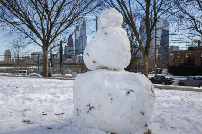
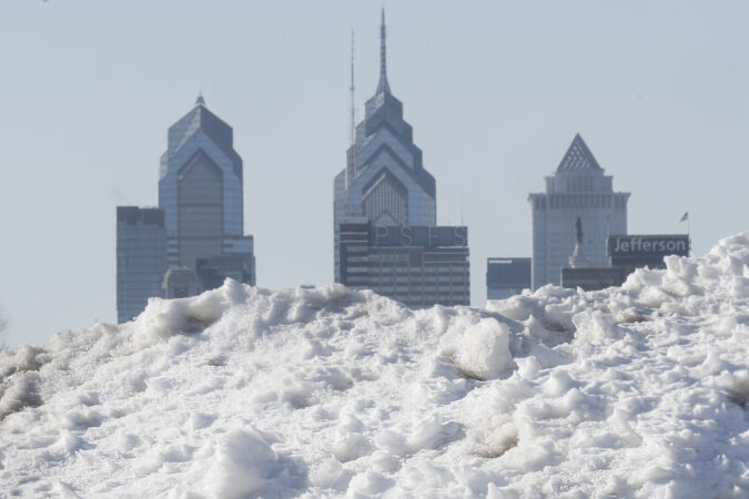
    That inert, frozen mass that has turned parking and walking and the routine business of life into punitive experiences around here is a certifiable Philadelphia rarity.

    It almost certainly will take a significant hit this week — temperature readings may reach the big 4-0 (hold the applause; a downside is possible) — but the snowpack already has earned historic status in Philly’s weather annals.

    The official snow depth at Philadelphia International Airport at 7 a.m. Monday was 5 inches, the 15th consecutive day that it has weighed in at 5 inches or more.

    That is tied for the fourth-longest streak in National Weather Service records dating to the late 19th century. But this one arguably is more impressive than its predecessors.

    The Philly snow cover’s staying power

    The staying power of the other snow-cover streaks at the top of the list were the results of heavy snow followed by additional snowfall of 10 inches or more that replenished the snow pack. That list includes the 44 inches that fell in a six-day period in February 2010.

    window.addEventListener(“message”,function(a){if(void 0!==a.data[“datawrapper-height”]){var e=document.querySelectorAll(“iframe”);for(var t in a.data[“datawrapper-height”])for(var r,i=0;r=e[i];i++)if(r.contentWindow===a.source){var d=a.data[“datawrapper-height”][t]+”px”;r.style.height=d}}});

    This time around, only 0.3 inches have been measured since the 9.3 inches of snow and white ice stopped falling on Jan. 25.

    The sleet that fell atop the several inches of snow added considerable durability to the pack, since ice melts more slowly than snow, and then it all was rock-frozen by a memorable arctic freeze, followed by reinforcements.

    Temperatures the last 15 days have averaged 10 to 15 degrees below normal, and Sunday’s low of 8 was the coldest of the season to date.

    It isn’t often that the Philadelphia region experiences such “magnitude … and persistence” of cold, said Kyle Imhoff, the Pennsylvania state climatologist. Plus, typically big snows are followed by a thawing period of few days later. What’s happened since Jan. 25, he said, “is a much rarer occurrence.”

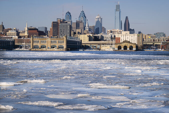
    The cumulative effects have been evident along the Schuylkill, which is looking (deceptively) fit for skating, and the Delaware River navigation channel. The river and most of Delaware Bay are between 90% and 99% ice covered, the U.S. National Ice Center reported Monday.

    It hasn’t been just us. Data pulled by Samantha Borisoff, climatologist at the Northeast Regional Climate Center, showed impressive snow-cover endurance streaks in Wilmington, Atlantic City, Washington, and New York.

    Ice cover throughout the Mid-Atlantic region expanded Sunday, said ice center physical scientist Jonathan Edwards-Opperman. While Saturday was harsher with winds gusting past 50 mph and below-zero windchills from midmorning on in Philly, the “strong winds pushed a lot of the existing ice into the shore, which exposed open water,” he said.
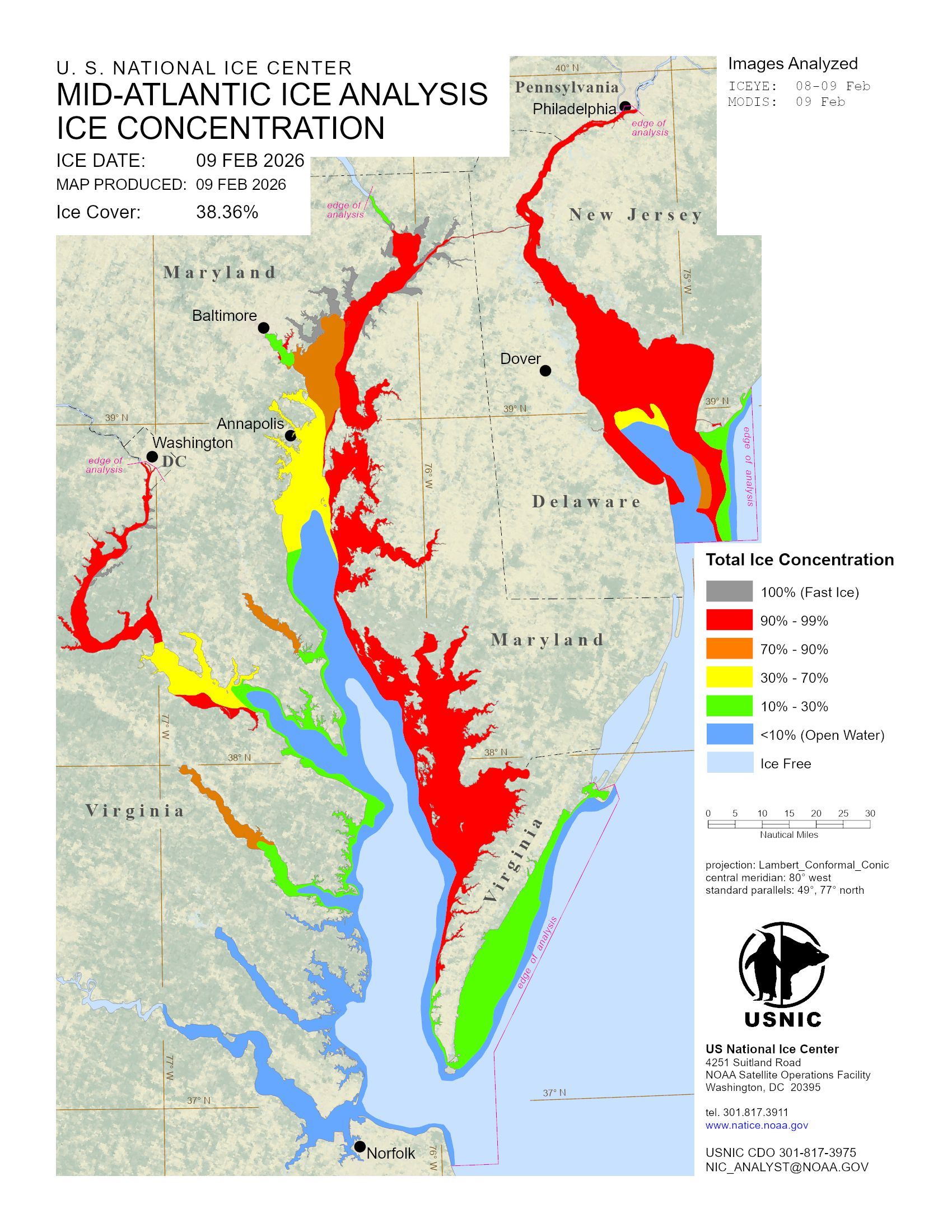
    Ice levels along Midatlantic waterways on Monday, Feb. 9, 2026.

    When the gusts backed off Sunday, the ice went to town. “We saw rapid new growth,” he said.

    Said PhilaPort spokesperson Ryan Mulvey, “Talking with people around the port we haven’t seen ice like this in over 10 years.”

    That said, however, he added that the Coast Guard has kept the traffic moving and “we have not experienced any ice-related delays.”

    It is about to get better

    It did not get to freezing Monday afternoon, but it should make it to the upper 30s, or perhaps the low 40s by midweek, said Amanda Lee, a meteorologist with the National Weather Service in Mount Holly.

    And daytime highs should go above 32 at least through the workweek. That combined with the growing power of the February sun — its daily wattage will be about 10% higher on Tuesday than it was on Feb. 1, according to NASA — should lessen the snow and ice cover considerably.

    That thaw, however, could come with some bumps in the road.

    “I think it’s fair to expect potholes to grow or develop as the weather gets warmer,” said PennDot spokesperson Helen Reinbrecht. Patching crews will be out there, conditions, permitting, she said.

    Those conditions should persist at least until the weekend, when another storm could affect the region, said Lee.

    It’s only Monday, which means the computers still have several more days of disputation.

    In the meantime, you may not be seeing much in the way of bare ground, but expect an outbreak of puddles. It’s been a while.
  • Ice is building on Philly’s waterways as the snowpack persists and the cold intensifies

    Ice is building on Philly’s waterways as the snowpack persists and the cold intensifies

    Accompanying one of the more-enduring snowpacks in the period of record, ice has continued to build in the Philadelphia region’s waterways, and all indications are that it’s going to intensify in the next three days, perhaps significantly.

    With temperatures expected to fall to single digits by Saturday night and wind gusts up to 55 mph, the region is about to experience an assault from a “cold air gun,“ said Alex Sosnowski, senior meteorologist at AccuWeather Inc.

    The combination, plus the below-freezing temperatures at least through Monday and the ongoing cold spell that began last month, will not only deepen the ice cover but will make it more uniform by freezing over breaks in the ice.

    “You’re going to see the ice-over become more extensive,” Sosnowski said.

    Earlier in the week, icing temporarily stranded a vessel on the Delaware River that was delivering much-needed salt supplies to Philly. (They did eventually get here.)

    The U.S. Coast Guard was using a 175-foot-long cutter to break up ice on a portion of the river channel that runs from the mouth of the ice-covered Delaware Bay — where Cape May-Lewes Ferry service was disrupted this week — to Trenton.

    As of Friday morning, the craft had been ramming ice for 45 hours since the freeze began at the end of last month, U.S. Coast Guard Petty Officer Matthew West said.

    So far, however, the ice hasn’t reached crisis levels, said Ryan Mulvey, a spokesperson for the Philadelphia Regional Port Authority. For ship traffic on the river, it’s been more a matter of “road work ahead” rather than ”road closed.”

    “We’re open as usual,” he said. “I think the largest ships help with breaking up some of the ice flow.”

    One thing is certain, meteorologists are warning: The ice factory is going to be in full production mode until Tuesday.

    And, ironically, even as precipitation deficits and drought conditions persist, flooding potential is a source of concern.

    The short-term outlook for icing in the Philly region

    A key to melting, said Sosnowski, is having a sequence of daily average temperatures above freezing, not just daytime highs above 32 degrees. Nights also have to warm up.

    The prospects of that happening aren’t looking good for the next several days. Officially, Friday was the 12th consecutive day of a snowpack of at least 5 inches at Philadelphia International Airport, the seventh-longest such stretch in records dating to the winter of 1884-85.

    Daily average temperatures have been below freezing every day since Jan. 23.

    Highs on Saturday and Sunday, even in the city, may struggle to reach 20 degrees, with lows in single digits Sunday and Monday mornings.

    A promised warmup during the workweek wasn’t looking as toasty on Friday as it was earlier in the week. Monday’s temperatures were forecast to top out in the 20s, and no daily average temperatures are forecast above freezing through Friday.

    Some rain or snow also is possible Wednesday, said Nick Guzzo, a meteorologist with the National Weather Service in Mount Holly. A storm is possible next weekend, but computer models continue to disagree with each other, and themselves.

    To erase the snowpack, the region could use a warm, moist air mass and rain that would produce “river rises” that would help break up the ice, the weather service says.

    But not too much rain.

    The long-term outlook: Flooding concerns amid a drought

    Some of the worst flooding on record has resulted from ice-jamming, a signature example occurring after Philadelphia’s mammoth 1996 snowstorm.

    Moist air preceding a rainfall all but erased the snowpack with a historic melt. When that air came in contact with the snow, it condensed, releasing latent heat that sped up the melting.

    Rain followed, and liberated ice jams led to destructive flooding along the Delaware and the Susquehanna Rivers and a presidential disaster declaration.

    NOAA’s Middle Atlantic River Forecast Center is well aware of the potential and is monitoring conditions, said senior hydrologist Johnathan Kirk.

    “That’s what we have to watch for,” said Sosnowski, who well remembers 1996.

    “It is going to take one of the more mild-mannered thaws to avoid ice-jam flooding,” he said.

    A mild thaw is possible, Sosnowski said, but “the odds are stacked against it. It’s been so cold for so long.”

  • A dash of snow, an Arctic chill, and 55 mph wind gusts are possible this weekend in Philly

    A dash of snow, an Arctic chill, and 55 mph wind gusts are possible this weekend in Philly

    By now Arctic air may qualify for a frequent-visitor pass around here, but the version coming this weekend will be of a different quality and have a particular sting.

    “It’s going to be a slap in the face,” said Cody Snell, a meteorologist with the National Oceanic and Atmospheric Administration’s Weather Prediction Center.

    After a day in which highs will be around freezing on Friday — a solid 10 degrees below normal — some nuisance snow is possible late in the day or evening and early Saturday, and maybe even squalls. Then temperatures are going to tumble through the teens in the wake of another potent Arctic front.

    They might not see 20 degrees in the Philly region until Monday.

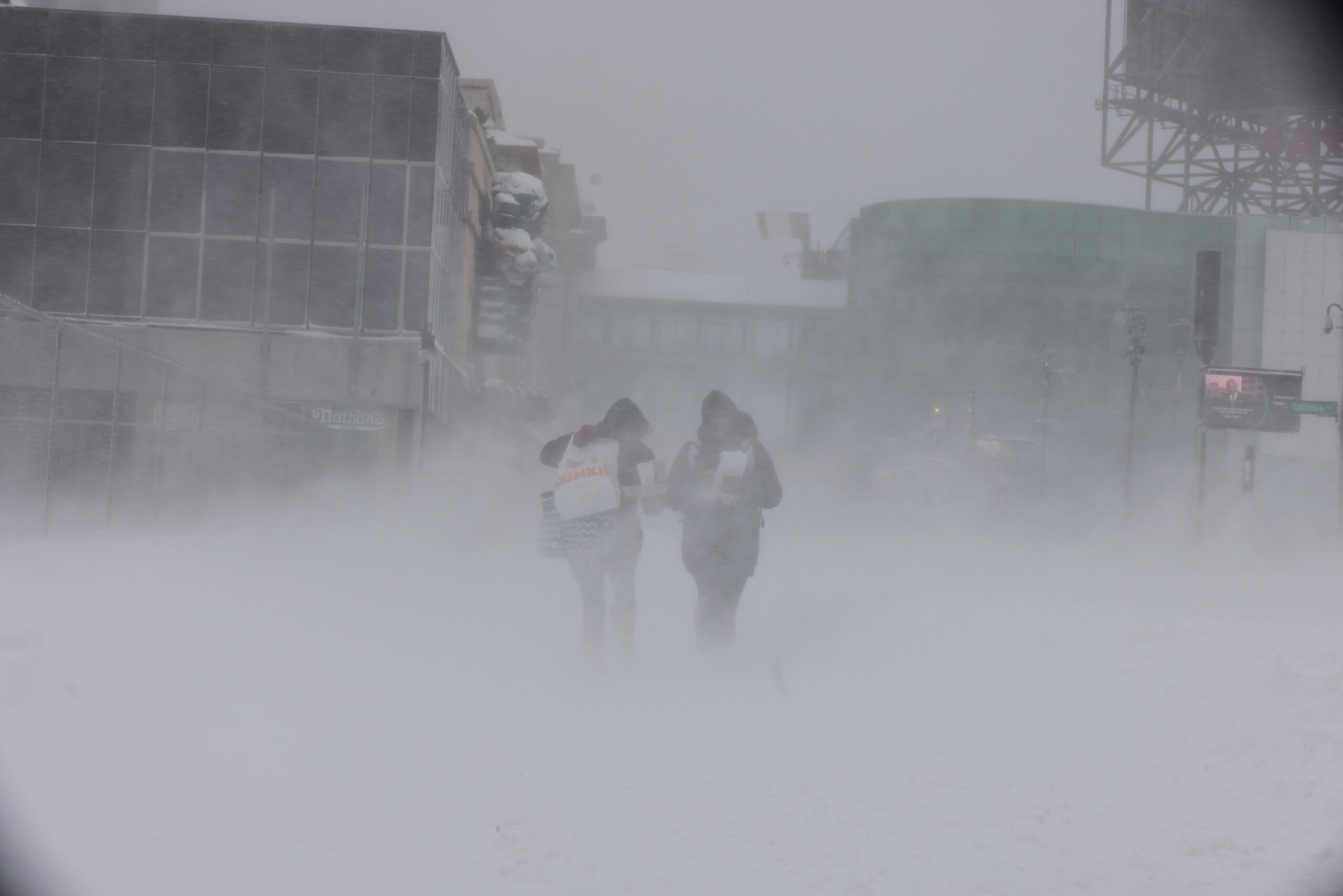
    Adding bite will be winds that could gust to 55 mph, and the National Weather Service says wind chills of 10 and 15 below are likely Saturday in the immediate Philly area. The agency has issued an “extreme-cold warning” — a relatively new addition to the advisory list — in effect Saturday afternoon through Sunday morning. Wind chills of 17 below zero are possible, and winds could gust to 55 mph, the weather service says.

    Said Ray Martin, a lead meteorologist at the weather service office in Mount Holly, “It’s going to be awful.” Among the recent sequence of Arctic invasions, “it looks like the worst.”

    In short, that unusually tenacious snowpack that was left over from the 9.3 inches of snow and white ice that fell on Jan. 25 and has since mutated into a form of frozen slurry will be spending at least another weekend in Philly.

    What’s more, it’s likely to be a harvest weekend for the ice that is solidifying upon the region’s waterways, a growing concern.

    A warm-up is due to begin Monday and pick up steam during the workweek, with highs maybe reaching 40 degrees on Thursday. But it may encounter some resistance, and another storm threat might be brewing for next weekend, forecasters say.

    The snowpack already has achieved an elite status

    Friday marked the 12h consecutive day in which the official snow cover at Philadelphia International Airport, measured daily at 7 a.m., was at least 5 inches.

    In the 142-year period of record, that ties for seventh place for a snow-cover duration of that depth.

    “To hold on to a snowpack like this is unusual,” said Johnathan Kirk, senior hydrologist at NOAA’s Middle Atlantic River Forecast Center, in State College, Pa., which is keeping a close eye on the waterway icing.

    The Schuylkill in Philly is ice-covered, as is the Delaware River from Trenton to Washington Crossing.

    In addition to an eight-day stretch when temperatures failed to reach 30, the durability is related to the 2 or so inches of sleet that capped the snow on Jan. 25. Sleet is white ice that melts more slowly than snow.

    The dry and cold air has been a natural preservative; snow and ice melt more readily when the air is moist.

    Another factor was the impressive liquid content of the snow and sleet, Snell said. The frozen mass contained 1.39 inches of liquid, the weather service said, comparable to what is contained in 15 to 18 inches of snow.

    As temperatures finally nudged above freezing, some melting did occur this week, which would explain that unsightly slushy porridge at Philly intersections. However, the official snow depth lost only an inch between Jan. 27 and Wednesday.

    The snowpack may receive a fresh frosting Friday night into early Saturday with up to an inch of snow, Martin said, but it’s not going to have the same staying power.

    What’s different about this Arctic air mass

    Any snow that falls is likely to get blown away in a hurry, Martin said, as winds will pick up before daybreak Saturday and gusts howl to 50 mph by late morning.

    Typically, cold air pours into the region from the northwest and becomes modified as it passes over land, the Great Lakes, and the mountains.

    This is going to be a straight-up Arctic shot. It will come more or less from the north, and the icy lakes are not going to do much to impede it, said Matt Benz, senior meteorologist at AccuWeather Inc.

    The weather center’s Snell said a weak storm system moving off the Atlantic coast is forecast to blow up as it interacts with warm Gulf Stream waters. The differences between the cold high pressure with its heavier air over the East and the lighter air of the storm are going to place the Philadelphia region in a frigid sandwich.

    Heavier air tends to rush toward lighter air, like air escaping from a punctured tire.

    A thaw is coming to Philly, eventually

    Just how warm it gets next week remains unclear, AccuWeather’s Benz said.

    “Arctic air is hard to dislodge sometimes,” he said, adding that recent model trends suggest the warm-up will not be quite as robust as expected earlier.

    A wild card would be a potential storm next weekend. The European forecast model was seeing rain and 60 degrees, Martin said, while the U.S. model was suggesting a blizzard.

    His take: “I have no clue at this point.”

    An anniversary of note

    On Feb. 5, 2010, 6.6 inches of snow fell upon the airport, the beginning of an unprecedented siege in which 44.3 inches accumulated in a six-day period.

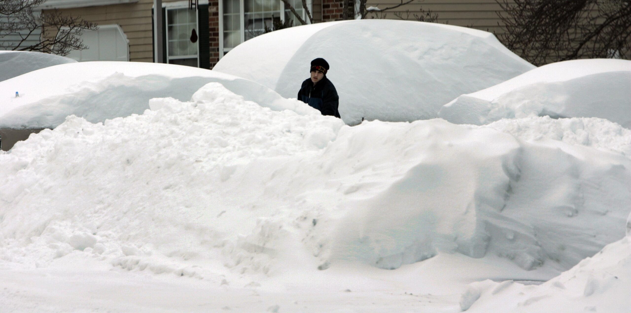
    A man shovels cars out under mountains of snow in West Bradford Township, Chester County, during the incredible snow siege of February 2010.

    Twelve days after the snow stopped, the official snow depth was down to 4 inches.

  • It’s ‘Groundhog Day’ in Philly this week as snow and ice persist

    It’s ‘Groundhog Day’ in Philly this week as snow and ice persist

    If it appears that the tenacious meringue of snow and ice that landed on the region two weekends ago hasn’t budged, it hasn’t.

    Among Philadelphia winters, this one is approaching a rarefied status.

    Not long after Phil predictably saw his shadow in Punxsutawney, the National Weather Weather Service contractor at Philadelphia International Airport reported a snow depth of six inches on Monday.

    That marked the eighth consecutive day of a snow cover of at least six inches, a streak unmatched since February 2010 — which included a five-day period in which 44 inches of snow had fallen.

    And what’s out there now may get a fresh frosting on Tuesday night that could affect the Wednesday morning commute, and perhaps snow squalls on Friday with the approach of another Arctic front as the freezer reopens.

    Don’t be surprised if next Monday morning looks a lot like this one.

    “The snowpack is not going anywhere,” said Amanda Lee, meteorologist at the weather service office in Mount Holly.

    What explains the durability of the snow cover

    The primary factor locking in the regional glacier has been the obvious — the cold. Sunday marked the ninth consecutive day that temperatures failed to surpass freezing, the longest stretch since 2004. The temperature did reach above freezing at Philadelphia International Airport on Monday.

    Temperatures since Jan. 24 have averaged 14 degrees below normal in Philly. January temperatures ended up finishing 2.2 degrees below normal, even though the month had a nine-day warm spell in which the highs went past 55 on five days.

    In addition to the cold, the icy layers of sleet that have put a cap and a patent-leather sheen on the several inches of snow that fell Jan. 25, have limited melting. Ice is way slower to melt than snow.

    Eight days after an official 9.3 inches of snow and ice was measured officially, about two-thirds of it has survived.

    The forecast for the next several days

    The region is in for a modest — very modest — warming trend. Readings cracked freezing Monday, reaching 35 degrees at 4 p.m. and are forecast to top out near 32 on Tuesday and Wednesday, and hold in the upper 20s Thursday. Those readings still would be several degrees below normal.

    Some light snow is possible Tuesday night, “maybe up to an inch,” Lee said. The weather service on Monday was listing a 72% probability of something measurable — defined as 0.1 inches or more — falling in Philly.

    Given the cold and the solidly frozen paved surfaces, “it could make things slippery for the morning commute on Wednesday,” said Matt Benz, senior meteorologist with AccuWeather Inc.

    Friday afternoon, he said, the region could see snow squalls — brief, mini-blizzards that can come on without notice and reduce visibility dangerously.

    Then it’s back to the freezer with expected weekend lows in single digits and highs struggling to reach 20.

    For those ready for something completely different, NOAA’s Climate Prediction Center on Monday suggested the potential for significant pattern change, although this may require a little patience around here.

    Its extended outlook for the six-to-10 day period that begins Sunday has most of the nation warmer than normal, with odds strongly favoring below-normal readings in the Philadelphia-to-Boston corridor. But a “rapid warmup” in the Philly region is possible around mid-month, the climate center says.

    In the short term, it appears that Philly is in for a repetitive sequence evocative of the 1993 movie classic Groundhog Day.

    “We’ve had lots of very similar days,” Lee said.

    We’ve noticed.

  • The arctic cold persists, and so does Philly’s snowpack. Both may even go away some day.

    The arctic cold persists, and so does Philly’s snowpack. Both may even go away some day.

    It looks like the Philly region will evade any snow generated by that coastal “bomb cyclone” during the weekend, but the disruptive snowpack on the ground continues to melt at a glacial pace. Maybe ever slower.

    “For now, it’s not budging,” said David Robinson, the New Jersey state climatologist who is an international expert on snow cover.

    And, ironically, that has a whole lot to do with what happened in the hours right after the snow stopped around 11:30 a.m. Sunday.

    Add one of the more signifiant Arctic cold spells in Philadelphia’s period of record, and the entire region has endured a white and wintry week rarely experienced around here.

    As of Friday morning, the official snow depth at the airport still was 6 inches, about two-thirds of what was measured when the storm ended five days before.

    For perspective, the depth was 6 inches five days after a snowstorm in 2016 — after 22.4 inches had fallen.

    The cold won’t be as harsh during the workweek, but a thaw isn’t imminent, and some snow is possible Wednesday.

    Temperatures are forecast to drop deep into the single digits Saturday morning, flirting with records. It is not due to get into the 20s until Sunday, when backlash winds from the potent coastal storm are expected to drive wind chills below zero.

    Those winds may contribute to significant flooding at the Shore, where they could gust to 50 mph.

    About last Sunday in Philly

    About 7.5 inches of snow had fallen officially by 11:30 a.m. Sunday at Philadelphia International Airport, more in some other places, when it yielded to several hours of sleet that accumulated 2 to 3 inches, coating the snow with a sparkling, icy veneer.

    “You can’t help but recognize the beauty of it,” said Robinson, a Rutgers University geography professor and keeper of the Rutgers Snow Lab.

    While it may be an aesthetic pleasure, especially at night under the full “snow moon” rising this weekend, it has had a profoundly chilling effect on cleanup efforts.

    The sleet, liquid that freezes before it lands, literally put an ice cap on the snow. “Ice pellets are tougher to melt,” said PennDot’s Thomas Rogal, a maintenance supervisor for the Philadelphia district. In a melting race, a homely sleet ball wouldn’t have a chance against a six-sided snowflake.

    On Sunday, said Rogal, the sleet was a game-changer for the road crews. Instead of just plowing, crews were “scraping the road surfaces,” he said. Sleet added a stubborn stickiness to the mass of frozen material.

    It also contained about as much liquid as several inches of snow, said Robinson.

    The surprisingly cold temperatures, in the lower 20s and teens, inhibited the effectiveness of salt on Sunday. “The material just didn’t function,” said Rogal.

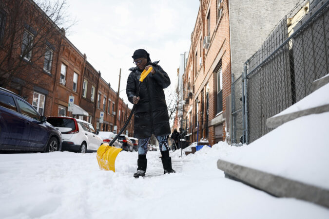
    In the city, the glacial mass has been especially disruptive, a royal, inconvenient pain for people living on side streets, for street crews, for anyone who has tried shoveling, and for the schools.

    In addition to the snow and ice challenges, the cold has stressed aging heating systems in the public schools, once they reopened.

    A thermometer in a Central High School classroom on Friday read 39 degrees. That’s colder than the normal high for the date in Philly — outdoors.

    When will all this go away?

    Philly hasn’t had a stretch of days like this in which the temperature has failed to reach 30 degrees since 1979, according to records tracked by the Pennsylvania state climatologist.

    And it likely is going to finish in the top 10 for consecutive days in which readings didn’t get past freezing, said Mike Silva, a meteorologist with the National Weather Service in Mount Holly.

    Low temperatures Thursday and Friday morning, 13 and 11, respectively, were several degrees above the forecasts. That probably was related to the winds at the airport, he said.

    It also may be related to the sleet, said Robinson: Ice doesn’t have quite the same chilling effect as fresh snow.

    Conditions Saturday morning — clear skies and lighter winds — should be more conducive for daytime heating (we use the term loosely) to radiate into space. Morning lows could approach the record of 3 degrees, set in 1948.

    Some moderation is expected with the workweek, but not much. “We were hoping to get to the mid-30s,” said Sliva, but “it looks like we may barely get to freezing.”

    Even at those temperatures, some melting should occur.

    The total daily solar energy beaming toward Philly now is about 30% higher than it was on Jan. 1, according to NASA’s calculations, and the sunrise-to-sunset time is increasing by about two minutes a day.

    Even the cold has a bright side, said PennDot’s Rogal. Potholes, it turns out, have something in common with a lot of humans: “They aren’t particularly fond of this weather.”

    “The freeze-thaw is what always gets us,” he said. “We’re actually in better shape when the cold sets and stays.”

    Even if it snows next week — “There’s a couple of systems that could affect us,” said Silva — based on 150 years of official record-keeping for Philly, it is going to warm up and the ground will reappear.

    Eventually.

  • A coastal ‘bomb’ and single-digit temperatures are expected this weekend in the Philly area

    A coastal ‘bomb’ and single-digit temperatures are expected this weekend in the Philly area

    It remains a long shot that a fresh layer of frosting will coat the hardening and tenacious snowpack, but evidently that street-congesting frozen mass isn’t exiting in the near future.

    As of Friday morning, it appeared that a potent coastal storm that is expected to qualify as a meteorological “bomb” was going to spare the Philadelphia region from another snowfall.

    But it is expected to have serious impacts on the New Jersey and Delaware beaches, with a combination of onshore gales and a tide-inciting full moon, forecasters are warning.

    On the mainland, it is poised to generate winds that would add sting to what has been one of the region’s most significant outbreaks of Arctic air in the period of record.

    Lows at Philadelphia International Airport both Thursday and Friday mornings — 13 and 11, respectively — were several degrees above what was forecast.

    But they are to drop into single digits Saturday morning, and flirt with a record. Wind chills during the weekend are expected be in the 10-below range, said Mike Silva, a meteorologist with the National Weather Service in Mount Holly.

    “Even though there might not be much or any snow in Philly,” he said, “it’s going to be cold, and we’re still going to have the wind impacts.”

    window.addEventListener(“message”,function(a){if(void 0!==a.data[“datawrapper-height”]){var e=document.querySelectorAll(“iframe”);for(var t in a.data[“datawrapper-height”])for(var r,i=0;r=e[i];i++)if(r.contentWindow===a.source){var d=a.data[“datawrapper-height”][t]+”px”;r.style.height=d}}});

    Is the snow threat off the table for Philly?

    Computer models continue to keep the storm far enough off the coast to preclude a major snowfall inland.

    But “it wouldn’t take much of a jog west to really mess up the forecast,” said Tom Kines, senior meteorologist with AccuWeather Inc. It’s been known to happen.

    On Friday morning, the National Weather Service was posting a 30% chance that Philly would get something measurable — technically 0.1 inches — Saturday night into Sunday, with about a 10%shot at an inch.

    The weather service was expecting an inch at the Shore, but with a slight chance of several inches.

    Forecasters are certain that a storm is going to blow up off the Southeast coast as frigid air that is penetrating all the way to Disney World interacts with the warm waters of the Gulf Stream.

    Gusts at the Shore during the day Sunday might be as high as 40 mph as the storm could reach “bomb” status.

    What exactly is a ‘bomb?’

    Two brave souls endure the snow and winds from a meteorological bomb cyclone in Atlantic City in January 2022.

    The technical definition of a meteorological bomb is a drop in central barometric pressure of 0.7 inches in a 24-hour period, about a 2% to 3% change in the weight of the air. That might not seem like much, but it’s a big deal if you’re a column of air.

    Such a drop in pressure indicates a rapidly developing storm. Air is lighter in the centers of storms, as precipitation is set off by lighter warm air rising over denser cold air.

    As a weather term, bomb first appeared in an academic paper in 1980 by atmospheric scientists Frederick Sanders at the Massachusetts Institute of Technology and John Gyakum at McGill University.

    They found that the western Atlantic, in the proximity of the Gulf Stream, was one of two regions on the planet most prone to bombs. The other was the area near the Kuroshio Current in the far northwestern Pacific.

    Both are massive reservoirs of warmer waters that interact with cold air coming off land masses. Some of the European settlers in the colonial era learned about the effects the hard way, experiencing mega-storms that were alien to areas in England.

    Gyakum, who was Sanders’ graduate student at MIT, recalled Thursday that the duo took some blowback for using the word bomb.

    But with a cyclone of such ferocity, the term was worth using to draw the public’s attention to potential impacts, which sometimes exceed those of hurricanes, Gyakum said.

    He said he had no doubt this weekend’s storm would reach bomb status.

    While any heavy snows from this storm are likely to bypass the Philly region, some accumulating snow is possible the middle of next week, Kines said, although nothing in a league with what happened Sunday.

    When can Philly expect a thaw?

    Temperatures during the coming workweek are due to moderate, at least slightly, with highs around freezing Monday through Thursday, 10 to 12 degrees warmer than what is expected this weekend.

    The cold “certainly eases up,” Kines said.

    But that 9.3 inches of snow and sleet that accumulated Sunday evidently has taken a particular liking to the region. As for when it will disappear, he said: “It’s going to take a while.”

    The overall cold upper-air pattern looks to persist, said Paul Pastelok, AccuWeather’s long-range forecaster. And the extensive snow cover is going to have a refrigerant effect on temperatures.

    So when will it warm up and go away?

    “We’ll find out Monday,” Kines said. He was referring to Groundhog Day, of course, when Punxsutawney Phil will issue his extended forecast.

    Nevertheless, he said, meteorologists will be on call if needed.

    “It never hurts to get a second opinion,” he said.

  • Another weekend snow watch and ‘exceedingly rare’ cold are on tap for Philly

    Another weekend snow watch and ‘exceedingly rare’ cold are on tap for Philly

    Another weekend snow chance and more cold are in the forecasts. But the big difference between last week and this one in the Philadelphia region is a matter of degrees — about 10 of them.

    A coastal “bomb cyclone” could form during the weekend with significant impacts, at least at the Shore. Computers were still sorting out what effects, if any, it would have in Philly. On Thursday, however, they favored snow staying to the south and east, with only a 40% chance they got to I-95.

    In the meantime the cold will be epical by Philly standards.

    If the forecast holds, in addition to coming close to ending a 32-year zero-less streak, Philadelphia would have daily minimums of 5 degrees Fahrenheit or lower on the next two mornings.

    And it appears the city will have its first nine-day stretch in which the temperature failed to reach 30 degrees since 1979, based on analysis of temperature data from the Pennsylvania state climatologist.

    In issuing a cold weather advisory for wind chills as low as 10 below zero, the National Weather Service in Mount Holly noted that “it is exceedingly rare to get this combination of length and magnitude of an arctic airmass for this area.”

    Philadelphia’s forecast high on Thursday, 19, would be more than 10 degrees lower than the forecast for Anchorage, Alaska.

    Heading into the weekend, that subtly laminated lunar landscape with the one-horse-open-sleigh look in the fields and parks is almost certain to persist while bedeviling road-clearing efforts.

    Some snow is possible late Saturday or Sunday — and this is becoming a habit — in time for the rising of the full “Snow Moon,” which may be a problem for the Jersey Shore. The full moon will likely contribute to tidal flooding.

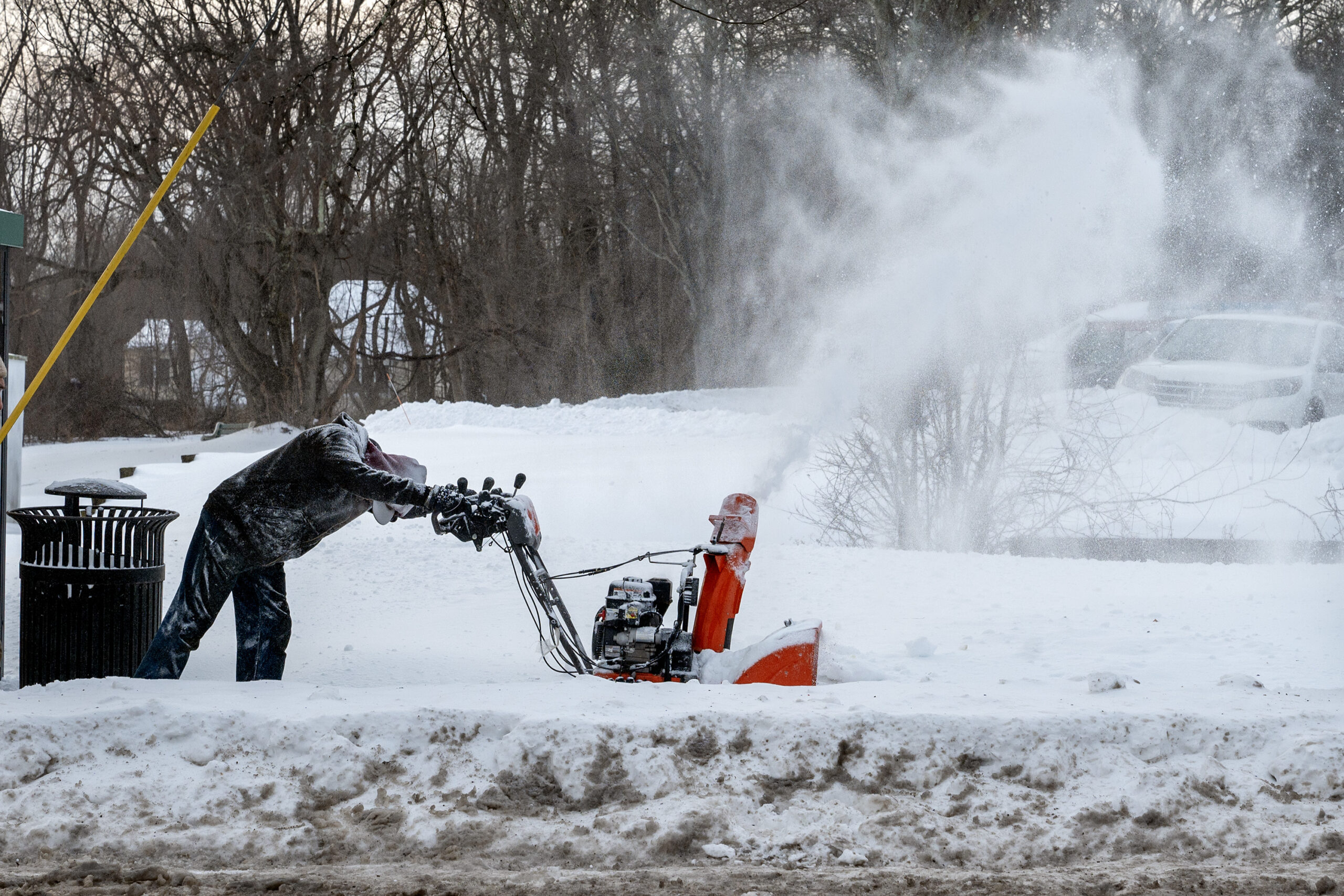
    Snow removal contractor Jordan Harlow clears the sidewalk in front of an apartment building on Main Street in Doylestown Wednesday, Jan. 28, 2026, following Sunday’s snowstorm. He said the layer of ice made it twice as difficult to use the snow blower.

    The snow outlook for the weekend

    On Wednesday only two things were certain about the latest threat: A major coastal storm is going to blow up during the weekend, and it’s not going to rain.

    “Everything looks like it’s going to come together,” said Paul Pastelok, the long-range forecaster for AccuWeather Inc.

    AccuWeather said it may intensify enough to qualify as a “bomb cyclone.”

    An early consensus among computer models was that the storm would stay too far offshore to generate a major snowfall in the immediate Philly area. Pastelok said it was looking for Philly to get “sideswiped” with a 1- to 3-inch event. However, that was very much subject to change.

    The weather service would not be making a first guess at potential accumulations until Thursday afternoon, said Alex Staarmann, a National Weather Service meteorologist in Mount Holly. In its forecast discussion Wednesday, it said that based on a consensus of the models, the Shore had a 35% to 50% chance of 6 inches of snow or more, with a 20% chance along I-95.

    More certain was the potential coastal flooding threat at the Shore with potent onshore winds coinciding with Sunday’s full moon.

    And while it may seem the atmosphere enjoys ruining weekends, it’s not uncommon for weather systems to fall into 3½- and seven-day cycles. That has to do with the spacing between weather systems, meteorologists say.

    Regardless of what happens during the weekend, the region is going to begin the workweek with snow on the ground.

    The snow is going to have more staying power than the average computer-model snow forecast.

    It’s not going to get a whole lot warmer anytime soon

    Even though it’s ice cold, as if developing a slow leak, the depth of the snow pack is actually decreasing, but ever so ponderously.

    That 9.3 inches of snow and sleet that accumulated Sunday was down to 6 inches at Philadelphia International Airport on Wednesday morning, Staarmann said.

    Compaction and sublimation, which is similar to evaporation, are lowering the depth, despite the cold. But Wednesday’s depth report was the same as Tuesday’s.

    And after what does or doesn’t happen Sunday, temperatures are forecast to remain below freezing at least until Feb. 4.

    No significant warm-up is in sight, and the National Oceanic and Atmospheric Administration’s Climate Prediction Center has odds strongly favoring below-normal temperatures until Feb. 11.

    The upper-air pattern continues to favor cold pouring into the Northeast.

    And more cold air is possible later in the month with a visit from the polar vortex, Pastelok said.

    Average temperatures in Philly finished 3.6 degrees below normal in December, and despite a 10-day warm spell earlier in the month, January is projected to finish at least 2 degrees below long-term averages.

    For Pastelok and other seasonal forecasters, it has been a tough winter.

    “We underestimated how cold the Northeast would be this year,” he said.

  • After Philly’s biggest snow in 10 years, a very big chill is coming

    After Philly’s biggest snow in 10 years, a very big chill is coming

    For the Philly region Monday it wasn’t so much a matter of digging out from the heftiest snowfall in a decade, it was more like a chipping, shaving, scraping, expletive-inducing, and ice-chunk hurling operation.

    Public transportation appeared to be getting back on track, and major roads were open for business with speed reductions removed, thanks to crews working through the weekend.

    But expect some side streets in the city and elsewhere to remain fit for sleigh rides this week and trash pickup to be delayed. City offices will be shut down again Tuesday, as will Philly school buildings, with Camden and more calling for a snow day or opting for remote learning.

    And if you’re stepping outside, get used to that underfoot crunching sensation. The removal operation isn’t going to get much help this week from the atmosphere. It’s about to turn about as frigid as it ever gets around here. New Jersey officials are warning of “historic” demands on energy.

    “We’re going to be in the freezer all week,” said Mike Gorse, meteorologist at the National Weather Service Office in Mount Holly. Philly may have its first zero-degree reading in 32 years later in the week.

    It’s as if after recent wimpy winters, the Arctic is reacquainting with Philly and much of the rest of the East.

    And did we mention another snow threat for the weekend?

    “There’s a chance,” said Marc Chenard, meteorologist with NOAA’s Weather Prediction Center in iced-over College Park, Md., who was among those who had to chuck some frozen boulders before leaving for work Monday morning. “I had to chip it and carry it in pieces,” he said. Sound familiar?

    Why this storm was particularly challenging

    Snow totals for the biggest snowfall since Jan. 22-23, 2016, varied throughout the region; the inconveniences, not so much.

    A general 8 to 12 inches of snow and sleet accumulated while temperatures remained mostly in the teens Sunday, 10 degrees or more below forecast.

    A shallow layer of warmer air caused a changeover to sleet, and the tiny ice balls remained frozen for the entire trip through the stubbornly cold air near the surface. As much as 2 to 3 inches of sleet piled on, containing the same amount of liquid as several inches of snow.

    That added weight to the snowpack. Based on the amount of melted precipitation measured in the 9.3 inches at Philadelphia International Airport, the snowpack weighed about as much as a 12- to 15-inch pile of the pure flaky fluff.

    On a 200-square-foot driveway — a 10 by 20 — what fell Sunday weighed about 1,100 pounds. On a 100-square-foot sidewalk — 5 by 20 — that would be about 550 pounds.

    In addition, ice tends to be rather shovel resistant.

    This is going to be a memorably cold week in Philly

    The ice and snow isn’t going to give up easily. On Monday, temperatures topped out in the upper 20s, and that’s going to be warmest day of the week.

    Based on the forecast, it may not get above 28 degrees until next week, said Chenard, a cold streak the region hasn’t seen in decades.

    Chenard said the upper-air patterns remain in place to import Arctic air on winds from the northwest for at least the next several days.

    In fact, temperatures may have trouble getting out of the teens in Philly until the weekend, and Philly has a shot at reaching zero for the first time in 32 years.

    The forecast lows are in the single digits all week, and down to 1 degree on Friday morning and 2 degrees on Saturday, the National Weather Service says. Both would be record lows for the dates.

    The stubborn snow cover “absolutely” will increase the chances of the airport reaching zero for the first time since January 1994, Gorse said. Snow is ideal for radiating daytime warmth (such as it is) into space.

    Temperatures will moderate some on the weekend, he said, but that might come in advance of yet another storm.

    Said Chenard, “There will be coastal low. It’s a matter of how close it is.”

    window.addEventListener(“message”,function(a){if(void 0!==a.data[“datawrapper-height”]){var e=document.querySelectorAll(“iframe”);for(var t in a.data[“datawrapper-height”])for(var r,i=0;r=e[i];i++)if(r.contentWindow===a.source){var d=a.data[“datawrapper-height”][t]+”px”;r.style.height=d}}});

    One historic footnote in the Philly weather annals

    Philly’s official snowfall total for the winter stands at 15.7 inches, almost double normal for the date and double what fell all of last season.

    Sunday’s was not only the biggest snow in 10 years, it also set a record for a Jan. 25.

    It beat the 8.5 inches of Jan. 25, 2000, a day that the weather service just as soon would like to forget.

    The storm came as a surprise, just a week after a weather service honcho announced a computer upgrade that would bring the nation closer to a “no surprise” era.

    Expect surprises to continue.

    Staff writers Ximena Conde, Kristen A. Graham, Maddie Hanna, Rob Tornoe, and Nick Vadala contributed to this article.

  • Philly’s biggest snow in 10 years has an icy finish, and it isn’t going anywhere soon

    Philly’s biggest snow in 10 years has an icy finish, and it isn’t going anywhere soon

    Hours of percussive sleet layered a nasty icing on Philadelphia’s biggest snowfall in 10 years Sunday, and it may be some time before bare ground resurfaces in the region, if not normality.

    “We’re going to have a rather glacial snowpack for the foreseeable future,” said Alex Staarmann, meteorologist with the National Weather Service in Mount Holly.

    This is not the stuff of postcards.

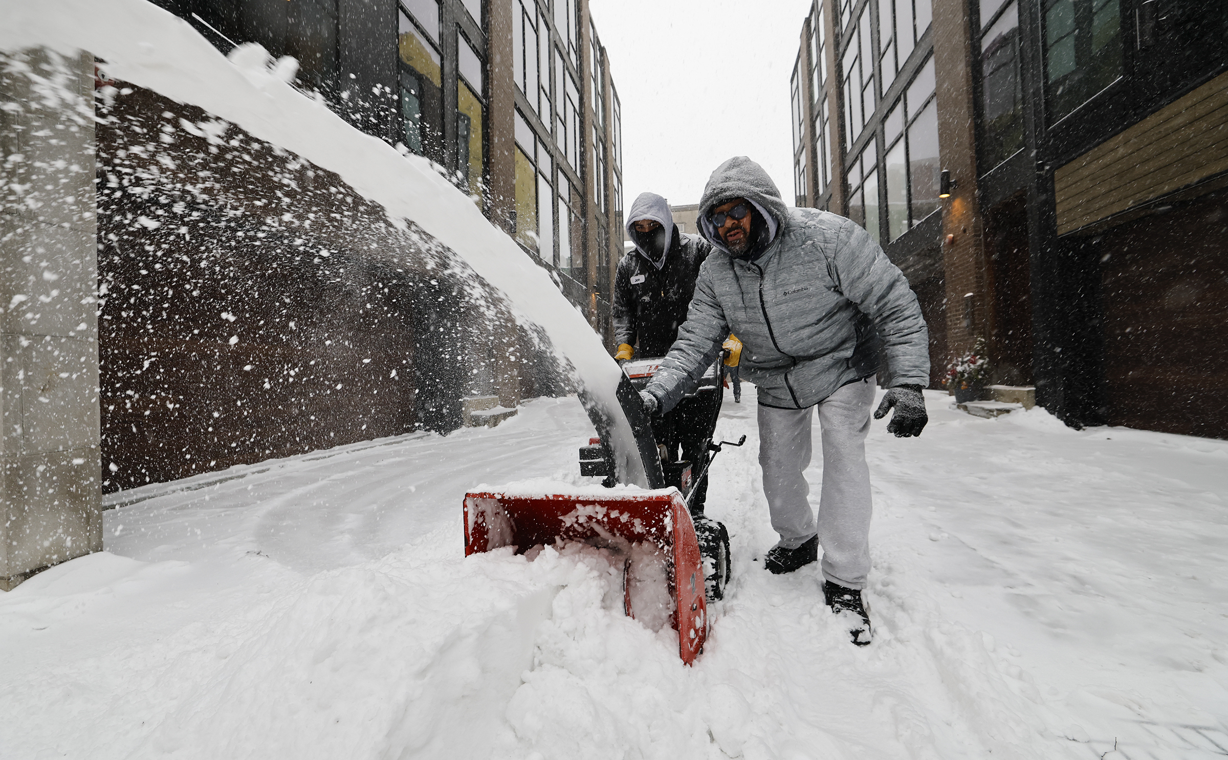
    Michael Thompson (right) and Jonathan Ahmad clear snow Sunday in Old City.

    Officially 9.1 inches of snow was measured at the unusually quiet Philadelphia International Airport, with similar amounts reported at some locations in the neighboring counties, as temperatures were stuck in the teens around Philly. Skippack, Montgomery County, reported just over a foot. For Philly, it also was a record for a Jan. 25.

    Late in the morning, the snow flipped over to sleet, which continued in the evening and added to accumulations through the region, including an additional 2.5 inches at the weather service Mount Holly office.

    Sleet — liquid that freezes before it lands — counts as snow in official measurements. In some places it fell at the rate of 0.5 inch an hour, the weather service said, an extraordinary rate for sleet.

    And shovelers beware: That mess may weigh as much as a foot or more of pure snow. Besides, we may be out of practice. This was the most snow since the 22.4 inches of Jan. 22-23, 2016.

    Along with sleet, some freezing rain — liquid that freezes on contact with a surface — was possible Sunday night, said Nick Guzzo, meteorologist at the National Weather Service in Mount Holly.

    However, only scattered power outages, a function of the unusual behavior of a potent but peculiar storm that wrought a familiar set of disruptions and inconveniences.

    At the airport, 651 of 672 flights were canceled Sunday, said spokesperson Heather Redfern, with the last departure at 10:30 a.m.

    SEPTA suspended Regional Rail and bus service at 2 p.m. Sunday. Schools decided preemptively to close on Monday. Speeds were reduced on highways. Mayor Cherelle L. Parker advised everyone to stay in their houses and out of their cars.

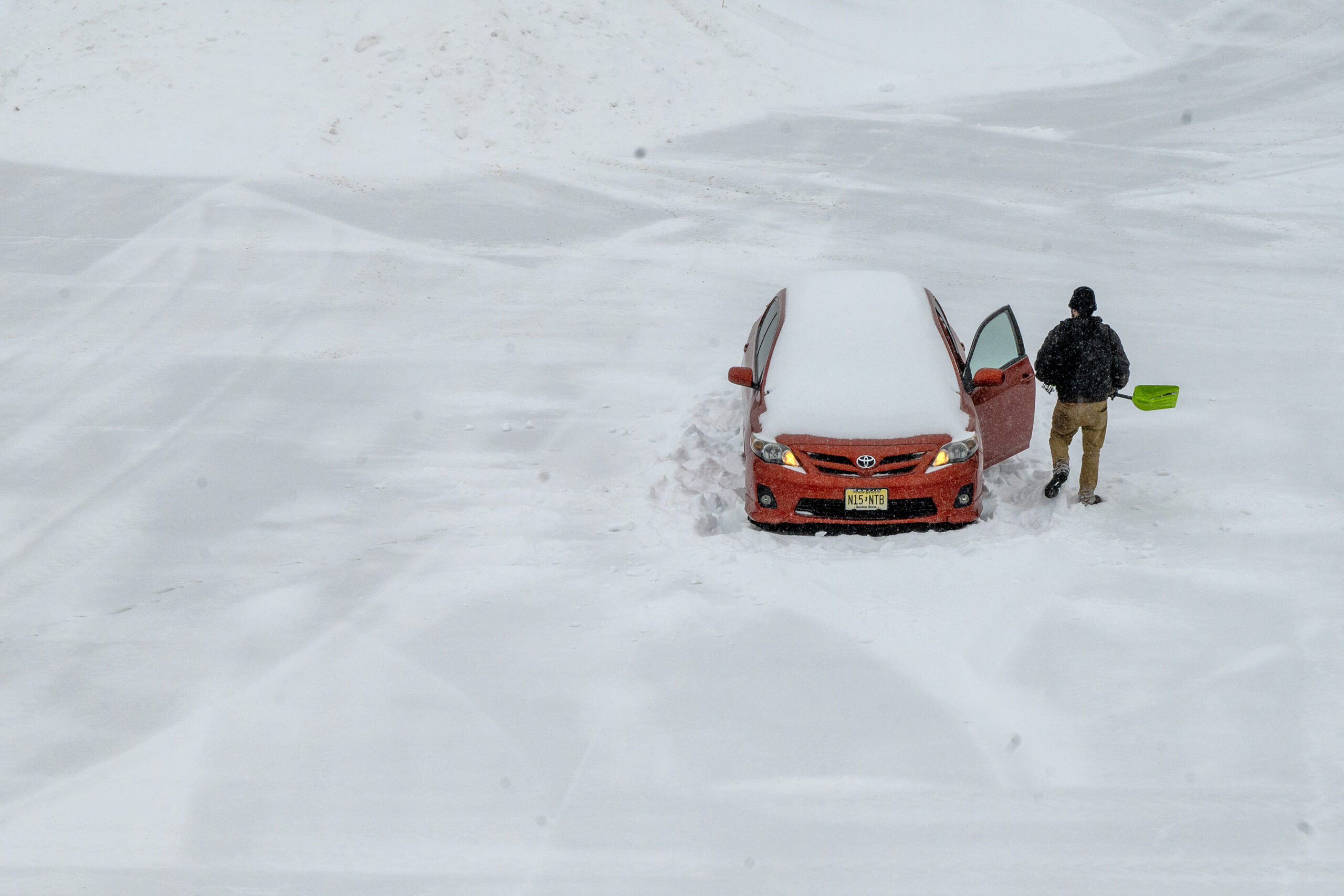
    Luis Nova digs his car out of his plowed-in space in an otherwise empty parking lot at the Westmont PATCO station in Haddon Township onSunday. Nova left his car there last Friday, and was in Philadelphia all weekend helping friends move and going to a goodbye party. He spent the morning sledding with friends in Clark Park in West Philadelphia, Nova said. “I knew what I was signing up for and was ready. I left all my equipment to get myself out. I spent four years in Rochester [New York] so I have a little experience with this. The only thing I’m missing is the kitty litter I usually keep in case I have to put it under the tires.”

    Malls and other businesses called it a day. Blue Mountain decided to suspend ski operations until Monday at noon — and when was the last time a ski outfit shut down because of snow, of all things?

    All things considered, a trauma-free day

    For the abject unpleasantness of the weather Sunday, the region for the most part appeared to be trauma-free.

    That probably had something to do with the fact that it was indeed, Sunday, and that the storm may have set an unofficial record for a pre-event drumbeat.

    Computers had been on to something big happening for about a week, at one point suggesting historic amounts of snow for Philly. The anticipation and anxiety evidently were major boons to local supermarkets — where carb shortages and human stampedes were reported — and hardware stores.

    In the end, the storm did unfold pretty much as the late-week forecasts suggested, with a thump of heavy snow in the morning with several inches accumulating.

    One not-so-mild surprise was the cold, with temperatures during the day Sunday several degrees below forecasts.

    The cold had a benefit: It resulted in a dry, powdery snow, said Tom Kines, senior meteorologist with AccuWeather. That robbed the region of that postcard look as the moderate winds were able to shake it off the trees, but it also reduced the power-outage potential.

    For those who have endured long power outages, it very likely was worth the aesthetic deprivation.

    When the snow turned to sleet during the late morning, temperatures were still in the teens, and the ice balls accumulated on the snowpack, adding unwanted weight.

    The ice also will add endurance to the snowpack, meteorologists said. Snowflakes can out-melt ice anyway. So forget the yard work for a while.

    What’s ahead for Philly’s weather?

    The sleet was likely to yield to freezing rain Sunday evening along and near the I-95 corridor, the weather service said, perhaps adding up to 0.2 inches of ice, especially south and east of the city.

    The precipitation was due to shut off during the early-morning hours of Monday. Then, the melt is going to take its good old time.

    Temperatures Monday are expected to be in the upper 20s.

    Then, it’s going to turn colder.

    Highs in Philly will struggle to reach 20 Tuesday through Saturday, with overnight lows in the single digits.

    The next several days should be dry, said Kines. Some talk is brewing about a storm threat late next weekend or early in the week, but that can wait for another day.

    Staff writer Michael Klein contributed to this article.

  • Heavy snow arrives, with ice to follow, and it all may stick around for a week, or more

    Heavy snow arrives, with ice to follow, and it all may stick around for a week, or more

    It may not approach their magnitudes, but Sunday’s snow-and-ice cold brew is expected to bear eerie similarities to some of Philly’s historic winter storms and perhaps rival them for disruption.

    By 7 a.m., up to 3 inches had been reported around the region, with heaviest amounts to the south where the snow started earlier.

    Officially, at Philadelphia International Airport, 1.6 inches had been measured, already making this the city’s biggest official total of the month. But Center City trumped it at 1.8.

    From 8 to 10 inches was expected around the city before the snow mixes with sleet and possibly freezing rain during the afternoon, said Nick Guzzo, a meteorologist at the National Weather Service Office in Mount Holly. All that is subject to change, of course.

    As for the potential mixing, “pick your poison,” said Guzzo’s colleague Mike Lee.

    The office has posted winter storm warnings for the entire region, joining offices from New Mexico to Maine.

    A crew from northern Illinois works to restore power at Broad Street and Warren Avenue in Malvern after the February 2014 ice storm.

    The precipitation is due to shut off early Monday, but by then it may be a case of welcome to ice station Philly.

    Nothing that falls is going to melt, as temperatures will get no higher than the 20s Sunday and may not see 30 for the rest of the week

    Affirming their faith in the forecasts, Philadelphia, New Jersey, and Pennsylvania have declared emergencies. If you have plans the next few days, don’t count on them happening, and some kids might be able to put off homework for a few days.

    Perhaps of more interest to some parties, Pennsylvania announced that all its liquor stores will be closed Sunday, and the Girl Scouts have pushed back their cookie-sale dates all the way to the spring equinox. (At least some of the bars and churches may be open.)

    How much for Philly?

    On Saturday, the National Weather Service was sticking with 8 to 10 inches for the immediate Philly area, said meteorologist Amanda Lee, with less to the southeast. AccuWeather Inc. was calling for 6 to 10 inches.

    A lot of that would fall during a “front-end thump,” said AccuWeather meteorologist Elizabeth Glenny. Once the mixing begins, accumulation rates would back off.

    While people understandably want to know how many inches of snow are going to land, that is almost always difficult to answer, meteorologists say, especially in a storm of this nature.

    In this case, snow amounts are dependent on a coastal storm that had not yet formed Saturday and on what might happen in parts of the atmosphere that are not well-observed.

    Temperatures in the bottom 5,500 feet of the atmosphere over Philly are expected to remain below freezing, said AccuWeather senior meteorologist Tom Kines, but computer models insist that a warm layer in the higher atmosphere would result in the changeover.

    That warmth would be imported from the Atlantic Ocean by the strong onshore winds from the northeast generated by the storm — it’s not for nothing that these things are called nor’easters.

    Another wild card would be if the snow is heavy enough that it could survive the warm layer and delay the changeover.

    But the mixing of sleet, which is liquid that remains frozen in its trip through the atmosphere, and freezing rain, liquid that freezes on contact, is inevitable, forecasters said.

    Freezing rain atop a snowpack is especially dangerous because it adds weight to vulnerable and snow-burdened power lines and tree branches. Sleet is polite enough to bounce off hard surfaces, but since it is pure ice, it is slower to melt.

    Said the weather service’s Mike Lee, the mixing “just means we’re getting a different blend of horrors.”

    Remembrance of Philly storms past

    Mike Lee said that about 1.5 inches of liquid precipitation — the amount of melted snow and ice — was expected to fall during the storm, and whatever landed was certain to participate in becoming a massive block of ice.

    Liquid-to-snow ratios can vary widely, but 1.5 inches of precipitation would be equivalent to the total precipitation contained in the record 30.7-inch snowfall of Jan. 7-8, 1996.

    “It’s a little bit scary, but true,” Glenny said.

    And it is close to what fell during Philly’s last double-digit snow, the 22.4 inches of Jan. 22-23, 2016.

    Market Street near 13th is mostly pedestrian traffic as snow falls over the region on Jan. 23, 2016.

    In mid-March 1993, a foot of snow accumulated rapidly during a blizzard, followed by several hours of sleet and a flash freeze during the early morning. It created what a weather service meteorologist famously called an “Arctic landscape.”

    The landscape Monday may be similar, but with one important difference.

    That March storm occurred near the equinox, when the sun was about 50% stronger than it is this time of year, according to NASA data, and days were close to two hours longer. (Yes, those days are coming.)

    The temperature bottomed out at 11 degrees Saturday morning, the lowest reading of the season at Philadelphia International Airport, and into the single digits outside the city.

    Most airlines have canceled flights departing Sunday from Philadelphia International Airport. By late Saturday afternoon, there were 502 canceled flights into or out of the airport, according to the city.

    Temperatures are expected to get no higher than the mid-20s Sunday and Monday. And then it’s going to get colder, with daytime highs no better than the low 20s, and nights in the single digits.

    Shovel early and often.

    (function () {window.addEventListener(‘message’, function (e) { var message = e.data; var els = document.querySelectorAll(‘iframe[src*=”‘ + message.id + ‘”]’); els.forEach(function(el) { el.style.height = message.height + ‘px’; }); }, false); })();