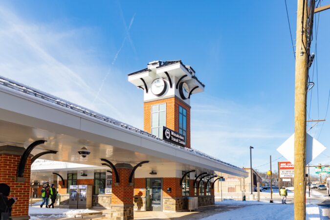
SEPTA officially unveiled its long-awaited Wissahickon Transportation Center in Manayunk, which is about six times the size of the previous small bus depot.
The new center on Ridge Avenue, near Main Street, is expected to serve 5,000 bus riders a day, officials said Monday at the ribbon cutting.
Construction of the $50 million project began in 2023 at what was already one of SEPTA’s busiest transportation hubs. It is located within walking distance of the Wissahickon Regional Rail Station.
Officials say the center improves connections, provides a better waiting experience for riders, and serves as a key transportation link to busy Main Street. They also say it makes navigating the immediate area easier for buses, pedestrians, and bicyclists.
“We are making bus service safer and more reliable at one of our busiest transportation facilities,” SEPTA board chair Kenneth Lawrence said in a statement. “This new hub provides better access to work, school, and other opportunities, including reverse commute connections for Philadelphia residents to Montgomery and Delaware Counties.”
window.addEventListener(“message”,function(a){if(void 0!==a.data[“datawrapper-height”]){var e=document.querySelectorAll(“iframe”);for(var t in a.data[“datawrapper-height”])for(var r,i=0;r=e[i];i++)if(r.contentWindow===a.source){var d=a.data[“datawrapper-height”][t]+”px”;r.style.height=d}}});
Among the improvements:
Weather-protected waiting areas, benches, and bicycle racks
Better lighting, signs, and security cameras
A supervisor’s booth
A new left turn lane dedicated to buses on a wider road
Improved crosswalks for pedestrians crossing Ridge Avenue
Bicycle racks
Improved crosswalks
Americans with Disabilities Act-compliant boarding areas
The previous center that fronted Ridge Avenue was basically a large bus shelter where commuters who live in neighborhoods in the city’s northwest and pass through on their way to jobs in King of Prussia and Plymouth Meeting change buses.
Nearly three-quarters of the passengers who board at Wissahickon are transferring to or from other SEPTA services.
“This is our largest customer-centric bus project to date,” said SEPTA general manager Scott Sauer.
Officials say the center lays the groundwork for SEPTA’s new bus network. For about five years, the transit agency had been taking steps toward launching its first comprehensive overhaul of the bus system since SEPTA opened in 1964, but last year SEPTA put the project on indefinite pause due to funding issues.
The new center, which is immediately behind the old facility, is part of the city’s larger Wissahickon Gateway Plan to grow and improve the area where the Schuylkill and Wissahickon Creek meet at Ridge Avenue and Main Street.
The gateway plan’s goal is to address stifling traffic, dangerous conditions for pedestrians and cyclists, and provide easier access to the river.
As part of the gateway, a new trail segment is also planned that would include a paved path allowing walkers, runners, and cyclists to circumvent the busy nexus of roads, giving easier access to the Schuylkill River Trail.
But bills proposed in the House by U.S. Rep. Chuck Fleischmann (R., Tenn.) and in the Senate by U.S. Sen. John Kennedy (R., La.) appear to still fall woefully short of what is needed, a coastal advocacy group says. U.S. House Rep. Jeff Van Drew, however, believes there will be adequate funding.
Dan Ginolfi, executive director of the American Coastal Coalition, an advocacy group for coastal communities and beaches, said the current best case would be the Senate bill, which proposes to spend $62.2 million. The House bill proposes $23 million.
However, both proposals fall short of the approximately $200 million needed to fund approved projects in various states that received no money last year, he said.
Any approvedmoney would go to the U.S. Army Corps of Engineers, which would choose which beach erosion projects to manage.
In New Jersey, projects set for Cape May, Stone Harbor, Avalon, Sea Isle, Strathmere, Ocean City, and Long Beach Island have been stalled because of the lack of funding. So, too, have projects in Maryland, Delaware, Georgia, and Florida.
That means “the level of risk in New Jersey right now is unacceptable,” Ginolfi said.
He noted that it’s not only beaches at risk, but homes, businesses, public property, and infrastructure.
“It really is imperative that the federal and state government work together to achieve a solution,” he said.
Ginolfi noted that coastal communities in the U.S. generate $36 billion in federal and state tax revenue. So he sees $200 million as a good return on investment.
He said his numbers for potential beach replenishment projects in the bills were confirmed with appropriations committees in both the House and Senate.
However, the office of Van Drew, a Republican who represents many New Jersey beach communities, said the coalition’s numbers “misrepresent the true amount of funding available.”
Paxton Antonucci, a spokesperson for Van Drew, said there is actually $166 million available in the House bill “for costs associated with shore protection like beach replenishment, which is the typical amount.”
He said that number will come close to $200 million “after we compromise with the Senate.”
In reality, Van Drew said, most beach replenishment funding comes from outside the regular budget process. He has actively sought such money.
In October, Van Drew wrote to the Army Corps, requesting that it “activate disaster recovery authorities … to repair shore protection projects at the Jersey Shore, in response to damages caused by Hurricane Erin and by the recent nor’easter over the weekend of Oct. 10-12.”
And he wrote to Gov. Phil Murphy and Gov.-elect Mikie Sherrill this week urging that New Jersey declare a state of emergency to secure federal money “for the severe coastal erosion and storm damage affecting the Jersey Shore.”
Van Drew said the Shore has been battered since July by “intense wind, wave, and water impacts from storm events including Hurricane Erin, Hurricane Imelda, offshore Hurricane Humberto, and a succession of destructive nor’easters.”
He said the result has been “significant dune loss, beach profile collapse, and damage to public infrastructure in multiple municipalities.”
The American Coastal Coalition has faulted Murphy’s office for failing to request disaster repair projects from the Army Corps in the wake of the storms.
However, Murphy’s office said the storms this year did not meet financial thresholds needed to qualify for major federal disaster declarations.
In addition, the office said that, even if they did, replenishment projects at Army Corps-engineered beaches are not routinely eligible for Federal Emergency Management Agency reimbursement.
Rather, the office blamed Congress for putting forth a budget that cut beach replenishment projects, and said that blue states are a target of the Trump administration.
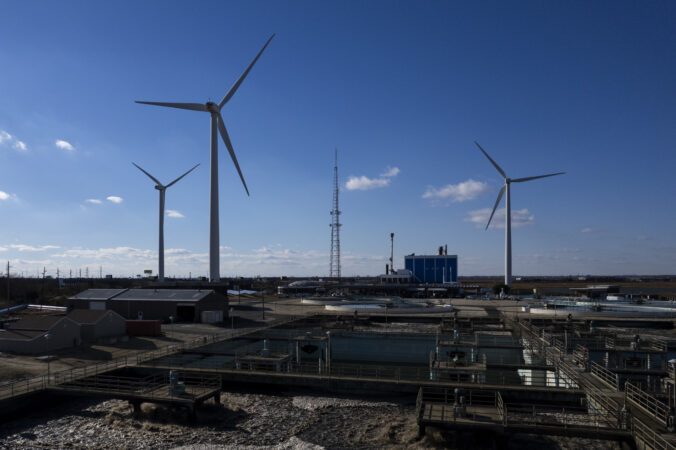
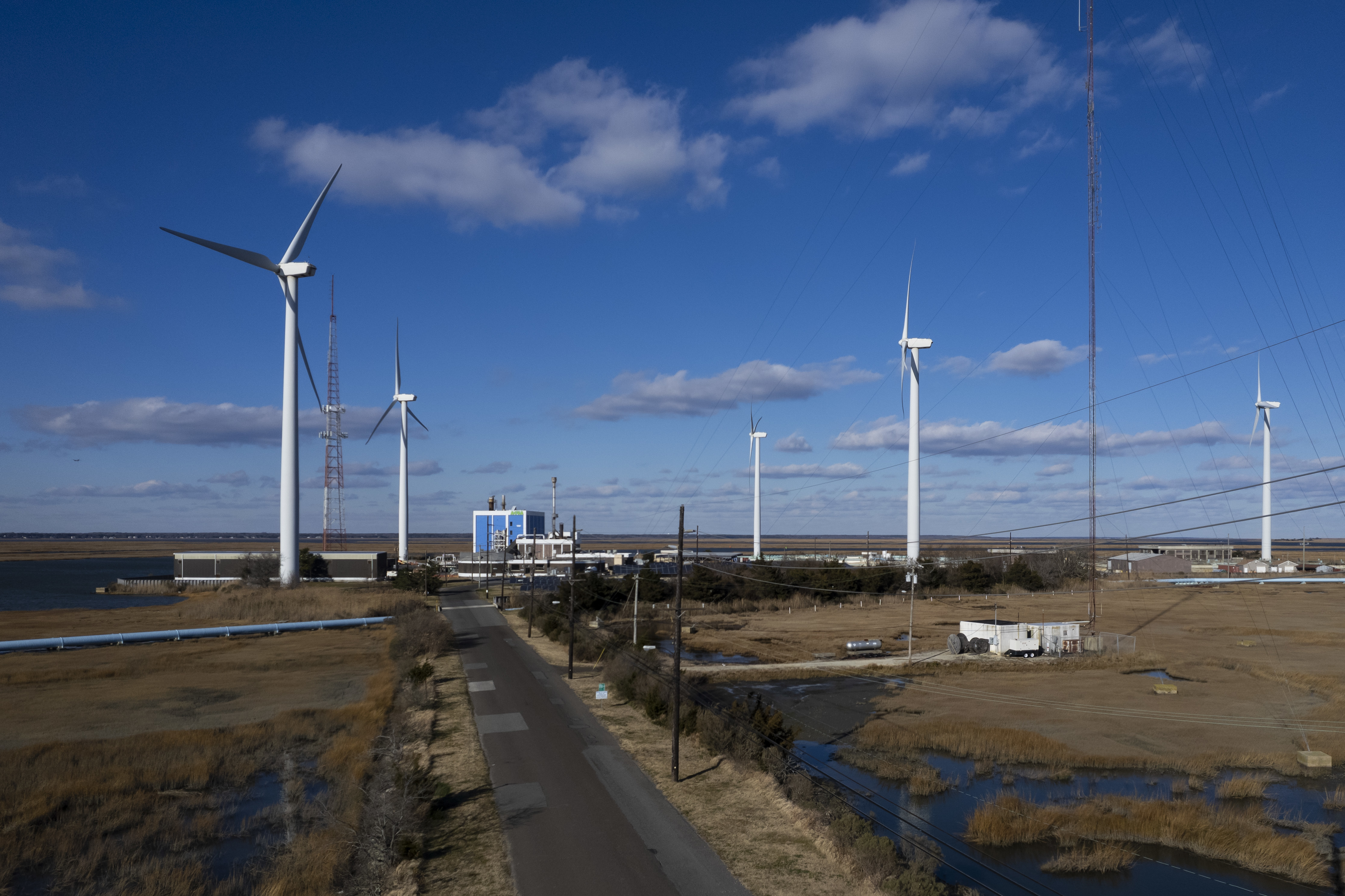
Blustery winds propelled the giant blades of five turbines at the Jersey-Atlantic Wind Farmon a recent day. Set on a back bay island, they were once contested over fears of noise, aesthetics, and worries of threats to Shore birds.
But two decades later, they have emerged as a spinning landmark to Atlantic City.
The 380-foot turbines silently rotate in clear view of motorists streaming to casinos. Some visitors have even requested hotel rooms facing the structures, which are taller than the Statue of Liberty.
The embrace of the land-based wind farm contrasts sharply with the more recently divisive battle over offshore wind projects, an effort stalled by economics and the Trump administration.
Together, the Jersey-Atlantic Wind Farm turbines produce 63% of the energy for the Atlantic County Utilities Authority’s wastewater treatment plant, which serves 14 municipalities. Officials calculate the farm has saved ratepayers $8.8 million since its grand opening on Dec. 12, 2005.
It is one of only two wind farms operating in New Jersey. The other is a much smaller farm in Bayonne.
“This was a total home run for everybody involved,” said Richard Dovey, president of the ACUA at the time it was built. “It’s been nothing but successful, environmentally and economically … [an] inspiration for many other entities, whether they’re public or private.”
How the wind farm came to be
The idea for a wind farm near Atlantic City came from a worker in the energy industry who passed the idea onto Dovey in the early 2000s. With Dovey’s help, it picked up support in former Gov. Jim McGreevey’s administration.
Dovey believed in renewable energy and thought it could power the ACUA’s regional wastewater treatment plant on City Island in Absecon Bay, about two miles from the Atlantic Ocean. He thought Atlantic City’s ample breezes from land and seawould make it an ideal location.
Atlantic City’s ample breezes from land and sea made an ideal location for a wind farm.
Community Energy Inc., a developer of wind power based in the Philadelphia suburbs, played a significant role in the project’s development and received a $1.7 million grant from the New Jersey Board of Public Utilities.
The New Jersey Sierra Club backed the project.
Construction began in mid-2005. The project cost $12 million and included driving pilings into an island of upland surrounded by wetlands and installing intricate concrete bases to support the turbines made by GE.
Currently, the wind farm is owned by Texas-based Leeward Energy. Leeward rents the land for the wind farm from ACUA.
In return, ACUA has a 20-year agreement to purchase the power produced by the turbines from Leeward for 7.9 cents a kilowatt-hour, which was cheap even then. Now, the rate is about half the market rate for energy.
It has helped ACUA keep some of the lowest sewer rates in the state.
However, that agreement is expiring, and the two sides are in negotiations to renew a contract, which could change the rate the ACUA pays for its wind power.
window.addEventListener(“message”,function(a){if(void 0!==a.data[“datawrapper-height”]){var e=document.querySelectorAll(“iframe”);for(var t in a.data[“datawrapper-height”])for(var r,i=0;r=e[i];i++)if(r.contentWindow===a.source){var d=a.data[“datawrapper-height”][t]+”px”;r.style.height=d}}});
Community concerns
Initially, the wind farm faced resistance. Residents in the neighboring Venice Park section of Atlantic City were concerned primarily about potential noise from the turbines.
To allay their fears, Dovey organized a bus trip that took residents to visit a wind farm in Somerset County in Pennsylvania.
“Their major concern was noise,” Dovey, now 73, recalls. “We drove literally underneath the turbine. One neighborhood leader took one step out and said my air conditioner is louder than this; let’s go home. They thought the turbines were beautiful, even inspiring.”
In addition, there were apprehensions regarding how the turbines would affect birds and marine life. The wind farm is just below the Edwin B. Forsythe National Wildlife Refuge, a 48,000-acre area of coastal habitat. New Jersey Audubon agreed to monitor the impact on the bird population as part of its support for the project.
According to the ACUA, a three-year study by NJ Audubon found “a small number of bird deaths which could be attributed to collisions with turbines.” It found more fatalities were caused by raccoons, feral cats, and collisions with wires and trucks.
People were also concerned about the visual impact, fearing they might spoil scenic views, affect property taxes, and hurt tourism. However, the wind farm has since become an iconic part of the landscape.
The concerns were part of a broader debate at the time regarding the emerging push among some New Jersey leaders for offshore wind farms, which had faced a moratorium by the state.
Even though the moratorium was lifted, and Gov. Phil Murphy backed a large offshore wind program that would have powered millions of homes, the debate continued. This year, President Donald Trump issued an executive order to stop offshore wind, making any project in the near future unlikely.
However, a federal judge recently ruled that Trump exceeded his authority with the order, a ruling the administration is likely to challenge. It is unclear whether renewable energy companies still have the political will for a renewed push to build an offshore wind farm off the coast of New Jersey.
Taking advantage of wind
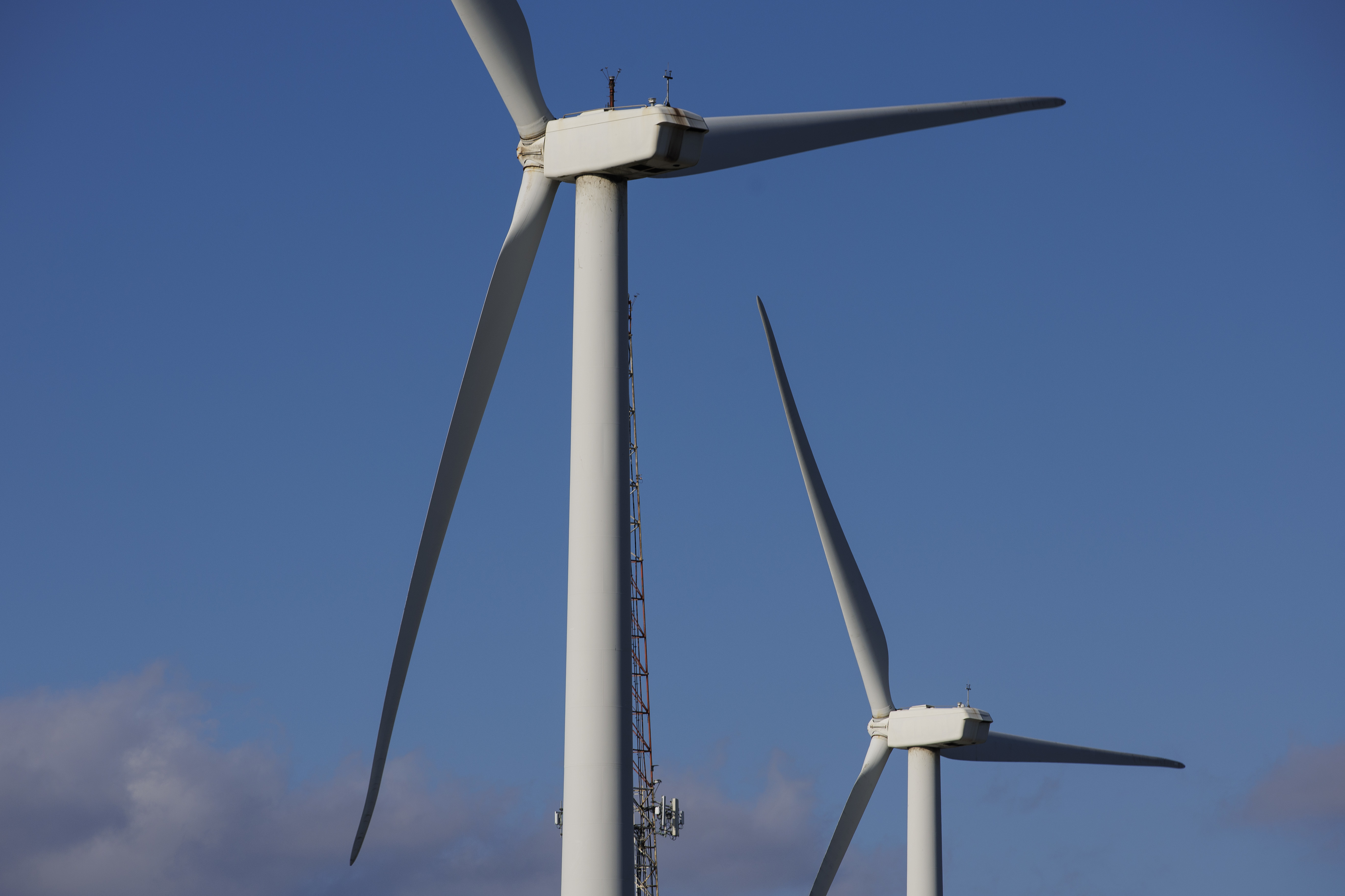
The Jersey-Atlantic Wind Farm is an example of how wind power can work, even if on a smaller scale. The farm is ideally located because of consistent land and ocean breezes. If winds exceed 45 mph, the turbines, each equipped with a weather station, switch off to protect the machinery. That happens only a few times a year.
Matt DeNafo, current president of the ACUA, says the wind farm has been a “huge project” for his organization. The ACUA is operating a pilot project that would store energy captured by the turbines in a battery. A solar array on site also provides about 3% of the facility’s power.
DeNafo said the arrangement with Leeward brought significant economic stability through the 20-year fixed rate. He said it allows the agency to offer the lowest wastewater rates in the region.
At the same time, the ACUA does not have to pay for maintenance of the turbines, while still collecting rent from Leeward.
If winds exceed 45 mph, the turbines, each equipped with a weather station, switch off to protect the machinery.
“It’s really been a great partnership for us. It’s been a beacon for our organization,” DeNafo said. One casino was “getting a lot of requests for windmill-view rooms because it’s got a calming effect.”
Harrah’s, MGM, and Borgata casino hotels all are in view of the windmills.
Amy Menzel, a spokesperson for the ACUA, said summer tours of the wind farm and treatment plant are popular.
“We give open house tours in the summer on Wednesdays,” Menzel said. “People can just drop in. We have a lot of curious people who are visiting the Shore. The tours are really a mix of locals and out-of-town visitors, people who just want to get a little closer and learn more.”
Editor’s note: This article has been corrected to note that the wind farm is on an upland, not a wetland.
In some regions, rainfall has plunged as much as eight inches below average for the past year, straining reservoirs, streams, and aquifers enough that the state Department of Environmental Protection has issued a drought warning — a notch shy of an emergency.
As a result, officials are asking residents to voluntarily curtail water use. Should conditions deteriorate, officials may impose mandatory restrictions on certain uses of water, though such measures are rarely invoked.
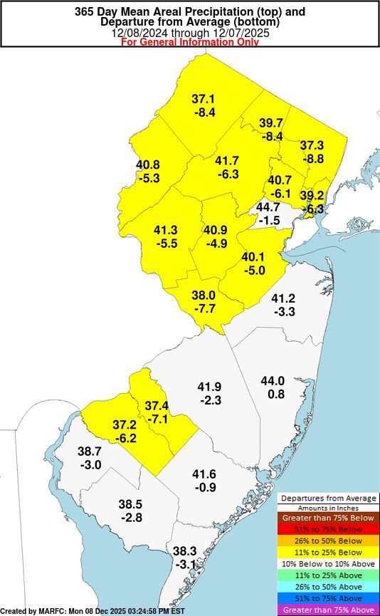
Map shows precipitation well below normal over the 365 days ending Dec. 7, 2025.
DEP Commissioner Shawn LaTourette said in a statement on Friday’s announcement that there is an “urgency of the need to conserve water.”
“The precipitation and water supply uncertainty we’ve experienced over the past year is a symptom of the impacts of climate change here in New Jersey,” LaTourette said.
It’s the second year the state is looking at a drought.
The last drought warning was issued in November 2024. That declaration came as firefighters had fought multiple simultaneous wildfires, one deadly, that broke out across the state amid dry, windy conditions.
That warning was lifted in June following record rainfall for some parts of the state in May.
Up to 8 inches below normal
However, the state overall has experienced below-average precipitation for more than a year, officials said.
New Jersey officials cited data from the Middle Atlantic River Forecast Center operated by the National Weather Service.
That data shows that Burlington, Camden, and Gloucester Counties are all running nearly four inches below average over the past 90 days.
Burlington County is running more than seven inches below normal for the past 365 days, and Camden County is running more than six inches below normal for the same period.
Northwestern New Jersey is running more than eight inches below normal over the past year.
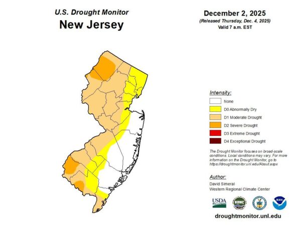
Likewise, the U.S Drought Monitor, a partnership of the University of Nebraska-Lincoln’s National Drought Mitigation Center and multiple federal agencies, shows the South Jersey counties along the Delaware River in either a moderate or severe drought.
About 3.5 million residents of New Jersey live in a drought-impacted area.
Officials said recent rains have not made much difference, considering the size of the gap. Ocean County is one of the few areas of the state with near-normal precipitation levels.
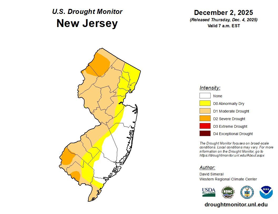
Map by the U.S. Drought Monitor shows that multiple counties in South Jersey are in a moderate to severe drought.
An update on rainfall and drought data is expected Wednesday.
State officials use multiple sources to determine the impact of rainfall on water supplies. Those include reservoir levels, stream flows, and groundwater (aquifers).
South Jersey counties, such as Burlington, Camden, Gloucester, and Salem, rely primarily on groundwater but also use water from the Delaware River and other rivers and streams.
Drought indicators for groundwater levels in South Jersey are designated as extremely dry while precipitation and stream flows are severely dry.
Officials say the persistent dryness has resulted in “observable stress across all specific indicators.” Nearly all regions of the state are classified as being severely or extremely dry.
Pennsylvania is also dry. Last week, the Commonwealth Drought Task Force said 37 counties are under a drought watch, although none in Southeastern Pennsylvania. A drought watch means an area has received 25% less rain over three months than normal. It is the lowest of three levels of drought declarations in Pennsylvania.
How to conserve
In New Jersey, officials have issued some tips on conserving water, such as:
Run dish and clothes washers only when full.
Turn off and winterize outdoor pipes and irrigation systems.
Check pipes for leaks.
Use a commercial car wash that recycles water.
Compost vegetable food waste instead of running the garbage disposal.
Installing a low-flow toilet can save up to 1,000 gallons per year.
Installing a low-flow shower head can save 7,700 gallons per year.
Installing newer faucets and aerators can save 16,000 gallons per year.
Few Philadelphians may recognize the name Dolly Ottey, yet nearly all know Elfreth’s Alley — the nation’s oldest residential street — which she helped rescue from decline and demolition starting in the 1930s.
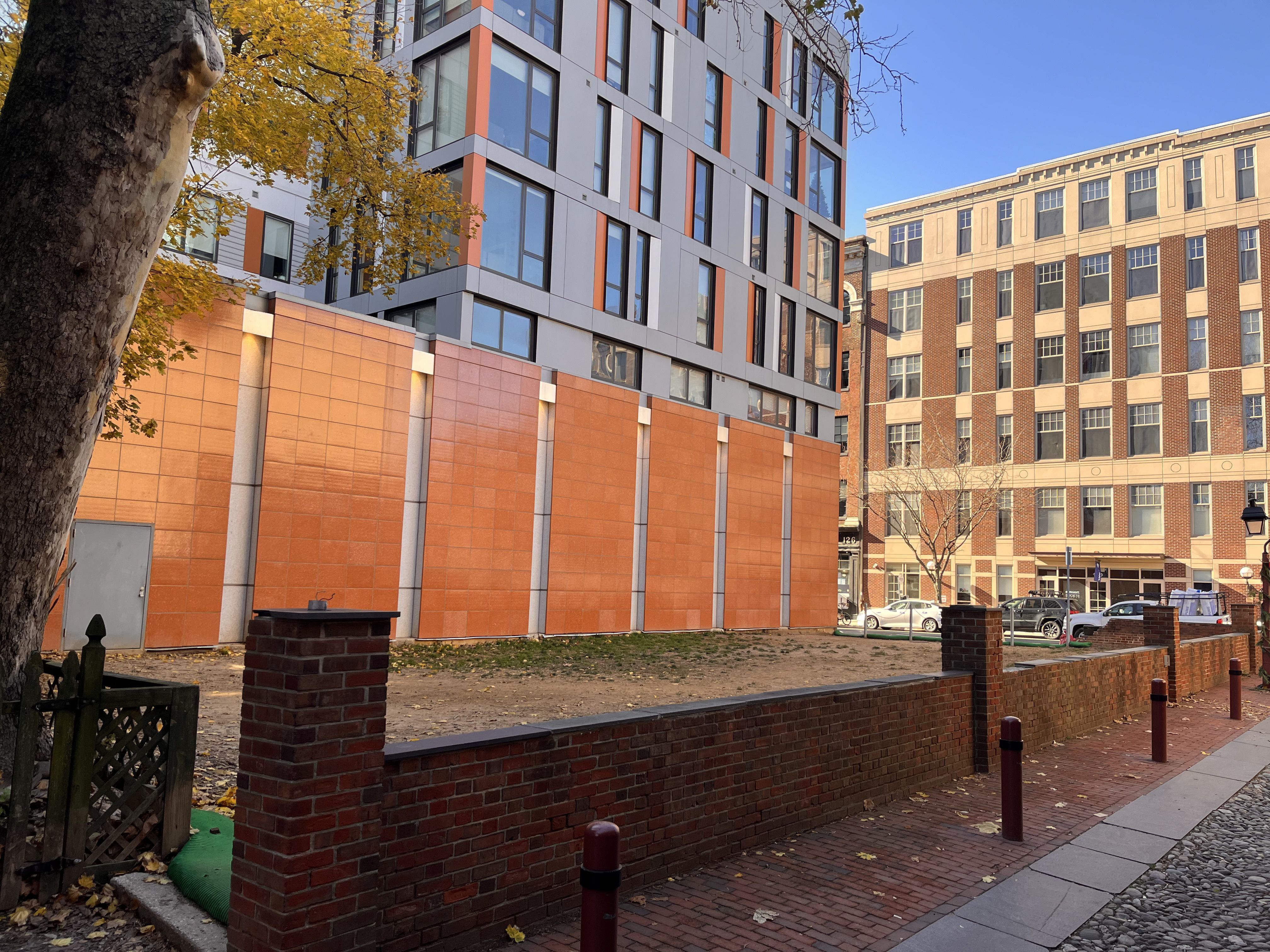
Now, after years of wrangling, a long-neglected vacant lot that some have derided as an eyesore at the historic location is slated for a transformation in time for the 250th anniversary of the Declaration of Independence.
Plans call for the lot at North Second Street and Elfreth’s Alley to be reborn as Dolly Ottey Park, honoring the woman who first championed preservation of the narrow cobblestone passage starting in the 1930s.
window.addEventListener(“message”,function(a){if(void 0!==a.data[“datawrapper-height”]){var e=document.querySelectorAll(“iframe”);for(var t in a.data[“datawrapper-height”])for(var r,i=0;r=e[i];i++)if(r.contentWindow===a.source){var d=a.data[“datawrapper-height”][t]+”px”;r.style.height=d}}});
Job Itzkowitz, executive director of Old City District, said the project took eight years of sporadic effort to get multiple parties to sign off on an agreement to create the park. Old City District is a nonprofit registered community organization.
“We want it to be a place where residents, tourists, visitors, employers, and employees can take a bit of a respite,” he said. “It’s going to be a drastic improvement.”
A conceptual rendering of Dolly Ottey park at Second Street and Elfreth’s Alley in Old City, Philadelphia. Organizers hope to transform the existing vacant space into a park by spring.
On a recent day, families and couples toured Elfreth’s Alley, taking pictures and discussing the history of the area. But none ventured into the vacant lot. Later, a lone woman could be seen walking her dog there.
Itzkowitz credited a renewed spirit of collaboration for breaking the stalemate.
He said changes in leadership at the real estate advisory board for the National Old City Apartments, which abuts the park, and crucial support from the nonprofit Elfreth’s Alley Association paved a path for agreement.
A view of a vacant lot at Second Street and Elfreth’s Alley in Old City Philadelphia. Plans for creation of Dolly Ottey Park at the location and named after an advocate who helped save Elfreth’s Alley in the early to mid 20th Century.
The lot is owned by Bit Investment Seventy-Eight LLC, according to city records, and is part of that company’s holdings for National Old City Apartments along North Second Street.
A usable space by spring
The pocket park will rise in two phases: an interim stage featuring a crushed stone base, picnic tables, planters, wild grasses, and repairs to a crumbling brick wall, followed by a more permanent design.
An architect has been hired to craft a cost-effective plan to deliver a usable public space by spring 2026.
The interim plan design for Dolly Ottey Park carries a modest $60,000 budget, with fundraising to break ground in February and finish by March. Old City District has set up an online link for public contributions.
Itzkowitz said the timing for the interim phase would ensure the park provides a welcoming experience for visitors during the Semiquincentennial as part of a significant historical landmark.
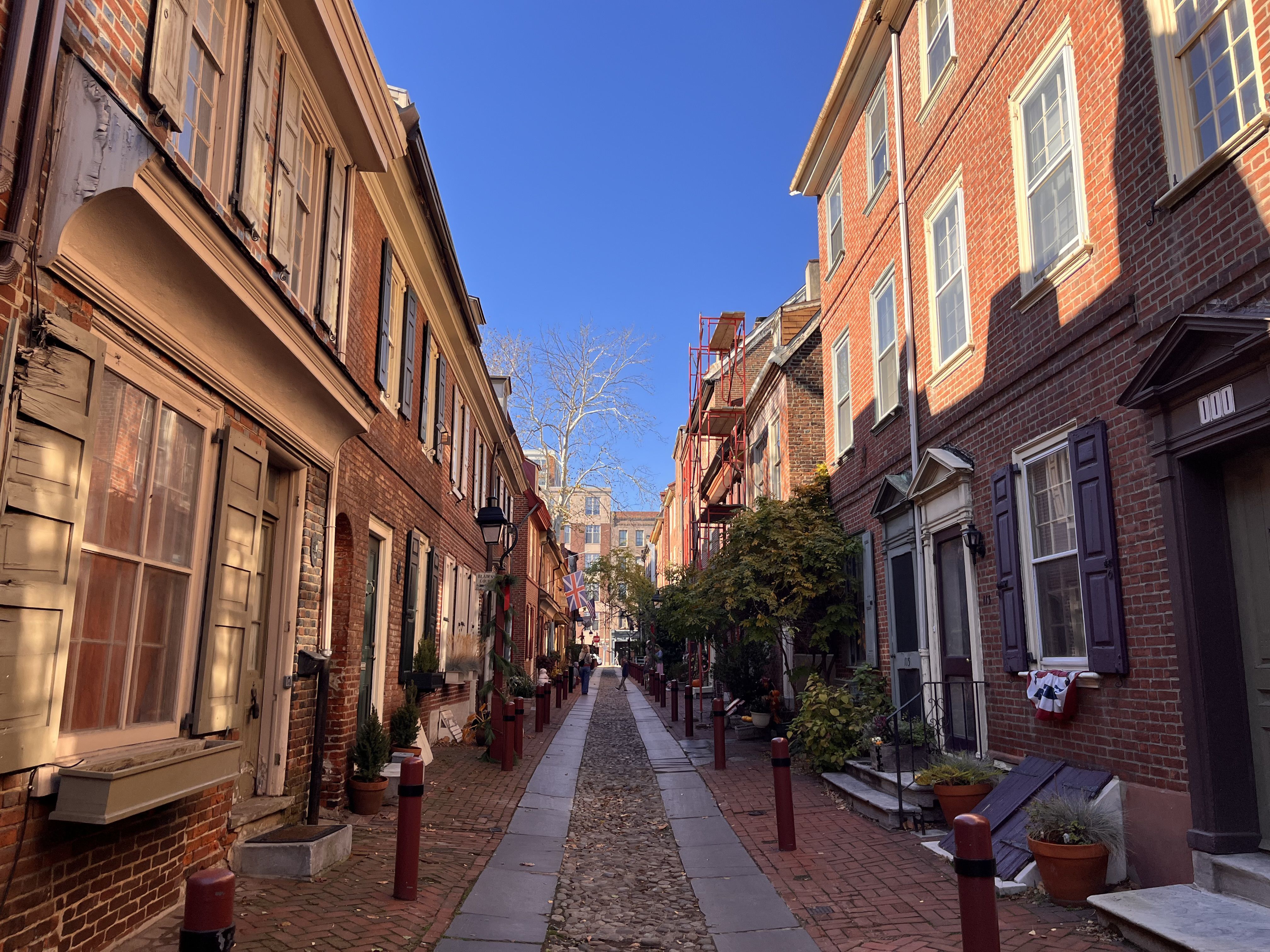
A view of Elfreth’s Alley.
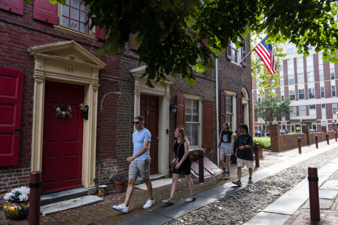
Elfreth’s Alley is believed to be America’s oldest continuously inhabited residential street. Its origins trace to the early 1700s, when two landowners combined properties to create a cart path leading to the river. People have been living there since 1713.
The cobblestone alley, about 400 feet long and lined by 30 brick buildings, was named for Jeremiah Elfreth, an 18th-century blacksmith. It originally housed artisans and merchants, serving as a base for business ventures. Notable figures such as Stephen Girard, who helped finance the War of 1812, are believed to have lived here.
However, Elfreth’s Alley faced demolition due to neglect and development pressure. From the 1890s to the 1930s, part of the block was rebranded as Cherry Street, leading to the loss of at least one historic home.
Who is Dolly Ottey?
Ottey, a resident and owner of the Hearthstone restaurant at 115 Elfreth’s Alley, formed the Elfreth’s Alley Association in 1934 to protect the unique street and save it from destruction.
A view from Elfreth’s Alley facing a vacant lot at Second Street that will be transformed into Dolly Ottey Park.
Elfreth’s Alley faced an even bigger existential threat in the 1950s and 1960s when proposed construction of I-95 would have demolished at least half the block.
The demolition was vehemently opposed by Ottey and the Elfreth’s Alley Association. The community gathered 12,000 signatures for a petition presented at City Hall, successfully pleading for the street to be spared.
Elfreth’s Alley was protected as a National Historic Landmark in the 1960s as a result and is listed on Philadelphia’s historic register.
Ottey died in 1996, in South Jersey, at age 85.
Elfreth’s Alley remains not only a residential area but also a cultural and historical attraction. It holds a museum that educates visitors on its history and the lives of early inhabitants.
U.S. Rep. Brian Fitzpatrick, a Republican, introduced a bill Thursday with a Democratic co-sponsor to modernize pipelines and emergency responses in the wake of a leak of a Sunoco pipeline detected this year in Bucks County.
The bill is named after the Wojnovich family, whose well was tainted with 12½ feet of jet fuel.
It would set aside $500 million in grants spread over five years to replace or upgrade high-risk hazardous liquid lines, “to facilitate the improved safety and modernization of hazardous liquid distribution infrastructure.”
In addition, it would require that prospective homeowners be made aware of nearby pipelines, what fuel they carry, any history of incidents, and who operates the lines.
Fitzpatrick introduced the bill, H.R. 6187, the Wojnovich Pipeline Safety Act of 2025, with U.S. Rep. Tom Suozzi, a Democrat from New York.
Fitzpatrick is up for reelection in 2026 in the 1st Congressional District, which includes all of Bucks County and a sliver of Montgomery County. As the last remaining Republican representing the Philadelphia suburbs in the U.S. House, Democrats believe he is vulnerable.
Fitzpatrick — as well as other federal, state, and local elected officials — has been involved since January, when a jet fuel leak from the Sunoco Twin Oaks pipeline was detected.
He and others have called for the line to be shut down. Fitzpatrick has called for independent testing of wells and “complete remediation” in the Mt. Eyre Manor neighborhood where the leak was detected.
“What families endured during this leak exposed areas where the state response was not fully equipped to meet the moment,“ Fitzpatrick said Friday in an email, ”which is why I have called on the responsible state agencies to produce a codified and consistently enforced plan that will guarantee clean water and long-term protections.”
He credited a neighborhood task force from Mt. Eyre with helping him write the bill,“from the ground up.”
The Wojnoviches live in the suburban Bucks County neighborhood near the popular Delaware Canal State Park towpath and only a few thousand feet from the Delaware River. Theirs was one of six wells thattested above state maximum contaminant levels. Other wells tested positive for contaminants, but under those levels.
Kristine Wojnovich at home in the Mt. Eyre neighborhood in Washington Crossing, Bucks County on Nov. 7, 2025. Just out of view, is the top of a 400 foot drinking water well contaminated after a Jan. 2024 jet fuel leak was detected in Sunoco’s Twin Oaks pipeline.
The family began noticing a petroleum odor in their tap water as far back as September 2023 and reported it to Sunoco, which is owned by Energy Transfer. However, the company initially informed the Wojnoviches that their water simply had bacteria.
It wasn’t until an inspection by the state Department of Environmental Protection in late January 2025 that a leak was confirmed.
“Every page of this bill is shaped by what Upper Makefield families lived through,” Fitzpatrick said in the release, noting, “the gaps in testing, the delays in information, the uncertainty about their water, and the absence of clear standards for communication and emergency response.”
Specifically, the bill would also require:
That real estate contracts include disclosure of any hazardous liquid pipeline easements within one-half mile of a property, whether the line has undergone repairs in the past 10 years, and a list ofany leaks or failures.
Overhaul of the U.S. Department of Transportation’s and the Pipeline and Hazardous Materials Safety Administration’s current online pipeline viewer so that leak, inspection, and remediation data are readily available.
Updates to local emergency alert systems and response plans.
Pipeline operators to conduct in-person tests of water, soil, or air for potential pipeline leaks or failures.
Penalties for leaks, failures, and delayed reporting, ranging from $2.5 million to $5 million.
The reimbursement of fire departments and EMS for equipment, overtime, and cleanup costs.
Establishing an Office of Public Engagement and regular federal reporting.
Kristine Wojnovich said she’s honored by the bill’s introduction, and credits both Fitzpatrick and the neighborhood task force that’s pushed for legislation.
“Aging pipelines and outdated leak detection methods are all over this country,” Wojnovich said. “And the leak and contamination that happened in our community could have happened anywhere. This legislation is a meaningful step forward.”
Two new studies on New Jersey’s rising sea levels predict potentially serious environmental outcomes in the Garden State, from the flooding of numerous toxic sites to significant erosion.
Multiple coasts, spanning from the Delaware Bay to the Hudson River, increase New Jersey’s vulnerability to sea-level rise.
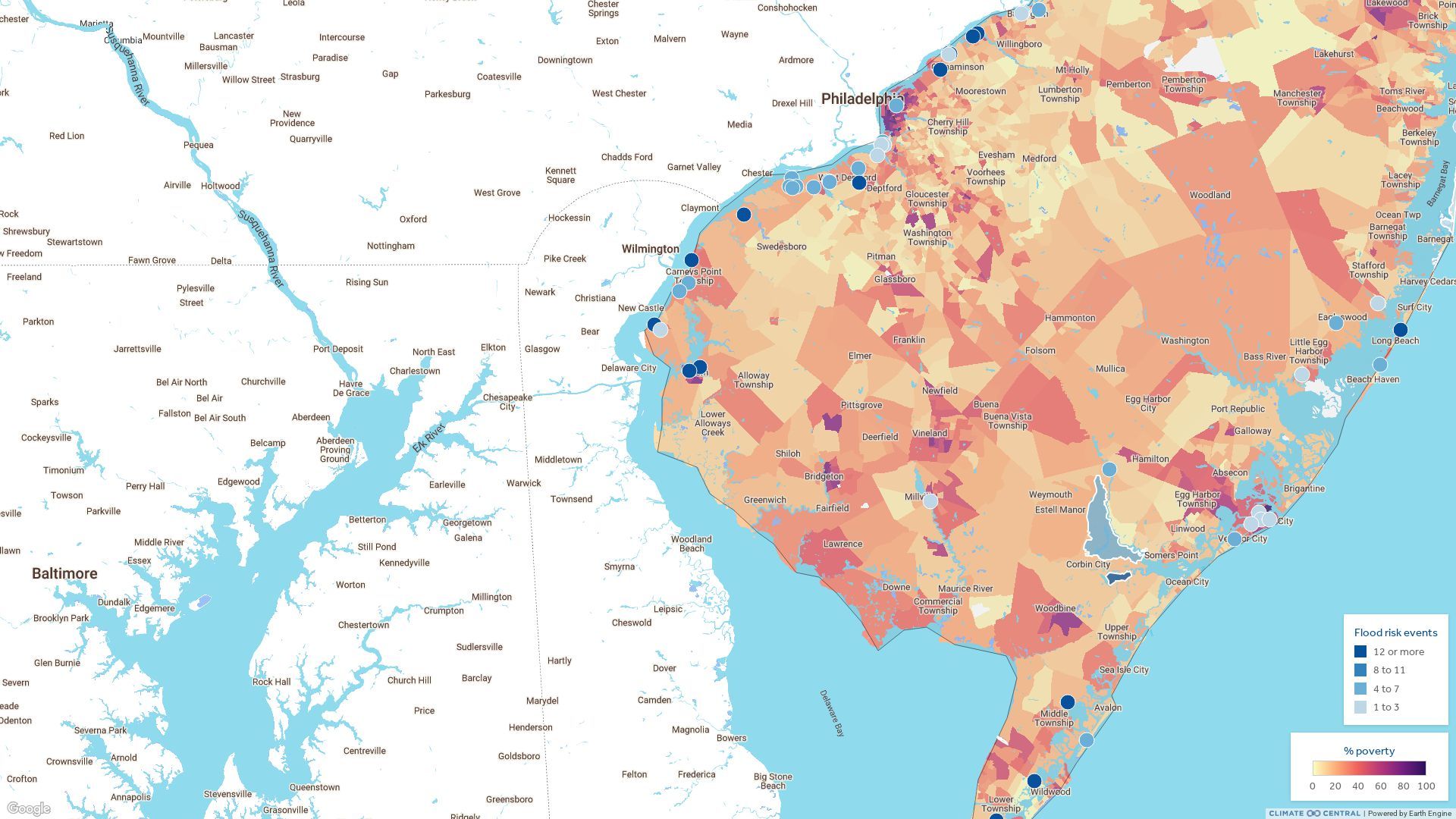
When combined with the state’s abundance of big industry, that means New Jersey has the nation’s second-highest exposure to potential flooding at industrial, toxic, and sewage treatment sites, according to a new peer-reviewed study led by Climate Central, a nonprofit run by scientists.
Meanwhile, a separate new study by RutgersUniversity says that the state faces a sea-level rise nearly three times faster than the global average over the coming decades.
Taken together, that means New Jersey faces more rising waters rimmed by chemical plants, Superfund sites, fossil fuel ports, and wastewater treatment plants.
“Flooding from sea level rise is dangerous on its own — but when facilities with hazardous materials are in the path of those floodwaters, the danger multiplies,” Lara Cushing, an associate professor at UCLAwho assisted with the Climate Central study, said in a statement.
Flooding near hazardous facilities
The Climate Central paper, published Thursday in the journal Nature Communications, analyzed and mapped 47,646 hazardous facilities along America’s coastlines. Researchers from UCLA, Nanjing University, and UC Berkeley assisted.
The researchers project that 3,740 facilities in the United States are at risk of a 100-year coastal flood within the next 25 years under a moderate greenhouse gas emissions scenario for sea-level rise (a 100-year flood has a 1% annual chance of occurring). And 5,138 facilities will be at risk by 2100.
Scientists usually consider three scenarios of greenhouse gas emissions when forecasting sea-level rise. A low-emissions scenario means basically no more rise in greenhouse gases. In an intermediate, or moderate, scenario, emissions rise slowly until 2050 and then decline. Under a high-emissions scenario, emissions rise through 2100. Each has an associated impact, with higher emissions resulting in higher sea levels.
More facilities would be flooded if emissions of greenhouse gases, which help trap heat in the atmosphere, go unchecked and continue to climb, the authors found.
Seven states — Louisiana, Florida, New Jersey, Texas, California, New York, and Massachusetts — account for nearly 80% of projected sites at risk of flooding by 2100.
Screen capture of a map from Climate Central’s coastal risk screening tool shows toxic facilities, such as industrial sites and sewage treatment plants, at risk of a 100 year flood by 2050.
New Jersey’s industrial legacy
According to Climate Central,New Jersey has 420 at-risk facilities that will be exposed to flooding by 2050, with the number rising to 492 facilities by 2100. The state is second only to Louisiana, which will have 1,632 facilities at risk by 2050.
Middlesex, Bergen, and Essex Counties have the most exposure, given their proximity to densely populated areas near major ports such as Newark and New York.
However, industrial facilities in Burlington, Camden, and Gloucester Counties also have exposure to flooding, some potentially multiple times, given their positions along the Delaware River. So, too, do facilities in Philadelphia.
Chemical and petroleum giants such as ExxonMobil, DuPont, and Chemours have facilities in Gloucester County just off the river, for example. Avient, a maker of specialized polymers, and Riverside Metals have facilities along the river in Burlington County.
InPhiladelphia, the Clearview Landfill Superfund site off Darby Creek, Ashland Chemical, and the city’s Southwest wastewater treatment plantare at risk of flooding in a major storm.
Indeed, the Delaware River is lined with wastewater treatment plants. Some, such as those in Philadelphia and Camden County, have older systems that together overflow millions of gallons of raw, diluted sewage into the river during storms, though the biggest proportion is from Philly.
Some of the industrial, wastewater treatment, and other facilities are at risk of 12 or more floods annually in decades to come as sea levels rise, according to the Climate Central study.
The authors found that certain communities are more likely to live near at-risk sites, such as those with a higher proportion of renters, households living in poverty, residents who identify as Hispanic, linguistically isolated households, households without vehicles, seniors, and nonvoters.
“This analysis makes it clear that these projected dangers are falling disproportionately on poorer communities,” Cushing said, noting that the people in thesecommunities often lack the resources to prepare for, or recover from, flooding.
Rising seas
Separately, a technical advisory panel at the New Jersey Climate Change Resource Center at Rutgers released a report last week focused on rising seas and coastal storms.
The report, commissioned by the New Jersey Department of Environmental Protection, found that under a moderate rise in emissions:
The state is likely to see a sea-level rise between 2.2 and 3.8 feet by 2100.
Between 2005 and 2020, sea level at tide gauges rose by about 4 inches. That ranged from around 3.7 inches at Atlantic City to around 4.4 inches at Cape May.
In the near term, New Jersey is likely to experience between 0.9 and 1.7 feet (11 and 20 inches) of sea-level rise by 2050.
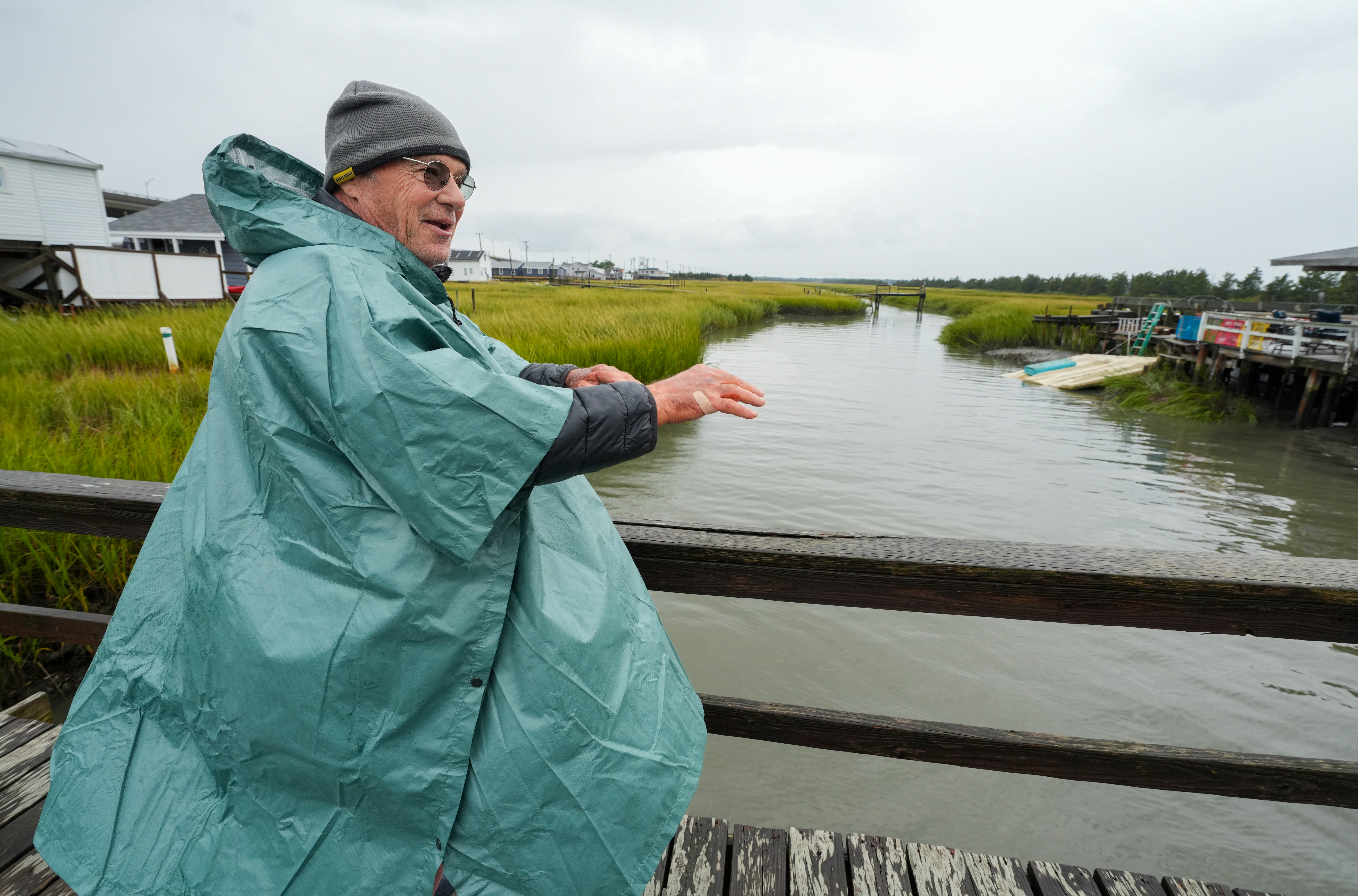
In this file photo, Haldy Gifford talks about the dead grass along the Grassy Sound, a roughly 120-acre spit of marshland off the back bay in Wildwood in Middle Township. Grassy Sound is beset by erosion.
“New Jersey’s shorelines have experienced and will continue to experience significant erosion driven by sea level rise and storms,” a summary of the report states. “While current levels of intervention have successfully reduced erosion rates in some places, these efforts may become economically unsustainable in the future, particularly for lower-income communities.”
Further, wetlands, which serve to protect wildlife habitats and the coastline from storm surges, will be greatly impacted.
“Even under a low emissions scenario, future projected rates of sea-level rise in coastal New Jersey may exceed the pace at which many coastal wetlands are able to adapt.”
Robert Kopp, a climate scientist and distinguished professor in Rutgers’ Department of Earth and Planetary Sciences, said in a statement that the world is on track to experience about 2.7 degrees Celsius of atmospheric warming by 2100 because of human-caused climate change.
Kopp cautioned that could increase given the change in U.S. climate policies.
Added Janine Barr, a Rutgers senior research specialist: “Sea-level rise is happening now in New Jersey and will continue into the future.”
Officials for the Bellwether District say they are in “late-stage negotiations” with potential tenants to occupy the first of many buildings planned for the 1,300-acre former refinery site in South and Southwest Philadelphia.
However, Amelia Chassé Alcivar, a spokesperson for HRP Group,the site’s owner, said during an update on the project Tuesday that she would not comment on potential tenants.
She was responding to a question from environmental advocate Mitch Chanin about whether a data center is a possible use on the site of the Philadelphia Energy Solutions (PES) refinery that closed in 2019 after an explosion and fire.
“I want to emphasize that no official announcements have been made at this time, so I cannot confirm … I cannot deny,” she said, adding that, “I would just generally preach caution if you’re reading anything in the press that is not confirmed by us on the record or by the company on the record.”
Chassé Alcivar said that there are no plans to build a traditional power plant on site.
A recent BillyPenn article cited a union official who said a cogeneration plant is being discussed for the site. Cogeneration is considered a nontraditional technology that simultaneously, and efficiently, produces heat and electricity on site.
Chassé Alcivar said solar installations are being planned for at least some of the six million square feet of rooftops the development will have when fully built out over several phases in years to come.
“I will share with this group that we are in late-stage negotiations with several prospective tenants,” she said.
What’s the Bellwether District?
HRP, which was spun off from its parent company, Hilco, is building two massive commercial campuses on the site of the former refinery.
window.addEventListener(“message”,function(a){if(void 0!==a.data[“datawrapper-height”]){var e=document.querySelectorAll(“iframe”);for(var t in a.data[“datawrapper-height”])for(var r,i=0;r=e[i];i++)if(r.contentWindow===a.source){var d=a.data[“datawrapper-height”][t]+”px”;r.style.height=d}}});
It plans about 14 buildings for a 750-acreindustrial campus with the potential for 10,500 jobs.
And it plans a series of smaller buildings on a 250-acre innovation campus, originally slated to house mostly life sciences companies, with the potential for 8,500 jobs. The buildings are being designed for uses such as bio-manufacturing, processing, production, and tech.
In all, HRP plans for about 14 million square feet of buildings across the two campuses.
The ground of the sprawling site was tainted by 150 years of petroleum-related uses. As a result, it is undergoing a complex environmental remediation.
Sunoco is responsible for contamination up to 2012. HRP is responsible for contamination after that. The two companies are coordinating cleanup with the state Department of Environmental Protection.
Remediation is expected to be ongoing for years. Some of the soil will be capped by buildings and parking lots. Barriers are being installed to prevent vapors from volatile organic compounds in the ground from penetrating work areas in the buildings.
What’s complete and what’s coming
HRP says it will invest more than $4 billion into the redevelopment.
So far, HRP has completed a 326,000-square-foot class A warehouse on its 750-acre industrial campus with poured concrete floors and structural steel column supports off 26th Street.
It is finishing a second, 727,000-square-foot warehouse adjacent to the first with a planned boulevard leading into the campus for a total of little more than 1 million square feet.
Last month, Bellwether applied for a permit for a 1.4-million-square-foot building titled DrinkPAK warehouse. California-based DrinkPAK is a large manufacturer of alcoholic and non-alcoholic canned beverages.
DrinkPAK’s website lists two existing facilities: The first in Santa Clarita, Calif., and a second scheduled to open this year in Fort Worth, Texas. A map shows a third facility projected to open in 2027 in the Northeast with a marker showing an area in Southeastern Pennsylvania.
Chassé Alcivar did not comment on that project during the meeting.
Other updates:
HRP said it is planning to widen the intersection of 26th Street and Penrose Avenue from three lanes to five. The intersection will have two left turn lanes, one straight lane, and then two dedicated right turn lanes. And a new boulevard entrance at 26th and Hartranft Streetsis being created, featuring roughly seven lanes in and out.
The company plans to plant 10,000 trees, bring buildings up to LEED standards, and to be solar ready. LEED certification is a system developed by the U.S. Green Building Council (USGBC) to verify a building’s sustainable design, construction, operation, and maintenance.
Weekly readings of a benzene monitor are being taken as part of the THRIVEair Community Air Monitoring Project (CAMP) in Southand Southwest Philadelphia. THRIVEair is a partnership between Drexel University and Philly Thrive, a local environmental justice organization.
HRP has launched a new driver education pilot program for students enrolled in construction and automotive career and technical education programs. Lack of a driver’s license has been cited as a barrier of entry to jobs.
More than 2.5 million miles of fuel pipelines run under homes, farms, parks, and schools in the United States — enough steel line to circle the earth 100 times.
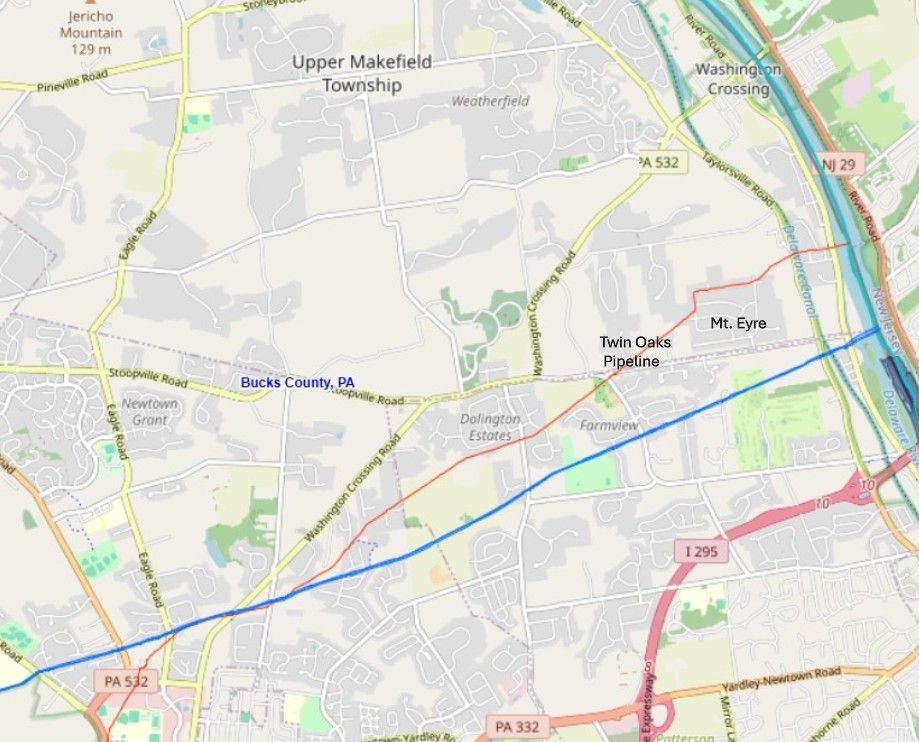
One of those pipelines slices under Mount Eyre Manor, a suburban Bucks County neighborhood perched high above the popular Delaware Canal State Park towpath and only a few thousand feet from the Delaware River.
For years, residents barely gave any thought to the Twin Oaks Pipeline, owned by Sunoco and its parent company, Energy Transfer. That changed in January when state inspectors uncovered a jet fuel leak.
Now, the pipeline is always on their minds.
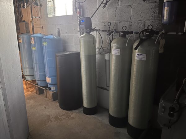
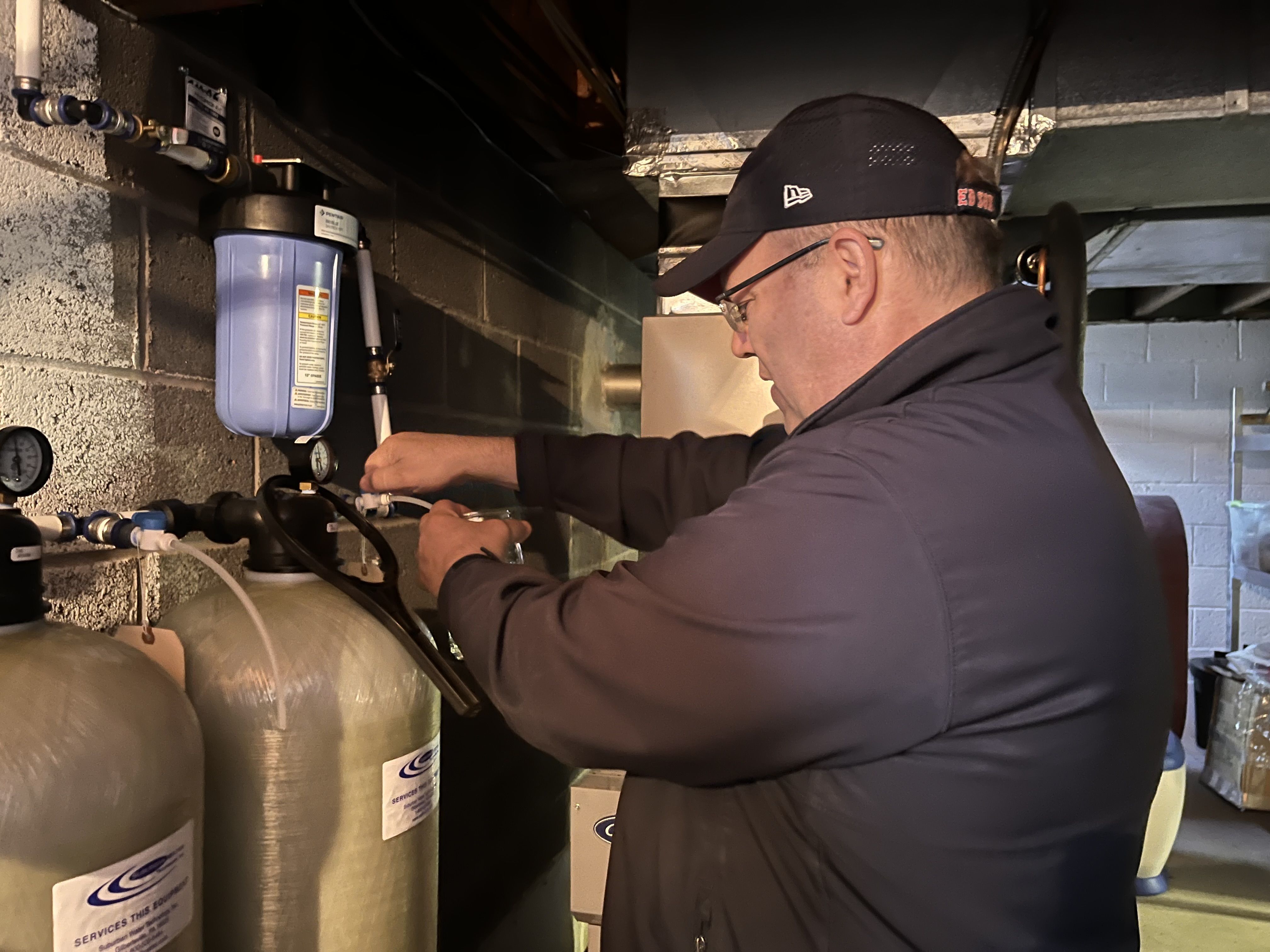
“We will never drink the water in this house again,” said Kristine Wojnovich, whose well was one of six tainted in the leak. Six metal tanks, part of a filtration system installed by Energy Transfer, now crowd her basement wall.
The Twin Oaks Pipeline stretches 106 miles. Built in 1958, its 14-inch diameter pipe carries jet fuel, diesel, or gasoline, depending on need, from Sunoco’s Twin Oaks Terminal in Aston, Delaware County, to a terminal in Newark, N.J.
Along its route, the pipeline burrows beneath suburbs, tunnels under waterways — including the Delaware River — and runs below a school’s grounds and state and local parks. It carves directly through Mount Eyre in the Washington Crossing section of Upper Makefield Township.
Federal regulators estimated that a “slow drip” had seeped undetected at least 16 months before the leak was detected.
Energy Transfer has accepted responsibility and apologized at public meetings. The company declined to comment for this article but noted that it has set up a website with updates and documents related to the spill.
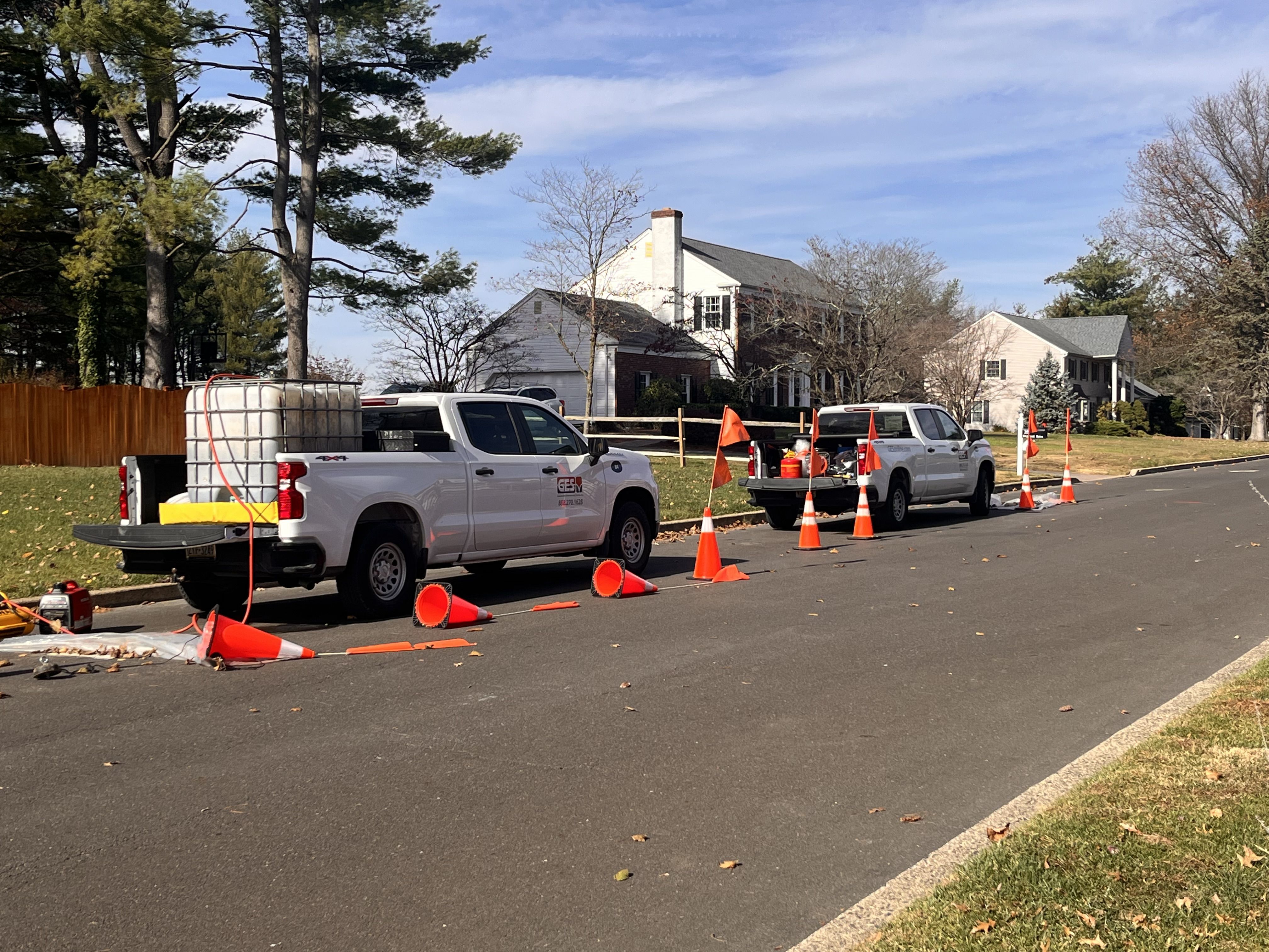
A contractor for Energy Transfer working on a recovery well in front of Kristine Wojnovich’s home in the Mount Eyre Manor neighborhood.
Signs of contamination
Wojnovich said she first noticed “something off with the water” as she was getting a drink after a workout in September 2023. She recalled the incident on a recent day from her living room as several white trucks owned by an Energy Transfer contractor were parked outside as part of well-monitoring work.
“It smelled to me like oil or gasoline or some kind of petroleum,” Wojnovich said.
Uncertain whether she was imagining it, she waited for her husband, Kevin, to return home. He, too, noticed the odor and suggested they call Sunoco.
The couple say Sunoco failed to locate a source of the odor and told them the likely cause was bacteria. Other neighbors had complained, too.
But it wasn’t until Jan. 21, 2025, that residents first learned of a leak discovered during an investigation by the Pennsylvania Department of Environmental Protection. The DEP advised the federal Pipeline and Hazardous Materials Safety Administration (PHMSA) that water samples from a Mount Eyre home “indicated the presence of kerosene, a major component of JP-8 jet fuel.”
PHMSA notified Energy Transfer and Sunoco.
Since then, residents have attended hours and hours of meetings. They’ve filed seven lawsuits, including a class action. Wojnovich is one of the plaintiffs.
Most people won’t drink the water. Many won’t cook with it. Wojnovich and her husband, Kevin, bathe elsewhere.
Wojnovich noted that when her well was initially tested after the leak, “fumes came out. It was overwhelming. They measured 12½ feet of jet fuel on top of our drinking water well.”
Her water, which eventually tested positive for contamination, now gets routinely tested by contractors paid by Energy Transfer. The company has drilled a second well for the family. But the Wojnoviches say their water still has a pungent odor.
Kevin Wojnovich samples water from a point-of-entry-treatment, whole-house filtration system that Sunoco installed at his Washington Crossing home after a 2024 jet fuel leak was detected in the company’s Twin Oaks pipeline.
The fallout
Of six wells that tested positive for hydrocarbons, four exceeded contaminant levels for drinking water. Residents suspect other wells were, or are, tainted and are skeptical about the way testing has been carried out.
According to the DEP, jet fuel contains “contaminants of concern” including benzene, toluene, ethylbenzene, xylenes, cumene, naphthalene, trimethylbenzenes, dichloroethanes, dibromoethane, and lead, which is also naturally occurring. The compounds can be harmful if ingested in large amounts. Some are carcinogens.
Energy Transfer has purchased a home with a contaminated well on Spencer Road, adjacent to where the leak was detected, for $721,800. It is across from the Wojnoviches’ home and sits vacant. The company purchased the home to drill two recovery wells in order to remove contaminated water.
Since digging up and repairing the pipe section, the company has recovered 1,027 gallons of fuel. About 163 gallons came from private wells, according to DEP records.
Energy Transfer has paid contractors to excavate and remove 276 tons of petroleum-impacted soil, according to a DEP document. It has installed four wells to recover petroleum from underground, dug 26 wells to monitor groundwater, and put in 181 point-of-entry treatment filtration systems in homes. It has collected 1,289 water samples from 363 individual wells.
A map from the federal Pipeline and Hazardous Materials Safety Administration shows the Mount Eyre Manor neighborhood in Washington Crossing, Bucks County, and Sunoco’s Twin Oaks pipeline in red. The blue line signifies another gas transmission pipeline.
Over the summer, Energy Transfer, using an inspection tool, identified multiple anomalies in the pipeline in Upper Makefield Township that required excavation, according to an Oct. 22 update.
The company said in an August letter that the anomalies presented no immediate danger and that there is no “data or information that the continued operation of the pipeline presents a critical safety concern or that the pipeline is leaking.”
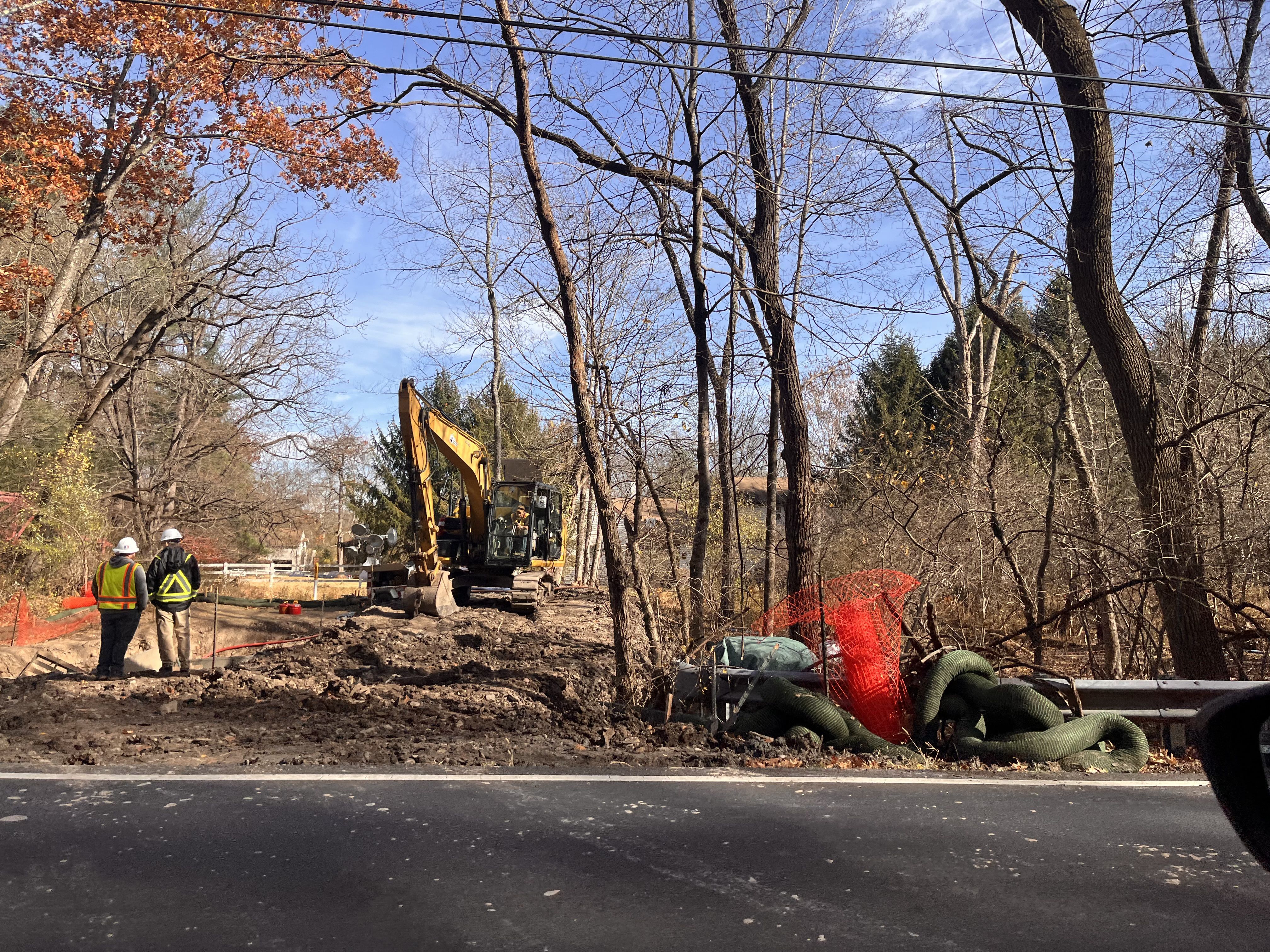
One of those excavations took place in a section of pipe next to the popular canal path used by cyclists and hikers. It is being dug up and replaced.
The excavation along Taylorsville Road won’t disturb the canal trail, company officials said during a recent meeting. The term anomaly does not mean a pipe section is an immediate threat to the safety or integrity of the pipeline, Matt Gordon, vice president of operations at Energy Transfer, said at the meeting.
Meanwhile, the pipeline continues to deliver fuel.
A contractor for Energy Transfer excavates a pipe found along Taylorsville Road with an anomaly that the company said was not in any immediate danger of failing.
‘Another house is up for sale’
The spill has upended life in and around Mount Eyre, neighbors say.
Joe Babiasz said many neighbors had bonded through their children’s schools and activities before the spill. Now, instead of talking soccer, they talk pipelines.
“It’s become part of daily life at this point,” Babiasz said. “When we get together socially, it’s the thing we talk about. It’s been kind of hard to just hang out with people and have it not come up. You can’t walk around the neighborhood without seeing a reminder. ‘Oh, there’s the monitoring well,’ or ‘another house is up for sale.’”
Residents have expressed outrage and skepticism toward Energy Transfer, the parent company of Sunoco, over the handling and testing of the contamination. They say theydon’t trust the company’s methods and doubt the safety of the 67-year-old pipeline.
“There are the trucks out there now,” Babiasz said on a recent day. “You can see them or hear them. It’s been integrated into our daily life.”
He asked: “Are they actually telling us everything?”
Residents wonder if the leak would have been discovered if they had municipal water. They wonder whether the leak created a toxic plume underground and where it might drift to, including into the river.
Neighbors plan to attend the next update by the DEP during a Dec. 8 webinar.
Katherine LaHart, a plaintiff in the class-action suit, said her well water was once clear. Now it is “black — Texas brown.”
“I worry every day about the integrity of our water, air and soil and the pipeline that runs through our neighborhood,” LaHart said. “It keeps me up at night.”
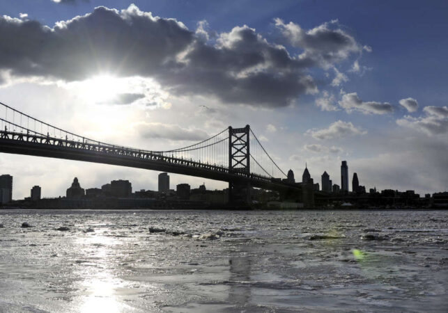
Philadelphia discharges 12.7 billion gallons of raw, diluted sewage into the Delaware River’s watershed each year, with Camden County adding to the mix, according to a new report.
That’s a problem, say the report’s authors at the nonprofit advocacy groupPennEnvironment. Philadelphia and Camden border the river, and significant recreational potential is blocked forpart of the year because of pollution from both, the authors say.
A waterway can remain unsafe for recreation for up to 72 hours after an overflow. That suggests local waterways could be unsafe for recreation up to 195 days per year, or more than half the year.
Five decades after the Clean Water Act mandated that waterways be made safe for swimming and fishing, combined sewer overflows (CSOs) continue to pollute during wet weather when untreated sewage and runoff surge into nearby creeks and rivers, creating the potential to sicken recreational users.
David Masur, executive director of PennEnvironment, said the group included Camden County in its most recent report“to get a more holistic view.”PennEnvironment’s first report on CSOs in 2023focused only on Philly.
The pollution “affects the waterway, the environment, and public health,” Masur said. “The river is the border between the two states, and people on both sides use it a lot.”
PennEnvironment acknowledges that both Philly and Camden County have programs to reduce overflows and is calling on federal officials for increased funding to put proper infrastructure into place.
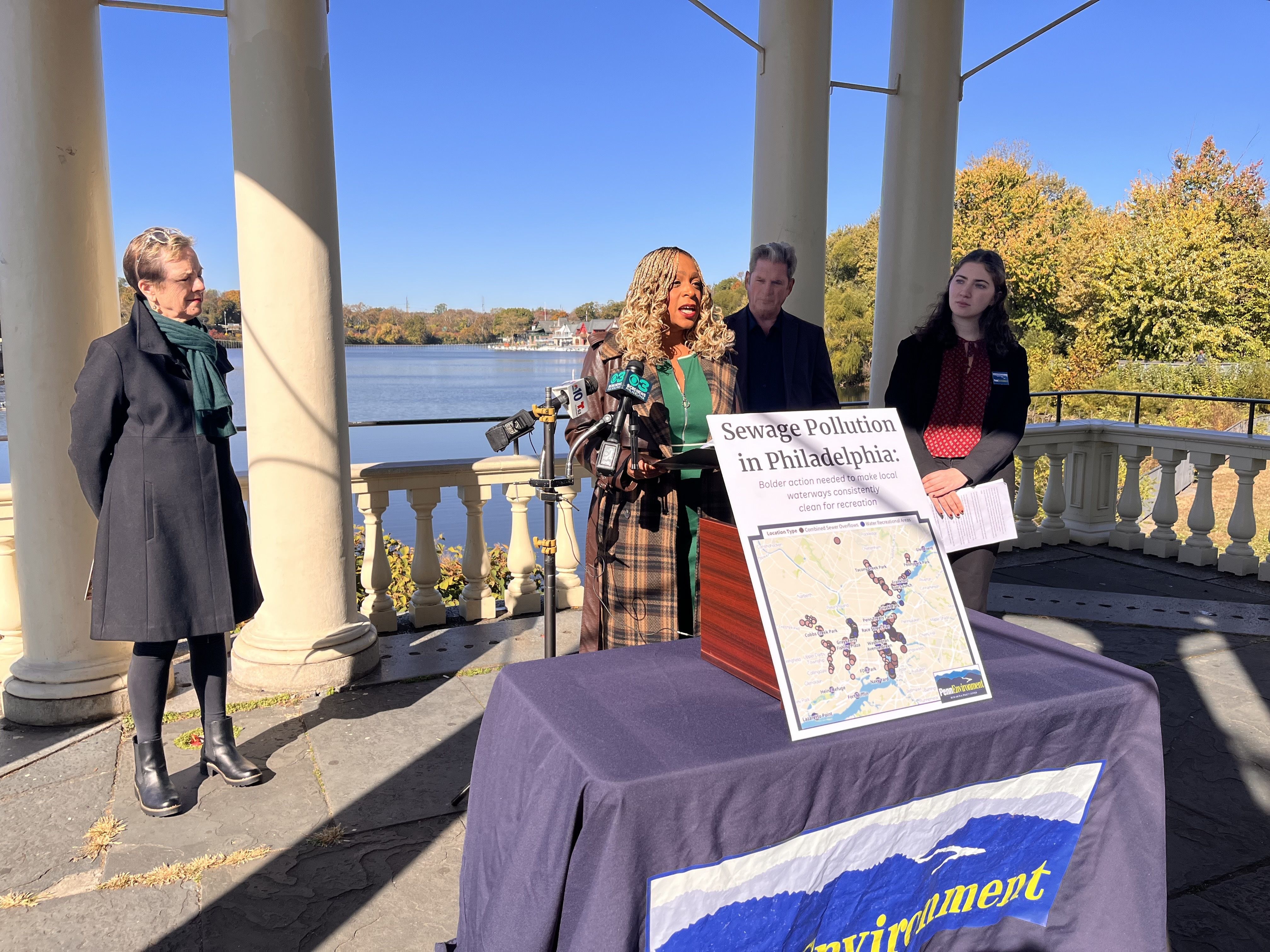
Philadelphia Council member Jamie Gauthier (center) spoke Monday about PennEnvironment’s report on pollution from combined sewer overflows. To her left is Margaret Meigs, president, Friends of the Schuylkill Navy. And to her right is Tim Dillingham, senior adviser, American Littoral Society, and Hanna Felber, clean water associate at PennEnvironment Research & Policy Center.
Frequent overflows, high volume in Philly
Roughly 60% of Philadelphia is served by a combined sewer system, which has 164 outfalls — really large metal or concrete openings — that discharge pollution into waterways. A CSO system uses a single pipe to collect and transport sewage from homes and businessesas well as stormwater runoff from streets and sidewalks.
During dry weather, the system can handle the volume before safely releasing it back into the rivers. But during heavy rainfall, thesystem discharges untreated, though highly diluted, sewage mixed with stormwater directly into waterways.
Despite the Philadelphia Water Department’s ongoing Green City, Clean Waters project — a 25-year plan focusing on green infrastructure to reduce overflows — the frequency and volume remain alarmingly high, the report states.
Overall, CSOs dumped an average of 12.7 billion gallons of raw sewage mixed with polluted stormwater per year into local waterways from 2016 to 2024, the authors of the report stated. They included an online map to show the location of the outfalls and annual overflow.
Half the sewage came from just 10 CSOs.
window.addEventListener(“message”,function(a){if(void 0!==a.data[“datawrapper-height”]){var e=document.querySelectorAll(“iframe”);for(var t in a.data[“datawrapper-height”])for(var r,i=0;r=e[i];i++)if(r.contentWindow===a.source){var d=a.data[“datawrapper-height”][t]+”px”;r.style.height=d}}});
Still, the numbers are a slight improvement over the 15 billion gallons a year released into local rivers, as PennEnvironment reported in 2023.
Philadelphia gets its drinking water from the rivers, but the CSOs are downstream of the city’s treatment plants on the Delaware and the Schuylkill.
The reportused publicly available data to show that five of six waterways in Philly produced at least one overflow 65 times or more per year on average between 2016 and 2024. Those were the Delaware River, the Schuylkill, and Cobbs, Frankford and Tacony Creeks.
In better news: The average volume of overflow per inch of precipitation declined by about 16% from previous periods, but progress is slow and threatened by increased rainfall and rising sea levels due to climate change, the authors say.
PWD could not be reached for comment.
window.addEventListener(“message”,function(a){if(void 0!==a.data[“datawrapper-height”]){var e=document.querySelectorAll(“iframe”);for(var t in a.data[“datawrapper-height”])for(var r,i=0;r=e[i];i++)if(r.contentWindow===a.source){var d=a.data[“datawrapper-height”][t]+”px”;r.style.height=d}}});
Camden County
The report also found persistent overflows in Camden County. The cities of Camden and Gloucester, along with the Camden County Municipal Utilities Authority (CCMUA), operate combined sewer systems that frequently overflow into the Delaware River and its tributaries, including the Cooper River and Newton Creek.
The report found that systemson the Camden County side of the river overflowed into local waterways an averageof 76 days per year from 2016 to 2024.
window.addEventListener(“message”,function(a){if(void 0!==a.data[“datawrapper-height”]){var e=document.querySelectorAll(“iframe”);for(var t in a.data[“datawrapper-height”])for(var r,i=0;r=e[i];i++)if(r.contentWindow===a.source){var d=a.data[“datawrapper-height”][t]+”px”;r.style.height=d}}});
The highest-frequency outfall for the Cooper River released sewage for an average of 118 days annually during that period.
The Delaware River received sewage overflows for an average of 94 days annually from its highest-frequency outfall.
The authors said gaps in data leave them unable to show the total volume of diluted sewage releasedfrom Camden. But they said that the amount of “solids/floatables” collected at each outfall is an indicator a waterway is polluted.
Dan Keashen, a spokesperson for Camden County, said officials have been making strides.
He said that crews recently cleaned 30 miles of pipe and that a $26 million project is underway to physically separate the combined sewer service area of Pennsauken that flows into Camden. Officials are also studying how to better achieve compliance for the largest outfall in the system, a project estimated to cost $40 million to $150 million when complete.
What can be done?
The report concludes that current plans by Philadelphia and Camden County are insufficient to achieve the goal of a clean Delaware River watershed.
The report was written by John Rumpler, clean water director for Environment America, PennEnvironment’s parent organization, and Elizabeth Ridlington, associate director of the Frontier Group, a nonprofit research group that is part of the Public Interest Network, an environmental advocacy organization.
The authors call for officials to accelerate action to end all sewer overflows, set a hard deadline, and find new ways to pay for necessary infrastructure upgrades.
Philadelphia CouncilmemberJamie Gauthier, chair of the committee on the environment, called overflows “a public health crisis” and urged PWD’s new commissioner, Benjamin Jewell, to act. She said elected officials in Harrisburg and Washington also need to step up.
PWD is separately under pressure by a new Environmental Protection Agency regulation that seeks to improve the amount of dissolved oxygen in the Delaware by ordering a large-scale reduction of ammonia at the city’s three water pollution control plants. PWD estimates that the price for compliance is $3.6 billion and would cost households an additional $265 annually on their water bills.
The authors of the PennEnvironment report concede the CSO task is daunting. But they say Portland and Boston faced similar situations, invested in infrastructure, and managed to make CSO overflows infrequent. Washington, D.C., they said, is on track to reduce sewage overflows by 96% in 2030.
Hanna Felber, a PennEnvironment advocate, said that PWD needs to use creative funding, such as floating longer-term bonds to finance projects, and that its engineers need to find more creative solutions, such as installing larger stormwater tunnels that flow separately from sewage.
“Unfortunately, our new report on sewage pollution in Philadelphia shows that on far too many days each year, the Philadelphia Water Department’s pipes and sewer systems dump huge volumes of raw sewage into our beautiful waters, harming our environment and depriving the public of a safe place to fish, boat, and float,” Felber said.