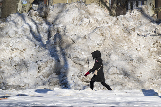
That inert, frozen mass that has turned parking and walking and the routine business of life into punitive experiences around here is a certifiable Philadelphia rarity.
It almost certainly will take a significant hit this week — temperature readings may reach the big 4-0 (hold the applause; a downside is possible) — but the snowpack already has earned historic status in Philly’s weather annals.
The official snow depth at Philadelphia International Airport at 7 a.m. Monday was 5 inches, the 15th consecutive day that it has weighed in at 5 inches or more.
That is tied for the fourth-longest streak in National Weather Service records dating to the late 19th century. But this one arguably is more impressive than its predecessors.
The Philly snow cover’s staying power
The staying power of the other snow-cover streaks at the top of the list were the results of heavy snow followed by additional snowfall of 10 inches or more that replenished the snow pack. That list includes the 44 inches that fell in a six-day period in February 2010.
window.addEventListener(“message”,function(a){if(void 0!==a.data[“datawrapper-height”]){var e=document.querySelectorAll(“iframe”);for(var t in a.data[“datawrapper-height”])for(var r,i=0;r=e[i];i++)if(r.contentWindow===a.source){var d=a.data[“datawrapper-height”][t]+”px”;r.style.height=d}}});
This time around, only 0.3 inches have been measured since the 9.3 inches of snow and white ice stopped falling on Jan. 25.
The sleet that fell atop the several inches of snow added considerable durability to the pack, since ice melts more slowly than snow, and then it all was rock-frozen by a memorable arctic freeze, followed by reinforcements.
Temperatures the last 15 days have averaged 10 to 15 degrees below normal, and Sunday’s low of 8 was the coldest of the season to date.
It isn’t often that the Philadelphia region experiences such “magnitude … and persistence” of cold, said Kyle Imhoff, the Pennsylvania state climatologist. Plus, typically big snows are followed by a thawing period of few days later. What’s happened since Jan. 25, he said, “is a much rarer occurrence.”
The cumulative effects have been evident along the Schuylkill, which is looking (deceptively) fit for skating, and the Delaware River navigation channel. The river and most of Delaware Bay are between 90% and 99% ice covered, the U.S. National Ice Center reported Monday.
It hasn’t been just us. Data pulled by Samantha Borisoff, climatologist at the Northeast Regional Climate Center, showed impressive snow-cover endurance streaks in Wilmington, Atlantic City, Washington, and New York.
Ice cover throughout the Mid-Atlantic region expanded Sunday, said ice center physical scientist Jonathan Edwards-Opperman. While Saturday was harsher with winds gusting past 50 mph and below-zero windchills from midmorning on in Philly, the “strong winds pushed a lot of the existing ice into the shore, which exposed open water,” he said.
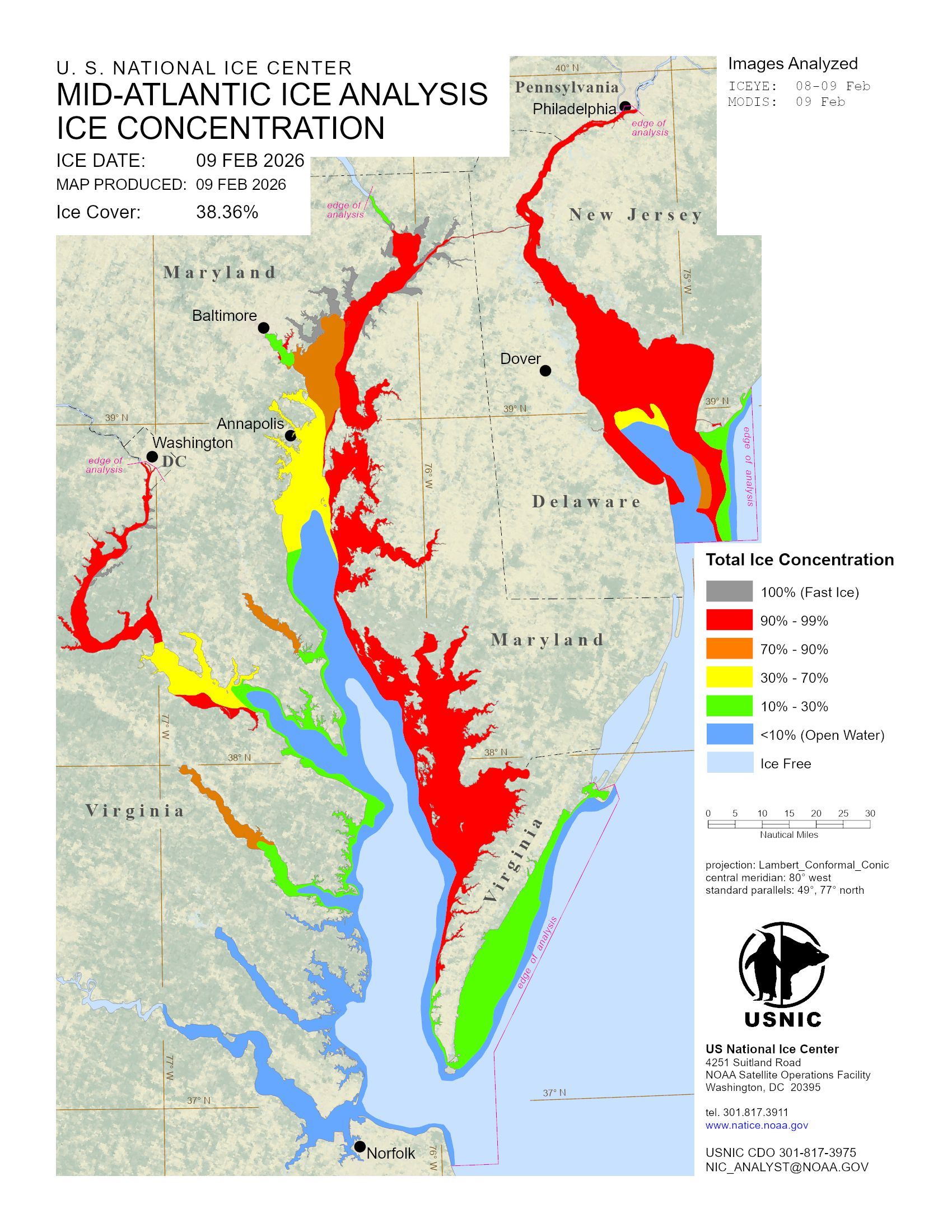
When the gusts backed off Sunday, the ice went to town. “We saw rapid new growth,” he said.
Said PhilaPort spokesperson Ryan Mulvey, “Talking with people around the port we haven’t seen ice like this in over 10 years.”
That said, however, he added that the Coast Guard has kept the traffic moving and “we have not experienced any ice-related delays.”
It is about to get better
It did not get to freezing Monday afternoon, but it should make it to the upper 30s, or perhaps the low 40s by midweek, said Amanda Lee, a meteorologist with the National Weather Service in Mount Holly.
And daytime highs should go above 32 at least through the workweek. That combined with the growing power of the February sun — its daily wattage will be about 10% higher on Tuesday than it was on Feb. 1, according to NASA — should lessen the snow and ice cover considerably.
That thaw, however, could come with some bumps in the road.
“I think it’s fair to expect potholes to grow or develop as the weather gets warmer,” said PennDot spokesperson Helen Reinbrecht. Patching crews will be out there, conditions, permitting, she said.
Those conditions should persist at least until the weekend, when another storm could affect the region, said Lee.
It’s only Monday, which means the computers still have several more days of disputation.
In the meantime, you may not be seeing much in the way of bare ground, but expect an outbreak of puddles. It’s been a while.
Leave a Reply