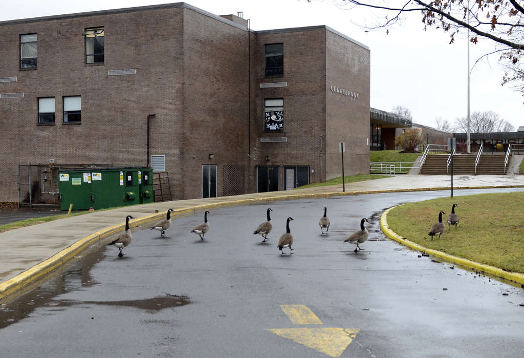
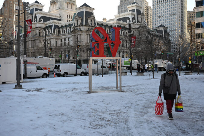
Students are going home from school Friday with charged computers, but Watlington, speaking at a city emergency services news conference, said he wanted students to focus on having fun.
“We’re inviting students and staff to enjoy this snowfall, which will be the most I’ve seen during my nearly four years here in Philadelphia,” the superintendent said. “Sledding is appropriate. Snow angels are appropriate, and [Police Commissioner Kevin Bethel] gave us permission to have one or two safe and fun snowball fights.”
If conditions require more days out of school buildings, “every subsequent day will be a remote learning day,” Watlington said.
Philadelphia Achdiocesan high schools and parochial elementary schools also will have a virtual day Monday.
Suburban schools prep
Philadelphia isn’t the only district that has already announced plans or warned that closures were likely.
In Upper Darby, school officials told families Thursday night to prepare for the prospect of virtual instruction on Monday, and possibly Tuesday.
“If the weather is more significant than anticipated, and there are power outages in the area, we will shift to a snow day,” with no virtual school, Superintendent Daniel McGarry said in the message.
In the Cheltenham School District, Superintendent Brian Scriven told families that “if weather conditions require us to close schools and offices,” the district will have a traditional snow day Monday. Tuesday is to be determined — and Wednesday could be virtual instruction, “if conditions are significant enough,” Scriven said.
Colonial School District Superintendent Michael Christian told parents Friday that “if the accumulation is as high as some meteorologists are projecting, we would call for a traditional snow day on Monday and quite possibly Tuesday as well.” And Wednesday could be a virtual instruction day, Christian said.
Meanwhile, the Council Rock School District said that “if school buildings must close on Monday,” students would have virtual instruction.
Based on what the computers and their human interpreters are saying, a key question this weekend will be whether measuring the snow in the Philly region will require a ruler or a yardstick.
This no doubt will be a moving target, but on Friday morning, the National Weather Service in Mount Holly was seeing eight to 14 inches for Philly, said meteorologist Alex Staarmann. Several inches were possible even at the Jersey Shore.
Friday AM Update: A major winter storm is still expected to impact the region Sat Night through Mon Morning. The primary change with this update is a slight reduction in snow totals across the Delmarva into southeastern NJ due to increasing sleet/freezing rain potential. (1/2) pic.twitter.com/OqV4a5QiHW
A wild card would be a potentially unpleasant atmospheric parfait that would add ice to the mix on Sunday, and computer models Friday were suggesting that mixing was likely near I-95 and in Delaware and South Jersey. However, the weather service expects that to yield to all snow Sunday night.
While this is all quite a complicated meteorological setup, in essence Arctic air is pressing southward and it is going to interact with an impressively juicy storm to the south.
“Having the Arctic front come through before the onset of wintry precipitation, that’s really concerning,” said Ray Kruzdlo, the staff hydrologist in the weather service office, where “it’s all hands on deck.”
Below-zero windchills are expected Saturday morning, prompting a cold-weather advisory, and temperatures in Philly may stay below freezing the rest of the month.
What time will the snow start and end?
The timing and duration of precipitation aren’t among the strong suits of computer models.
The weather service’s winter storm watch, which covers the entire region, all of Delaware, and most of Pennsylvania and New Jersey, is in effect from 7 p.m. Saturday until 1 p.m. Monday.
The daytime Saturday “looks fine if you have to get out,” said Tom Kines, senior meteorologist with AccuWeather Inc.
The weather service is listing the likeliest starting time as the early morning hours of Sunday, with snow likely into the early morning hours of Monday.
Sunday is going to be one of the colder days of the winter with temperatures in the teens and lower 20s. The weather service introduces the possibility of freezing rain and sleet by 1 p.m., with a forecast temperature of 19 degrees.
Yes, it can rain when it’s below 20 degrees at the surface, and precipitation doesn’t get much more dangerous.
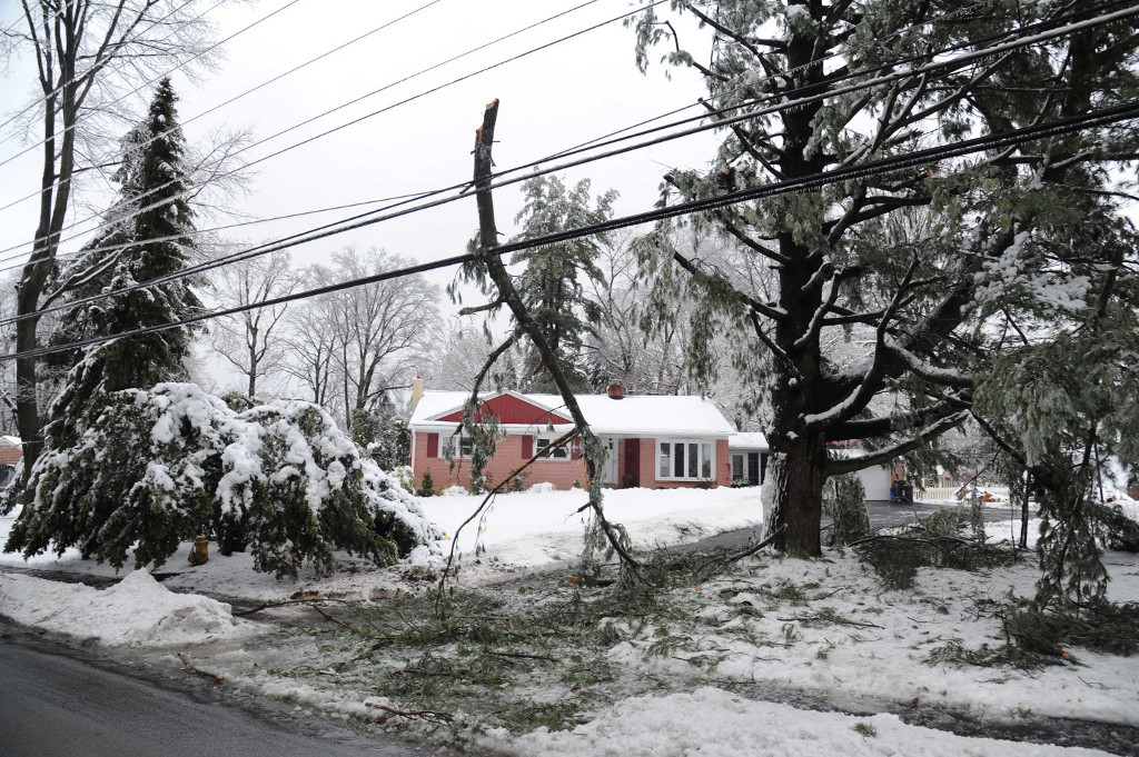
Snow and sleet, liquid that freezes on the way down, can at least provide traction on the roads. Rain that freezes on contact becomes an ice sheet. Also, when freezing rain accumulates on fallen snow it can bring down trees and power lines.
Peco has heard the storm rumors (who hasn’t?) and will have crews on call through the weekend, said spokesperson Candace Womack.
The threat of ice is related to the possibility of warm layers of air, borne on onshore winds from the ocean, at levels of the atmosphere where precipitation is formed.
That could well happen Sunday as the coastal storm intensifies, said Kruzdlo, and winds build from the Northeast, perhaps gusting past 20 mph. Any rain or sleet would encounter very cold air at the surface, locked and dammed in place by the Appalachian Mountains.
“That’s the complexity of living where we are so close to the ocean,” Kruzdlo said. “We have tens of thousands of observations at the surface,” he added, but data from the upper atmosphere is wanting, adding challenges to forecasting changeovers.
Along the I-95 corridor, storms of purely snow are the exceptions, Kruzdlo said.
One of the more notable busts occurred in January 2015 when forecasts called for an I-95 East Coast snowstorm so ferocious that the mayor of New York imposed a curfew.
His boss at the time, weather service head Louis Uccellini, said no apology was necessary: Science has its limits. Busts have been known to happen in the battle of science against nonlinear.
This time around, meteorologists are all but certain something “impactful” is going to happen.
Said Kruzdlo, the slim chance of this storm “not being significant is leaving us.”
Philadelphia is expected to see its most significant winter storm in years this weekend, with nearly a foot of snow and ice expected from a formidable low-pressure system sweeping across the eastern United States.
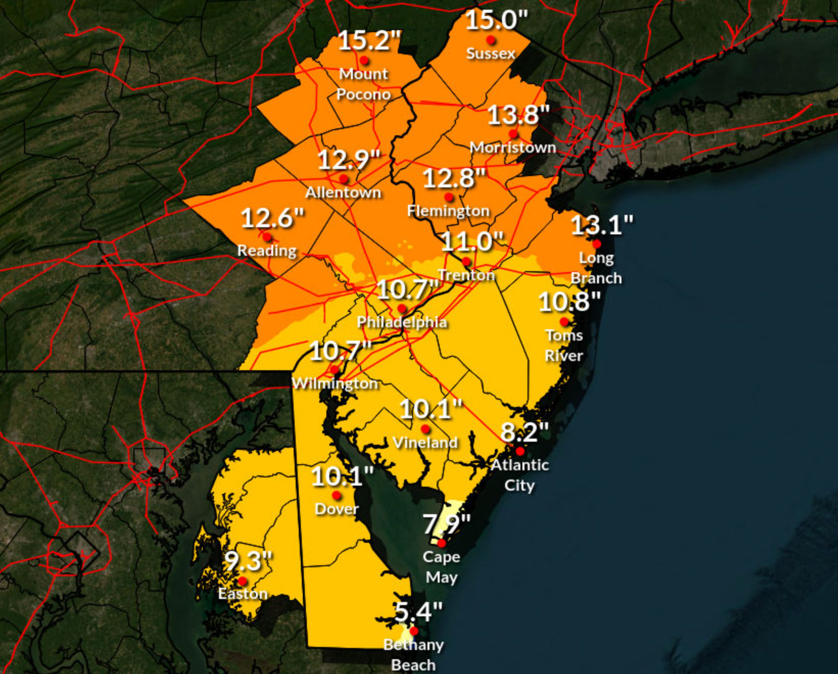
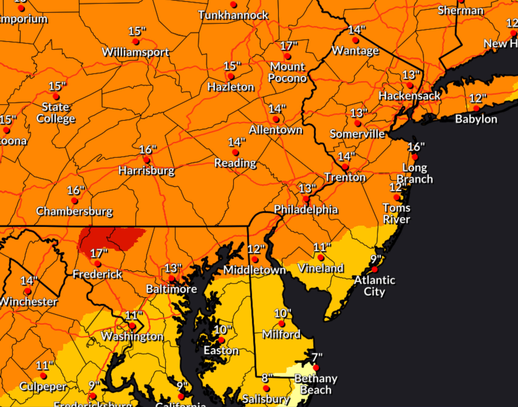
Official National Weather Service forecasts say six to 18 inches of snow is possible across most of New Jersey and Pennsylvania, including Philadelphia as the storm pushes through the region Saturday night to early Monday morning. More than 21 states are expected to experience at least moderate impacts from the storm, the weather service said.
Forecasters said that mixing with sleet and freezing rain could hold down overall snow totals across Philadelphia and South Jersey, but the storm is likely to hinder if not halt most travel on Sunday, regardless.
The National Weather Service puts out forecasts for every few square miles of land in the United States four times a day through a system called the National Digital Forecast Database.
The maps below display that data. Use it to find how much snow is expected anywhere in the eastern United States. It will show the most recent forecast for the next three days.
(function () {window.addEventListener(‘message’, function (e) { var message = e.data; var els = document.querySelectorAll(‘iframe[src*=”‘ + message.id + ‘”]’); els.forEach(function(el) { el.style.height = message.height + ‘px’; }); }, false); })();
A considerable amount of freezing rain and sleet may also fall during the storm, leading to icing concerns. The map below displays the forecast for ice accumulation, or accretion, over the next three days.
(function () {window.addEventListener(‘message’, function (e) { var message = e.data; var els = document.querySelectorAll(‘iframe[src*=”‘ + message.id + ‘”]’); els.forEach(function(el) { el.style.height = message.height + ‘px’; }); }, false); })();
A major snowstorm is expected to hit Philadelphia and the region this weekend. It could be the city’s first double-digit snowfall in 10 years, though the latest forecast has snow totals down slightly.
Heavy snow and potentially dangerous icing are expected in Philly this weekend
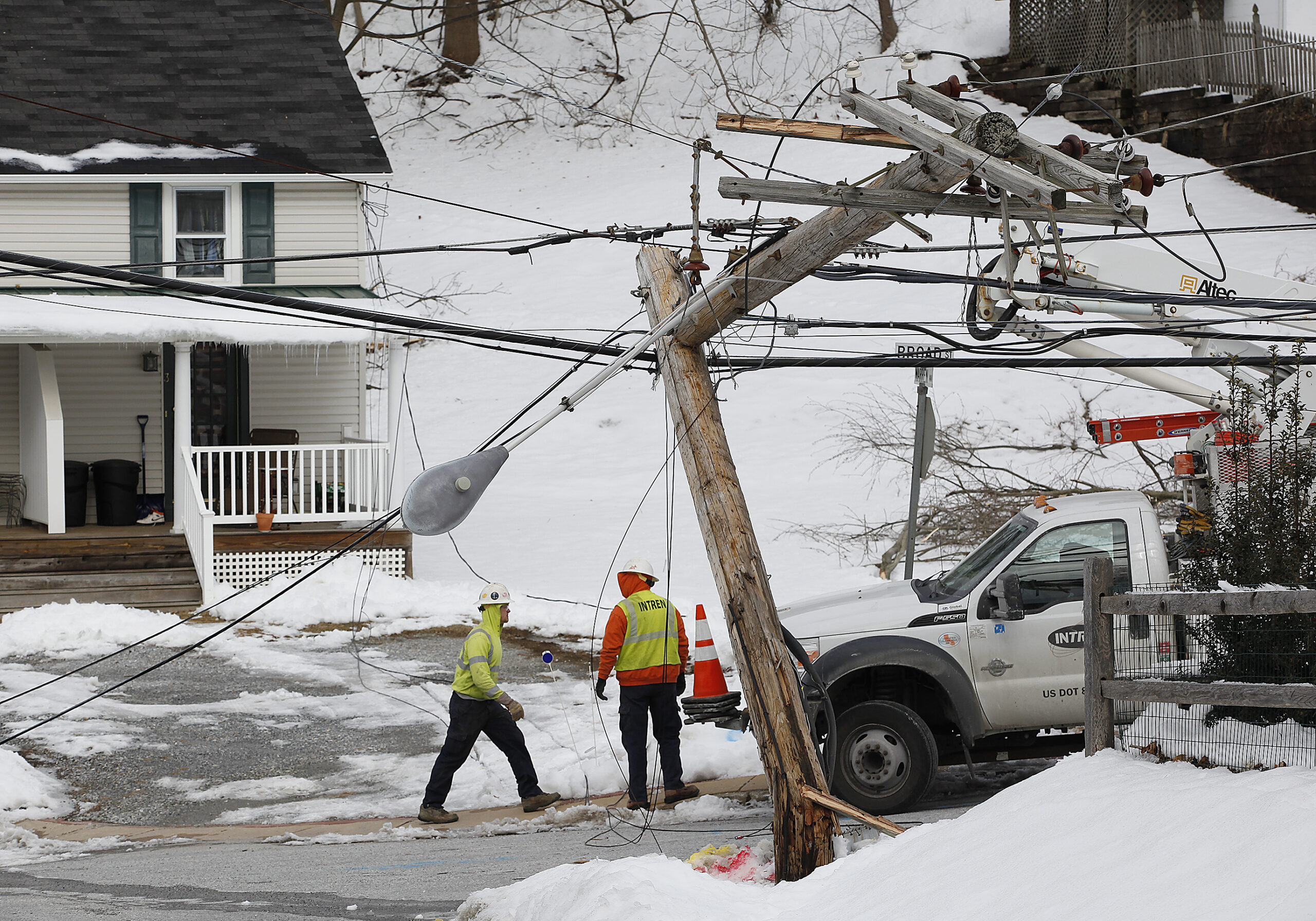
FILE – February 8, 2014 A crew from northern Illinois works to restore power at Broad Street and Warren Avenue in Malvern. February 8, 2014.
Philadelphia could experience more snow this weekend than it did during the the entire winter of 2024-25, but the forecast updates Friday suggested that may not be the worst of the storm’s offerings.
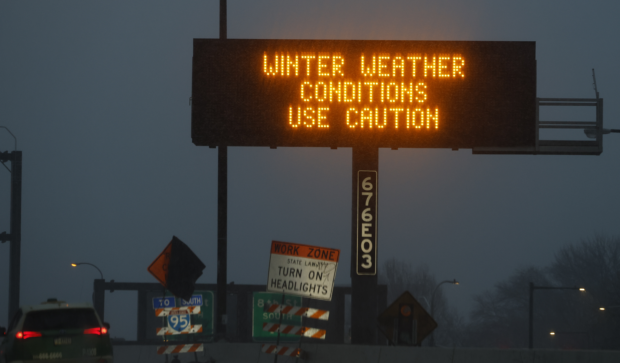
In issuing a profoundly predictable winter storm warning, in effect from 7 p.m. Saturday until 1 p.m. Monday, the National Weather Service said that in addition to 8 to 12 inches of snow, as much as a quarter-inch of freezing rain could accumulate. That would greatly increase the power outage potential.
Whatever the outcome, the storm still in its formative stage already has had significant impacts on the region and may have set an unofficial record for pre-storm buildup and preemptive closings.
Philadelphia Mayor Cherelle L. Parker declared a state of emergency for Sunday, as did Pennsylvania Gov. Josh Shapiro and New Jersey Gov. Mikie Sherrill. PennDot is imposing speed restrictions. SEPTA is expecting issues.
Some schools already were planning for multiple-day closings, as the snow and ice will be accompanied by one of the region’s more impressive cold snaps of the last several years.
Were it not for the storm, in fact, the cold might be getting headlines.
Wind chills Saturday morning are expected to drop below zero. Sunday’s high of 25 degrees may make it the warmest day of the week.
It is likely that layers of snow and ice will harden into a frozen mass that the January sun won’t be able to do a whole lot about.
As a public service, for now we will hold off on mentioning another potential storm threat.
Gov. Josh Shapiro on Friday signed a disaster emergency declaration for Pennsylvania, freeing up resources for preparation and support efforts ahead of the coming weekend winter storm.
“Today, I signed a disaster declaration for the entire Commonwealth to ensure our agencies have all necessary resources ready to go,” Shapiro said in a statement. “Stay off the roads if you can, be safe, and follow instructions from PEMA and your local authorities.”
The declaration, Shapiro’s office said, more easily allows the state to use funding to give various state agencies the resources required to more effectively respond to the storm and county and municipality level. Much of the state is expected to experience significant snowfall as part of the storm, with forecasters calling for 8 to 12 inches of snow for the Philadelphia region, as well as ice totals of 0.25 inches.
In addition to announcing the disaster emergency declaration, Shapiro’s office urged Pennsylvanians to stay off the roads during the storm if possible.
Locally, Delaware County also declared a disaster emergency that will run for seven days starting Friday, county officials said. The storm, the county said in a statement, could cause “injury, damage, and suffering” to Delco residents, prompting the declaration.
“Please avoid unnecessary travel, particularly during the peak of the storm and ensure that you have enough essentials to last several days in case travel becomes difficult,” said Delaware County Council Chair Richard Womack.
New Jersey Gov. Mikie Sherrill declares state of emergency
New Jersey Gov. Mikie Sherrill has declared a state of emergency in the state ahead of the impending weekend winter storm, and issued statewide commercial vehicle restrictions on interstate highways.
“It’s been a while since we have seen a storm like this,” Sherrill said at a Friday news conference. “We’re tough, but we need to be prepared. We have to be safe.”
Sherrill, who was inaugurated earlier this week as New Jersey’s 57th governor, also urged residents to stay indoors throughout the duration of the storm, and refrain from traveling unless absolutely necessary. Potential road conditions for early Monday, she added, remained in flux, as the state could possibly “still be digging out” from the storm.
“Don’t commit to anything Monday morning,” Sherrill said.
Sherrill noted that while forecasts have been somewhat fluid, it appeared at the time of her briefing Friday that North Jersey was likely to see higher snow totals of 12 to 18 inches, while South Jersey could see 12 inches or less. The whole state, however, is expected to see impacts from snow and ice.
As part of Sherrill’s declaration, the State Emergency Operation Center will activate at 6 p.m. Saturday, officials said. Activating the center will allow state leaders to coordinate county and state responses to the storm, and monitor assistance requests around New Jersey.
“This is a good weekend to stay and watch some football, play a board game with your kids, but please stay off the roads on Sunday,” Sherrill said.
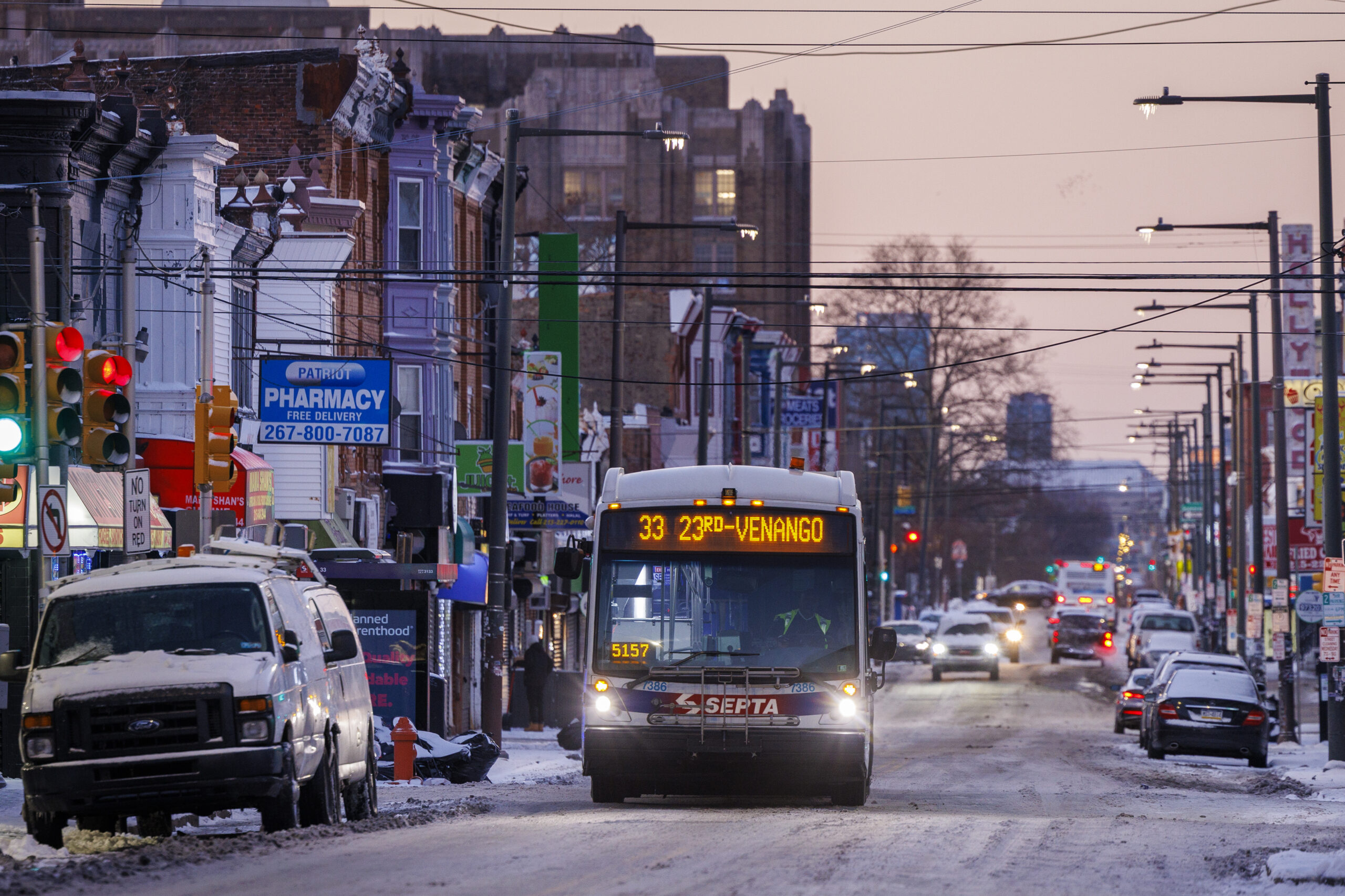
SEPTA expects service interruptions during storm Sunday: ‘Bad day to travel’
SEPTA officials gathered at their West Philadelphia depot Friday to unveil plans for this weekend’s winter storm, and demonstrate the machinery they have to battle the snow and ice.
Up to 70% of SEPTA’s workforce will be working Saturday and Sunday to clear travel lanes, keep trains and buses moving, and respond to emergencies. That said, SEPTA expects interruptions to its transit system as there is a lot of work ahead, said SEPTA General Manager Scott A. Sauer.
Crews will utilize large blowers, snow throwers, augers, and other pieces of heavy equipment to clear tracks and other critical areas, as well as 6,000 tons of salt to spread at stations and other facilities. SEPTA has 300 parking lots across their five-county service region as well as platforms and customer service areas.
“Extreme weather like this is very hard on our vehicles. As you know, we have the oldest rail fleet in the country. It’s hard on the trains as well as our tracks and other infrastructure,” Sauer said. “I fully expect we will see some equipment problems and need to make emergency repairs, but I am confident that our work crews are ready to handle any issues that come up.”
Blocked rail lines, power interruptions, residential cars blocking travel lanes, and more all contribute to service disruptions, Sauer said. SEPTA stresses that Sunday will be a “bad day to travel,” and to stay home unless it is absolutely necessary.
According to SEPTA, even if snowfall ends on Sunday, don’t expect the transit system to be back to normal by Monday morning.
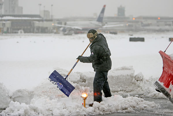
Edge lights being cleared of snow on a runway at Philadelphia International Airport during a 2010 storm.
A “handful of flights” at Philadelphia International Airport had been cancelled as of Friday afternoon for Saturday and Sunday as the city expected a weekend snowstorm. More cancellations were likely ahead of the start of the storm, said airport spokesperson Heather Redfern via email.
“This is an all-hands-on-deck situation for the Department of Aviation’s team, and our operations team will be working throughout the weekend to ensure the safe operation of runways, taxiways, roadways and terminals,” she said.
In preparation for the storm, the department’s crews are getting equipment ready to keep runways, taxiways, airport roadways, and sidewalks clear, she said. Deicing airplanes is handled by the airlines.
The airport does not close, she noted, even if flights are canceled by airlines or in the event that the Federation Aviation Administration issues a ground stop.
Travelers who have flights booked for the coming days through the airport should check in with their airlines, the airport advises, to see if their flight has been canceled or if they can reschedule it.
“PHL’s top priority is ensuring the safety of the traveling public and our staff as we work to ensure ongoing operations,” said Redfern.
PennDot says it’s equipped to handle ‘bear’ of a storm
Local PennDot officials said the department’s Philadelphia-area operations are well positioned to deal with the impending winter storm’s impacts, but urged residents to avoid being out and about if possible.
“This storm should be treated by travelers as a potentially serious weather event, and we hope everyone will make the accommodations to avoid travel if possible during this winter storm,” deputy communications director Brad Rudolph at a Friday news conference.
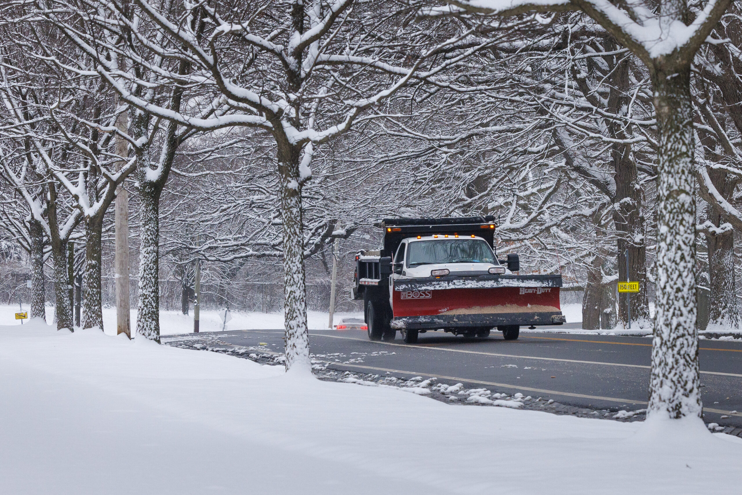
The department has already activated its anti-icing efforts, sending crews out to spray a salt brine mixture on expressways and major roadways to limit or prevent ice accumulation, officials said. In addition, it has access to about 425 trucks for snow clearing work, and has amassed about 70,000 tons of salt for its regional stockpile, Rudolph said.
Though salt is plentiful, officials noted, it is likely to be less effective than usual during this storm because of the low temperatures that are anticipated. Salt is more effective at preventing or melting ice when temperatures are above 20 degrees, and that level of warmth is likely to be in short supply during the storm and in the days after.
“One pound of salt will melt about 46 pounds of ice and snow at 30 degrees,” said PennDot senior district executive for maintenance Tom Rogal. “At 10, 15 degrees, it’s about one pound [of salt] to five pounds [of ice and snow]. So, you can only imagine how much more salt we would have to use.”
Plowing operations are slated to begin once snow begins to fall, and roadways are to be treated throughout the storm until the precipitation moves out and roads are cleared. PennDot, Rogal added, has also brought in additional resources to deal with the storm’s impacts, including more machines used for clearing snow and ice.
Despite the potentially serious impacts of the storm, Rogal said he remained confident PennDot was prepared.
“It’s a bear, but we’re equipped for it,” he said. “We can handle the situation. We’ve done this. Our operators are well-trained, and they take their job very seriously.”
Delaware doesn’t want people sledding down sand dunes
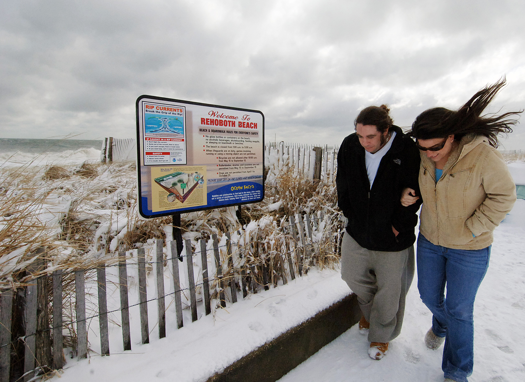
Delaware’s beaches are expecting up to 6 inches of snow.
Delaware beaches may not face as much snow as points north this weekend, but the National Weather Service still expects up to 6 inches of snow, and “very cold, windy conditions” will lash the working, vacation, and retirement communities — and the extensive sand dunes that bracket the area at Cape Henlopen and Delaware Seashore state parks.
But if that’s the kind of weather warning that gets your winter-sports hopes up, think again. “Do Not Sled or Snowboard on Dunes,” which “contain fragile wildlife habitat and provide protection for the beaches” and nearby neighborhoods, warns the state Department of Natural Resources and Environmental Control. Indeed, even walking across the shore dunes is prohibited at those parks, except at marked trails and crossings.
In the warning post, Delaware pointed sledders to a list of alternate sites where downhill runs are encouraged. Unfortunately for beach residents and visitors, almost all the officially approved sledding hills in this low-lying state are nearly two hours north, rimming the Brandywine and other streams that flow south from Pennsylvania. At least in the Diamond State, beach snow sports aren’t a thing.
Winter storm warning up, snow totals down slightly
As of Friday afternoon, forecasters expect Philadelphia to receive over 10 inches of snow between Sunday and Monday.
The National Weather Service has added the entire region to a winter-storm warning that now covers about half the country.
While the agency has trimmed back the snow amounts for Philly, it has added more ice, said Nick Guzzo, meteorologist in the Mount Holly office.
The weather service now is calling for 8 to 12 inches of snow for Philadelphia, but has increased ice totals to 0.25 inches as more freezing now is expected.
As of Friday afternoon, ice accumulations around three tenths of an inch are expected in and around Philadelphia, an increase compared to previous forecasts.
Sleet, which counts toward snow totals, and freezing rain are to do mix in Sunday afternoon after several inches of snow have accumulated.
The snow is expected to start in the early-morning hours, and precipitation could flip back to snow early Monday.
The winter storm warning goes into effect at 7 p.m. Saturday and continues through Monday morning.
Whatever falls is likely to stay around for awhile as the coldest weather of the season, perhaps in the last several years, settles over the region.
Philadelphia’s court system will be largely closed Monday due to the impending winter storm, meaning all scheduled trials and other hearings will be rescheduled for other dates.
Emergency services will remain open, the courts said on social media, including arraignment court. And people will still be ale to file emergency protection from abuse petitions at the Stout Center for Criminal Justice.
Vehicle restrictions on Pa. highways will be in effect Sunday
PennDOT is implementing vehicle restrictions beginning midnight Sunday
Starting at midnight on Sunday, the Pennsylvania Department of Transportation will implement vehicle restrictions aimed at limiting the number of cars on roads statewide during the coming winter storm.
PennDot’s vehicle restrictions are instituted in a tiered system, with Sunday’s coming in at tier four — the second-highest level. Under that tier, commercial vehicles are totally prohibited from using a number of interstates around Pennsylvania, as well as the Pennsylvania Turnpike.
“The decision to implement these restrictions was made with the intention of balancing safety for everyone on the roadway, including commercial drivers,” said PennDot secretary Mike Carroll. “We will remove these restrictions as soon as conditions warrant.”
In addition to limiting the travel of vehicles like tractor trailers and commercial buses, PennDot’s restrictions also apply to school buses, motorcycles, RVs, and passenger vehicles that are towing trailers, Carroll added. None of those vehicles, he said, are permitted to use roadways while the restrictions are in place.
“These restrictions aren’t about the quality of the driver,” said Pennsylvania Turnpike CEO Mark Compton. “These restrictions are about the amount of time it takes for us to clear an incident on one of these roadways. We ask that you please adhere to these restrictions.”
Officials urged motorists to stay home amid the coming storm, noting that the anticipated snowfall rate of one to two inches per hour, as well as the overall snowfall totals, will make keeping roads safe and clear difficult.
Restrictions, PennDot notes online, are evaluated hourly. Pennsylvania’s traveler information website, 511PA, keeps an up to date map of which roads are impacted by the restrictions, and Carroll recommended travelers check that website before heading out, should they absolutely have to.
“Stay home and watch the NFL games, despite the fact that the Eagles and Steelers are not playing,” Carroll said.
Schedule change for two Philly basketball games due to snowstorm
St. Joe’s men’s basketball moved Saturday’s 6 p.m. game against Dayton to 2 p.m. due to the Philly region expecting a major snowstorm this weekend.
With heavy snowfall expected this weekend, two Big 5 basketball programs are moving their tipoff times.
The St. Joseph’s men’s team was slated to take on Davidson at 6 p.m. on Saturday at Hagan Arena. Now, the Hawks will be starting at 2 p.m. to avoid interference with potential snowfall on Saturday night.
Meanwhile, Drexel women moved its Sunday matchup against Towson at the Daskalakis Athletic Center to Saturday at 6 p.m., which will now be a homecoming doubleheader with the men’s team, which face Northeastern at 2 p.m.
The women’s team will play back-to-back days, as the Dragons host Stony Brook on Friday night (6 p.m.).
Archdiocesan schools will use a flexible instruction day Monday
All archdiocesan schools in Philadelphia, and all Archdiocese of Philadelphia high schools, including those in suburban counties, will use a flexible instruction day Monday.
Archdiocesan elementary schools in the suburbs typically follow the snow closing decisions of their local school districts, but officials urged parents and students to check with their local school administration for information about Monday.
A pine tree branch leans against power lines on Sout New Street in West Chester on Feb. 5, 2014. An overnight freezing rain storm swept through the region leaving downed trees and power lines in its wake.
Neither sleet nor freezing rain are particularly pleasant forms of precipitation, but in terms of their impacts, they can be very different.
Sleet forms when a partially melted snowflake or rain drop freezes on the way to the ground.. Freezing rain is rain that doesn’t turn to ice until it lands on a surface and freezes on contact.
During a winter storm, both hold down accumulations. Typically, an inch of liquid precipitation can yield a foot of snow. A similar amount of liquid would yield about 4 inches of sleet. Freezing rain, of course, is measured as pure liquid. A quarter-inch is enough to trigger a winter-storm warning.
Both can fall when surface temperatures are well below freezing, if the upper air is warm enough.
Sleet has an endearing quality for the power companies and their customers: It bounces, rather than glooming on to wires.
Freezing rain is a menace to wires and adds weight to snow on tree branches.
In 2014, freezing rain that began 18 hours after a heavy snowfall resulted in Peco’s biggest winter outage total on record, affecting more than 700,000 customers.
In a battle between sleet and freezing rain, you probably should root against the latter.
Assuming that a 100% chance of snow, and everything else, from the winter menu assures that something actually will happen, this would mark the third consecutive weekend with notable precipitation in the region.
Nearly an inch of rain was measured in Philly on Jan. 10, and last Saturday and Sunday several inches of snow accumulated in areas away from the city heat island in separate snow events.
It’s not like the atmosphere particularly cares about our weekend plans.
It is not uncommon for snow and rain to show up on the same days of the week over periods of several weeks.
That’s the result of the typical spacing between weather systems as they move across the country, meteorologists say.
Sometimes, that keeps happening in 3- to 3½-day intervals — until it doesn’t.
But not to get too far ahead of ourselves, another threat may be brewing for next weekend.
SEPTA buses, trolleys and trains will also be impacted by the snowstorm.
Philadelphians can expect SEPTA service disruptions as a result of the storm.
“Significant accumulations of snow and ice are likely to create unsafe conditions, both on the roads and the rails, and we’ll be making adjustments,” said SEPTA General Manager Scott Sauer.
“Customers should expect impacts to bus, trolley, and regional rail service.”
Sauer said SEPTA lines will operate for as long as it’s safe to do so and it will try to announce any service shutdowns two hours in advance when possible.
For essential workers who are required to commute Sunday, Sauer said the Broad Street Line and Market Frankford Line are the most reliable. Those lines are easier to keep open because large chunks of the rail are underground and the elevated tracks can be kept clear with frequent service, he said.
While inconvenient, suspending service before the height of the storm will ensure no one is stranded and no equipment is damaged, said Sauer.
Sauer warned it may take a few days to get service back to normal and reminded people to avoid travel unless absolutely necessary during the height of the storm.
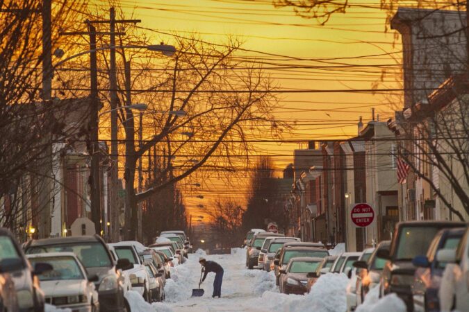
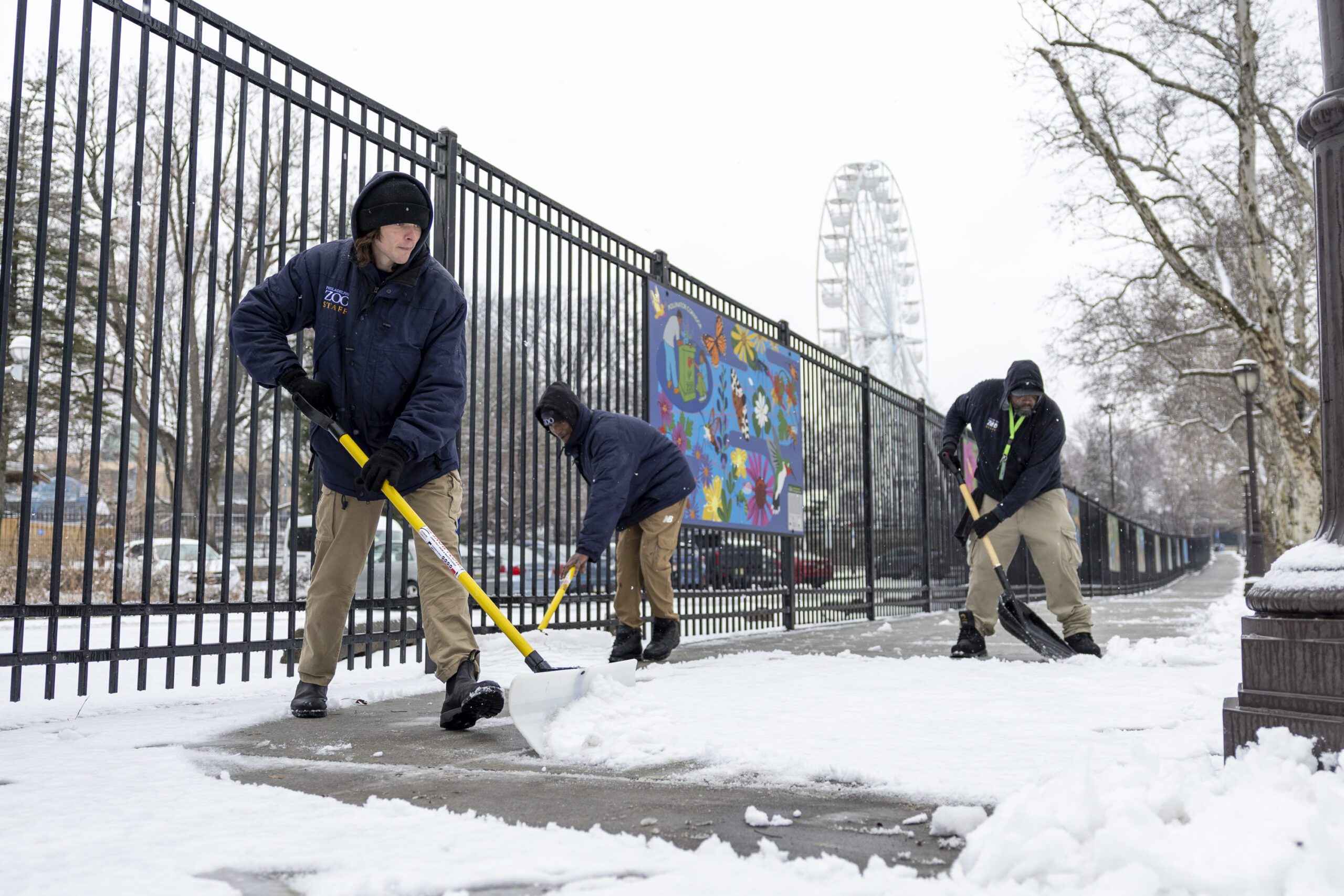
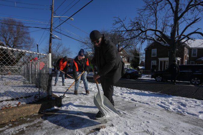
Philly residents can be fined for not shoveling snow
Philadelphia Zoo workers shovel snow on the sidewalks earlier this month.
More than 1000 workers are helping treat the streets and roads of Philadelphia, said Director of the Office of Clean and Green Carlton Williams.
Williams said workers are scheduled to work around the clock with 600 pieces of equipment and 30,000 tons of salt at the ready to make roads passable.
But he reiterated that residents bear some responsibility as well, reminding people that tickets will be issued for untreated sidewalks. They’ll have six hours to shovel after the storm and failing to do so could lead up to a $300 fine.
“We expect our residents to be out there, because, again, this is a safety issue,” said Williams. “If that becomes frozen or we can’t get access to someone because sidewalks aren’t shoveled that’s a problem for our emergency responders.”
City warming centers to remain open during snowstorm
Crystal Yates-Galle, Deputy Managing Director for Health and Human Services, said the city’s warming centers will continue to remain open during this storm as part of the ongoing Code Blue declaration, which allows the city to also add shelter beds to the system.
Warming centers are located at select libraries during the daytime from 9 a.m. to 9 p.m.
From 9 p.m. to 9 a.m., select recreation centers will act as warming centers.
The need is already proving to be great. The city reached capacity at four of its five warming centers Thursday, Yates-Gale said, but plans to open more as needed.
Shelter beds are also at capacity, though the city plans to add another 150 beds throughout the system within the next two weeks.
Philadelphia Police Commissioner Kevin J. Bethel said his department would be working with outreach workers to connect homeless people to city services during the snow emergency.
Monday will be a full snow day, but if schools need to remain closed Tuesday and beyond, students have Chromebooks and will turn to remote learning until it’s safe to return.
“We’re inviting students and staff to enjoy this snowfall, which will be the most I’ve seen during my nearly four years here in Philadelphia,” Watlington said.
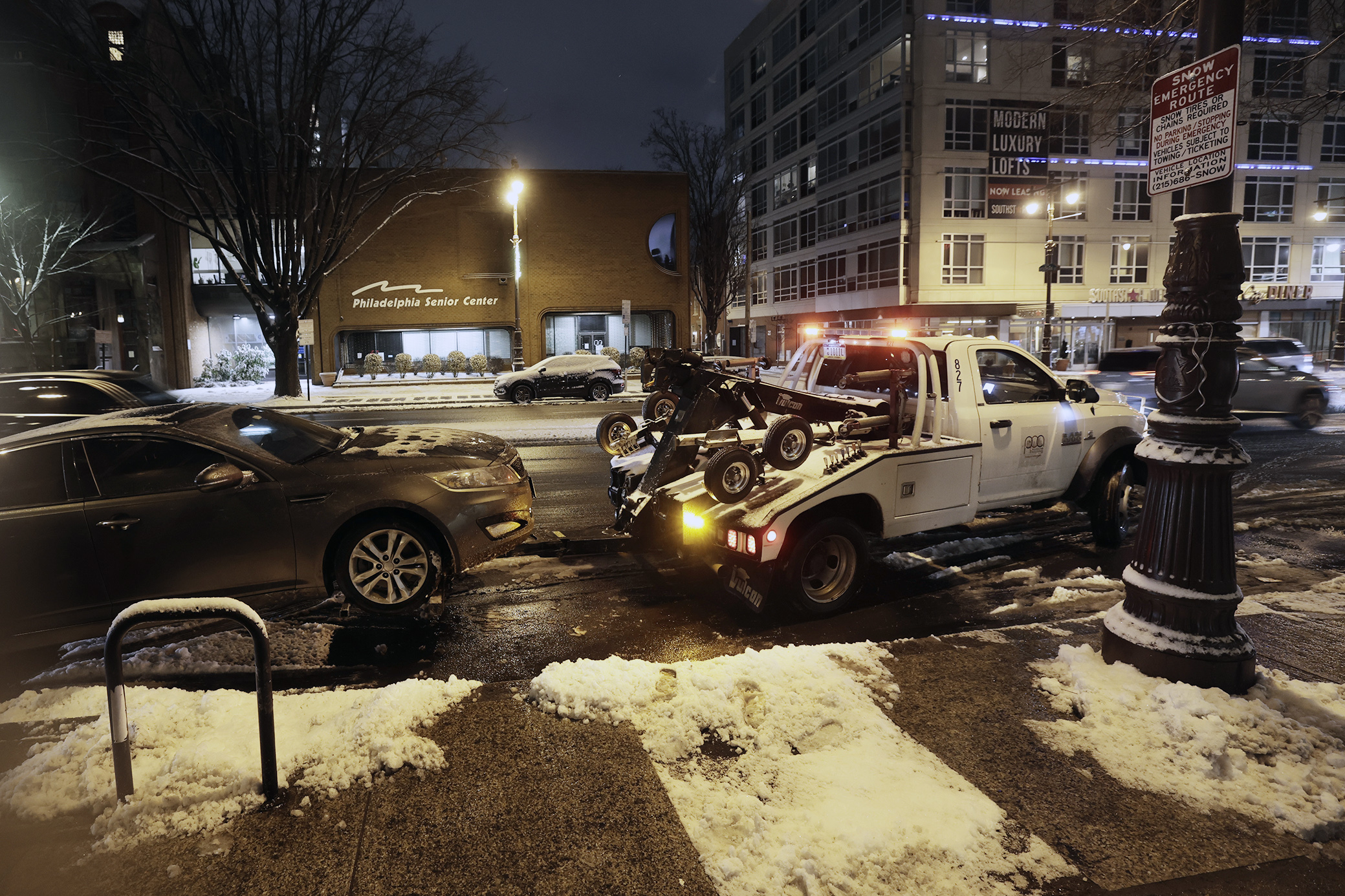
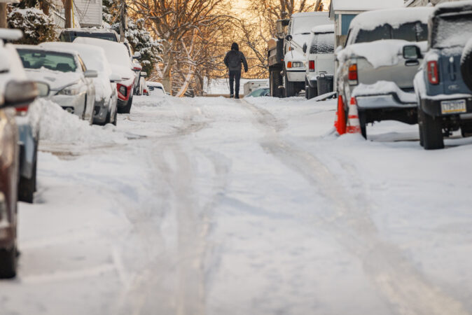
‘Your cars will be towed’: City officials warn residents about snow parking
A Philadelphia Parking Authority truck tows a car from South Broad Street, a snow emergency route.
Regardless of how much snow Philly gets, the roads are a major concern for city officials.
Illegal parking, especially on narrow residential streets, is a focus for officials.
The city has been treating roads since Wednesday, according to Carlton Williams, director of the Office of Clean and Green.
But in order for plow operations to flow smoothly, Williams said residents would need to avoid parking in front of fire hydrants and blocking corners.
“Do not park on designated snow emergency routes,” said Williams.
“Your cars will be towed, snow emergency routes are necessary for our emergency responders to get to a location as quickly as possible and park cars impede that process.”
To help clear those emergency routes, the Philadelphia Parking Authority will institute $5 flat rate parking beginning at 7 p.m. on Saturday at any of its lots.
Philly trash and recycling collection suspended Monday, delayed rest of the week
Heavy snow will impact trash collection services in Philly.
Trash and recycling collection will be suspended across Philadelphia Monday, the city announced in a news conference Friday.
Collection days for the rest of the week will be pushed back a day, and residents are asked to hold their trash and recycling until the next day.
“There will be no two-day-a-week trash collection in those neighborhoods who receive that service.” said Carlton Williams, director of the Office of Clean and Green Initiatives.
Due to the amount of snow forecast, Williams asked residents with driveway collection to bring trash out to the street or use the drop off center, due to plowing issues.
Parker declares snow emergency in Philly beginning Saturday night
A plow truck drives along Reservoir Drive in Fairmount Park in February 2025.
With more than a foot of snow possible this weekend, Philadelphia Mayor Cherelle L. Parker announced a snow emergency would go into effect Saturday at 9 p.m.
“We hope you will help us by keeping our roadways as free as possible of any vehicles that don’t necessarily need to be parked there,” Parker said at a news conference Friday, warning roads would be “hazardous” Sunday.
“Please take this storm seriously,” Parker said. “Limit unnecessary travel once conditions worsen, and if you must be out, give yourself extra time, drive slowly and stay off the roads if conditions become hazardous, so our crews and first responders can do their jobs safely.”
Crews have already begin brining city streets, and while the focus will be on the city’s major roadways, Parker pledged to also get to residential streets as soon as possible.
“We will make every effort to get to every primary, secondary and tertiary street in the city of Philadelphia,” Parker said. “That is our standard.”
Forecasters expect about 13 inches of snow to accumulate in and around Philadelphia through Monday.
Love it or hate it, more snow than Philly has seen in a long time is all but certain this weekend.
Forecasters continue to predict as much as 18 inches of snow could fall in and around Philadelphia beginning Saturday night, which would mark the city’s first double-digit snowfall in a decade, almost to the day.
The situation is so serious, former NBC10 meteorologist Glenn “Hurricane” Schwartz has come out of retirement and is doing forecasts on TikTok.
“It’s going to be a historic storm,” Schwartz predicted Thursday night.
At this point, the only thing that might keep down the snow totals is a wintry mix of sleet and freezing rain, which could fall during peak portions of the storm Sunday. Even so, precipitation is expected to shift fully back to all snow by Sunday night, with an additional inch or two likely before the storm moves through.
When it’s all said and done, forecasters predict about 13 inches of snow will have fallen in Philadelphia.
Officially, a winter storm watch is in effect for the region beginning 7 p.m. Saturday through 1 p.m. Monday. With temperatures expected to plummet Friday night (along with wind chills between -10° and 0°), a cold weather advisory is also in effect through Saturday morning.
Philly-area schools prepare for closures that could last multiple days
Cheltenham School District warned parents buildings could be closed multiple days if “conditions are significant enough.”
Ahead of the impending snowstorm, some Philadelphia area school districts are sharing plans for closures — maybe for multiple days.
In Upper Darby, school officials told families Thursday night to prepare for the prospect of virtual instruction Monday, and possibly Tuesday.
“If the weather is more significant than anticipated and there are power outages in the area, we will shift to a snow day,” with no virtual school, Superintendent Daniel McGarry said in the message.
In the Cheltenham School District, Superintendent Brian Scriven told families that “if weather conditions require us to close schools and offices,” the district will have a traditional snow day Monday. Tuesday is to be determined – and Wednesday could be virtual instruction, “If conditions are significant enough,” Scriven said.
Maps: How much snow and sleet could fall across the Philly region
Snow near Poplar Drive and Girard Avenue in Philadelphia earlier this month.
Official National Weather Service forecasts say 12 to 18 inches of snow is possible across most of New Jersey and Pennsylvania, including Philadelphia as the storm pushes through the region Saturday night to early Monday morning. More than 21 states were expected to experience at least moderate impacts from the storm, the weather service said.
The National Weather Service puts out forecasts for every few square miles of land in the United States four times a day through a system called the National Digital Forecast Database.
The map below displays that data. Use it to find how much snow is expected anywhere in the eastern United States. It will always show the most recent forecast for the next three days.
(function () {window.addEventListener(‘message’, function (e) { var message = e.data; var els = document.querySelectorAll(‘iframe[src*=”‘ + message.id + ‘”]’); els.forEach(function(el) { el.style.height = message.height + ‘px’; }); }, false); })();
(function () {window.addEventListener(‘message’, function (e) { var message = e.data; var els = document.querySelectorAll(‘iframe[src*=”‘ + message.id + ‘”]’); els.forEach(function(el) { el.style.height = message.height + ‘px’; }); }, false); })();
The timing and duration of precipitation aren’t among the strong suits of computer models.
The weather service’s winter storm watch, which covers the entire region, all of Delaware, and most of Pennsylvania and New Jersey, is in effect from 7 p.m. Saturday until 1 p.m. Monday.
The daytime Saturday “looks fine if you have to get out,” said Tom Kines, senior meteorologist with AccuWeather Inc.
The weather service is listing the likeliest starting time as the early morning hours of Sunday, with snow likely into the early morning hours of Monday.
Sunday is going to be one of the colder days of the winter with temperatures in the teens and lower 20s. The weather service introduces the possibility of freezing rain and sleet by 1 p.m., with a forecast temperature of 19 degrees.
Wintry mix could limit snow totals. It’s a real Philadelphia tradition.
Sleet and freezing rain could mix with snow in Philly this weekend.
One thing arguing against mega-snow totals this weekend along I-95 and South Jersey is the likelihood sleet and freezing rain would mix with the snow at the height of the storm’s impacts.
That’s part of the cost of doing business in Philly winters.
Our biggest snows typically come from coastal nor’easters, so-named for their onshore winds the import warm air off the Atlantic to the upper atmosphere, the sources of precipitation. Sea-surface temperatures off Atlantic City are in the upper 30s.
The warmth above changes the snow to rain that freezes on contact when it reaches a cold surface, a sidewalk, or street, or windshield. Or precipitation becomes sleet, liquid that becomes a ball of ice before it reaches the surface.
Storms that are purely snow are the exception in the Philly area, says Ray Kruzdlo, the hydrologist at the National Weather Service Office in Mount Holly.
One of American history’s most famous wintry mixes accompanied the Continental Army’s surprise invasion of the Hessians in Trenton in 1776 during the American Revolution. After crossing the Delaware on Christmas night, diary accounts tell of Gen. George Washington led his troops through a nasty wintry mix.
Conversely, Thomas Jefferson, 150 miles from the ocean in western Virginia, measured more than 20 inches of snow.
One of the more notable busts occurred in January 2015 when forecasts called for an I-95 East Coast snowstorm so ferocious that the mayor of New York imposed a curfew.
His boss at the time, weather service head Louis Uccellini, said no apology was necessary: Science has its limits. Busts have been known to happen in the battle of science against nonlinear.
This time around, meteorologists are all but certain something “impactful” is going to happen.
Ray Kruzdlo, the staff hydrologist in the weather service office, said the slim chance of this storm “not being significant is leaving us.”
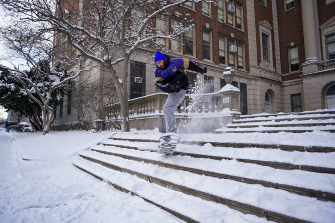
Informal plans for a snowball fight in Rittenhouse Square. Debates on the best snow to craft the most aerodynamic orb.
A run on ice salt. Public denunciations of said runs.
Searches for snow shovelers.
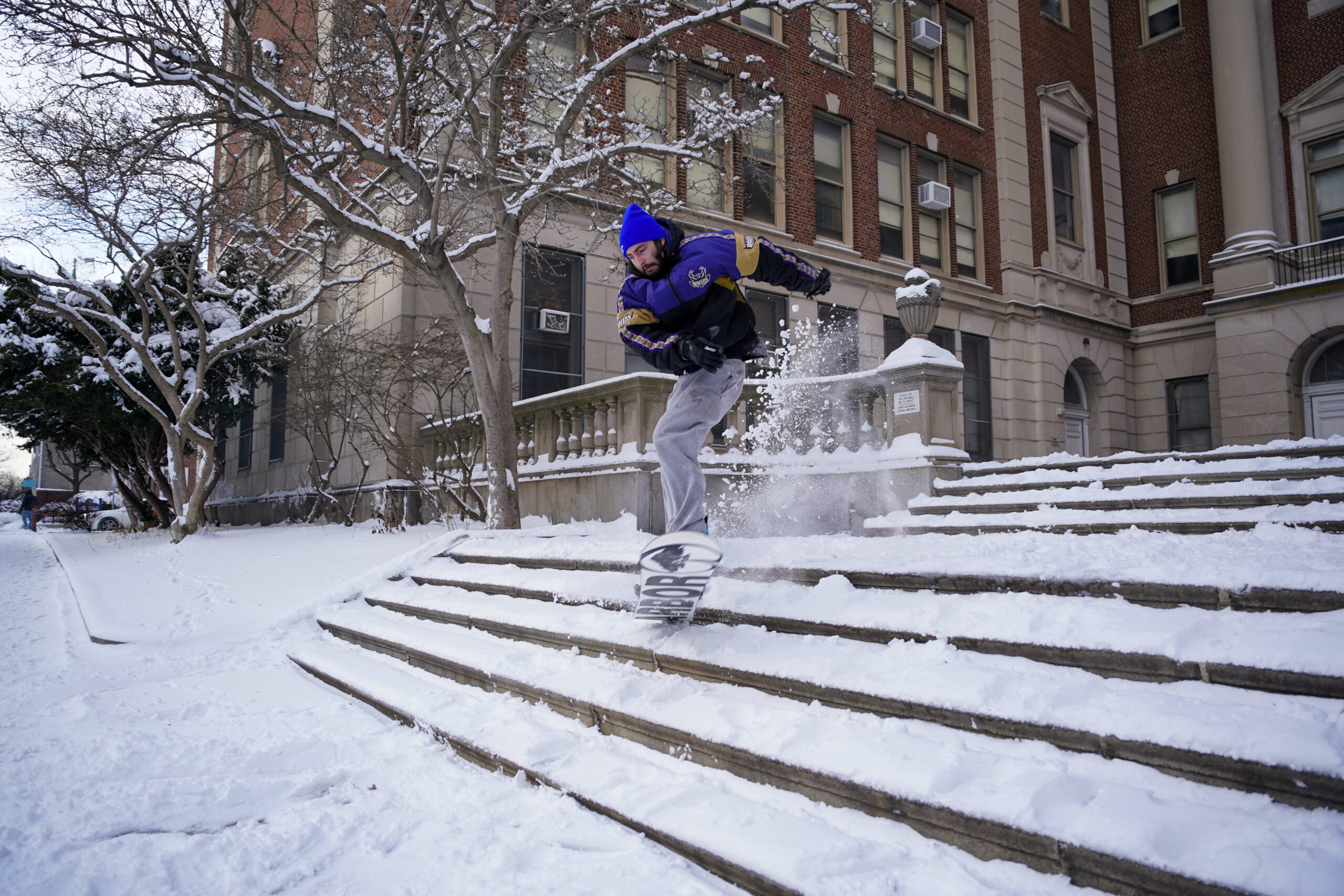
Love it or hate it, Philadelphia could be racking up its first double-digit snowfall since 2016, and residents are bursting at the seams of their snowsuits with the peril and promise of a real, old-school winter wonderland.
Alex Janconski, a manager at Stanley True Value, a hardware store in Roxborough, said the recent snow dustings in the city had already proved to be good for business but this weekend’s forecast had made it hard for suppliers to keep up. People seem to be stocked up on shovels at this point, Janconski said, but in recent days salt has been a hot commodity.
People are taking whatever they can get — rock salt, fast melt, magnesium chloride.
Janconski said the urgency felt by his customers is reminiscent of the COVID-19 days. Three pallets of ice melt sold within 15 minutes of opening Thursday. He suspects the demand has to do with the significant snow projections.
“In terms of the inches, it’s hard to get away from that number and feel like, oh, I can get away with just having nothing,” he said.
While the traditional run on stores before a storm is a strongly held American tradition, there is an added novelty in a city like Philadelphia, where some generations can still wax poetic about staring at the TV waiting for school closure announcements that would give them the all-clear to sled down the Art Museum steps, at Clark Park, or on Fairmount Park’s Belmont Plateau.
Snowfall in the digital age, as the rarity that it is, has lost much of the whimsy.
“Forecasts of any type are going to be imperfect,” he said in a TikTok video, after announcing Wednesday that he would be doing two weather updates a day until the storm hits.
“You got any sports forecasts that are correct? Political forecasts? Economic forecasts? It’s hard to predict the future.”
“Dual [sic] at high noon?” asked the poster, whom, sadly, The Inquirer could not reach to ask about what makes a great snowball fight setting.
Another thread pitched a pond hockey game at FDR Park should the ice be thick enough. Supportive commenters already began work to get the Philadelphia Flyers and Gritty to join.
Meanwhile, contingency plans abound ahead of the potential weekend dump. Businesses are calling it and closing their doors, and state agencies are fully activated, adjusting their various plowing and emergency response plans.
Even the 25th Annual Keystone Sacred Harp Convention at the Rotunda finds itself adjusting to potential snow.
The members of the group, who don’t actually play any harps, practice a style of early American a cappella singing called shape-note singing that uses a series of different shapes rather than typical oval-shaped note heads. The notation was invented in Philadelphia in the 1700s, according to the convention’s chair, Rachel Hall.
About 200 people from across the country were originally slated to come to the events over the weekend, Hall said. But, if the snow falls as predicted, Hall plans on hosting the singers in the living room of her West Philly home Sunday for those willing to make the trudge. She said she likes how the activity brings people together.
“We have a lot of traditions that enable us to come together and think about things that are beyond ourselves,” Hall said.
As soon as the snow stops falling, it’s time to get shoveling. In Philadelphia, you have six hours to clear the sidewalks in front of your home before facing potential fines, according to city rules.
For residents, whether you rent or own, here’s what you need to know.
Can I get fined for not shoveling my sidewalks?
Yes. Fines range from $50 to $300 for those who violate city snow-removal rules.
How much time do I have to clear my sidewalks?
You have six hours after the snow stops falling to clear your sidewalks.
From left: Philadelphia Zoo Garden service workers Joseph Mineer, of Fairmount, Naeem Price, of North Philadelphia, and David Wallace, of Southwest Philadelphia, clear snow from the sidewalks near the bus drop-offs in Philadelphia on Saturday, Jan. 17, 2026.
Who’s responsible for clearing the sidewalks? What if I’m a renter?
Whether you rent or own, you’re responsible for clearing a path, unless you live in a multifamily dwelling, like an apartment building or a building with more than one unit. In this case, the building owner or agent is responsible for snow removal.
What about businesses?
For businesses, clearing sidewalks and parking lots is the responsibility of the property owner, said Chris Young, communications manager for the Streets Department.
The city is responsible for clearing sidewalks at city facilities.
How wide do I need to make the path?
A path must be at least 3 feet wide, unless the width of the pavement from your property line to the curb is less than that. In that case, your path can be narrower but has to be at least one foot wide. Paths must be thoroughly cleared, and you can’t dump the snow and ice into the street. Pro tip: Push and clear snow toward your building.
You can use a commercial deicer to salt your sidewalk or driveway, and it’s a good idea to apply it as soon as you see a light layer of snow. If you don’t have a deicer, you can use kitty litter for temporary traction.
Can I report someone who hasn’t shoveled their sidewalk?
If you want to report a sidewalk that has not been cleared, call 311 or report the issue online through the 311 portal.
A Philadelphia Parks and Recreation plow truck heads along Reservoir Drive, Fairmount Park near Diamond Street, after overnight snowfall, Philadelphia, Wednesday morning Feb. 12, 2025.
What happens if I’m parked along a snow emergency route?
When a snowstorm hits, the city may declare a snow emergency. When that happens, the city plows 110 miles of snow emergency routes from curb to curb, which means vehicles and dumpsters within those areas must be moved or you face fines of up to $130. If you can’t get to your car, or if your car can’t be moved, it doesn’t matter. Your car will be towed and ticketed if you don’t move it.
You can view a list of snow emergency routes at bit.ly/3YSMeDm/.
If you live, own a business, or frequently park in these areas, you’re advised to plan ahead as winter weather approaches. Large signs reading “Snow Emergency Route” in white letters on a red background will be posted along the streets once a snow emergency is declared.
If your vehicle was towed from a snow emergency route, call 215-686-SNOW (7669) and be prepared to provide information to identify your vehicle.
What if I live in the suburbs?
If you live outside of the city, the rules vary by township. These include how quickly you have to remove snow and how wide the pathway must be.
In most towns, property owners and tenants can face fines if sidewalks aren’t cleared. Check with your township for specific details.
The details are likely to remain elusive well into the weekend, but on Wednesday evidence was accumulating that the Philadelphia region could become a winter wonderland for the remainder of January.
“We’re definitely going to get some snow,” said Alex Staarmann, a meteorologist with the National Weather Service in Mount Holly, which probably won’t make a first accumulation guess until Thursday afternoon. Snow could begin as early as Saturday night and continue into Monday.
The weather service Thursday posted a winter-storm watch for the entire region — for all of Delaware and most of Pennsylvania and New Jersey — in effect from 7 p.m. Saturday until 1 p.m. Monday.
At the weather office, “It’s all hands on deck,” said agency hydrologist Ray Kruzdlo Thursday. The “outside chance” that the region would be spared a major storm “is leaving us.”
AccuWeather Inc. is calling for 6 to 10 inches for Philly, very much subject to change, said senior meteorologist Bob Larsen.
Several inches of snow would be all but certain, the weather service said. Philadelphia could have a 75% chance of a foot or more, based on analysis of a blend of computer models, and a 50-50 shot of 18 inches or more. However, the individual models are having their usual squabbles, with the American being the snowiest.
Risk of a big winter storm continues to grow, tho uncertainty remains on how much snow falls, & any poss. mixing with ice &/or rain. Consider your plan of action regarding a large snow storm. Travel may be very difficult Sunday, even Monday. Further clarity as we get it. pic.twitter.com/6FWtwqzoDu
In any event, Staarmann said: “It could be a significant storm for most of the region.”
And that applies to the rest of the Mid-Atlantic and Northeast. AccuWeather Inc. estimated that snow and ice during the weekend could affect half the nation’s population.
Said Stephen Morgan, a meteorologist with Fox Weather: “It’s one of the most sprawling systems we’ve seen in several years.”
Predictably, computer models have been using the map as a Ouija board, moving around the zones of the expected heaviest snows.
Earlier in the week, it appeared that the region would be near the northern edge of the snowfall; on Wednesday, however, the models bumped the snow north, increasing the chances that snow could mix with sleet and freezing rain in Delaware and South Jersey.
The snow could mix with sleet at the height of the storm even in the Philly region, the weather service said. That would hold down accumulations: Sleet is slow to accumulate. Conversely, since it is pure ice, it is slower to melt.
Should any rain get mixed in, it would freeze on contact: The upper air may be warmer, but temperatures at the surface are forecast to be mostly in the teens Sunday.
The amounts of snow and mixing would depend on the track of a storm that is forecast to develop off the Texas Gulf Coast and track through the Tennessee Valley and off the Mid-Atlantic coast on Sunday. That track ultimately will be determined by other moving parts in the atmosphere.
As the storm intensifies, its onshore winds would import warmer air into the upper atmosphere, changing the snow to sleet and/or freezing rain, but the surface layers would remain quite cold, Larsen said.
Despite the potential mixing, it is at least possible that Philly will get its first double-digit snowfall since Jan. 22, 2018, said Paul Dorian, a meteorologist with Arcfield Weather, based in Valley Forge.
In the short term, Thursday may be a day to savor. It’s heading into the mid-40s, with nothing falling from the skies. The cold begins to filter in Friday, and highs will be in the teens Saturday.
After the precipitation shuts off Sunday night or Monday, whatever has fallen won’t be in a hurry to disappear, Staarmann said.
Temperatures might not get above freezing for several days after the snow stops, he said. Wind chills are expected to be in the single digits Monday morning, and below zero Tuesday.
“This overall very cold weather pattern is likely to continue into next weekend, potentially beyond,” the weather service said.
Computer models continue to insist with a rather uncharacteristic certainty that the Philadelphia region and much of the Mid-Atlantic can expect a significant snowstorm during the weekend.
On Wednesday, models were in general agreement that Philly had a high likelihood of a snowfall of at least 6 inches, the National Weather Service said, with the potential for substantially more.It listed Sunday’s snow probability at 80%, unusually high for an event at least four days away.
Whatever does or does not happen from here, the likes of Acme, Giant, Wegmans, Whole Foods, and Trader Joe’s thank you.
“All the tools we have are starting to point toward something is going to happen,” said Mike Lee, a lead meteorologist at the weather service office in Mount Holly.
“We know it’s going to get more people uneasy, but we want people to be aware.”
It’s too early to make a guess on snow totals, his colleague, Alex Staarmann said.
“We’re definitely going to get some snow. It could be a significant storm for most of the region. That’s all we can say at this point.”
He added that it wouldn’t melt quickly with temperatures remaining below freezing for several days. Wind chills Monday night could fall below zero, he said.
As for the chances that snow will snub the region this weekend (it’s been known to happen), Bob Oravec, lead forecaster with the National Oceanic and Atmospheric Administration’s Weather Prediction Center, said that’s highly unlikely. “Given the very good agreement in the numerical models, this has a very low chance of being a bust overall.”
Early estimates for snow amounts vary from the prodigious to the prosaic.
The big commercial services, AccuWeather Inc. and the Weather Channel, also are on board. In fact, although the storm remains a virtual concept, the Weather Channel already has affixed a name to it.
When might snow arrive in the Philly area?
Forecasters said the snow could begin as early as late Saturday, and continue into Monday.
The snow would spread south to north.
In the early going, it was uncertain which areas would receive the very heftiest amounts.
The snow machine would be set off by dry polar air interacting with copious moisture to the south, which is likely to encounter resistance to the north.
The big snows would occur between that dry wall to the north and a wall of ice and rain to the south, said Matt Benz, a senior meteorologist with AccuWeather.
Whatever does fall in Philly likely would all snow, but it’s possible sleet could mix in south of the city.
After temperatures moderate the next two days and climb into the mid-40s Thursday, the cold air is expected to pour into the region Friday. High temperatures Saturday through Monday may struggle to get past 20, with or without a snow cover.
Some of the key west-to-east moving features that will power the system have not yet made landfall, and thus have not been observed by land-based instruments.
One piece of energy is over the Pacific, and another somewhere over Siberia, Benz said.
“The pieces just aren’t moving that quickly,” he said. They may not make landfall over North America until Thursday, he added, and that could be present real issues for the machines and their human interpreters.
Said Oravec: “Historically, when these features can better be identified by the weather balloon network across North America, the models forecasts improve and converge on a common solution.”
Benz said it may take until Friday for computers to sort it all out with newly ingested data.
Recall that the snow forecasts last weekend bedeviled forecasters on both Saturday and Sunday.
Oravec said computer models are marvels and “do a great job at identifying large-scale patterns that are conducive for major winter storms.”
But “some of the smaller details that can enhance the impacts are harder to model.”
Perhaps the most important data point to consider: The prospective first flakes may not be in evidence until the very beginning of next week.
The region evidently is about to migrate from the refrigerator to the freezer this week, with wind-chill levels possibly approaching zero as temperatures fall to the teens and a brisk west wind adds sting.
“Wind chill” has been a staple of National Weather Service forecasts and media weather reports since 1973.
(Commercial services, such as AccuWeather Inc., now have their own variants.)
At different times it has been a subject of contention, confusion, derision, and revision; its popularity, however, endures.
In terms of alerting the public to potential health hazards, “I think it’s useful,” saidMichael DeAngelis, vice chair of emergency medicine at Temple University’s Lewis Katz School of Medicine.
Said Harvey V. Lankford, a retired physician and writer who has done a deeper dive into wind chill than most humans: “It’s a yardstick.
“The public loves it.”
But where do those numbers come from, and do they tell us how we really feel?
The birth of ‘wind chill’
Gentoo penguins walk at Neko Harbour in Antarctica, Saturday, Nov. 22, 2025. (AP Photo/Mark Baker)
Wind chill is a measure of heat loss from the body from the combination of temperature and wind.
What we know about its effects has a lot to do with former Eagle Scout Paul Siple, the pride of Erie’s Central High School.
He pursued his quest while accompanying Admiral Richard Byrd on his legendary expeditions to that icy forbidden planet known as Antarctica, where the wind stings “like a knife drawn across the face,” as one of his associates put it. At age 19, Siple had won a highly publicized national competition to join Byrd.
Siple minted the term wind chill in his 565-page unpublished doctoral dissertation, a copy of which Lankford obtained from Clark University, in Worcester, Mass.
On a later expedition, Siple, assisted by geologist Charles Passel, conducted experiments measuring how long it took to freeze a container of water under a variety of temperature and wind conditions. Winds obviously accelerated the freezing process.
Using that data they estimated heat loss from human skin, publishing their findings in a landmark 1945 paper.
But Lankford said Siple got remarkable results in his more primitive earlier research, which included estimating frostbite thresholds, using a relatively simple formula involving wind speeds and temperatures.
Siple’s work would become the basis for the wind chill factor that the weather service massaged and began sharing publicly in 1973.
Frostbite and the wind chill revision
The wind chill calculations underwent a significant revision a quarter century ago.
U.S. and Canadian scientists during the 1990s used human subjects to upgrade the index, including establishing new frostbite thresholds.
Twelve subjects, with sensors inside their cheeks and their faces bare, were subjected to temperatures ranging from 32 to 58 below at three different wind speeds.
They were monitored for signs of “frostnip,” which precedes frostbite by about a minute.
For the record, the researchers found that with wind chills of 40 below, frostnip occurs within 15 minutes.
The weather service said the revised index profited from “advances in science, technology and computer modeling.”
Yet Siple obviously had been on to something decades earlier, Lankford said.
In a paper published in 2021 in the journal Wilderness and Environmental Medicine, Lankford and coauthor Leslie R. Fox wrote that some of the modern findings on frostbite thresholds were remarkably similar to what appeared in Siple’s dissertation.
Lankford said they were not surprised by the similarities: “We were stunned.”
Those conditions can seriously exacerbate certain lung problems.
For the healthy, he recommends proceeding with caution while exercising. Sweating in the cold — it does happen, just ask runners and hikers — can increase the risk of hypothermia.
Plus, your brain, heart, kidneys, and other internal organs will be diverting blood flow from muscles and extremities, and that could slow recovery from exertion.
Or you could just put off that run or bike workout until Thursday, when it may go up to 40 degrees.
Some snow is possible in the Philly region during the holiday weekend, but about the only thing certain is that schools will be closed until Tuesday.
Snow — not a whole lot of it — is expected Saturday morning, and possibly again during the day Sunday.
“Definitely something,” said Ray Martin, a lead meteorologist at the National Weather Service Office in Mount Holly, “maybe not a lot of something.”
In short, he added, expect a “100% chance of forecast uncertainty.”
How much for Philly?
(function () {window.addEventListener(‘message’, function (e) { var message = e.data; var els = document.querySelectorAll(‘iframe[src*=”‘ + message.id + ‘”]’); els.forEach(function(el) { el.style.height = message.height + ‘px’; }); }, false); })();
Some snow is expected in the early morning hours of Saturday, said Dan Pydynowski, senior meteorologist with AccuWeather Inc., and “sidewalks and streets could be slick for a time” in the Philly region.
However, temperatures in the afternoon are expected to approach 40 degrees and that should melt any snow. If the precipitation lingers, it likely would turn to rain.
That snow would be associated with a system from the west, and more significant amounts are expected well north and west of Philly.
On Sunday when it will be colder, the source would be a coastal storm that has been befuddling computer models the last three days. On Wednesday, the U.S. model was seeing a significant snowstorm for the I-95 corridor. On Thursday, it said never mind and fell in line with other guidance that kept the storm offshore.
On Friday, models were bringing the storm closer to the coast, but the model consensus was that it would be more of threat at the Shore and perhaps throw back a paltry amount to the immediate Philly region.
“On the other hand, a slight shift … in the track could bring 1-2 inches into the urban corridor,” the weather service said in its afternoon discussion.
Said Martin, “It’s always tricky with these offshore lows. It’s also possible that both systems pass us and we get basically nothing.”
Far more certain is a rather big chill
A Philadelphia firefighter spreads salt to control icing at a fire scene on Friday.
That the region was about to experience its coldest weather of the season to date was all but certain.
High temperatures on Monday, Martin Luther King Jr. Day, probably won’t get out of the 30s, and no higher than the mid 20s Tuesday and Wednesday, forecasters say.
Overnight lows are due to tumble into the teens, with wind chills approaching zero early Wednesday.
No more precipitation is forecast at least through Thursday, but with odds favoring continued below-normal temperatures through Jan. 29 and above-normal precipitation, it should be a robust period for virtual snow threats, if not actual snow.